335 résultats
179440805London: Printed for A. Strahan and T. Cadell Edinburgh E. Balfour 1794. A very good copy small marginal tear just touching a blank section of map. 31 x 52 cm. Removed from: Robertson William Historical Disquisition concerning the knowledge which the ancients had of India. [Printed for A. Strahan and T. Cadell] [Edinburgh] [E. Balfour] unknown books
179440805London: Printed for A. Strahan and T. Cadell Edinburgh E. Balfour 1794. A very good copy small marginal tear just touching a blank section of map. 31 x 52 cm. Removed from: Robertson William Historical Disquisition concerning the knowledge which the ancients had of India. [Printed for A. Strahan and T. Cadell] [Edinburgh] [E. Balfour] unknown
1915181190Munich: J.B. Obernetter 1915. Hardcover. VG- covers have heavy wear but pages of text and illustrations are clean and clear. Front cover is unnattached and heavy chipping to spine. Tan boards with brown lettering 2 preliminary leaves 180 pp many uncut bw illustrations and diagrams. Text is in Portuguese. Title translates to: "Treaty of the sphera with Theorica of the sun and the moon and the first book of Geographia by Claudio Ptolomeo." History of Portuguese nautical science at the time of the great discoveries. J.B. Obernetter hardcover books
1915181190Munich: J.B. Obernetter 1915. Hardcover. VG- covers have heavy wear but pages of text and illustrations are clean and clear. Front cover is unnattached and heavy chipping to spine. Tan boards with brown lettering 2 preliminary leaves 180 pp many uncut bw illustrations and diagrams. Text is in Portuguese. Title translates to: "Treaty of the sphera with Theorica of the sun and the moon and the first book of Geographia by Claudio Ptolomeo." History of Portuguese nautical science at the time of the great discoveries. J.B. Obernetter hardcover
31327, brepols, 2009 443 p., 30 colour ill., 210 x 270 mm, Languages: French Hardback. ISBN 9782503531649.
Minor discoloration to rear board (spotting). 1 lower corner lightly bumped. Scholar's bookplate to inner cover (G. P. Goold). ; Contents: Almagest through the Ages; Physics and Philosophy in the Almagest; Ptolemy as a Mathematician; Spherical Astronomy in the Almagest; Motion of the Sun; Theories of the Moon; Parallaxes and Eclipses; Fixed Stars; Superior Planets; Inferior Planets; Retrograde Motions and Maximum Elongations; Latitudes and visibility Periods; Epilogue: The other Ptolemy, Dated Observations, Numerical Parameters. ; Acta Historica Scientiarum Naturalium Et Medicinalium 30; 1.25 x 10.25 x 7.25 Inches; 455 pages
16322Paris, René Julliard, 1963. 16 x 24, 238 pp., quelques illustrations en N/B, 1 carte, broché, bon état (couverture intérieure arrière défraîchie).
1519045673Venice: Aldus & Andreas Torresano 1519. First Edition. Hardcover Full Leather. Very Good Condition. Contemporary calf worn paneled with a central Venetian device. Corners worn through rubbing to hinges old paper spine labels lacking ties but sound overall. Very light dampstain in top margin in latter sections scattered very minor foxing heavier to endpapers but generally bright and clean. 301 19 leaves. Ahmanson-Murphy 183 Adams P1860 The first Aldine edition of Pontano's commentary on the Ptolemaic Centiloquium and Pontano's De rebus coelestibus two of the central astrological texts of the Renaissance. This volume was meant to complement the two volume edition of Pontano's works published by Aldine the year previous. Size: Quarto 4to. Previous owner's signature in ink. Quantity Available: 1. Shipped Weight: Under 1 kilo. Category: Science & Technology; Astronomy; Philosophy. Inventory No: 045673. <br/><br/> Aldus & Andreas Torresano hardcover books
1519045673Venice: Aldus & Andreas Torresano 1519. First Edition. Hardcover Full Leather. Very Good Condition. Contemporary calf worn paneled with a central Venetian device. Corners worn through rubbing to hinges old paper spine labels lacking ties but sound overall. Very light dampstain in top margin in latter sections scattered very minor foxing heavier to endpapers but generally bright and clean. 301 19 leaves. Ahmanson-Murphy 183 Adams P1860 The first Aldine edition of Pontano's commentary on the Ptolemaic Centiloquium and Pontano's De rebus coelestibus two of the central astrological texts of the Renaissance. This volume was meant to complement the two volume edition of Pontano's works published by Aldine the year previous. Size: Quarto 4to. Previous owner's signature in ink. Quantity Available: 1. Shipped Weight: Under 1 kilo. Category: Science & Technology; Astronomy; Philosophy. Inventory No: 045673. <br/><br/> Aldus & Andreas Torresano hardcover
1901031228Paris: Editore Alfredo Firmin-Didot 1901. 1st Edition . Soft cover. Good. Ii Pp 571-1023. Original Printed Green Wrappers. 26.5 Cm Tall. Volume I Part 2 Only. Text In Greek And Latin Extensively Annotated In Latin. Wear With Minor Losses To Spine Edges Preliminary Pages Detached But Present. <br/> <br/> Editore Alfredo Firmin-Didot paperback
053104Paris Editions Hier et Demain 1976 grand in folio (46,5x35) 1 volume sous boitage de l'éditeur, dos et plat supérieur titrés, renfermant un fascicule de texte de 24 pages [1], suivi de 27 planches doubles hors-texte en couleurs de cartes. Collection cartographie antique. Collationné complet. Tirage limité à 999 exemplaires numérotés. Bel exemplaire ( Photographies sur demande / We can send pictures of this book on simple request ) poids du colis: 3 kilogrammes, emballage de protection
[Anno MCCCCLXXXII augusti vero kalendas XVII impressum Ulme per ingeniosum virum Leonardum Hol. (Ulm, Lienhart Holle, 16 luglio 1482)]. Foglio del "Tolomeo di Ulm" (prima edizione, del 16 luglio) recante la carta geografica della penisola indocinese impressa in xilografia a doppia pagina su una facciata e il relativo testo descrittivo, stampato su una pagina dell'altra facciata. Il foglio misura mm. 401x523; l'immagine, misura, al filetto esterno della xilografia, mm. 380x300 (nel punto più corto in larghezza) e mm. 380x372 (nel punto più lungo in larghezza). Coloritura a mano originale. Sulla xilografia sono visibili delle ossidazioni dovute alla presenza al verso del foglio d'una cornice e d'una iniziale a stampa miniate con un colore verde che col tempo ha ossidato la carta. Nel 1482 Lienhart Holle pubblicò ad Hulm una edizione della Geografia di Tolomeo basata sulle carte di Nicolaus Germanus (c. 1420 - c. 1490) che aveva prodotto a Firenze una serie di magnifici atlanti manoscritti su pergamena negli anni 60 e 70 del Quattrocento. Il modello sul quale furono esemplate le carte di Hulm fu l'atlante manoscritto che Nicolaus aveva offerto al papa Paolo II e che pare fosse stato inviato appositamente in Germania (senza essere mai più rispedito a Roma: è conservato allo Schloss Wolfegg). L'edizione di Ulm è il primo atlante pubblicato a Nord delle Alpi e il primo con le carte impresse in xilografia (i due incunaboli precedenti della Geografia di Tolomeo - Bologna 1477 e Roma 1478 - recavano carte incise in rame). L'incisore delle xilografie fu probabilmente Johann Schnitzer di Armsheim (il planisfero reca la sua firma). Una delle mappe più ricercate della penisola indocinese, la terza in assoluto, in ordine di tempo, che sia stata impressa in un atlante a stampa. Per quanto riguarda il Tolomeo stampato ad Ulm cfr. Gof P1084; HC *13539; BMC II 538; IC.9309; Schreiber 5031; Sabin 66472; Nordenskiold Collection II, 199.Sheet of "Ptolemy of Ulm" (first edition, July the 16th, 1482) bearing the geographical map of the Indochinese peninsula printed in double-page woodcut on one side and the relative descriptive text, printed on one page of the other side. The sheet measures mm. 401x523; the image measures, to the external fillet of the woodcut, mm. 380x300 (at the shortest point in width) and mm. 380x372 (at the longest point in width). Original hand coloring. On the woodcut you can see some oxidations due to the presence on the back of the sheet of a frame and of an initial illuminated with a green color that over time has oxidized the paper. In 1482 Lienhart Holle published in Hulm an edition of Ptolemy's Geography based on the maps of Nicolaus Germanus (c. 1420 - c. 1490) who had produced in Florence a series of magnificent handwritten atlases on parchment in the 1460s and 1470s. The model on which Hulm's maps were patterned was the manuscript atlas that Nicolaus had offered to Pope Paul II and which seems to have been specially sent to Germany (without ever being sent back to Rome: it is kept at Schloss Wolfegg). The Ulm edition is the first atlas published north of the Alps and the first with the maps printed in woodcut (the two previous incunabula of Ptolemy's Geography - Bologna 1477 and Rome 1478 - had copper engraved maps). The engraver of the woodcuts was probably Johann Schnitzer of Armsheim (the planisphere bears his signature). One of the most sought after maps of the Indochinese peninsula, the third ever, in order of time, which has been imprinted in a printed atlas.
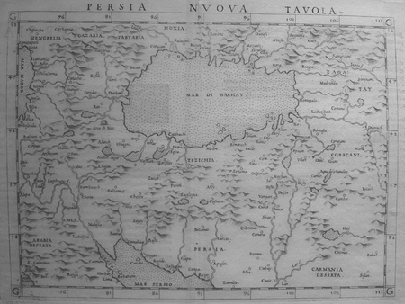
156118808Venedig, Valgrisi, 1561. 3 Teile in 1 Bd. 4 nn. Bll., 358 S., 1 Bl.; 28 Bll., 47 S., 24 Bll. mit einigen Textholzschnitten. 64 doppelblattgroßen Kupferkarten (mit Rückentext). Gr.-8°. Pgmt. der Zeit mit hs. Rückentitel (Gebrssprn.). [5 Warenabbildungen]
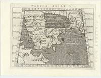
62444Venice 1596. FIRST EDITION THUS. Original engraved map of the Arabian Peninsula 16 x 21.5 cm. overall with Latin text to verso. Embellished with sea monster to lower right corner. An excellent copy. This early map engraving is from Claudius Ptolemaeus Ptolemy and Giovanni Antonio Magini's Geographiae universae tum veteris tum novae absolutissimum opus duobus voluminibus distinctum. The work was published in Venice by S. Galignani de Karera's Heirs in 1596. This is the first Magini edition. "The copperplate maps prepared for this edition and engraved by Girolamo Porro are on a smaller scale and somewhat better executed than those in the editions of 1562" Phillips. [Venice, 1596]. unknown
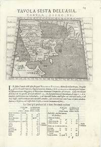
63967Venice 1596. Original engraved map of the Arabian Peninsula 12.5 x 17.5 cm on single leaf 29 x 20.5 cm with Italian text beneath. Verso printed with a map of Central Asia 'Tavola Settima Dell'Asia. Tabula Asiae VII' 12.5 x 17.5 cm. A very good example. This early map engraving is from Claudius Ptolemaeus Ptolemy and Giovanni Antonio Magini's Geographiae universae tum veteris tum novae absolutissimum opus duobus voluminibus distinctum. The work was published in Venice by S. Galignani de Karera's Heirs in 1596. This is the first Magini edition. "The copperplate maps prepared for this edition and engraved by Girolamo Porro are on a smaller scale and somewhat better executed than those in the editions of 1562" Phillips. [Venice, 1596]. unknown
15617550Carte par Ptolémée. Produite sur cuivre pour la première fois par Ruscelli. Nomenclature latine "Tabula Asiae IIII". Descriptif au dos en italien.Venise, chez Valgrise 1561.Carte trapézoïdale sous chemise cartonnée, mais envoyée sans le support. Carte très primitive et rare. Très bon état. Format in-4° (25x19).
1972010314PARIS CLUB DU LIVRE PHILIPPE LEBAUD 1972 Un fort volume grand in-folio de 206 pges , dans sa très belle reliure éditeur plein cuir havane , dos plat , motifs de frises grecs inscrustés sur les plats et médaillon en cuir sur le premier plat , tête doré et bien complet de bsa chemise et de sa boite bordurée , ouvrage comportant 20 lithographies originales en couleurs de Jean PICART LE DOUX , tirage à 300 ex. numérotés , un des 225 sur Rives signé par l' artiste , très bon exemplaire . PORT POUR LA FRANCE 20 ? ET POUR L' U.E. 28 ? Très bon Couverture rigide
511112Roma, Is.M.E.O., 1971. Grand in-4 broché, XIX-118 pp., 3 planches dépliantes de cartes en noir in fine, index. (Reports and Memoirs, XV, 1).
1561LBW0251d[Venise, 1561]. 183 x 246 mm.
197249351972 pet. in-8, ill., pleine toile éditeur P. Denoel 1974,
19861265801986 Vernal/ Philippe Lebaud - 1986 - In-8, broché, couverture frottée - 181 pages
1949R86739Paris, Cerf 1949 101pp., 20cm., dans la série "Sources chrétiennes. Série annexe de textes non chrétiens" vol.24, br.orig., non coupé, bon état, bilingue: grec-français, R86739
62323Paris chez Cardin Besongne 1640 - reprint en fac-simile - Loge Astrologique de France 1985 In-12 xix-465pp. un des 300 exemplaires numérotés unknown
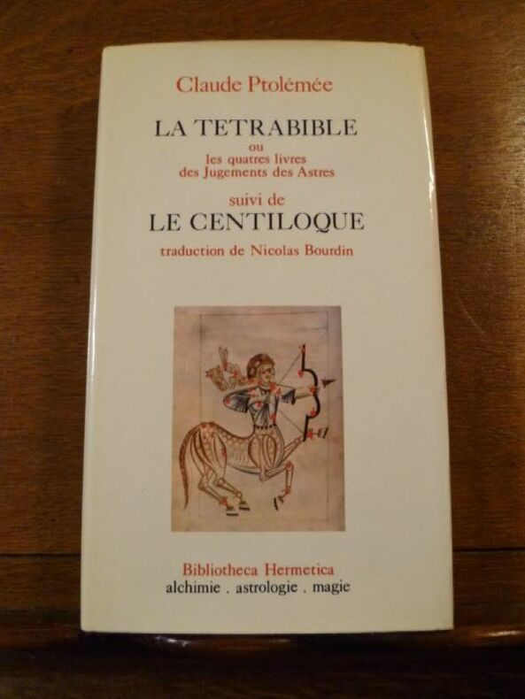
1361Bibliotheca Hermetica, CAL, 1974. Un volume relié (12 x 20,5 cm) de 285 pp. Reliure pleine toile d'éditeur sous jaquette illustrée. Ouvrage en bon état.
1361Bibliotheca Hermetica, CAL, 1974. Un volume relié (12 x 20,5 cm) de 285 pp. Reliure pleine toile d'éditeur sous jaquette illustrée. Ouvrage en bon état.