MAGINI (Giovanni Antonio) & PTOLEMEE (Claude).Livre Rare Book
335 résultats
1617LBW-1926[Arnhem, Joannes Jansson, 1617]. 130 x 168 mm.
1617LBW-1923[Arnhem, Joannes Jansson, 1617]. 128 x 170 mm.
1617LBW-1938[Arnhem, Joannes Jansson, 1617]. 128 x 168 mm.
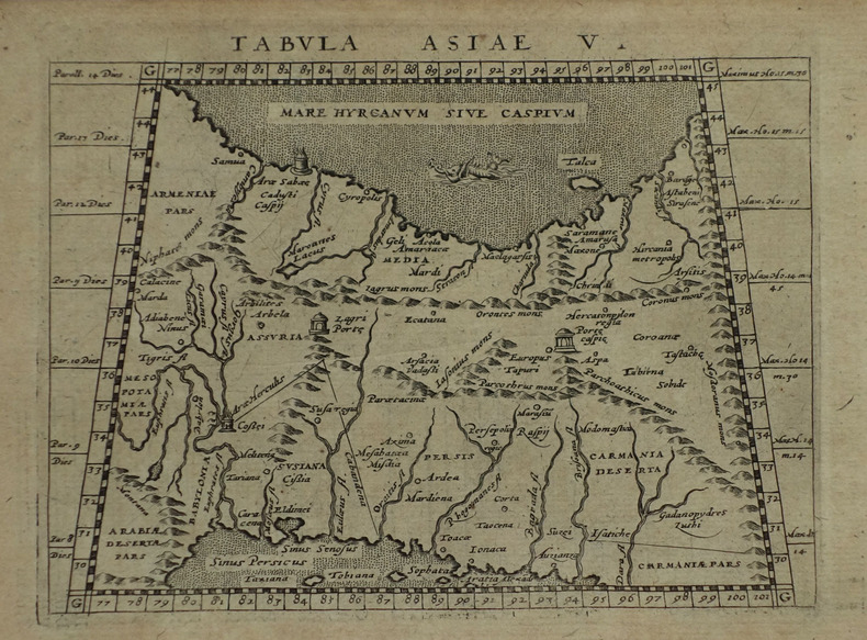
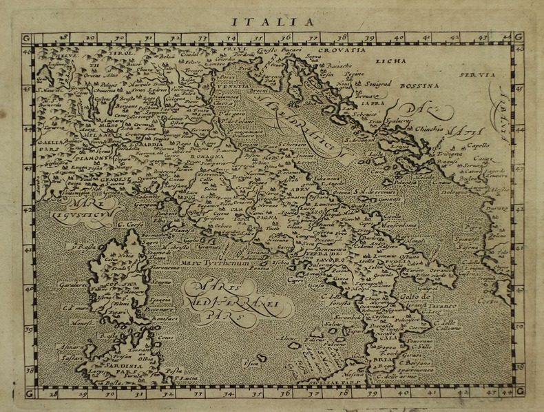
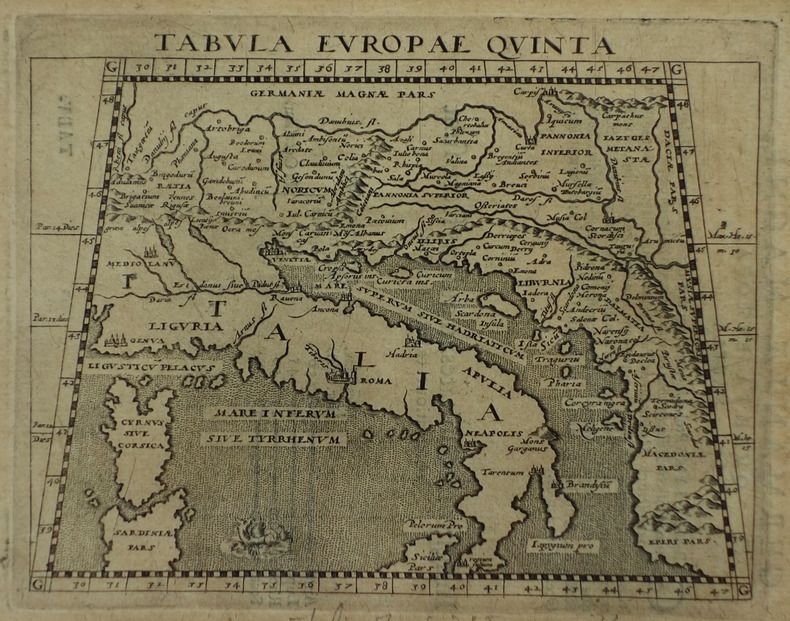
1617LBW-1918[Arnhem, Joannes Jansson, 1617]. 130 x 168 mm.
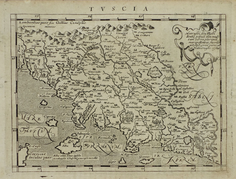
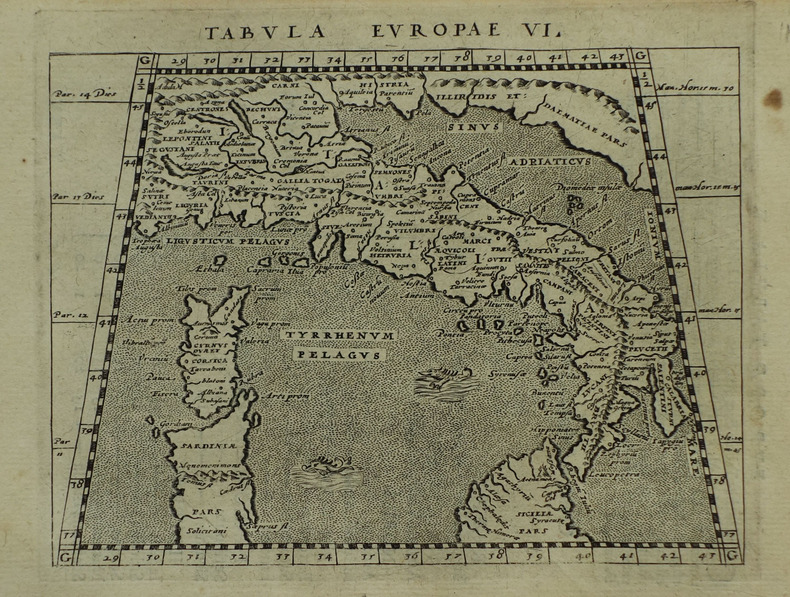
1617LBW-1934[Arnhem, Joannes Jansson, 1617]. 130 x 169 mm.
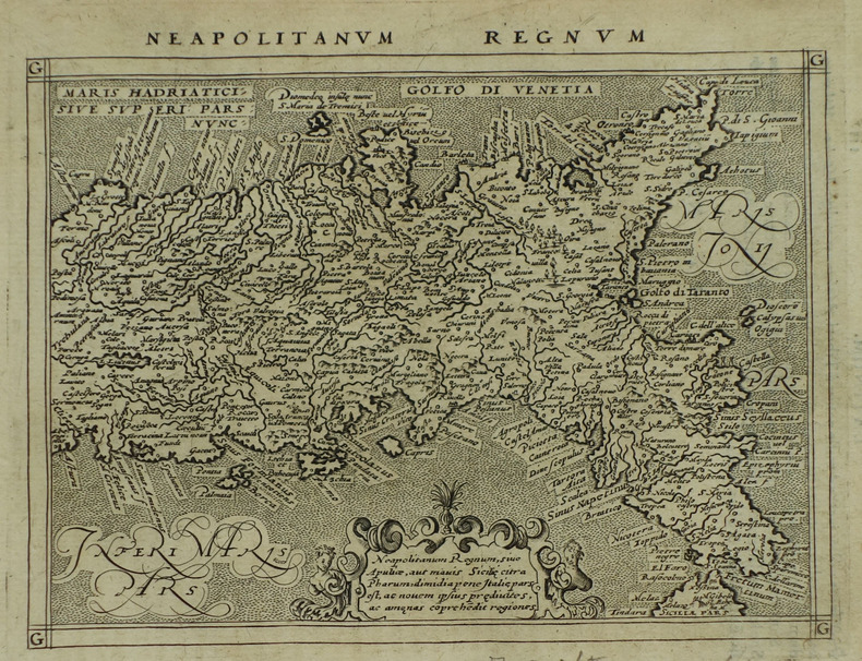
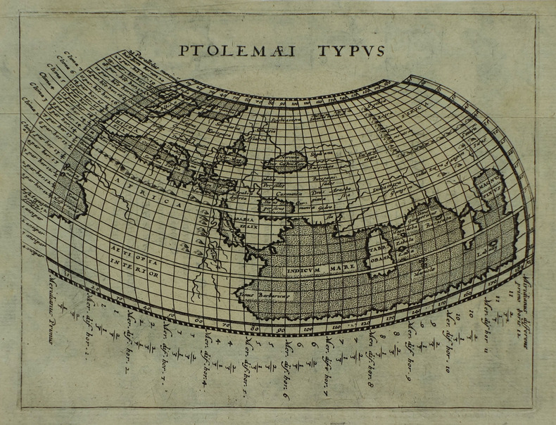
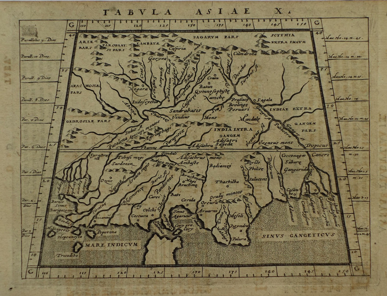
1617LBW-1933[Arnhem, Joannes Jansson, 1617]. 129 x 170 mm.
1617LBW-1937[Arnhem, Joannes Jansson, 1617]. 132 x 172 mm.
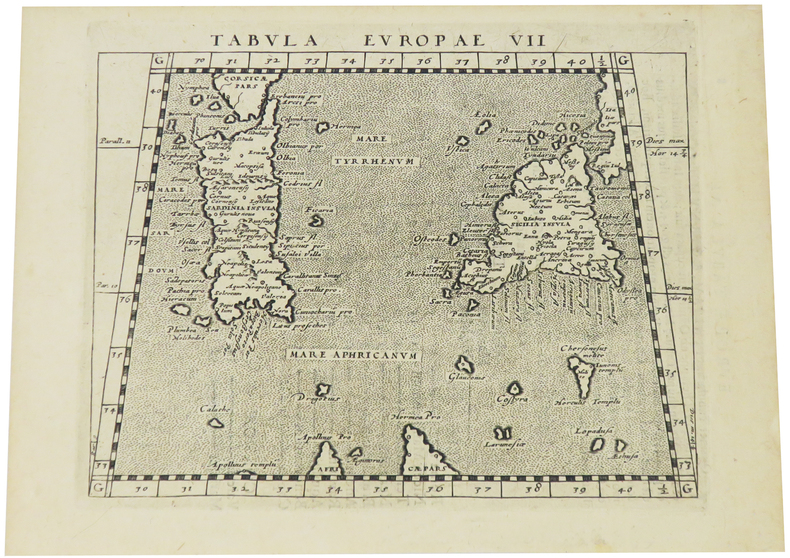
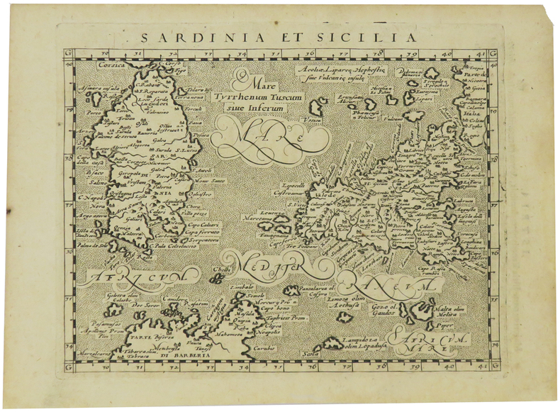
1617LBW-1935[Arnhem, Joannes Jansson, 1617]. 130 x 169 mm.
1617LBW-1921[Arnhem, Joannes Jansson, 1617]. 130 x 166 mm.
1617LBW-1931[Arnhem, Joannes Jansson, 1617]. 127 x 163 mm.
1617LBW-1932[Arnhem, Joannes Jansson, 1617]. 129 x 167 mm.
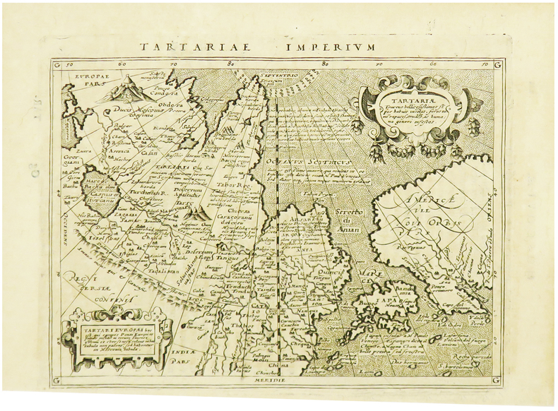
1617LBW-1964[Arnhem, Joannes Jansson, 1617]. 129 x 170 mm.
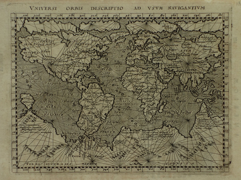
1617LBW-1922[Arnhem, Joannes Jansson, 1617]. 131 x 172 mm.
2024__0903696746Hurtwood Pr Ltd 2024. Hardcover. New. 208 pages. 11.50x9.25x9.09 inches. Hurtwood Pr Ltd hardcover
0903696746.Ghardcover. Good. Access codes and supplements are not guaranteed with used items. May be an ex-library book. hardcover
46530570-nnew. unknown
46530570like new. unknown
20082-0789315912Universe Pub 2008. Hardcover. New. 304 pages. 14.00x9.00x1.25 inches. Universe Pub hardcover
1730332605Amsterdam: R. & W. Wetstein William Smith 1730. unbound. Map. Copper plate engraving. Image measures 13.25" x 18".<br/> <br/> Printed circa 1730 this map of the Indian subcontinent was based on Ptolemy's 2nd century map and refined by Mercator beginning in the 16th century. This 1730 edition features graticule lines and a cartouche with a cherub. Covering an area from the Himalayan Mountains south to the Indian Ocean the map names many cities and topographical features. The map is in good condition wear to edges small tear to top of original center fold line. <br> <br> Gerard Mercator 1512-1594 was an accomplished mathematician cartographer globe maker and engraver best known for the Mercator Projection. Incorporating the newly accepted fact that the world is round Mercator was able to render longitude lines consistently straight on a chart. Although this requires some distortion it was of great use for navigators; furthermore it has since become historically important as it is still the most commonly used projection today.<br/> <br/> R. & W. Wetstein, William Smith unknown
1584Map1002Cologne: Goldefridi Kempensis 1584. 2nd Edition . No Binding. Fine. Folio. AN ORIGINAL MAP. Original hand colouring. 47x40cms Folding double page.PLEASE EMAIL FOR PHOTOS. <br/> <br/> Goldefridi Kempensis unknown
1985W119448Citta del Vaticano, Biblioteca Apostolica Vaticana 1985 370pp., 25cm., original 1985-edition, softcover, pages still uncut, in the series "Studi e Testi" volume 315, good condition, [Contains a critical Greek text edition, as well as an introduction, translation and commentary in French], R119448
in-8 broché de 150 pages environ. Tres bel exemplaire de cette revue trimestrielle destinee essentiellement aux enseignants (histoire - français - latin - grec) de l'enseignement secondaire [FL-18] Autres numéros sur demande.
197591129Editions Retz , Bibliotheca Hermetica Malicorne sur Sarthe, 72, Pays de la Loire, France 1975 Book condition, Etat : Bon relié, pleine toile éditeur, sous jaquette imprimée éditeur blanche, illustrée d'une figure en couleurs In-8 1 vol. - 303 pages
1968C111968Köln, 1968 xxiv + 152pp., 21cm., softcover, Doctoral Dissertation (Inaugural-Dissertation zur Erlangung der Doktorwürde einer Hohen Rechtswissenschaftlichen Fakultät der Universität zu Köln), stamp at verso of title page, text is clean and bright, good condition, C111968
xxiv + 152pp., 21cm., softcover, Doctoral Dissertation (Inaugural-Dissertation zur Erlangung der Doktorwürde einer Hohen Rechtswissenschaftlichen Fakultät der Universität zu Köln), stamp at verso of title page, text is clean and bright, good condition, C111968