PTOLEMEE ClaudeLivre Rare Book
335 résultats
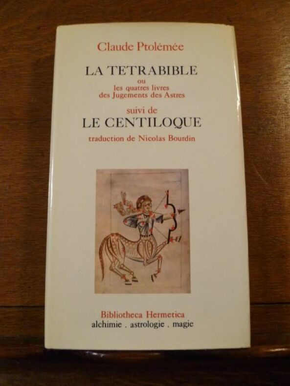
1361Bibliotheca Hermetica, CAL, 1974. Un volume relié (12 x 20,5 cm) de 285 pp. Reliure pleine toile d'éditeur sous jaquette illustrée. Ouvrage en bon état.
1361Bibliotheca Hermetica, CAL, 1974. Un volume relié (12 x 20,5 cm) de 285 pp. Reliure pleine toile d'éditeur sous jaquette illustrée. Ouvrage en bon état.
1974028470Paris 1974 E. P. Denoël Hardcover Very Good 1st Edition
62323Paris chez Cardin Besongne 1640 - reprint en fac-simile - Loge Astrologique de France 1985 In-12 xix-465pp. un des 300 exemplaires numérotés unknown
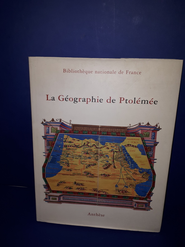
1988AA280B.n.f Anthèse 1988 In-4° de 87 pp.,
195948400Madrid, Victoriano Suarez, 1959. 4°. Mit zahlr. meist ganzs. Abbildungen. 281 S., 2 Bll., Lwd. d. Zt. m. goldgepr. Rückentitel u. dem eingeb. OUmschlag.
In 4° (234 x 163 mm), 3 parti in 1 volume.; [8], 358, [2] pagine; [28] carte; 47, [49] pagine, 64 carte geografiche a doppia pagina delle quali 27 raffiguranti il mondo antico e 37 raffiguranti il mondo moderno con la descrizione al retro, 12 xilografie e diagrammi nel testo, marche tipografiche (alcuni difetti.). Solida legatura coeva in pergamena con unghie (sguardie nuove).
156118808Venedig, Valgrisi, 1561. 3 Teile in 1 Bd. 4 nn. Bll., 358 S., 1 Bl.; 28 Bll., 47 S., 24 Bll. mit einigen Textholzschnitten. 64 doppelblattgroßen Kupferkarten (mit Rückentext). Gr.-8°. Pgmt. der Zeit mit hs. Rückentitel (Gebrssprn.). [5 Warenabbildungen]
157418848Venetia (Venice), Giordano Ziletti, 1574-(73). 4to. Hcalf from ab 1820. Gilt back. Slight rubbing to spine. (78),350 pp. and 65 double-page engraved maps with text on verso of plates (130) pp,56,65 pp. 6 textlvs. at end with brownspots in right margin, sometimes a little browning to pages, few brownspots and a few textlvs. with minor wormtracts. Complete with all 65 maps called for, each measuring ab. 19 x 26 cm. A great part of the maps have some background shadowing from the printers ink, mainly due to the fact, that this is the third Ruscelli-edition, where the plates have been used before. 3 printer's wood-cut devices and 20 smaller and larger woodcuts in the text. 2 woodcuts with Ptolemy shown observing.
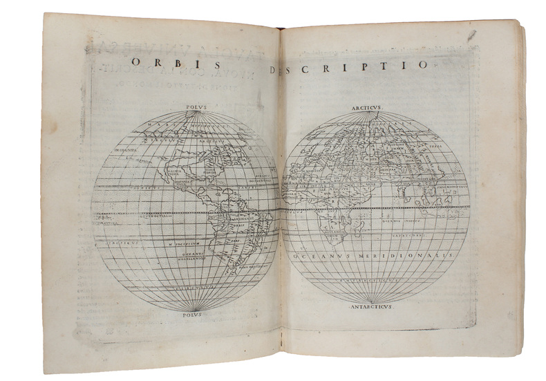
1561220449Venice: Vincenzo Valgrisi 1561. hardcover. very good. Venice: Vincenzo Valgrisi 1561. 3 parts in 1 volume: "La Geografia" by Ptolemy Ruscelli's "Espositioni et Introduttioni Universali" and "Discorso Universale di M. Gioseppe Moleto mathematico". Short thick 4to bound in full contemporary vellum with red speckled edges modern description pasted on spine. Features 64 double page maps: 27 Ptolemaic maps showing the ancient world as Ptolemy knew it including one world map 37 "modern" maps with two world maps and several woodcut diagrams illustrations and decorative initials. First Italian edition. Binding well-worn at edges. Small wormholes in a few pages of text. Library stamp manuscript notes and seal in red ink on title page. Marginal dampstains and occasional foxing with small pencil and contemporary ink notations in margins and on some maps. In general maps are clean and bright. Bookplate of Otto Orren Fisher and ink inscription dated 1724.<br/><br/> Girolamo Ruscelli c. 1504-1566 was a Venetian editor. He introduces several important innovations in this volume through his 37 "modern" maps which cover Europe Africa Asia and the New World. Ruscelli includes a double hemisphere world map which was the first of its kind to be used in an atlas and "Carta Marina Nuova Tavola" a rare sea chart of the world. He includes a revised version of the Zeno map of the Arctic first published in 1558. The Zeno map describes the purported journey of the author's ancestors in the 1390s to Greenland Iceland the mythical islands of Frisland and Icaria and what is now thought to be Newfoundland and Labrador. While Zeno shows Greenland connected to Norway Ruscelli has updated the map by eliminating this land bridge. Despite its inaccuracies and inclusion of mythical lands the Zeno map persisted as the prevailing map of the Arctic and Greenland for many years. Six other New World maps include the South American continent Brazil Central America and the Baja Peninsula the eastern coast of North America Cuba and Hispaniola. Claudius Ptolemy 90-168 CE was a Roman geographer and mathematician living in Egypt who compiled his knowledge and theories about the world's geography into one seminal work. Although his maps did not survive his mathematical projections and location coordinates did. During the Renaissance revival of Greek and Roman works "Geographia" was rediscovered by monks and based upon Ptolemy's detailed instructions the maps were recreated. The first printed edition of "Geographia" with maps was published in Bologna in 1477. A rare and exciting edition for any collector.<br/><br/> Vincenzo Valgrisi unknown books
1564265015Venice: Giordano Ziletti 1564. hardcover. very good. 3 parts in 1. Each part has a separate title page with large printer's device. Part 2: Espositioni et Introduttioni Universali di Girolamo Ruscelli sopra tutta la Geografia di Tolomeo. Part 3: Discorso Universale di M. Gioseppe Moleto mathematico. Illustrated with 63 of 64 fine double-leaf copper engraved maps including the rare "World in Hemispheres". Additional large in-text engravings and decorative initials throughout. 8 358 110 204 48 index 47 pages. Short thick 4to bound in old calf with gilt devices on covers neatly re-cased binding well-rubbed but very sound; very clean copy virtually free of foxing; one map ink stained; lacks the final world map "Carta Marina" a.e.g. Venetia: Appresso Giordano Ziletti 1564. Text in Italian. Bookplate of Otto Orren Fisher pasted on inside cover. Manuscript note in ink on title page reads: Ex Libris Stephan Tiapas.<br/><br/> Second edition of Ruscelli's Italian translation very similar to the edition of 1561 and containing the same series of maps. The double- page maps are partly based on those of Jacopo Gastaldi in the edition of 1548 but on a larger scale. According to Nordenskiold two important innovations were introduced by the 1561 edition into cartographical literature. One: the division of the Map of the World in two hemispheres. Two: The re-issue of the Zeno Map of the Arctic Regions which had appeared first 3 years before. "If the remarkable map in this little work had not received extensive circulation under the sanction of Ptolemy's name it would probably have been forgotten. During nearly a whole century it exercised an influence on the mapping of the northern countries to which there are few parallels in the history of cartography".<br><br>Girolamo Ruscelli c. 1504-1566 was a Venetian editor whose maps are primarily based on those by Jacopo Gastaldi 1548 but with many of his own additions and reproduced on a larger scale. Ruscelli introduces several important innovations in this volume through his 37 "modern" maps which cover Europe Africa Asia and the New World. Ruscelli includes a double hemisphere world map which was the first of its kind to be used in an atlas and "Carta Marina Nuova Tavola" a rare sea chart of the world. He includes a revised version of the Zeno map of the Arctic first published in 1558. The Zeno map describes the purported journey of the author's ancestors in the 1390s to Greenland Iceland the mythical islands of Frisland and Icaria and what is now thought to be Newfoundland and Labrador. While Zeno shows Greenland connected to Norway Ruscelli has updated the map by eliminating this land bridge. Despite its inaccuracies and inclusion of mythical lands the Zeno map persisted as the prevailing map of the Arctic and Greenland for many years. Six other New World maps include the South American continent Brazil Central America and the Baja Peninsula the eastern coast of North America Cuba and Hispaniola. Claudius Ptolemy 90-168 CE was a Roman geographer and mathematician living in Egypt who compiled his knowledge and theories about the world's geography into one seminal work. Although his maps did not survive his mathematical projections and location coordinates did. During the Renaissance revival of Greek and Roman works "Geographia" was rediscovered by monks and based upon Ptolemy's detailed instructions the maps were recreated. The first printed edition of "Geographia" with maps was published in Bologna in 1477. A rare and exciting edition for any collector. Sabin 66504<br/><br/> Giordano Ziletti unknown books
157418848Venetia Venice Giordano Ziletti 1574-73. 4to. Hcalf from ab 1820. Gilt back. Slight rubbing to spine. 78350 pp. and 65 double-page engraved maps with text on verso of plates 130 pp5665 pp. 6 textlvs. at end with brownspots in right margin sometimes a little browning to pages few brownspots and a few textlvs. with minor wormtracts. Complete with all 65 maps called for each measuring ab. 19 x 26 cm. A great part of the maps have some background shadowing from the printers ink mainly due to the fact that this is the third Ruscelli-edition where the plates have been used before. 3 printer's wood-cut devices and 20 smaller and larger woodcuts in the text. 2 woodcuts with Ptolemy shown observing. <br/><br/><em>Third edition of Ruscelli's translation from Venice 1561. The maps are printed from the same plates with the exception of Ptolemy's map of the world for which Malomba had returned to the original conical projection of Ptolemy. Moreover one map is added: the map of "Territorio di Roma". In general the maps are enlarged copies of Gastaldi's maps from the edition of 1548 which came out in 8vo. The Ruscelli translation contains an important innovation namely the division of the world map into two parts one for the Old World and one for the New as seen on the plate "Tavola Universal" depicting the 2 hemispheres. The atlas contains 27 ptolemaic maps and 38 new. 1 World 1 Hemisphere 10 Europe 4 Africa 12 Asia and 38 others. 10 of the maps relate to America.Philipps I:380. Sabin 66505. Nordenskiöld Nr. 34 p.27. </em> unknown
1548ST20876Venice: Giovanni Baptista Pedrezano 1548. First Complete Edition in Italian. Translated by Pietro Andrea Mattioli. Binding size: 175 x 116 mm. 6 7/8 x 4 5/8". ENTIRELY COMPLETE: binder's blank 816 pp. collating as dagger8 A-DD8 DD8 being blank 240 pp. as maps a-h8. <br/> Modern 19th century vellum over flexible boards three raised double bands new pastedowns and free endpapers. Woodcut initials throughout occasional diagrams one full-page decorative woodcut side-borders to title-page fine woodcut portrait of Ptolemy observing the heavens and 60 DOUBLE-PAGE COPPER-ENGRAVED MAPS BY GIACOMO GASTALDI ALL COLORED BY A CONTEMPORARY HAND the land masses enhanced with small depictions of ships mermaids sea monsters strange human figures wild and domestic animals including fish an elephant leopard and chicken and other charming embellishments Pedrezano's large woodcut device on colophon leaf 2D7r and verso of final leaf the maps with landmarks and place names each map guarded by a thin vellum strip taken from a 14th century manuscript executed in a fine scribal hand. Front flyleaf with the early signature of Lelio Capilupi presumably belonging to the book's first or at least early owner and very possibly being that of the Mantuan poet humanist and courtier Lelio Capilupi 1497-1560 known for his "Centones ex Virgilio." Adams P-2234; Alden & Landis 548/31; Burden North America 16 & 17; EDIT16 CNCE 47524; Harrisse BAV 285; JCB3 I:153; Mortimer Italian 404; Nordenskiold 2:214; Phillips Atlases 369; Sabin 66502; Shirley Mapping of the World 87 & 88; Streeter sale 1. Spine and part of the covers with some darkening apparently as an antiquing effect but the binding completely solid and entirely harmless. Intermittent faint dampstain at various places on the page though the vast majority of leaves unaffected map of British Isles with very small repaired hole caused by acidic paint only visible if you look for it bottom margin of three maps and one left margin of another neatly reinforced a handful of margins a bit smudged other trivial imperfections but an extremely attractive copy internally the paper remarkably strong and fresh and with virtually none of the signs of use so often seen with early atlases.<br/> <br/> Because of its innovative size its extensive use of copper engravings instead of woodcuts its introduction of nearly three dozen modern maps and especially its new images of the Americas this is a landmark cartographical publication--and the copy we offer is an extremely rare example of the work enriched with full contemporary hand coloring. It is the first complete printing in Italian following Berlinghieri’s verse paraphrase of 1482 of Ptolemy's universally recognized atlas of the classical world and much more important it is the first version of the work small enough to be practicably carried by hand or in a purse or pocket. In addition although a very small number of earlier atlases exist with copper engravings no previous one is engraved to the extent seen here with five dozen double-page maps presenting dramatically finer detail for example in more refined coastlines and more cleanly realized decorative elements than was possible with images cut from wood. As Nordenskiold notes our 1548 edition was a kind of rediscovery of the virtues of the intaglio cartographic image with no engraved atlas having been printed in the 16th century before ours. In terms of content of central importance here are first engraved maps of parts of North and South America providing legitimacy to Nordenskiold's characterization of our work as "the very first atlas of the New World." There are seven major America-related cartographical achievements in our Pedrezano edition five of them being the modern World map map 59; the other world map "Carta marina" which is the first sea chart depicting the modern world map 60; "Tierra nova" the first separate map of the South American Continent map 54; "Nueva Hispania" the earliest separate map of the Gulf Coast Mexico and the present American Southwest map 55; and "Tierra nueva" the earliest individual map of the east coast of North America from north Florida to Labrador map 56 showing the discoveries of Giovanni da Verrazzano and Jacques Cartier. These last three plus a map of Cuba and one of Hispaniola represent the earliest printed American regional maps. Beyond the American images the 1548 "Geografia" also includes an atypically exo-European eclecticism highlighted by what is apparently the first separate map of the Indian peninsula along with the first separate map devoted to Arabia and the first reference to Singapore on a printed map. The maps were the work of Giacomo Gastaldi ca. 1500 - 1566 Cosmographer to the Venetian Republic and the most prominent Italian cartographer of the period known especially for keeping up to date with the latest geographical discoveries and incorporating them into his maps. While 26 of the 60 maps are based on Ptolemy distinctive here and in other editions within their trapezoidal frames the greater number 34 are the modern work of Gastaldi. The book is consequently one of the very best examples of the integration of the period's Age of Discovery with the groundwork laid by Classical writers. Gastaldi was also responsible for updating and adding modern place names an enormous undertaking as is reflected in the 127-page index here. The history of world exploration owes an immeasurable debt to Claudio Tolomeo ca. 90 - ca. 168 AD who included in his "Geografia" what was known about the geography of the world during the Roman Empire of his lifetime and except for some excavated carved maps Ptolemy's are essentially all we have as a source for the world trodden by the ancients. Manuscripts of his work are known to date as early as ca. 1300 and there were multiple 15th century printings. But all incunabular editions were very large books volumes to be beheld rather than be held and used in any portable context. Waldseemuller's 1513 Strassburg edition was just as weighty. By contrast our edition offered its owner a much more practical format and yet because of its broadening world of 60 maps it was nevertheless the most comprehensive atlas--and the most important one--published between Waldseemuller's and the monumental Ortelius "Theatrum" of 1570. Copies of the 1548 Ptolemy appear on the market from time to time though they typically are beset with condition problems. What seems never to appear--at least so far as we've been able to ascertain--are copies of the book with contemporary coloring. Surely even with a small format atlas issued for functional purposes there must have been copies that were colored on occasion. The Morgan Library does own a copy--apparently once possessed by Marie de Medici--that is colored and it is possible that such copies silently reside in other admittedly sometimes very brief records of institutional holdings but we were unable to find any evidence of such. Likewise and perhaps more telling we were unable to find any copies with period color in auction records which certainly would have prominently announced such an important feature. The Streeter copy and the Wardington copy for example were uncolored. In sum this is a cartographic work of signal importance in especially attractive condition with no small amount of charm in its maps' various real and imagined inhabitants and offered in a colored state that seems virtually never to appear for sale. Giovanni Baptista Pedrezano unknown
1564265015Venice: Giordano Ziletti 1564. hardcover. very good. 3 parts in 1. Each part has a separate title page with large printer's device. Part 2: Espositioni et Introduttioni Universali di Girolamo Ruscelli sopra tutta la Geografia di Tolomeo. Part 3: Discorso Universale di M. Gioseppe Moleto mathematico. Illustrated with 63 of 64 fine double-leaf copper engraved maps including the rare "World in Hemispheres". Additional large in-text engravings and decorative initials throughout. 8 358 110 204 48 index 47 pages. Short thick 4to bound in old calf with gilt devices on covers neatly re-cased binding well-rubbed but very sound; very clean copy virtually free of foxing; one map ink stained; lacks the final world map "Carta Marina" a.e.g. Venetia: Appresso Giordano Ziletti 1564. Text in Italian. Bookplate of Otto Orren Fisher pasted on inside cover. Manuscript note in ink on title page reads: Ex Libris Stephan Tiapas.<br/> <br/> Second edition of Ruscelli's Italian translation very similar to the edition of 1561 and containing the same series of maps. The double- page maps are partly based on those of Jacopo Gastaldi in the edition of 1548 but on a larger scale. According to Nordenskiold two important innovations were introduced by the 1561 edition into cartographical literature. One: the division of the Map of the World in two hemispheres. Two: The re-issue of the Zeno Map of the Arctic Regions which had appeared first 3 years before. "If the remarkable map in this little work had not received extensive circulation under the sanction of Ptolemy's name it would probably have been forgotten. During nearly a whole century it exercised an influence on the mapping of the northern countries to which there are few parallels in the history of cartography".<br> <br> Girolamo Ruscelli c. 1504-1566 was a Venetian editor whose maps are primarily based on those by Jacopo Gastaldi 1548 but with many of his own additions and reproduced on a larger scale. Ruscelli introduces several important innovations in this volume through his 37 "modern" maps which cover Europe Africa Asia and the New World. Ruscelli includes a double hemisphere world map which was the first of its kind to be used in an atlas and "Carta Marina Nuova Tavola" a rare sea chart of the world. He includes a revised version of the Zeno map of the Arctic first published in 1558. The Zeno map describes the purported journey of the author's ancestors in the 1390s to Greenland Iceland the mythical islands of Frisland and Icaria and what is now thought to be Newfoundland and Labrador. While Zeno shows Greenland connected to Norway Ruscelli has updated the map by eliminating this land bridge. Despite its inaccuracies and inclusion of mythical lands the Zeno map persisted as the prevailing map of the Arctic and Greenland for many years. Six other New World maps include the South American continent Brazil Central America and the Baja Peninsula the eastern coast of North America Cuba and Hispaniola. Claudius Ptolemy 90-168 CE was a Roman geographer and mathematician living in Egypt who compiled his knowledge and theories about the world's geography into one seminal work. Although his maps did not survive his mathematical projections and location coordinates did. During the Renaissance revival of Greek and Roman works "Geographia" was rediscovered by monks and based upon Ptolemy's detailed instructions the maps were recreated. The first printed edition of "Geographia" with maps was published in Bologna in 1477. A rare and exciting edition for any collector. Sabin 66504<br/> <br/> Giordano Ziletti unknown
2015R200130790Guy Trédaniel. 2015. In-8. Broché. Etat d'usage, Couv. légèrement pliée, Dos satisfaisant, Papier jauni. 184 pages, marque-page inclus - coins frottés.. . . . Classification Dewey : 130-Phénomènes paranormaux. Pseudo-sciences
1023827670.Ghardcover. Good. Access codes and supplements are not guaranteed with used items. May be an ex-library book. hardcover
1287729436.Gpaperback. Good. Access codes and supplements are not guaranteed with used items. May be an ex-library book. paperback
1956W74057Louvain, Bibliothèque de l'Université / Bureaux du Recueil / Publications Universitaires de Louvain 1956 131 + 358pp., 26cm., dans la série "Université de Louvain. Recueil de travaux d'histoire et de philologie. 4e série" fasc.8, brochure originale, non coupé, bel état, [texte de "L'optique" de Ptolémée en latin, introduction et notes en français], W74057
1956W116111Louvain, Bibliothèque de l'Université / Bureaux du Recueil / Publications Universitaires de Louvain 1956 131 + 358pp., 26cm., dans la série "Université de Louvain. Recueil de travaux d'histoire et de philologie. 4e série" fasc.8, jolie reliure solide en toile brune, titre doré au dos, qqs. cachets sur la page de titre, texte frais, bon état, [texte de "L'optique" de Ptolémée en latin, introduction et notes en français], poids: 1kg., W116111
1956DL1160Louvain:: Bibliotheque de l'Universite Bureaux de Recueil 1956. 1956. Series: Universite de Louvain Recueil de Travaux d'Histoire et de Philologie 4th ser. fasc. 8. First edition. 8vo. 131 358 pp. 100 figs. Original printed wrappers. Ownership ink signature of David C. Lindberg. Very good. Bibliotheque de l'Universite Bureaux de Recueil, 1956. unknown books
1956DL1160Louvain:: Bibliotheque de l'Universite Bureaux de Recueil 1956. 1956. Series: Universite de Louvain Recueil de Travaux d'Histoire et de Philologie 4th ser. fasc. 8. First edition. 8vo. 131 358 pp. 100 figs. Original printed wrappers. Ownership ink signature of David C. Lindberg. Very good. Bibliotheque de l'Universite Bureaux de Recueil, 1956. unknown
45260156like new. unknown
B9781018753300Hardback. New. hardcover
1533204261533 Basle, Joannes Herwagen, mars 1533, petit in folio de (16)-244-145-85 pp. reliure d'origine de plein velin ivoire dont les bords ont été rogné, rognés, angles des premiers feuillets habilement restaurés par un professionnel, dans l'ensemble assez bon exemplaire.
Paris, Librairie orientaliste Geuthner 1950. In-4 agrafé. Les églises de la Gaule Mérovingienne. Le culte d'Horus à Edfou sous les Ptolémees. Les études byzantines en Amérique. La civilisation Etrusque. Bon état