335 résultats
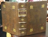
1621B6798Padova: Paolo & Francesco Galignani. 1621. . Some toning interior otherwise clean and crisp. Edition: Second Italian edition. Binding: Recent full calf boards. Matching upper and lower with double blind panels gilt floral devices at corners of inner panel. Spine with 4 raised bands abbreviated title in gilt on maroon label in 2 remaining compartments with gilt devices and blind rules. Notes: Translated from Latin into Italian by Leonardo Cernoti Vinitiano.<br>Text in Italian. <br>A fine example of this monumental atlas and treatise on cartography considered to be the most influential cartographic and geographical account of the ancient world originally written by Ptolemy in Greek around 150 AD. <br><br>Claudius Ptolemy c.100 – c.170 AD was a mathematician astronomer astrologer and geographer living in the city of Alexandria then the Roman province of Egypt under Roman rule who wrote a number of scientific treatises that greatly influenced Byzantine Islamic and Western European science. His Geografia written around 150 AD is a thorough discussion on maps and the geographic knowledge of the Greco-Roman world and also serves as a handbook on how to draw maps using geographic coordinates for parts of the Roman world known at the time. Geografia draws from an earlier work by Marinus of Tyre now lost to us as well as various Roman and Persian gazetteers.<br>Geografia is divided into 8 books: book I is a treatise on cartography describing the methods used to assemble and arrange Ptolemy's data; from Book II through the beginning of Book VII a gazetteer provides longitude and latitude values for the world known to the ancient Romans; the rest of book VII provides details on three projections to be used for the construction of a map of the world varying in complexity and fidelity; book VIII constitutes an atlas of regional maps. The maps include a recapitulation of some of the values given earlier in the work which were intended to be used as captions to clarify the map's contents and maintain their accuracy during copying.<br>Geografia was translated into Arabic in the 9th century and Latin around 1406 and was a highly influential resource on the cartographic traditions of the medieval Caliphate and Renaissance Europe.<br><br> Size: Small Folio 301x 206 mm Illustration: Complete with 64 engraved maps 27 Ptolemaic 37 modern including the rare double-page world map “Orbis Terrae Compendiosa Descriptio†engraved by Girolamo Porro in addition to 14 in-text illustrations plus title vignette and chapter headpieces. Folio pagination. La Seconda Parte Della Geografia di Cl. Tolomeo…: title dated 1620; period marginalia in margins of 126v; 154 mispag. 174. Pg. 13 of Commentarii et Annotationi… unnumbered. Volume: 2 parts in 1 volume. References: Sabin 66506; Phillips Atlases 405; Adams M-118; Shirley 193-96 Pages: Blank 2. Title. 1597 dedication to Marco Cornaro from Gio. Battista & Giorgio Galignani. 1621 dedication to Marco Cornaro from Paolo & Francesco Galignani. Blank. Della Geografia di Claudio Tolomeo: p. 1-62. Commentarii et Annotationi dell’Eccell. Sig. Gio. Antonio Magini Padouano…: p. 1-21. Blank 2. Table of contents. Index 27. La Seconda Parte Della Geografia di Cl. Tolomeo…: p. 2-212. Blank. Index 59. Blank 3. Category: Book Atlas & Cartography; Paolo, & Francesco Galignani. hardcover
31327, brepols, 2009 443 p., 30 colour ill., 210 x 270 mm, Languages: French Hardback. ISBN 9782503531649.
197734088Éditions de la différence 1977
31328, brepols, 2011 Hardback. 470 pages ., 3 b/w ill. 16 colour ill., 210 x 270 mm, Languages: English, Terraum orbis 8 ISBN 9782503523781.
200690171Museum. New. 2006. Paperback. 0954904141 . FREE UPGRADE to Courier/Priority Shipping Upon Request - IN STOCK AND IMMEDIATELY AVAILABLE FOR SHIPMENT - Flawless copy brand new pristine never opened -- 72 pp. ; 70 illus. -- with a bonus offer-- . Museum paperback
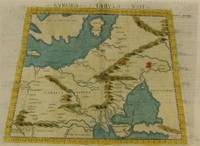
1574M7264Venice: Ruscelli c. 1574. Very Good;. Notes: Italian text on verso.<br>Girolamo Ruscelli 1518–1566 was an Italian mathematician and cartographer active in Venice during the early 16th century. Ruscelli is best known for his important revision of Ptolemy's Geographia published posthumously in 1574. Size : 190x265 mm 7.48x10.43 Inches Coloring: Hand Colored Category: Maps Russia; Maps Europe Ukraine; Maps Europe Poland Lithuania; Ruscelli unknown
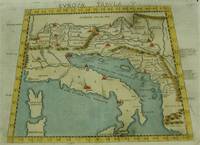
1574M7262Venice: Ruscelli c. 1574. Very Good;. Notes: Italian text on verso.<br>An early map of Italy the Adriatic Sea. Croatia Dalmatia Slovenia and Serbia beautifully hand coloured. <br>Girolamo Ruscelli 1518–1566 was an Italian mathematician and cartographer active in Venice during the early 16th century. Ruscelli is best known for his important revision of Ptolemy's Geographia published posthumously in 1574. Size : 186x266 mm 7.32x10.47 Inches Coloring: Hand Colored Category: Maps Europe Italy; Maps Europe Balkans; Ruscelli unknown
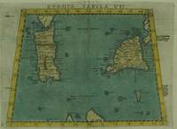
1574M7263Venice: Ruscelli c. 1574. Very Good;. Notes: Italian text on verso.<br>Early map of Sicily Malta and Sardinia beautifully hand coloured. <br>Girolamo Ruscelli 1518–1566 was an Italian mathematician and cartographer active in Venice during the early 16th century. Ruscelli is best known for his important revision of Ptolemy's Geographia published posthumously in 1574. Size : 190x265 mm 7.48x10.43 Inches Coloring: Hand Colored Category: Maps Mediterranean Islands; Ruscelli unknown
1786RW1618Nancy:: Chez C. S. Lamort 1786. 1786. 4to. 2 vi 192 2 pp. 2 large folding zodiac maps. Title vignette full mottled calf leather gilt-stamped spine label raised bands; joints worn corners showing. Very good. Side-by-side translation of Ptolemy's Greek into French describing the position of the stars during Ptolemy's lifetime. / "Montignot has given us the original Greek and a French translation of the seventh book of Ptolemy's great work under the title of `Etat des etoiles fixes au second siecle' in quarto. He has given the designation of the same stars by Flamstead Flamsteed and Beyer and their position in the year 1786." – Thomas Jefferson to Joseph Willard. Chez C. S. Lamort, 1786. hardcover books
146020Used. For more details please contact me unknown
1016854706.Ghardcover. Good. Access codes and supplements are not guaranteed with used items. May be an ex-library book. hardcover
1990154085Wigston: Magna Books 1990. 1st ed. thus. Nice copy. large folio. laminated boards xv 56pp. colour maps appends. bibliog. index With 27 fine double-page coloureed maps taken from an edition of Clavdii Ptolemaei: Cosmographia Magna Books hardcover
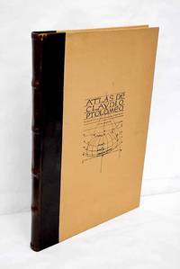
19833638099Valencia.: Vicent García. 1983. Hardcover. Falta el facsimil con los mapas . Good. 46 cm. 1 v. il. col. map. col. Encuadernación en tapa dura de editorial holandesa. Libro de estudios del facsimil. Introducción por Víctor Navarro Brotóns ; traducción y notas por Angel Aguirre Alvarez Víctor Navarro Brotóns y Enrique Rodríguez Galdeano. Tít. de la cub. : Atlas de Claudio Ptolomeo . Falta el facsimil con los mapas . ISBN: 8485094352 v.1 Geografía del mundo antiguo. Geografía regional en general. Geografía universal 913.1"01" Mapas. Atlas geográficos. Globos terráqueos 912100:528.9:091.07 Vicent García. hardcover
053104Paris Editions Hier et Demain 1976 grand in folio (46,5x35) 1 volume sous boitage de l'éditeur, dos et plat supérieur titrés, renfermant un fascicule de texte de 24 pages [1], suivi de 27 planches doubles hors-texte en couleurs de cartes. Collection cartographie antique. Collationné complet. Tirage limité à 999 exemplaires numérotés. Bel exemplaire ( Photographies sur demande / We can send pictures of this book on simple request ) poids du colis: 3 kilogrammes, emballage de protection
60385Paris, Bookking International, 1990, gd. in-folio, cartonnage couv. ill. coul. éd., XVI pp. de texte par Lelio PAGANI et XXVII pp. de reproductions des 27 doubles planches en coul. du Manuscrit latin VF.32 du XVe siècle de la Bibliothèque Nationale de Naples, bibliographie ainsi que le sommaire des planches, Superbe album qui reprend les planches de la "Cosmographie" de Ptomélée détenu par la bibliothèque nationale de Naples. RARE Très bon état
2014497656.Gpaperback. Good. Access codes and supplements are not guaranteed with used items. May be an ex-library book. paperback
2329075766.Gpaperback. Good. Access codes and supplements are not guaranteed with used items. May be an ex-library book. paperback
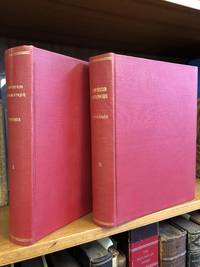
18131346487Paris: Chez Henri Grand 1813 1816. First French Edition. Hardcover. Octavo Two Volumes. In Very Good condition. Bound in full 20th-century red library bindings with gilt lettering to spine. Boards show mild shelf wear and soiling. Very mild age toning to text blocks. Facing text in Greek and French. Contains mathematical diagrams. Shelved in Case 10. 1346487. Shelved Dupont Bookstore. Chez Henri Grand hardcover
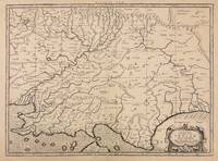
1730332605Amsterdam: R. & W. Wetstein William Smith 1730. unbound. Map. Copper plate engraving. Image measures 13.25" x 18".<br/> <br/> Printed circa 1730 this map of the Indian subcontinent was based on Ptolemy's 2nd century map and refined by Mercator beginning in the 16th century. This 1730 edition features graticule lines and a cartouche with a cherub. Covering an area from the Himalayan Mountains south to the Indian Ocean the map names many cities and topographical features. The map is in good condition wear to edges small tear to top of original center fold line. <br> <br> Gerard Mercator 1512-1594 was an accomplished mathematician cartographer globe maker and engraver best known for the Mercator Projection. Incorporating the newly accepted fact that the world is round Mercator was able to render longitude lines consistently straight on a chart. Although this requires some distortion it was of great use for navigators; furthermore it has since become historically important as it is still the most commonly used projection today.<br/> <br/> R. & W. Wetstein, William Smith unknown
12582Suivi de : LORENCE Gilles : Comment les astres influent-ils sur l'homme ? (selon Ptolémée). Sans lieu. Ed. LAF. Vers 1980. Grand in-8 (30x21). 150 feuillets tapuscrits. Broché.
9293Paris, Librairie Académique Perrin, 1977 14 x 21, 429 pp., illustrations N/B, cartonnage éditeur + jaquette, bon état
16322Paris, René Julliard, 1963. 16 x 24, 238 pp., quelques illustrations en N/B, 1 carte, broché, bon état (couverture intérieure arrière défraîchie).
1024156877.Ghardcover. Good. Access codes and supplements are not guaranteed with used items. May be an ex-library book. hardcover
101720411X.Ghardcover. Good. Access codes and supplements are not guaranteed with used items. May be an ex-library book. hardcover
0243512473.Gpaperback. Good. Access codes and supplements are not guaranteed with used items. May be an ex-library book. paperback