NEPTUNE FRANCOIS.Livre Rare Book
Librairie Le Bail · Paris, France1 500,00 €
141 résultats
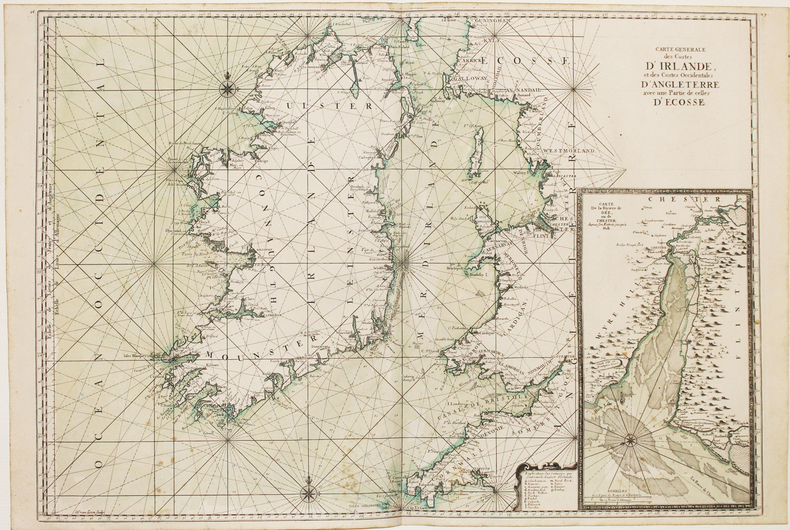
169316114(No date, no place, (1693). Very large engraved seechart, measuring 60,5 x 85,5 cm. in original outline colouring with inset view of the River Dee at Chester. The chart showing the whole of Ireland and the Westcoast of England from Cornwall to Cuningham in the north. A fine impression on good thick paper, bearing the watermark: BYCOLUMBIER. Folded down the center.
169316114No date no place 1693. Very large engraved seechart measuring 605 x 855 cm. in original outline colouring with inset view of the River Dee at Chester. The chart showing the whole of Ireland and the Westcoast of England from Cornwall to Cuningham in the north. A fine impression on good thick paper bearing the watermark: BYCOLUMBIER. Folded down the center. <br/><br/><em>The "Neptune Francois" was published in 1693 and its charts are larger and more lavishly decorated then those of any preceding book of its kind.This cart is without year place and "par ordre du Roi" pointing to a later print but issued from the original copperplate. It is also without "Imprimerie Royale" belonging to the most recent impression from 1792. Koeman IV425:10. </em> unknown
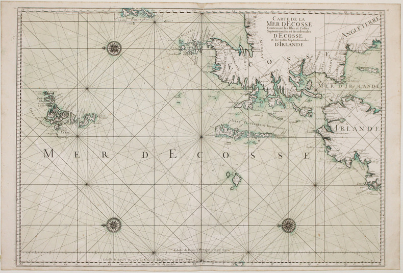
169316116(No place, no date(1693)). Very large engraved seechart, measuring 60 x 86,5 cm. in original outline colouring. The chart showing the Northern part of England from Lancaster to Banf, of Ireland from Blackrock to Carlingford and all the Islands to the north: Shetland, Orkney, Faroe etc. etc. A fine impression on good thick paper with the watermark: BYCOLUMBIER. Folded down the center.
169316116No place no date1693. Very large engraved seechart measuring 60 x 865 cm. in original outline colouring. The chart showing the Northern part of England from Lancaster to Banf of Ireland from Blackrock to Carlingford and all the Islands to the north: Shetland Orkney Faroe etc. etc. A fine impression on good thick paper with the watermark: BYCOLUMBIER. Folded down the center. <br/><br/><em>The "Neptune Francois" was published in 1693 and its charts are larger and more lavishly decorated than those of any preceding book of its kind. The chart is without year place and "par Ordre du Roi" pointing to a later impression but issued from the original copperplate. It is also without "Imprimerie Royale" belonging to the imprints from 1792. Koeman IV425:9. </em> unknown
1693LBW-2927[1693]. 590 x 880 mm.
169332305A Paris, (but Amsterdam, Pierre Mortier), 1693. 58x88 cm. Kobberstukket søkort over Øresund med den Skånsk/Hallandske kystline og den Sjællandske fra Møn i syd til Hesselø i nord. I pragtfuld fuld håndkolorering. Øverst i midten er indsat Amager og Saltholm i større målestok. Kortet ""ligger ned"", er orienteret øst/vest. Med kompasrose og vindretninger angivet.
169347353A Paris, (but Amsterdam, Pierre Mortier), 1693. 58x88 cm. Kobberstukket søkort over Øresund med den Skånsk/Hallandske kystline og den Sjællandske fra Møn i syd til Hesselø i nord. I pragtfuld fuld håndkolorering. Øverst i midten er indsat Amager og Saltholm i større målestok. Kortet ""ligger ned"", er orienteret øst/vest. Med kompasrose og vindretninger angivet.
169347353A Paris but Amsterdam Pierre Mortier 1693. 58x88 cm. Kobberstukket søkort over Øresund med den Skånsk/Hallandske kystline og den Sjællandske fra Møn i syd til Hesselø i nord. I pragtfuld fuld håndkolorering. Øverst i midten er indsat Amager og Saltholm i større målestok. Kortet "ligger ned" er orienteret øst/vest. Med kompasrose og vindretninger angivet. <br/><br/><em>Det berømte søkort over Sundet fra Jaillot's "Neptune Francois" men i P. Mortier's samtidige udgivelse heraf fra Amsterdam med tilføjelsen "Levée et Gravée" i kartouchen. Jaillot's to søkort over Danmark gav anledning til en kritik af Jens Sørensens opmåling idet Admiralitete forelagde ham de franske og påtalte at Sørensens kort næppe kunne være korrekte. Det var de imidlertid. Her er for første gang trykt det mere korrekte Amagerkort der foranlediger at øen på næsten alle senere kort gengives stor og rund. </em> unknown
169332305A Paris but Amsterdam Pierre Mortier 1693. 58x88 cm. Kobberstukket søkort over Øresund med den Skånsk/Hallandske kystline og den Sjællandske fra Møn i syd til Hesselø i nord. I pragtfuld fuld håndkolorering. Øverst i midten er indsat Amager og Saltholm i større målestok. Kortet "ligger ned" er orienteret øst/vest. Med kompasrose og vindretninger angivet. <br/><br/><em>Det berømte søkort over Sundet fra Jaillot's "Neptune Francois" men i P. Mortier's samtidige udgivelse heraf fra Amsterdam med tilføjelsen "Levée et Gravée" i kartouchen. Jaillot's to søkort over Danmark gav anledning til en kritik af Jens Sørensens opmåling idet Admiralitete forelagde ham de franske og påtalte at Sørensens kort næppe kunne være korrekte. Det var de imidlertid. Her er for første gang trykt det mere korrekte Amagerkort der foranlediger at øen på næsten alle senere kort gengives stor og rund. </em> unknown
1693LBW-2918[1693]. 607 x 868 mm.
1693LBW-2928[1693]. 585 x 873 mm.
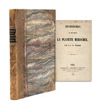
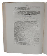
1846365003Paris: Bachelier Imprimeur-Libraire . Quai des Augustins 1846. First edition with half-title. pp. i-ii 1-3 4-254. 1 vols. 8vo. Contemporary half brown calf and marbled boards black spine label. Ownership signature of Alexander Evans on title page. Rubbed. Very good. First edition with half-title. pp. i-ii 1-3 4-254. 1 vols. 8vo. "I show that that one can only account for the movements of Uranus by introducing the perturbing action of a new planet" p. 5.<br /> French astronomer Urbain Le Verrier 1811-77 successfully predicted the location of an eighth solar planet now called Neptune. The seventh planet Uranus had been discovered telescopically in 1781 by William Herschel. Le Verrier demonstrated that the perturbations of the orbit of Uranus could be explained by the existence of a further celestial body and performed the mathematical calculations. The existence of the planet was confirmed by observation in September 1846 I.G. Galle writing to Le Verrier from Berlin "The planet whose position you communicated really exsts" p. 248. This book gathers four memoranda of "partial publications" read at the Academie des Sciences between November 1845 and October 1846 with a fifth part dated 5 October 1846. He notes that "this success permits us to hope that after thirty or forty years of observations of the new planet one will be able to use it in turn for the discovery of the planet after it in terms of distance from the Sun. And so on; sadly one will come upon bodies invisible by reason of their immense distance from the Sun but whose orbits will over centuries be charted with great exactness through the theory of secular inequalities" p. 254.<br /> <br /> "undeniably one of the major scientific events of the nineteenth century" Lequeux p. 22. <br /> <br /> Uncommon and with nice contemporary American provenance the original owner likely being Alexander Evans 1818-1888 engineer and attorney member of Congress from Maryland 1847-53 and an amateur astronomer who travelled to Illinois to observe the total eclipse in 1869. OCLC reports a dozen locations over several records most in France. For Le Verrier see James Lequeux Le Verrier-Magnificent and Detestable Astronomer Springer 2013 Bachelier, Imprimeur-Libraire ... Quai des Augustins unknown
184549635Paris, Bachelier, 1845 a. 1846. 4to. No wrappers. In: ""Comptes rendus hebdomadaires des séances de l’Académie des sciences"", Vol. 21, No 19, Vol. 22, No 22, Vol. 23, Nos 9, 14, 16 a. 17. (6 entire issues offered). Le verrier's papers: pp. 1050-1055 (No 19), pp. 907-919 (no 22), pp. 428-438 (No 9), pp. 657-659, 659-643, 676 (No 14), pp. 741, 741-754, 754 (No 16), pp. 798-799, 799-800 (No 17). With title-pages to vol. 21,22 a. 23. Titlepages with a small stamp in upper corner and a perforated stamp to lower margin. Light yellowing to title-pages, otherwise clean and fine on good paper.
184549635Paris Bachelier 1845 a. 1846. 4to. No wrappers. In: "Comptes rendus hebdomadaires des séances de l’Académie des sciences" Vol. 21 No 19 Vol. 22 No 22 Vol. 23 Nos 9 14 16 a. 17. 6 entire issues offered. Le verrier's papers: pp. 1050-1055 No 19 pp. 907-919 no 22 pp. 428-438 No 9 pp. 657-659 659-643 676 No 14 pp. 741 741-754 754 No 16 pp. 798-799 799-800 No 17. With title-pages to vol. 2122 a. 23. Titlepages with a small stamp in upper corner and a perforated stamp to lower margin. Light yellowing to title-pages otherwise clean and fine on good paper. <br/><br/><em>First printing of Le Verrier's importent and famous papers predicting and confirming the discovery of the Planet Neptune including the "preparatory" paper the first paper on the anomalities in the orbit of Uranus the calculations on which eventually leading to his prediction and discovery of a new planet Neptune the following year 1846."In 1846 John Cauch Adams. and Urban J. Leverrier. simultaneously and independently determined the location of a possible new planet. In 1845 he wrote of his findings of the mathematical location of a new planet to Sir George Bidell Airy Because Adams was unknown his letter was put aside. Meanwhile the same perturbations of Uranus had become of interest to Leverrier. On July 1should be June ! 1846 he presented a paper "Recherches sur les mouvements d'Uranus" to the Academie des Sciences inParis. When Airy realized that Leverrier and Adams had reached the same conclusions he hastened to suggest that a search be made for the newplanert. Shortly hereafter it was seen bur not recognized. About a week before it was found in England it was discovered by Galle in Berlin on information supplied by Leverrier. Thus the honour of the discovery or even co-discovery of the new planet Neptune was lost to Adams and credited to Leverrier. Adams paper was reade before the Royal Astronomical Society November 13 1846 and was published in 1847. Milestones p. 40.Milestones of Science No 132. - Dibner No. 16. </em> unknown