610 résultats
Fine English Paperback. Pbo. Roy. 8vo. (24 x 17 cm). In English. 32 p. The rising sun in the Balkans: The Republic of Macedonia.
21790Bucarest/Paris, Chez H. Champion - 1922 - In-8 - Broché - 190 pages -Ex. non coupé, Propre
Bucarest/Paris, Chez H. Champion - 1922 - In-8 - Broché - 190 pages -Ex. non coupé, Propre
Very Good Turkish, Ottoman (1500-1928) Original color map. Folded. Oblong atlas folio. (50 x 60 cm). In Ottoman script. Shows Eastern parts of Anatolia; Siverek, Urfa city and border of Diyarbakir and Adiyaman cities; Siverek; Harput (Kharpout); et alli. Scale: 1/200.000. Hegira: 1333 = Gregorian: 1917. Not description on map-maker. This is one the serie of the Bonn projection maps which are the first map series in modern techniques in Turkey and the Ottoman Empire. This is one the serie of the Bonn projection maps which are the first map series in modern techniques in Turkey and the Ottoman Empire. In order to produce these maps covering Turkish territory, Reconnaissance Branch was incorporated into The Mapping Commission. The maps were produced in the datum based on the latitude and longitude of Ayasofya Mosque in equal area Bonn Projection. The field works for the 123 sheets covering the country were conducted by 76 staff. The production was completed in 18 years starting from east west. Field works continued without stopping except in years 1914 and 1920. This map series called also reconnaissance maps contributed a lot to producing 1:25.000 scale maps. Subasi is cartographer of this map according to Türkezer - Cobanoglu: History of Mapping in Turkey-1:200.000 Scale Maps.
193510209Éditions Bernard Grasset 1935 572 pages in8. 1935. broché. 572 pages. Publié en 1935 par l'historien allemand Johann Gustav Droysen cet ouvrage est une biographie historique d'Alexandre le Grand qui est longtemps restée une référence sur le sujet. Il ouvre la voie à une nouvelle école historique allemande marquée par la pensée hégélienne et met en lumière l'unité civilisationnelle de la période hellénistique
19625363Club des libraires de France 1962 335 pages in8. 1962. reliure editeur pleine toile sous rodhoid. 335 pages. Traduction inédite de l'Histoire d'Alexandre le grand présentant sa vie ses guerres et sa mort accompagnée d'une étude sur l'imagination populaire et illustrée de miniatures du XVe siècle issues d'un manuscrit de la Geste d'Alexandre
1988176861988. Athènes Institut Français 1988 2ème ed. - 2 volumes brochés 17 cm x 24 cm XXVI+ 682 pages 1 carte dépliante hors-texte - Texte de Jean N. Kalleris importante bibliographie abr. techniques sources index toponymie - Etat neuf ; le tome III annoncé n'est jamais paru
1991LFA-126741636Un ouvrage de 256 pages, format 215 x 280 mm, illustré, broché couverture couleurs, publié en 1991, Henri Veyrier
19601605a1127a4zbvkLondon, Her Majesty's Stationary Office, 1964 (1960). xii, 404 pages; incl. 3 multiple folded tabels / x, pages 405-628. - Publisher's gilt-titled darkred cloth-bindings with gilt emblems at frontpanels; 4to.(ca. 33 x 20 x 5 cm; ca. 3,1 kg.).
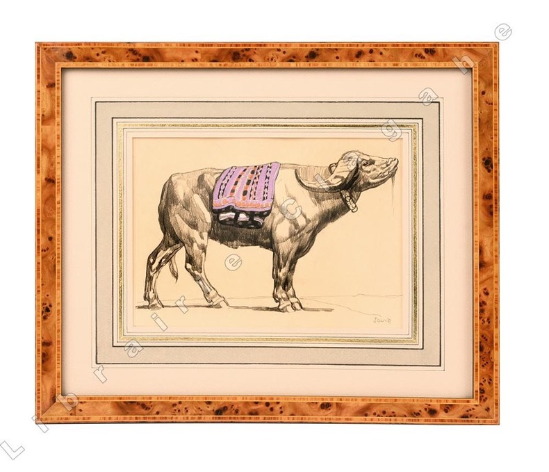
185221442Dessin original au crayon gras, gouache et aquarelle sur papier japon impérial (185 x 217 mm ; recadré 151 x 212), signé au crayon dans le coin inférieur droit ; passe-partout à large encadrement bicolore beige et vert et large filet doré, encadrement de loupe. Format total 295 x 355 mm. Au dos, partie de dessin au crayon et fusin, découpée.
12540Paris, La Renaissance du Livre 1926 - Bibliothèque de Synthèse Historique. L' Evolution de l' Humanité, dirigée par Henri Berr - in-8 broché - 7 planches, 9 figures et 4 cartes HT - XVII et 494 pages - Ex. non coupé, bon exemplaire
71338Coll. "L'évolution de l'humanité" n° 34, éd. Albin Michel, 10 février 1972, fort in-12, cartonnage souple, couv. ill. en bleu éd., 510 pp., 1 carte en noir sur deux pages, 1 plan en noir, notes, bibliographie, index, table des matières, "Ce volume de Pierre Jouguet, ancien membre de l'École française d'Athènes, qui fut membre de l'Institut et professeur à la Faculté des Lettres de Paris, est le sixième qui, dans la Collection « L'Évolution de l'Humanité », est consacré à l'hellénisme antique. « Après avoir - dans la mesure du possible - expliqué le miracle grec, la floraison magnifique d'un individualisme qui ne s'était vu nulle part ailleurs ; après avoir précisé les caractères du génie grec dans la religion, l'art et la spéculation, puis la constitution originale de la Cité, il nous faut étudier... les conditions nouvelles qui ont favorisé l'expansion de l'hellénisme, tout en lui faisant subir une transformation profonde. » Très bon état
14075Paris, Albin Michel, 1972. Coll. "L'Evolution de l'Humanité, 34". In-12 broché, couv. ill., 508 p. Cartes. Très bon état.
80159Paris, Albin Michel, 1970. 11 x 18, 506 pp., broché, très bon état.
1961471PARIS. ALBIN MICHEL. (DE LA COLLECTION "L’EVOLUTION DE L’HUMANITE ". BIBLIOTHEQUE DE SYNTHESE HISTORIQUE FONDEE PAR HENRI BERR). 1961. IN-8 BROCHE DE XXI + 532 PAGES, COUVERTURE BEIGE, TITRE IMPRIME EN NOIR. BEL EXEMPLAIRE.
Albin Michel, L'évolution de l'humanité, 1972, 506 p., poche, traces d'usage, couverture un peu jaunie, tranches légèrement tachées, état correct.
Paris, La Renaissance du Livre 1926 - Bibliothèque de Synthèse Historique. L' Evolution de l' Humanité, dirigée par Henri Berr - in-8 broché - 7 planches, 9 figures et 4 cartes HT - XVII et 494 pages - Ex. non coupé, bon exemplaire Envoi : "A Mademoiselle Germaine Rouillard, hommage très respectueusement amical de son professeur, collègue et disciple"
Gorgeous leather spine has wear along ends and rubbing. Minor browning to pages. Former owner's bookplate on inner cover. ; L'Évolution De L'Humanité. Synthèse Collective XV.
in-16, 506 pp, broche, couverture illustree. Très bel exemplaire, tres frais. [@]
Very Good German Original color map on cloth. A little foxing on cloth. Very good. Folded. Folio. (57 x 43 cm). Toponyms in German. [MAP of BALKANS] 40-44 Zajecar. [Macedonia, Donau -Danube- River, Hungary and Bulgaria border, East Serbia].
Very Good German Original color map on cloth. A little foxing on cloth. Very good. Folded. Oblong folio. (45 x 51 cm). In German. [MAP of WEST GREECE] L. 15. Paramythia (Corfu). Jonisches Meer. Scale: 1/300000. A sheet of the collection of 'The general map of Central Europe'. appeared in the years between 1873-1876 with the work of Joseph Ritter von Scheda, (1815-1888) who was a general, geographer and cartographer.
Very Good German Original color map on cloth. A little foxing on cloth. Very good. Folded. Oblong folio. (45 x 51 cm). In German. [MAP of WEST GREECE] L.15. Philiataes (Corfu). Jonisches Meer. Scale: 1/300.000. A sheet of the collection of 'The general map of Central Europe'. appeared in the years between 1873-1876 with the work of Joseph Ritter von Scheda, (1815-1888) who was a general, geographer and cartographer.
Very Good German Original color map on cloth. Oblong atlas folio. (46 x 52 cm). Toponyms in German. [MAP of BALKANS] J.10. Glina and around. North Bosnia and Herzegovina sheet. A sheet of the collection of 'The general map of Central Europe'. appeared in the years between 1873-1876 with the work of Joseph Ritter von Scheda, (1815-1888) who was a general, geographer and cartographer.