PE Tardieu P EBiblio.com
41 résultats
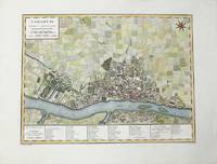
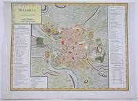
1792M4250Paris 1792. A tear on the right margin beyond the plate mark has been repaired upper margin shaved closely otherwise very good. Notes: A detailed and decorative city plan of Madrid and vicinity with a list of major edifices in two panels on the left and right hand sides. Size : 330x435 mm 13x17.125 Inches Coloring: Hand Colored Category: Maps City Maps; Maps Europe Spain unknown
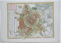
1792M4116Paris 1792. Excellent. Notes: A detailed and decorative city plan of Vienna and vicinity with a list of major edifices on the left hand side. Size : 345x440 mm 13.625x17.25 Inches Coloring: Hand Colored Category: Maps City Maps; Maps Europe Austria unknown
17998682Paris F. Buisson 1799-1804. Two copper engraved maps each 65 x 47 cm engraved by Jean-Baptiste Pierre Tardieu lainé of 385 Rue de Sorbonne; black and white a couple of closed tears old fold lines blank verso. Maps 38 and 39 from the atlas volume of Voyage dans l'intérieur de la Chine et en Tartarie fait dans les années 17921793 et 1794 par Lord Macartney Ambassadeur du Roi d'Angleterre auprès de l'Empereur de Chine the French translation of Sir George Stauntons account of the first British diplomatic mission to China headed by Lord Macartney. The maps cover the route between Guangzhou Canton and Beijing Peking. Map unknown
179817003Sur le Pas-de-Calais 1798. Only edition. Hardcover. Fine. 8vo. ivi106pp. Bound to style in half leather; red leather lettering label gilt mottled paper boards with tooling in blind; handmade paper end papers. With the large folding map of the British Isles by Tardieu. A fine copy. In French. Divided into sections by name or group and attributed to the Comte de Girardin 1762-1827. Rare. Lowndes p. 274. Sur le Pas-de-Calais hardcover books
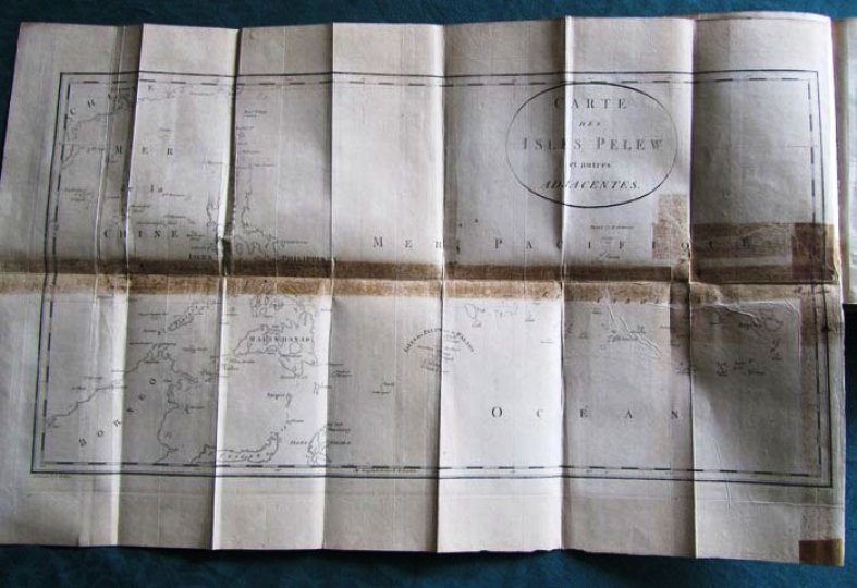
179314659Situées dans la partie occidentale de l'Océan Pacifique; Composée sur les journaux et les communications du Capitaine Henri Wilson et de quelques-uns de ces Officiers, qui, en août 1783, y on fait naufrage sur l'Antelope, paquebot de la Compagnie des Indes orientales. Traduit de l'anglais, de George Keate (1729-1797), Ecuyer, Membre de la Société royale, et de celle des Antiquaires.2 tomes en 1 volume. Relation du naufrage au large des Iles Palau ornée d'un frontispice, d'une grande carte et de 12 planches dépliantes, dont certains renforcées ainsi que 3 portraits, soit 17 planches au total. Vocabulaire de la langue Pelew en fin d'ouvrage.L'édition originale anglaise : <i>An Account of the Pelew Islands, situated in the Western part of the Pacific Ocean</i> d'après Henry Wilson est compilé par George Keate en 1788.Edition originale de la traduction française. A Paris, chez Maradan 1793. 280 et 272 pages.Reliure demi basane fauve racinée de l'époque. Dos lisse orné et doré avec pièce de titre rouge. Tranches marbrées. Pas de rousseur. Très bon état. Format in-8°(21x13).Les Palaos, officiellement la République des Palaos (en anglais Palau) est un pays d'Océanie situé en Micronésie, à l'est des Philippines, au nord de l'Indonésie, à l'ouest des États fédérés de Micronésie et occupant l'extrémité occidentale de l'archipel des îles Carolines.
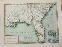
1799M5632Paris c. 1799. Very Good. Notes: The map depicts Florida during its time under Spanish control. Numerous Indian villages are located and roads are shown connecting early settlements. There are no engraved political divisions indicating the mapmaker's bias toward either the territorial claims of Spain or the United States. The map provides an excellent view of the Gulf Coast with a dramatically over-sized Tampa Bay. Numerous Indian villages are located and roads are shown connecting early settlements. The Bahamas are also well delineated.<br> Size : 335x440 mm 13.125x17.25 Inches Coloring: Hand Colored Category: Maps United States South Florida; Maps United States South States; unknown
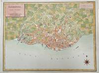
1792M4211Paris 1792. Very Good upper margin has been extended. Notes: Map of Lisbon capital of Portugal published in late 18th century.<br>Antoine-François Tardieu 1757-1822 was a French geographical engraver and publisher active in Paris during the late 18th and early 19th centuries. Size : 340x447 mm 13.375x17.625 Inches Coloring: Hand Colored Category: Maps City Maps; Maps Europe Portugal unknown
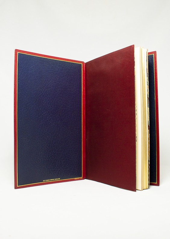
175116344Londres [Paris], Nourse, 1751. Album in-8, maroquin rouge janséniste, doublure de maroquin bleu, gardes de moire rouge indien, tranches dorées. De la bibliothèque Henri Beraldi (I, 1934, n°223) avec l’ex-libris au bas du premier contreplat; ex-libris R. Zierer, et Jean-François Chaponnière. Reliure signée Noulhac, 1918.
1785M10371Paris c.1785. Excellent wide margins. Notes: A fine early plan of Warsaw is based upon the 4-sheet plan of Warsaw by Pierre Ricaud de Tirregaille entitled Plan de la ville de Varsovie first published in 1762 and Antonio Rizzi-Zannoni's single sheet version of the map published in 1772.<br>Pierre Ricaud de Tirregaille a French Architect and Engineer worked in Warsaw as a surveyor and as an army engineer. Crown Marchal Bielinski commissioned Tirregaille to prepare a detailed plan of the city of Warsaw which resulted in the first map of Warsaw based upon a scientific survey.<br>Rizzi-Zannoni's plan published in 1772 of which we have an example coincided with the efforts of Polish Nobles to enlist the assistance of French "democracy" experts in Paris including Rosseau and Malby to help restructure the Polish "Republic" on the eve of the first partition.<br> Size : 345x455 mm 13.58x17.91 Inches Coloring: Hand Colored Category: Maps City Maps; Maps Europe Poland Lithuania; unknown
1798005808Paris: Dezauche et Tardieu 1798. First edition. NA. Very Good. Spectacular topographical map printed in the sixth year of the Revolutionary French Republic -- the Directoire. The oversized copper engraved map assembled from six separate folding parts all linen backed. The map features a very beautiful and large allegorical title cartouche in one corner and a highly decorative key Explication des Signes contained in a large pastoral illustration and set in a pyramid monument. The individual pieces are 49 by 75 cm and the map in its entirety measures about 147 by 148 cm we are not counting overlapped margins. Slipcase which we believe is the original measures 19 by 13 by 5.5 cm. Fairly scarce with just five institutional holdings showing on OCLC First Search and all these national libraries: the British Library the BNF the Bayerishces Staatsbibliothek the Sachsiches Landesbibliothek the Biblioteca Nacional de Espana. Labels with handwritten details on the linen side of the maps exposed when the maps are folded and on the box. Lightest of scattered soiling on the map. The slipcase likewise. <br /><br /> Dezauche et Tardieu books
1798005808Paris: Dezauche et Tardieu 1798. First edition. NA. Very Good. Spectacular topographical map printed in the sixth year of the Revolutionary French Republic -- the Directoire. The oversized copper engraved map assembled from six separate folding parts all linen backed. The map features a very beautiful and large allegorical title cartouche in one corner and a highly decorative key Explication des Signes contained in a large pastoral illustration and set in a pyramid monument. The individual pieces are 49 by 75 cm and the map in its entirety measures about 147 by 148 cm we are not counting overlapped margins. Slipcase which we believe is the original measures 19 by 13 by 5.5 cm. Fairly scarce with just five institutional holdings showing on OCLC First Search and all these national libraries: the British Library the BNF the Bayerishces Staatsbibliothek the Sachsiches Landesbibliothek the Biblioteca Nacional de Espana. Labels with handwritten details on the linen side of the maps exposed when the maps are folded and on the box. Lightest of scattered soiling on the map. The slipcase likewise. Dezauche et Tardieu unknown
1793173071793 12 volumes, reliure demi-velin havane in-quarto (binding half calfskin in-4) (21 x 26,7 cm), reliure d'époque, dos long (spine without raised band) décoré or (gilt decoration) filets et roulettes or (gilt line and fillets) - fers spéciaux or "aux vases laurés" (specials blocking stamps) - titre frappé or (gilt title) - pièce de titre sur fond rouge (label of title) avec filets et roulettes or (label of title with gilt lines and fillets) et pièce de tomaison sur fond vert foncé avec filet or (label of volume numbering with gilt line and fillets), mors fendu sur 1/2 cm en bas du tome 1 et 10 et en haut du tome 12, coiffe supérieure du tome 8 fendue mais sans manque, papier peigné marron aux plats, tranches lisses (edges smoothes), traces d'humidité en marge avec un peu d'acidité mais sans atteinte au texte aux tomes 9-10-11-12, orné de 275 planches, parfois dépliantes, montrant des plantes, des animaux, des outils et appareils, des installations...etc....SOIT : au Tome 1 : d'un frontispice "Buste de l'Abbé rozier" gravé sur bois en noir par Tardieu + 23 planches hors-texte (20 planches + 2 Tableaux + 1 carte) + Tome 2 : 28 planches (27 planches + planche 4 bis) + Tome 3 : 20 planches + Tome 4 : 11 planches + tome 5 : 30 planches (29 planches + planche 2 bis) + Tome 6 : 24 planches + Tome 7 : 22 planches + Tome 8 : 40 planches + Tome 9 : 18 planches + Tome 10 : 30 planches (29 planches + planche 27 bis) + Tome 11 : 15 Planches + 3 grands Tableaux dépliants in-fine + Tome 11 : 10 planches + un Grand Tableau dépliant, Tome 1 : XVI + 631 pages + Tome 2 : 611 pages + Tome 3 : 610 pages + Tome 4 : 623 pages + Tome 5 : 646 pages + Tome 6 : 676 pages + Tome 7 : 680 pages + Tome 8 : 632 pages + Tome 9 : 608 pages + Tome 10 499 pages + SUPPLEMENT Tome 11 : 492 + LVI + SUPPLEMENT Tome 12 : 663 pages, 1793-1805 Paris Les Libraires Associés Editeurs,
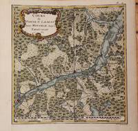
1762M9032Paris 1762. Very Good backed on acid free tissue paper for long term preservation left margin is extended. Notes: Fine and scarce French 18th century map of St. Lawrence River and Quebec. The course of the river to the East is from Montreal and passing through the Quebec City and it extends to Tadoussac. Size : 220x215 mm 8.66x8.46 Inches Coloring: Hand Colored Reference: Kershaw vol.II #659. Category: Maps Canada East Quebec; Maps Canada East Quebec St. Lawrence River; unknown
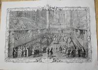
1722P5187Paris 1722-31. Very Good. Notes: A pair of superb early 18th century French copper engraving showing the day of the coronation of Louis XV from Lever du Roi to the Royal Feast. The plates and frames are designed and engraved by Pierre Dulin Perrot Cochin Larmessin Duchange Tardieu Beauvais Desplaces Dupuis Edelinck Chereau Audrand Petit Haussard Jaurat Devret Simonneau Berey Bailleul and Putheau. The Coronation of Louis XV King of France and Navarre in the Church of Reims Sunday October XXV MDCCXXII. Image Size : Platemark Size : 543x794 mm 21.38x31.26 Inches Paper Size : 628x870 mm 24.72x34.25 Inches Coloring: Black & White Medium: Copper Engraving Categories: Portraits Royalty; Views Europe France Others; unknown
178488246Imprimerie de la Société Littéraire-Typographique | s. l. [Kehl] 1784-1789 | 14 x 21.7 cm | 70 vol. reliés
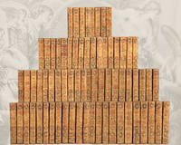
178488246s. l. Kehl: Imprimerie de la Société Littéraire-Typographique 1784. Fine. « Divine Voltaire ora pro nobis ! » Exceptional copy on large paper and contemporary binding Imprimerie de la Société Littéraire-Typographique s. l. Kehl 1784-1789 14 x 21.7 cm 70 vol. reliés The Kehl edition the most renowned edition of Voltaire's works illustrated and published on deluxe paper. It was printed on five different types of paper and only the deluxe editions such as ours on laid paper feature engravings. These are naturally the most sought-after and rarest copies. Binding in full painted sheep decorated with a honeycomb motif smooth spine tooled with gilt fleurons fillets and compartments light beige calf lettering and volume pieces gilt chain-roll border on covers marbled endpapers gilt roll on edges all edges marbled contemporary binding. Two volumes nos. 50 and 70 with slight variations in gilt tools on the spines and with orange morocco lettering pieces edges and covers treated somewhat differently. General condition of the 70 volumes: bindings with light rubbing to corners gilt a little dulled occasional foxing a few wormholes and old restorations not affecting the text. 28 volumes vols. 4 5 8 10 11 13 16 17 19 20 24 27 28 33 34 35 36 37 43 48 61 62 63 65 66 67 68 70 with cracked joints at the ends and 20 volumes vols. 8 11 12 14 16 18 33 34 37 42 46 49 53 56 57 60 65 66 68 70 with damaged caps. Two editions were published at the same time. Our copy belongs to the prestigious in-8 edition on large paper published in 70 volumes the other edition being in-12 format in 92 volumes. It is richly illustrated with 125 etched plates: - There are 17 portraits including 3 of Voltaire: a frontispiece portrait by N. de Largillière engraved by P. Alex. Tardieu; one drawn from Houdon's bust by Moreau le Jeune and engraved by P. Alex. Tardieu; and one allegorical portrait by Louis Croutelle after Moreau le Jeune belonging to the second series of illustrations of Voltaire's works executed by Moreau for the publisher Renouard. The 14 other portraits include an allegorical frontispiece of Frédéric-Guillaume Prince of Prussia depicted in profile in a medallion by Dambrun after Moreau le Jeune; a portrait of Henry IV by Pourbus engraved by Tardieu; one of Charles VII engraved after the original in the King's Cabinet by Mavieri; another of Agnès Sorel drawn by Moreau the Younger after the original in the King's Cabinet and engraved by Mavieri; one of Joan of Arc engraved by Beisson; followed by the Count of Dunois engraved after the original in the King's Cabinet by J. B. Fosseyeux; one of Louis XIV drawn by Moreau Le Jeune after C. Le Brun engraved by J. B. Fosseyeux; one of Charles XII engraved by P. Alex. Tardieu after the original in the King's Cabinet; one of Pierre I engraved by P. G. Langlois after a painting by L. Caravaque; one of Madame du Châtelet after Marie Anne Loir and engraved by P. G. Langlois; one of the Count of Argental after J. Defraine and engraved by J. B. Fosseyeux; one of Frédéric II of Prussia painted from life by Van Loo and engraved by P. G. Langlois; one of Catherine II of Russia engraved by J. B. Fosseyeux; and one of d'Alembert after De La Tour engraved by N. F. Maviez. - 93 engravings by Moreau le Jeune including 44 figures for le Théâtre engraved by Lingée Simonet de Launay Trière Halbou Duclos Romanet Dambrun de Longueil Delignon Le Mire Le Veau 10 for la Henriade engraved by Masquelier Delignon Dambrun Patas Gutemberg Helman Simonet Duclos Romanet 21 for la Pucelle engraved by Simonet Dambrun Halbou Baquoy Trière Delignon de Longueil Croutelle and Duclos 4 for the Contes in verse engraved by Langlois Duclos Delignon and Le Veau and 14 for the Romans engraved by Trière Duclos de Longueil Dambrun Baquoy Delignon Simonet Langlois and Halbou. - 14 scientific plates in volume 31 illustrating the experiments of Newton Descartes and Leibniz. - 1 battle Imprimerie de la Société Littéraire-Typographique unknown