628 résultats
29356Paris 1850 Gravure sur acier 42 x 51cm couleurs époque Bwx-09 unknown
29351Paris 1850 Gravure sur acier 42 x 51cm couleurs époque Bwx-09 unknown
29354Paris 1850 Gravure sur acier 42 x 51cm couleur epoque Bwx-09 unknown
29353Paris 1850 Gravure sur acier 42 x 51cm couleur époque Bwx-09 unknown
29347Paris 1850 Gravure sur acier 42 x 51cm couleurs époque Bwx-09 unknown
29346Paris 1850 Gravure sur acier 42 x 51cm couleurs époque bx-1. Présentée en quatre cartes : Palestine ou Terre Sainte divisée en douze tribus puis deux royaumes et en quatre provinces et Syrie méridionale en 962 - Terre de Chanaan ou terre promise et voyages des israélites a sa recherche - Royaume d'Hérode - Carte pour servir a l'intelligence des livres d'Esdras de Tobie de Judith d'Esther de Job et des prophètes sur laquelle on a tracé l'itinéraire des Apôtres St Pierre et St Paul unknown
29348Paris 1850 Gravure sur acier 42 x 51cm couleurs époque Bwx-09 unknown
29355Paris 1850 Gravure sur acier 42 x 51cm couleur époque Bwx-09 unknown
29360Paris 1850. Gravure sur acier 42 x 51cm couleur epoque Bwx-09 unknown
29363Paris 1850 Gravure sur acier 42 x 51cm couleur époque Bwx-09 unknown
29357Paris 1850 Gravure sur acier 42 x 51cm couleur époque Bwx-09 unknown
29361Paris 1850. Gravure sur acier 42 x 51cm couleur epoque Bwx-09 unknown
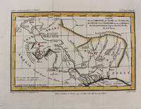
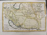
1797M10803Paris 1797. Very Good. Size : 195x288 mm 7.68x11.34 Inches Coloring: Hand Colored Category: Maps Asia Middle East Iran Iraq; unknown
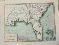
1799M5632Paris c. 1799. Very Good. Notes: The map depicts Florida during its time under Spanish control. Numerous Indian villages are located and roads are shown connecting early settlements. There are no engraved political divisions indicating the mapmaker's bias toward either the territorial claims of Spain or the United States. The map provides an excellent view of the Gulf Coast with a dramatically over-sized Tampa Bay. Numerous Indian villages are located and roads are shown connecting early settlements. The Bahamas are also well delineated.<br> Size : 335x440 mm 13.125x17.25 Inches Coloring: Hand Colored Category: Maps United States South Florida; Maps United States South States; unknown
1797M10801Paris 1797. Very Good. Notes: Important early map of present day southern Iraq. Size : 132x208 mm 5.20x8.19 Inches Coloring: Hand Colored Category: Maps Asia Middle East Iran Iraq; unknown
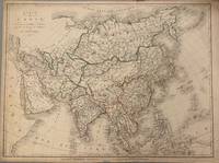
1821331698Paris: Ambroise Tardieu 1821. unbound. Map. Original outline color. Image measures 21 1/2" x 16"<br/> <br/> Simple and elegant map of Asia. Highly detailed the map shows rivers population centers and topography. Relief is depicted pictorially. In good condition with some closed tears to margins and edge toning.<br> <Br> Ambroise Tardieu 1788-1841 was a French engraver mapmaker and publisher. From a family of engravers he was trained by his uncle Pierre Alexandre Tardieu and became celebrated for his portraits. He also published a number of atlases. He and his uncle are not to be confused with Jean Baptiste Pierre Tardieu an unrelated French cartographer and engraver.<br/> <br/> Ambroise Tardieu unknown
1783M2768Paris: Le Clerc Nicolas Gabriel 1783. Excellent. Size : 238x480 mm 9.375x18.875 Inches Coloring: Hand Colored Category: ; Maps Europe Ukraine Le Clerc, Nicolas Gabriel unknown
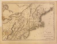
1801301221Paris: Maradan 1801. Map. Uncolored engraving. Image measures 14 1/4" x 19 3/4". Stains and foxing but otherwise in good condition.<br/> <br/> Important early map of the United States published in "Voyage dans la Haute Pensylvanie et dans l'etat de New-York" by Michel Guillame de Crevecoeur. One of the most highly detailed and comprehensive maps published post-Revolution it depicts the northeast US extending from Maine to northern Virginia and westward to the Ohio River. In the Finger Lakes region surveyed bounty land known as the Central New York Military Tract or New Military Tract is indicated. Following the Revolutionary War New York soldiers were guaranteed 500 acres as compensation for their service. Nearly two million acres were reserved for this purpose. Other interesting features of the map include the Connecticut Western Reserve in present day Ohio and lack of a northern border in Maine. Cities counties rivers and roadways are labeled. Some stains along left margin. Minor spotting. <br> <br> Pierre Francois Tardieu 1711-1771 came from a family of engravers and map makers based in Paris.<br/> <br/> Maradan unknown
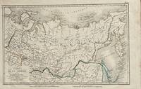
1821172Paris: Tarieu Pirre 1821. 9 3/4 x 15 1/2 inches. Very good. Beautifully engraved map of Siberia as delineated in the early 19th century. Laid down on a small scale the map covers from Novelle Zemla to Kamtchatka Peninsula. From the Arctic Ocean to the Territory of the Chines there is an underlying physical geography focused on a riverine regime. Overall a very nice cartifact. Tarieu, Pirre unknown
286753Pierre-Francois Tardieu. unbound. Map. Engraving with modern hand coloring. Image measures 12.5 x 16.75 inches. Sheet measures 17 x 22 inches. In very good condition.<br/> <br/> Beautiful early map of Florida and Georgia western Louisiana southern parts of the Carolinas and the Bahamas circa 1798. The interior of Florida was not yet mapped with distortions to Baie du St. Espirit. Pierre Francois Tardieu 1711-1771 came from a family of engravers and map makers based in Paris. This map was engraved by Jean Emmanuel Jerome Vallet. Hard to find.<br/> <br/> Pierre-Francois Tardieu unknown
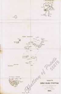
183455879<p>steel engraving map from 'Voyage Pittoresque Autour du Monde' vol.1 pl. 74. Dumont was a French explorer and naval officer. For thirty-eight months he explored the south and western Pacific Australia New Zealand and Antarctica. Several seaweeds plants and shrubs are named after him as well as D'Urville Island. Reference: Taylor 19 Graesse VIII 227. Condition: with paper loss and burn marks slightly into plate.</p> L. Tenré in Paris.
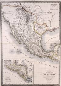
1842M7906Paris: P. Lehuby c. 1842. Very Good;. Notes: A rare and important version of Lapie's Mexico map circa 1842 which depicts Texas as an independent Republic. With an inset map in the lower left of Guatemala. Size : 550x395 mm 21.65x15.55 Inches Coloring: Original Outline Coloring Category: Maps United States South;Maps United States South Texas;Maps Central America Mexico; P. Lehuby unknown
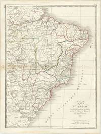
1821M2689Paris 1821. Very good. Size : 407x545 mm 16x21.5 Inches Coloring: Original Hand Coloring Category: Maps South America Countries; unknown
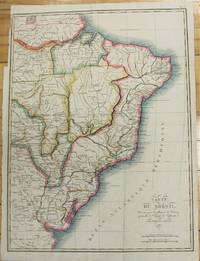
61285Paris: par Ambroise Tardieu 1821. Double page engraved map of Brazil 52.5 x 40 cm overall sheet size 58 x 44 cm. With outline hand colouring. Centrefold crease as issued. Small ink stain to upper right of map. Generally very good. Paris: par Ambroise Tardieu, 1821. unknown
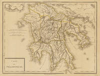
179734633Paris um 1797. In excellent condition. 34.5 x 435 cm 13.5 x 1725 inches. Original antique copper engraving colored in outline when published. Antique map of the Peloponnes in Greece hand colored in outline. Many place names rivers and mountains are shown. Title cartouche in the lower left corner mile sclae in the left sided middle. Pierre Antoine Tardieu also known as P.F. Tardieu March 9 1784 in Paris July 17 1869 in Paris was a French engraver steel engraver and cartographer.Pierre Antoine Tardieu was born in his family's ancestral home on Place de Estrapade. He was taught his craft by his father Antoine François Tardieu. He was the first of his family to carry out his maps in steel engraving. The extraordinary quality of his work even drew the attention of Alexander von Humboldt.In 1818 he married Eugénie-Isabelle de Bonnaire.1 In the years 1832 to 1834 he was involved in several arms dealerships as a volunteer in the reintroduced Garde Nationale. During this time he also became an elementary school inspector.He also took part in the industrial exhibition in 1834 where he received the bronze medal from Louis-Philippe I for his work. In 1837 he was finally appointed Knight of the Legion of Honour. He worked in his father's workshop for a total of 25 years before becoming self-employed. However he continued to live in the house where he was born until his death. In 1861 he retired at the age of 77. In excellent condition. unknown