A TardieuBiblio.com
88 résultats
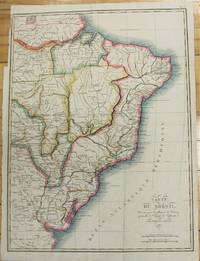
1821M2689Paris 1821. Very good. Size : 407x545 mm 16x21.5 Inches Coloring: Original Hand Coloring Category: Maps South America Countries; unknown
183455879<p>steel engraving map from 'Voyage Pittoresque Autour du Monde' vol.1 pl. 74. Dumont was a French explorer and naval officer. For thirty-eight months he explored the south and western Pacific Australia New Zealand and Antarctica. Several seaweeds plants and shrubs are named after him as well as D'Urville Island. Reference: Taylor 19 Graesse VIII 227. Condition: with paper loss and burn marks slightly into plate.</p> L. Tenré in Paris.
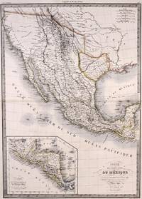
1842M7906Paris: P. Lehuby c. 1842. Very Good;. Notes: A rare and important version of Lapie's Mexico map circa 1842 which depicts Texas as an independent Republic. With an inset map in the lower left of Guatemala. Size : 550x395 mm 21.65x15.55 Inches Coloring: Original Outline Coloring Category: Maps United States South;Maps United States South Texas;Maps Central America Mexico; P. Lehuby unknown
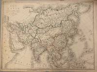
1821331698Paris: Ambroise Tardieu 1821. unbound. Map. Original outline color. Image measures 21 1/2" x 16"<br/> <br/> Simple and elegant map of Asia. Highly detailed the map shows rivers population centers and topography. Relief is depicted pictorially. In good condition with some closed tears to margins and edge toning.<br> <Br> Ambroise Tardieu 1788-1841 was a French engraver mapmaker and publisher. From a family of engravers he was trained by his uncle Pierre Alexandre Tardieu and became celebrated for his portraits. He also published a number of atlases. He and his uncle are not to be confused with Jean Baptiste Pierre Tardieu an unrelated French cartographer and engraver.<br/> <br/> Ambroise Tardieu unknown
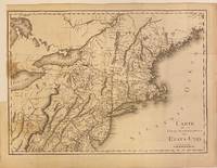
1801301221Paris: Maradan 1801. Map. Uncolored engraving. Image measures 14 1/4" x 19 3/4". Stains and foxing but otherwise in good condition.<br/> <br/> Important early map of the United States published in "Voyage dans la Haute Pensylvanie et dans l'etat de New-York" by Michel Guillame de Crevecoeur. One of the most highly detailed and comprehensive maps published post-Revolution it depicts the northeast US extending from Maine to northern Virginia and westward to the Ohio River. In the Finger Lakes region surveyed bounty land known as the Central New York Military Tract or New Military Tract is indicated. Following the Revolutionary War New York soldiers were guaranteed 500 acres as compensation for their service. Nearly two million acres were reserved for this purpose. Other interesting features of the map include the Connecticut Western Reserve in present day Ohio and lack of a northern border in Maine. Cities counties rivers and roadways are labeled. Some stains along left margin. Minor spotting. <br> <br> Pierre Francois Tardieu 1711-1771 came from a family of engravers and map makers based in Paris.<br/> <br/> Maradan unknown
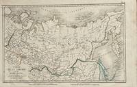
1821172Paris: Tarieu Pirre 1821. 9 3/4 x 15 1/2 inches. Very good. Beautifully engraved map of Siberia as delineated in the early 19th century. Laid down on a small scale the map covers from Novelle Zemla to Kamtchatka Peninsula. From the Arctic Ocean to the Territory of the Chines there is an underlying physical geography focused on a riverine regime. Overall a very nice cartifact. Tarieu, Pirre unknown
1853117582Paris : Furne 1853. 425x280mm. 2 ff. 30 doubles planches avec frontiÂres coloriÂŽes demi-chagrin ˆ coins titre et filets dorÂŽs au dos plats papier marbrÂŽ reliure moderne. 2156 Furne unknown
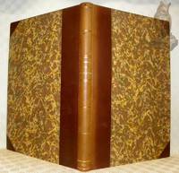
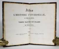
1836014368Paris: Furne & Fruger et Brunet 1836. Hardcover. Very Good/No Jacket. 12mo - over 6¾ - 7¾" tall. Half morocco marbled paper boards gilt spine decoration. Marbled endpapers. Twenty double-page map spreads designed and engraved by Ambroise Tardieu featuring plans of the cities of Athens Sparta ruins Carthage Jerusalem Syracuse Rome and Constantinople. Spine sunned light rubbing to extremities. Inner hinge cracked at flyleaf. Bookplates to flyleaves. Furne & Fruger et Brunet hardcover
183578717Paris: Chez de Pelafol libraire c 1835. Oblong folio 26x34 cm. Original printed publishers wrappers with vignette soiled some small stains and a few loss of paper. - Missing: endpapers title the 2 large flding maps and 1 folding map "Ile de Bourbon". But still a nice collection of all the 86 engraved departemental maps & "Paris" & "Environs de Paris" coloured by hand in vivid colors and the folding maps: "Alger" and 5 of 6 of the colonial maps "Guyane" "Sénéal" "Martinique etc" Guadaloupe" and "Les Possessions Françaises Orientales" also coloured by hand. - Together 94 maps. Chez de Pelafol, libraire unknown
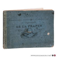
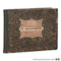
183078711Paris: Pelasol c. 1830. Oblong folio 25x33 cm. Contemporary half cloth covers marbled paper spine partly damaged; marbled paper rubbed and loss of paper at the borders; first endpapaers renewed. Calligraphed title with on verso "Table. composant l'Atlas"and explications of "Signes conventionnels pour les Departemens". And 97 engraved maps 'sous la direction de P. Tardieu' with explanatory texts printed in the margins in a very small type. A bit loose in binding small lightbrown spots in places. 97 maps complete: 2 large folding maps 'France' & 'Douanes'. - 86 'Departements'. 2 second copy of 'Seine' & 'environs de Paris' only these 2 handcoloured. - 1 'Alger' folding map - 6 'Colonies' folding maps. - Binding used; small waterstain in lower margins but on the whole an acceptable copy Pelasol hardcover
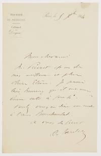
1864603961864. Paris 5.XII.1864. 1 Seite gr.-8°. Mit Siegelspur und Adresse. Gestochener Briefkopf "Faculté de Médecine / Cabinet du Doyen". Ambroise Auguste Tardieu 1818-1879 französischer Rechtsmediziner; das Battered-Child-Syndrome ist auch als Tardieu-Syndrom bekannt. - An Professor Regnauld mit der Bitte um Empfehlung eines Schülers. ". Mr. Prévost est un de mes meilleurs et plus chers elèves. Je serais très heureux qu'il eut une bonne note à sortie. Voulez-vous en dire un mot à l'ami Boucharelat ." unknown
183756149<p>lithograph map and 2 profiles on double-page sheet. EXTREMELY RARE map from "Atlas Journal de la Navigation Autour du Globe de la Frégate la Thétis et de la Corvette l'Esperance pendant les années 1824 1825 et 1826"; pl. 51; REFERENCE: Borba de Moraes I p. 115; Sabin 6874; cf. Ferguson 2236; Ferguson 1204; cf. Hill p. 31; Numa Broc Oceanie 89; cf. Nissen ZBI 483; Howgego B50.</p> Arthus Bertrand, Paris.
183760644<p>lithograph 3 maps on double-page sheet EXTREMELY RARE. Maps from "Atlas Journal de la Navigation Autour du Globe de la Frégate la Thétis et de la Corvette l'Esperance pendant les années 1824 1825 et 1826"; pl. 47; REFERENCE: Borba de Moraes I p. 115; Sabin 6874; cf. Ferguson 2236; Ferguson 1204; cf. Hill p. 31; Numa Broc Oceanie 89; cf. Nissen ZBI 483; Howgego B50. Condition: with heavy foxing in margins slight foxing on plate. Soft cover.</p> Arthus Bertrand, Paris.