Charvet, E.-L.-G. :Livre Rare Book
283 résultats
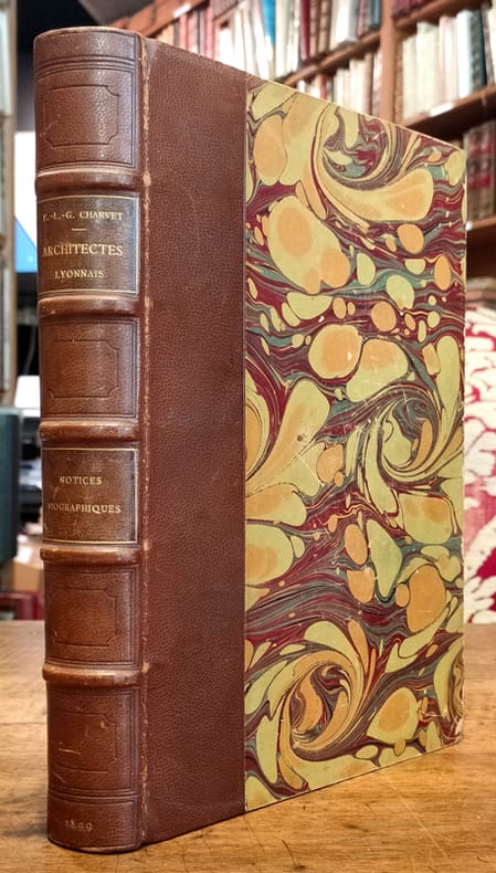
18995157Lyon, Bernoux et Cumin, 1899 ; grand in-8 ; demi-chagrin maroquiné havane, dos à nerfs orné de caissons à froid, titre doré, plats de couverture conservés (reliure de l'époque) ; IX (1bl.), 436 pp., (2) ff. de tables ; 2 dessins de Philibert de l'Orme en frontispice et 20 portraits photographiques hors-texte, nombreuses signatures en fac-similé.
Fine Fine English Original bdg. with original dust wrapper. DJ. Folio. (39 x 32 cm). In English and Turkish. First Edition. 338 p., 291 ills. in total including b/w and colors: Color ills. of 245 maps (some of them 2 page-sized) and 46 small ills. including some of Constantinople photos and maps. The Pervititch maps that are published in this book should be interpreter from this general point of view. Istanbul realized its modernization in the second half on the 19th century. The frequent fires that occurred in the city were major disasters for its inhabitants, but at the same time created opportunities for the city administrators who intended to push through this modernization. In the aftermath of the 1870 Beyoglu fire, one of the biggest of these fires, a significant change occurered in the realitonship between society and fires. The population of Istanbul became acquainted with insurance that covered fire risks. Numerous insurance companies established branches in Istanbul. Fire insurance became a productive industry. This development turned maps showing the fire risks in the building stock of the city an extremely necessary source of information for insurance companies. Initially, insurance maps were commisioned to the C.E. Goad Company for a rahter limited area of the city between 1904-1906. Later, Jacques Pervititch prepared much more detailed maps covering almost the entire area of the city for the Central Office of Turkish Insurance Agents. Pervititch drew over 230 maps between 1922 and 1945.
Fine English Paperback. 4to. (31 x 25 cm). In English. 511 p., color ills. "This is a temporary exhibition project to display the history of Istanbul from its foundation to its transformation into a capital city during the Roman and Byzantium Empires, and its rebirth by the Turkish conquest of the city in 1453. The exhibition will feature collections from the Istanbul Archeological Museum, Topkapi Palace Museum, Museum of Turkish and Islamic Arts as well as some other State museums, along side with rare and precious items coming from the British Museum, Hermitage Museum, Bargeloo Museum, the Louvre Museum and the Vatican Museum to present the impacts and interactions of the Byzantium Empire with other entities of its time. This will be the first time that a comprehensive exhibition is opened in Turkey on Byzantium. Additionally, Istanbul's history as an Imperial capital identified with history of Europe will be reflected with its bright and turbulent phases.".
New English Original decorative cloth bdg. Folio. (33 x 33 cm). In English and Turkish.155 p., color and b/w ills., maps (some folded). Some of plans - maps and their makers from the contents of book: "The earliest city planning sketches displaying the then status of the city are the plans drawn by Livio Amedeo Missir located at the Santa Maria Church.", The well-known geographer Jean Denis barbie de Bocage's plan, In 1830s, British Navy Officer's plans, Luigi Storari's plan, Lamec Saad's plan, Charles Goad's plans, Karl Baedeker's plans, and very important maps of Izmir (Smyrna - Smyrne) city. 500 copies were printed.
As New English Original bdg. in publisher's special slip-case. Mint. 4to. (32 x 23 cm). In Turkish and English abstracts. 3 volumes set: ([26], 1046 p.; [30], 1047-1926 pp.; [30], 1927-2876 pp). Ills. Mersin Sempozyumu. 19-22 Kasim 2008. 3 volumes set in special slip-case.
492 pages. Index. With 1 chart, 389 figures and 19 tables. Colour map stored inside back board. "I hope this book helps foreigners as well as Chinese to understand the urban development process..." - from Preface. Clean, bright and unmarked with negligible wear. Appears unread. An excellent copy. Book
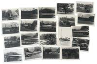
1960235211960. Bridge construction photo archive depicting the crews equipment and labor required to build a small road bridge during the postwar expansion of American highway and local road networks. The photographs likely document the 1960s to early 1970s when pre-stressed concrete beams had become common in bridge work and heavy trucking allowed long prefabricated members to be delivered directly to job sites. In the 1960s bridge construction relied much more on manual surveying paper plans and workers doing dangerous tasks directly on-site. The Occupational Safety and Health Act of 1970 which gave the federal government authority to enforce workplace safety standards was not revised until the 1990s. The photos show a different industry standard for safety enforcement on job sites compared to contemporary labor safety codes. The archive shows drilling foundations preparing abutments hauling girders positioning cranes and lowering long concrete beams into place over a creek or river crossing.<br /> <br /> Photo archive of 20 silver gelatin photographs 3.5 x 4 inches United States circa 1960s-1970s. Workers stand beside cranes tracked equipment tractor-trailers and long prestressed concrete beams at a rural or suburban bridge site. Trucks marked "Yost Construction Inc." haul bridge members through town and onto the work site while a drilling rig marked "Rotary Drilling" and "water systems and service" operates near the roadbed. Several scenes show cranes lifting or preparing to lift girders crews guiding beams by hand concrete supports rising from the water and the bridge span taking shape between tree-lined banks. A man is seen walking across the beam laid for the bridge in its early stages without strapping harnessing or today's standards of safety.<br /> <br /> The Federal-Aid Highway Act of 1956 accelerated road building across the United States and state and county bridge replacement projects followed the same demand for stronger crossings heavier vehicle loads and faster construction methods. This archive records the practical labor behind that expansion rather than finished civic architecture with attention on machines crew placement contractor trucks and the sequence of bridge assembly. Light handling wear and minor curling; overall in very good condition. unknown
New English Original cloth bdg. In publisher's special box. Elephant folio. (51,5 x 35 cm). In English and Turkish. 336 p. The book features maps in Italian, Greek, Hungarian, Armenian and Swedish. The collection is compiled from major museums and libraries around the World. This is a follow up to Maps of Turkey Through the Ages published in 2018. Presented by Prof. Cemal Sengör and preface by Ilber Ortayli. Contributed by Ilber Ortayli, Dogan Uçar, M. Sinan Genim, Ahmet Isik Dogan, Mehmet Perinçek, Mustafa Kaçar, Dogan Kuban, Cahit Kayra, Murat Önes, Misra Erkaya, Celal Sengör Ingiliz, Fransiz, Alman ve Rus kartograflarin Istanbul için özel olarak hazirladiklari 14.-19. yüzyillara ait haritalarin çogunlukta oldugu atlasta ayrica Italyanca, Yunanca, Macarca, Ermenice ve Isveççe Istanbul'un tarihteki haritalari yer aliyor. Roma ile ayni yillarda yerlesim alani olarak seçilen Istanbul'un antik dönemine iliskin Homerus'un anlatimina göre 17. ve 18.yüzyillarda çizilen haritalarin detaylarinda MÖ 513-480 yillarinda Istanbul ve Çanakkale Bogazlari üzerinde kurulan Darius Hispastes ve Kserkses köprülerinin anlatim ve çizim detaylari ilk kez Tarihte Istanbul Haritalari kitabinda yer aliyor. Dünya kütüphanelerinden derlenen pek çok harita ve belge ilk kez bu kitapta bir araya getirildi. Türkçe ve Ingilizce olarak hazirlanan Tarihte Istanbul Haritalari atlasi, Tarihte Türkiye Haritalari atlasinin devami niteliginde. Boyut Yayin Grubu'nun Koleksiyon Kitaplar serisinde Bülent Özükan'in hazirlayarak yayinladigi Tarihte Istanbul Haritalari kitabi, Osmanli ve Türk cografyasina iliskin büyük boyda yayinlanan (51.5 x 35 cm) kitaplar serisinin altincisini olusturuyor.