376 résultats
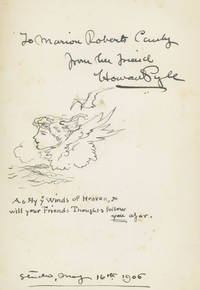
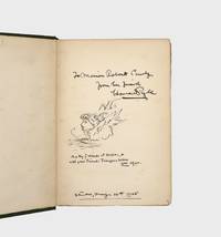
1895376555New York: G.P. Putnam's 1895. Hildegarde edition. 12mo. Original green cloth stamped in gilt to spine and upper cover. Interior a touch toned else Fine. Hildegarde edition. 12mo. Inscribed on the front free endpaper with a drawing of the recipient: "To Marion Robert Canby "from her friend underlined Howard Pyle portrait of a winged Miss Canby flying high in the clouds "As Fly ye Winds of Heaven so "will your Friends Thoughts follow you afar" ____ May 16 1906 G.P. Putnam's unknown
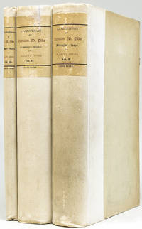
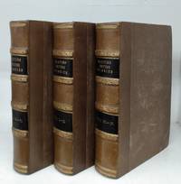
1895248210New York: Francis P. Harper 1895. New Edition #4 of 150 on Holland paper. Best Edition. Illustrated with frontispiece portrait 7 maps including 6 large folding maps in pocket of Volume III at back. cxiv 356; vi 357-856; 8 857-956 pp. 3 vols. Original cloth and boards paper spine labels. Boards shelfworn spines clean. New Edition #4 of 150 on Holland paper. Best Edition. Illustrated with frontispiece portrait 7 maps including 6 large folding maps in pocket of Volume III at back. cxiv 356; vi 357-856; 8 857-956 pp. 3 vols. Howes P-373 "aa"; Basic Texas Books 163; Rittenhouse 467 note Francis P. Harper unknown books
1895100325New York: G.P. Putnam's 1895. Hildegarde edition. Volume one of two only vols. 12mo. Original green cloth. Fine. Hildegarde edition. Volume one of two only vols. 12mo. Inscribed by Pyle with a Drawing. Inscribed on the front free endpaper with a drawing of the recipient: "To Marion Robert Canby "from her friend underlined Howard Pyle portrait of a winged Miss Canby flying high in the clouds "As Fly ye Winds of Heaven so "will your Friends Thoughts follow you afar" ____ May 16 1906 G.P. Putnam's unknown books
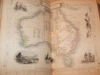
1850095871London and New York: The London Printing and Publishing Company 1850. Volumes 1 to 4 of 6. Books measure 11 x 7 3/4 inches. Collation xxiv744pp 23842188pp 18 full page portraits 29 double page maps. Volume 1. British North America. Volume 2. Australia. Volume 3. New Zealand Tasmania. Volume 4. Africa West Indies. Map 1. World Western. 2. British America. 3. North America. 4. Canada. 5. Canada New Brunswick. 6. Nova Scotia. 7. Australia. 8. Eastern Hemisphere. 9. New South Wales. 10. Victoria Port Philip. 11. South Australia. 12 Western Australia. 13 Polynesia. 14. Van Dieman's Island. 15. New Zealand. 16. The World. 17. Falkland Island's. 18. West India Island's. 19. Jamacia. 20. Africa. 21. Jamacia. 22. Cape Colony. 23. Natal Kaffraria. 24. Western Africa. 25. South America. 26. Central America. 27. British Guayana. 28. Isthmus of Panama. 29. Island's in the Atlantic. Bound in original publishers half calf calf corners cloth baords raised bands gilt tooling full marble edges marble endpapers. Calf rubbed scuffed on edges and corners. Bindings in good clean firm condition. Internally some occasional staining to portraits maps in very good clean condition. A very nice work maps in very good clean condition. First Edition. Period Half Calf. Very Good. Large 8vo. The London Printing and Publishing Company Hardcover
188993881Boston MA: E. W. Walker & Co. As New. 1889. Hardcover. FREE UPGRADE to Courier/Priority Shipping Upon Request - IN STOCK AND IMMEDIATELY AVAILABLE FOR SHIPMENT - AS NEW THE TEXT BLOCK IS PRISTINE CLEAN UNMARKED AND IN EXCELLENT CONDITION - - TWO 2 VOLUME SET. Hardcover1004 pp. Numerous b&w illustrations. Lavishly illustrated work containing numerous chapters on many of the most signifcant American artists of the late nineteenth century including Walter Shirlaw William Morris Hunt Elihu Vedder Frederick Bridgman William Merritt Chase Carl Wimar J. Francis Murphy J. Wells Champney Albert Bierstadt Sanford Gifford J. Carroll Beckwith Winslow Homer Frederick Edwin Church George Inness Thomas Moran A. F Bellows and many other figures both major and minor. Includes hundreds of illustrations in various media among which are a total of nineteen etchings by S. J. Ferris W. Wellstood J. D. Smillie William Unger R. Swain Gifford Stephen Parrish Henry Farrer Anna Lee Merritt F. S. Church Charles A. Platt Peter Moran and Samuel Coleman. Vol I - Artists included: Dailey Garrett Smillie & others; ext. Illus essays on W. Shirlow Huntington Swain Gifford Wm. Merrit Chase also good info on later 19th c. Artists - many hard to find also Linton"s history of wood engraving in American in 8 parts. Cincinatti Artists of the Munich School. 32 etchings photo etchings and steel plates; 105 full page wide cut illus. ; 280 illustrations - 528 pages. Vol II - artists included: John Trumbull Ch. Hassam-Wallston H. P. Barnes etc. ext. Essays on F. S. Church J. Wells Champney Alex H. Wyant F. Duvenech G. Inness etc. 30 etchings and photo etchings 89 full page wood cut illus. 270 illus. In text. Vol II pp 529-1004. -- with a bonus offer-- . E. W. Walker & Co. hardcover
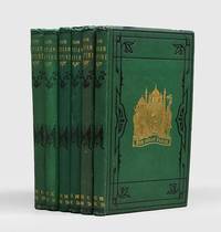
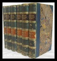
1879190151London: The London Printing and Publishing Company Limited 1879-81. An attractive visual record of India First edition thus based on Martin's The Indian Empire 1858-61 but with a new introduction taking in recent developments in the Great Game volume III closing with the conclusion of the Second Afghan War 1878-80 and General Roberts's entry into Kandahar. The Dublin-born writer and civil servant Robert Montgomery Martin c.1802-1868 wrote extensively on colonial matters "his life was dominated by a self-appointed task - the study of the British empire which Martin saw in terms of a vast free-trade area of new territories in allegiance to the British crown" ODNB. He had first-hand experience of India moving to Calcutta in 1828 as a surgeon where for a short time he edited the Bengal Herald. All of his writings were "influenced by his practical Christianity and by his association with leading intellectuals. He opposed duelling suttee and slavery advocated the abolition of flogging and was active in the work of the Aborigines Protection Society. At a time when some questioned the value of the empire Martin was its spokesman" favouring "a reformed colonial policy" ibid. 6 vols quarto. 100 steel-engraved plates with tissue guards of portraits views and battle scenes two double-page colour maps; title pages printed in red and black; letterpress printed in double columns. Original green sand-grain cloth over bevelled boards gilt lettered spines covers with ornamental panel in black to front covers and blind to back covers yellow-coated endpapers. A few inner hinges cracked but sound closed-tears to a couple of tissue guards scattered foxing. A very good set. hardcover
184523360J.K. Wellman New YorK 1845. Hardback NO DUSTJACKET ISSUED 1845 1st Edition 2nd Printing and the first to appear under Poe's name SCUFFED & Rubbed CONTEMPORARY RED MOROCCO LEATHER Boards with Gold Gilt Design on Front WITH Gold Gilt Name Joseph D. Smalley in the Center Front Cvr Spine Titled & Lined in Gold Gilt with WEAR & SCUFF on Spine. Magazines bound into Hardback VG/Good NO DustJACKET SOLD AS-IS includes The Raven by Poe 1st edition 2nd Printing Slight Chipping Tears Corner Covers Interior Some FOXing & occassional stains. . Hinges Relatively Tight. 5 3/4 X 8 3/4 in Approx Text block tight. Some scuffing to top and bottom of spine and corners. " Mrs. Sedgwick has some pieces as does Rev. T.H. Stockton and others. Many articles about women! Many about Christianity! Plus articles about a huge array of subjects! 378 pages. Some foxing an occassional light stain wear pgs. Light Aging Light Wrinkling some interior Pages O/W Nice. 8VO. Gold Gilt on Outer Pages Edges. Rebacked Binding WORN . Published in this Magazine Format which is Bound into HARDBACK BOOK In Rubbed CONTEMPORARY RED MOROCCO LEATHER Plain endpapers FoXed have Angel BOOKPLATE attached Endpapers Frontispiece woodblock of " Entry in Ark in b/w by Seba Smith" B&w engraved plates and hand- colored floral plates Contributions also by William Cullen Bryant Felicia Hemans Whittier Washington Irving and others Rebacked Binding WORN Edgar Allen Poe's "The Raven" is the last work in the volume pg. 376. Includes works by J. G. Whittier Seba Smith on N. American Indians John B. Newman ETC THE Original Printing of Poes Poem Raven was also published in 1845 in another Magazine earlier in same Year. Literary Emporium Dec. 1845 is the second appearance of The Raven though some argue it is the first both in the same year. First Edition. Full-Leather. J.K. Wellman, New YorK hardcover
184530034Hardback NO DUSTJACKET ISSUED 1845 1st Edition 2nd Printing and the first to appear under Poe's name. 2 VOLS IN 1 USED VG Hardcover. Rubbing to the edges. Bound in three-quarter leather with the owner's embossed on the front IN GOLD GILT. AEG all edges gilt . Clean & tight with some foxing. Besides the second appearance in print of Poe's "The Raven" contains a number of hand-colored plates. ; Small 4to . 378 pages . RAISED BANDS ON BROWN LEATHER SPINE LITE RUB WEAR SOME SCUFF GOLD GILT Frontispiece woodblock of " Entry in Ark in b/w by Seba Smith" B&w engraved plates and hand- colored floral plates Contributions also by William Cullen Bryant Felicia Hemans Whittier Washington Irving and others Rebacked Binding WORN In Rubbed CONTEMPORARY RED MOROCCO LEATHER Edgar Allen Poe's "The Raven" is the last work in the volume pg. 376. Includes works by J. G. Whittier Seba Smith on N. American Indians John B. Newman ETC THE Original Printing of Poe's Poem Raven was also published in 1845 in another Magazine earlier in same Year. Literary Emporium Dec. 1845 is the second appearance of "The Raven" though some argue it is the first both in the same year.<br /><br /> J.K. Wellman, New York hardcover
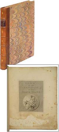
180998618London: Printed for R. Bowyer The Proprietor 1809. Hardcover. Very Good. First edition. Large quarto. Sympathetically rebound in later period-style quarter morocco and marbled papercovered boards with dark red spine label. Engraved title and 12 plates. Some staining and foxing to the title and plates smudging to the front fly else a handsome very good copy. A volume of poems commissioned by the London publisher Robert Bowyer to celebrate Britain's abolition of the slave trade. Work p. 309; Sabin 50145. Printed for R. Bowyer, The Proprietor hardcover
1849012511Calcutta: Calcutta Published by Order of the Honorable the Lieutenant Governor North-Western Provinces;.Printed by J. C. Sherriff Bengal Military Orphan Press. 1849. Book measures 31x25.cm. Collation 4 iii1124 cxxxiii 2211pp 9 coloured folding maps 8 coloured single page maps. Bound in period or early cloth paper title label. Cloth rubbed wear on corners & edges of boards. Binding in good firm condition. Internally previous owners bookplate 1 map has a short closed tear. Pages and maps in very good clean condition. A good solid clean copy. . First Edition. Cloth. Near Very Good. Quarto. Calcutta Published by Order of the Honorable the Lieutenant Governor, North-Western Provinces;.Printed by J. C. Sherriff, Bengal Hardcover
1836222555London : John Murray 1836-1840 1836. First Edition. Hardback. Bookplate to the front paste-down. Very good copies all in the original full aniline calf. Raised bands with gilt cross-bands; contrasting red & burgundy Morocco gilt-blocked labels; very impressively finished. Spine bands and panel edges somewhat rubbed and dulled as with age. Remains a particularly well-preserved set overall; tight bright clean and strong.; 8vo 8"" - 9"" tall; Physical description; 6 volumes including the scarce final volume xvi712xii760xli677viii682xvi457p. lxix197 : ill fronts map fold. plan fold. ; 23cm. Notes; Vols 2-5 published by W.H. Allen and Co. Includes bibliographical references and index. Subjects; India - History - British occupation 1765-1947. London : John Murray 1836-1840 hardcover
1850145271London: The London Printing and Publishing Company nd. 1850s. Hardcover. Very good. 6 vols. in 3 books: xxiv 744; ii 384 ii 188; 564 ii 172 p. 29 cm. Engraved title in vol. 1. 32 engraved portraits and views. 39 double-page Tallis maps with outline hand-colour drawn and engraved by J. Rapin. Text in double columns. Rebound in half brown leather with brown cloth by Keith Felton. Marbled endpapers and text block edges. 4 raised bands on spine gilt trim. Some rubbing and scratches to cloth. Corners worn. A few scuffs to leather spines and a few small black marks. Former owner's bookplates on front pastedowns. Vol. I has repaired edge to frontispiece. Some light dampstains to edges of book 2's frontispiece. <br/><br/>These volumes provide information on the history topography geology government population and industry of the Empire. I. British North America. Vol. II. Australia. Vol. III. New Zealand Tasmania Etc. Vol. IV. Africa and the West Indies. V. British India. VI. Ceylon East India and Mediterranean Settlements. Montgomery was a civil servant who served as Colonial Treasurer of Hong Kong from 1844 to 1845. He was a founding member of the Statistical Society of London 1834 the Colonial Society 1837 and the East India Association 1867. TPL 3009. Mendelssohn III 269-70. See Sabin 4498 Hocken p. 56 & Ferguson 12306. The London Printing and Publishing Company hardcover
1857CRTeMART11<p>London & New York: The London Printing and Publishing Company 1851-1857. 1857. 6 Volumes in 12 preliminary matter for the six volumes bound in at end. 4to. engraved title 32 engraved portraits & views the portrait of Banks supplied & 39 double-page Tallis maps with outline hand-colour drawn & engraved by J.Rapin. text in double columes. original blind & gilt-stamped cloth some fraying to corners & joints & chipping to spine ends 2 covers with modest stains plates with significant foxing & some with marginal dampstaining the maps clean. "A work of extraordinary research reference and completeness upon colonial matters and policy." Hocken The volumes provide information on the history topography geology government population industry and trade of Australia New Zealand British India South Africa the West Indies Gibraltar Hong Kong Canada with separate chapters on Canada East and West Nova Scotia New Brunswick Prince Edward Island Newfoundland Vancouver's Island and Hudson's Bay Territory &c. TPL 3009. Mendelssohn III 269-70. See Sabin 44908 Hocken p. 56 & Ferguson 12306. Hardcover. Good.</p> London & New York: The London Printing and Publishing Company, [1851-1857?]. hardcover
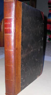
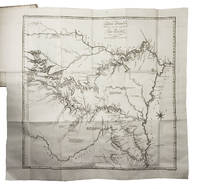
18115236London: Longman Hurst et al. 1811. First British edition. . Quarto pp. xx 436. Two maps one of which is folding. Pike made the first American exploration of the Southwest under US government auspices: it is consequently the foundation of any collection on that area. Most of this region was Spanish territory at the timewhich led to Pike's arrest with his entire party above Santa Fe; he was sent to Chihuahua for trial. After considerable delay and the confiscation of all his notes maps etc. he was escorted through Texas back to Louisiana. Pike called attention to the weakness of the Spanish defenses and the importance of the Santa Fe trade. The American first edition came out in 1810 in a very confused textual state; the British edition is much clearer due to the editor Rees who "undertook to brink something like cosmos out of this chaos . by weaving as much as he could of the matter of the Appendixes into the main text or into the footnotes thereto thereby greatly reducing the bulk of the appendicial texts." Coues quoted in Wagner-Camp. The folding map shows some minor foxing common with this map; otherwise the text is quite clean and fresh. The binding is 19th century 3/4 calf over marbled boards. There is a bookplate on the inside front board otherwise no markings. Very nice copy. <br/><br/> Longman Hurst [et al.] hardcover books
1812HALCSZKGO2PHAmsterdam 1812. 8vo. Cornelis Timmer colophon: printed by A. Breeman & Co. Contemporary gold-tooled half calf with a red morocco title label on the spine. With 3 engraved folding maps: the first two showing the interior of Louisiana and the third the Mississippi River. 2 volumes. VIII 327 1; 4 374 pp. First and only edition of the Dutch translation of a well-known account of the two expeditions of the United States soldier and explorer Zebulon Montgomery Pike 1779-1813: searching for the sources of the Mississippi River and exploring New Mexico and the western parts of Louisiana. "For several years he Pike served with the frontier army restlessly awaiting an opportunity to distinguish himself. At length it came when Gen. James Wilkinson directed him to lead an exploring party to the source of the Mississippi. Afterwards The young lieutenant was dispatched upon a longer and more important expedition setting out from St. Louis on July 1 1806. He was instructed to explore the headwaters of the Arkansas and Red rivers and to reconnoitre the Spanish settlements of New Mexico After returning to the United States Pike found his name coupled . with the Burr-Wilkinson scheme for empire in the Southwest" DAB.The folding maps are reinforced in the gutter and the second half of the second volume browned and with some foxing otherwise in good condition only slightly trimmed preserving the tranchefiles. Front hinge cracked but the front board still attached spine chipped and some other general wear.l Sabin 62840 2 maps; Streeter Texas 1047B; cf. DAB XIV pp. 599-600; Howgego 1800-1850 P27-28. unknown
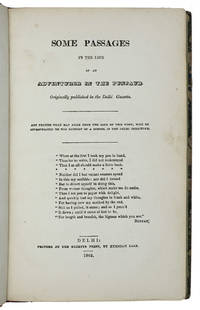
1842ABC_45539Delhi: Gazette Press by Kunniah Lall 1842. Contemporary half red roan with gold-tooled title on spine marbled sides. 8vo. With a loosely inserted letterpress printed "Note by the publishers" declaring that in hindsight the publisher would have preferred this edition in larger dimensions and in 2 volumes but the printer lacked understanding of "the art of book printing". Also included is a manuscript note with bibliographical information relating to Indian printing. First edition of one of the first titles published by the Gazette Press in Delhi and printed by Kunniah Hall. The content is a collection of articles that were previously published in the Delhi Gazette written by Brigadier-General Sir Henry Montgomery Lawrence. He was an advocate for the independence of Punjab and died while defending that in Lucknow earning the nickname "Lawrence of Lucknow". The book offers a wealth of information on the Punjabs in the form of fictionalised memoirs of Colonel Bellasis providing many hardly known details about the region and people to the Western reader. Therefore it is of great importance. The present first edition is very rare WorldCat only offers 3 copies worldwide and we traced 2 more copies in Oxford and the British Library.From the library of Edward Thornton 1799-1875 with his owner's inscription on the front paste-down. Thornton was East India House Officer and author of The History of the British Empire in India 1842. Spine restored with the original spine label laid onto backstrip. Covers slightly rubbed. Otherwise in very good condition.l WorldCat 3 copies; for the author: Riddick p. 211. Gazette Press, by Kunniah Lall, unknown
184520343Clermont 1845. First Edition. Modern Half Morocco. Cloth over boards. Flaps within to contain plates. Montgomery Livingston. Scarce suite of Hudson River lithographic views with no copies listed on OCLC First Search. With no publisher's or printer's name given on any of the prints it is believed by art historian Kenneth W. Maddox who studied these prints and the career of Livingston that these prints were distributed exclusively among members of the wealthy and influential Livingston family and were not intended for commerce. However lest one think that the artist was a mere dilettante he approached his art career with total dedication and did have some success as a professional artist even if ultimately he was overshadowed by the flashier Hudson River School whose paintings were flashier but also frequently improving upon nature so to speak. N.d. but almost certainly the early1840s. Oblong folio 49.5 by 31.5 cm. Including the title page five lithographs of the Hudson River by Clermont the Livingston family homestead outside of Rhinebeck in Dutchess County New York State. Plus four pages or leaves the same size as the prints with blank versos of Maddox's overview of the prints and his chronology of Livingston's life his exhibition record etc. The artist grew up at Clermont and as an adult lived in another smaller house on the property until he was forced to sell because of financial troubles. Clermont still stands and it is today a house museum and while there has been much change along the river's banks the stretch of river in that area remains often scenic. As to the quaity of the lithographs they come as close as possible to passing as actual pencil drawings. Title page has numerous repaired closed tears and small chips -- the repair effectuated by mounting it onto another sheet. unknown
1811236052London.: Printed for Longman Hurst Rees Orme and Brown. 1811. First edition. . Gilt decorated hard cover. Professionally rebound in leather. Top edge gilt. . Fine copy. Very tight copy. Folio. . Zebulon Pike's landmark account of early American exploration. Exploratory Travels Through the Western Territories of North America details Pike’s 1805–1807 expeditions up the Mississippi and into the American Southwest including one of the earliest American descriptions of the Spanish borderlands. A foundational work of Western Americana. Large folding map. Very scarce in this condition. Edges trimmed not affecting text. Printed for Longman, Hurst, Rees, Orme, and Brown. hardcover
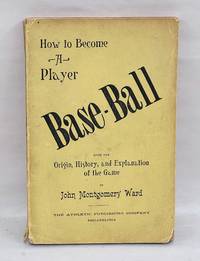
1888JMW003Philadelphia: The Athletic Publishing Company 1888 First edition. Publisher's olive cloth decorated in black to front board and spine and in blind to rear board lettered in gilt to front board yellow-coated endpapers. An exceptional copy with mild rubbing to the spine and corners else fine. Overall a lovely copy with a bright interior. Housed in a custom folding box. Smith 7017. This comprehensive guide to baseball was written by John Montgomery Ward 1860-1925 a Major League player and the first president of the Brotherhood of Professional Base Ball Players. With a chapter for each position in the game the book includes strategies and methods used by the players aimed at fans seeking to better understand the game as well as players seeking to improve their skills. Notably the book contains one of the first detailed descriptions of the game's history and origins. First Edition. Hard Cover. Fine. Philadelphia: The Athletic Publishing Company hardcover books
1888JMW004Philadelphia: The Athletic Publishing Company 1888 First edition. Publisher's yellow wrappers lettered in black. Near fine with light toning to spine very light soiling to wrappers black marker line to fore edge of text block light chipping to spine ends top left corner of rear wrapper missing and some tears to top corners of a few pages at back of book small closed tear to bottom of rear panel and gift inscription to verso of frontis. Overall an exceptional copy of a very scarce book. In Base-Ball: How to Become a Player baseball Hall of Famer John Montgomery Ward explains the history theory and positions of the game. The book is notable for being one of the first instructional baseball books. As a player Ward's most notable achievement was pitching the second perfect game in major league history in 1880. Yet his playing career was just a one part of his illustrious baseball career - he was also a manager executive author and union organizer. A passionate supporter of player rights Ward spearheaded the creation of the first sports labor union the Brotherhood of Professional Base Ball Players in 1885 primarily as a reaction to the NL and AA's restrictive reserve clause. Ward also founded the Players' League in 1890 as a way of combatting the reserve clause but the league only lasted a year. . First Edition. Original Wraps. Near Fine. Philadelphia: The Athletic Publishing Company paperback
1810E0837<p>53-2775651531871 pages with frontispiece 3 folding tables a chart on 5 separate leaves and 6 maps 5 folding. Octavo 8 1/2" x 5 1/2" rebound in red cloth with gilt lettering to spine and lettering in gilt with five raised spine bands in custom enclosure. Howes P-373 "b"; Wagner-Camp 9:1; Graff 3290; Wheat Transmississippi 297 298 299; Field 1217; Streeter Texas 1047C; Bradford 4415; Rittenhouse 467; Sabin 62936; Jones 743; Braislin 1474; Jenkins Basic Texas Books 163; Hill 1357; Reese Best of the West # 32 First edition.</p><p>Zebulon Pike U.S. army officer and explorer for whom Pikes Peak in Colorado was named. In 1805 Pike then an army lieutenant led a 20-man exploring party to the headwaters of the Mississippi River with instructions to discover the river s source negotiate peace treaties with Indian tribes and assert the legal claim of the United States to the area. <br /><br />Pike traveled 2000 miles by boat and on foot from St. Louis Missouri to Leech and Sandy lakes in northern Minnesota. He erroneously identified Leech Lake as the river s source. <br /><br />In July 1806 Pike was dispatched to the Southwest to explore the Arkansas and Red rivers and to obtain information about the adjacent Spanish territory. Pike established an outpost near the site of present-day Pueblo Colorado and then led his party northwest where they encountered the Front Range of the Rocky Mountains. After trying unsuccessfully to scale the mountain peak later named for Pike the party proceeded southward to northern New Mexico where they were apprehended by Spanish officials on the charge of illegal entry into New Mexico. They were escorted across Texas to the Spanish American border at Natchitoches Louisiana where on July 1 1807 they were released.</p><p>Pike s report on Santa Fe with information noting particularly the military weakness of the capital and the lucrativeness of the overland trade with Mexico stimulated the expansionist movement into Texas.<br /><br /><strong> Condition:</strong></p><p>Rebound. Frontispiece stained and toned title with two inch by half inch chipped at head corner internally very good house in a custom enclosure.</p> C. & A. Conrad, & Company; Somervell & Conrad; Bonsal, Conrad, & Company, and Fielding Lucas Jr hardcover
181027020Philadelphia: Printed by John Binns published by C. & A. Conrad & Co. of Philadelphia Somervell & Conrad of Petersborough. Bonsal Conrad & Co. of Norfolk and Fielding Lucas Jr. of Baltimore 1810. 8vo. 8 3/8 x 5 1/4 inches. Stipple-engraved India paper proof portrait frontispiece of Pike by Edwin 6 engraved maps 5 folding 3 folding letterpress tables. Contemporary tree calf boards rebacked in calf and retaining original gilt morocco spine label.<br/> <br/> One of the most important of all American travel narratives: the first edition of the report of the first United States government expedition to the Southwest including an account of Pike's exploration of the headwaters of the Arkansas and Red rivers the sources of the Mississippi River and the Spanish settlements in New Mexico.<br/> <br/> Pike's narrative stands with those of Lewis and Clark and Long as the most important of early books on western exploration and as a cornerstone of Western Americana. "In 1805 Pike was given the difficult assignment of conducting a reconnaissance of the upper Mississippi region. He was ordered to explore the headwaters of that river to purchase sites from the Indians for further military posts and to bring a few influential chiefs back to St. Louis for talks. The trip was only moderately successful as a mission to the tribes but Pike was able to convey important geographical information to President Jefferson and other Washington officials. On Pike's second expedition 1806-1807 he was assigned to explore the head-waters of the Arkansas River then proceed south and descend the Red River from its source . Pike and his men were taken into custody by a Spanish patrol and Pike was able to observe many areas in New Mexico Chihuahua and Texas . His book created interest in the Southwest and stimulated the expansionist movement in Texas" Hill. The maps were the first to exhibit a geographic knowledge of the Southwest based on first-hand exploration and are considered "milestones in the mapping of the American West" Wheat. "The description of Texas is excellent" Streeter Texas.<br/> <br/> Bradford 4415; Braislin 1474; Field 1217; Graff 3290; Hill 2004 1357; Howes P373; Jones 743; Rittenhouse 467; Sabin 62836; Streeter Sale 3125; Streeter Texas 1047C; Wagner-Camp 9:1; Wheat Transmississippi 297 298 299. Printed by John Binns, published by C. & A. Conrad, & Co. of Philadelphia, Somervell & Conrad of Petersborough. Bonsal, Conrad, unknown
181068974Philadelphia: Published by C. & A. Conrad & Co. 1810. Full Description:<br> <br> PIKE Zebulon Montgomery. An Account of Expeditions to the Sources of the Mississippi. and through the Western Parts of Louisiana to the Sources of the Arkansaw Kans La Platte and Pierre Juan Rivers; Performed by the Order of the Government of the United States during the Years 1805 1806 and 1807. And a Tour through the Interior Parts of New Spain When Conducted through these Provinces by Order of the Captain-General in the Year 1807. Illustrated by Maps and Charts. Philadelphia: Published by C. & A. Conrad & Co. 1810.<br> <br> First edition of the first United States government expedition to the Southwest and one of the most important of all American travel narratives. Octavo 8 1/2 x 5 1/4 inches; 216 x 135 mm. 5 1 blank 1 1 blank 105 1 blank 9 Meteorological Observations 1 blank 107-277 3 blank 2 Meteorological Observations 65 1 53 1 blank 87 1 blank pp. Stipple-engraved frontispiece portrait of Pike by Edwin and with six engraved maps and charts five of which are folding and three folding letterpress tables.<br> <br> Full contemporary sheep. Spine with repairs along hinges and head and tail piece. Black leather spine label lettered in gilt. Edges speckled brown. Boards with some minor rubbing and chipping. Some light foxing and toning throughout. The second letterpress chart with a two-inch closed tear at the margin but with no loss. Overall a very good copy and much better than usually found.<br> <br> This important expedition was made as part of a concerted effort by President Jefferson to explore the newly acquired territory west of the Mississippi. Leaving the St. Louis area in July 1806 Pike explored Kansas Oklahoma Northern Texas the Spanish settlements of New Mexico and Colorado until captured by the Spanish. Conducted through Santa Fé to Chihuahua he was returned through Texas to Louisiana. All of Pike's papers were confiscated but he managed to save his precious journals by secreting them amongst his men. When published in 1810 the narrative offered the first accurate description of the great Southwest. The maps were the first to exhibit a geographic knowledge of the Southwest based on first hand exploration and are considered "milestones in the mapping of the American West" Wheat.<br> <br> Graff 3290. Howes P373 "First government exploration of the Southwest". Sabin 62936. Streeter 3125. Streeter Texas 1047. Wagner-Camp 9:1. Wheat Transmississippi West 297 298 and 299.<br> <br> HBS 68974.<br> <br> $13500. Published by C. & A. Conrad, & Co... unknown
181040869Philadelphia: C. and A. Conrad and Co. of Philadelphia; Somervell and Conrad of Petersborough; Bonsal Conrad and Co. of Norfolk; and Fielding Lucas Jr. of Baltimore. Printed by John Binns 1810. Text: 8vo 8 1/2 x 4 3/4 inches. Atlas: 4to 10 1/2 x 11 inches. Text: 2 1-277 5 1-65 1 1-53 1 1-87 1. 492 pp. Engraved frontispiece portrait of Pike Letterpress Title Deposit Statement To the Public To the President Pike's Expeditions Part I-III Appendices to Parts I-III. Atlas: 6 engraved maps 5 of which are folding. 3 folding tables. Text volume in contemporary tree calf expertly re-backed to style spine in six gilt-ruled compartments with gilt calf lettering-piece in second gilt date in sixth and blind center tool in rest. Atlas volume in contemporary quarter calf with tips over original blue paper boards with printed paper label spine in seven gilt-ruled compartments with gilt red morocco lettering-piece in second gilt date in sixth and blind center tool<br/> <br/> One of the most important of all American travel narratives; Pike's account contains the first maps to incorporate geographical knowledge of the Southwest based on first-hand exploration. It is a milestone in the mapping of the American West. Wheat Here in the rarest and most desirable form with the plates and maps in a quarto atlas.<br/> <br/> Pike's narrative along with that of Long and Lewis and Clark is one of the most significant early books on the exploration of the American West. As such it is a cornerstone of Western Americana. In particular Streeter felt its "description of Texas is excellent." Hill gives the following summary of its contents: "In 1805 Pike was given the difficult assignment of conducting a reconnaissance of the upper Mississippi region. He was ordered to explore the headwaters of that river to purchase sites from the Indians for further military posts and to bring a few influential chiefs back to St. Louis for talks. The trip was only moderately successful as a mission to the tribes but Pike was able to convey important geographical information to President Jefferson and other Washington officials. On Pike's second expedition 1806-1807 he was assigned to explore the headwaters of the Arkansas River then proceed south and descend the Red River from its source. Pike and his men were taken into custody by a Spanish patrol and Pike was able to observe many areas in New Mexico Chihuahua and Texas. His book created interest in the Southwest and stimulated the expansionist movement in Texas." The atlas volume consists of the following maps plus three tables: 1. "Falls of St. Anthony." 2. "Map of the Mississippi River from its Source to the Mouth of the Missouri laid down from the notes of Lieutn Z. M. Pike by Anthony Nau. Reduced and Corrected by Astronomical observations of Mr. Thompson at its source; and of Captn. M. Lewis where it receives the waters of the Missouri." 3. "The First Part of Captn. Pike's Chart of the Internal Parts of Louisiana. 40 miles to the inch by Anthony Nau." 4. "Map of the Internal Provinces of New Spain. The outlines are from the Sketches of but corrected and improved by Captain Zebulon M. Pike who was conducted through that Country in the year 1807 by Order of the Commandant General of those Provinces." 5. "A Chart of the Internal Part of Louisiana. Including all hitherto unexplored Countries lying between the River La Platte of the Missouri on the N: and the Red River on the S: the Mississippi East and the Mountains of Mexico West; with a part of New Mexico and the Province of Texas. By Z. M. Pike Captn U. S." 6. "A Sketch of the Vice Royalty Exhibiting the several Provinces and its Approximation to the Internal Provinces of New Spain." Tables: 1. "Recapitulation of Furs and Peltries Fond du Lac department Marks and Numbers as per margin. North West Company 1804-5." 2. "Abstract of the number &c. of the Nations of Indians residing on the Mississippi and its confluent streams from St. Louis Louisiana to its source including Red lake and Lower Red river." 3. "A Statistical Abstract of the nations of Indians who inhabit that part of Louisiana visited by captain Z. M. Pike in his tour of discovery in that country in the years 1806 and 1807."<br/> <br/> Bradford 4415. Braislin 1474. Field 1217. Graff 3290. Hill 1357 2004. Howes P373 "Best Issue." Jones 743. Rittenhouse 467. Sabin 62836. Schwartz and Ehrenberg p.225. Streeter sale 3125. Streeter Texas 1047C. Wagner-Camp 9:1. Wheat Transmississippi 297 298 299. C. and A. Conrad, and Co. of Philadelphia; Somervell and Conrad of Petersborough; Bonsal, Conrad, and Co. of Norfolk; and Fieldi unknown
181027020Philadelphia: Printed by John Binns published by C. & A. Conrad & Co. of Philadelphia Somervell & Conrad of Petersborough. Bonsal Conrad & Co. of Norfolk and Fielding Lucas Jr. of Baltimore 1810. 8vo. 8 3/8 x 5 1/4 inches. Stipple-engraved India paper proof portrait frontispiece of Pike by Edwin 6 engraved maps 5 folding 3 folding letterpress tables. Contemporary tree calf boards rebacked in modern calf and retaining original gilt morocco spine label.<br/> <br/>One of the most important of all American travel narratives: the first edition of the report of the first United States government expedition to the Southwest including an account of Pike's exploration of the headwaters of the Arkansas and Red rivers the sources of the Mississippi River and the Spanish settlements in New Mexico.<br/> <br/>Pike's narrative stands with those of Lewis and Clark and Long as the most important of early books on western exploration and as a cornerstone of Western Americana. "In 1805 Pike was given the difficult assignment of conducting a reconnaissance of the upper Mississippi region. He was ordered to explore the headwaters of that river to purchase sites from the Indians for further military posts and to bring a few influential chiefs back to St. Louis for talks. The trip was only moderately successful as a mission to the tribes but Pike was able to convey important geographical information to President Jefferson and other Washington officials. On Pike's second expedition 1806-1807 he was assigned to explore the head-waters of the Arkansas River then proceed south and descend the Red River from its source . Pike and his men were taken into custody by a Spanish patrol and Pike was able to observe many areas in New Mexico Chihuahua and Texas . His book created interest in the Southwest and stimulated the expansionist movement in Texas" Hill. The maps were the first to exhibit a geographic knowledge of the Southwest based on first-hand exploration and are considered "milestones in the mapping of the American West" Wheat. "The description of Texas is excellent" Streeter Texas.<br/> <br/>Bradford 4415; Braislin 1474; Field 1217; Graff 3290; Hill 2004 1357; Howes P373; Jones 743; Rittenhouse 467; Sabin 62836; Streeter Sale 3125; Streeter Texas 1047C; Wagner-Camp 9:1; Wheat Transmississippi 297 298 299. Printed by John Binns, published by C. & A. Conrad, & Co. of Philadelphia, Somervell & Conrad of Petersborough. Bonsal, Conrad, unknown books