2 079 résultats
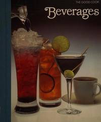
1982129649Time-Life Books. As New. 1982. Hardcover. 0809429330 . - IN STOCK AND IMMEDIATELY AVAILABLE FOR SHIPMENT - THE TEXT BLOCK IS PRISTINE CLEAN UNMARKED AND IN EXCELLENT CONDITION -- with a bonus offer--; 10.6 X 9.3 X 0.6 inches; 176 pages . Time-Life Books hardcover
1982128466Time-Life Books. As New. 1982. Hardcover. 080942925X . - IN STOCK AND IMMEDIATELY AVAILABLE FOR SHIPMENT - THE TEXT BLOCK IS PRISTINE CLEAN UNMARKED AND IN EXCELLENT CONDITION -- with a bonus offer-- . Time-Life Books hardcover
1983128472Time Life Education. As New. 1983. Hardcover. 0809429454 . - IN STOCK AND IMMEDIATELY AVAILABLE FOR SHIPMENT - THE TEXT BLOCK IS PRISTINE CLEAN UNMARKED AND IN EXCELLENT CONDITION -- with a bonus offer-- . Time Life Education hardcover
1728269980London: James and John Knapton 1728. unbound. Sea Chart. Uncolored engraving. Sheet measures 25.5" x 30".<br/><br/> This stunning map of the western hemisphere depicts North America and South America presented on Edward Wright's projection also called a globular projection. It extends from the Hudson Bay south to Terra del Fuego with the oceans featuring rhumb lines to facilitate navigation. The map focuses more on the coastlines rather than the interiors. New Zealand appears in its embryonic form with partial coastline shown. Perhaps the most notable feature is the mapping of California as an island and the unmapped northwest coast of North America.<br><br>Insular California was first mentioned in the early 16th century. Although contrary evidence from various explorers was available by the 17th century that California was in fact a peninsula cartographers remained divided on the subject and California continued to appear on maps as an island.<br><br> This chart was made for the 1728 issued of "Atlas maritimus & commercialis or A general view of the world so far as relates to trade and navigation". The atlas which was meant to compete with Mount and Page's popular "English Pilot" was a collaboration between some of the leading cartographers of the time including Sir Edmund Halley John Senex Nathaniel Cutler Steven Parker and Daniel Defoe. The atlas unfortunately failed to achieve commercial success as great as its rival making this a hard-to-find map.<br><br>The map is in good condition with minor wear along the original folds and overall toning. Some toning over joint. Original plate mark is visible.<br><br>John Senex 1678-1740 was a kind of Renaissance man of the 18th-century map world working at times as a scholar surveyor engraver astrologer book seller and publisher of maps atlases and globes. In a short period he developed from an apprentice into one of the most important cartographers of the period and became a Fellow of the Royal Society of London as well as Official Geographer to Queen Anne of Great Britain. Although well regarded for his pocket-size maps Senex is probably best known for his globes which display a knowledge of astronomy equal to the skill of their craftsmanship. After his death in 1740 his wife Mary continued his business and continued to produce and sell cartographic works of high quality. Together their work represents a successful and valuable partnership in 18th-century mapmaking and publishing.<br><br> Sir Edmond Halley 1656--1742 was an English astronomer geophysicist mathematician meteorologist and physicist known for computing the orbit of the eponymous Halley's Comet. He was the second Astronomer Royal in Britain after John Flamsteed. Globular Projection maps were invented by Halley Harris and Senex. This is a wonderful example of their collaborative work.<br/><br/> James and John Knapton unknown books
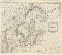
86033London J. & J. Knapton W. & J. Innys 1728. . Six engraved sea charts on one double-page map sheet. Good condition. Dimensions: 50 x 61 cm.<br /> Published in the 'Atlas maritimus & commercialis: or a General View of the World so far as Relates to Trade & Navigation'. The Atlas maritius can be used as an index of English trading activity at this period since detailed insets and harbour plans emphasise those areas of greatest commercial significance. Although the author of the text is anonymous Daniel Defoe is thought to have contributed to it and Halley the Astronomer-Royal added a prefatory note discussing the use of the charts; it is therefore sometimes catalogued under his name. It has also been attributed to Harris Senex and Wilson those name appears on one chart. Senex was certainly responsible for one of the atlas's innovations the globular chart of Western Europe whose projection according to the title-page was "authorizedby letters patent".<br />The atlas was purely commercial and was not a real rival to the 'English Pilot': unlike the Pilot it compressed global coverage into one book as well as describing the the south and west coast of America omitted by the former.<br /> London, [J. & J. Knapton, W. & J. Innys, 1728]. unknown
1812118384Boston: Published by Charles Williams J. Belcher Printer 1812. Hardcover. good to very good. 1st Edition. v7-219pp. 12mo. 5 woodcut plates after drawings by the author including Missouri antelope Rocky Mountain sheep a man and woman of the Flat-Head Nation and the earliest engraved view of Cincinnati; lacking the errata slip. Full speckled calf with raised bands and gilt lettered maroon morocco spine labels; light toning with minor foxing throughout heavier on preliminaries; name place and date on 2nd blank; small hole in text p.209 last leaf with repair to fore edge. good to very good Eberestadt 105:104; Graff #963 and #964; Howes C984; Wagner-Camp 10. "One of the most important of Western narratives and the earliest authentic relation of a captivity among the Sioux" - Eberstadt. 1812 Published by Charles Williams, J. Belcher, Printer hardcover
181212378Boston: Charles Williams 1812. First Edition. Full leather. Good. First edition of A Topographical Description of the State of Ohio by Major Jervis Cutler. Twelvemo v 1 7-219pp. Full leather title in gilt over red morocco spine label five gilt-ruled bands. Boards rubbed edges lightly worn. Toning to pages occasional foxing. Both hinges solid but starting to separate. Missing a single leaf pages 97-98. Lacking errata slip as is common. Complete with 5 full-page illustrated plates including the first engraved view of Cincinnati in 1809. Sabin 18170 Howes C984 Thomson 298 Graff 963 A scarce work on early Ohio. Charles Williams unknown
1994x-0471950521John Wiley & Sons Inc 1994. Hardcover. New. 1st edition. 491 pages. 9.75x6.50x1.50 inches. John Wiley & Sons Inc hardcover
1986SONG0824775031CRC Press 1986-12-08. 1. hardcover. Used: Good. 6.14x1.25x9.21. Buy with confidence. Excellent Customer Service & Return policy. CRC Press hardcover
1986x-0824775031Marcel Dekker Inc 1986. Hardcover. New. 1st edition. 568 pages. 9.25x6.50x1.50 inches. Marcel Dekker Inc hardcover
192951499San Francisco:: John Henry Nash 1929. First edition. One of 300 copies. original full gilt-ruled and lettered vellum. . Very fine. Folio. The printer's own copy with his bookplate; furthermore an association copy warmly inscribed by Leland W. Cutler for John Henry Nash in 1943. John Henry Nash, hardcover
1969mon0003207374Beacon Press 1969T. paperback. Good. 0.5000 7.8000 5.4000. Cover and edges may have some wear. Has some writing/underlining. Previous owner's name on first page. Beacon Press paperback
BOOK_9780471950394New. unknown
2008DBS-9781412951890SAGE PUBLICATION 2008. 1st. Hardcover. New. SAGE PUBLICATION hardcover
2008DBS-9781412951890SAGE PUBLICATION 2008. 1st. Hardcover. New. SAGE PUBLICATION hardcover
1999SKU0617537Andrew Hall Cutler 1999-06-21. paperback. New. 8x0x10. New Textbook Ships with Tracking Andrew Hall Cutler paperback
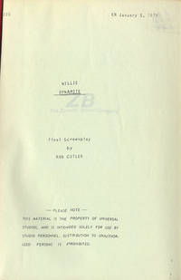
1919WALTER-FILM002220Vintage original script USA. Studio mimeograph brad bound printed wrappers 113 pp. with many pages of revisions on pink paper dated 1/19/73 JUST ABOUT FINE. <br /><br />"Sets out to tackle. 'the subject of the black pimp his rise and fall '. The movie '. wants to show us the effects of a decadent capitalistic system that pushes certain black men into a life of crime."" Bogle p. 229 '<br /><br />Film is also notable sadly as the penultimate screen performance by the magnificent actress Diana Sands who portrays a prostitute determined to prevent a younger woman from falling into the clutches of the lead character. Universal paperback books
ria9780471950523_inpHardcover. New. New Book; Fast Shipping from UK; Not signed; Not First Edition; N/A hardcover
1994DADAX0471950521Wiley 1994-01-15. 1. hardcover. New. 6.30x1.34x9.33. Buy with confidence. Excellent Customer Service & Return policy. Wiley hardcover
20061-0618615385McDougal Littell/Houghton Mifflin 2006. Hardcover. New. student edition. 11.00x8.75x1.50 inches. McDougal Littell/Houghton Mifflin hardcover
1994SONG0471950521Wiley 1994-01-15. 1. hardcover. Used: Good. 6.30x1.34x9.33. Buy with confidence. Excellent Customer Service & Return policy. Wiley hardcover
1997__185898386XEdward Elgar Pub 1997. Hardcover. New. 777 pages. 10.00x7.25x2.75 inches. Edward Elgar Pub hardcover
2008Star-9788131214442Elsevier India 2008. Hardcover. New. Elsevier India hardcover
2008Star-9788131214442Elsevier India 2008. Hardcover. New. Elsevier India hardcover
1728268137London: James and John Knapton 1728. unbound. Sea Chart. Uncolored engraving.19 x 22 1/2 inches.<br/><br/> This beautiful early sea chart of the Coromandel coast in Southeast India covers the entire eastern coast of India as well as the western coast of Burma Myanmar and southern Thailand. Extends from modern day Kanyakumari north to include the Ganges River Delta the coast of Bangladesh and then south along western coast of Burma or Myanmar to Thailand. The northern parts of Sri Lanka or Ceylon are also included. The chart notes several villages and settlements along the coast. Islands coastal features rhumb lines and other geographical features are also noted.<br><br>The Coromandel Coast was one of the most important regions for the British Dutch French Danish and Portuguese during this time as much of the Indian trade was controlled through its various harbors and ports.<br><br>This chart was made by Senex for the 1728 issued of "Atlas maritimus & commercialis or A general view of the world so far as relates to trade and navigation". The atlas which was meant to compete with Mount and Page's popular "English Pilot" was a collaboration between some of the leading cartographers of the time including Sir Edmund Halley John Senex Nathaniel Cutler Steven Parker and Daniel Defoe. The atlas unfortunately failed to achieve commercial success as great as its rival making this a hard-to-find map.<br><br>The map is in good condition with minor wear along the original centerfold and overall toning. Map is lined with archival paper.<br><br>John Senex 1678-1740 was a kind of Renaissance man of the 18th-century map world working at times as a scholar surveyor engraver astrologer book seller and publisher of maps atlases and globes. In a short period he developed from an apprentice into one of the most important cartographers of the period and became a Fellow of the Royal Society of London as well as Official Geographer to Queen Anne of Great Britain. Although well regarded for his pocket-size maps Senex is probably best known for his globes which display a knowledge of astronomy equal to the skill of their craftsmanship. After his death in 1740 his wife Mary continued his business and continued to produce and sell cartographic works of high quality. Together their work represents a successful and valuable partnership in 18th-century mapmaking and publishing.<br><br> Sir Edmond Halley 1656--1742 was an English astronomer geophysicist mathematician meteorologist and physicist known for computing the orbit of the eponymous Halley's Comet. He was the second Astronomer Royal in Britain after John Flamsteed. Globular Projection maps were invented by Halley Harris and Senex. This is a wonderful example of their collaborative work.<br/><br/> James and John Knapton unknown books