2 079 résultats
1728268137London: James and John Knapton 1728. unbound. Sea Chart. Uncolored engraving.19 x 22 1/2 inches.<br/> <br/> This beautiful early sea chart of the Coromandel coast in Southeast India covers the entire eastern coast of India as well as the western coast of Burma Myanmar and southern Thailand. Extends from modern day Kanyakumari north to include the Ganges River Delta the coast of Bangladesh and then south along western coast of Burma or Myanmar to Thailand. The northern parts of Sri Lanka or Ceylon are also included. The chart notes several villages and settlements along the coast. Islands coastal features rhumb lines and other geographical features are also noted.<br> <br> The Coromandel Coast was one of the most important regions for the British Dutch French Danish and Portuguese during this time as much of the Indian trade was controlled through its various harbors and ports.<br> <br> This chart was made by Senex for the 1728 issued of "Atlas maritimus & commercialis or A general view of the world so far as relates to trade and navigation". The atlas which was meant to compete with Mount and Page's popular "English Pilot" was a collaboration between some of the leading cartographers of the time including Sir Edmund Halley John Senex Nathaniel Cutler Steven Parker and Daniel Defoe. The atlas unfortunately failed to achieve commercial success as great as its rival making this a hard-to-find map.<br> <br> The map is in good condition with minor wear along the original centerfold and overall toning. Map is lined with archival paper.<br> <br> John Senex 1678-1740 was a kind of Renaissance man of the 18th-century map world working at times as a scholar surveyor engraver astrologer book seller and publisher of maps atlases and globes. In a short period he developed from an apprentice into one of the most important cartographers of the period and became a Fellow of the Royal Society of London as well as Official Geographer to Queen Anne of Great Britain. Although well regarded for his pocket-size maps Senex is probably best known for his globes which display a knowledge of astronomy equal to the skill of their craftsmanship. After his death in 1740 his wife Mary continued his business and continued to produce and sell cartographic works of high quality. Together their work represents a successful and valuable partnership in 18th-century mapmaking and publishing.<br> <br> Sir Edmond Halley 1656--1742 was an English astronomer geophysicist mathematician meteorologist and physicist known for computing the orbit of the eponymous Halley's Comet. He was the second Astronomer Royal in Britain after John Flamsteed. Globular Projection maps were invented by Halley Harris and Senex. This is a wonderful example of their collaborative work.<br/> <br/> James and John Knapton unknown
2004CBS-9781588290670Sp Springer 2004. New. Sp Springer unknown
2004CBS-9781588290670Sp Springer 2004. New. Sp Springer unknown
26702Boston: Printed by Adams and Nourse in Court-Street. 1785. 4to: xxxii 568 pp. Very good on lightly spotted and discoloured paper. In heavily-worn original boards consisting of quarter-binding with grey boards and cream spine with slight staining at head of spine. Foxed endpapers. LACKING PLATES. Fifty-four papers by James Bowdoin Edward Augustus Holyoke Benjamin Lincoln Joseph Willard Mannaseh Cutler Caleb Gannett Eli Forbes Edward Wigglesworth Jeremy Belknap and others. The prelims include a three-page list of the Academy's members including George Washington John Adams John Hancock Benjamin Franklin and eight pages of its 'Statutes'. Boston: Printed by Adams and Nourse, in Court-Street. 1785. hardcover
2512864-nnew. unknown
2512864like new. unknown
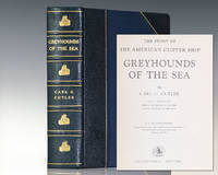
1930131492New York: Halcyon House 1930. First edition of Cutler's masterwork on the history of the American clipper ship. Quarto bound in three quarters morocco gilt titles and tooling to the spine frontispiece. In near fine condition. Carl Cutler spent his life studying clipper ships and the exploits of the hardy men who took them over the world. Ships like the Sea Witch Flying Cloud Champion of the Seas and Red Jacket ruled the seas for more than a decade establishing records yet to be broken for their speedy runs across the Atlantic and Pacific around Cape Horn and on to China and India. This the third edition published over 50 years after the first includes Cutler's Five Hundred Sailing Ship Records of American Built Ships a premier reference on the subject. Halcyon House unknown
mon0000061463McGraw-Hill 1960-01-01. Hardcover. Like New. 1.2000 in x 9.1000 in x 6.2000 in. McGraw-Hill hardcover
1728250790London: James Knapton 1728. Sea Chart. Uncolored engraving.<br/><br/> An alternate projection of the globe as a flat map to the prevailing Mercator Projection. Includes rhumb lines and coastal details. From Atlas Maritimus a commercial sea atlas was published as a guide to British global commerce. Good condition with some stains along lower center fold. Sir Edmond Halley 1656--1742 was an English astronomer geophysicist mathematician meteorologist and physicist known for computing the orbit of the eponymous Halley's Comet. He was the second Astronomer Royal in Britain after John Flamsteed. John Senex 1678 to1740 was an English cartographer engraver and explorer who worked prominently in the 18th century. He is especially known for his maps of the world some of which have added elevations and minuscule detailed engravings. Globular Projection maps were invented by Halley Harris and Senex.<br/><br/> James Knapton unknown books
1728250790London: James Knapton 1728. Sea Chart. Uncolored engraving.<br/> <br/> An alternate projection of the globe as a flat map to the prevailing Mercator Projection. Includes rhumb lines and coastal details. From Atlas Maritimus a commercial sea atlas was published as a guide to British global commerce. Good condition with some stains along lower center fold. Sir Edmond Halley 1656--1742 was an English astronomer geophysicist mathematician meteorologist and physicist known for computing the orbit of the eponymous Halley's Comet. He was the second Astronomer Royal in Britain after John Flamsteed. John Senex 1678 to1740 was an English cartographer engraver and explorer who worked prominently in the 18th century. He is especially known for his maps of the world some of which have added elevations and minuscule detailed engravings. Globular Projection maps were invented by Halley Harris and Senex.<br/> <br/> James Knapton unknown
18798165like new. unknown
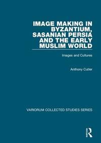
2009SBS-9780754659495ASHGATE 2009. Hardcover. New. ASHGATE hardcover
2009SBS-9780754659495ASHGATE 2009. Hardcover. New. ASHGATE hardcover
2014__1433817934Amer Psychological Assn 2014. Hardcover. New. 1st edition. 2 pages. 9.00x11.50x3.75 inches. Amer Psychological Assn hardcover
1728279748James and John Knapton 1728. First. unbound. Sea Chart. Colored engraving. Sheet measures 21 1/4" x 25". Image measures 19 1/2" x 23 1/2".<br/><br/> This stunning map of the western hemisphere depicts Guiana and Brazil in South America presented on Edward Wright's projection also called a globular projection. It features rhumb lines to facilitate navigation. The map focuses more on the coastlines rather than the interiors. <br><br> This chart was made for the 1728 issued of "Atlas maritimus & commercialis or A general view of the world so far as relates to trade and navigation". The atlas which was meant to compete with Mount and Page's popular "English Pilot" was a collaboration between some of the leading cartographers of the time including Sir Edmund Halley John Senex Nathaniel Cutler Steven Parker and Daniel Defoe. The atlas unfortunately failed to achieve commercial success as great as its rival making this a hard-to-find map.<br><br>The map is in good condition with minor wear along the original folds and overall toning. Some toning over joint. Original plate mark is visible.<br><br>John Senex 1678-1740 was a kind of Renaissance man of the 18th-century map world working at times as a scholar surveyor engraver astrologer book seller and publisher of maps atlases and globes. In a short period he developed from an apprentice into one of the most important cartographers of the period and became a Fellow of the Royal Society of London as well as Official Geographer to Queen Anne of Great Britain. Although well regarded for his pocket-size maps Senex is probably best known for his globes which display a knowledge of astronomy equal to the skill of their craftsmanship. After his death in 1740 his wife Mary continued his business and continued to produce and sell cartographic works of high quality. Together their work represents a successful and valuable partnership in 18th-century mapmaking and publishing.<br><br> Sir Edmond Halley 1656--1742 was an English astronomer geophysicist mathematician meteorologist and physicist known for computing the orbit of the eponymous Halley's Comet. He was the second Astronomer Royal in Britain after John Flamsteed. Globular Projection maps were invented by Halley Harris and Senex. This is a wonderful example of their collaborative work.<br/><br/> James and John Knapton unknown books
SKU1015838American Psychological Association. First Edition. Hardcover. Very Good. 11x9x3. 2 volume set. Very good plus condition Pictures upon request. Very minor shelf and perusal wear. Text appears clean and unmarked. Pages are well bound. Light pencil mark across the bottom of the book block. American Psychological Association hardcover
1728279748James and John Knapton 1728. First. unbound. Sea Chart. Colored engraving. Sheet measures 21 1/4" x 25". Image measures 19 1/2" x 23 1/2".<br/> <br/> This stunning map of the western hemisphere depicts Guiana and Brazil in South America presented on Edward Wright's projection also called a globular projection. It features rhumb lines to facilitate navigation. The map focuses more on the coastlines rather than the interiors. <br> <br> This chart was made for the 1728 issued of "Atlas maritimus & commercialis or A general view of the world so far as relates to trade and navigation". The atlas which was meant to compete with Mount and Page's popular "English Pilot" was a collaboration between some of the leading cartographers of the time including Sir Edmund Halley John Senex Nathaniel Cutler Steven Parker and Daniel Defoe. The atlas unfortunately failed to achieve commercial success as great as its rival making this a hard-to-find map.<br> <br> The map is in good condition with minor wear along the original folds and overall toning. Some toning over joint. Original plate mark is visible.<br> <br> John Senex 1678-1740 was a kind of Renaissance man of the 18th-century map world working at times as a scholar surveyor engraver astrologer book seller and publisher of maps atlases and globes. In a short period he developed from an apprentice into one of the most important cartographers of the period and became a Fellow of the Royal Society of London as well as Official Geographer to Queen Anne of Great Britain. Although well regarded for his pocket-size maps Senex is probably best known for his globes which display a knowledge of astronomy equal to the skill of their craftsmanship. After his death in 1740 his wife Mary continued his business and continued to produce and sell cartographic works of high quality. Together their work represents a successful and valuable partnership in 18th-century mapmaking and publishing.<br> <br> Sir Edmond Halley 1656--1742 was an English astronomer geophysicist mathematician meteorologist and physicist known for computing the orbit of the eponymous Halley's Comet. He was the second Astronomer Royal in Britain after John Flamsteed. Globular Projection maps were invented by Halley Harris and Senex. This is a wonderful example of their collaborative work.<br/> <br/> James and John Knapton unknown
1999DADAX0967616808Brand: Andrew Hall Cutler 1999-06-21. First Edition. paperback. New. 8.50x0.50x10.75. Buy with confidence. Excellent Customer Service & Return policy. Brand: Andrew Hall Cutler paperback
1999x-0849318858CRC Pr I Llc 1999. Hardcover. New. 1st edition. 299 pages. 10.50x7.50x1.00 inches. CRC Pr I Llc hardcover
1999x-0849318874CRC Pr I Llc 1999. Hardcover. New. 1st edition. 288 pages. 7.75x10.25x0.75 inches. CRC Pr I Llc hardcover
17854672Boston: Printed by Adams and Nourse in Court-Street 1785. Hardcover. Very Good. Rare complete copy with the six folding plates. Later 3/4 leather and marbled boards; boards loose. The Academy's members included George Washington John Adams John Hancock and Benjamin Franklin. <br/><br/> Printed by Adams and Nourse, in Court-Street hardcover books
1918P3882London : Mess Fores 1918. Very Good. Image Size : 458x302 mm 18.03x11.89 Inches Platemark Size : Paper Size : 605x436 mm 23.82x17.17 Inches Coloring: Printed in Color Medium: Lithograph Categories: Portraits Royalty; Mess Fores unknown
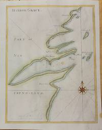
1728M10726London c.1728. Very Good. Notes: Published in Atlas Maritimus & Commercialis. Size : 344x260 mm 13.54x10.24 Inches Coloring: Hand Colored Category: Maps Canada East Newfoundland; unknown
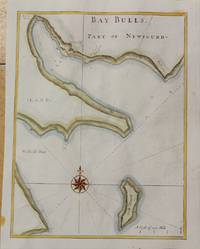
1728M10725London c.1728. Very Good. Notes: Published in Atlas Maritimus & Commercialis. Size : 345x264 mm 13.58x10.39 Inches Coloring: Hand Colored Category: Maps Canada East Newfoundland; unknown