[TRIGONOMETRY and SURVEYING].Biblio.com

229 résultats
2805<p>Manuscript 4to. 23.5 x 17.5 cm 2 ff. pencil sketch of arms Marlborough and blank 196 ff. and with 27 drawn folding plates many of which are colored. Bound in contemporary French calf spine gilt in six decorative compartments with title on letterpiece. Excellent with all plates drawn and many some colored in a very professional hand.<br /><br /></p><p>Very attractive early 18th-century French illustrated manuscript of practical geometry in seven books including individual sections on longimetry planimetry and stereometry—the fundamentals of precision surveying and draftsmanship. The manuscript closely follows but is not identical to Jacques Ozanam's <i>Géométrie Pratique du sr Boulenger</i> Paris 1684 which itself was a revision of <i>La Géométrie pratique </i>Paris 1640 by the mathematician Jean Boulenger. Though the work was reprinted well into the 18th C the present volume seems to follow Ozanam's 1693 edition most closely. Ozanam's book however lacks the drawn and colored figures of the present volume many of which are quite elaborate. The facade of Notre Dame is shown in an exercise for calculating the height of a wall and a segment on proportion features detailed miniature maps of the Brittany coastline identifying towns such as St. Malo and Mont St. Michel. <br /></p><p>The manuscript exemplifies the early 18th C approach to applied trigonometry—a field that by the mid-17th C was starting to resemble an exact science. Book II defines the common functions sine cosine secant etc.; Book V treats longimetric puzzles such as determining the height of a mountain or a spire or measuring the length of bodies of water; the final two books treat planimetry and stereometry including applied trigonometry—calculating the volumes of real bodies i.e. barrels pipes etc. Those sections of the manuscript that do not appear in <i>Géométrie Pratique</i>—mainly a tract on logarithms and a discussion of surveying instruments—also fall within Ozanam's oeuvre as he published a monograph on compasses in 1673 and a book of logarithmic tables and trigonometric functions in 1685.</p><p>Jacques Ozanam 1640-1717 was best known for his <i>Récréations mathematiques</i> Paris 1694 which "may be regarded as the forerunner of modern books on mathematical recreations." In addition to Boulenger's work he also revised that of Adriaan Vlacq 1600-1667 and the Jesuit mathematician Claude-François Milliet Dechalles.</p> DSB.10 pp.263-265. [France, early 18th century].
2805<p>Manuscript 4to. 23.5 x 17.5 cm 2 ff. pencil sketch of arms Marlborough and blank 196 ff. and with 27 drawn folding plates many of which are colored. Bound in contemporary French calf spine gilt in six decorative compartments with title on letterpiece. Excellent with all plates drawn and many some colored in a very professional hand.<br /><br /></p><p>Very attractive early 18th-century French illustrated manuscript of practical geometry in seven books including individual sections on longimetry planimetry and stereometry—the fundamentals of precision surveying and draftsmanship. The manuscript closely follows but is not identical to Jacques Ozanam's <i>Géométrie Pratique du sr Boulenger</i> Paris 1684 which itself was a revision of <i>La Géométrie pratique </i>Paris 1640 by the mathematician Jean Boulenger. Though the work was reprinted well into the 18th C the present volume seems to follow Ozanam's 1693 edition most closely. Ozanam's book however lacks the drawn and colored figures of the present volume many of which are quite elaborate. The facade of Notre Dame is shown in an exercise for calculating the height of a wall and a segment on proportion features detailed miniature maps of the Brittany coastline identifying towns such as St. Malo and Mont St. Michel. <br /></p><p>The manuscript exemplifies the early 18th C approach to applied trigonometry—a field that by the mid-17th C was starting to resemble an exact science. Book II defines the common functions sine cosine secant etc.; Book V treats longimetric puzzles such as determining the height of a mountain or a spire or measuring the length of bodies of water; the final two books treat planimetry and stereometry including applied trigonometry—calculating the volumes of real bodies i.e. barrels pipes etc. Those sections of the manuscript that do not appear in <i>Géométrie Pratique</i>—mainly a tract on logarithms and a discussion of surveying instruments—also fall within Ozanam's oeuvre as he published a monograph on compasses in 1673 and a book of logarithmic tables and trigonometric functions in 1685.</p><p>Jacques Ozanam 1640-1717 was best known for his <i>Récréations mathematiques</i> Paris 1694 which "may be regarded as the forerunner of modern books on mathematical recreations." In addition to Boulenger's work he also revised that of Adriaan Vlacq 1600-1667 and the Jesuit mathematician Claude-François Milliet Dechalles.</p> DSB.10 pp.263-265. [France, early 18th century]. books
184455840Hartford CT: Belknap and Hamersley 1844. 8vo. 160; 112 pp. Numerous woodcut engraved diagrams figures. Contemporary full speckled calf speckled fore-edges tan & gilt morocco spine label minor shelfwear slight rubbing occasional light foxing still an excellent copy. Third edition revised & expanded of this popular American treatise on surveying published originally in 1804 would continue to be updated and revised for over half a century. An edition of Abel Flint’s work was one of the two consulted by Abraham Lincoln while he studied to become a surveyor as it emphasized higher math including logarithms plane geometry and trigonometry. Belknap and Hamersley, unknown
pp. 160, 112. Illustrated with diagrams and drawings. Some damp stain and age stain. Early Lititz ownership. Small loss on front paste down. 12mo. 190 mm. Original full roan binding. Original gold lettered leather spine label. Hardbound. Very good copy. SCIENCE BOX 1
0282628533.Gpaperback. Good. Access codes and supplements are not guaranteed with used items. May be an ex-library book. paperback
London, Longman, Brown, Green, and Longmans, 1846, in-16, legatura coeva in piena tela (piatto anteriore staccato), pp. XXIV, 443, [1]. Con figure nel testo.
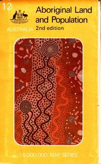
1988105790Canberra: Department of Aboriginal Affairs. 1988. Large colour folding map 79 x 88 cm in original printed illustrated wraps. Some wear to edges clean very good condition. "Over 92 million hectares or about 12 per cent of the land area of Australia is held by or on behalf of Aborigines. More than two-thirds of this land is freehold the remainder being reserve leasehold or mission land. The map shows all areas of 10 hectares or more - over 4000 parcels of land - and classifies them by size and type of tenure. Also shown are the 415 centres inhabited by 50 or more Aboriginal people." 2nd Edition. Department of Aboriginal Affairs paperback
Toulouse, Douldoure 1833. In-16 broché couverture muette de 104 pages avec figures. Bon état
Legatura coeva in mezza pelle con titoli dorati sul dorso, 8vo cm12x19, pp 81 (1); due tavole litografiche ripiegate in fine, di cui una colori, con esempi di rilevamento basati sul cirocndario del torrente Nure presso Piacenza (“C. Manuelita”), disegno di una diottra azimutale ecc. Non comune.
288 pages. Index. Black and white diagrams and illustrations. Fold-out 3-panel plan of Newreg Colliery. Intended "to provide students of coal mining and young surveyors with an explanation of the elementary principles which are applied to the practice of mine surveying and with a description of the constructional details of the instruments in common use." - from Preface. Markings throughout. Additional information laid inside back board and affixed to back endpaper. Above-average wear. Reading copy only. Book
Ex-library book with the usual stamps, stickers, etc. Binding is solid and text/interior is clean with very occasional marking. 282 pages, contents include The archaeological environment, The material of antiquity (inorganic and organic and animal) Interaction of materials with their surroundings, The work of archaeological laboratories (soils, stone, bone, teeth, etc.) Scientific aids for the excavator and Archaeological prospecting: resistivity surveying, gravitationaly surveying, magnetic methods, etc.
In 8, cm 14 x 22, pp. XVI + 252 + (2) con 1 tavola fuori testo piu' volte ripiegata incisa all'acquaforte. Brossura muta spugnata d'attesa. Edizione originale e unica di questo saggio di matematica pratica, opera di questo artigliere piemontese che oltre a molte generalita' aritmetiche, algebriche e geometriche, fornisce infiniti metodi di calcolo per la soluzioni di problemi pratici quali i rapporti tra pesi, misure, unita' monetarie (tesa nostrale, brenta, peso dell'acqua, lunghezza del raso, misura della legna ecc.), metodi veloci per le quattro operazioni (applicati anche a zecchini, soldi, doppie e danari, moltiplicazione di rubbi di salnitro, zolfo, stagno, rame, ottone, trabucchi di muraglia ecc.), frazioni, calcolo letterale, progressioni aritmetiche e geometriche, algebra e applicazioni in artiglieria e per la realizzazione di lavori di fortificazione e di costruzione in generale relativamente a muri, volte, lastricati, regola di falsa posizione semplice e doppia, applicata, ad esempio, al lancio di bombe in un assedio. Della regola di allegazione che viene applicata alla fabbricazione di monete in lega e alla fusione dei pezzi di artiglieria. '... E' un buon trattatello di aritmetica e degli elementi d'algebra, con utili applicazioni all'arte militare, cui era dedicato l'autore come capitano dei minatori.' Riccardi, I, 585.
PARIS, Lib. Baillière et fils - ss date (1905) - Coll. "Encyclopédie agricole" publiée par une réunion d'Ingénieurs agronomes sous la direction de G. Wery - In-12 - Broché - Couverture illustrée - 186 figures dans le texte et 9 planches dont 1 pliante coloriée - Publicités des ouvrages de l'Encyclopédie agricole en début et fin - XII & 499 pages - Bon exemplaire
8963PARIS, Lib. Baillière et fils - ss date (1905) - Coll. "Encyclopédie agricole" publiée par une réunion d'Ingénieurs agronomes sous la direction de G. Wery - In-12 - Broché - Couverture illustrée - 186 figures dans le texte et 9 planches dont 1 pliante coloriée - Publicités des ouvrages de l'Encyclopédie agricole en début et fin - XII & 499 pages - Bon exemplaire
10960à l’usage des personnes studieuses. Ouvrage à l’aide duquel on peut apprendre, sans le secours d’aucun maître : le système métrique dans sa perfection, l’arpentage et la division des terres, avec instrumens ou sans autres instrument que le mètre ; la trigonométrie rectiligne ; la levée des plans par plusieurs méthodes différentes, notamment par une méthode moderne, au moyen de laquelle on peut obtenir la contenance effective de tout polygone quelconque, par le secours des triangles et des quadrilatères formés dans ces polygones. On trouvera aussi dans cet ouvrage une division moderne appuyée sur les principes dont il vient d’être parlé ; la manière de faire et de calculer les triangulations par plusieurs procédés de gnomonique, et les tables des carrés précédées du binôme, etc. etc. A la suite le comparateur de l’Oise ou tables générales de conversion de toutes les mesures anciennes du département de l’Oise en nouvelles, et réciproquement, à l’usage des avocats, avoués, notaires, juges de pais, greffiers, huissiers, cultivateurs, propriétaires etc. etc. In 8 demi cuir vert, titre, filets, roulette dorés. Faux-titre, titre, 228 pages, III. Table des matières 1 page errata. . Titre, 224 pages, 1 page de table. En fin de volume : 202 figures en 12 planches dépliantes, lithographiées (une tache d’encre à la dernière). Se vend à Formerie (Oise) chez l’auteur 1843. Bon exemplaire
5606ouvrage à l’aide duquel on peut apprendre,le système métrique sans sa perfection, l’arpentage et la division des terres,avec instruments,ou sans autre instruments que le mètre;la trigonométrie rectiligne;la levée des plans par plusieurs méthodes différents.In 4 demi-cuir marron époque, titre et filets dorés. Faux-titre, titre,III,1 page d’errata ;228 pages,12 planches dépliantes,texte sur 2 colonnes,à la suite Le comparateur de l’Oise ou table générales de conversion de toutes les mesures anciennes du département de l’Oise,en nouvelles, et réciproquement, à l’usage de MM les avocats,huissiers, géomètres, arpenteurs, propriétaires,cultivateurs etc. par J.BA THOREL titre,1 page,226 pages,4 pages de table des matières,errata.Se vend à Formerie (Oise)chez l’auteur 1843-1845.Cuir légèrement cassant sinon bon exemplaire,peu courant
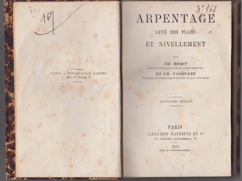
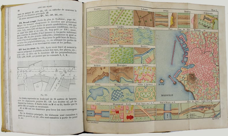
4184Paris : L. Hachette, 1873,In-16,1/2 veau piéce de titre rouge,filets dorés, 240 p., fig. et 5 planches dépliantes,in fine,petites rousseurs 1ers feuillets et planches
6796Tours, Mame; Paris, Poussielgue, 1881.
4848Paris, Librairie Générale, Mame Tours, J. de Gigord Paris, sans date, reliure pleine-toile verte d'éditeur, 14x22 cm, 462 pages. 485 figures, X planches.
51574Paris Librairie Hachette et Cie 1880 in 12 (18,5x12) 1 volume reliure demi chagrin rouge de l'époque, dos à nerfs, orné de caissons de filets dorés, plats de percaline verte (plat supérieur orné au centre du fer doré du Lycée de Montpellier, 240 pages, avec 81 gravures et 5 planches gravée dépliantes in fine. Sixième édition. Très bel exemplaire, reliure très fraiche ( Photographies sur demande / We can send pictures of this book on simple request )
14080P., Hachette, 1876, in 12 relié demi chagrin, dos orné, 240pp., 5 planches dépliantes et nombreuses figures, petite mouillure claire en pied.
74267Paris, éd. Librairie Hachette et Cie, 1876, cinquième édition, in-12, demi-veau noir, plats papier marbré "moucheté" brun et blanc, filets, auteur et titre dorés sur dos lisse, reliure d'époque, 240 pp., ill. par 5 pl. dépliables et 199 figures in-texte, vocabulaire des termes techniques, table des matières, Livre "technique" sur l'arpentage et le calcul des cotes pour l'élaboration de plans de géomètre. Bien complet des 5 planches dépliables. L'édition originale date de 1859. Pas courant Bel état de la reliure; quelques rousseurs légères éparses
1087In 12 broché,240 pages,figures dans le texte et 5 planches dépliantes en fin de volume + catalogue de 4 pages. Hachette & Cie 1863.(très petit manque en tête réparé) sinon Bon état
Roma, Puccinelli, 1851. In folio. (mm. 315 x 225). Brossura editoriale (manca la posteriore). Pp. 94, (4). Dall'indice: degli olivi, dei pascoli, dei boschi cedui, stima de terreni, stima delle case coloniche, etc.
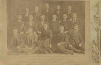
1891List2113Huron 1891. Albumen photograph measuring 5 ½ x 4 inches on larger mount. Some fading very good overall. A scarce and possibly image from the post-statehood Surveyor-General’s office. Surveying in the Dakota Territory and in the early statehood period was quite difficult due to the terrain and the abundance of privately held mining claims. This photograph shows an early South Dakota office led by General B.H. Sullivan. Included in the picture is Miss Eva Jackson the Assistant Transcribing Clerk. unknown