229 résultats
1977137003No place of publication.: 江苏人民出版社.Jiangsu ren min chu ban she. 1st Edition 2nd Printing. 1977. Colour Chinese transportation map featuring the city of Nanjing capital city of Jiangsu Province and its surrounding regions. Upper side: A transpiration map of Nanjing and neighbouring counties right section with a list of names of stations buses trains coaches ferries and their addresses lower right edge tourist guide including the addresses and phone numbers of major travel agents hospitals cinemas and more left section accompanied by two tables of bus routes. On reverse: a "Map of Nanjing Municipal Transpiration Map" scale not given a chart of terminus for bus and trolley bus lower right section. Some soiling on reverse stamp of a prior dealer in Guangzhou a handwritten date of "September 17th 1977" upper side light creases good copy. Text in Chinese. Sheet measures 37.8 x 52.3cm. . 江苏人民出版社.[Jiangsu ren min chu ban she]. unknown
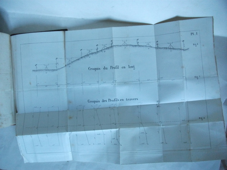
192657325Tours - Paris, Librairie Générale de l’Enseignement, A. Mame et fils, J. de Gigord 1926 In-8 14 x 22 cm. Reliure de l’éditeur pleine percaline vert clair, XXX + 674 pp., 19 planches dans le texte, certaines dépliantes, 668 figures dans le texte. Exemplaire en bon état. Ouvrage sur l’arpentage, le levé des plans, le nivellement et le tracé des voies de communication, divisé en deux parties, la Planimétrie et l’Altimétrie.
1914100148587MARCH S. et Cie 1914 in8. 1914. Cartonné. « Éléments de topographie et tracé des voies de communication » d'Edmond Gabriel est un manuel technique complet publié en 1914 (réédité en 1926) dédié à la science de la topographie c'est-à-dire l'étude de la mesure et de la représentation de la surface terrestre. L'ouvrage d'environ 650 pages aborde en détail les instruments d'arpentage l'évaluation des surfaces et des angles et comprend de nombreuses illustrations figures et planches dépliantes
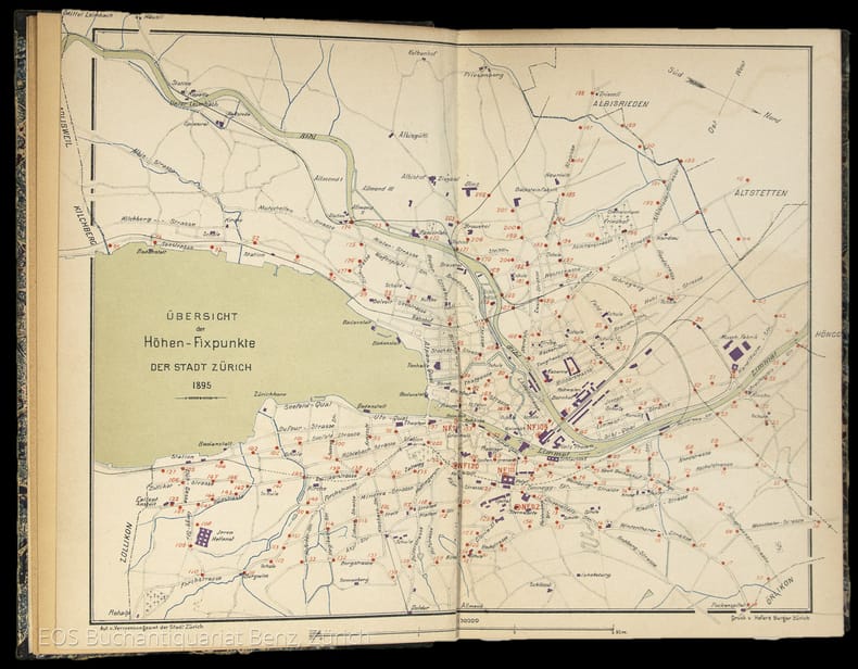
18954834DBZürich, Museumsgesellschaft Zürich, 1895. 8°. 166 S., mit vielen ganzseitigen Abbildungen. Halbleinenband mit handschriftlichem Bibliotheks-Rückenschild.
18954834DBZürich, Museumsgesellschaft Zürich, 1895. 8°. 166 S., mit vielen ganzseitigen Abbildungen. Halbleinenband mit handschriftlichem Bibliotheks-Rückenschild. + Wichtig: Für unsere Kunden in der EU erfolgt der Versand alle 14 Tage verzollt ab Deutschland / Postbank-Konto in Deutschland vorhanden +, 4834DB|4834DB_2 [2 Warenabbildungen]
19413877Kyiv 1941. Very good. Together 2 views 205 x 325 mm; 8" x 13" printed on cheap thin paper Ad 1: long closed tear through image without loss light staining creasing edges a little frayed; Ad 2: short closed tears along edges two small holes in blank area at lower left light staining. Overall in very condition suitable for exhibition and study. Tragically topical apparently unrecorded views of Kyiv being rude field printings on cheap paper likely created by Nazis during the so-called "First Battle" of Kiev Aug. 23 - Sept. 26 1941 or shortly thereafter. We are mindful that the present views are historically "toxic" but given the context of the current Russian war-crimes against the people of the Ukraine we believe that there is an urgent need for them to be preserved. <br /> <br /> The first print is a view of Kyiv looking at the city center from the south specifically from the wooded hill of Lysa Hora which had a complex fortification system. During the German occupation the fort became a military plant and tank base. Here Kyiv rises above the Dnipro river on the right. The key below identifies 22 sites mostly of military significance such as buildings bridges power plants hospitals factories churches and cloisters. To each site is assigned a code consisting of a letter or letters and a numeral or numerals: these are certainly map references i.e. K10 L10 F-G7 etc. We have been unable to locate this exact map but large bird's-eye maps of Kyiv taken by the Vermessungs- und Karten-Abteilung survive in the Kiev Polytechnic Museum and also the David Rumsey Collection. That a need for vantage-point views such as ours to accompany such a map seems self-evident. <br /> <br /> The second is a view of Kyiv taken from the Great Lavra Bell Tower in the Pechersk Lavra monastery strategically positioned in the city center looking towards the Dnieper Valley in the northeast. The key identifies 13 sites likewise militarily important but with the notable inclusion of the "Podol Judenstadt" no. 6 a Jewish neighborhood to the north of the city. <br /> <br /> Our prints may date before Nov. 3 1941 because on this day just two months into the German occupation of Kyiv a huge explosion brought down the Uspensky Sobor cathedral in the Pechersk Lavra monastery across the courtyard from the Bell Tower from which the present view was drawn.<br /> <br /> The "Motorized Surveying and Map Detachment" was an integral part of the German military and accompanied the army throughout the European and North African theater. These surveyors photographers and printers traveled with equipment to the front lines sometimes on special trains. The detachments were self-contained and had the capability to print onsite even in the most hostile conditions. Ephemeral views such as the present pair were printed in small numbers for the sole use of German occupying troops. The present prints were purchased by a Munich bookseller from a private collector in Germany along with other documents from the period.<br /> <br /> NOTA BENE: These prints were both purchased at an auction in Germany in early January 2021 i.e. BEFORE the Russian invasion of Ukraine on February 24 2022. unknown
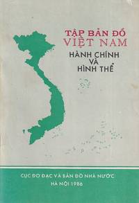
1986222320Hà Nội.: Cục Đo Đạc và Bản Đố Nhà Nườc. 1986. 13 colour maps with 5 inset maps. 23pp. 19.5 x 13cm. Paperback covers little shelf worn and marked though overall a very good copy. A pocket-sized atlas of Vietnam prepared only 10 years following the reunification of the North and South. Indicative of a nation reorienting towards asserting her territorial claims in the South China Sea the entirety of the Paracel and Spratly Islands have been painstakingly noted with their Vietnamese names. . Cục Đo Đạc và Bản Đố Nhà Nườc. paperback
16p. Illustrated with drawings with and a location map showing milestones, initial stones, terminal stones, bridges, trails, etc. Inked ownership "Alice E. Starner from Madeline Flemming, 1/10/66. Tall 8vo. Original printed wraps. PA PAMPH 20_10 BX3
19792111902156000007Japan Surveying Association 1979. Soft Cover. Fine. The book is in fine condition. Japan Surveying Association paperback
1893W82097Huy, chez l'auteur-éditeur 1893 96pp.+ 8 planches dépliantes, 22cm., br.orig., 6e éd., bon état, W82097
96pp.+ 8 planches dépliantes, 22cm., br.orig., 6e éd., bon état, W82097
19342EqParis Delagrave 1934 in folio 126 pages - cartonnage editeur - bon etat
19342EqParis Delagrave 1934 in folio 126 pages - cartonnage editeur - bon etat
In-8° gr. pp. 512, bross. edit. con tracce d'uso.
In-8°, pp. XXVII-559. Leg. in mezza pelle coeva con titolo in oro al dorso. Tracce del tempo e piccole mancanze sui piatti. Diffuso ingiallimento sulle pagine.
Con 7 tavv. più volte ripieg. f.t. (6 nella 1a opera); Sc. M.
In-16 gr., mz. pelle coeva, fregi e tit. oro su tassello al dorso, pp. VIII,436, con 17 tavv. in b.n. f.t. più volte ripiegate. Prima edizione di questo celebre trattato. Cfr. CLIO,I, p. 632. Lievi fioriture peraltro ben conservato.
in-8 (mm 170x110). Pagine VIII, 238. Brossura editoriale stampata. SI AGGIUNGE: Altri tre volumi della serie, tutti in brossura editoriale: Id. Trattato degli Arbori; Varrone, Della Agricoltura libri tre; Cosimo Trinci. Diciotto Trattati di Agricoltura.. .
In-8 p., 2 volumi in 1, mz. pelle coeva (abras.), pp. 216; 264; con 12 tavv. f.t., più volte ripieg. Prima edizione. Cfr. CLIO,II,854. Qualche fiorit. e alc. postille a matita, ma complessivam. buon esempl.
4914Contenant des surfaces et des volumes,le levé des plans, le partage des terrains, le nivellement In 12 demi-cuir rouge à nerfs,titre,fers dorés,filets à froid.Faux-titre,titre, 277 pages,313 figures dans le texte,complet des 4 planches dépliantes en fin de volume LEPAGNEZ libraire éditeur à Vesoul(Haute-Saône)1870.Rousseurs éparses habituelles,plus fortes en début et fin de volume
19281035091928 Librairie Garnier Frères , Paris - 1928 - 1 vol in-12 - Cartonnage pleine toile rouge de l'éditeur ( reliure usagée ) - 306 pages - Ouvrage illustré de 72 figures et hors-texte
In-16° (19 x 13 cm). 214 pp. 3 grandi tavole ripiegate. Brossura editoriale.
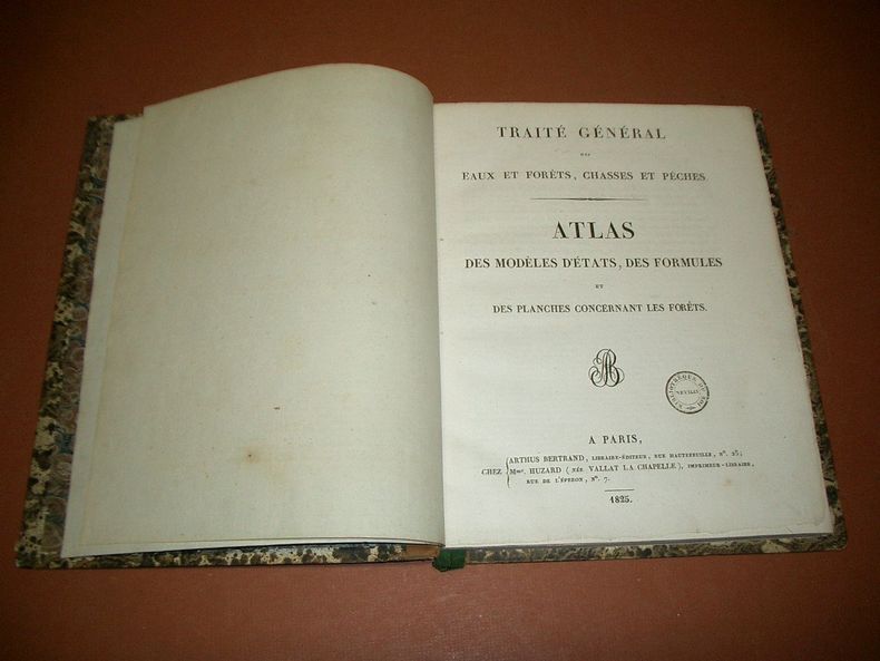
72674A Paris, Chez Arthus Bertrand, Mme Huzard, 1825, 1 volume de 22x28 cm environ, (1) ff., 8 pp., 49 planches (6 planches de Botanique, 21 planches concernant les Arbres, 3 planches Arpentage, 1 planche Avenues perpétuelles, 1 planche Carbonisation, 1 planche Insectes, 16 planches Bois de marine), (1) ff. Demi-reliure veau bistre et cartonnage marbré, dos lisse portant titres dorés, gardes marbrées. Feuillets non rognés. Coiffe inférieure fendue, des rousseurs, frottements sur les coupes, bon état pour le reste.
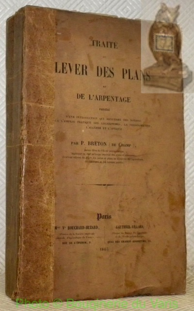
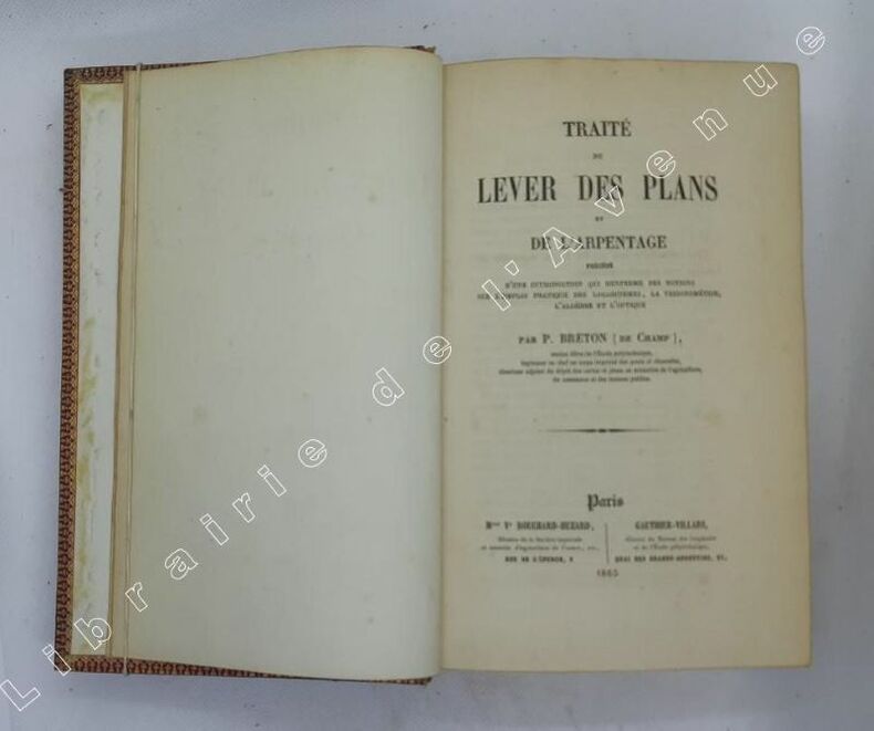
31381Paris, Bouchard-Huzard / Gauthier-Villard 1865, 230x145mm, XXXI- 595pages, broché. Bande de papier collé sur le dos. A faire relier.
1865108539Paris, Vve Bouchard-Huzard : Gauhtier-Villars 1865 In-8 22,5 x 13,5 cm. Reliure de l’époque plein chagrin rouge, dos à nerfs encadrés de fers dorés, plats encadrés d’un quadruple filet écoinçonné doré, contre-plats encadrés de roulette dorée, tranches dorées, XXXI-595 pp., 9 planches repliées in fine, table des matières. Reliure frottée, intérieur assez frais, pages de garde poussiéreuses.