J Webber [James Cook]Biblio.com
370 résultats
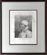
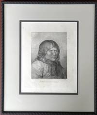
1784H14381London 1784. Fine. Visible portion of sheet measures 13.5 x 10.5; frame with double matting to high archival standards measures approx. 22 x 18 inches. Not examined outside of frame. unknown
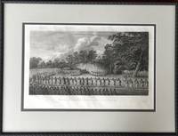
1784H14380London 1784. Fine. Visible portion of sheet measures 13.5 x 10.5; frame with double matting to high archival standards measures approx. 22 x 18 inches. Not examined outside of frame. unknown
179379084Edinburgh:: Printed for R. Morison and Son 1793. The Fourth Edition. old full sheep. Vol. III lacks the last two leaves of text; plates missing as noted. One plate in Vol. III appears to be supplied from another edition. The text is age-toned throughout with some marginal chips and tears and moderate use to the bindings Old ink ownership notation on each front pastedown. . 16mo. Engraved frontispiece portrait and added engraved title page in Vol. I. Vol. I is lacking 3 of 7 engraved plates; Vol. II missing 2 of 7 plates; and Vol. IV is missing 1 of 4 plates. . Forbes 234 Printed for R. Morison and Son, unknown
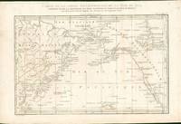
178529431Paris: Moutard 1785. First French edition. Map. Overall very good condition. This is a detailed map of the North Pacific from Cook's 3rd voyage 1776-8 from the first French edition. The map spans the North Pacific from Hawaii to the Arctic circle and northern Alaska the west coast of America to China and has much coastal detail.<br /> This is the French version of the North Pacific that is derived from Lt. Henry Roberts' world map of Cooks' voyages and is printed on laid paper with that has been folded originally to fit into the smaller format of the 4to French edition. Copper engraved map14.5 x 10.25" including text. Moutard unknown
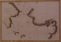
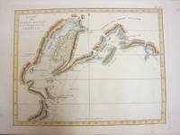
1790202841London: Alexander Hogg 1790. unbound. very good. Sea Chart. Engraving with modern hand coloring. Image measures 8" x 12.75".<br/> <br/> Beautiful map of the Bering Strait. Details the topography of the coastlines indicates depths and routes. Based on a map by Captain James Cook. Beautifully clear image with vibrant coloring. Minor toning to edges of sheet. Lower margin cropped.<br> <br> Captain Cook 1728 -1779 was among the most famous and important explorer navigator cartographer and captain of his time whose scientific and geographical knowledge influenced his successors well into the 20th century. He started sailing as a teenager and went on to join the Royal Navy in 1755. In 1766 he was commissioned to explore the Pacific and went on the sail thousands of miles across largely uncharted regions of the world. These three historic voyages led him to some of the first sightings of Antarctica his discovery of many Polynesian islands including the Hawaiian Islands first European contact with east Australia the circumnavigation of New Zealand and the first correct mapping of the Pacific Northwest.<br/> <br/> Alexander Hogg unknown
1795M4229Leyden Amsterdam The Hague: Honkoop Allart Van Cleef 1795. Very Good. Size : 260x215 mm 10.25x8.5 Inches Coloring: Black & White Category: Maps Ocean Pacific; Honkoop, Allart, Van Cleef unknown
1795M4230Leyden Amsterdam The Hague: Honkoop Allart Van Cleef 1795. Very Good. Size : 200x170 mm 7.875x6.75 Inches Coloring: Black & White Category: Maps Ocean Pacific; Honkoop, Allart, Van Cleef unknown
1795M4242Leyden Amsterdam The Hague: Honkoop Allart Van Cleef 1795. Excellent. Size : 250x300 mm 9.875x11.75 Inches Coloring: Black & White Category: ; Maps Ocean Indian Honkoop, Allart, Van Cleef unknown
178834759Hamburg, 1788. kl. 8°, 277 S., 270 S.; KEINE Schönheit! Bezahlung per PayPal möglich, we accept PayPal, Einb. beschabt u. bestoßen u. angeschmutzt, fingerspurig, Schnitte angeschmutzt, altersbed. Bräunungen, Gebr.sp., Pappband, gebunden
1790059866Newcastle upon Tyne: M. Brown at the Bible in the Flesh Market 1790. Not Given . Hardcover. Very Good Plus. 8vo. Engraved Plate. NEWCASTLE : 1790. Hardback. Covers Cook's first and second voyages. Volume two; pages i 513-1022 pages. Printed title-page. Engraved Plate; between pp.722/723. Old leather; boards detached. Gilt lettered spine smooth; no raised bands. Neat owner name; no internal markings. Bright tight and clean. Boards worn but sound. Original end-papers present. Boards GOOD; internally VERY GOOD. Scarce. ESTC N26645. Will be well-packed for posting/shipping. 8vo. NEWCASTLE: M. Brown at the Bible in the Flesh Market. SCARCE. <br/> <br/> M. Brown, at the Bible, in the Flesh Market hardcover
1784017016London: printed for John Stockdale 1784. Disbound copy being sold as a defective volume. Book measures 21x13.5.cm. xii 400pp 16 plates. Binding worn disbound. Internally pages and plates clean. A good copy.F. Hardcover. Good. 8vo. printed for John Stockdale Hardcover
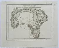
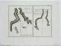
1785H14385London 1785. Very Good. Visible area of sheet measures 20 x 13 inches; double matted framed and glazed to high archival standards; frame measures approx. 27 x 21 inches. A rare image from the atlas of Cook's Third Voyage. unknown
1778M7011Amsterdam 1778. Very Good;. Notes: From Capt. Cook's voyages Size : 254x318 mm 10.00x12.52 Inches Coloring: Hand Colored Category: Maps Polar Arctic Regions Alaska Greenland Iceland; unknown
1778M7009Amsterdam 1778. Very Good;. Notes: From Capt. Cook's voyages Size : 208x190 mm 8.19x7.48 Inches Coloring: Hand Colored Category: Maps Polar Arctic Regions Alaska Greenland Iceland; unknown
1778M7010Amsterdam 1778. Very good. Notes: From Capt. Cook's voyages Size : 285x221 mm 11.22x8.70 Inches Coloring: Hand Colored Category: Maps Canada West; unknown
1795M4238Leyden Amsterdam The Hague: Honkoop Allart Van Cleef 1795. Excellent. Size : 240x185 mm 9.5x7.25 Inches Coloring: Hand Colored Category: Maps Ocean Pacific; Honkoop, Allart, Van Cleef unknown
1795M4236Leyden Amsterdam The Hague: Honkoop Allart Van Cleef 1795. Excellent. Size : 185x235 mm 7.25x9.25 Inches Coloring: Black & White Category: Maps Ocean Pacific; Honkoop, Allart, Van Cleef unknown
1795M4237Leyden Amsterdam The Hague: Honkoop Allart Van Cleef 1795. Excellent. Size : 200x240 mm 7.875x9.5 Inches Coloring: Black & White Category: Maps Ocean Pacific; Honkoop, Allart, Van Cleef unknown
1795M4241Leyden Amsterdam The Hague: Honkoop Allart Van Cleef 1795. Excellent. Size : 175x235 mm 6.875x9.25 Inches Coloring: Black & White Category: ; Maps Ocean Indian Honkoop, Allart, Van Cleef unknown
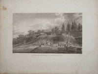
178522401London 1785. Copper engraved view from the folio atlas to Captain Cook's third voyage this classic view of the natives and their dwellings in Nootka Sound. Light general foxing around edges slightly visible inside the impression line otherwise good condition. unknown
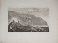
178522404London 1785. Very good condition. Copper engraved view of natives in traditional garb tending their kayaks at the water's edge. Drawn by John Webber and published in James Cook's third voyage around the world. 15 x 9 1/2" on large paper. unknown
1790187878Berlin, Hesse, 1787-1790. Alle Tle. ohne Einbd. Angeschmutzt. Stark gebräunt. Tl. 5 etliche S. knittrig bzw. eselsohrig.
1789173685Paris, 1789. 1 Bl., 497 (recte 499) S. Pp. d. Zt. m. Rsch. Einbd. berieben u. bestoßen. Rücken m. kl. Kleberest. Sign. a. Innendeckel. Tekt. verso Tit. Leicht gebräunt bzw. braunfl.
1780gnt780aLondon: David Henry; Elizabeth Newbery. G : in good condition without dust jacket. Cover heavily rubbed and scuffed. Prelims stained. 1780. First Edition. Marbled hardback boards with brown leather spine. 220mm x 140mm 9" x 6". vi 628pp xvi plates. 12 of 14 b/w plates 6 fold-out. Includes an account of the death of Captain Cook. Two plates missing Dean Stanhope & Miscellaneous. . David Henry; Elizabeth Newbery hardcover
1785015833Great Britain 1785. Print for cook's third voyage. Print measures 38x23 plus margin. Lightly dust marked small pinhole Print on good clean condition. . Very Good. unknown