[Western Americana]Biblio.com
4 240 résultats
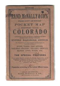
190778144Chicago: Rand McNally & Company 1907. Highly detailed map of Colorado delineating its counties by color and indicating the locations of 28 railroads. A key along the left margin supplies the location and population of various cities large and small.<br />  <br /> 38 p. with the folding map 27 ¾†x 21â€. Original printed brown paper wrappers bound with three staples. A few tiny splits to the map with some minor soiling and edgewear to the wrappers; otherwise very good. Rand McNally & Company unknown
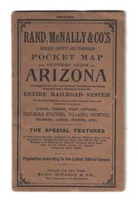
190878140Chicago and New York: Rand McNally & Co 1908. Uncommon folding map of the Arizona Territory published four years before statehood. In addition to locating all cities towns post offices railroad stations villages counties islands lakes and rivers it shows in detail the entire railroad system identifies the nearest mailing point of all local places and names the express company doing business over each road. The 14†x 21†color map is housed within printed brown paper wrappers 4†x 6 ½†along with a list of Arizona railroads a 10-page index and advertisements for Elmer Chute’s New Map of Goldfield and other Rand McNally & Co. maps.<br /> <br /> 18 p. with the folding map. Original printed brown paper wrappers bound with three staples. A few very minor creases to the map with some minor edgewear to the wrappers; otherwise very good. Scarce OCLC locates no holdings of this 1908 map with only two of the 1907 issue and just one of the 1909. Rand, McNally & Co unknown
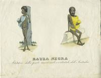
27365Italy 184-. Print. The images of two Western Australian aboriginals Patet and a woman natives of King George's Sound Albany. These were patterned after the engravings that appeared in Prichard's "Natural History of Man" by J. Bull and the format is larger than issued in Prichard.<br /> <br /> Copper engraving period hand color. Printed area 6 1/4 x 8 3/4" on paper 9 x 11". Plate mark visible on two sides. Slt. foxing in the lower portion. Libraries Australia ID 9024501 states "Engraved above image: Etnografia Ser. III H 23 bis Atlante tav. CIV bis" but this is trimmed from this copy. unknown
188962722Battle Creek MI: Review & Herald 1889. Thick 8vo. xxv 1 508 pp. Lithograph frontisp. 15 lithograph and woodcut-engraved plates. Pictorial red publisher’s cloth cover art image of author being named “Timus White Chief of the Palouses†gilt decorative lettering on spine decorated endpapers minor shelfwear rubbing soiling to back cover inner front hinge starting still VG- copy. Fourth edition of this expanded edition of the author’s memoir detailing his life emigrating across the Oregon & California Trail in 1852 to Shasta City gold mining the 1853 Rogue River Indian War including the Takelma Shasta and Applegate River People Athabascan; details on the events leading to the Whitman Massacre defending the Northwest against Confederate sympathizers mail carrier and later gold mining in the Okanagan/Kootenay Valley and later as scout and translator for General O.O. Howard during the Nez Perce Indian War. Of particular interest in this later edition is the inclusion of the detailed biographical supplement and addresses for Oregon Idaho & Washington Territory Pioneers gathered together by Hubert Howe Bancroft including occupations and genealogical information. Howes H811; Smith 4891; Graff 2018. Review & Herald, hardcover
1842AQ24365London: Printed by William Clowes and Sons 1842. 46pp. Stitched as issued. Slight chipping to fore-edge of title page occasional spotting. An apparently unrecorded report of Her Majesty's Commissioner on the state of the British Settlements on the Western Coast of Africa specifically regarding the climate of the Gold Coast Sierra Leone and Gambia and its relation to the health of residences in those areas such as the detrimental effects of high temperatures and the spread of dysentery and fever. . First edition. Folio. Printed by William Clowes and Sons unknown
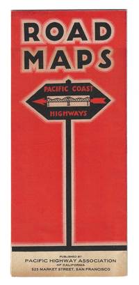
193077734San Francisco: Pacific Highway Association of California 1930. Highly detailed folding map with large cartographic renderings of the highway system in California Oregon and Washington along with several insets including street diagrams and traffic information for Seattle Portland Oakland San Francisco Los Angeles Sacramento Grants Pass and San Jose. There are also photographic illustrations of the Great Carquinez Bridge and the Antioch Bridge respectively eight strip maps and mileage tables.<br /> <br /> Designed and printed by Independent Pressroom San Francisco. Printed in black and orange on a 16" x 18 1/2" sheet which folds to 4" x 9 1/4" 16 panels. Some light toning and wear along the extremities; otherwise very good. Scarce OCLC located only one holding at Stanford University. Pacific Highway Association of California unknown
198263559Norman OK: Univ. of Oklahoma Press 1982. 4to. xiv 4 391 1 pp. Double-page title with over 800 text illustrations diagrams and photos throughout. Simulated brown calf boards gilt saddle on front cover gilt illustration on spine slight shelfwear w/ d.j. NF/NF copy w/ former ownership markings and notes for Leslie Warren Wilson descendant of John W. Wilson homesteaded in 1910 on Wilson Farms in Pettibone ND and Joseph A. Alford homesteaded 1905 in Elida NM. Second printing of this first complete work in print on saddles and Western gear detailing every aspect of saddlery saddle measurement selection fitting the horse rider and saddle as well as leatherwork details. Univ. of Oklahoma Press, hardcover
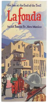
74081A collection of travel brochures and a map dating from the 1950s for travel in Santa Fe New Mexico. The materials were likely gathered as part of a trip to the southwestern city for the 239th Annual Fiesta de Santa Fe which was held from August 31 to September 3 1951. An official program for this event is among the materials. The Fiesta has been criticized over the years for its reenactment of the 1692 reconquest of the city by General Don Diego de Vargas 1643-1704 and glorification of the defeat of Pueblo Indians at the hands of the Spanish an event that is described in this brochure.<br/> <br/> This group includes:<br/> <br/> WELCOME! 239th Annual Fiesta de Santa Fe August 31 - September 1-2-3 1951. 24 p. booklet 8 ½" x 11" with pictorial yellow paper wrappers. Official program with fiesta history calendar of activities and local advertisements.<br/> <br/> CITY OF SANTA FE SANTA FE COUNTY NEW MEXICO. Folding map 23 ½" x 19" printed in black on light pink paper. Dated January 1 1949 and distributed by the Santa Fe Chamber of Commerce. Small ink notation along the border.<br/> <br/> RELAX AND PLAY IN SANTA FE'S BRACING MOUNTAIN AIR. 12 p. booklet 8 ½" x 11" filled with sepia tone images of outdoor activities. Undated issued by the Chamber of Commerce. Vertical crease along the middle as though folded in half.<br/> <br/> LA COCINA DE SANTA FE. Menu 5 ½" x 8 ½" for the restaurant which was recommended by Duncan Hines and the A.A.A. Four panels printed in black on tan cardstock and undated.<br/> <br/> LA FONDA: The Inn at the End of the Trail in old Santa Fe New Mexico. Stapled folding brochure 4" x 9" promoting expansion of the pueblo-style hotel. 12 panels internally printed in two colors with a full color cover illustration.<br/> <br/> FRED HARVEY SOUTHWESTERN HOTELS IN NEW MEXICO ARIZONA AND RESTAURANTS IN OHIO ILLINOIS MISSOURI KANSAS NEW MEX. ARIZONA CALIFORNIA 1951. Folding brochure printed in red and black on a 24" x 9" sheet of cream stock that folds to 4" x 9" 12 panels.<br/> <br/> EL NAVAJO GALLUP NEW MEXICO: "The Heart of the Indian Empire" - A Fred Harvey Hotel. Folding brochure promoting the hotel and local Navajo Country tours. Printed in black on an 8" x 9" sheet of yellow paper that folds to 4" x 9" 4 panels.<br/> <br/> THE ALVARADO ALBUQUERQUE NEW MEXICO: A Fred Harvey Hotel. Folding brochure advertising stays at the hotel which was named after Hernando de Alvarado commander of artillery in Coronado's expedition. Printed in black on an 8" x 9" sheet of white paper that folds to 4" x 9" 4 panels. unknown
190662652St. Louis MO: Holt St. Louis Streets Dept. 1906. Forty-four of 46 original linen-backed panoramic silver gelatin photographs comprised of 116 approx. 8 x 10 in. images divided into 2-4 panel panoramic photographs w/ captions neatly written w/in negatives at lower fore-edge annotations in red & black ink occasional pencil notes sectional numbers on versos edgewear & rubbing some lifting to fore-edges of some of the images creasing soot soiling to versos minor over-exposure to some images still a VG archive. This historic archive of panoramic photographs meticulously document the now largely disappeared and built-over River des Peres in a Ruscha-like manner and if pasted end-to-end would span nearly 100 feet. Capturing the River des Peres Valley which still meandered at the beginning of the 20th-Century along the Western boundaries of St. Louis MO and reveal a fast-growing Western city industrializing and appropriating the marshy lowlands farms and rural areas into factories breweries and railroad routes. Eleven of the images wind through Forest Park where much of the river had been channeled in 1904 through wooden sewers and culverts in order to cut down on the stench and prepare the park for the 1904 St. Louis World’s Fair. Holt 1866-1925 was renowned for his excessive photographic documentation leading groups of city engineers armed with large format cameras shooting on glass plate negatives recording the sprawling activities of the burgeoning St. Louis community in the Progressive Era. As evidenced by this meticulously shot archive of panoramic images Holt and his team document from the Mouth of River des Peres looking North with railroad bridge in right foreground and steamers in the river alongside the banks. The images continue along the River des Peres capturing the brewery next to the Railroad and between Broadway & Alabama Ave.; the sprawling unidentified factory on Webster; and also demarcating where the City Limits Stones were set and what numbers. A four-panel panoramic photo denotes the Saints Peter & Paul Cemetery on Gravois Avenue followed by others indicating different distances from Gravois Road bridges and houses along the road a road grading and roadbuilding team West of Gravois and then recording the rural lowland areas Southwest of Gravois and then towards Echelberger Street. About halfway through the series the images begin capturing more industrial and suburban development including the St. Louis & San Francisco Railroad Line Frisco RR telephone poles along Fyler Ave. Frisco RR stone station on Fyler with nearby culvert; the Hirsch Rolling Mill Co. complex with railcars labeled and carrying steel and railroad bridge in the distance. The photos show the River des Peres winding around revealing the Clifton Heights in the background; between Knox and Sulpher Ave. with Fire Engine House in the right foreground and many different railroad company cars including those for the Cotton Belt Line the Chicago Peoria & St. Louis RR the Missouri Kansas & Texas RR; and many for the Frisco RR. Several photos shot by Holt and his team May 10 1906 capture the sprawling Laclede Fire Brick Manufacturing Co. complex the Frisco RR Arch Bridge and even a Birds-Eye view. Other photos approaching Forest Park also depict the Police Headquarters Stables the Forest Park Highlands and once in the Park a group of boys playing baseball in the lower foreground. The final three-panel panoramic photo was taken looking West with Delmar Blvd. on the right and the Frisco RR trestle in the middle foreground Delmar Garden in the background and center field filled with the trestle stretching over the River des Peres. Unsurprisingly this cataloguer could find no similar partial or extant collection of images and the original negatives appear to have probably been dumped by St. Louis City Hall housecleaning around 1950 when they offloaded the thousands of photos shot by the Holt for the Street Department. The historically invaluable images were all sold at an auction comprising three 13 foot high stacks of negatives nearly all of them on glass. Purchased originally by Swekosky the collection was lent to Dick Lemen of Moline IL who cleaned printed and enlarged the photos purchased them and later donated the remnants of what he preserved to the St. Louis Mercantile Library. These photographs capture a Western waterway almost entirely displaced with nearly all of its original route completely rebuilt as it was engineered to operate as the backbone of the St. Louis sewer system and almost completely underground with just a few sections near the mouth with a channel and paved bans. In 1904 the Forest Park section was covered in a “large wooden box†to prevent visitors to the World’s Fair from breathing the unhealthy stench and after a 1915 flood backed up sewers killed 11 people in flooding and destroyed over 1000 homes chief engineer Horner was ordered to prepare a plan to completely control and build over the River des Peres. It still carries storm water and sewage in separate pipes and now that the channel has almost no direct source from the Mississippi River and all of the lowland meadows wetlands and areas that existed at the beginning of the 20th Century have been entirely paved over there largely remains no water to supply the river itself. Some of the River at the site of the former Carondelet Coke Plant has been largely remediated and a short piece connected to the Mississippi Greenway near River City Casino. See: Kelly Moffitt Salvaged Photographs from the St. Louis Street Department circa 1900-1930 Catalogued in New Book St. Louis on the Air St. Louis Public Radio Aug. 2 2017; Enter Dick Lemen Dr. William G. Swekosky The collection Grows Unwieldy Lafayette Square Archives 2020; Michael Allen The Harnessed Channel: How the River Des Peres Became a Sewer Preservation Research Office Nov. 27 2010; Chris Naffziger Reconnecting with the Roots of River des Peres in St. Louis Terrain Magazine 2022. Holt, [St. Louis Streets Dept.], unknown
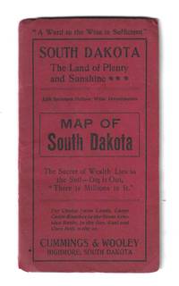
191078148Highmore South Dakota: Keiser Land Company 1910. Printed by Will A. Beach in Sioux Falls using the E. Frank Peterson map of South Dakota to promote settlement in Stanley Sully Hughes Hyde and Hand Counties which are highlighted in green of course. The remaining counties and the Indian Reservations are outlined in red. Advertisements and agricultural statistics frame the map with a lengthy text on the verso describing the natural resources educational advantages and other local opportunities.<br />  <br /> Printed on both sides of a 22†x 17†sheet which folds to 3 ½†x 8 ½â€. A few minor splits and tears with some mild toning to the outer panels; else very good. Scarce OCLC locates only three holdings: Yale South Dakota and Michigan. Keiser Land Company unknown
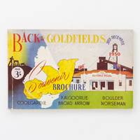
1950123012Kalgoorlie: Back to the Goldfields Celebrations 1950. First Edition. Paperback. Very Good. Kalgoorlie Back to the Goldfields Celebrations 1950. Oblong octavo 180 pages with numerous illustrations and advertisements. Colour pictorial card covers a little creased and rubbed with a few tiny closed tears; a very good copy. An attractive souvenir with much of Western Australian mining interest as well as short local histories of goldfields towns such as Coolgardie Kalgoorlie Boulder Broad Arrow Norseman. Back to the Goldfields Celebrations paperback
189063750San Francisco CA: C.P. Heininger 1890. Oblong 12mo. 6 x 5 in. 18 leaves unnumbered. Albertype sepia-tinted lithographs from photographs and original drawings including double-page “Birds Eye View of Portland & Vicinity†a few folds neatly repaired minor age toning some slight edgewear minor closed tear head of spine old reinforcement on verso of spine still a VG- copy w/ publisher’s advertising label mounted on rear pastedown bookseller’s stamp for Eli Sherwin Denison General Newsagent Southern Pacific Company Portland OR. First edition of this very scarce original view book issued by one of the most dominant travel souvenir publisher’s in 19th-Century California and the West C.P. Heininger. Not only did they publish and sell view books photo albums and guidebooks but also created business cards walking canes and novelties made from Redwood and Redwood tree bark. This souvenir view book’s Birds-Eye fiew of Portland focused on the Willamette River looking South with western downtown Portland and docks on right-hand side of image while East Portland and Albina appear to the left-hand of the image capturing the railroad shops and grain elevator. Of additional interest are the included views of the North Pacific Exposition Building constructed in Goose Hollow on Burnside in 1888 serving as the venue for the annual Industrial Exposition flower shows and athletic field which later evolved into the Multnomah Stadium and was destroyed in a 1910 fire. Heininger 1857-1943 first established his souvenir lithograph printing offices sometime in 1885 and would continue selling novelties and printed view books until 1924-1927. Denison 1827-1898 was a longtime General Newsagent for the Central Pacific & Union Pacific Line and in 1869 developed his business under the Southern Pacific where he remained until the end of 1890 when he set up his own line The Laundry Farm Railroad. Worldcat locates 5 copies of the 1890 ed. Stanford Bancroft Multnomah County Lib. U of O Seattle Public. C.P. Heininger, unknown
182928055London: John Murray 1829. Paperback. Very good condition. Important early report on the Swan River Colony based on Captain Stirling's findings during his 1827 expedition and intended as a guide for prospective emigrants. The 29 page article is titled "Regulations for the Guidance of those who may Propose to embark as settlers for the New Settlement on the Western Coast of New Holland" and includes a one page woodblock map. The map "Sketch of the New Settlement on Swan River" has the text "Fine undulating grass plains thinly wooded" stretching from Mangles Bay to Port Leschenault. The WA coast is shown from above Swan River in the north around Cape Leeuwin and further to the East. Disbound from Vol XXXIX with the title page pp 315-344 with some extraneous pages. John Murray paperback
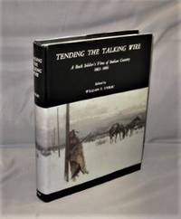
197927309<p>Western Americana . Tending the Talking Wire: A Buck Sergeant's View of Indian Country 1863-1866. Edited by William E. Unrau. Salt Lake City: University of Utah Press 1979. First Printing of the First US Edition. A Fine tight copy in a Fine unclipped dust jacket. Hervey Johnson of Hillsboro Ohio was a private in the 11th Ohio Cavalry stationed in the mid-1860s at a string of small posts along the Sweetwater River from Independence Rock to South Pass 100 miles to the west. Their main duty was to protect the line of the transcontinental telegraph—"the line" he calls it here. Frequently the line was cut by American Indian tribesmen; often large portions of the line were carried away to make it more difficult to repair During his three years in the Army Johnson wrote about 100 letters home to his sisters and mother in Ohio. The family were Quakers so he often uses the pronouns "thee" and "thy" instead of "you" and "your." From various sources at the time he heard about the July 25 1865 battle at Platte Bridge Station. At the time he wrote this letter Johnson was stationed at a post on the Sweetwater near Independence Rock about 55 miles west of Platte Bridge which he generally refers to here as "the Bridge." </p> University of Utah Press, hardcover
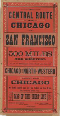
1882List2451Chicago: Rand McNally and Co 1882. Lithographic broadside illustration printed in color measuring 11 x 5 ¾ inches. Closed tear to margin paper reinforcement to corners verso very good condition quite bright and attractive. Very Good. An attractive advertisement for the Chicago and North-Western’s routes to San Francisco printed during the tenure of the railroad tycoon Marvin Hughitt as General Manager a position he held from 1876 to 1880 before being named Second Vice President. The advertisement was printed by Rand McNally and Company which in its early years focused on railroad-related materials. The Omaha and California line of the Chicago and North-West Railway connected passengers from Chicago to California. Other maps printed by Rand McNally and Co. during the period illustrate the route. We find no other examples of this broadside. Rand, McNally and Co unknown
195232978Glendale CA.: The Arthur H. Clark Company 1952. First edition. With illustrations from contemporary sources these being two portraits a military scene a facsimile from Riley's journal and a fold-out map of the Santa Fe Trail. Tall 8vo in the publisher's original red cloth the spine gilt lettered. 222pp. A very fine copy but for a little cosmetic scarring to the endpaper along the front fold line otherwise pristine. FIRST EDITION OF THIS FINE ACCOUNT OF EARLY TRAVELS ON THE SANTA FE TRAIL. An often overlooked aspect of American History the trail was one of the first major route west; connecting Franklin Missouri with Santa Fe New Mexico. Beginning in 1822 the trail was used to take advantage of new trade opportunities with Mexico which had just recently won its independence from Spain. This caught unwelcome attention from the Plains Indians. By 1829 it was decided the caravans needed a military escort a decision which was extremely controversial at the time.<br> The escort consisted of four companies of the Sixth United States Infantry commanded by Captain brevet Major Bennet Riley after whom Fort Riley of Kansas is named. Major Riley had fought as a young officer in the War of 1812. While well intentioned the military escort and a number of armed clashes along its route complicated United States relations not only with the Plains Indians but also with the Republic of Texas and with Mexico.<br> This work is drawn directly from the journals of Major Riley and the reports of Lieutenant George Cooke; very early and important accounts of Americans in regions previously controlled by Spain. The Arthur H. Clark Company hardcover
1920List3343United States 1920. Painted poster with affixed photograph measuring 14 x 21 inches. Toned with water damage and slight damage to edges; very good to excellent. A painted poster advertising the 1920 film The Girl Who Dared a Western directed by Clifford Smith and starring Edythe Sterling. The story follows Barbara Hampton a rancher’s daughter who is elected sheriff of a small town and must take on the cattle rustlers who are after her father. Sterling born Edith May Kessinger 1893–1962 was a prolific actress known for working with animals; after her film career she performed riding stunts in a Wild West show. Smith 1894–1937 was similarly prolific directing more than eighty films during his career—mainly Westerns which were especially popular during the silent era. This poster is hand-painted with a photograph from the film affixed and advertises 1¢ admission which was remarkably cheap even for the time. unknown
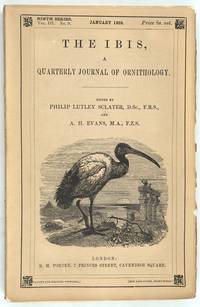
190927730London: R. H. Porter 1909. First printing. Pamphlet. Very good condition. Four issues of this journal of ornithology. The October issue has an article by W.R. Ogilvie- Grant with field notes by G.C. Shortridge on "On a Collection of Birds from Western Australia" Pages 650 to 689 to be continued includes a fine hand colored lithograph of Sericornis Balstoni and Malurus Bernieri fairy wren. Large 8vo printed paper wrapped issues of the journal housed in a slip box. Bright clean copies with some chipping of spines and one cover. R. H. Porter unknown
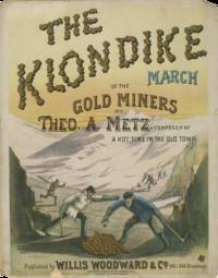
1897Cat358New York: Willis Woodward & Co 1897. Folio sheet music complete. Illustrated color lithograph title page by Robert Teller. Covers detached contents complete good with lithographed cover in particularly bright and attractive condition. Sheet music issued at the height of the Klondike Gold Rush capitalizing directly on the surge of public interest following the discoveries in the Yukon in 1896–1897. The lithographed title page signed in style by Robert Teller shows a dramatic scene of prospectors working a gold deposit in the mountains with two miners in the foreground bent over a pile of freshly uncovered gold tools in hand. Theodore August Metz was a German-born musician trained on violin in Hanover who emigrated to the United States and worked various trades before establishing himself as a bandleader and composer in Chicago’s late 19th-century popular music scene. He achieved national prominence with “There’ll Be a Hot Time in the Old Town Tonight†1896–97 a widely performed marching tune that became especially popular during the Spanish-American War and in minstrel and touring band repertories. <br /> <br /> OCLC 726910235 locating a single copy at the Levy Collection. Willis Woodward & Co unknown
19788811Santa Barbara CA: Harold G. Davidson 1978. Limited to 200 copies this copy unnumbered and unsigned. 4to 288pp. Photo frontis black and white facsimiles throughout. Bound in publisher's red leather with gilt lettering. Housed in gray marbled paper slipcase with red leather paste on with gilt lettering on front. Fine book in slipcase with some light wear. Harold G. Davidson unknown
187162250Hartford CT: Columbian Book Co. 1871. 8vo. xxi 1 23-602 pp. plus 4 pp. publisher’s ads. Steel-engraved frontisp. with numerous woodcut engravings & illustrations. Plum-coloured publisher’s cloth gilt bear stamped on front cover title lettering embossed in blind on spine minor foxing to frontisp. minor sunning & wear to spine edgewear slight uniform interior toning still a VG- copy. Second printing of this informative work gathered from the author’s first-hand interviews with early settlers and mountain men of the Pacific Northwest including Joe Meek William Henry Gray and others. Much of the work was actually written in the house of noted Oregon pioneer & author Belle W. Cooke who describes how she was “often reading the manuscript to my father and mother for comment.†Victor herself notes after publication that some of the historical facts regarding Marcus Whitman his efforts in the Oregon Country and the massacre orally related to her by Gray needed to have been checked more carefully. Victor d. 1902 was the primary author for the Bancroft histories of Oregon Washington and the Northwest Coast as well as a noted author of poetry and literature. See Powers History of Oregon Literature pp. 282 305-309 Graff 4477 1870 ed. Columbian Book Co., hardcover
195458591New York: The Westerners 45 West 57th St. 1954-1964. 48 issues in 6 volumes. Approx. 1150 pp issues & vol. runs separately paginated. including biennial indexes for each volume. With colour plates illustrated ads inserted ads photo illustrations maps issues were printed on varying grades and types of paper over this 10 year run so some are a little toned and there are a few colour-tinted publisher’s inserts. Uniformly bound in burgundy-coloured simulated calf gilt lettering & ruling on spines a couple issues w/ minor tears and wear to corners still an excellent set bound and from the library of William Henry Bishop b. 1922 w/ TLS laid-in from Peter Decker on letterhead addressed to Bishop Shelburne Hotel New York dated March 16 1954 including New York Posse Membership No. 117 on the laid-in card as well as 4 ff. mimeographed copy of The Westerners by-laws. First editions of this complete run of the first 10 years of The Westerners Brand Book quarterly which included articles and memoirs by some of the most significant Western historians of the 19th & 20th Centuries. Articles ranged in topics from the Hudson’s Bay Company fur traders to Western Knives along with outlaws gunfighters pioneering families and Western artists. A number of articles detail the lives mistreatment and condition of American Indians including those of the Umpqua Cheyenne Sioux Pawnee as well as Indian Health Service military campaigns and more. At the time of Bishop’s acceptance as a Westerners New York Posse member he was managing the Alaska Livestock & Trading Co. sheep & cattle ranch at Chernofski Harbor on Unalaska Island which encompassed 120000 acres as well as executive with Oregon Worsted Co. The Westerners were originally founded in Chicago by Leland Case Don Russell Ray Allen Billington Elmo Scott Watson and others but quickly grew to include Corrals in Denver Los Angeles Washington D.C. London and others with the groups publishing articles and reviews. The Westerners, 45 West 57th St., unknown
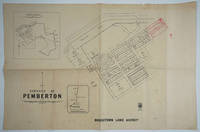
193325852Perth: Department of Lands and Surveys 1933. Cadastral map showing land use. Includes plan showing townsite boundary. Version dated "6.2.33". Addition of lots 185-200 on upper right to town plan printed in red. <br /> <br /> The earliest held by SLWA seems to be ca. 1950. Call Number 9024.P3G46<br /> 1 map ; 58 x 76 cm. encapsulated in plastic.<br /> <br /> Western Australia. Department of Lands and Surveys.<br /> Map Dept. of Lands & Surveys W.A. 1937.<br /> Available at 3rd Floor Map Stack Call number: 35/11/MANJ 1937 plus 1 more.<br /> Call Number <br /> 9024.M25G46<br /> Related titles <br /> Townsite maps Western Australia.<br /> Description <br /> 1 map ; 54 x 69 cm. encapsulated in plastic.<br /> Part of collection: Townsite maps Western Australia. Department of Lands and Surveys unknown
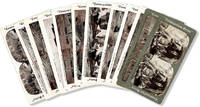
62435N.p. n.d. ca 1910s: Cosmopolitan Series. Twelve lithoprint stereoviews on cardstock each 3-1/2" x 7". Very mild edge-rubbing occasional light soil on versos; Very Good to Near Fine. <br /> <br /> A selection of Western and Native American scenes from this anonymously-published series. Though not expensively produced and though printed images halftones rather than original photos this selection is unusual for being very well-preserved. Includes scenes in New Mexico Colorado Yellowstone Park Alaska Minnesota and Arizona along with a few unlocated western views - "Camping in the Wild West;" "A Real American Cowboy;" and three Native American views including "Chippewa Squaw Making Birch Canoe" "Chief Blackhaw Squaw and Papoose;" and "Mounted Sioux Indians Western Plains." For brief reference on the series see DARRAH p.120. Cosmopolitan Series unknown
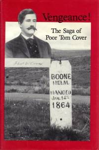
198962162El Segundo CA: Upton & Sons Publishers 1989. Tall 8vo. 347 1 pp. Photo frontisp. numerous photo and text illustrations. Light blue publisher’s cloth gilt lettering minor toning to fore-edges w/ d.j. cover art of Boone Helm grave marker & Tom Cover photo still VG/NF copy from the library of Tom Koenninger 1932-2010 former editor managing editor journalist for The Columbian newspaper and board member on the Vancouver National Historic Trust. First edition of this work tracing the life of gold miner vigilante and later Riverside CA founder and orchard grower Tom Cover. He and his partners had made the big gold strike in Virginia City Montana Territory gracked down and hung the Plummer gang including Sheriff Henry Plummer and Boone Helm witnessed the murder of John Bozeman and later settled in Los Angeles. Thrapp posits that the Helm family members finally exacted revenge upon Cover during a prospecting trip in 1884 into the Colorado Desert as he disappeared in Sept. 1884 and was never heard from again. Upton & Sons, Publishers, hardcover