1 504 résultats
19931314937Rockford IL: Photo Department Publication 1993. First Edition. Hardcover. Oblong Folio; unpaginated; VG-/no-DJ; dark green spine with blind stamped text; cloth has slight wear to exterior; minor rubbing to corners; strong boards; text block shows mild wear to exterior edges; interior clean; frontispiece; profusely illustrated with black and white photographs; additional shipping may be necessary due to size/weight restrictions for international/expedited orders. 1314937. FP New Rockville Stock. Photo Department Publication hardcover books
2018246949New York: Bloomsbury 2018. Hardcover. 437p. chronological tables photos cast of characters index near-fine first edition in bright unclipped dj. A thorough study of the phenomenon with statements quotes interviews with and by just about everyone involved in the project up to and including the film version with Streep and the late Ron Liebman. Bloomsbury hardcover books
186913783Rochester N. Y.: Benton & Andrews. Very Good. 1869. Softcover. Backstrip chipped light soil to cover light foxing pp 100 else G . Benton & Andrews paperback books
1856261861856. Butts Isaac Ridler 1795-1882. The New Business Man's Assistant and Ready Reckoner for the Use of Merchants Mechanics and Farmers. Consisting of Legal Forms & Instructions Indispensable in Business Transactions; Together with Greater Variety of Useful Tables than are to be found in any other work. Boston: I.R. Butts 1856. 132 4 pp. With four-page publisher catalogue. Octavo 4-1/2" x 7-1/2". Printed wrappers some chipping to spine corners and edges. Internally clean and bright. A nice copy. $10. From the series of self-published guides by Butts. With numerous tables and forms. See Cohen Bibliography of Early American Law 8169-8187. unknown books
18392072825th Cong. 3d Sess.: HD92. 1839. 10pp. Caption title as issued. Disbound. Light scattered foxing. Very Good. HD92. unknown books
177926521London: Royal Society of London 1779 1780. First Edition. Quarter Leather. Very Good. This complete volume of papers by numerous authors on a variety of subjects including medicine natural history physics mathematics and archaeology illustrated with numerous plates. iii-viii 323 2 v-vii 325-696 1 pp. 8vo. Library binding tan leather spine with gold embossed titling scuffing and tears where call numbers have been removed. Interiors clean ex-library stamp on title page and occurring sporadically within. Numerous folding plates that illustrate articles. Pages were trimmed slightly when rebound. Royal Society of London unknown books
1913234266Toronto: William Briggs 1913. First edition. 1 vols. 8vo. Original green cloth remainder binding with black lettering on front cover and spine. First edition. 1 vols. 8vo. William Briggs unknown books
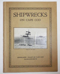
192526191North Truro: Privately Printed 1925. First edition. Paperback. Very Good. Small bound wrappers. 58 pp. Illustrated with black and white photographs and one drawn map. A handsome very good copy with just some light age wear to the page edges. Photograph of a sailing ship in peril is tipped on the front cover. Privately Printed paperback books
1827305824Charleston: James S. Burges 1827. First and only edition. 18 2 blank pp. 12mo. Modern pale yellow wrappers. Custom chemise and quarter morocco slipcase. Some pale foxing to title otherwise clean. First and only edition. 18 2 blank pp. 12mo. Rarity of American Judaica. A rare pamphlet issued by the first Jewish Reform movement in the United States the Sephardic Reformed Society of Israelites in Charleston South Carolina recording an address by one of the movement's leaders. The Reformed Society of Israelites formed in 1824 when it split off from the Kahal Kadosh Beth Elohim KKBE synagogue in Charleston seeking to implement a number of reforms it deemed crucial to engaging the rising generation. In the process the Society posited a distinctly American form of practice. <br/>Led by Isaac Harby Abraham Moise and David Nunes Carvalho the Reformed Society of Israelites reflected the fact that as Jonathan Sarna has phrased it: "Jews who did not feel at home in synagogue no longer had to compromise their principles for the sake of consensus; they felt free to withdraw and start their own congregations. In free and democratic America congregational autonomy became the rule resulting in a new American Judaism - a Judaism of diversity and pluralism."<br/><br/><br/>The present address was delivered on the third anniversary of the Society by Isaac Cardozo 1786-1855 who served as the group's Vice-President from 1828-1832. Cardozo invokes a "spirit of reform in all existing institutions which is abroad" and reminds the group of its origin as "a society that was instituted mainly for effecting the observance of order and decorum in Hebrew worship: for adapting it to the feelings and propensities of the enlightened Israelite of the present day; and for endeavoring to bring about by argument and petition what neither necessity nor persuasion could before accomplish" before he goes on to defend the mission against various critiques. <br/> <br/>Apart from being a leader within Charleston's Sephardic Jewish community Cardozo was also the patriarch of an important southern African-American family. He had six children with his common-law wife Lydia Weston a free black woman from a prominent Charleston family--one of a number of openly mixed-race households in antebellum Charleston. One of their sons was Francis Cardozo 1836-1903 who became the first African-American to hold statewide office in the United States serving as Secretary of State in South Carolina from 1868 to 1872. Another son Thomas served as State Superintendent of Education from 1873 to 1876. <br/><br/>RARE: OCLC reports only two institutional copies and A.S.W. Rosenbach in his American Jewish Bibliography located only one copy in a private collection. Rosenbach 289 locating one copy in a private collection; OCLC USC Presbyterian College; American Imprints 28385; Singerman 0442 James S. Burges unknown books
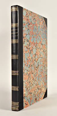
182229763Philadelphia: H.C. Carey & I. Lea 1822. Folio. Mounted on guards throughout. Letterpress title copyright notice on verso 1p. 'Advertisement' dated 'June 21 1822' verso blank 1p. 'Contents' and 'Index' verso blank. 46 double-page hand-coloured engraved maps of America all but one with borders of letterpress descriptive text 1 uncoloured double-page engraved view showing the comparative heights of mountains throughout the world 1 hand-coloured double-page engraved table showing the comparative lengths of the principal rivers worldwide 5 letterpress tables 4 double-page 3 of these hand-coloured 18pp. of uncoloured letterpress text. Contemporary half black morocco over plain paper boards rebacked with original spine laid down and corners renewed. Housed in a cloth clamshell case leather label.<br/> <br/>First edition of one of the most important early atlases printed in the United States: a handsome atlas of the Americas with individual hand-coloured maps of each state in the Union including a seminal map of the West by Stephen H. Long.<br/> <br/>At the time of publication this was the best and most detailed atlas to be produced in the United States. Fielding Lucas the major Baltimore printer was the principal engraver and substantial historical background text accompanies each map. Among the most noted maps in the atlas is Major Stephen H. Long's "Map of Arkansa and other Territories of the United States." That map which depicts the Missouri basin between Nashville in the east the Mandan villages in the north and the Rocky Mountains in the west was based on the surveys conducted by Long on his expeditions of 1819 and 1820. The map published in Carey & Lea's atlas preceded the official account of that expedition by expedition botanist Edwin James which included a smaller map with similar detail titled "Country drained by the Mississippi Western Section". Carey and Lea's 1822 publication of James Account perhaps explains the prior inclusion of this map with Long expedition information in their atlas. On this famous map is the printed legend which would perpetuate a myth for many years to come identifying the high plains as the "Great American Desert." Carey and Lea's atlas was first issued as here in 1822; an 1823 second issue followed substantially the same as the first but with a new title and revised states of several maps and text leaves generally minor revisions including additional shading to maps and improved resetting of several text leaves.<br/> <br/>Phillips 1373a; Howes C133 "aa"; Sabin 15055; Wheat Transmississippi West 348 and 352. H.C. Carey & I. Lea unknown books
1823WRCAM43415APhiladelphia: H.C. Carey & I. Lea 1823. Letterpress title copyright notice on verso 1p. advertisement verso blank 1p. table of contents verso blank. Forty-six double-page handcolored engraved maps of the United States all but one with borders of letterpress descriptive text; uncolored double-page engraved view showing the comparative heights of mountains throughout the world; handcolored double-page engraved table showing the comparative lengths of the principal rivers worldwide; five letterpress tables four double-page three of these handcolored; 18pp. of letterpress text. Mounted on guards throughout. Modern half calf and marbled boards spine gilt leather label. Dampstaining along lower edge causing chipping to initial leaves. Closed tear in bottom margin of first map repaired with tissue. Very light offsetting from maps. Some dust soiling light tanning and foxing. Good plus. A handsome atlas of the Americas with individual color maps of each state in the Union including a seminal map of the West by Stephen H. Long. At the time of publication this was the best and most detailed atlas to be produced in the United States with substantial historical background text accompanying each map. Fielding Lucas the major Baltimore printer was the principal engraver. <br> <br> Among the most noted maps in the atlas is Major Stephen H. Long's "Map of Arkansa and other Territories of the United States." That map which depicts the Missouri basin between Nashville in the east the Mandan villages in the north and the Rocky Mountains in the west was based on the surveys conducted by Long on his expeditions of 1819 and 1820. The map published in Carey & Lea's atlas preceded the official account of that expedition by expedition botanist Edwin James which includes a smaller map with similar detail titled "Country drained by the Mississippi Western Section." Carey & Lea's 1823 publication of James' ACCOUNT perhaps explains the prior inclusion of this map with Long expedition information in their atlas. <br> <br> On this famous map is the printed legend which would perpetuate a myth for many years to come identifying the high plains as the "Great American Desert." Carey & Lea's atlas was first issued in 1822; this is the second issue with revised states of three maps Maine North Carolina and Louisiana with the same printing of the remaining maps and a cancel title. HOWES C133 "aa." PHILLIPS ATLASES 1373a. SABIN 15055. WHEAT TRANSMISSISSIPPI 348 352. H.C. Carey & I. Lea hardcover books
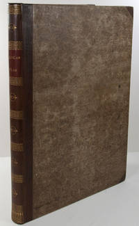
182729764Philadelphia: H.C. Carey & I. Lea 1827. Folio. Mounted on guards throughout. Letterpress title copyright notice on verso 1p. "Advertisement" to Third Edition dated "January 1827" verso blank 1p. "Contents" and "Index" verso blank plus forty-six double-page handcolored copper engraved maps most with descriptive letterpress in margins and many with supplementary text pages following; one double-page engraved plate of mountains uncolored; and one double-page colored plate of river lengths. Titlepage remargined minor foxing some faint staining along bottom edge. Later 19th-century three-quarter calf and original plain paper boards later gilt morocco label. Boards slightly rubbed.<br/> <br/>One of the most important early atlases printed in the United States: a handsome atlas of the Americas with individual colour maps of each state in the Union including a seminal map of the West by Stephen H. Long.<br/> <br/>At the time of publication this was the best and most detailed atlas to be produced in the United States. Fielding Lucas the major Baltimore printer was the principal engraver and substantial historical background text accompanies each map. Among the most noted maps in the atlas is Major Stephen H. Long's "Map of Arkansa and other Territories of the United States." That map which depicts the Missouri basin between Nashville in the east the Mandan villages in the north and the Rocky Mountains in the west was based on the surveys conducted by Long on his expeditions of 1819 and 1820. On this famous map is the printed legend which would perpetuate a myth for many years to come identifying the high plains as the "Great American Desert." The 1827 edition "Third edition Corrected and Improved" of Carey & Lea's historic atlas first published in 1822 includes much new material with all the maps and text updated except for the Washington D.C. and Michigan maps. This was the first American atlas that was modeled on Le Sage's plan of having explanatory text surrounding the maps. The maps for the most part by Fielding Lucas are beautifully drawn and colored.<br/> <br/>Howes C133 "aa"; Phillips 1373a; Sabin 15055; Wheat Transmississippi West 348 and 352. H.C. Carey & I. Lea unknown books
182325085Philadelphia: H.C. Carey & I. Lea 1823. Folio. 17 1/2 x 11 7/8 inches. Mounted on guards throughout letterpress title copyright notice on verso 1p. Advertisement verso blank 1p. Contents verso blank 46 double-page hand-coloured engraved maps of the United States all but one with borders of letterpress descriptive text 1 uncoloured double-page engraved view showing the comparative heights of mountains throughout the world 1 hand-coloured double-page engraved table showing the comparative lengths of the principal rivers worldwide 5 letterpress tables 4 double-page 3 of these hand-coloured 18pp. of letterpress text. Expertly bound to style in half calf over contemporary marbled paper covered boards flat spine in six compartments divided by gilt roll tools red morocco label in the second compartment the others with a repeat decoration in gilt.<br/> <br/>One of the most important early atlases printed in the United States: a handsome atlas of the Americas with individual colour maps of each state in the Union including a seminal map of the West by Stephen H. Long.<br/> <br/>At the time of publication this was the best and most detailed atlas to be produced in the United States. Fielding Lucas the major Baltimore printer was the principal engraver and substantial historical background text accompanies each map. Among the most noted maps in the atlas is Major Stephen H. Long's "Map of Arkansa and other Territories of the United States." That map which depicts the Missouri basin between Nashville in the east the Mandan villages in the north and the Rocky Mountains in the west was based on the surveys conducted by Long on his expeditions of 1819 and 1820. The map published in Carey & Lea's atlas preceded the official account of that expedition by expedition botanist Edwin James which included a smaller map with similar detail titled "Country drained by the Mississippi Western Section". Carey and Lea's 1823 publication of James Account perhaps explains the prior inclusion of this map with Long expedition information in their atlas. On this famous map is the printed legend which would perpetuate a myth for many years to come identifying the high plains as the "Great American Desert." Carey and Lea's atlas was first issued in 1822; this is the 1823 second issue substantially the same as the first but with a new title and revised states of several maps and text leaves generally minor revisions including additional shading to maps and improved resetting of several text leaves though this copy with first state settings of the Maryland and Virginia text leaves.<br/> <br/>Howes C133 "aa"; Phillips 1373a; Sabin 15055; Wheat Transmississippi West 348 and 352. H.C. Carey & I. Lea unknown books
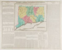
182319787Philadelphia: Carey & Lea 1823. Engraving with full period colour. Backed on linen. Split at fold expertly repaired. Occasional creases. Fascinating and informative map of Connecticut from one of the most innovative American atlases of the 19th century.<br/> <br/>Carey & Lea's atlas established a style that was widely admired especially in Europe: placing a fully coloured map as the centerpiece of the page and surrounding it with geographical and historical facts. The texts were well written and intriguing. The immense transformation of continental America: the vast migration settlement and industrialization really began at about this time not long after the War of 1812 when expansion and opportunity were American by-words. It was at this time that American atlases began to need semi-annual revisions because the country had changed so rapidly. In fact the Carey & Lea gazetteer style most reminiscent of Herman Moll really was too time consuming for the firms that published atlases of America as the century progressed. Carey & Lea unknown books
1822005211Philadelphia PA: Carey & Lea 1822. Book. Very good- condition. Unbound. First Edition. 22.25" width x 17.5" height printed sheet with images of North America and South America side by side totalling 15.25" x 8.75" of hand-colored maps centered at top of sheet five color. Excellent condition with minimal browing to center fold which is offsetting from original glue from reverse hinge. Dark spot of staining at top edge of margin near title of map. Small tear to bottom fold. Minor browning to margins of sheet easily framed out. An attractive image suitable for office/library display or gift. Includes an extra sheet of letterpress to accomodate the large image size. Shows Lake of the Woods northwest of Lake Superior all the way east to Newfoundland; Indian territory is marked as such. Originally bound in an atlas titled "A Complete Historical Chronological and Geographical Atlas Being A Guide to the History of North and South America and the West Indies: Exhibiting an Accurate Account of the Discovery Settlement and Progress of their Various Kingdoms States Provinces &c. Together with Wars Celebrated Battles and Remarkable Events to the Year 1822. According to the Plan of LeSage's Atlas and Intended as a Companion to Lavoisne's Improvement of that Celebrated Work." Americana. Carey & Lea Paperback books
1822005216Philadelphia PA: Carey & Lea 1822. Book. Very good- condition. Unbound. First Edition. 22.25" width x 17.5" height printed sheet with hand-colored image measuring 9.25" x 15" centered at middle of sheet three color. Nice condition with minimal browing to center fold which is offsetting from original glue from reverse hinge. Small tear to bottom fold with browning from early tape repair. Minor browning to margins of sheet easily framed out. An attractive image suitable for office/library display or gift. Originally bound in an atlas titled "A Complete Historical Chronological and Geographical Atlas Being A Guide to the History of North and South America and the West Indies: Exhibiting an Accurate Account of the Discovery Settlement and Progress of their Various Kingdoms States Provinces &c. Together with Wars Celebrated Battles and Remarkable Events to the Year 1822. According to the Plan of LeSage's Atlas and Intended as a Companion to Lavoisne's Improvement of that Celebrated Work." Americana. Carey & Lea Paperback books
1822005212Philadelphia PA: Carey & Lea 1822. Book. Very good- condition. Unbound. First Edition. 22.25" width x 17.5" height printed sheet with 18" x 11.75" hand-colored map centered at top of sheet three color. Nice condition with browing to center fold which is offsetting from original glue from reverse hinge. The back of the hinge has been repaired with tape. Minor browning to margins of sheet easily framed out. Includes an extra sheet of letterpress to accomodate the large image size. An attractive image suitable for office/library display or gift. Includes an extra sheet of letterpress to accomodate the large image size. Originally bound in an atlas titled "A Complete Historical Chronological and Geographical Atlas Being A Guide to the History of North and South America and the West Indies: Exhibiting an Accurate Account of the Discovery Settlement and Progress of their Various Kingdoms States Provinces &c. Together with Wars Celebrated Battles and Remarkable Events to the Year 1822. According to the Plan of LeSage's Atlas and Intended as a Companion to Lavoisne's Improvement of that Celebrated Work." Americana. Carey & Lea Paperback books
1825005755Philadelphia PA: Carey & Lea 1825. Book. Very good condition. Unbound. Early edition. Excised from full sheet of text with image remaining. 11.25" height x 8.5" width hand-colored map four color with minimal fading to color. Excellent condition with crease at center as issued. An attractive image suitable for framing or gift presentation. Originally bound in an atlas titled "A Complete Historical Chronological and Geographical Atlas Being A Guide to the History of North and South America and the West Indies: Exhibiting an Accurate Account of the Discovery Settlement and Progress of their Various Kingdoms States Provinces &c." No date listed circa 1825. Americana. Carey & Lea Paperback books
1822005191Philadelphia PA: Carey & Lea 1822. Book. Very good condition. Unbound. First Edition. 22.25" width x 17.5" height printed sheet with 8.75" x 11.75" hand-colored map near center of sheet five color. Excellent condition except for slight browing to center fold which is offsetting from original glue from reverse hinge. Minor browning to margins of sheet easily framed out. Small tear entering text not affecting image or presentation. An attractive image suitable for office/library display or gift. Originally bound in an atlas titled "A Complete Historical Chronological and Geographical Atlas Being A Guide to the History of North and South America and the West Indies: Exhibiting an Accurate Account of the Discovery Settlement and Progress of their Various Kingdoms States Provinces &c. Together with Wars Celebrated Battles and Remarkable Events to the Year 1822. According to the Plan of LeSage's Atlas and Intended as a Companion to Lavoisne's Improvement of that Celebrated Work." Americana. Carey & Lea Paperback books
1822005199Philadelphia PA: Carey & Lea 1822. Book. Very good condition. Unbound. First Edition. 22.25" width x 17.5" height printed sheet with 9.25" x 11.5" hand-colored map near center of sheet five color. Excellent condition except for slight browing to center fold which is offsetting from original glue from reverse hinge. Minor browning to margins of sheet easily framed out. Two tiny tears at bottom margin not affecting the text or image. An attractive image suitable for office/library display or gift. Originally bound in an atlas titled "A Complete Historical Chronological and Geographical Atlas Being A Guide to the History of North and South America and the West Indies: Exhibiting an Accurate Account of the Discovery Settlement and Progress of their Various Kingdoms States Provinces &c. Together with Wars Celebrated Battles and Remarkable Events to the Year 1822. According to the Plan of LeSage's Atlas and Intended as a Companion to Lavoisne's Improvement of that Celebrated Work." Americana. Carey & Lea Paperback books
1822005198Philadelphia PA: Carey & Lea 1822. Book. Very good condition. Unbound. First Edition. 22.25" width x 17.5" height printed sheet with 13" x 14" hand-colored map near center of sheet five color. Excellent condition except for slight browing to center fold which is offsetting from original glue from reverse hinge. Minor browning to margins of sheet easily framed out. Small tear at bottom edge entering text but not affecting image. An attractive image suitable for office/library display or gift. Originally bound in an atlas titled "A Complete Historical Chronological and Geographical Atlas Being A Guide to the History of North and South America and the West Indies: Exhibiting an Accurate Account of the Discovery Settlement and Progress of their Various Kingdoms States Provinces &c. Together with Wars Celebrated Battles and Remarkable Events to the Year 1822. According to the Plan of LeSage's Atlas and Intended as a Companion to Lavoisne's Improvement of that Celebrated Work." Americana. Carey & Lea Paperback books
1822005196Philadelphia PA: Carey & Lea 1822. Book. Very good condition. Unbound. First Edition. 22.25" width x 17.5" height printed sheet with 8.25" x 11.25" hand-colored map near center of sheet five color. Excellent condition except for slight browing to center fold which is offsetting from original glue from reverse hinge. Minor browning to margins of sheet easily framed out. An attractive image suitable for office/library display or gift. Originally bound in an atlas titled "A Complete Historical Chronological and Geographical Atlas Being A Guide to the History of North and South America and the West Indies: Exhibiting an Accurate Account of the Discovery Settlement and Progress of their Various Kingdoms States Provinces &c. Together with Wars Celebrated Battles and Remarkable Events to the Year 1822. According to the Plan of LeSage's Atlas and Intended as a Companion to Lavoisne's Improvement of that Celebrated Work." Americana. Carey & Lea Paperback books
1822005193Philadelphia PA: Carey & Lea 1822. Book. Very good- condition. Unbound. First Edition. 22.25" width x 17.5" height printed sheet with 15.5" x 12.25" hand-colored map near center of sheet four color. Nice condition except for slight browing to center fold which is offsetting from original glue from reverse hinge and overall minor browing of paper. An attractive image suitable for office/library display or gift. Originally bound in an atlas titled "A Complete Historical Chronological and Geographical Atlas Being A Guide to the History of North and South America and the West Indies: Exhibiting an Accurate Account of the Discovery Settlement and Progress of their Various Kingdoms States Provinces &c. Together with Wars Celebrated Battles and Remarkable Events to the Year 1822. According to the Plan of LeSage's Atlas and Intended as a Companion to Lavoisne's Improvement of that Celebrated Work." Americana. Carey & Lea Paperback books
1822005215Philadelphia PA: Carey & Lea 1822. Book. Very good condition. Unbound. First Edition. 22.25" width x 17.5" height printed sheet showing regions of South America hand-colored; image size measures 9" x 13" centered at top of sheet six color. Excellent condition with minimal browing to center fold which is offsetting from original glue from reverse hinge. Small tear to bottom fold. Minor browning to margins of sheet easily framed out. An attractive image suitable for office/library display or gift. Originally bound in an atlas titled "A Complete Historical Chronological and Geographical Atlas Being A Guide to the History of North and South America and the West Indies: Exhibiting an Accurate Account of the Discovery Settlement and Progress of their Various Kingdoms States Provinces &c. Together with Wars Celebrated Battles and Remarkable Events to the Year 1822. According to the Plan of LeSage's Atlas and Intended as a Companion to Lavoisne's Improvement of that Celebrated Work." Americana. Carey & Lea Paperback books
1822005214Philadelphia PA: Carey & Lea 1822. Book. Very good condition. Unbound. First Edition. 22.25" width x 17.5" height printed sheet with 9.75" x 11.75" hand-colored map centered at top of sheet four color. Nice condition with browing to center fold which is offsetting from original glue from reverse hinge. Minor browning to margins of sheet easily framed out. An attractive image suitable for office/library display or gift. Originally bound in an atlas titled "A Complete Historical Chronological and Geographical Atlas Being A Guide to the History of North and South America and the West Indies: Exhibiting an Accurate Account of the Discovery Settlement and Progress of their Various Kingdoms States Provinces &c. Together with Wars Celebrated Battles and Remarkable Events to the Year 1822. According to the Plan of LeSage's Atlas and Intended as a Companion to Lavoisne's Improvement of that Celebrated Work." Americana. Carey & Lea Paperback books