Bosse, AbrahamBiblio.com
285 résultats
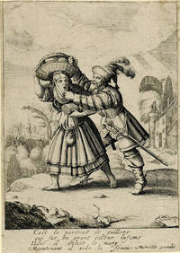
1670989Paris 1670. Etching and engraving on cream laid paper 6 3/4 x 4 15/16 inches 170 x 123 mm narrow margins. In very good condition with extremely minor areas of light discoloration in the areas of the sheet corners. Adhered to archival board. The inscription below the image roughly translates to This is the portrait of Guillery who was a great thief stealing from a woman. unknown
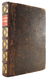
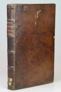
167426798London: Printed by J. M. for Henry Herringman 1674. The Fourth Edition NCBEL I 1219; Wing C-6652. Period full leather binding. Lacks title label to spine. Binding - Gd worn with rounded corners/old repair to front joint. Text - VG. 42 41 1 80 = 78 skipping pp 59/60 text continuous 4 70 154 23 1 148 pp. Divisional dated titlepages. Frontispiece of Cowley by Faithorne. Headpieces. Folio: 1 a - c4 B - 3C4 3D2 2A - S4 T2. 11-7/8" x 7-1/2" <br/><br/> Printed by J. M. for Henry Herringman hardcover books
1603228104Antwerp: Abraham Ortelius 1603. unbound. very good. Map. Engraving with original hand coloring. Image measures 13.25" x 18.25".<br/><br/> Beautifully colored map of Croatia. Shows place names topographical and geographical features a compass rose and a ship in the Adriatic. Latin text on verso. From "Theatrum Orbis Terrarum". Light scattered stains to margins and cartouche. Minor abrasion to upper right. A few small chips and tears to edges. Abraham Ortelius 1527--1598 a Flemish cartographer and geographer is widely regarded as one of the important and influential cartographers in history. He is known for his "Theatrum Orbis Terrarum" which was the first modern atlas.<br/><br/> Abraham Ortelius unknown books
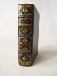
167736147Sur la Copie a Paris: Chez Frederic Leonard 1677. Second French edition. Engraved title two parts continuous pagination. 24 550 38 pp. 1 vols. Sm. 12mo. Vellum. Title in pen on spine upper joint torn some soiling of binding light browning of text mostly marginal else a very good copy. Second French edition. Engraved title two parts continuous pagination. 24 550 38 pp. 1 vols. Sm. 12mo. Amelot de la Houssaye was secretary to the French embassy at Venice and his account of the Republic for the first time revealed the policy of the Venetian governement. When the book appeared the Venetian state complained to the French court and Amelot was sent to the Bastille for six weeks. Chez Frederic Leonard unknown books
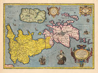
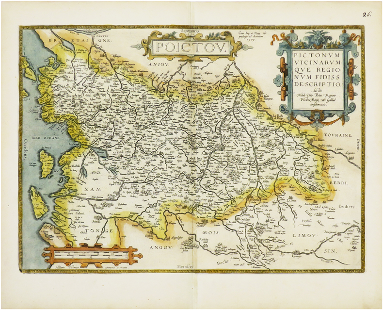
160323753Antwerpen: J.B. Vrients 1603. Other. In excellent condition. 363 by 504mm 14 by 19 inches. Original antique copper engraving published 1603 at J.B. Vrients in an edition of Abraham Ortelius Theatrum. Finely hand colored in wash and outline. This antique historical map was published from 1595 to 1624 onwards in various edition of the Theatrum and the Parergon by Ortelius. Verso Latin text last line of text endsputant and with signature ix. The map is ornated with three cartouches in the upper middle the title cartouche in the upper right corner we find a cartouche with the privilegium. On the lower right side cartouche with text. Villages and towns are shown as miniature views moreover the map is ornated with ships. Ortelius was born on 14 April 1527 in the city of Antwerp which was then in the Habsburg Netherlands modern-day Belgium. The Orthellius family were originally from Augsburg a Free imperial city of the Holy Roman Empire. In 1535 the family had fallen under suspicion of Protestantism. Following the death of Ortelius's father his uncle Jacobus van Meteren returned from religious exile in England to take care of Ortelius. Abraham remained close to his cousin Emanuel van Meteren who would later moved to London. In 1575 he was appointed geographer to the king of Spain Philip II on the recommendation of Arias Montanus who vouched for his orthodoxy. He travelled extensively in Europe and is specifically known to have traveled throughout the Seventeen Provinces; in southern western northern and eastern Germany e.g. 1560 15751576; France 15591560; England and Ireland 1576; and Italy 1578 and perhaps twice or thrice between 1550 and 1558. Beginning as a map-engraver in 1547 he entered the Antwerp Guild of Saint Luke as an illuminator of maps. He supplemented his income trading in books prints and maps and his journeys included yearly visits to the Frankfurt book and print fair where he met Gerardus Mercator in 1554. In 1560 however when travelling with Mercator to Trier Lorraine and Poitiers he seems to have been attracted largely by Mercator's influence towards the career of a scientific geographer. Wikipedia Koe. Ort. 46; Broe. 192 Theatrum 16o3 Latin text edition signature ix; Shirley 1991 maps 186 pl. 71 259a 365. J.B. Vrients unknown
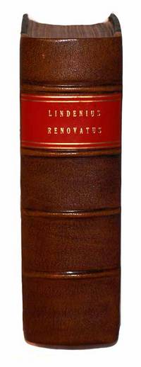
16861110210007Norimbergae : Impensis Johannis Georgii Endteri 1686. Leather Bound. Very Good. Nuremberg: Johann Georg Endter 1686. Thick 4to. Two parts in one volume. 24 1097 pp. 59; 6 160pp. 2. Latin. Fully bound in contemporary calf. Modern reback with gilt lettered bright red spine label. Wear and chipping to extremities. Covers decoratively blind stamped. New endpapers. Warrington Dispensary Library stamp. Minor browning/foxing to pages. Interior pages are clean and unmarked. Beautiful engravings and printed titles. <br><br>Fourth edition considerably expanded by Georg Abraham Mercklin. "Van der Linden's book was at the time of its appearance the most complete medical bibliography yet produced"-Garrison-Morton 6744 referenceing the 1637 orginal edition.<br><br> Norimbergae : Impensis Johannis Georgii Endteri hardcover
169718401697 Réunion de plusieurs ouvrages ou chez Frédéric Léonard, Paris, 1697 ou Adrian Moetjens, La Haye, 1697. In-12, plein vélin époque.9 ff, 223 pp, 1 ff, 68 pp, 88 pp, 103 pp, 36 pp, 94 pp, 24 pp, 68 pp, 24 pp, 5 pp .2 planches dépliantes
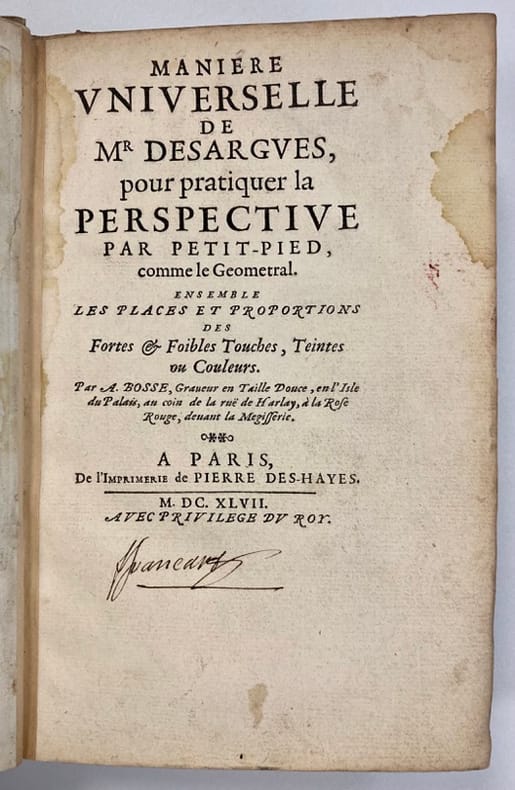
1647453071647 Paris. Pierre Deshayes. 1647. 1 volume in-8, plein vélin fin XIXème à rabats, dos lisse. (8) ff. ; 342 pp. ; (1) f.
1620902224AGAntwerpen:, Ortelius, [um 1620]. Kolorierter Kupferstich 37,5 x 48,5 cm, Blattgröße 47 x 54,5 cm.
160153035Antwerp. 1601. Ornate map of Luxembourg eastern Belgium and part of North Eastern France with flamboyant strapwork decoration to title across upper centre. Decorated frame. The stippling around the scale identifies this as the later of two plates of the same subject. Published in Ortelius' landmark atlas the Theatrum Orbis Terrarum. Copper engraving. Fine condition Later colour. Size: 48.5 x 37.5 cm. Ref: Van den Broecke 64. unknown
16694024London: Printed by J. M. for Henry Herringman 1669. Folio pp. xlii 41 1 80 4 58 61-70 154 23 1 148 frontispiece portrait. Contemporary mottled calf. Lightly toned a bit of soiling and spotting. Rubbed rebacked to style with gilt decoration and red label hinges relined no rear flyleaf. Ink inscription of 'Mary Ever' to flyleaf. The second edition - following two issues the previous year - of the influential and popular collected works of Abraham Cowley 1618-1667. It 'reprints the contents of Poems 1656 together with the two prose tracts of 1661 and the 1663 Verses with some additional poems published and unpublished; the most significant new material is Several discourses by way of essays in verse and prose a collection of prose essays interspersed and accompanied by poems dealing with such topics as 'Of Liberty' 'Of Agriculture' 'The Garden' addressed to Evelyn and 'Of Myself'' ODNB. ESTC R21122. Printed by J. M. for Henry Herringman unknown
1668AR19GTBR5422London: printed by John. Macock. for Henry Herringman 1668. Hardback full contemporary calf. 29.5cm x 20cm. Spine relaid end-paper renewed. Portrait frontis. 18 41pp; 1; 80pp 4; 70pp; 154pp; 23pp; 24; 148pp 1 page of mss index torn with loss. A little wear to binding. a few marks to contents but generally a clean. Elegia dedicatoria ad illstrissimam academiam Cantabrigiensem; The preface of the author; Miscellanies; The mistress or Several copies of love-verses; Pindarique odes written in imitation of the stile & manner of the odes of Pindar -- Davideis a sacred poem of the troubles of David; Davideidos liber primus; An account of the life and writings of Cowley by Thomas Sprat; Verses written on several occasions; Several discourses by way of essays in verse and prose. A heavy book additional postage will be required for delivery outside the UK. . Hard Cover. Very Good. printed by J[ohn]. M[acock]. for Henry Herringman Hardcover
16864450Norimbergea [Nuremberg], Johannis Georgii Endteri, 1686. In-4 de [24]-1097-[58], [6]-160-[2] pages, dos en basane, plats recouvert de vélin (reliure du temps), coiffes absentes, un mors fendu, rousseurs caractéristique des livres de ce temps.
167768020à Cologne: Chez Pierre du Marteau 1677. Fine. Chez Pierre du Marteau à Cologne 1677 8.50 x 14 cm relié First edition under initials L.M.P. for ""le ministre prisonnier"". Title page with sphere. Contemporary full marbled brown sheep binding. Spine with raised bands decorated. Brown sheep title-label. Slight lack at foot. One corner slightly bumped. Good copy perfectly fresh. In his memoirs written in Holland where he found refuge Wicquefort diplomat and intellectual takes up his pen to defend himself against accusations of high treason which earned him a sentence of life imprisonment. Famous diplomat first in the service of Mazarin then imprisoned for a writing on the relations of young Louis XIV with Mazarin's niece he finds refuge in Holland where he will inform France of the actions of foreign diplomats and ambassadors. In 1675 the Williamson Affair emerges: Wicquefort is accused of high treason after having sold secret dispatches to the ambassador of the English Crown Sir Williamson. He is arrested on March 25th and taken to prison. In 1676 he is condemned to life imprisonment after a resounding trial and to the confiscation of his goods. It is during his stay in prison that he writes these memoirs on diplomats ministers ambassadors and law in Europe. Wicquefort will manage to escape from prison in 1679. Chez Pierre du Marteau hardcover
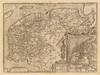
161233372Antwerp: Juan Baptist Vrients 1612. A minor printers crease on the right side of the double page slightly visible. Overall in excellent condition. 36.8 x 498 cm 14.5 x 195 inches. Hand-Colored Original Copperplate Engraving by Abraham Ortelius depicting Frisia Occidentalis. Sibrandus Leonis Leovardiensis Describ. Cum privilegio Imp. et Reg. Mtm. ad. decenninium. 1579. Published Antwerp Juan Baptist Vrients 1612. Sheet: 36.8 x 498 cm 14.5 x 195 inches. A fine and original hand-colored example of Ortelius's celebrated cartographic work documenting this region of Germany with the precision and decorative artistry characteristic of the 16100s. Abraham Ortelius 1527-1598 was a Flemish cartographer and geographer from Antwerp widely regarded as the creator of the first modern atlas. His landmark publication Theatrum Orbis Terrarum 1570 set the standard for atlas-making for the next century presenting uniform copper-engraved maps with scholarly commentary. By Ortelius's death the Theatrum had appeared in 25 editions in seven languages. In 1575 King Philip II of Spain appointed him Royal Geographer. His maps engraved with extraordinary precision are among the most sought-after in antique cartography held in collections including the Plantin-Moretus Museum in Antwerp the Library of Congress and the British Library.This original copperplate engraving with original hand coloring depicts the region of Frisia Occidentalis. Sibrandus Leonis Leovardiensis Describ. Cum privilegio Imp. et Reg. Mtm. ad. decenninium. 1579. published in Antwerp Juan Baptist Vrients 1612. An inset map is included providing additional geographic context. The map records the political and geographic boundaries of the region as understood in 1612 offering a fascinating window into the history of German territorial organization. Sheet measures 36.8 x 498 cm 14.5 x 195 inches. In good condition overall with minor signs of age appropriate for a 17th-century engraving. Ready to frame. Broe. 81 Juan Baptist Vrients unknown
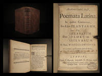
166816395<p><b>1668 HERBAL Abe Cowley English Poetry Thomas Sprat London Plants Herbs Botany</b></p><p>Abraham Cowley was one of the leading English poets during the 17th-century. Cowley wrote poems on a variety of subjects most famously an '<i>Ode to Pindar'</i>. These poems many of which were written about flowers and agriculture were published throughout his lifetime as well as frequently republished following his death in 1667. This 1668 edition of the works of Cowley includes a life of Cowley by Thomas Sprat the editor of this edition.</p><p>Item number: #16395</p><p>Price: $550</p><p>COWLEY Abraham</p><p><b><i>Abrahami Couleij Angli poemata Latina : in quibus continentur sex libri plantarum viz. duo herbarum florum sylvarum et unus miscellaneorum.</i></b></p><p>Londini : Typis T. Roycroft impensis Jo. Martyn 1668.</p><p><br /></p><p><u>Details</u>: </p><p>· Collation: Complete with all pages</p><p>o 34 420 i.e. 416</p><p>o Pagination errors as expected</p><p>· Language: Latin </p><p>· Binding: Leather</p><p>o Visible repair at inner hinges</p><p>· Size: ~7in X 4.75in 18cm x 12cm</p><p>Our Guarantee:</p><p>Very Fast. Very Safe. Free Shipping Worldwide.</p><p>Customer satisfaction is our priority! Notify us with 7 days of receiving and we will offer a full refund without reservation!</p><p>16395</p><p>Photos available upon request. </p> T. Roycroft, impensis Jo. Martyn hardcover
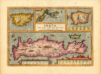
161220464Antwerp: Juan Baptist Vrients 1612. Other. In excellent condition. 342 by 491mm 13 by 19 inches. Original copper engraving published 1624 in the famous historical Atlas Parergon Latin text-edition by Abraham Ortelius. Finely later hand-colored in wash and outline. Four maps on one plate: Corsica the Ionian Islands Cephalonia Zacynthus Corcyra Sardinia and Crete. Villages and towns are shown as miniature views moreover the map at the bottom is ornated with ships sea monsters and animals. At the bottom we find two cartouches with listings of antique place names and explanations. Ortelius was born on 14 April 1527 in the city of Antwerp which was then in the Habsburg Netherlands modern-day Belgium. The Orthellius family were originally from Augsburg a Free imperial city of the Holy Roman Empire. In 1535 the family had fallen under suspicion of Protestantism. Following the death of Ortelius's father his uncle Jacobus van Meteren returned from religious exile in England to take care of Ortelius. Abraham remained close to his cousin Emanuel van Meteren who would later moved to London. In 1575 he was appointed geographer to the king of Spain Philip II on the recommendation of Arias Montanus who vouched for his orthodoxy. He travelled extensively in Europe and is specifically known to have traveled throughout the Seventeen Provinces; in southern western northern and eastern Germany e.g. 1560 15751576; France 15591560; England and Ireland 1576; and Italy 1578 and perhaps twice or thrice between 1550 and 1558. Beginning as a map-engraver in 1547 he entered the Antwerp Guild of Saint Luke as an illuminator of maps. He supplemented his income trading in books prints and maps and his journeys included yearly visits to the Frankfurt book and print fair where he met Gerardus Mercator in 1554. In 1560 however when travelling with Mercator to Trier Lorraine and Poitiers he seems to have been attracted largely by Mercator's influence towards the career of a scientific geographer. Wikipedia Broe. 217 Juan Baptist Vrients unknown
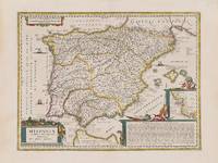
1662200014AG1662. Amsterdam Janssonius c.1662. Original hand-coloured copper engraving. Plate Size: 49.2 cm x 37 cm. Sheet Size: 59.8 cm x 45 cm. Original map. Very good condition. Faint hint of foxing along left fore edge. Centre fold as issued. Latin text on reverse. Koeman I 6000H:1.2. Border with longitudinal and latitudinal information. A richly detailed and very interesting map showing Roman Hispania - the Iberian Peninsula and the Balearic Islands. The three Ancient Roman provinces organised by the emperor Augustus of Hispania Citerior et Tarraconensis Hispania Baetica and Lusitania Hispania are shown on the map. Northern tip of Africa 'Hispania Transfretana Sive Tingitana Qua et Mauritania' pictured also. Relief shown pictorially with rivers mountains and significant towns and cities depicted. Large decorative cartouche with finely detailed Classical allusions in lower right section of map contains an inset box showing the coastal area around 'Gades' Cadiz. Cartouche also lists numerous place names of uncertain location in Latin. Bar-scales within cartouche in top right corner of the map. Decorative title cartouche in lower left corner. Three ships are also pictured suggesting the region's maritime importance. 'Mare Mediterraneum Internum' and 'Ocean Atlanticus Quod et Mare Hesperium Vespertinum Occiduum et Externum' are also listed. Abraham Goos 1590 c. 1643 was a Dutch cartographer publisher and engraver. He made globes maps of North America a comprehensive map of European coastlines and the first printed Hebrew language map of The Holy Land. His first teacher was Jodocus Hondius 15631612 a renowned map-maker whose son-in-law was Johannes Janssonius. After Hondius died his son-in-law Jan Janssonius took over Hondius's business and continued the partnership with Goos. One of Hondius' specialties was the manufacture of globes and Goos and Janssonius continued this regularly modifying them as more geographical information became available. In 1616 he published Nieuw Nederlandtsch Caertboeck an atlas of the Seventeen Provinces in 23 maps and one of the first atlases of the Netherlands; Johannes Janssonius 1588-1664 was a renowned geographer and publisher of the seventeenth century when the Dutch dominated map publishing in Europe. unknown
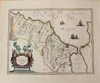
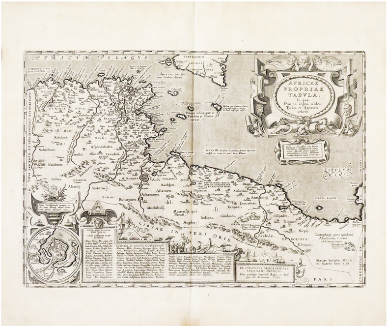
1636M10932Amsterdam c.1636. Very Good. Notes: Decorative map of Morocco based on Abraham Ortelius map of Northwest Africa. It is oriented with north to the right and including the Strait of Gibraltar. Fine early map of Morocco showing large fortified towns of Marakesh Taradante and Fez.<br> Size : 388x502 mm 15.28x19.76 Inches Coloring: Original Hand Coloring Category: Maps Africa North; unknown
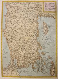
1612M3955Antwerp 1612. Very Good. Notes: With rare Spanish text on verso.<br>Map of Asia Minor Turkey Cyprus and the Eastern Mediterranean sea. Size : 322x230 mm 12.68x9.06 Inches Coloring: Original Hand Coloring Reference: Marcel P.R. van den Broecke #174 Category: Maps Asia Near East Turkey: Maps Mediterranean Islands; unknown
1601299086Antwerp: Abraham Ortelius 1601. unbound. Map. Engraving with beautiful original hand color. Image measures 14" x 18 3/4". Staining and toning to margins repair to lower centerfold but otherwise is good condition.<br/><br/> Old color example of this lovely map of Valencia by Ortelius. The map extends from Murcia and Orihuella to the Cenia River and extending inland to include Aragon and Castilla. North is oriented to the right. Includes a beautifully designed strapwork cartouche and two large sailing vessels. Abraham Ortelius 1527-1598 a Flemish cartographer and geographer is widely regarded as one of the important and influential cartographers in history. He is known for his "Theatrum Orbis Terrarum" which was the first modern atlas. Van den Broecke #30<br/><br/> Abraham Ortelius unknown books
1612LBW-6675Anvers, 1579 [1612]. 360 x 504 mm.
1608LBW01b3a[Anvers, 1608]. 335 x 486 mm.
1695191214Petrus Vander Aa 1695. Hardcover. Fair boards show medium shelfwear; internal spine hinges are split with some loose pages; light age toning as expected; small tear to the foldout plate. Brown cloth over boards; Black title block with gilt lettering on spine. Various paginations throughout with unpaginated bw plates throughout one foldout. Text in Latin. At head of title: Abrahami Gorlaei antverplani./ Rubricated title-pages with vignettes; added title-pages engraved./ Part 2 has title: Dactyliothecae . seu variarum gemmarum quibus antiquitas in signando uti solita scalpturae triplo quam fuerunt partim antehae ineditarum partim ex scriptis eruditorum virorum collectarum numero locupletiores . Accedit Marbodaei galli caenomanensis Carmen de gemmis & lapidibus. The panels show Greek and Roman signet rings cameos and amulets as well as a portrait of Gronovius 1645 - 1716. Petrus Vander Aa hardcover
1609299053Antwerp: Abraham Ortelius 1609. unbound. Map. Engraving with beautiful original hand color. Image measures 14" x 18 3/4". Staining and toning to margins repair to lower centerfold but otherwise is good condition.<br/><br/> The Vale of Tempe is a gorge in the Tempi municipality of northern Thessaly Greece located between Olympus to the north and Ossa to the south and between the regions of Thessaly and Macedonia. Ortelius shows us a mixture of Greek myth and history. Beautifully composed he describes it as "where gods dwell meet in companies and having done divine service and ceremonies in due form and manner they banquet and make merry." Abraham Ortelius 1527--1598 a Flemish cartographer and geographer is widely regarded as one of the important and influential cartographers in history. He is known for his "Theatrum Orbis Terrarum" which was the first modern atlas. Van den Broecke #231<br/><br/> Abraham Ortelius unknown books