ORTELIUS (Abraham);Livre Rare Book

213 résultats
1598LBW-1415Anvers 1598 81 x 105 mm.
1598LBW-1423Anvers 1598 82 x 105 mm.
1598LBW-1416Anvers 1598 82 x 107 mm.
1598LBW-1401Anvers 1598 81 x 105 mm.
1598LBW-1409Anvers 1598 81 x 106 mm.
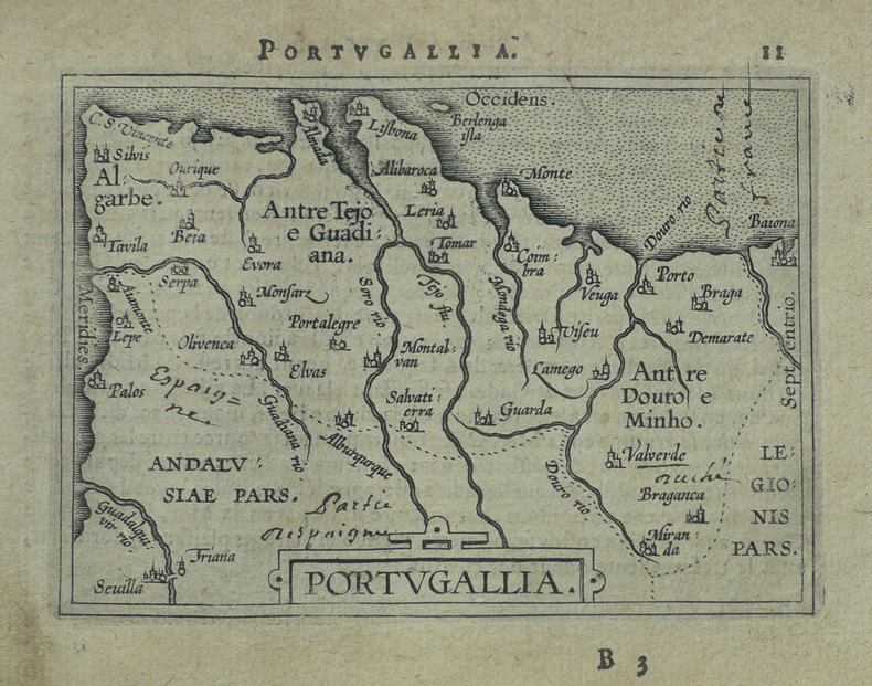
1598LBW-1395Anvers 1598 80 x 105 mm.
1598LBW-1420Anvers 1598 83 x 106 mm.
1598LBW-1411Anvers 1598 80 x 109 mm.
1598LBW-1375Anvers 1598 80 x 104 mm.
1598LBW-1404Anvers 1598 82 x 107 mm.
1598LBW-1384Anvers 1598 81 x 106 mm.
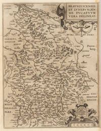
159835926Antwerpen: Platin 1598. In very good condition. 31 x 235 cm 12.25 x 925 inches. Hand-Colored Original Copperplate Engraving by Abraham Ortelius depicting Braunsvicensis et Luneburgensis Ducatuum Vera Delineat. Published Antwerpen Platin 1598. Sheet: 31 x 235 cm 12.25 x 925 inches. A fine and original hand-colored example of Ortelius's celebrated cartographic work documenting this region of Germany with the precision and decorative artistry characteristic of the 15900s. Abraham Ortelius 1527-1598 was a Flemish cartographer and geographer from Antwerp widely regarded as the creator of the first modern atlas. His landmark publication Theatrum Orbis Terrarum 1570 set the standard for atlas-making for the next century presenting uniform copper-engraved maps with scholarly commentary. By Ortelius's death the Theatrum had appeared in 25 editions in seven languages. In 1575 King Philip II of Spain appointed him Royal Geographer. His maps engraved with extraordinary precision are among the most sought-after in antique cartography held in collections including the Plantin-Moretus Museum in Antwerp the Library of Congress and the British Library.This original copperplate engraving with original hand coloring depicts the region of Braunsvicensis et Luneburgensis Ducatuum Vera Delineat. published in Antwerpen Platin 1598. The map features a decorative Baroque cartouche containing the title inscription. A distance scale is incorporated within the cartouche or alongside it. The map records the political and geographic boundaries of the region as understood in 1598 offering a fascinating window into the history of German territorial organization. Sheet measures 31 x 235 cm 12.25 x 925 inches. In good condition overall with minor signs of age appropriate for a 16th-century engraving. Ready to frame. Broe. 99 French text; Koeman Ort 31; Platin unknown
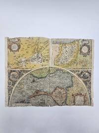
1584356976Abraham Ortelius. 1584. Poor condition numerous old repairs several closed tear affecting the image at the margins and the center fold. some dampstaining. 38.3x50.5 cm. Cadiz map engraved by Georg Hoefnagle. Image size: 38.8x48.7 cm. Latin text on verso Trimmed to the edges of the image at the top and bottom. Original hand coloring. weight: 0.1 lb. Abraham Ortelius. unknown