Ortelius, AbrahamBiblio.com

23 962 résultats
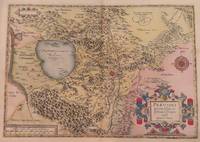
1606m1300Antwerp: Published in "Theatrum Orbis Terrarum" c. 1606. Copperplate engraving. Old colour some darkening along c/f otherwise very good. 14" x 19-1/2. Based on Gastaldi's double sheet map. Shows Romania Bulgaria and western Turkey. Impressive oversized cartouche. Ortelius was one of the great Flemish cartographers of the 16th Century and produced what is considered to be the first modern world atlas. Van den Broecke 159 Published in "Theatrum Orbis Terrarum",
50-0440New York: Kennedy Graphics. Distributed graphics by Alan Wofsy Fine Arts. Silkscreen. One of 100 signed and numbered impressions. New York: Kennedy Graphics. Distributed graphics by Alan Wofsy Fine Arts. unknown
0574-17Antwerpen Plantin 1587. Orig.-Kupferkarte. Blattgr. ca. 41 x 54 cm. Bildauschn. 34 x 44 cm. In sehr gutem sauberen Zustand. van den Broeke 107 - Kupferstichkarte nach Markus Setznagel. Mit einer Ansicht auf die Stadt Salzburg in der rechten unteren Ecke - Abraham Ortelius 1527-1598 Antwerp published the first modern uniform Atlas Theatrum Orbis Terrarum. [Antwerpen, Plantin 1587]. unknown
1998Manohar-9788185753218Pencraft International 1998. Hardcover. New. Pencraft International hardcover
1998Manohar-9788185753218Pencraft International 1998. Hardcover. New. Pencraft International hardcover
18901034LLondon: Kegan Paul Trench Trubner & Co 1890. Vol. I stated second edition others 1st. editions. Hardcover full leather. very good. Kegan Paul Trench Trubner & Co. 1880 vol. II 1885 vol. 3 1890 Vol 1 second edition. - <br /> 3 volumes. xvi 247; vii 1 399; xii 292 pp. Folding table of comparative genealogy in Vol. I. 8vo 19.8x13 cm 7¾x5¼" 19th century calf ruled in gilt raised spine bands morocco lettering pieces marbled endpapers & edges. Vol. I stated second edition the others apparently first editions.<br /> Forbes 3209.<br /> <br /> We add the separately published "INDEX to the Polynesian Race" with a brief Memoir of Judge Fornander published by Bishop Museum Press Honolulu 1909 hardcover 9.75 x 6.5" 86 pages in very good condition. Comes with the Ex-Libris of Aubrey Penderel Janion a photographer born in London in 1894 died on Maui in 1986.<br /> <br /> Abraham Fornander was a Swedish-born emigrant who became a citizen of the Kingdom of Hawaii swearing an oath of allegiance to Kamehameha III the Hawaiian king after having come to Hawaii by deserting the whaleship Ann Alexander. He became an important Hawaiian journalist judge and ethnologist. With ownership signature in Vol. I on half title "Honolulu in November 1891 H.A. Widemann." Rubbing to spines and extremities; foxing primarily to earlier and later leaves; very good. Kegan Paul, Trench, Trubner & Co hardcover
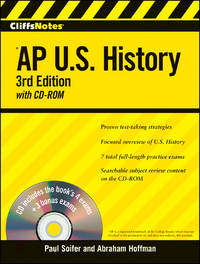
2009SONG0470402164Cliffs Notes 2009-01-09. 3. paperback. Used: Good. 8.25x0.72x10.88. Buy with confidence. Excellent Customer Service & Return policy. Cliffs Notes paperback
181137495Dublin: Printed By N. Kelly for Gilbert and Hodges. Very Good with no dust jacket. 1811. First Edition. Hardcover. 5 219 pages; Colles was professor of anatomy and surgeon at the Royal College of Surgery of Ireland. First in Europe to treat the problems of artery and aneurysm. Rebound in modern black cloth. Contents firm and bright clean. Provenance- gifted in pencil from John Fitzworth to Jonathan Havery . Printed By N. Kelly, for Gilbert and Hodges, hardcover
1979x-0851863221Royal Society of Chemistry 1979. Hardcover. New. 385 pages. 8.58x5.75x1.26 inches. Royal Society of Chemistry hardcover
1978x-0851863124Royal Society of Chemistry 1978. Hardcover. New. 387 pages. 8.66x5.67x1.26 inches. Royal Society of Chemistry hardcover
1940032012Paris: Centre National De La Recherche Scientifique De France / Institut International De Cooperation Intellectuelle 1940. 1st Edition 1st Printing. Soft cover. Very Good. Vi 348 Pp. Printed Card Covers. Lightly Used Slight Edge Wear Some Browning To Spine Contents Very Clean. Ownership Signature Of Physicist Hendrik A. Kramers Author Of One Of The Papers And Bookplate Of Another Physicist Jan Korringa Formerly A Student And Later An Associate Of Kramers. <br/> <br/> Centre National De La Recherche Scientifique De France / Institut International De Cooperation Intellectuelle paperback
1977x-0851863027Royal Society of Chemistry 1977. Hardcover. New. 330 pages. 8.58x5.75x1.02 inches. Royal Society of Chemistry hardcover
177110865Leyden Johannes le Mair en Abraham Kallewier/ Leiden T. Koet 1771-1777. 74 3 8 62 8 14 1 7 1 8 15 7 30 p. Origineel goud-bestempeld Leer met ribben 8° Een bundel met zeldzame werken van en over de predikant en geliefd hoogleraar Nicolaas Hoogvliet 1729-1777. De laatste 30 pagina's bevatten diverse lijkdichten in een fraai oud handschrift overgenomen uit andere publicaties. Leyden, Johannes le Mair en Abraham Kallewier/ Leiden, T. Koet unknown
1983Q-019316308XOxford University Press 1983-02-24. Hardcover. New. New. In shrink wrap. Looks like an interesting title! Oxford University Press hardcover
15843014<p>Map. Paper size: 422 x 530 mm. Image size: 330 x 465 mm. 16th century map in original hand-coloring. Decorative polychrome cartouche and compass rose. Depicts bodies of water heights and towns/cities. Latin text to verso. Van den Broecke 2nd ed. 1584 L3.; 422 x 530 mm.; All shipments through USPS insured Priority Mail.</p> Abraham Ortelius
196727463HEYNE WILHELM 1967. 1. softcover. Dracula HEYNE, WILHELM paperback
1719014625Paris 1719. Map measures 46x40.cm. Map in very good clean condition. . Very Good. unknown
1590003611Belgico Antwerp: Abraham Ortelius 1590. No Binding. Very Good. Elephant Folio - over 15" - 23" tall. ORTELIUS Abraham. VG 1590 B&W Map of the Black Sea Coast. 50 35.5 the Map 54 44.5 cm map including margins. Latin Text to verso of 1 side p xxvii. No pin holes inscriptions etc very light edge browning. Includes part of Ukraine Russia Georgia Bulgaria Romania and Turkey. Belongs to a series of historical maps known as the Parergon Theatri from 1579 onwards. Tooley's Dictionary of Mapmaker Early World Press 2004 p358-359 Marcel P. R. van den Broecke Ortelius Atlas Maps HES Publishers 2011 p633. <br/> <br/> Abraham Ortelius unknown
16248000Antwerp: Plantin-Moretus 1624. Copper engraving 36 x 46 cms modern hand colour Latin text on verso. Ancient Dacia and Moesia modern Romania and Bulgaria on the Black Sea. Our example was published by Balthasar Moretus at the Plantin Press in the final edition of the Parergon. Ortelius's Theatrum Orbis Terrarum is generally considered the first modern atlas of the world originally published in 1570. Ortelius gathered and selected the best available cartographic knowledge and presented it in a single volume duly credited and finely engraved in a consistent style with explanatory text. The Theatrum was very decorative and hugely popular amongst the wealthy and educated running into over forty editions in Latin and the major European languages. For Ortelius himself however his accompanying atlas of ancient geography the Parergon was a "personal work" Koeman. He seems to have regarded himself first and foremost as an antiquary and rather than copying other people's maps he drew the originals himself; they were subsequently engraved for him by the master engraver Jan Wierix. The results have to be evaluated as the most outstanding engravings depicting the wide-spread interest in classical geography in the 16th century Koeman. Koeman Atlantes Neerlandici Ort 46. Van den Broecke 212.2 Map Plantin-Moretus unknown
16247933Antwerp: Plantin-Moretus 1624. Copper engraving 36.5 x 46.5 cms modern hand colour a couple of unobtrusive printers creases Latin text on verso. Ancient Gaul engraved on the basis of Caesars commentaries on the Gallic Wars his first hand account of the campaign. The text on the verso explores ancient source material relating the the druids. Our example was published by Balthasar Moretus at the Plantin Press in the final edition of the Parergon. Ortelius's Theatrum Orbis Terrarum is generally considered the first modern atlas of the world originally published in 1570. Ortelius gathered and selected the best available cartographic knowledge and presented it in a single volume duly credited and finely engraved in a consistent style with explanatory text. The Theatrum was very decorative and hugely popular amongst the wealthy and educated running into over forty editions in Latin and the major European languages. For Ortelius himself however his accompanying atlas of ancient geography the Parergon was a "personal work" Koeman. He seems to have regarded himself first and foremost as an antiquary and rather than copying other people's maps he drew the originals himself; they were subsequently engraved for him by the master engraver Jan Wierix. The results have to be evaluated as the most outstanding engravings depicting the wide-spread interest in classical geography in the 16th century Koeman. Koeman Atlantes Neerlandici Ort 46. Van den Broecke 194.3 Map Plantin-Moretus unknown
16248029Antwerp: Plantin-Moretus 1624. Copper engraving 39.5 x 49.5 cms modern hand colour Latin text on verso. Van den Broecke stresses the sigificance of this map of Gaul: in contrast to plate Ort 194 Gallia vetus based on Caesars commentaries this map is based on ancient geographical rather than on ancient military sources and is much more detailed. It contains the largest amount of text to be found on any map by Ortelius . testifying the importance he attached to it. It contains all elements of Ortelius as a true Renaissance scholar. Our example was published by Balthasar Moretus at the Plantin Press in the final edition of the Parergon. Ortelius's Theatrum Orbis Terrarum is generally considered the first modern atlas of the world originally published in 1570. Ortelius gathered and selected the best available cartographic knowledge and presented it in a single volume duly credited and finely engraved in a consistent style with explanatory text. The Theatrum was very decorative and hugely popular amongst the wealthy and educated running into over forty editions in Latin and the major European languages. For Ortelius himself however his accompanying atlas of ancient geography the Parergon was a "personal work" Koeman. He seems to have regarded himself first and foremost as an antiquary and rather than copying other people's maps he drew the originals himself; they were subsequently engraved for him by the master engraver Jan Wierix. The results have to be evaluated as the most outstanding engravings depicting the wide-spread interest in classical geography in the 16th century Koeman. Koeman Atlantes Neerlandici Ort 46; Van den Broecke 196.2. Map Plantin-Moretus unknown
15957641Antwerp Plantin-Moretus 1595. Copper engraving 36.5 x 51 cms black and white Latin text on verso. First published in the 1570 edition of the Theatrum Christiaan Sgrothen is cited as the principal source. Ortelius's Theatrum Orbis Terrarum is generally considered the first modern atlas of the world originally published in 1570. Ortelius gathered the best available cartographic knowledge and presented it in a consistent style in a single volume with text. The Theatrum was very decorative and hugely popular amongst the wealthy and educated running into over forty editions in Latin and the major European languages. Van den Broecke 56 Map unknown
16247958Antwerp: Plantin-Moretus 1624. Copper engraving 32.5 x 48 cms modern hand colour Latin text on verso. Latium the hinterland of ancient Rome. Van den Broecke notes a minor change in nomenclature which was made for the 1624 edition 209.3 which is not present here although our example was published by Balthasar Moretus at the Plantin Press in the final edition of the Parergon. Ortelius's Theatrum Orbis Terrarum is generally considered the first modern atlas of the world originally published in 1570. Ortelius gathered and selected the best available cartographic knowledge and presented it in a single volume duly credited and finely engraved in a consistent style with explanatory text. The Theatrum was very decorative and hugely popular amongst the wealthy and educated running into over forty editions in Latin and the major European languages. For Ortelius himself however his accompanying atlas of ancient geography the Parergon was a "personal work" Koeman. He seems to have regarded himself first and foremost as an antiquary and rather than copying other people's maps he drew the originals himself; they were subsequently engraved for him by the master engraver Jan Wierix. The results have to be evaluated as the most outstanding engravings depicting the wide-spread interest in classical geography in the 16th century Koeman. Koeman Atlantes Neerlandici Ort 46. Van den Broecke 209.2 Map Plantin-Moretus unknown
16247957Antwerp: Plantin-Moretus 1624. Copper engraving 36 x 46 cms modern hand colour Latin text on verso. The Dalmatian coast in antiquity. Our example was published by Balthasar Moretus at the Plantin Press in the final edition of the Parergon. Ortelius's Theatrum Orbis Terrarum is generally considered the first modern atlas of the world originally published in 1570. Ortelius gathered and selected the best available cartographic knowledge and presented it in a single volume duly credited and finely engraved in a consistent style with explanatory text. The Theatrum was very decorative and hugely popular amongst the wealthy and educated running into over forty editions in Latin and the major European languages. For Ortelius himself however his accompanying atlas of ancient geography the Parergon was a "personal work" Koeman. He seems to have regarded himself first and foremost as an antiquary and rather than copying other people's maps he drew the originals himself; they were subsequently engraved for him by the master engraver Jan Wierix. The results have to be evaluated as the most outstanding engravings depicting the wide-spread interest in classical geography in the 16th century Koeman. Koeman Atlantes Neerlandici Ort 46. Van den Broecke 203.1 Map Plantin-Moretus unknown
15958231Antwerp Plantin-Moretus 1595. Copper engraving 33 x 46 cms modern hand-colour Latin text on verso. Ortelius map of the western Balkans drew on the cartography of Augustin Hirschvogel. Van den Broecke 145.3 Map unknown