Rochefort, Abraham deBiblio.com
23 962 résultats
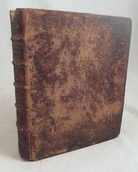
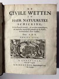
70017The civil laws in their natural arrangement translated from the French and so rendered by remarks as otherwise on the laws and customs of these countries. First piece dated 1704.Jean Domat 1625-96 French jurist & intimate of Pascal brought together in one system the materials of Roman law & French legislations and decisions. The book was originally published in French in 1689.Full leather binding with guilt decorations. In the front middle a big hole and further some wear. Quarto edition in -4 20 x 18 cm. Interior in good condition except for some even browning on some of the pages. Endpapers with frayes.Provenance: From the library of jurist H.A. Stein no pasted in exlibris.NL Een vertaling en bewerking van 'Les loix civiles dans leur ordre naturel' door de Fransman Jean Domat. Het werk is aangepast aan de wetten en gewoonten van de Noordelijke Nederlanden. A.D.R. is Abraham de Rochefort.<p data-start=""581"" data-end=""972"">De uitgave behandelt het burgerlijk recht in systematische orde en behoort tot de belangrijke praktische juridische compendia uit de vroege achttiende eeuw. Het boek was bedoeld voor advocaten notarissen magistraten en andere praktijkjuristen. De inhoud behandelt uiteenlopende civielrechtelijke onderwerpen zoals eigendom erfrecht contracten schuldvorderingen huwelijk en procesrecht.</p><p data-start=""974"" data-end=""1366"">Bijzonder is de poging om het recht niet alfabetisch of chronologisch maar volgens een natuurlijke schikking te ordenen een methodische benadering die aansluit bij de rationalistische juridische traditie van de vroege Verlichting. Het werk staat daarmee op de overgang tussen het traditionele Romeins-Hollandse recht en de meer systematische juridische wetenschap van de achttiende eeuw. Belangrijke bron voor oud-Vaderlands recht Romeins-Hollands recht en zo nu nog relevant.</p> hardcover
2018Adhya-9781496354884WOLTERS KLUWER 2018. Paperback. New. WOLTERS KLUWER paperback
2018Adhya-9781496354884WOLTERS KLUWER 2018. Paperback. New. WOLTERS KLUWER paperback
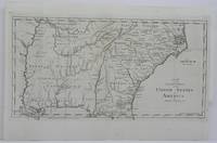
1797M4824USA 1797. Very Good. Size : 210x400 mm 8.25x15.75 Inches Coloring: Black & White Category: Maps United States East Carolinas; Maps United States South States; unknown
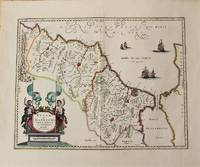
1636M10932Amsterdam c.1636. Very Good. Notes: Decorative map of Morocco based on Abraham Ortelius map of Northwest Africa. It is oriented with north to the right and including the Strait of Gibraltar. Fine early map of Morocco showing large fortified towns of Marakesh Taradante and Fez.<br> Size : 388x502 mm 15.28x19.76 Inches Coloring: Original Hand Coloring Category: Maps Africa North; unknown
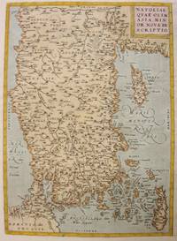
1612M3955Antwerp 1612. Very Good. Notes: With rare Spanish text on verso.<br>Map of Asia Minor Turkey Cyprus and the Eastern Mediterranean sea. Size : 322x230 mm 12.68x9.06 Inches Coloring: Original Hand Coloring Reference: Marcel P.R. van den Broecke #174 Category: Maps Asia Near East Turkey: Maps Mediterranean Islands; unknown
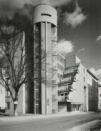
199647238Wien New York: Springer 1996. First edition. Hardcover. Very good condition. Signed and dated by Abraham on dedication page. Laid in note by Cooper Union president John Jay Iselin on official stationary to Milton Glaser. Quarto. 315pp. Original gray cloth with black-stamped sketch on cover black lettering on spine; in matching original dustjacket b/w lettering on spine. Gray endpapers. "The Austrian architect Raimund Abraham born in 1933 in Lienz Tyrol has been living working and teaching in the U.S.A. since 1964. As an exponent of the Viennese avant-garde of the early sixties his work was exhibited together with the works of Hans Hollein and Walter Pichler at the Museum of Modern Art in New York in 1967." Publisher. Profusely illustrated with color and b/w reproductions of architectural drawings and plans and photographs. Appendices with Abraham's' projects biography prizes and awards bibliography and photo credits at rear. Dustjacket with very light wear along edges. Slight sunning along edges of block not affecting images. Springer hardcover
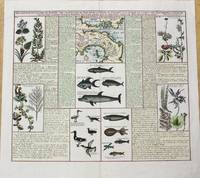
1719M10232Paris c.1719. Very Good. Notes: Three maps covering the Isthmus of Darien and the Gulf of Panama. It is illustrated with seven panels of finely engraved examples of the region's flora and fauna including fish birds and plant life. Size : 370x433 mm 14.57x17.05 Inches Coloring: Hand Colored Category: Maps Central America Countries; unknown
1755016046Richterischen Altenburg 1755. Edition Unstated . Hardcover. Very Good Condition/No Dust Jacket. Size: 9 1/2" x 8" . Text is in German. Text body is clean and free from previous owner annotation underlining and highlighting. Full leather marbled end papers pp. 24 531 3 plus 22 engraved folding plates. Robert Smith's 1689-1768 "A compleat system of opticks in four books" translated and revised by Abraham Gotthelf Kastner 1719-1800 a mathematics and physics professor. This work was one of the most influential optical textbooks of the 18th century. Covers worn especially at corners and spine ends previous owner's name on front fly leaf scattered toning. Quantity Available: 1. Shipped Weight: 3 lbs 13 oz. Category: Antiquarian & Rare; German Language; Pictures of this item not already displayed here available upon request. Inventory No: 016046. . Richterischen hardcover
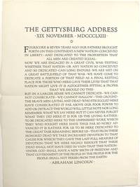
194058841New York: Frederic W. Goudy for R. R. Bowker Co 1940. Large folio broadside approx. 24½" x 18" previous central fold; all else fine. Set by Bertha Goudy and beautifully printed in the Goudy-designed Forum type. Only the Huntington in OCLC but there are also copies at Vassar and Syracuse and likely others framed up hanging on the wall somewhere and uncatalogued. Frederic W. Goudy, for R. R. Bowker Co unknown
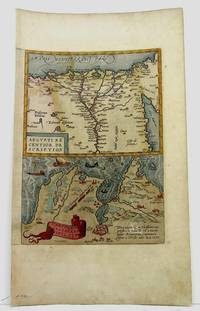
1590M3954Antwerp 1590. Very Good. Size : 320x230 mm 12.625x9 Inches Coloring: Hand Colored Category: Maps Africa North Egypt unknown
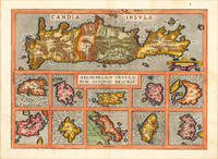
159816875Antwerp: Christopher Platin 1598. Other. A very good example in excellent condition. 364 by 509mm 14 by 20 inches. Original antique copper engraving published 1598 in a French edition of the Theatrum Orbis Terrarum. Finely hand-colored in wash and outline. Decorative map showing eleven maps of the Greek Archipelago in the Mediterranean on one doublepage plate. The title of the map appears in the centre the upper part of the map is a large map of Candia Crete already with many names of villages and other small places. Below are ten more small insets of Greek islands in the Archipelago Metellino Cerigo Scarpanto Nicsia Santorini Milos Stalimente Negroponte Rhodos and Scios. Ortelius was born on 14 April 1527 in the city of Antwerp which was then in the Habsburg Netherlands modern-day Belgium. The Orthellius family were originally from Augsburg a Free imperial city of the Holy Roman Empire. In 1535 the family had fallen under suspicion of Protestantism. Following the death of Ortelius's father his uncle Jacobus van Meteren returned from religious exile in England to take care of Ortelius. Abraham remained close to his cousin Emanuel van Meteren who would later moved to London. In 1575 he was appointed geographer to the king of Spain Philip II on the recommendation of Arias Montanus who vouched for his orthodoxy. He travelled extensively in Europe and is specifically known to have traveled throughout the Seventeen Provinces; in southern western northern and eastern Germany e.g. 1560 15751576; France 15591560; England and Ireland 1576; and Italy 1578 and perhaps twice or thrice between 1550 and 1558. Beginning as a map-engraver in 1547 he entered the Antwerp Guild of Saint Luke as an illuminator of maps. He supplemented his income trading in books prints and maps and his journeys included yearly visits to the Frankfurt book and print fair where he met Gerardus Mercator in 1554. In 1560 however when travelling with Mercator to Trier Lorraine and Poitiers he seems to have been attracted largely by Mercator's influence towards the career of a scientific geographer. Wikipedia Broe. 147 Christopher Platin unknown
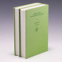
2000SKU-0672AA03505035Brill Publishing 2000. 1. Hardcover. Very Good. Complete 2-Volume Set ; Very Good; Hardcover; Very light wear to the covers of both volumes; Textblock edges of both volumes are unblemished; The endpapers and text pages of both volumes are all bright and unmarked; The bindings are excellent with straight spines; This book set will be shipped in a sturdy cardboard box with foam padding; Medium Format 8.5" - 9.75" tall; 4.5 lbs; Light green cloth covers with titles in dark green lettering; 2000 Brill Publishing; 1056 pages; "A Dictionary of Samaritan Aramaic Handbook of Oriental Studies: Section 1; The Near and Middle East English Hebrew and Samaritan Edition" by Tal Abraham. Brill Publishing hardcover
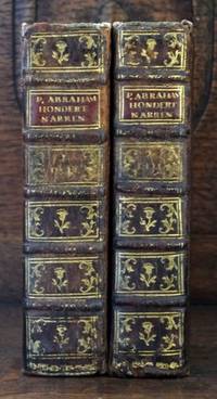
173432881734. : 8 . Complete with 50 full page engravings as mentioned in the registers. Second part 1743. Uniformly bound with very nice illustrations depicting various kinds of fools Part 1: 2 Blank pages / 1 Frontispiece / Title Page / 2 Blank pages / 10 NNP / 2 Blank pages / 554 Pages / 20 NNP / 2 Blank pages / 25 Engraved Plates Part 2: 2 Blank pages / 1 Engraved Title / 1 Title Page / 8 NNP / 546 Pages / 14 NNP / 2 Blank pages / 25 Engraved Plates Binding: Contemporary Full Leather Sextodecimo 16mo Height cm: 155 CM Width cm: 95 CM Thickness cm: 75 CM hardcover
2021Adhya-9781788017695RSC 2021. Hardcover. New. RSC hardcover
2021Adhya-9781788017695RSC 2021. Hardcover. New. RSC hardcover
2007x-3540301577Springer Verlag 2007. Hardcover. New. 1st edition. 453 pages. 9.75x6.50x0.75 inches. Springer Verlag hardcover
BN102981TERRE DE BRUME. Softcover. SEPT PAS VERS SATAN <br/><br/>SEPT PAS VERS SATAN TERRE DE BRUME paperback
BN103663Elsevier Masson. Softcover. Le traitement de la dépendance au tabac: Guide pratique <br/><br/>Le traitement de la dépendance au tabac: Guide pratique Elsevier Masson paperback
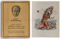
19493492BB1949. Amsterdam Verlag der Erasmus-Buchhandlung 1949. 4°. Mit handkol. Frontispiz und Titelvignette 99 S. Text ca. 400 Textillus und 100 ganzs. Abb. sowie Tafeln A B und C. Halbledeband goldgepr. Rückentitel Schutzumschlag. WG 24. - Nr. 91 von 100 Exemplaren der Vorzugsausgabe von Horodisch im Impressum signiert. Enthält am Schluss drei unveröffentliche Zeichnungen Kubins Strichätzungen signiert. - Schutzumschlag angestaubt. unknown
89117Antwerp Belgium Abraham ORTELIUS 1584. Original Antique Engraved Map. Engraved surface 19 x 12.5 inches. Mounted Overall 27 x 21 inches. In very good condition. Lovely bright and clean map good strong impression. Vertical centre fold present and correct. Some minor tanning to edges from mount. Else an excellent clean and bright map. Antwerp, Belgium, Abraham ORTELIUS, 1584 unknown
197428134HEYNE WILHELM 1974. 9. softcover. Dracula HEYNE, WILHELM paperback
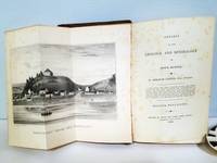
1836020572Halifax NS: Gossip and Coade Times Office 1836. First Edition. Hardcover. Light scattered foxing owner name on front endpaper some looseness of front cover with internal tape reinforcement. Overall Very Good. Small quarto 5-3/4" x 8-3/4" in original brown cloth rebacked with heavy brown binder's tape with most of the original spine label pasted on; xxxix 272 1 pages. Illustrated with a folding lithographic frontispiece "Parrsboro' From the Water 1836" a full-page lithograph "Cape Split 1836" and a hand-colored folding map "A New Map of Nova Scotia Cape Breton Prince Edward Island and part of New Brunswick" by C.H. Belcher with "Explanation of the Maps" bound in. <br/><br/> Gossip and Coade, Times Office hardcover
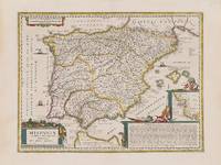
1662200014AG1662. Amsterdam Janssonius c.1662. Original hand-coloured copper engraving. Plate Size: 49.2 cm x 37 cm. Sheet Size: 59.8 cm x 45 cm. Original map. Very good condition. Faint hint of foxing along left fore edge. Centre fold as issued. Latin text on reverse. Koeman I 6000H:1.2. Border with longitudinal and latitudinal information. A richly detailed and very interesting map showing Roman Hispania - the Iberian Peninsula and the Balearic Islands. The three Ancient Roman provinces organised by the emperor Augustus of Hispania Citerior et Tarraconensis Hispania Baetica and Lusitania Hispania are shown on the map. Northern tip of Africa 'Hispania Transfretana Sive Tingitana Qua et Mauritania' pictured also. Relief shown pictorially with rivers mountains and significant towns and cities depicted. Large decorative cartouche with finely detailed Classical allusions in lower right section of map contains an inset box showing the coastal area around 'Gades' Cadiz. Cartouche also lists numerous place names of uncertain location in Latin. Bar-scales within cartouche in top right corner of the map. Decorative title cartouche in lower left corner. Three ships are also pictured suggesting the region's maritime importance. 'Mare Mediterraneum Internum' and 'Ocean Atlanticus Quod et Mare Hesperium Vespertinum Occiduum et Externum' are also listed. Abraham Goos 1590 c. 1643 was a Dutch cartographer publisher and engraver. He made globes maps of North America a comprehensive map of European coastlines and the first printed Hebrew language map of The Holy Land. His first teacher was Jodocus Hondius 15631612 a renowned map-maker whose son-in-law was Johannes Janssonius. After Hondius died his son-in-law Jan Janssonius took over Hondius's business and continued the partnership with Goos. One of Hondius' specialties was the manufacture of globes and Goos and Janssonius continued this regularly modifying them as more geographical information became available. In 1616 he published Nieuw Nederlandtsch Caertboeck an atlas of the Seventeen Provinces in 23 maps and one of the first atlases of the Netherlands; Johannes Janssonius 1588-1664 was a renowned geographer and publisher of the seventeenth century when the Dutch dominated map publishing in Europe. unknown
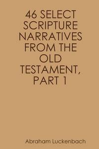
20201593201922Lenape Texts & Studies 2020. First Edition. Paperback. Good. Missing dust jacket; Pages can have notes/highlighting. Spine may show signs of wear. ~ ThriftBooks: Read More Spend Less.1838 Daniel Fanshaw publication New York. Full leather. Good clean unmarked copy. Steel engravings throughout. Exceptionally rare 1838 Delaware Lenape Old Testament narratives translated by Abraham Luckenbach published by Fanshaw. Original full leather binding with intact spine label; interior lightly foxed. A cornerstone piece for Native American scriptural translation collections and early missionary language work. Early Moravian missionary Abraham Luckenbach translated key Old Testament stories into the Delaware Lenape language published in 1838 by Fanshaw. A rare example of Indigenous-language scripture this edition was created for teaching and spiritual instruction among Delaware communities preserving both linguistic and cultural heritage in the Northern Unami dialect. This could have light cosmetic flaws but remains in good condition. This copy is the First Edition of the published work. Secure packaging for safe delivery.Dust jacket quality is not guaranteed. Lenape Texts & Studies paperback