[Abraham Leisy]; [Babette Leisy]; Roosen, Gerrit [Mennonite Autograph Theological Manuscript Book]Biblio.com
23 962 résultats
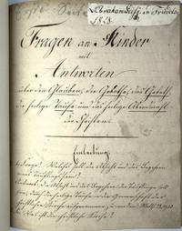
1828512100Self-Published 1828. Hardcover. VERY GOOD. 89 32pp. Two autograph manuscripts in fine longhand by Abraham Leisy. The first is a transcription of the Gerrit Roosen's Mennonite Catechism; the second text is a 32-page collection of pious tales. The books were bound together with a signature inlaid from a letter by Abraham Leisy and pasted to the title page of the first volume. Bound in black finished cloth with 'Biblische Fragen' stamped to the front cover. The FFEP bears a note by Leisy's sister Babette reading 'Babette Leisy. / Cleveland. / Dieses Buch brachte meinen topfchen Diana im Jahr 1895. von Deutschland Friedelsheim das hat alles Bruders Abraham Leisy geschrieben.' 'The Abraham and Katarina Leisy family emi grated to America in 1855 from Friedelsheim Germany. They settled on a farm outside of Donnellson Iowa. The Leisys were members of the West Zion Mennonite Church of Donnellson.' Mennonite Life April 1976. Abraham's sons notably founded the Leisy Brothers' 'Union Brewery' in 1862 in Keokuk Iowa. When the state of Iowa banned manufacture of alcoholic beverages in 1884 the brewery was moved to Peoria Illinois and renamed 'Leisy Brewing Company' a major regional beer producer and known as the last Mennonite-operated brewery in the U.S. Self-Published hardcover
1860230801860. Good. 1860. 16pp. Good condition. Large moisture stain affects pages 1-12. Age toning throughout. Light foxing primarily to first two pages. Page edges worn particularly top edge with some dog-earing to upper right corner. Paper wearing thin at the spine folds. The Lincoln speech runs to page nine followed by the speech of John Hickman of Pennsylvania through page 15. The last page includes: "The Dred Scott Decision and Douglas' Endorsement Thereof". Lincoln's famous Cooper Union speech in which he declares his view that slavery should not be extended into the Western Territories and claims that the Founding Fathers would feel the same way. An important moment in his political ascension. cfm unknown
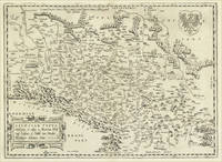
159816878Antwerp: Christopher Platin 1598. Other. A very good example in excellent condition. 332 by 4850mm 13 by 191 inches. Original copper engraving published 1598 in a French edition of the Theatrum Orbis Terrarum. Finely hand-colored in wash and outline. There are three maps on one plate each showing a title cartouche. Villages and towns are shown as miniature views. Ortelius was born on 14 April 1527 in the city of Antwerp which was then in the Habsburg Netherlands modern-day Belgium. The Orthellius family were originally from Augsburg a Free imperial city of the Holy Roman Empire. In 1535 the family had fallen under suspicion of Protestantism. Following the death of Ortelius's father his uncle Jacobus van Meteren returned from religious exile in England to take care of Ortelius. Abraham remained close to his cousin Emanuel van Meteren who would later moved to London. In 1575 he was appointed geographer to the king of Spain Philip II on the recommendation of Arias Montanus who vouched for his orthodoxy. He travelled extensively in Europe and is specifically known to have traveled throughout the Seventeen Provinces; in southern western northern and eastern Germany e.g. 1560 15751576; France 15591560; England and Ireland 1576; and Italy 1578 and perhaps twice or thrice between 1550 and 1558. Beginning as a map-engraver in 1547 he entered the Antwerp Guild of Saint Luke as an illuminator of maps. He supplemented his income trading in books prints and maps and his journeys included yearly visits to the Frankfurt book and print fair where he met Gerardus Mercator in 1554. In 1560 however when travelling with Mercator to Trier Lorraine and Poitiers he seems to have been attracted largely by Mercator's influence towards the career of a scientific geographer. Wikipedia Broe. 143 Christopher Platin unknown
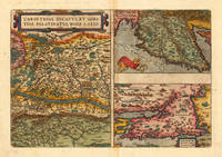
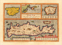
161213729Antwerp: Juan Baptist Vrients 1612. Other. In excellent condition. 342 by 491mm 13 by 19 inches. Original antique copper engraving decorative hand colored. Published 1612 in the historical Atlas "Parergon" by Abraham Ortelius bound with his famous Theatrum Orbis Terrarum. Finely hand-colored in wash and outline. Four maps on one plate: Corsica the Ionian Islands Cephalonia Zacynthus Corcyra Sardinia and Crete. Villages and towns are shown as miniature views moreover the map at the bottom is ornated with ships sea monsters and animals. At the bottom we find two cartouches with listings of antique place names and explanations. A very good example in excellent condition. Ortelius was born on 14 April 1527 in the city of Antwerp which was then in the Habsburg Netherlands modern-day Belgium. The Orthellius family were originally from Augsburg a Free imperial city of the Holy Roman Empire. In 1535 the family had fallen under suspicion of Protestantism. Following the death of Ortelius's father his uncle Jacobus van Meteren returned from religious exile in England to take care of Ortelius. Abraham remained close to his cousin Emanuel van Meteren who would later moved to London. In 1575 he was appointed geographer to the king of Spain Philip II on the recommendation of Arias Montanus who vouched for his orthodoxy. He travelled extensively in Europe and is specifically known to have traveled throughout the Seventeen Provinces; in southern western northern and eastern Germany e.g. 1560 15751576; France 15591560; England and Ireland 1576; and Italy 1578 and perhaps twice or thrice between 1550 and 1558. Beginning as a map-engraver in 1547 he entered the Antwerp Guild of Saint Luke as an illuminator of maps. He supplemented his income trading in books prints and maps and his journeys included yearly visits to the Frankfurt book and print fair where he met Gerardus Mercator in 1554. In 1560 however when travelling with Mercator to Trier Lorraine and Poitiers he seems to have been attracted largely by Mercator's influence towards the career of a scientific geographer. Wikipedia Broe. 217 Juan Baptist Vrients unknown
159821946Antwerpen 1598. Other. A strong impression in excellent condition. 370 by 500mm 14 by 19 inches. Original antique copper engraving published 1598 in a French text edition of the " Theatrum Orbis Terrarum. Decorative map of Ortelius" first plate covering Gelderland. Based on Christiaan Sgrothen" s map of 1567 and is richly engraved with fine detail particularly along the rivers. The map is oriented with north to the left with ribbon cartouches marking the cardinal directions. Two ships sail in the Zuyder Zee and a decorative cartouche with flowers and birds. Ortelius was born on 14 April 1527 in the city of Antwerp which was then in the Habsburg Netherlands modern-day Belgium. The Orthellius family were originally from Augsburg a Free imperial city of the Holy Roman Empire. In 1535 the family had fallen under suspicion of Protestantism. Following the death of Ortelius's father his uncle Jacobus van Meteren returned from religious exile in England to take care of Ortelius. Abraham remained close to his cousin Emanuel van Meteren who would later moved to London. In 1575 he was appointed geographer to the king of Spain Philip II on the recommendation of Arias Montanus who vouched for his orthodoxy. He travelled extensively in Europe and is specifically known to have traveled throughout the Seventeen Provinces; in southern western northern and eastern Germany e.g. 1560 15751576; France 15591560; England and Ireland 1576; and Italy 1578 and perhaps twice or thrice between 1550 and 1558. Beginning as a map-engraver in 1547 he entered the Antwerp Guild of Saint Luke as an illuminator of maps. He supplemented his income trading in books prints and maps and his journeys included yearly visits to the Frankfurt book and print fair where he met Gerardus Mercator in 1554. In 1560 however when travelling with Mercator to Trier Lorraine and Poitiers he seems to have been attracted largely by Mercator's influence towards the career of a scientific geographer. Wikipedia unknown
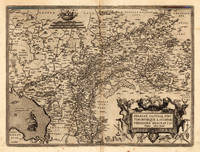
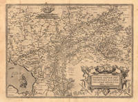
161213895Antwerp: Vrients 1612. Other. In excellent condition. 372 by 503mm 14 by 19 inches. Original antique copper engraving published 1612 in a Italian text edition of the " Theatrum Orbis Terrarum. Uncolored example in a strong impression. The map is ornated with a title cartouche in the lower right corner naming the autor "Christian Schrot" on whom Abraham Ortelius based his cartographic source for this map in his atlas. Top left corner with a small mileage scale. For the decoration of the map we find a sailing ship in the "Zuyder Zee". Ortelius was born on 14 April 1527 in the city of Antwerp which was then in the Habsburg Netherlands modern-day Belgium. The Orthellius family were originally from Augsburg a Free imperial city of the Holy Roman Empire. In 1535 the family had fallen under suspicion of Protestantism. Following the death of Ortelius's father his uncle Jacobus van Meteren returned from religious exile in England to take care of Ortelius. Abraham remained close to his cousin Emanuel van Meteren who would later moved to London. In 1575 he was appointed geographer to the king of Spain Philip II on the recommendation of Arias Montanus who vouched for his orthodoxy. He travelled extensively in Europe and is specifically known to have traveled throughout the Seventeen Provinces; in southern western northern and eastern Germany e.g. 1560 15751576; France 15591560; England and Ireland 1576; and Italy 1578 and perhaps twice or thrice between 1550 and 1558. Beginning as a map-engraver in 1547 he entered the Antwerp Guild of Saint Luke as an illuminator of maps. He supplemented his income trading in books prints and maps and his journeys included yearly visits to the Frankfurt book and print fair where he met Gerardus Mercator in 1554. In 1560 however when travelling with Mercator to Trier Lorraine and Poitiers he seems to have been attracted largely by Mercator's influence towards the career of a scientific geographer. Wikipedia Broe. 61. State 3/4. Vrients unknown
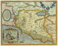
161230976Antwerp: Balthasar Moretus 1612. Other. In excellent condition. 356 by 453mm 14 by 17 inches. Original antique copper engraving from the 'Theatrum Orbis Terrarum' by Abraham Ortelius the world's first modern atlas published in Antwerp 1612. Depicting Rome & Latium this map is a fine example of 1610s European cartography. Image: 356 by 453mm 14 by 17 inches. An attractive and historically significant 17th-century map for the discerning collector. Abraham Ortelius 15271598 was a Flemish cartographer and geographer born in Antwerp. He is widely regarded as the creator of the first modern atlas the 'Theatrum Orbis Terrarum' Theatre of the World first published in 1570 by Gilles Coppens de Diest in Antwerp. Considered the world's first true atlas it established the modern format of uniform standardized maps bound together in a single volume. Appointed Geographer to King Philip II of Spain in 1575 Ortelius was one of the most influential figures in the history of cartography. His maps are held in the collections of the British Library the Library of Congress and major European institutions. The 'Theatrum' went through more than 30 editions and was translated into multiple languages making Ortelius's maps among the most sought-after in the world of antique cartography.The map is ornated with three cartouches in the upper left corner the title cartouche on the upper right side we find an oval text cartouche and in the lower left corner an inset. The privilegium is written on the lower right side. Villages and towns are shown as miniature views. Moreover the map is ornated with a ship.A fine example from Theatrum Orbis Terrarum Antwerp sought after by collectors of antique maps of Italy antique maps of Rome and antique copper engravings for sale. In good condition consistent with age. Light age-toning to the sheet as expected for a 17th-century engraving. Centerfold as published. Koe. Ort. 46; Broe: 209 state 2/2; Balthasar Moretus unknown
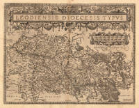
159813893Antwerp 1598. Other. In excellent condition. 380 by 497mm 15 by 19 inches. Original antique copper engraving published 1598 in a French text edition of the " Theatrum Orbis Terrarum. Uncolored copy in a strong impression. The map is ornated a large title cartouche and below a decorative milage scale. This antique map shows Luttich in Belgium. The map is equipped with many small place names rivers woods etc. Ortelius was born on 14 April 1527 in the city of Antwerp which was then in the Habsburg Netherlands modern-day Belgium. The Orthellius family were originally from Augsburg a Free imperial city of the Holy Roman Empire. In 1535 the family had fallen under suspicion of Protestantism. Following the death of Ortelius's father his uncle Jacobus van Meteren returned from religious exile in England to take care of Ortelius. Abraham remained close to his cousin Emanuel van Meteren who would later moved to London. In 1575 he was appointed geographer to the king of Spain Philip II on the recommendation of Arias Montanus who vouched for his orthodoxy. He travelled extensively in Europe and is specifically known to have traveled throughout the Seventeen Provinces; in southern western northern and eastern Germany e.g. 1560 15751576; France 15591560; England and Ireland 1576; and Italy 1578 and perhaps twice or thrice between 1550 and 1558. Beginning as a map-engraver in 1547 he entered the Antwerp Guild of Saint Luke as an illuminator of maps. He supplemented his income trading in books prints and maps and his journeys included yearly visits to the Frankfurt book and print fair where he met Gerardus Mercator in 1554. In 1560 however when travelling with Mercator to Trier Lorraine and Poitiers he seems to have been attracted largely by Mercator's influence towards the career of a scientific geographer. Wikipedia Broe. 64. State 1/3. unknown
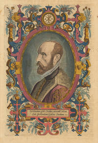
161230060Antwerp: Vrients 1612. Other. In exellent condition. 318 by 209mm 12 by 8 inches. Original antique copper engraving later hand colored. Latin text edition. This is the beautiful hand colored portrait of Abraham Ortelius as frontispiece to his "Theatrum Orbis". Engraved by Phillipe Galle. Ortelius was born on 14 April 1527 in the city of Antwerp which was then in the Habsburg Netherlands modern-day Belgium. The Orthellius family were originally from Augsburg a Free imperial city of the Holy Roman Empire. In 1535 the family had fallen under suspicion of Protestantism. Following the death of Ortelius's father his uncle Jacobus van Meteren returned from religious exile in England to take care of Ortelius. Abraham remained close to his cousin Emanuel van Meteren who would later moved to London. In 1575 he was appointed geographer to the king of Spain Philip II on the recommendation of Arias Montanus who vouched for his orthodoxy. He travelled extensively in Europe and is specifically known to have traveled throughout the Seventeen Provinces; in southern western northern and eastern Germany e.g. 1560 15751576; France 15591560; England and Ireland 1576; and Italy 1578 and perhaps twice or thrice between 1550 and 1558. Beginning as a map-engraver in 1547 he entered the Antwerp Guild of Saint Luke as an illuminator of maps. He supplemented his income trading in books prints and maps and his journeys included yearly visits to the Frankfurt book and print fair where he met Gerardus Mercator in 1554. In 1560 however when travelling with Mercator to Trier Lorraine and Poitiers he seems to have been attracted largely by Mercator's influence towards the career of a scientific geographer. Wikipedia Vrients unknown
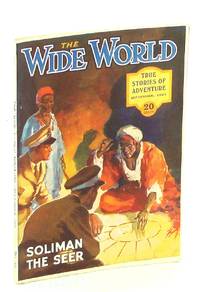
1923346H5235New York: The International New Company 1923. Book. Illus. by Prater Ernest; Holloway Cyril; Wood Stanley L.; waters D.B.; Nicolson W.C.; Robinson T.H.; Hiley F.E.; Sindall A.; De Walton John; Edwards Lionel; Whitaker W.G.; Elcock Howard K. Very Good. Single Issue Magazine. First Edition. 8vo - over 7¾" - 9¾" tall. Abundant black and white illustrations and reproductions of photos. Features: 'Twixt Sunset and Sunrise - Mining Engineer William Bartle relates a story from Mexico where outside the large cities "no foreigner's life is worth a farthing"; The Cannibal Islands - Part II - photo-illustrated article by Clifford Collinson who has lived in the Solomon Islands for several years and in this instalment visits the little-known atolls of Ong-Tong-Java with nice photos; The Disappearance of Annie Mooney - A thirty-year-old mystery is solved in a strange and unlooked-for manner - was she kidnapped by the Chinese all those years ago; The Most Wonderful School in the World - A remarkable "sun-cure" establishment at Aigle in the Swiss mountains where children - recently hopeless cripples - learn their lessons and romp in deep snow clad only in loin-cloths and boots! - with photos; Obyada Bad Indian - story related by a member of the Royal North-West Mounted police about a troublesome individual near Red Deer Alberta; The Rum-Runner - the story of a sea captain's first smuggling voyage as told in St. Pierre headquarters of a fleet of ships engaged in the liquor-running business; Soliman the Seer - the mysterious fortune-teller of the Pyraid of Cheops; The Children of the Wilderness Conclusion - Juliet Bredon's photo-illustrated travels in little known Mongolia; A Wildfowling Adventure - a nasty little adventure on the Solway Firth; Fishing for Crocodiles - using a special hook and line; On Patrol - a quaint little experience related by a flying officer of the Royal Air Force; The MIssing Links - An Indian magician discovers a thief when the police had failed; Round the World With a Lasso - former Texas Ranger Captain George Ash tours the world giving exhibitions and training troops in the use of the lasso - article with photos; The Strangest Mutiny on Record - The Schooner Pedro Varela; Six Hundred Thousand Francs - One of the most audacious jewel robberies ever perpetrated in Paris; and more. 88 pages plus 16 pages of nostalgic ads. Clean and unmarked with light wear. A quality copy of this excellent vintage issue. The International New Company Paperback
2021DBS-9781788825245MEDPLUS 2021. 1ST. Hardcover. New. MEDPLUS hardcover
2021DBS-9781788825245MEDPLUS 2021. 1ST. Hardcover. New. MEDPLUS hardcover
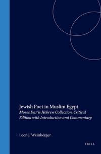
2000__9004119310Brill Academic Pub 2000. Hardcover. New. 532 pages. 9.50x6.50x1.50 inches. Brill Academic Pub hardcover
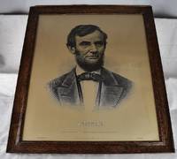
18992111010020Pennsylvania Lancaster County Lancaster: J.P. McCaskey 1899. First Edition. Art Prints & Posters. Good. The Iconography of Abraham Lincoln Large print of Lincoln printed in 1899 from the Lincoln Art series. Mounted under glass in wooden frame. Dimensions in frame: 25 1/2 x 29 1/2 inches. A few light scuffs to print. "Lincoln: Here was a type of the true elder race And one of Plutarch's men talked with us face face. - Lowell." - James Russell Lowell. A line from Lowell's Ode to Lincoln from the Harvard Commemoration July 21 1865. This etching depicts a head and shoulders portrait of President Abraham Lincoln. He wears a dark jacket and vest along with a white collared shirt and black bow tie. There is a slight shadow above Lincoln's shoulders. J.P. McCaskey unknown
157426946Antwerpen: Platin 1574. Other. A strong impression. In excellent condition. 280 by 385mm 11 by 15¼ inches. Copper engraving uncolored as published. Latin text edition printed 1574. Broe. 102. Platin unknown
35923463like new. unknown
35923463-nnew. unknown
18492251like new. unknown
18492251-nnew. unknown
2016x-0691647704Princeton University Press 2016. Hardcover. New. 610 pages. 9.25x6.12x1.46 inches. Princeton University Press hardcover
1986Q-0193163063Oxford University Press 1986-04-24. Hardcover. New. New. In shrink wrap. Looks like an interesting title! Oxford University Press hardcover
190659273Keswick: GP Abraham. 1906. Hardcover. Very Good. xx 2 394pp 5 fronti 29 monogravure plates 10 pen & ink sketches 9 plates of drawings of routes all prsent as listed. Sl spotting of prelims bound in original green cloth sl bumped top/base spine; Octavo . GP Abraham hardcover
19853747BASTEI 08/1985. 1. softcover. Dracula Der weltbekannte Roman in faszinierenden Bildern! BASTEI paperback
35771922like new. unknown
35771922-nnew. unknown