ORTELIUS (Abraham);Livre Rare Book
213 résultats
1598LBW-1391Anvers 1598 81 x 106 mm.
1598LBW-1425Anvers 1598 80 x 105 mm.
1598LBW-1428Anvers 1598 81 x 105 mm.
1590003611Belgico Antwerp: Abraham Ortelius 1590. No Binding. Very Good. Elephant Folio - over 15" - 23" tall. ORTELIUS Abraham. VG 1590 B&W Map of the Black Sea Coast. 50 35.5 the Map 54 44.5 cm map including margins. Latin Text to verso of 1 side p xxvii. No pin holes inscriptions etc very light edge browning. Includes part of Ukraine Russia Georgia Bulgaria Romania and Turkey. Belongs to a series of historical maps known as the Parergon Theatri from 1579 onwards. Tooley's Dictionary of Mapmaker Early World Press 2004 p358-359 Marcel P. R. van den Broecke Ortelius Atlas Maps HES Publishers 2011 p633. <br/> <br/> Abraham Ortelius unknown
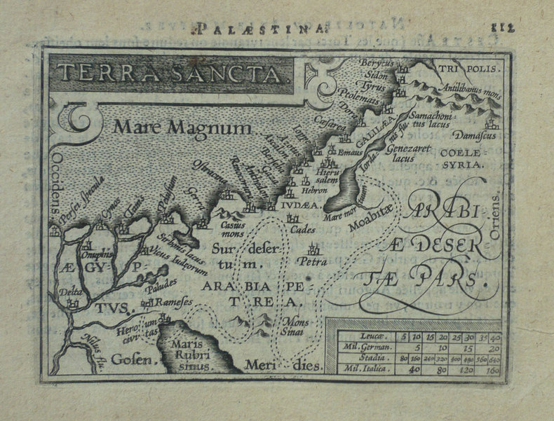
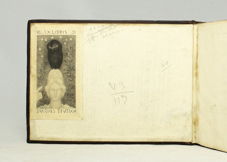
159516728Antverpiæ, Philippo Gallæo execudebat Arnoldus Coninx, 1595. In-8 oblong de [8]-109-[2] feuillets, plein maroquin brun, dos à nerfs orné de double D entrelacés, plats décorés d'un cartouche ovale doré, orné d'une composition allégorique, double filet doré encadrant les plats, tranches dorées. Reliure début XVIIème siècle. Ex-libris Jacques Teutsch.
1590M3954Antwerp 1590. Very Good. Size : 320x230 mm 12.625x9 Inches Coloring: Hand Colored Category: Maps Africa North Egypt unknown
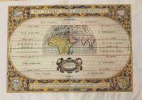
1590M8858Antwerp 1590. Very Good margins are extended. Notes: A fine world map by Abraham Ortelius based on Ptolemy surrounded by the maps of the four continents Americas Europe Asia and Africa. Map is superbly decorated within ornamental 16th century design. Latin text on verso. Size : 310x439 mm 12.20x17.28 Inches Coloring: Original Hand Coloring Reference: Shirley World 176: Van den Broecke 186. Category: Maps World; unknown
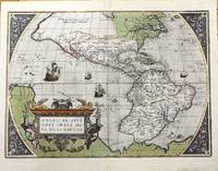
1584M11280Antwerp Belgium 1584. Very Good. Notes: Decorative and famous early map of the Americas.<br>The map shows North and South America and the Great Southern Continent extending northward to include New Guinea. The title is in a strapwork cartouche and the sea area is decorated with four ships and a sea creature.<br>Latin text on verso. <br>Abraham Ortelius April 1527 – June 1598 was a Flemish cartographer geographer and cosmographer from Antwerp in the Spanish Netherlands. He is recognized as the creator of the first modern atlas the Theatrum Orbis Terrarum Theatre of the World. Along with Gemma Frisius and Gerardus Mercator Ortelius is generally considered one of the founders of the Netherlandish school of cartography and geography. He was a notable figure of this school in its golden age approximately 1570s–1670s and an important geographer of Spain during the age of discovery. The publication of his atlas in 1570 is often considered as the official beginning of the Golden Age of Netherlandish cartography. Size : 362x500 mm 14.25x19.69 Inches Coloring: Original Hand Coloring Reference: Marcel P. R. Van Den Broecke #10.<br> Category: Maps North America; Maps South America Continent; unknown
1587016842: Abraham Ortelius Original 1587 But This A Reprint 1587. 5th or later Edition . No Binding. Near Fine/No Jacket. 19" x 17. Image Size: 18 7/8" X 13 3/4". Text "Cum Privilegio Decennali Ab. Ortelius Delineab. Et Excudeb. 1587" At Lower Right. However This Must Be A Late Eighteenth Century To Twentieth Century Reprint Printed On Wove Paper Sheet Never Placed In An Atlas. Strong Impression And Color Minor Loss Of A Millimeter Depth In A Tiny Area Of Lower Left Margin Otherwise Undamaged. Margins Irregular Up To 1" Deep. Professionally Cleaned And De-Acidified With Archival Materials By A Museum-Experienced Conservator. <br/> <br/> Abraham Ortelius (Original 1587 But This A Reprint) unknown
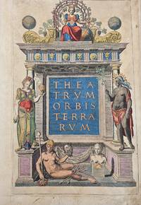
157112719Antwerp Gielis Coppens van Diest 1571. Theatrum Orbis Terrarum. Complete copy bound in a contemporary vellum binding 8 53 maps 29 Folio. Engraved architectural title with the figure of Europe at the top. With 53 contemporary handcoloured double-page engraved maps. H. 43 x W. 30 cm. / H. 16.90 x W. 11.8 inch. Rare early edition of Ortelius' revolutionary atlas first published in Antwerp in 1570 also a Latin edition. Ortelius' atlas was revolutionary because it was the first attempt to present the geography of the world in a uniformly produced collection of maps of all known parts of the world. Ortelius designed the maps himself basing his designs on the cartographic sources that he had at hand and equally revolutionary also mentioning his sources on the maps and once finished had them engraved by Frans Hogenberg and Ambrosius and Ferdinand Aertsen. Finally Gielis Coppens van Diest printed the maps after which they could be coloured also in a uniform style and bound in a logical order in one volume. These atlases were a new phenomenon and proved to be very popular in Europe. Soon editions were published in various languages of Europe in print runs of a few hundred copies each. Few maps are slightly finger-stained in the wide margins. Contemporary vellum binding with some scratches and stains. Overall a remarkable copy of this famous atlas in beautiful contemporary colours. Van den Broecke estimates that of this 2nd Latin edition approximately 275 copies were printed. Literature: Van de Krogt/ Koeman IIIA 31:002; Adams O-335; Phillips 382; Shirley 122 with the world map in his first plate first state. Antwerp, Gielis Coppens van Diest hardcover
15958359Antwerp Plantin-Moretus 1595. Copper engraving 37 x 50 cms black and white small hole at centrefold Latin text to verso. Shirley notes that the map is a general improvement on the previous Mercator-Ortelius outline and draws attention to a detail which vividly suggests the personal involvement of the map-maker Welsh antiquary Humphrey Lluyd: the Caernarvon peninsula near Lluyds home town of Denbigh is badly distorted but it has been suggested very reasonably that this may have been due to Lluyds attempt to sketch this in by eye from the nearby mountains. Ortelius's Theatrum Orbis Terrarum is generally considered the first modern atlas of the world originally published in 1570. Ortelius gathered and selected the best available cartographic knowledge and presented it in a single volume duly credited and finely engraved in a consistent style with explanatory text. The Theatrum was very decorative and hugely popular amongst the wealthy and educated running into over forty editions in Latin and the major European languages. Shirley British Isles 185. Van den Broecke 19.3 Map unknown
15849733Antwerp 1584. Copper engraving 34.5 x 49.5 cm modern hand-colour centrefold reinforced on verso several neat marginal restorations Latin text on verso. The British Isles aligned with west at the top of the map and north on the right which makes better use of the available space on the page; it was chiefly derived from Mercators map of 1564. Abraham Ortelius's Theatrum Orbis Terrarum is widely considered the first modern world atlas originally published in 1570. Ortelius gathered and selected the maps which he believed represented the best available cartographic knowledge of his day which he then presented it in a single volume duly credited and finely engraved in a consistent style with explanatory text. The Theatrum was highly decorative and hugely popular amongst the wealthy and educated running into over forty editions in Latin and other major European languages. Shirley British Isles 139 but cf. 86.Van den Broecke 16. Map unknown
157521270Amsterdam: Ortelius 1575. Very good overall. A classic map of the British Isles published in the 'Theatrum Orbis Terrarum' regarded as the first modern atlas. The map was oriented with north to the right so that the map fitted the sheet of paper as it predates the convention of north to the top of the map.<br /> <br /> Ort 16 Koeman/Meurer: 6 Karrow: 1/11 van der Krogt AN: 5000:31A. Listed on Van Den Broecke as 1575L6 100 copies printed small page number 7 mm; last line centred like 3 lines above it: sem;Ponticum Virunium;Ioannem Prisæum;&Bedam. Shirley: British Isles 1477-1650 86. <br /> <br /> Latin text on verso. 19 1/2 x 13 1/2". Centerfold and right margin strengthened. Original color heightened. Ortelius unknown
159037978np 1590. Image area 19 1/2 x 13 1/2 inches in 28 x 23 inch mat. Single crease down center with one 1/2 inch spot worn through otherwise a nice handsome map. Image area 19 1/2 x 13 1/2 inches in 28 x 23 inch mat. Abraham Ortelius 1527-1598 was a Flemish geographer of German origin. His major work Theatrum Orbis Terrarum 1570 with later revisions and addenda was the first modern atlas. It was based on contemporary charts and maps and contained a collection of plates engraved by Franz Hagenberg in a uniform size and format. The Theatrum preceded the first Atlas of Ortelius' good friend Gerardus Mercator. In fact popular and sentimental legend has it that Mercator delayed publication of his own work so that his younger friend's would appear first. although this simply is not true Mercator wasn't ready the legendary cartographer did compliment Ortelius for the "care and elegance" he put into his "Theatrum. unknown
158453076Antwerp. c.1584-95. A beautiful map of the British Isles north to the right. The map is based on Mercator's earlier map of the British Isles of 1564. Title in strapwork cartouche at top right text in Latin in its own cartouche at lower right scale and royal arms; ships at sea. It is difficult to put an exact date on the map because of the complex publishing history of Ortelius' atlas. Published in the Theatrum Orbis Terrarum. Size: 345 x 505 mm. Copper engraving. Coloured. Framed size: 780 x 640 mm. Fine condition good margins. Moreland & Bannister p. 200-203; Van den Broecke 16. unknown
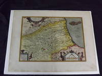
1590101237<p>Hand colored double-page engraved map 325 x 425 mm 14" x 18" Latin text on verso. Wide margins minor soiling in margins slight aging; otherwise bright and clean with strong impression. Ortelius 1527-1598 is typically viewed as the creator of the modern atlas. He started his career as a map-engraver around 1547 and by 1570 he published the first edition of his Theatrum Orbis Terrarum Atlas of the Whole World which included seventy maps many engraved by Frans Hogenberg. This map is colorful impression of Abruzzi Italy and it was probably published in 1612.</p>
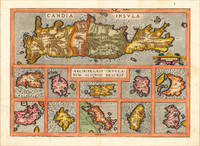
159816875Antwerp: Christopher Platin 1598. Other. A very good example in excellent condition. 364 by 509mm 14 by 20 inches. Original antique copper engraving published 1598 in a French edition of the Theatrum Orbis Terrarum. Finely hand-colored in wash and outline. Decorative map showing eleven maps of the Greek Archipelago in the Mediterranean on one doublepage plate. The title of the map appears in the centre the upper part of the map is a large map of Candia Crete already with many names of villages and other small places. Below are ten more small insets of Greek islands in the Archipelago Metellino Cerigo Scarpanto Nicsia Santorini Milos Stalimente Negroponte Rhodos and Scios. Ortelius was born on 14 April 1527 in the city of Antwerp which was then in the Habsburg Netherlands modern-day Belgium. The Orthellius family were originally from Augsburg a Free imperial city of the Holy Roman Empire. In 1535 the family had fallen under suspicion of Protestantism. Following the death of Ortelius's father his uncle Jacobus van Meteren returned from religious exile in England to take care of Ortelius. Abraham remained close to his cousin Emanuel van Meteren who would later moved to London. In 1575 he was appointed geographer to the king of Spain Philip II on the recommendation of Arias Montanus who vouched for his orthodoxy. He travelled extensively in Europe and is specifically known to have traveled throughout the Seventeen Provinces; in southern western northern and eastern Germany e.g. 1560 15751576; France 15591560; England and Ireland 1576; and Italy 1578 and perhaps twice or thrice between 1550 and 1558. Beginning as a map-engraver in 1547 he entered the Antwerp Guild of Saint Luke as an illuminator of maps. He supplemented his income trading in books prints and maps and his journeys included yearly visits to the Frankfurt book and print fair where he met Gerardus Mercator in 1554. In 1560 however when travelling with Mercator to Trier Lorraine and Poitiers he seems to have been attracted largely by Mercator's influence towards the career of a scientific geographer. Wikipedia Broe. 147 Christopher Platin unknown
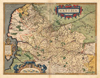
158812476Antwerpen 1588. Other. A very good copy in fine condtion a minor discoloration in the upper centerfold. . 380 by 490mm 15 by 19 inches. Original antique copper engraving published in the first Spanish edition of the 'Theatrum Orbis Terrarum by Abraham Ortelius. Finely handcolored in wash and outline when published. Detailled map of Artois with many cities and place names. The engraved cities are shown as miniature cityviews a few place names heightend in gold. Among the place names we find St. Omer Arras Renty Monstreul etc. Ornated with a large decorative title cartouch as well two further cartouches with a dedication and a milage scale. This map is in very fine original handcolor typical for a Spanish edition in that period. Abraham Ortelius engraved this map after the cartographic sketch by Iacobo Surbonio Montano. Ortelius was born on 14 April 1527 in the city of Antwerp which was then in the Habsburg Netherlands modern-day Belgium. The Orthellius family were originally from Augsburg a Free imperial city of the Holy Roman Empire. In 1535 the family had fallen under suspicion of Protestantism. Following the death of Ortelius's father his uncle Jacobus van Meteren returned from religious exile in England to take care of Ortelius. Abraham remained close to his cousin Emanuel van Meteren who would later moved to London. In 1575 he was appointed geographer to the king of Spain Philip II on the recommendation of Arias Montanus who vouched for his orthodoxy. He travelled extensively in Europe and is specifically known to have traveled throughout the Seventeen Provinces; in southern western northern and eastern Germany e.g. 1560 15751576; France 15591560; England and Ireland 1576; and Italy 1578 and perhaps twice or thrice between 1550 and 1558. Beginning as a map-engraver in 1547 he entered the Antwerp Guild of Saint Luke as an illuminator of maps. He supplemented his income trading in books prints and maps and his journeys included yearly visits to the Frankfurt book and print fair where he met Gerardus Mercator in 1554. In 1560 however when travelling with Mercator to Trier Lorraine and Poitiers he seems to have been attracted largely by Mercator's influence towards the career of a scientific geographer. Wikipedia Koe. Ort 23 / #37 115. Broe. 73. unknown
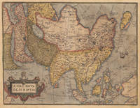
158017201Antwerp: Christopher Platin 1580. Other. A very good example in excellent condition and original colors. 376 by 489mm 14 by 19 inches. Original copper engraving oldcolored published 1582 in Antwerpen in the atlas Theatrum Orbis Terrarum. This is the 2nd plate of Ortelius's "Asia Nova Descriptio". It has the lower case "Farfana" and the town "Ara" has disapeared. The map is finely hand-colored in wash and outline when published. A colored title cartouche is in the lower left corner. Villages and towns are shown as miniature views moreover the map is ornated with sea monsters. A highly decorative 16th century map of Asia. Ortelius was born on 14 April 1527 in the city of Antwerp which was then in the Habsburg Netherlands modern-day Belgium. The Orthellius family were originally from Augsburg a Free imperial city of the Holy Roman Empire. In 1535 the family had fallen under suspicion of Protestantism. Following the death of Ortelius's father his uncle Jacobus van Meteren returned from religious exile in England to take care of Ortelius. Abraham remained close to his cousin Emanuel van Meteren who would later moved to London. In 1575 he was appointed geographer to the king of Spain Philip II on the recommendation of Arias Montanus who vouched for his orthodoxy. He travelled extensively in Europe and is specifically known to have traveled throughout the Seventeen Provinces; in southern western northern and eastern Germany e.g. 1560 15751576; France 15591560; England and Ireland 1576; and Italy 1578 and perhaps twice or thrice between 1550 and 1558. Beginning as a map-engraver in 1547 he entered the Antwerp Guild of Saint Luke as an illuminator of maps. He supplemented his income trading in books prints and maps and his journeys included yearly visits to the Frankfurt book and print fair where he met Gerardus Mercator in 1554. In 1560 however when travelling with Mercator to Trier Lorraine and Poitiers he seems to have been attracted largely by Mercator's influence towards the career of a scientific geographer. Wikipedia Broe. 7. Christopher Platin unknown
157415880Antwerp: Plantin 1574. Maps. Very good overall. The map of Asia from Ortelius' groundbreaking 'Theatrum Orbis Terrarum' considered the first modern geographical atlas 'produced in thirty-one editions between 1570 and 1612' David Parry: 'The Cartography of the East Indian Islands' 2005. Covering the area from the Middle East to Nova Guinea with part of the coast line of Australia 'Terrae Incognitae Australis Pars' in the lower right corner. Based on Ortelius' own 1567 wall map of Asia from the Theatrum Orbis Terrarum. Van den Broecke Ort #6 "Occurrence in Theatrum editions and page number: 1574L3 175 copies printed large page number 11 mm last line centered like 2 lines above it: nem in maiori Tabula ante tres annos edidimus". It has the capital "F" in La Farfana and the town "Ara" is still present above Aden. A total of only 1675 of this edition were printed compared to the more common Ort 7 edition. Image size:19 3/4 x 14 3/4". With an ornate cartouche and sailing ships. Latin text on verso. Paper size: 21 x 16 1/2". Copper engraving with original hand color. A very small burn hole at the ocean south of Japan; a defect in the plate at the lower edge to the right of the cartouche creating a short black line. Plantin unknown
159553045Antwerp. c.1595. Splendid map of the Artois region of north eastern France from Calais to Cambrai. Magnificent strapwork title cartouche at upper right scale with strapwork decorations at lower left. The dedicatory cartouche at left identifies this plate as van den Broecke 74. Published in the famous Theatrum Orbis Terrarum by the master Flemish cartographer Abraham Ortelius. Copper engraving. Fine condition good margins. Later colour. Size: 48 x 36.5 cm. Van den BroeckeOrtelius Atlas Maps 74. unknown
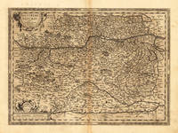
15957611Antwerp 1595. Copper engraving 35.5 x 48.5 cms recent-hand-colour Latin text on verso. First published in a 1592 edition of the Theatrum replacing the earlier Austriae Ducatus plate; Wolfgang Lazius is credited as the source. Van den Broecke 106 Map unknown
159817608Antwerp: Platin 1598. Other. In excellent condition. 356 by 486mm 14 by 19 inches. Original antique copper engraving published 1598 in a French text edition of the " Theatrum Orbis Terrarum. Uncolored example in a strong impression as published. This is the second plate of the Austria map after Wolfgang Lazius published for the first time in the "Theatrum Orbis Terrarum" after 1595. Here present in the 1598 edition. A highly decorative early map of the duchy of Austria towns are still shown as miniature engraved city views mountains woods rivers and lakes are decorative engraved. In the lower right corner a milage scale with a coat of arms. In the center of the map we find Vienna. The map reaches in the west from Linz towards the Neusiedler lake in the east. In the south with the neighbouring Carintia and Salzburg. Ortelius was born on 14 April 1527 in the city of Antwerp which was then in the Habsburg Netherlands modern-day Belgium. The Orthellius family were originally from Augsburg a Free imperial city of the Holy Roman Empire. In 1535 the family had fallen under suspicion of Protestantism. Following the death of Ortelius's father his uncle Jacobus van Meteren returned from religious exile in England to take care of Ortelius. Abraham remained close to his cousin Emanuel van Meteren who would later moved to London. In 1575 he was appointed geographer to the king of Spain Philip II on the recommendation of Arias Montanus who vouched for his orthodoxy. He travelled extensively in Europe and is specifically known to have traveled throughout the Seventeen Provinces; in southern western northern and eastern Germany e.g. 1560 15751576; France 15591560; England and Ireland 1576; and Italy 1578 and perhaps twice or thrice between 1550 and 1558. Beginning as a map-engraver in 1547 he entered the Antwerp Guild of Saint Luke as an illuminator of maps. He supplemented his income trading in books prints and maps and his journeys included yearly visits to the Frankfurt book and print fair where he met Gerardus Mercator in 1554. In 1560 however when travelling with Mercator to Trier Lorraine and Poitiers he seems to have been attracted largely by Mercator's influence towards the career of a scientific geographer. Wikipedia Broe. 106 Platin unknown
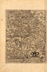
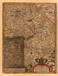
159821963Antwerp: Christopher Platin 1598. Other. A strong impression in excellent condition. 324 by 245mm 12 by 9 inches. Original copper engraving published 1598 in the famous atlas 'Theatrum Orbis Terrarum'. In French text edition. Detailed map of the Basel territory with renaissance title cartouche and scale bars. Villages and towns are shown as miniature views. Ortelius was born on 14 April 1527 in the city of Antwerp which was then in the Habsburg Netherlands modern-day Belgium. The Orthellius family were originally from Augsburg a Free imperial city of the Holy Roman Empire. In 1535 the family had fallen under suspicion of Protestantism. Following the death of Ortelius's father his uncle Jacobus van Meteren returned from religious exile in England to take care of Ortelius. Abraham remained close to his cousin Emanuel van Meteren who would later moved to London. In 1575 he was appointed geographer to the king of Spain Philip II on the recommendation of Arias Montanus who vouched for his orthodoxy. He travelled extensively in Europe and is specifically known to have traveled throughout the Seventeen Provinces; in southern western northern and eastern Germany e.g. 1560 15751576; France 15591560; England and Ireland 1576; and Italy 1578 and perhaps twice or thrice between 1550 and 1558. Beginning as a map-engraver in 1547 he entered the Antwerp Guild of Saint Luke as an illuminator of maps. He supplemented his income trading in books prints and maps and his journeys included yearly visits to the Frankfurt book and print fair where he met Gerardus Mercator in 1554. In 1560 however when travelling with Mercator to Trier Lorraine and Poitiers he seems to have been attracted largely by Mercator's influence towards the career of a scientific geographer. Wikipedia Broe: 114a Christopher Platin unknown
158426177Antwerp: Diesth 1584. Other. Old colored example. In excellent condition. 325 by 277mm 12 by 11 inches. Original copper engraving published 1584 in an early Latin text edition of the 'Theatrum Orbis Terrarum'. Oldcolored example in outline and wash color. Detailed map of the Basel territory with renaissance title cartouche and scale bars. Villages and towns are shown as miniature views. Ortelius was born on 14 April 1527 in the city of Antwerp which was then in the Habsburg Netherlands modern-day Belgium. The Orthellius family were originally from Augsburg a Free imperial city of the Holy Roman Empire. In 1535 the family had fallen under suspicion of Protestantism. Following the death of Ortelius's father his uncle Jacobus van Meteren returned from religious exile in England to take care of Ortelius. Abraham remained close to his cousin Emanuel van Meteren who would later moved to London. In 1575 he was appointed geographer to the king of Spain Philip II on the recommendation of Arias Montanus who vouched for his orthodoxy. He travelled extensively in Europe and is specifically known to have traveled throughout the Seventeen Provinces; in southern western northern and eastern Germany e.g. 1560 15751576; France 15591560; England and Ireland 1576; and Italy 1578 and perhaps twice or thrice between 1550 and 1558. Beginning as a map-engraver in 1547 he entered the Antwerp Guild of Saint Luke as an illuminator of maps. He supplemented his income trading in books prints and maps and his journeys included yearly visits to the Frankfurt book and print fair where he met Gerardus Mercator in 1554. In 1560 however when travelling with Mercator to Trier Lorraine and Poitiers he seems to have been attracted largely by Mercator's influence towards the career of a scientific geographer. Wikipedia Broe. 113 Diesth unknown