Ortelius, AbrahamBiblio.com
213 résultats
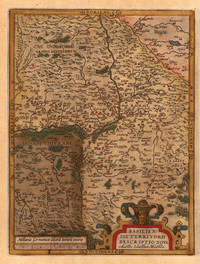
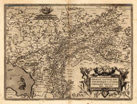
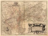
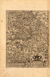
159821963Antwerp: Christopher Platin 1598. Other. A strong impression in excellent condition. 324 by 245mm 12 by 9 inches. Original copper engraving published 1598 in the famous atlas 'Theatrum Orbis Terrarum'. In French text edition. Detailed map of the Basel territory with renaissance title cartouche and scale bars. Villages and towns are shown as miniature views. Ortelius was born on 14 April 1527 in the city of Antwerp which was then in the Habsburg Netherlands modern-day Belgium. The Orthellius family were originally from Augsburg a Free imperial city of the Holy Roman Empire. In 1535 the family had fallen under suspicion of Protestantism. Following the death of Ortelius's father his uncle Jacobus van Meteren returned from religious exile in England to take care of Ortelius. Abraham remained close to his cousin Emanuel van Meteren who would later moved to London. In 1575 he was appointed geographer to the king of Spain Philip II on the recommendation of Arias Montanus who vouched for his orthodoxy. He travelled extensively in Europe and is specifically known to have traveled throughout the Seventeen Provinces; in southern western northern and eastern Germany e.g. 1560 15751576; France 15591560; England and Ireland 1576; and Italy 1578 and perhaps twice or thrice between 1550 and 1558. Beginning as a map-engraver in 1547 he entered the Antwerp Guild of Saint Luke as an illuminator of maps. He supplemented his income trading in books prints and maps and his journeys included yearly visits to the Frankfurt book and print fair where he met Gerardus Mercator in 1554. In 1560 however when travelling with Mercator to Trier Lorraine and Poitiers he seems to have been attracted largely by Mercator's influence towards the career of a scientific geographer. Wikipedia Broe: 114a Christopher Platin unknown
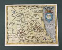
158426177Antwerp: Diesth 1584. Other. Old colored example. In excellent condition. 325 by 277mm 12 by 11 inches. Original copper engraving published 1584 in an early Latin text edition of the 'Theatrum Orbis Terrarum'. Oldcolored example in outline and wash color. Detailed map of the Basel territory with renaissance title cartouche and scale bars. Villages and towns are shown as miniature views. Ortelius was born on 14 April 1527 in the city of Antwerp which was then in the Habsburg Netherlands modern-day Belgium. The Orthellius family were originally from Augsburg a Free imperial city of the Holy Roman Empire. In 1535 the family had fallen under suspicion of Protestantism. Following the death of Ortelius's father his uncle Jacobus van Meteren returned from religious exile in England to take care of Ortelius. Abraham remained close to his cousin Emanuel van Meteren who would later moved to London. In 1575 he was appointed geographer to the king of Spain Philip II on the recommendation of Arias Montanus who vouched for his orthodoxy. He travelled extensively in Europe and is specifically known to have traveled throughout the Seventeen Provinces; in southern western northern and eastern Germany e.g. 1560 15751576; France 15591560; England and Ireland 1576; and Italy 1578 and perhaps twice or thrice between 1550 and 1558. Beginning as a map-engraver in 1547 he entered the Antwerp Guild of Saint Luke as an illuminator of maps. He supplemented his income trading in books prints and maps and his journeys included yearly visits to the Frankfurt book and print fair where he met Gerardus Mercator in 1554. In 1560 however when travelling with Mercator to Trier Lorraine and Poitiers he seems to have been attracted largely by Mercator's influence towards the career of a scientific geographer. Wikipedia Broe. 113 Diesth unknown
15957610Antwerp 1595. Copper engraving 38.5 x 49.5 cms recent-hand-colour Latin text on verso. First published in a 1573 edition of the Theatrum Philip Appian is credited as the source; Van den Broecke notes minor ornamental changes horizontal cross hatching which indicate that our map was printed from the plate in its third state. Map unknown
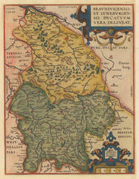
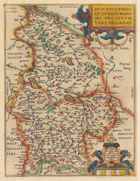
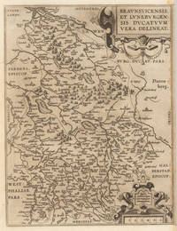
159535925Antwerpen: Platin 1595. In excellent condition. 31 x 235 cm 12.25 x 925 inches. Hand-Colored Original Copperplate Engraving by Abraham Ortelius depicting Braunsvicensis et Luneburgensis Ducatuum Vera Delineat. Published Antwerpen Platin 1595. Sheet: 31 x 235 cm 12.25 x 925 inches. A fine and original hand-colored example of Ortelius's celebrated cartographic work documenting this region of Germany with the precision and decorative artistry characteristic of the 15900s. Abraham Ortelius 1527-1598 was a Flemish cartographer and geographer from Antwerp widely regarded as the creator of the first modern atlas. His landmark publication Theatrum Orbis Terrarum 1570 set the standard for atlas-making for the next century presenting uniform copper-engraved maps with scholarly commentary. By Ortelius's death the Theatrum had appeared in 25 editions in seven languages. In 1575 King Philip II of Spain appointed him Royal Geographer. His maps engraved with extraordinary precision are among the most sought-after in antique cartography held in collections including the Plantin-Moretus Museum in Antwerp the Library of Congress and the British Library.This original copperplate engraving with original hand coloring depicts the region of Braunsvicensis et Luneburgensis Ducatuum Vera Delineat. published in Antwerpen Platin 1595. The map features a decorative Baroque cartouche containing the title inscription. A distance scale is incorporated within the cartouche or alongside it. The map records the political and geographic boundaries of the region as understood in 1595 offering a fascinating window into the history of German territorial organization. Sheet measures 31 x 235 cm 12.25 x 925 inches. In good condition overall with minor signs of age appropriate for a 16th-century engraving. Ready to frame. Broe. 99 Latin text Koeman Ort 28 & 29. Platin unknown
159535923Antwerpen: Platin 1595. In excellent condition. 31 x 235 cm 12.25 x 925 inches. Hand-Colored Original Copperplate Engraving by Abraham Ortelius depicting Braunsvicensis et Luneburgensis Ducatuum Vera Delineat. Published Antwerpen Platin 1595. Sheet: 31 x 235 cm 12.25 x 925 inches. A fine and original hand-colored example of Ortelius's celebrated cartographic work documenting this region of Germany with the precision and decorative artistry characteristic of the 15900s. Abraham Ortelius 1527-1598 was a Flemish cartographer and geographer from Antwerp widely regarded as the creator of the first modern atlas. His landmark publication Theatrum Orbis Terrarum 1570 set the standard for atlas-making for the next century presenting uniform copper-engraved maps with scholarly commentary. By Ortelius's death the Theatrum had appeared in 25 editions in seven languages. In 1575 King Philip II of Spain appointed him Royal Geographer. His maps engraved with extraordinary precision are among the most sought-after in antique cartography held in collections including the Plantin-Moretus Museum in Antwerp the Library of Congress and the British Library.This original copperplate engraving with original hand coloring depicts the region of Braunsvicensis et Luneburgensis Ducatuum Vera Delineat. published in Antwerpen Platin 1595. The map features a decorative Baroque cartouche containing the title inscription. A distance scale is incorporated within the cartouche or alongside it. The map records the political and geographic boundaries of the region as understood in 1595 offering a fascinating window into the history of German territorial organization. Sheet measures 31 x 235 cm 12.25 x 925 inches. In good condition overall with minor signs of age appropriate for a 16th-century engraving. Ready to frame. Broe. 99 Latin text Koeman Ort 28 & 29. Platin unknown
159835926Antwerpen: Platin 1598. In very good condition. 31 x 235 cm 12.25 x 925 inches. Hand-Colored Original Copperplate Engraving by Abraham Ortelius depicting Braunsvicensis et Luneburgensis Ducatuum Vera Delineat. Published Antwerpen Platin 1598. Sheet: 31 x 235 cm 12.25 x 925 inches. A fine and original hand-colored example of Ortelius's celebrated cartographic work documenting this region of Germany with the precision and decorative artistry characteristic of the 15900s. Abraham Ortelius 1527-1598 was a Flemish cartographer and geographer from Antwerp widely regarded as the creator of the first modern atlas. His landmark publication Theatrum Orbis Terrarum 1570 set the standard for atlas-making for the next century presenting uniform copper-engraved maps with scholarly commentary. By Ortelius's death the Theatrum had appeared in 25 editions in seven languages. In 1575 King Philip II of Spain appointed him Royal Geographer. His maps engraved with extraordinary precision are among the most sought-after in antique cartography held in collections including the Plantin-Moretus Museum in Antwerp the Library of Congress and the British Library.This original copperplate engraving with original hand coloring depicts the region of Braunsvicensis et Luneburgensis Ducatuum Vera Delineat. published in Antwerpen Platin 1598. The map features a decorative Baroque cartouche containing the title inscription. A distance scale is incorporated within the cartouche or alongside it. The map records the political and geographic boundaries of the region as understood in 1598 offering a fascinating window into the history of German territorial organization. Sheet measures 31 x 235 cm 12.25 x 925 inches. In good condition overall with minor signs of age appropriate for a 16th-century engraving. Ready to frame. Broe. 99 French text; Koeman Ort 31; Platin unknown
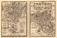
15958222Antwerp Plantin-Moretus 1595. Copper engraving 31 x 47.5 cms modern hand-colour Latin text on verso. Two maps on one sheet the Duchy of Brunswick-Lüneburg and the environs of Nuremberg.Van den Broecke 99a.1/99b.2 Map unknown
157430110Antwerpen: Platin 1574. Other. In very good to exellent condition. 310 by 220mm 12 by 8 inches. Hand-Colored Original Copperplate Engraving by Abraham Ortelius depicting Buchauiae siue Fuldensis Ditonis Tyous. Wolfgango Regr: will auc tore. 1574. Published Antwerpen Platin 1574. Sheet: 310 by 220mm 12 by 8 inches. A fine and original hand-colored example of Ortelius's celebrated cartographic work documenting this region of Germany with the precision and decorative artistry characteristic of the 15700s. Abraham Ortelius 1527-1598 was a Flemish cartographer and geographer from Antwerp widely regarded as the creator of the first modern atlas. His landmark publication Theatrum Orbis Terrarum 1570 set the standard for atlas-making for the next century presenting uniform copper-engraved maps with scholarly commentary. By Ortelius's death the Theatrum had appeared in 25 editions in seven languages. In 1575 King Philip II of Spain appointed him Royal Geographer. His maps engraved with extraordinary precision are among the most sought-after in antique cartography held in collections including the Plantin-Moretus Museum in Antwerp the Library of Congress and the British Library.This original copperplate engraving with original hand coloring depicts the region of Buchauiae siue Fuldensis Ditonis Tyous. Wolfgango Regr: will auc tore. 1574. published in Antwerpen Platin 1574. The map records the political and geographic boundaries of the region as understood in 1574 offering a fascinating window into the history of German territorial organization. Sheet measures 310 by 220mm 12 by 8 inches. In good condition overall with minor signs of age appropriate for a 16th-century engraving. Ready to frame. Platin unknown
159816878Antwerp: Christopher Platin 1598. Other. A very good example in excellent condition. 332 by 4850mm 13 by 191 inches. Original copper engraving published 1598 in a French edition of the Theatrum Orbis Terrarum. Finely hand-colored in wash and outline. There are three maps on one plate each showing a title cartouche. Villages and towns are shown as miniature views. Ortelius was born on 14 April 1527 in the city of Antwerp which was then in the Habsburg Netherlands modern-day Belgium. The Orthellius family were originally from Augsburg a Free imperial city of the Holy Roman Empire. In 1535 the family had fallen under suspicion of Protestantism. Following the death of Ortelius's father his uncle Jacobus van Meteren returned from religious exile in England to take care of Ortelius. Abraham remained close to his cousin Emanuel van Meteren who would later moved to London. In 1575 he was appointed geographer to the king of Spain Philip II on the recommendation of Arias Montanus who vouched for his orthodoxy. He travelled extensively in Europe and is specifically known to have traveled throughout the Seventeen Provinces; in southern western northern and eastern Germany e.g. 1560 15751576; France 15591560; England and Ireland 1576; and Italy 1578 and perhaps twice or thrice between 1550 and 1558. Beginning as a map-engraver in 1547 he entered the Antwerp Guild of Saint Luke as an illuminator of maps. He supplemented his income trading in books prints and maps and his journeys included yearly visits to the Frankfurt book and print fair where he met Gerardus Mercator in 1554. In 1560 however when travelling with Mercator to Trier Lorraine and Poitiers he seems to have been attracted largely by Mercator's influence towards the career of a scientific geographer. Wikipedia Broe. 143 Christopher Platin unknown
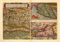
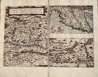
15848Antwerp: Abraham Ortelius 1584. 1584. Three maps on one sheet- Carinthiae measures 13 1/4 x 9 1/2 inches. Top right map 9 1/4 x 6 1/8 bottom right 9 1/4 x 6 inches. Overall with gutters 13 1/4 x 19. Very good with one tiny hole in Austrian map. Ortelius. Map is in very good condition with one tiny circular hole in the large map. Color is not contemporary. Overall the condition of this 440 year old map makes it suitable for framing. Abraham Ortelius unknown
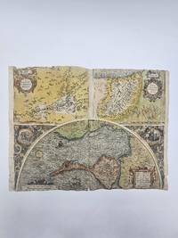
1584356976Abraham Ortelius. 1584. Poor condition numerous old repairs several closed tear affecting the image at the margins and the center fold. some dampstaining. 38.3x50.5 cm. Cadiz map engraved by Georg Hoefnagle. Image size: 38.8x48.7 cm. Latin text on verso Trimmed to the edges of the image at the top and bottom. Original hand coloring. weight: 0.1 lb. Abraham Ortelius. unknown
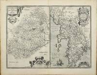
159511327Antwerp 1595. No binding. Very Good. 375 x 505 mm. in very good condition. Abraham Ortelius' map of two French regions. That on the left is the region of Le Mans with the city at the centre. On the right is Brittany and Normandy. The map was first published in the 'Additamentum' to Ortelius' 'Theatrum Orbis Terrarum' of 1595. This example with Spanish text on the verso is from the 1602 edition of the 'Theatrum'. The Le Mans is derived from a map by Matthaeus Ogerius in 1539. That of Brittany and Normandy from various sources but primarily Gerard Mercator's map of 1585. Van der Broecke cites also Bertrand d'Argentre's 1519-90 map of Brittany from 1588 and Lezin Guyet. This is an example of the first state. Abraham Ortelius 1527-98 developed an interest in cartography geography and history at an early age. He began as a 'kaarten afzetter' or illuminator of maps and would purchase single maps from booksellers and colour them for re-sale mounted on linen suitable for wall-hanging. At twenty he was entered in the Guild of St Luke at Antwerp. Ortelius travelled extensively in Europe and maintained regular correspondence with mapmakers historians and scientists acquiring information which was to form his greatest opus the 'Theatrum Orbis Terrarum'. What made the atlas stand out as the first modern atlas was its uniformity. They were produced in a similar style and none of the ancient Ptolemaic maps were included. The atlas was accompanied a catalogue of the authors whose source Ortelius had drawn upon in compiling the work. Without this list many cartographers of the day would remain unknown to us today. From its first appearance in 1570 the 'Theatrum' was far more comprehensive in scope than any contemporary work. In all over forty different editions were published with text in Latin Dutch German French Spanish English or Italian with the maps being frequently revised or replaced. By 1612 when the final edition was published the atlas contained no less than 128 maps. Provenance: private Jersey collection. Broecke 1996 37; Karrow 1993 1/188 & 189; Koeman 1967-70 Ort 28 no. 127. unknown
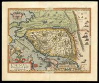
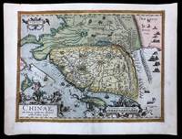
158415641Antwerp: Plantin Press 1584. 450 by 540mm. 17.75 by 21.25 inches. Engraved map with hand colour loss to top right margin skilfully reinstated. The earliest printed map to focus on China and the first to illustrate the Great Wall. It was the first western map of China drawn directly from the findings of the Portuguese mapmaker Luis Jorge de Barbuda or Ludovicus Georgius. Barbuda was a Jesuit and he made a manuscript map of China from information on the area gathered by the Jesuit mission. Arias Montanus passed this map on to Ortelius. He issued this first separately published map of China in 1584 which remained the standard map of China for over fifty years. The map is oriented to the west. Japan is shown on a curved projection borrowing from Portuguese sources. Wind wagons are shown in the north a Chinese invention that also became popular in the Low Countries. The text on the reverse of the map is in Latin and gives an insight into the climate national features inhabitants and economy of China at that time. Abraham Ortelius is one of the most famous of the early mapmakers and publishers. His 'Atlas of the Whole World' 'Theatrum Orbis Terrarum' was first published in 1570 the first uniformly sized systematic collection of maps and hence can be called the first 'Atlas'. These beautiful maps were elegantly engraved by Frans Hogenberg. Plantin Press], unknown
158415208Antwerp: Plantin Press 1584 1595. 440 by 550mm. 17.25 by 21.75 inches. Hand-coloured engraved map with fine original colour. The earliest printed map to focus on China and the first to illustrate the Great Wall. It was the first western map of China drawn directly from the findings of the Portuguese mapmaker Luis Jorge de Barbuda or Ludovicus Georgius. Barbuda was a Jesuit and he made a manuscript map of China from information on the area gathered by the Jesuit mission. Arias Montanus passed this map on to Ortelius. He issued this first separately published map of China in 1584 which remained the standard map of China for over fifty years. The map is oriented to the west. Japan is shown on a curved projection borrowing from Portuguese sources. Wind wagons are shown in the north a Chinese invention that also became popular in the Low Countries. The text on the reverse of the map is in Latin and gives an insight into the climate national features inhabitants and economy of China at that time. Abraham Ortelius is one of the most famous of the early mapmakers and publishers. His 'Atlas of the Whole World' 'Theatrum Orbis Terrarum' was first published in 1570 the first uniformly sized systematic collection of maps and hence can be called the first 'Atlas'. These beautiful maps were elegantly engraved by Frans Hogenberg. Plantin Press], unknown
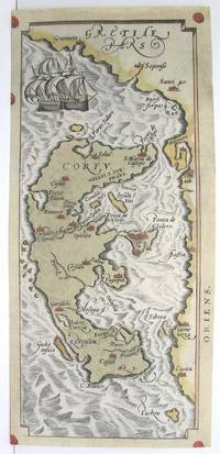
1590M3046Antwerp 1590. Very Good; left and lower margins extended. Size : 233x100 mm 9.125x3.875 Inches Coloring: Original Hand Coloring Category: ; Maps Europe Greece Macedonia unknown
1587239611Antwerp: Abraham Ortelius 1587. unbound. Map. Uncolored engraving. Image measures 14" x 19.5".<br/> <br/> These two maps on one sheet detail areas of western Mexico above and the Greater Antilles below. Ortelius created them from information compiled by other mapmakers such as Mercator Guttierez and Alsons de Sata Cruz. These sources allowed him to include a wealth of detailed information that is mostly if not entirely accurate. Above the map of western Mexico shows the area around Culiacan and the Spanish settlement of Villa S. Michaels which was notable in the period for its silver mines. It begins at the Yucatan and extends through the Cayman Magnus and the Caymanes. The map below illustrates the Greater Antilles including Cuba Hispaniola Jamaica St. Jois Insula St. Johns the Bahamas Virgin Islands and the Windward Islands all in impressive detail. The section of South Florida also shows suggestion of the Florida Keys which was uncommon for these period. A notable error is that the Tropic of Cancer is labelled as the Tropic of Capricorn. A highly decorative note with strapwork and foliage fills the acific Ocean to the left of Mexico and provides information about the upper map. The lower map also has a framed cartouche with birds perched atop it. Two ship illustrations float in the choppy seas around the islands. The map is a first state from the 1587 French edition of Ortelius's "Theatrum Orbis Terrarum." It is in good condition with no chips or tears. Stain at the center seam in the lower margin not affecting the image some overall stains. French text on verso. Abraham Ortelius 1527--1598 a Flemish cartographer and geographer is widely regarded as one of the important and influential cartographers in history. He is known for his "Theatrum Orbis Terrarum" which was the first modern atlas. This map is an uncommon uncolored example of this wonderful map by Ortelius.<br/> <br/> Abraham Ortelius unknown
1574M8062Belgium c.1574. Very Good. Size : 220x246 mm 8.66x9.69 Inches Coloring: Hand Colored Category: Maps Europe Poland Lithuania; unknown
15899903Antwerp Plantin 1589. Copper engraving 7.8 x 10.6 cm modern hand colour small wormhole top right Latin text on verso. Miniature map of Morocco. Koeman Atlantes Neerlandici Ort 53 Map unknown
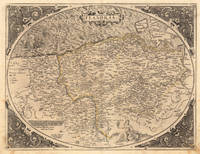
157221509Antwerpen: Platin 1572. Other. In excellent condition. 385 by 503mm 15 by 19 inches. Original antique copper engraving uncolored as published. This very decorative antique map shows Flanders from Greuelinge in the west to Brussels in the east and Schouwen in the north and Lens in the south. The corners of the oval map are engraved with the cardinal points. In the North Sea are 2 sailing ships that fire with cannons a decorative compass rose and a sea monster. The title is engraved in the center of a very nice cartoushe. Ortelius was born on 14 April 1527 in the city of Antwerp which was then in the Habsburg Netherlands modern-day Belgium. The Orthellius family were originally from Augsburg a Free imperial city of the Holy Roman Empire. In 1535 the family had fallen under suspicion of Protestantism. Following the death of Ortelius's father his uncle Jacobus van Meteren returned from religious exile in England to take care of Ortelius. Abraham remained close to his cousin Emanuel van Meteren who would later moved to London. In 1575 he was appointed geographer to the king of Spain Philip II on the recommendation of Arias Montanus who vouched for his orthodoxy. He travelled extensively in Europe and is specifically known to have traveled throughout the Seventeen Provinces; in southern western northern and eastern Germany e.g. 1560 15751576; France 15591560; England and Ireland 1576; and Italy 1578 and perhaps twice or thrice between 1550 and 1558. Beginning as a map-engraver in 1547 he entered the Antwerp Guild of Saint Luke as an illuminator of maps. He supplemented his income trading in books prints and maps and his journeys included yearly visits to the Frankfurt book and print fair where he met Gerardus Mercator in 1554. In 1560 however when travelling with Mercator to Trier Lorraine and Poitiers he seems to have been attracted largely by Mercator's influence towards the career of a scientific geographer. Wikipedia Platin unknown
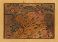
15791444c.1579. 15-3/4" x 19-3/4"- 40 x 50.1 cm. . Copper engraved map with original hand colouring. Laid down on board. An attractive map of Friesland and Groningen with inset of ancient Friesland. Abraham Ortelius 1527-1598 was a prominent Flemish cartographer who produced the first world atlas "Theatrum Orbis Terrarum" in 1570. This map was based on an earlier manuscript map by Sibrandus Leo whose name is featured in the title. unknown
158819751Antwerpen: Platin 1588. Other. In very good condition verso skilfully reinforced with thin Japan paper due to the old oxidation of the colors. Else a very good example. 308 by 442mm 12 by 17 inches. Hand-Colored Original Copperplate Engraving by Abraham Ortelius depicting Frisiae Orientalis Descriptio. Published Antwerpen Platin 1588. Sheet: 308 by 442mm 12 by 17 inches. A fine and original hand-colored example of Ortelius's celebrated cartographic work documenting this region of Germany with the precision and decorative artistry characteristic of the 15800s. Abraham Ortelius 1527-1598 was a Flemish cartographer and geographer from Antwerp widely regarded as the creator of the first modern atlas. His landmark publication Theatrum Orbis Terrarum 1570 set the standard for atlas-making for the next century presenting uniform copper-engraved maps with scholarly commentary. By Ortelius's death the Theatrum had appeared in 25 editions in seven languages. In 1575 King Philip II of Spain appointed him Royal Geographer. His maps engraved with extraordinary precision are among the most sought-after in antique cartography held in collections including the Plantin-Moretus Museum in Antwerp the Library of Congress and the British Library.This original copperplate engraving with original hand coloring depicts the region of Frisiae Orientalis Descriptio. published in Antwerpen Platin 1588. The map records the political and geographic boundaries of the region as understood in 1588 offering a fascinating window into the history of German territorial organization. Sheet measures 308 by 442mm 12 by 17 inches. In good condition overall with minor signs of age appropriate for a 16th-century engraving. Ready to frame. Broe. 82 Platin unknown
159821946Antwerpen 1598. Other. A strong impression in excellent condition. 370 by 500mm 14 by 19 inches. Original antique copper engraving published 1598 in a French text edition of the " Theatrum Orbis Terrarum. Decorative map of Ortelius" first plate covering Gelderland. Based on Christiaan Sgrothen" s map of 1567 and is richly engraved with fine detail particularly along the rivers. The map is oriented with north to the left with ribbon cartouches marking the cardinal directions. Two ships sail in the Zuyder Zee and a decorative cartouche with flowers and birds. Ortelius was born on 14 April 1527 in the city of Antwerp which was then in the Habsburg Netherlands modern-day Belgium. The Orthellius family were originally from Augsburg a Free imperial city of the Holy Roman Empire. In 1535 the family had fallen under suspicion of Protestantism. Following the death of Ortelius's father his uncle Jacobus van Meteren returned from religious exile in England to take care of Ortelius. Abraham remained close to his cousin Emanuel van Meteren who would later moved to London. In 1575 he was appointed geographer to the king of Spain Philip II on the recommendation of Arias Montanus who vouched for his orthodoxy. He travelled extensively in Europe and is specifically known to have traveled throughout the Seventeen Provinces; in southern western northern and eastern Germany e.g. 1560 15751576; France 15591560; England and Ireland 1576; and Italy 1578 and perhaps twice or thrice between 1550 and 1558. Beginning as a map-engraver in 1547 he entered the Antwerp Guild of Saint Luke as an illuminator of maps. He supplemented his income trading in books prints and maps and his journeys included yearly visits to the Frankfurt book and print fair where he met Gerardus Mercator in 1554. In 1560 however when travelling with Mercator to Trier Lorraine and Poitiers he seems to have been attracted largely by Mercator's influence towards the career of a scientific geographer. Wikipedia unknown
157221923Antwerpen 1572 - 73. Other. In very good to excellent condition. 370 by 500mm 14 by 19 inches. Original antique copper engraving hand colored in outline when published. Decorative map of Ortelius" first plate covering Gelderland. Based on Christiaan Sgrothen" s map of 1567 and is richly engraved with fine detail particularly along the rivers. The map is oriented with north to the left with ribbon cartouches marking the cardinal directions. Two ships sail in the Zuyder Zee and a decorative cartouche with flowers and birds. Ortelius was born on 14 April 1527 in the city of Antwerp which was then in the Habsburg Netherlands modern-day Belgium. The Orthellius family were originally from Augsburg a Free imperial city of the Holy Roman Empire. In 1535 the family had fallen under suspicion of Protestantism. Following the death of Ortelius's father his uncle Jacobus van Meteren returned from religious exile in England to take care of Ortelius. Abraham remained close to his cousin Emanuel van Meteren who would later moved to London. In 1575 he was appointed geographer to the king of Spain Philip II on the recommendation of Arias Montanus who vouched for his orthodoxy. He travelled extensively in Europe and is specifically known to have traveled throughout the Seventeen Provinces; in southern western northern and eastern Germany e.g. 1560 15751576; France 15591560; England and Ireland 1576; and Italy 1578 and perhaps twice or thrice between 1550 and 1558. Beginning as a map-engraver in 1547 he entered the Antwerp Guild of Saint Luke as an illuminator of maps. He supplemented his income trading in books prints and maps and his journeys included yearly visits to the Frankfurt book and print fair where he met Gerardus Mercator in 1554. In 1560 however when travelling with Mercator to Trier Lorraine and Poitiers he seems to have been attracted largely by Mercator's influence towards the career of a scientific geographer. Wikipedia Koe. Ort 1C / 15. Broe. 61. 1 of 2. unknown
15957641Antwerp Plantin-Moretus 1595. Copper engraving 36.5 x 51 cms black and white Latin text on verso. First published in the 1570 edition of the Theatrum Christiaan Sgrothen is cited as the principal source. Ortelius's Theatrum Orbis Terrarum is generally considered the first modern atlas of the world originally published in 1570. Ortelius gathered the best available cartographic knowledge and presented it in a consistent style in a single volume with text. The Theatrum was very decorative and hugely popular amongst the wealthy and educated running into over forty editions in Latin and the major European languages. Van den Broecke 56 Map unknown
1584M1477Antwerp 1584. Excellent; upper margin extended. Notes: Note: This is one of the three maps of the large double-sheet Ortelius "La Florida Auctore Hieron. Chiaues. / Gvastecan Reg. / Pervviae Auriferae Regionis Typus. Didaco Mendezio Auctore." It has been seperated from the larger map. Note that the reference listed is for the double-sheet map.<br><br>"Published in editions of Theatrum Orbis Terrarum from 1854 onwards A. Ortelius here shows the three main areas of Spanish Colonial Interest in America in the 16th century: Florida Guasteca and the gold rich regions in Peru. The anonymous map of Guasteca continues the coastline of the gulf of Mexico to the south of the riode las Palmas." John Goss Size : 170x220 mm 6.75x8.625 Inches Coloring: Hand Colored Reference: Reference: Goss Map 13 Category: Maps Central America Mexico unknown