95 résultats
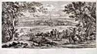
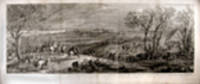
168515007Paris: distribuë par l'Auteur en l'Hostel des Manufactures des Gobelins et en la rue St.Jacques 1685. Copper engraving on two joined sheets by Van Huctenburg and A.F. Baudouinst after Van der Meulen. Titled in French and Latin. Painted from life by the artist who accompanied Louis XIV on his campaigns Adam Frans Van der Meulen depicted in this wonderful panorama a post-battle view of Dôle the capital of Franche-Comté and the handsome surrounding region. In it Louis XIV and his brother survey the city they've won from a hilltop. There is actually no unpleasant evidence of military activity except for some smoke billowing from the far side of Dôle. Adam Frans Van der Meulen was a landscape and genre painter who specialized in battle scenes and his early works i.e. those from the years before he left for Paris the earliest dated work is from 1653 are mainly cavalry skirmishes in the manner of his teacher Pieter Snayer. After he moved to Paris the character of his work changed and became more ceremonial. He now specialized in large topographical views and military scenes and in royal journeys processions and receptions. His most important task was to accompany the king on his many campaigns during the wars of conquest waged in the 1660s and 1670s against inter alia the Spanish Netherlands and as Peintre de conquêtes du roi officially to portray the memorable sieges battles and conquests of le Roi Soleil in large-scale canvases or cartoons which were later transformed into tapestries. Van der Meulen was born in Brussels in 1632. In 1646 he was apprenticed to the battle painter Pieter Snayers. In 1651 he became a master in the Guild of St Luke in Brussels but by 1663 he had moved to Paris where he joined a group of Netherlandish artists associated with the French painter Charles Le Brun 1619-90 who not only was Premier peintre du roi but also from 1663 director of the Parisian tapestry manufactory Manufacture royale des Gobelins. Van der Meulen quickly became a protégé of Le Brun and on his recommendation Van der Meulen was appointed court painter to Louis XIV on 1 April 1664 and at the same time became Le Brun's collaborator in the tapestry manufactory. In 1673 he was accepted as a member of the Académie royale de Peinture et de Sculpture without any obligation to submit a morceau de réception; in 1681 he became conseiller and in 1686 premier conseiller. He died as a highly esteemed artist in the Hôtel des Gobelins 15 October 1690. distribuë par l'Auteur, en l'Hostel des Manufactures des Gobelins, et en la rue St.Jacques unknown books
168516903Paris: distribuë par l'Auteur en l'Hostel des Manufactures des Gobelins et en la rue St.Jacques 1685. Copper engraving on two joined sheets after Van der Meulen. Titled in French and Latin. In excellent condition. Some infill work along the bottom margin. Image size: 18 1/2 x 38 5/8 inches. A striking contemporary view of Gray in Franche-Comte by the celebrated court painter Van der Meulen.<br/> <br/>This fine view shows the town of Gray in Franche-Comte built on the banks of the Saône River. One of the most important trading towns in Franche-Comte the region became a possession of the Spanish Hapsburgs in 1556. Although some of the region's fortified towns were occupied by France during the Wars of Religion peace and prosperity continued until the advent of the Thirty Years War when the region was ravaged by both Catholics and Protestants. Louis XIV conquered Franche-Comté in 1668 and again in 1674 and finally obtained its cession from Spain. Van der Meulen's striking image depicts the king and his armies entering the town after they successfully re-conquered the region. Adam Frans Van der Meulen was a landscape and genre painter who specialized in battle scenes and his early works i.e. those from the years before he left for Paris the earliest dated work is from 1653 are mainly cavalry skirmishes in the manner of his teacher Pieter Snayer. After he moved to Paris the character of his work changed and became more ceremonial. He now specialized in large topographical views and military scenes and in royal journeys processions and receptions. His most important task was to accompany the king on his many campaigns during the wars of conquest waged in the 1660s and 1670s against inter alia the Spanish Netherlands and as Peintre de conquêtes du roi officially to portray the memorable sieges battles and conquests of le Roi Soleil in large-scale canvases or cartoons which were later transformed into tapestries. Van der Meulen was born in Brussels where he was baptized in 1632. In 1646 he was apprenticed to the battle painter Pieter Snayers. In 1651 he became a master in the Guild of St. Luke in Brussels but by 1663 he had moved to Paris where he joined a group of Netherlandish artists associated with the French painter Charles Le Brun 1619-90 who not only was Premier peintre du roi but also from 1663 director of the Parisian tapestry manufactory Manufacture royale des Gobelins. Van der Meulen quickly became a protégé of Le Brun and on his recommendation Van der Meulen was appointed court painter to Louis XIV on 1 April 1664 and at the same time became Le Brun's collaborator in the tapestry manufactory. In 1673 he was accepted as a member of the Académie royale de Peinture et de Sculpture without any obligation to submit a morceau de réception; in 1681 he became conseiller and in 1686 premier conseiller. He died as a highly esteemed artist in the Hôtel des Gobelins 15 October 1690. distribuë par l'Auteur, en l'Hostel des Manufactures des Gobelins, et en la rue St.Jacques unknown books
16853659Paris: distribuë par l'Auteur en l'Hostel des Manufactures des Gobelins et en la rue St.Jacques 1685. Copper engraving on two joined sheets by A.F. Baudouin with the figures by R. Bonnart after Van der Meulen. Titled in French and Latin. A fine view of the fortified town of Calais and its environs recalling king Louis XIV's gradual acquisition of territory on the Channel coast from 1667 onwards.<br/> <br/>This excellent panorama shows Calais as seen from the landward side looking across to the ramparts of the fortifications surrounding the town to the roofs of the town itself and then beyond to the sea. In the fore and mid-ground the French army of King Louis XIV moves forward towards the town this scene enlivened by Van der Meulen's portrayal of the stormy conditions: hats blow off cloaks are wrapped around peoples' heads foot soldiers lean into the wind. This sort of detail supports the statement in the imprint that the present scene was painted from life by Van der Meulen. Adam Frans Van der Meulen was a landscape and genre painter who specialized in battle scenes and his early works i.e. those from the years before he left for Paris the earliest dated work is from 1653 are mainly cavalry skirmishes in the manner of his teacher Pieter Snayer. After he moved to Paris the character of his work changed and became more ceremonial. He now specialized in large topographical views and military scenes and in royal journeys processions and receptions. His most important task was to accompany the king on his many campaigns during the wars of conquest waged in the 1660s and 1670s against inter alia the Spanish Netherlands and as Peintre de conquêtes du roi officially to portray the memorable sieges battles and conquests of le Roi Soleil in large-scale canvases or cartoons which were later transformed into tapestries. Van der Meulen was born in Brussels where he was baptised in 1632. In 1646 he was apprenticed to the battle painter Pieter Snayers. In 1651 he became a master in the Guild of St Luke in Brussels but by 1663 he had moved to Paris where he joined a group of Netherlandish artists associated with the French painter Charles Le Brun 1619-90 who not only was Premier peintre du roi but also from 1663 director of the Parisian tapestry manufactory Manufacture royale des Gobelins. Van der Meulen quickly became a protégé of Le Brun and on his recommendation Van der Meulen was appointed court painter to Louis XIV on 1 April 1664 and at the same time became Le Brun's collaborator in the tapestry manufactory. In 1673 he was accepted as a member of the Académie royale de Peinture et de Sculpture without any obligation to submit a morceau de réception; in 1681 he became conseiller and in 1686 premier conseiller. He died as a highly esteemed artist in the Hôtel des Gobelins 15 October 1690. distribuë par l'Auteur, en l'Hostel des Manufactures des Gobelins, et en la rue St.Jacques unknown books
168515007Paris: distribuë par l'Auteur en l'Hostel des Manufactures des Gobelins et en la rue St.Jacques 1685. Copper engraving on two joined sheets by Van Huctenburg and A.F. Baudouinst after Van der Meulen. Titled in French and Latin. Painted from life by the artist who accompanied Louis XIV on his campaigns Adam Frans Van der Meulen depicted in this wonderful panorama a post-battle view of Dôle the capital of Franche-Comté and the handsome surrounding region. In it Louis XIV and his brother survey the city they've won from a hilltop. There is actually no unpleasant evidence of military activity except for some smoke billowing from the far side of Dôle. Adam Frans Van der Meulen was a landscape and genre painter who specialized in battle scenes and his early works i.e. those from the years before he left for Paris the earliest dated work is from 1653 are mainly cavalry skirmishes in the manner of his teacher Pieter Snayer. After he moved to Paris the character of his work changed and became more ceremonial. He now specialized in large topographical views and military scenes and in royal journeys processions and receptions. His most important task was to accompany the king on his many campaigns during the wars of conquest waged in the 1660s and 1670s against inter alia the Spanish Netherlands and as Peintre de conquêtes du roi officially to portray the memorable sieges battles and conquests of le Roi Soleil in large-scale canvases or cartoons which were later transformed into tapestries. Van der Meulen was born in Brussels in 1632. In 1646 he was apprenticed to the battle painter Pieter Snayers. In 1651 he became a master in the Guild of St Luke in Brussels but by 1663 he had moved to Paris where he joined a group of Netherlandish artists associated with the French painter Charles Le Brun 1619-90 who not only was Premier peintre du roi but also from 1663 director of the Parisian tapestry manufactory Manufacture royale des Gobelins. Van der Meulen quickly became a protégé of Le Brun and on his recommendation Van der Meulen was appointed court painter to Louis XIV on 1 April 1664 and at the same time became Le Brun's collaborator in the tapestry manufactory. In 1673 he was accepted as a member of the Académie royale de Peinture et de Sculpture without any obligation to submit a morceau de réception; in 1681 he became conseiller and in 1686 premier conseiller. He died as a highly esteemed artist in the Hôtel des Gobelins 15 October 1690. distribuë par l'Auteur, en l'Hostel des Manufactures des Gobelins, et en la rue St.Jacques unknown
16853659Paris: distribuë par l'Auteur en l'Hostel des Manufactures des Gobelins et en la rue St.Jacques 1685. Copper engraving on two joined sheets by A.F. Baudouin with the figures by R. Bonnart after Van der Meulen. Titled in French and Latin. A fine view of the fortified town of Calais and its environs recalling king Louis XIV's gradual acquisition of territory on the Channel coast from 1667 onwards.<br/> <br/> This excellent panorama shows Calais as seen from the landward side looking across to the ramparts of the fortifications surrounding the town to the roofs of the town itself and then beyond to the sea. In the fore and mid-ground the French army of King Louis XIV moves forward towards the town this scene enlivened by Van der Meulen's portrayal of the stormy conditions: hats blow off cloaks are wrapped around peoples' heads foot soldiers lean into the wind. This sort of detail supports the statement in the imprint that the present scene was painted from life by Van der Meulen. Adam Frans Van der Meulen was a landscape and genre painter who specialized in battle scenes and his early works i.e. those from the years before he left for Paris the earliest dated work is from 1653 are mainly cavalry skirmishes in the manner of his teacher Pieter Snayer. After he moved to Paris the character of his work changed and became more ceremonial. He now specialized in large topographical views and military scenes and in royal journeys processions and receptions. His most important task was to accompany the king on his many campaigns during the wars of conquest waged in the 1660s and 1670s against inter alia the Spanish Netherlands and as Peintre de conquêtes du roi officially to portray the memorable sieges battles and conquests of le Roi Soleil in large-scale canvases or cartoons which were later transformed into tapestries. Van der Meulen was born in Brussels where he was baptised in 1632. In 1646 he was apprenticed to the battle painter Pieter Snayers. In 1651 he became a master in the Guild of St Luke in Brussels but by 1663 he had moved to Paris where he joined a group of Netherlandish artists associated with the French painter Charles Le Brun 1619-90 who not only was Premier peintre du roi but also from 1663 director of the Parisian tapestry manufactory Manufacture royale des Gobelins. Van der Meulen quickly became a protégé of Le Brun and on his recommendation Van der Meulen was appointed court painter to Louis XIV on 1 April 1664 and at the same time became Le Brun's collaborator in the tapestry manufactory. In 1673 he was accepted as a member of the Académie royale de Peinture et de Sculpture without any obligation to submit a morceau de réception; in 1681 he became conseiller and in 1686 premier conseiller. He died as a highly esteemed artist in the Hôtel des Gobelins 15 October 1690. distribuë par l'Auteur, en l'Hostel des Manufactures des Gobelins, et en la rue St.Jacques unknown
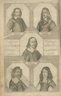
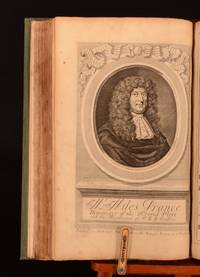
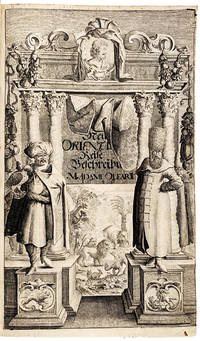
1669ABE-EBAY-205728107208London: John Starkey and Thomas Basset 1669. Hardcover. Good. The Voyages and Travells of the Ambassadors Sent by Frederick Duke of Holstein to the Great Duke of Muscovy and the King of Persia. Begun in the year 1633 and finish'd in 1639. Containing a Compleat History of Muscovy Tartary Persia. And other adjacent Countries. With several Publick Transactions reaching near the Present Times; in seven books. Written originally by Adam Olearius Secretary to the Embassy. Faithfully rendred into English by John Davies of Kidwelly. The Second Edition Corrected. London: Printed for John Starkey and Thomas Basset 1669. whereto are added. The Voyages and Travels of J. Albert de Mandelslo A Gentleman belonging to the Embassy sent by the Duke of Holstein to the great Duke of Muscovy and the King of Persia into the East-Indies. Begun in the year 1638 and finish'd in 1640. Containing a particular description of the great Mogul's Empire the Kingdoms of Decan Calicuth Cochim Zeilon Coromandel Pegu Siam Cambodia Malacca Summatra Java Amboina Banda the Moluccas Philippine and other Islands Japan the Great Kingdom of China the Cape of Good Hope Madagascar &c. In three books. Illustrated with Maps and Figures. Rendred into English by John Davies of Kidwelly. The Second Edition Corrected. London: J. Starkey and T. Basset 1669. Misbound with the title page and a preliminary leaf from the second volume bound at front and the title page and prelims from the first volume fronting the second volume. The pages are all there but here the order is two leaves 316pp eleven leaves 232pp. five leaves. The book has been rebacked in modern times and given the title ""Mandelslo's Voyages"" - so perhaps the owner was more interested in the Mandelslo content! Has 3 of the 6 maps. Present are the Baltic map showing present day Lithuania Latvia and Estonia; the map of Persia showing the wider Middle East / Southwest Asia; and the map of the Persian province of Kilan on the Caspian. The frontispiece the two portraits and the in-text Cyrillic chart are also present. Absent are the map of the East Indies; the map of Muscovy; and the map of the Volga. Boards worn and chipped. Pages have yellowing foxing stains smudges creases small tears; there is a small ink margin stain affecting a number of pages in the first volume; there is some top-corner dampstain occasional and marginal in the first volume growing more pronounced towards the end of the second volume and intruding somewhat from the margin on a number of leaves. There are several tears reaching into the text without loss one involving a flap; there is a rust hole obliterating several letters on either side; one leaf is torn halfway up at the hinge. Two facing pages have a long note in the margin in an old hand; an old ownership marking to the reverse of the frontispiece has been scribbled over; the Mandelslo title page has a small modern marking in pen. The Middle East map has a slight hole worn at the center of one of the folds. Good condition. John Starkey and Thomas Basset hardcover
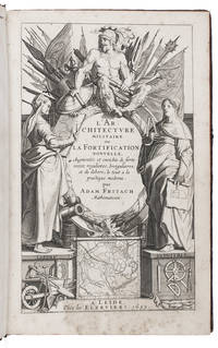
1635I44CZ6VY8TIKLeiden 1635. Folio. Abraham and Bonaventura Elzevier Mottled tanned sheepskin ca. 1730 straight-sewn on 6 cords gold-tooled spine with morocco label gold-tooled board edges curl-marbled endpapers red edges headbands in blue and white. With an integral engraved title page with 3 allegorical figures of Ares/Mars Labore and Industria military surveying and building attributes and a fortification plan divisional titles for the second and third livre 35 double-page engraved illustration plates lettered A-Mm containing 185 numbered figures 8 double-page letterpress tables labelled I-VII and Table du profil woodcut headpieces and decorated initials 1 series. Set in roman and italic types with incidental textura and fraktur. With 2 figures in the plates coloured by an early hand. 8 179 1 blank pp. First French edition of the best most detailed best illustrated and most influential handbook of fortification from the Dutch golden age and an ambitious piece of book production from the golden age of the Elzeviers' printing office. Besides numerous fortification plans and views the plates show for example bridges tools for digging construction and demolition and a horse-powered Archimedes's screw for pumping water while three plates show the arrangement of troops' quarters in camp. While some of the fortification plans are theoretical others show the fortifications of cities of the Low Countries and Rheinland during the Eighty Years' War. The text is divided into three "books" the first covering the origins development and most recent Dutch improvements in the art of fortification the second systematically presenting the various forms of fortification and the third on offensive and defensive tactics of siege warfare. Together with the excellent plates it gives remarkable insight into the working techniques and tools of fortification building ca. 1630. The lexicon gives terminology for fortification and related fields in French German Dutch and Latin and remains an essential source on the subject.With two small drawings an occasional manuscript note some underlining and a bookplate. With some foxing in the engraved title-page and a few other leaves occasional mostly marginal stains and minor browning but otherwise in good condition. With superficial damage to the boards and worming slightly affecting the boards and badly damaging the backstrip which has been restored at the head and foot. First French edition of the most influential fortification manual of its day probably more widely read than the German original.l Berghman Cat. rais. Elzeviriennes 651; Jähns II 117; Jordan Bibl. Gesch. Festungsbaues 1301 4 copies; Rahir 417; Sloos Warfare 8022; STCN 3 copies; Willems 425; for Freitag: www.presseforschung.uni-bremen.de/dokuwiki/doku.phpid=freitag_adam. hardcover
16699791London: John Starkey and Thomas Basset 1669. 2nd revised English. Half morocco. Very good. Folio. 2 parts in 1 each separately paginated with separate title-pages. Note: in this copy the title page for Mandelslo appears first in error. 6316;2223210pp. Complete with an added engraved title with 5 portraits 2 separate engraved portraits and a total of 6 folding or double-page maps. In this copy the very large folding map of the Volga River found at p. 112 has been divided in two the second half bound at p. 126 with a slight loss at the fold where they were divided. Engraved table of the Ruthenian alphabet in text. 19th century brown morocco spine over old marbled boards rubbed. Small chip at the top of spine otherwise an attractive copy. This is an odd copy quite complete but with certain preliminaries for the first part bound at front of the second part. The second edition revised of the English translation first published in 1662 made from a 1659 version in French. It contains material not found in the original German edition of 1656 and 1658. An important account of Central Asia including Persia and Russia and the East Indies. The Duke of Holstein's embassies were to negotiate trade. See Cox's THE LITERATURE OF TRAVEL Vol. 1 pp. 249 and 271 for more details. Wing O270. John Starkey and Thomas Basset unknown books
166928698London: Printed for John Starkey and Thomas Basset 1669 1669. Second edition in English preceded by the edition of 1662. ESTC R30756; Wing O270; Cox Literature of Travel I page 249. Several of the maps have paper repairs at the folds and in the margins; the third map of the River Volga is a little darkened at the edges and dust-soiled; the two leaves Q4 & R1 adjacent to that map are also a little darkened and dust-soiled; one clean tear to a leaf without loss; very good copy. Folio in fours contemporary mottled calf rebacked red morocco spine label blind rules and gilt lettering. Frontispiece six folding maps two portraits and one engraved Cyrillic alphabet in the text. In 1634 Frederick III of Holstein-Gottorp present day Denmark and Germany sent an expedition with Adam Olearus 1603-1671 as its secretary from Hamburg to Moscow in an attempt to establish commercial relations with Russia which failed. Undeterred Frederick sent a similar expedition to Persia in 1636 also with Adam Olearius as secretary The first part of this work is the first English translation by John Davies of Olearius' detailed account of those expeditions in its second edition. The second part contains the account by German adventurer Johan Albrecht de Mandelslo 1616-1644 of his departure from Frederick's mission to Persia and continuation on to India China Japan and Formosa also translated by Davies from Olearius' posthumous editing and publication of that travelogue. Though trade missions generally make for dull reading Olearius' narrative is quite engaging with details and anecdotes about the people and places they encountered. Typical of his observations is one about the Russians: "There is no place in the World where drunkenness is more common than in Muscovy . . . Ecclesiastics and laicks Men and Women Old and Young will drink strong water at any time before at and after their meals . . . will drink of it till they lye down and many times die in the place." From the library of John Evelyn with the Evelyn book label "JE" on the front paste-down. Early marginal notes in Mandelslo's adventures though not in Evelyn's hand alas. London: Printed for John Starkey and Thomas Basset, 1669 unknown
1634006-A1634. Radierung, 1634, auf Bütten. 10,8:17,2 cm. Literatur: Robert-Dumesnil 3, I (von III); Blum 8, I (von III); Russell 1982, Nr. 18, I (von III). Prachtvoller und kräftiger Druck vor der Nummer und der Beschädigung der rechten unteren Plattenecke. Mit feinem Rändchen um die Plattenkante. - Bis auf eine dünne Stelle links oben und Reste alter Hinterklebung verso am Oberrand ausgezeichnet und frisch erhalten. Eines der wenigen Nachtstücke im 43 Blatt umfassenden graphischen Werk des Künstlers, das, wie man weiß, von der Landschaftsmalerei A. Elsheimers (1578-1610) beeinflußt ist.
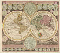
170030095Amsterdam: Petrus Schenk 1700. Other. A very skillfull small restauration in the paper at the upper part of the centre fold of the map towards the blank margins and just touching the engraved border of the round celestial map. The map is overall in very good to excellent condition. A very skillfull small restauration in the paper at the upper part of the centre fold of the map towards the blank margins and just touching the engraved border of the round celestial map. The map is overall in very good to excellent condition. 50.3 x 576 cm 19.75 x 2275 inches. Copper engraving hand colored in outline and wash when published. Adam Friedrich Zürner produced this interesting and detailed world map for Petrus Schenk. Depicted is a fine double hemisphere world map which is decorated with landscape in the background and two smaller double hemisphere celestial maps of the southern and northern hemisphere. In the upper section of the map are further 12 small celestial and terrestial circular maps in the lower section a small engravingSystema Copernici and another one with the phases of the moonPhases Lunae at the very bottom another 12 engraved small round astronomical diagrams. The two hemispheres are cartographically up-to-date and show the routes of explorers including Magellan Dampier Tasman Gaetani and Chaumont. Nova Britannia an island separately adjacent from New Guinea is shown with an inscription saying that it was discovered by Dampier in 1700 Shirley. Shirley 639 Petrus Schenk unknown
1699NF2821RELATION DU VOYAGE DE MR. EVERT ISBRAND ENVOYE DE SA MAJESTE CZARIENNE A L'EMPEREUR DE LA CHINE EN 1692 93 & 94 Amsterdam Chez Jean-Louis De Lorme Librairie fur le Rockin a la Liberte 1699 first edition 250 pages with both frontispiece and map present some wear to the fore edge corner tips else a vg copy with just about fine contents void of any foxing whatsoever with attractive marbled end-papers bound in a full leather 19th century calf binding with faux raised spine of six compartments one of which is decorative and one which bears the title. A most uncommon work this volume with a bookplate and a handust-wrapper ritten pencil notation that this is from the library of the Duke of Devonshire. Text in French of course. Chez Jean-Louis De Lorme, Librairie fur le Rockin, a la Liberte hardcover
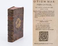
161431198AB1614. Herbornæ Nassoviorum Herborn 1614. Octavo. 16 423 p. Hardcover / Original very decorative 17th century binding in full leather with coat of arms supralibro of Danish Statesman and Diplomat Adam Gottlob Moltke to boards. Binding with some minor cracks to spine but still holding boards slightly rubbed and partially with minor loss to leather but with the original spine-label intact and the binding overall still in splendid glory / Extrem seltene Publikation des Wetteraner Mediziners Johannes Pincier Professor in Herborn und Marburg sowie Leibarzt in Dillenburg und Braunfels. Aus der Bibliothek des dänischen Oberhofmarschalls am Hof in Kopenhagen Adam Gottlob Moltke 1710 - 1791. Lenz / Müller-Jahncke p. 198 Wetteraner Mediziner des 16.Jahrhunderts: "Das Werk stellt eine Uebersicht ueber die Anatomie des menschlichen Koerpers in lateinischen Hexametern dar." / Allgemeine Deutsche Biographie 26 1888 S. 148-149 Online-Version hardcover
1700000819Boston Massachusetts MA 1700. On offer is a superb and important piece of Americana specifically a handwritten deed concerning the very important geographic area of Fort Warren which defends the harbor in Boston Massachusetts and has done so from 1861 through the end of World War II. To buffs of the Civil War it was also the location where the famous Union marching anthem 'John Brown' was written using a tune from an old Methodist camp song 'Glory Glory Hallelujah!' and signed by Isaac Addington who served on the Salem Witch Trial Grand Jury and Adam Winthrop the son of John Winthrop First Governor of Massachusetts. John Winthrop 1588-1649 is perhaps best remembered for the famous sermon in which he likened the Massachusetts Bay Colony to a 'city upon a hill' a model to the world of social and religious order." Ref: Wikipedia. This manuscript document is dated Boston 27 Dec 1700. Folded into thirds Calligraphic initials. SIGNED BY ADAM WINTHROP son of John Winthrop First Governor of Massachusetts and ISAAC ADDINGTON clerk of the Grand Jury during the Salem Witch Trials. This is the original deed referenced by Holmes Abiel 1763-1837. Cambridge : Hilliard and Brown 1829. from the Coll. Mass. HiM. Soc. iii. 299. which states: "In 1700 Adam conveyed the island to his son-in-law and daughter to be transmitted to their descendants. The Indenture handsomely written on parchment is now before me. It covenants and grants the island to "John Wainwright and to Ann his wife during the term of their natural lives and afterward to the use and behoof of the heires of their two body. begotten or to be begotten forever." The island was next owned by their son John Winthrop Professor of Mathematics and Natural Philosophy In Harvard College; and next by his sons Hines and William of Cambridge lately deceased. James purchased of William his share and a few years since sold to the United States about five acres in two parcels at the east and west end of the island with a passage way rota the one to the other for the purpose of fortifications. On the west end has been erected Fort Warren which defends the entrance of the harbour." CONDITION: signatures are strong and legible majority of the deed legible though with age-wear sometimes serious rubbing and fading discoloration some holes; certainly not in the presumed fine condition when Abiel Holmes held the document in 1829 but certainly very presentable with the red wax seal still intact. This document is a wonderful tapestry comprised of the strands of early Colonial history. Inherited by his son Adam it links the famous Winthrop name from his namesake Grandfather Adam Winthrop 1548-1623 an English lawyer and famous Puritan reformer in the Elizabethan and Jacobean periods through his great grandson Professor John Winthrop who was intimately connected to Harvard University's early history. The document is also witnessed and signed by Isaac Addington the first Secretary of the Mass. Bay Colony from 1692 to 1714 who additionally served on the grand jury in the Salem witch trials. The trials famously resulted in the executions of 20 people 14 women 6 men. PROVENANCE: Most recently from a private collector the present condition suggests this deed has long been in private hands and not an institutional archive. While in the 1820s the deed was possibly present in the archives of the Mass Historical Society it did not remain in the archives long thereafter and entered less protected private circulation. That stated Mr. Jeremy B. Dibbell of the Massachusetts Historical Society has kindly confirmed that this document like others that have entered private hands is not the property of the Massachusetts Historical Society. . Good. Atlas Folio - over 23" - 25" tall. Manuscript. unknown
1650B5834Paris: : Mariette c. 1650-1700; . Rare example in near fine condition with repaired tear to the 151st plate small marginal hole on the 36th plate and occasional marginal spots. . Edition: First or Early Binding: 18th century black half-calf with marbled boards spine flat with horizontal gilt dentelles creating five 5 compartments; all edges speckled brown. Notes: Captions in French This is a rare attractive example of views of French topography engraved by the accomplished members of the Perelle family and published as collection in an oblong album; the present work may therefore not necessarily have another matching or comparative album containing the same plates. Size: oblong quarto 193x 305 m Illustration: With illustrated title page and 178 etched plates from various suites by the Perelle family including Gabriel Perelle 1603-77 Nicolas b.1631 and Adam 1638-1695 predominantly landscapes but including a set of the 12 months of the year a set of six illustrating fountains of Fontainebleau and The Château de Saint-Cloud four illustrating the seasons numerous Mediterranean harbour views and maritime scenes and many othersetchings on laid paper various watermarks throughout probably mid to late 17th century. Provenance: unobtrusive blind stamp on lower free endpaper “Neatham Mill Library// TW// 228†References: William Roberts 'Perelle's Topographical Albums: Problems and Solutions' Relations & Relationships in Seventeenth-Century French Literature Portland State University 2004 pp. 163-176; Berlin Kat. 2483 2675; cf. Fowler 245 and Millard I 136-37; Category: Book Europe France; Book Plate Books General; Mariette, hardcover
1679605L18London: Various 1679-1680. First edition. Leather. Very Good. 12.5" by 8". None. A selection of very scarce pamphlet publications emphasising the anti-Catholic sentiment and hysteria caused by the 'Popish' plots against the British Monarchy in the seventeenth century. Eight extraordinarily scarce works on the Popish Plot with several not seen at auction since the 1970's. Comprising of eight works bound as one. The first five pamphlets regard Titus Oates William Bedloe and Miles Prance with their fictional 'Popish Plots'. These gentleman worked hard to convince the monarchy and general public that the Catholics and Jesuits intended to assassinate the King Charles II implicating many innocent people who lost their lives. The final three works focuses solely on Elizabeth Cellier an accused Catholic who was imprisoned for her involvement in the so-called 'Meal-Tub Plot' against James II Charles II's successor. Titus Oates also known as Titus the liar was an English perjurer who fabricated the 'Popish Plot'. This plot was a supposed Catholic conspiracy to assassinate Charles II. The first work to this book 'A True Narrative.' is the first edition and is Oates asserting and declaring this plot which led to the executions of at least 22 men. He was requested to publish his own narrative of the conspiracy which then took this form. Oates took advantage of the already existing Anti-Catholic sentiment which had flared from the King's marriage to the Catholic princess Catherine of Portugal. Oates and William Bedloe even tried to implicate the Queen in this plot. It later transpired that this plot was false and Oates was tried for perjury. 'A True Narrative of the Horrid Popish Plot.' is lacking the frontispiece and the first three leaves after title page work begins on the third page of the dedication to Charles II. 'The King's Evidence Justified.' is another work by Oates in the same year where he further defends his stance regarding this conspiracy. The ESTC notes that this work is a reply to Roger Palmer The Earl of Castlemaine a prominent Catholic who came under suspicion regarding this plot. Castlemaine was tried for treason and represented himself before becoming acquitted. 'A Modest Vindication of Titus Oates.' by Adam Elliot forms as the clergyman's memoir. He knew Oates from their time at Cambridge together and had some turbulence in their relationship. Oates had thrown some accusations around regarding Elliot to help undermine him as a witness in a legal case. He also created a lawsuit against Elliot accusing him of misdeeds during their Cambridge years. This memoir written by the Church of England Clergyman demonstrates how specious Oates's accusations against the Jesuits had been and refutes those accusations against himself. 'A Narrative and Impartial Discovery of the Horrid Popish Plot' is the account of one William Bedloe an English fraudster who chose to corroborate the previous claims of Titus Oates and continue the tale of a supposed plot made by the Catholics against the King. He claims that he knew the details of the supposed murder of magistrate Sir Edmund Berry Godfrey giving names of men he claims that he saw commit the crime stating that it was related to the 'Popish Plot'. For this information he was awarded £500. This work is Bedloe's chief writing and explores in detail his numerous allegations. The Oxford DNB notes that 'Bedloe was an opportunistic rogue fraud and criminal. His rambling evidence led to the deaths of a number of innocent people. Although he was less odious except to his victims than Titus Oates Bedloe's imposing personality and opportunism seem to have led his dupes not to see through his elaborate and to a neutral eye improbably lies until it was too late'. This work has an engraved portrait of Bedloe. 'A True Narrative and Discovery of Several Very Remarkable Passages' is a work by Miles Prance one of the men accused by William Bedloe for murdering Sir Edmund Berry Godfrey. Prance was committed to Newgate for this crime. Whilst in prison Prance confessed and then recanted. He then confessed again implicating several other innocent people in the murder which lead to their arrests and deaths. He gave evidence at the trial against these men and shared the reward money given with Bedloe. He also informed on many more Catholics under the influence of Titus Oates and William Bedloe. It was not until James II's reign that Prance was found guilty of perjury. This work is Prance's testimony regarding the murder of Godfrey and also includes information regarding a conspiracy to murder the Earl of Shaftsbury. This work has an engraved portrait of Prance. 'The Tryal and Sentence of Elizabeth Cellier' is the principal contemporary account of the notable Catholic midwife's treason trial for the alleged 'Meal-Tub Plot'. Cellier was innocent of this charge and was later acquitted. This work is the proceedings of Cellier's trial with information on the jurors and the court proceedings verbatim. Pagination to this work begins on C1r as called for. The 'Meal-Tub Plot' was given its name as this was the location incriminating documents were found. 'Malice Defeated' is Elizabeth Cellier's vindication of herself following her release from prison after being accused of plotting to murder James II. The work gives her account of events attacks her accuser Thomas Dangerfield and also discusses the treatment or torture of prisoners in Newgate prison she witnessed. This then led to her being put on trial for libel. Cellier gained a nickname as the 'Popish Midwife' from her enemies. She was a witty forthright woman who worked hard to advance the field of midwifery. 'Tho. Dangerfield's Answer to a Certain Scandaloud Lying Pamphlet' is a response to Elizabeth Cellier's 'Malice Defeated'. In this Dangerfield regards Cellier as a liar. Dangerfield's unreliability as a witness allowed Cellier's acquittal from her initial trial. Dangerfield published several pamphlets over time such as 'Dangerfield's Narrative'. Bound in a quarter calf binding with cloth covered boards. Externally generally smart with rubbing to the joints and to the extremities. Small cracks to the front joint at the head and tail. Minor loss to the head and tail of spine due tor rubbing. Internally firmly bound. 'A True Narrative of the Horrid Popish Plot.' is lacking the frontispiece and the first three leaves after title page work begins on the third page of the dedication to Charles II. Title page of 'A True Narrative of the Horrid Popish Plot' is spotted. Tidemarks from water damage to pages 11-32 of 'A True Narrative' to the outer margin resulting in a small loss to the bottom corner of pages 19-20 not affecting text. 'The King's Evidence Justified' is age toned with occasional spots. 'A true narrative and discovery' is mispaginated with page 21 being mislabelled as 23 and page 24 being mislabelled as page 22 as is called for the work is complete. Ink offsetting to page 28 of 'The Tryal and Sentence' to the margins not affecting text. 'The Tryal and Sentence' 'Malice Defeated' and 'Tho Dangerfield' are slightly damp-stained with tidemarks to the page edges which are cockled not affecting text. Minor chips to the edges of 'Tho. Dangerfield's Answer'. Pages are generally bright with slight age toning to the edges. Light scattered spotting throughout heavier to the page edges. Very Good Various hardcover
164519076Croissant 1645. Small folio 26.5 x 18.5 cm. Adam Philippon Contemporary limp sheepskin parchment. Ad 1: with a wholly engraved print series consisting of a title-page dedication privilege and 50 plates. The leaves are numbered 1-42 followed by 10 plates with their numbers changed by hand and the privilege. Ad 2: a series of 6 numbered engraved plates each with two friezes. 2 series in 1 volume. 59 ll. Ad 1: rare series of engravings of Roman art and architecture after drawings made by the French draughtsman Adam Philippon during his travels in Italy. "Adam Philippon was Jean Le Pautre's teacher and the present suite was in part etched by Le Pautre after his master. It is thus among Le Pautre's earliest work. . The remains of the present suite was apparently etched by another of Philippon's pupils Gabriel la Dame The number 26 is given by Guilmard as the number of plates for which Le Pautre was responsible but the exact number for which Le Pautre was responsible remains uncertain. In 1640 Philippon had been one of a group of artists sent to Rome with Roland Fréart by Louis XIII to try to persuade Nicolas Poussin and other artists to return with them to France. It is probable that the young Le Pautre travelled with him" BAL. Ad 2: very rare early impression of a series of 6 plates each with two designs for friezes decorated with acanthus scrolls tritons and other figures by the most important and imaginative ornament engraver of the 17th century the famous French architectural designer Jean le Pautre 1618-1682. With some pencil drawings owner's notations in ink on the verso of the dedication and a crude copy in red ink of a drawing on the back of the plate facing plate 34. The right corner of the opening flyleaf torn-off and lacking the closing flyleaf. The last plate slightly wrinkled some minor thumbing throughout and a minor waterstain in the margins of the first and last few leaves otherwise in good condition. The binding slightly soiled and wrinkled with a couple minor smudges and tears but still firm.l Ad 1: BAL 2519; Berlin Kat. 312; Guilmard 72; Millard I no. 98 vol. 1.2; WorldCat 7 copies with varying number of plates; ad 2: Fuhring Ornament prints in the Rijksmuseum 953-957; lacking plate 5; cf. BAL 1833.8; Berlin Kat. 313.8. ABE CAT Architecture ABE CAT Art History unknown
1645MEE1127Schlesswig:: Bey Jacob zur Glocken. Jm Jahr 1645-1647. 1645. Large 4to. 13 ff. 546 i.e. 536 pp. 1 f. 42 pp. 6 ff. With full-page engraved half title 10 double-page engraved plates 11 full-pages engraved plates 60 text figures engr. head and tail pieces initial letters. Title with vignette "Allah" in Arabic script. First edition of Offt begehrte Beschreibung der newen orientalischen Reise 1645-7. This is an important and widely-read seventeenth century account of travels through Russia and Persia and into India and the Far East. The maps include the large folding plan of the Volga plus the Baltic regions Muscovy Persia Asia China etc. In addition to the OLEARIUS book this HAND-COLORED DOUBLE-PAGE ENGRAVED MAP depicting Adam Olearius' Olschlager route from the atlas of Willem Janszoon Blaeu 1571-1638. The map is fully hand-colored in a contemporary hand. The map is entitled: Nova et Accurata Wolgae Fluminis olim Rha dicti deline atio Auctore Adamo Oleario. / Illustrissimo Domino Dno. Benedicto Bagge de Berga Sneco haec Geographica fluminis Wolgae descriptio humillime offertur. Amsterdam Apud Janssonio-Waesbergios et Moses Pitt. Double-page 1680. 570x650 mm. Contains 3 cartouches the map was originally issued by Jan Jansson Nieuwen atlas of 1658. / "The first edition of Olearius' account of his travels was published in 1647 in Schleswig under the title Offt begehrte Beschreibung der newen orientalischen Rejse so durch Gelegenheit einer Holsteinischen Legation an d. Konig in Persien geschehen. An extended and restructured edition appeared in 1656: Vermehrte Newe Beschreibung der Muscowitischen und Persischen Reyse so durch gelegenheit einer Holsteinischern Gesandschafft an den russischen Zaar und Konig in Persien geschehen reprint with a commentary by D. Lohmeier Tubingen 1971. The Vermehrte Newe Beschreibung is divided into six "books" of which the fourth treats the mission's route up to Isfahan with detailed descriptions of Ardabil Qazvin Qom Kasan and their stay at the Safavid court. Book five is an encyclopedic description of Persia covering aspects such as geography fauna and flora political institutions manners customs and clothing Safavid history education language and script trade and religion. The return journey from Isfahan is the subject of book six. Amongst the numerous ethnographic observations mention should be made of Olearius' depiction of the Asura ceremonies and other Shi'ite rituals including the recitation of a "Machtelnamae" and the celebration of Ali's designation as the Prophet's successor "Chummekater;" p. 435ff. 456ff. Of interest for the history of printing is the regular insertion of Persian and Turkish quotations in the original script serving as a model for the later account by Engelbert Kaempfer. The copper plate illustrations are of particular value especially his detailed city views and the portrait of Shah afi. Modern scholars such as Strack Emerson and Brancaforte have presented different views on the question of Olearius' objectivity and the extent to which he was affected by contemporary assumptions Strack; Brancaforte; Emerson. "Olearius provided the first comprehensive description of Persia since antiquity but his achievements appear less significant when compared with the far broader range and experience of later travelers who wrote after him in the course of the 17 century" Lohmeier p. 59. Still all later travelogues are heavily indebted to him and his work can be studied as a starting point for the genre. His outstanding contribution to the cartography of Persia is his Nova Delineatio Persiae et Confiniorvm veteri longe accurator edita Anno 1655 the first realistic map of Iran that in particular corrects the location and form of the Caspian Sea." – Encyclopedia Iranica. / Olearius "Born in 1599 with the German name Ohlschlegel later Olschlager Olearius studied theology mathematics astronomy and geography at the University of Leipzig. After various teaching assignments in 1633 he entered the service of Frederick III 1597-1659 ruler of the Duchy of Schleswig-Holstein-Gottorp. As secretary and counselor he took part in the diplomatic missions to Russia and Persia that were aimed at negotiating a new direct trade route for Persian silk. After the initial consent of the Tsar the embassy set out for Persia in 1635. Taking the route through Moscow and following the Volga to Astrakhan they entered Persia after crossing the Caspian Sea at Sama-i. There the delegation had to wait for three months before they were allowed to proceed. Olearius used the time to acquire a basic knowledge of Persian and Arabic. Their route then took them from Ardabil Qazvin and Kasan to Isfahan the capital. After a stay of several months the mission returned without concrete results by a similar route this time passing through Rast. Olearius continued his service in Gottorp as court mathematician and principal of the extensive court library and collections Kunstkammer. He was deeply engaged in the baroque literary scene of his time and achieved wide international recognition. He died in 1671 and was buried in Schleswig Lohmeier." – Encyclopedia Iranica. REFERENCES: Wing CD-ROM 1996 O269; ESTC RLIN R021580. FULL TITLE: Offt begehrte Beschreibung Der Newen Orientalischen Rejse So durch Gelegenheit einer Holsteinischen Legation an den Konig in Persien geschehen. Worinnen Derer Orter vnd Lander durch welche die Reise gangen als furnemblich Russland Tartarien vnd Persien sampt jhrer Einwohner Natur Leben vnd Wesen fleissig beschrieben vnd mit vielen Kupfferstucken so nach dem Leben gestellet gezieret. Jtem Ein Schreiben des Wol Edeln rc. Johan Albrecht Von Mandelslo worinnen dessen OstIndianische Reise uber den Oceanum enthalten. Zusampt eines kurtzen Berichts von jetzigem Zustand des eussersten Orientalischen Konig Reiches Tzina. Durch M. Adamum Olearium Ascanium Saxonem Furstl: Schlesswig-Holsteinischen Hoff-mathemat. . Mit Rom. Kays. Maj. vnd Churfl. Durchl. zu Sachsen privilegijs auff 10 Jahr bey Verlust Tausend Thlr. nicht nachszudrucken. . Bey Jacob zur Glocken. Jm Jahr [1645]-1647. hardcover
1660B6282Paris: N. Langlois n/a c.1660’s-1670’s. Expertly rebacked; few tear repairs mostly marginal; overall in near fine condition with plates clean and crisp. . Binding: Contemporary mottled full calf; expertly rebacked; spine with five 5 raised bands; gilt lettered title on morocco label on two; compartments with central gilt floral ornament; dated; endpapers renewed; all edges cut. Notes: PERELLE GABRIEL 1603/or 10/ or 20 - 1675/or77/ or 80 an eminent French designer and engraver born at Paris. He excelled in drawing and engraving landscapes and views of which we have a prodigious number which prove the fertility of his invention and an extraordinary facility of execution rather than an observant study of nature. They are however composed in a very pleasing style and executed with neatness and taste. He usually enriched them with ruins and other objects which give an agreeable variety to his scenery. His principal defect is in the management of his masses and his lights are scattered and in spots by which the general effect of his prints is materially injured. Although by far the greater part of his plates are from his own compositions he also engraved from the designs of several other masters particularly Paul Brill Gaspar Poussin Jan Asselyn and above all after Silvestre. He was assisted in his numerous works by his sons ADAM 1638/ or 40-1695 and Nicholas b.1631/ or 38- 1695 PERELLE who after his death engraved a great number of plates of architectural views landscapes &c. but which are inferior to those of their father. <br>He is considered the Hollar of France both in his style of engraving and the esteem in which his views are held. His large views of public buildings and gardens in France Italy and Spain were published with those of Silvestre in 1680; and there is a set of smaller views by these artists.<br><br> Size: oblong folio 285x370mm Illustration: Illustrated with 164 architectural etchings of palaces great houses and churches detailed views of their gardens gates squares fountains etc. The album of Perelle engravings depict four 4 overall areas 1. Paris and surroundings 2. Versailles 3. France and 4. A collection on Rome - the latter containing six 6 plates etchings after drawings by Asselyn. This attractive album consists solely of large views no plan outlines or small sized half-paged etchings otherwise often featured as part of these albae. Title pages point to the publication being very early – not yet including the imprints printed in later publications.<br>The album on Paris containing 61 plates starts with a title without imprint but signatures by Perelle and Langlois; perspective views of Paris follow with its bridges the Seine the Louvre and Tuileries the Palais-Royal the Luxembourg or ‘Palais d'Orleans’ the Place Dauphine the College des quatre nations; the small island of the Notre Dame on the Seine the city hall the famous entrance gates to the city: Porte de la Conference St.Honore St. Denis St. Martin St.Bernard and St.Anthoine; depictions of monuments and buildings as the l'Arc de Triomphe the Notre Dame the ‘Monastere Royal de Val de Grace’ fountains and the observatory the ‘Invalides’ l'Hospital de la Salpestriere gardens of the Hotel de Conde and St. Victor. The views of the surrounding Paris feature the Chateau de Vincennes Conflans the Chateau of St. Maur the Chateau of Madrid the Chateau of St. Cloud the Chateau of Meudon the House of Boisfrant at St.Ouen the Grotte of Ruel.<br>The album on Versailles with 36 plates # 62- 97 starts with its title page without imprint then depicts perspectives of the castle the gardens and castle grounds the king's stables the great entrance cascades grottes water-fountains bassins dedicated to gods and the menagerie.<br>Perelle’s great houses of France with 45 plates #98-142 begins with its titlepage with no imprint except signatures followed by more buildings in the environs of Paris of Chaville St. Germain en Laye Maison Sceaux Rincy Pompone Choisi; this is followed by views of Fontaine-bleau the Chateau of the Vaux le Vicomte of Villiers-Coste-Rez Monceaux Liencour Chantilly Richelieu and Ancy.<br>The Rome or fourth album with 22 etchings starts with a title leaf without imprint but signatures of Perelle and N. Langlois; followed by magnificent views of St. Peter St. Angelo the new capitol and the arc of Constantin and the Colisseum the arc of Septimus Severus the bath of Emperor Diocletian; a group of six unsigned plates after I. Asselin e. showing Charles V Rome’s aquaeduct the Colisseum 2 ruins of the Palais Maior ruins of Marius’ trophies; this is followed by views of the Vigne Pamphili with its entrance garden amphitheatre and the fountain of Venus; at the end a plate depicting the fountain of Tivoli.<br> References: Michael Bryan Dictionary of Painters and Engravers Biographical and Critical 1849 p.560; Berlin Katalog 2483&2675; BNF - Getty Research Institute 2015 pp. 90-115 chap. II: Architecture and engraved views; Brunet IV p. 494; Fowler p. 245; Ganay Category: Book Art Architecture & Design; Book Plate Books General; Book Europe France; Book Europe Italy; N. Langlois hardcover
16881669671688. PERELLE Gabriel Adam and Nicholas. Recueil de Veues des Plus Beaux Lieux de France. Comprised of seven parts in one volume each part with individual title. Illustrated with a total 281 etched and/or engraved plates on 253 leaves comprising 267 views and 14 plans and/or maps 3 being large folding. Oblong folio 295 x 382 mm bound in contemporary French mottled calf with intricate gilt-stamped floral ornaments in spine compartments red leather title label. Paris: Chez Nicolas Langlois ca. 1688. Early impressions of the finest most complete series of etched views to document French gardens and châteaux. A comparable or more authentic portrayal of seventeenth-century French architecture and garden design does not exist. Of the total 267 etched and/or engraved views over 150 concentrate specifically on seventeenth-century French landscapes and garden designs. These views represent the gardens in their original splendour the landscape populated with elegant figures in contemporary costume. Regrettably several of the private châteaux and most of the accompanying gardens no longer exist. The contents of the volume begins with etched views of Parisian edifices city portals fountains gardens and monumental buildings such as the Louvre Palais Royal Palais du Luxembourg L'Hotel de Ville etc. Then a number of the surrounding châteaux and their estates are pictured including Versailles which we see literally rise before our eyes as the plates were executed over a period of several years while the palace and gardens were under construction Vincennes Chantilly St. Cloud and Fontainebleau plus sixteen views of Rome and its environs including the gardens of Pamphili and Tivoli. Most importantly this set is comprised of early Nicolas Langlois 1640-1703 impressions of these grand plates. Gabriel Perelle 1595-1677 studied drawing with Daniel Rabel official artist of the court of Henry III and then Perelle entered the atelier of the French painter Simon Vouet. Perelle had two sons Nicolas Perelle born 1631 and Adam Perelle 1640-1695. The engraved work by the three Perelles is so similar in style that their work is often signed: "Fait par Perelle" as it frequently is in the present album. The majority of impressions are sharp and dark. A few tears repaired a three inch crack to bupper hinge however still strong and perfectly intact. Overall an exceptional copy. Fowler 245. Brunet IV 494. Berlin Katalog 2483. See: Millard I 136 & 137. hardcover books