[John Thomson]Biblio.com
4 023 résultats
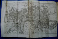
1827e5429aEdinburgh: John Thomson. G : in good condition. Some dust soiling to some page edges and offsetting. Contents firm. 1827. Fourth Edition. Leather cover. 180mm x 110mm 7" x 4". xii 256pp; 192pp. 2 fold out linen maps and engraved plates. . John Thomson hardcover
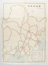
1519172590奉天. Mukuden.: 満鉄鉄道総局. Mantetsu Tetsudo Sokyoku. 昭和 15 1940. Colour folded map seven small very holes not affecting the printed image otherwise good. 53 x 38.5cm Map showing the comprehensive railway network in Manchuria with names of all the stations. It includes the lines run by the South Manchurian Railway Company their temporary industrial lines light rail as well as the lines run by other Russian and Chinese companies. By 1940 the network had expanded so much that it included almost the whole of Manchuria. . 満鉄鉄道総局. [Mantetsu Tetsudo Sokyoku]. unknown
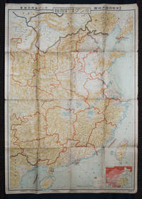
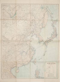
1938159295Tokyo: 大日本雄辯會講談社 Dainihon Yūbenkai Kōdansha. Shōwa 13. 1938. Two large detailed maps of China and on the reverse of the Soviet Union in Asia Manchuria and Mongolia printed double sided on a single large sheet. Issued as a supplement to Volume 14 Number 1 of the magazine Kingu on New Year's Day in 1938. <br> <br>Holes at a number of holes causing a small amount of loss some occasional browning some chipping on margins. The map has clearly been used but is still largely complete. The colourful map of China on a scale of 1:2600000 includes part of Manchukuo and Inner and Outer Mongolia on the north and part of French Indochina to the south-west. It shows East Hebei Autonomous Anti- Communist Council Jidong Fanggong Zizhi Zhengfu 冀東防共自治政府 south of Manchukuo which existed from late 1935 until February the 1st1938. The legend includes national and provincial borders cities roads railways sea and air routes and undersea cables. There is an inset map of East Asia titled "Present Situation of Far East" on the lower right corner which shows the areas under influence of Communism and those under influence of/controlled or colonised by the United Kingdom France Japan and China. <br> <br>The map on the reverse printed in blue and black shows the Asian section of the Soviet Union Manchuria and Mongolia on a scale of 1:3000000. There is an inset map of Asia titled "Asian Continent" at the upper left corner the area enclosed by a rectangle which indicates the area covered in this map. The legend includes cities railways roads national borders district borders province borders and air routes. . 大日本雄辯會講談社 [Dainihon Yūbenkai Kōdansha]. unknown
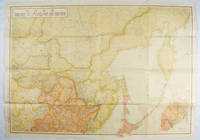
1419171112東京. Tokyo.: 伊林書店. Ibayashi Shoten. 昭和14 1939. Colour printed folding map 78 X 109cm minor damage original envelope 27.5 x 20cm. Very good copy. This map offers comprehensive information on northern China Manchuria the Soviet Union and Hokkaido including Kuril Islands under the Japanese control. It also includes the Jewish Autonomous State which existed in the late 1930s. The inset map provides detailed information on the border area of Japan Manchuria and the Soviet Union. Legends include national borders railways major cities iron mines and oil wells. <br> <br>Published in 1939 this map is an expression of the tension Japan felt in its relationship with the Soviet Union. At the time the Soviet Union was seen as the mighty threat to the lying just north of Manchuria and Japan . . 伊林書店. [Ibayashi Shoten]. unknown
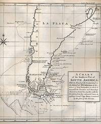
1767r3544cLondon: J Knox. G : in Good condition. Cover rubbed and scuffed with edge and corner wear. Fep loosening. Slight foxing. 1767. First Edition. Brown hardback leather cover. 220mm x 130mm 9" x 5". 520pp. 2 fold out engraved charts. Heraldic bookplate of Cameron of Lochiel on paste down with motto 'Pro Rege et Patria'. Contents include: The Voyage of Sir Francis Drake; The Voyage of William Dampier the Voyage of Captain Woodes Rogers in the Duke and Captain Stephen Courtney in the Duchess including the account of their finding Alexander Selkirk on the island of Juan Fernandez with his manner of life during a residence of four years at that place and the voyage round the world by George Anson with a brief detail of the disastrous fate of the Spanish squadron under Admiral Pizarro sent out to intercept him. Includes fold out charts of South America and of the Pacific Ocean. . J Knox hardcover
1767r3544London: J Knox. G: in good condition without dust jackets as issued. Covers rubbed with some partial hinge cracking. Inner hinge cracking. Previous owners inscriptions to feps. A few maps with mis-creasing and closed tears - no loss. Occasional minor foxing and marking. 1767. First Edition. Original brown leather cover. 220mm x 130mm 9" x 5". xiv 516pp; 496pp; 520pp; 464pp; 472pp; 543pp; 528pp. 16 b/w engraved maps - 15 fold-out. 24 b/w plates - 9 fold-out. Contents includes: The four Voyages of Christopher Columbus; Conquest of Mexico by Hernando Cortes; Conquest of Peru by Francis Pizarro; Voyage to South America by Dom George Juan and Don Antonio de Ulloa; Patagonia; John Niehoff's voyage to Brazil and the East Indies; Lionel Wafer's Journey over the Isthmus of Darien; A brief account of North America from Major Roger describing the several British Colonies; Colonel Bouqet's Expedition against the Ohio Indians; Reflections on the War with the savages of North America; the first voyage to the East Indies by Vasquez de Gama; Voyage to the Cape Verde Islands by George Roberts; Mr Peter Kolben's voyage to the Cape of Good Hope and the Hottentot Natives; The Voyage of Sir Francis Drake around the Globe; The Voyage round the World of William Dampier; The Voyages og Woodes Rogers and Stephen Courtney round the World including finding Alexander Selkirk on the Island of Juan Fernandez; The Voyage round the World of George Anson; Travels through the most Northern Parts of Europe; Travels of Monsieur Maupertius in the Polar Circle; Lorde Molesworth in Denmark and Sweden; Bernard Connor in Poland; Mr Beauplan and Others in the Ukrain; Travels through Europe; Keysler's Travels through Europe; Travels through France by Sacheveral Stephens; Rev. Clarke's Travels through Spain and Portugal; Mr Hanway's Account of Russia; John Thevenot's Voyage and Travels from Italy to Constantinople; Mr Wood's Journey to Palmyra; Maundrell and Shaw in the Holy Land and Barbary; Dr Pococke through Egypt; Journey to Mequines by Mr Windus; Travels to the Inland parts of Africa by Francis Moore; Travels of Sir John Chardin in Persia; An Account of Indostan by Thomas Roe and Mr Holwell; A Journey from St Petersburg to Pekin by John Bell; Accounts of England and Scotland and a 1762 List of the Royal Navy. Heavy item - shipping supplement may apply for overseas. . J Knox hardcover
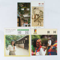
1970161824Japan.: various. Late 1970s - Early1980s. Four pamphlets relating to travel in Korea aimed at Japanese travellers in the late 70s/early 80s. All in good condition. Text in Japanese. Small collection of travel ephemera collected by a Polish Australian woman living in Kobe in the lates 70s/early 80s. A fascinating snapshot of travel to Korea aimed at Japanese travellers. Titles are: <br> <br>韓国: 魅力のトリップ. Charming Trip to Korea. <br>女性のための韓国. Travelling to Korea for Women. <br>韓国: 魅力のトリップ. Charming Trip to Korea. <br>韓国: 観光情報. Korea: Tourist Information. <br> <br>Text in Japanese. . various. unknown
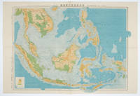
1572160538東京.Tokyo.: 日本名所圖繪社.Nihon Meisho Zuesha. 昭和16 1941. Folding colour Japanese map of the Malay Archipelago and Thailand scale 1: 8500000 with attractive original pictorial paper envelope. This map also shows the Dutch French and American colonies. Hainan Province and the South China Sea are shown in the north. Agricultural and mineral resources indicated across the map. Few small holes at holes and other light signs of wear. Slipcase lttle torn. Text in Japanese and English. 53.3 × 78.2cm. . 日本名所圖繪社.[Nihon Meisho Zuesha]. unknown
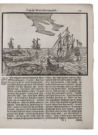
166598MCBSHUHD3NAmsterdam 1665. 4to. Gillis Joosten Saeghman Late 19th-century vellum with the title stamped on the spine with black foil a black single fillet border on both boards. With a woodcut vignette of ships on the title page 16 further woodcuts on integral leaves 1 full-page signed by Christoffel van Sichem IV and 9 half-page and smaller with his monogram and a woodcut ship in a cartouche plus 1 repeat woodcut decorated initials and decorative bands built up from cast fleurons. Set in textura types with incidental roman and italic. 32 pp. First Dutch translation of the accounts of three voyages to Greenland by Jens Munk John Monck Martin Frobisher and Godske Lindenau searching for a passage to the East Indies through the Hudson Strait. Also containing a description of Greenland and an account of whaling including an unsigned illustration of a beached sperm whale with new illustrations by Christoffel van Sichem IV 1642-1693. It is a Dutch translation of La Peyrère's 1647 Relation du Groenland 1647 via the somewhat abbreviated German translation published in Hulsius's 1650 collection which contains the additional description of Spitsbergen and a discourse on whaling. La Peyrère included revised versions of Jens Munk's account of his voyage to Hudson Bay originally published in Navigatio septentrionalis 1624 and the accounts of voyages by Martin Frobisher and Godske Lindenau. Red armorial library stamp of the Forschungsstelle Volk und Raum on the title page: this was a research institute active at The Hague during the occupation of The Netherlands by Nazi Germany. Good copy.l Alden & Landis 663/79; Gosch Danish Arctic expeditions II pp. lxii-lxiii; JCB III pp. 98-99; Tiele Mém. 256; Sabin 28641 & 51334; STCN 4 copies; cf. Howgego to 1800 F80-F81 L128 and M180. ABE CAT Alaska Canada & Greenland hardcover
1419160524Tokyo.: 大日本帝國陸地測量部. 昭和14 1939. Large colour folding Japanese WWII map. Scale 1:5000000 featuring Japan Korea Taiwan Karafuto Eastern China parts of French Indochina and the Northern Philippines US colony in detail. Legend includes territorial boundaries national and regional and shows some borders as unclear i.e. Taiwan and bordering region along Northeast China the Soviet Union and Mongolia air routes submarine communication cables linking major costal cities i.e. Hong Kong Xiamen Shanghai Nagasaki etc. airports radio stations mining fields and more. A small chart shows the names of mountains rivers and lakes also included adjacent to legend. Some small holes at folds creases and some minor loss edges generally very good. Text in Japanese. 109 x 77.8cm. . 大日本帝國陸地測量部. unknown
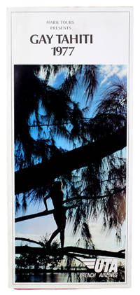
19773373<p>12-panel folded brochure. White stock printed in color. Color illustrations. Minor soiling to outer panels; stamps of a San Francisco travel agency to rear panel; tiny areas of separation to a few folds. About Very Good.</p><p>Travel brochure for ten-day tours from Los Angeles to Tahiti for "thirty people that enjoy the gay lifestyle". The brochure details the daily activities offered including an eight-day stay at a village on Moorea as well as information about accommodations meals the tour guide and so on.</p><p>Throughout it stresses that "this is a GAY tour" with sections on "gay leisure" "gay enchantment" and "a gay treat" about Kia Ora Village on Moorea. However it is worth noting that these sections in fact could be taken from any travel brochure -- there's nothing mentioned about what makes the leisure "gay" for example -- and throughout the emphasis is on the people and culture of Tahiti members of the tour will get to enjoy. Still there are a few nods to gay culture of the time like mention of a "lively" discotheque on a schooner permanently anchored at Kia Ora and the fact that there are no single room options for tour participants -- everyone has to bunk with someone else. Oh and this rather great aside: "For your stay you become Tahitian. You fish with them swim with them sing with them drink with them and -- well who knows what else with them."</p><p>Not located in OCLC.</p> Mark Tours
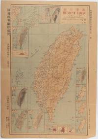
1945215871Taiwan.: 禹甸圖書局. Yudian tushuju. 1945. 1945 Ministry of Interior map of Taiwan published in the 34th year of the Republic of China with inset title and key top right. Romanised Japanese names for some areas and cities written in capital letters on main map which is surrounded by 15 small inset maps at edges each with its own scale. Paper browned wear at folds and edges repaired with archival washi on reverse some light stains and a few marks. 1 x 3cm chip bottom right corner. 77.4 x 54 cm. Text in traditional Chinese characters. Inset maps show clockwise from right edge; 1. Distribution of inhabitants according to ethnic background or minority group 2. Qing Dynasty prefectures and counties 3. Japanese administrative regions during the occupation 4. Strategic industrial and military places three city maps - 5.Chilung or Keelung port 6. Taipei city and 7. Tainan city 8. Geological formations 9. agricultural metallurgical and mineral products 10. Soil types 11. Topography of the island including sea currents and altitude diagram 12. Taiwan's position in relation to the mainland coast provinces of Fujian and Zhejiang as well as the Liuqiu Ryukyu Islands including Okinawa 13. Okinawa detail 14. Climate and rainfall in January 15. Climate and rainfall in July. . 禹甸圖書局. [Yudian tushuju]. unknown
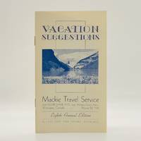
19423445Winnipeg Manitoba: Mackie Travel Service 1942. First Edition First Printing. Stapled Wraps. pp. 16. 12mo. measuring 4" x 7". Illustrated twice-stapled card covers bearing an image in black-and-white of the Rocky Mountains. Period booklet issued by local Winnipeg travel firm advertising a range of travel packages to a variety of Canadian destinations including: "Banff Jasper and the Rockies" "Minaki Lodge Ontario" "Kenora - Holst Point Lake of the Woods" "Lake of the Woods" "Norway House" aboard the SS Keenora and many others. All destinations include prices range of activities for adults and children and detailed itineraries. Unusually these packages were offered in the midst of the Second World War as indicated by various "war taxes" attached to the corresponding prices. No detectable flaws; bright clean and unmarked with tight stapled binding. Near fine. <br/><br/> Mackie Travel Service paperback
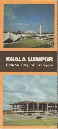
1965223458Kuala Lumpur.: Department of Tourism Ministry of Commerce & Industry Malaysia. Circa1965. Brochure with colour photographic illustrations a large colour map on one side 67.6 x 50cm folded 22.8 x 10cm. Very good condition. . Department of Tourism, Ministry of Commerce & Industry, Malaysia. unknown
1893D108611893. Hardcover. Fine. Dated 1893 sketchbook album in oblong 12mo 120 x 170mm manuscript in pencil with drawings and notes; 40 cream sheets lightly aged at edges 2 sheets are blank. The sketches are generally of building façades captured from a distance but also with some extreme close-ups of sculptural details or decoration on the monuments from gothic towers to ornate door hinges. Some sketches are accompanied with notes by the artist and most are captioned with the site or dated with the month and year being 93. The formatting of the date and spelling throughout suggest this album belonged to an American traveler who visited several sites in Western Europe during the spring of 1893. The drawings are accomplished works of art done by a skillful hand perhaps a novice architect others are barely sketched perhaps unfinished but displaying an interesting narrative which weaves moments of voyage through Martigny St. Maurice and Lausanne in Switzerland; Heidelberg Castle Mainz Cathedral Mayence and Cologne Germany; Utrecht and Holland; and cathedrals at Soissons and Reims in France. Original canvas covers with elastic strap somewhat loose back cover splitting otherwise sound and in very good condition. Inside there is a label of the Carlo Cogiola store in Milan. A great little item full of classic yet original views of historical churches and building parts. <br/><br/> hardcover
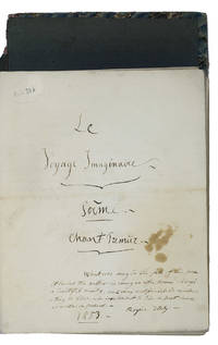
1853BC3EG701U79OAdegeest manor house at Voorschoten between The Hague and Leiden 1853. Loose quires in cover: marbled boards joined together by a spine of red painted sheepskin green ties. Large 4to 27 x 21.5 cm. Extensive autograph poetical work in four Chants provided with elaborate notes containing a romantic imaginary voyage in French verses. The anonymous author - indicating himself with his initials "J.F. v. H. St." - has composed the poem at the manor house Adegeest at Voorschoten between The Hague and Leiden and has dated his work: Mars deleted and 1 April 1853. At the time the manor house was in the possession of the very rich family Dorrepad. G.L. Dorrepad 1816-1883 was an entrepreneur who had gathered his wealth in the Dutch East Indies he was involved f.e. in a notorious financial scandal denounced by the famous Sicco Roorda van Eysinga. To all probability our anonymous author was the private teacher for his children at Adegeest.In the introduction the author states that he had never visited the countries and regions he describes so passionately "N'ayant jamais visité les lieux que je decrits". Citing Cicero Lord Byron Alexandre Dumas and many others he concentrates on classical Greece and Italy and the Mediterranean.Contents: pp. I-V; Avertissement; 1-53: Chant premier; 55-81: Notes; 1-61: Chant second; 63-120: Notes; I-VI Avertissement; 1-68: Chant trousième; 69-132: Notes; 1-76: Chant quatrième; 77-136: Notes.Cover rubbed and spine damaged otherwise in good condition. hardcover
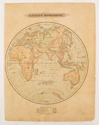
1875175128Harper & Brothers. 1875. Spherical map printed in colour 21.3 x 21.2 cm with shaded key to elevation and ocean currents unrelated text on the verso paper toned and margins soiled bottom edge ragged small sealed to to the inner margin but in sound condition. Map showing the five continents of Asia Africa Antarctica Europe and Australia. Published by Harper & Brothers for inclusion in their "School Geography". Plateau of Tibet very prominently marked. Gobi Desert and Plateau of Mongolia also marked India described as Hindostan Indo-China includes Thailand. . Harper & Brothers. unknown
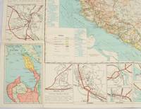
1962174808Kuala Lumpur.: Survey Department Federation of Malaya. 1962. Very attractive large coloured folding map 108 x 83cm showing all the major hotels and rest houses throughout the country. Coloured references show rubber rice coconut and oil palm areas pineapple and miscellaneous cultivation areas mining land jungle built-up areas and shopping centres along with major features such as rivers principal roads minor roads and cart tracks railways lighthouses district state and international boundaries and triganometrical stations with heights. Scale 18 miles to an inch mile. Two inset maps of Northern Malaya and South Western Malaya are 9 miles to an inch. There are smaller inset maps of Ipoh; Malacca Singapore & Johor Bahru Penang Sungei Patani Kuala Lipis Kuantan Alor Star Kota Bharu Petaling Jaya Seremban Klang Batu Pahat Muar Segamat Johore Bahru and a small inset map of Malaya and adjacent territories. There is a large black & white table of approximate mileages. When folded the map is encased in the original printed manila covers measuring 21 x 14cm with a printed price of $2.50. A crisp bright map in very good condition. Survey Department Federation of Malaya No. 23. . Survey Department Federation of Malaya. unknown
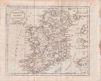
1796176602circa1796. Engraved map 18.3 x 22 cm 21.7 x 27 cm sheet original folds age toning and some offsetting inner edge darkened and discoloured but the map in good condition. Finely engraved map showing Ireland divided into counties lower coast of Scotland and Wales and the Isles of Man and Anglesea; also noting Nymph Bank 'discovered in 1735 by Capt. Doyle.' . unknown
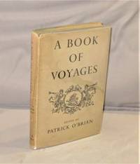
194728119<p>London:: Home & Van Thal 1947. First Printing of the First UK Edition. A Very Good copy with light wear to the board edges in a Very Good plus unclipped dust jacket with light wear to the extremitites. A Book of Voyages presents writings by various travelers annotated and introduced by Patrick O'Brian. Most are taken from the seventeenth and eighteenth centuries; O'Brian felt that unlike Elizabethan or Victorian accounts these writings were relatively unknown in our time. On her journey through the Crimea Lady Craven witnesses barbaric entertainments in the court of the Tartar Khan. John Bell tells us of his day's hunting with the Manchu emperor in 1721 outside Peking. An English woman in Madras gives us a detailed description of the extraordinary costume and body decoration of a high-born Indian woman wife of a nabob. These and other selections are glimpses of a world now gone forever that few readers would ever see for themselves.</p> Home & Van Thal, hardcover
195962335Princeton NJ: D. Van Nostrand Co. Inc. 1959. 4to. xii 2 208 pp. Title in red & black photo frontisp. numerous photo plates 1 large folding map & other charts. Red publisher’s cloth gilt illust. front cover gilt lettering on spine w/ d.j. cover art of sailing yacht minor edgewear creasing price-clipped still NF/VG bright copy from the library of Charles H. “Brig†Belvin IV b. 1937 w/ ownership markings on ffep. First edition of this excellent and informative work recounting the author’s voyage with his wife with their friend Eunice Boardman and her fifty foot ketch Renegade through the Virgin Islands. D. Van Nostrand Co., Inc., hardcover
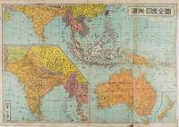
1572159290東京.Tokyo.: 金鈴社. Kinrei-sha. 昭和十八 October 101943. Two maps printed in colour on a single side of a folded sheet. The map titled "Complete Map of India and Australia" shows the region covering Australia southern India western mainland south-east Asia Indonesia the Philippines and New Guinea. The other map titled "India and Burma" shows the region covering India Afghanistan the western section of China Burma and Thailand on the lower left side. New Zealand is in an inset map in the lower right corner. As the note on the cover says "Including the detailed descriptions of the Solomons New Guinea and southern islands" this map shows the theatres of the Pacific War and the surrounding areas. The map indicates agricultural and mineral resources as well as cities roads railways sea routes national borders etc. Cover and publication details printed on two panels on the reverse. Some marking and browning. . 金鈴社. [Kinrei-sha]. unknown
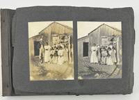
19152566Various locations in Mexico 1915. About good. 196 photographs on forty-nine leaves. Sixteen photographs loose on remnant leaves. Oblong octavo. Covers lacking. Several leaves loose some chipped. Images mostly clean some lightly faded. An interesting vernacular photograph album of what appear to be vacation photographs taken at the turn of the century. The initial images depict a family at a farm several of them scenes of working life including digging ditches and men on horseback; further on in the album there are more scenes of locals in the countryside documenting daily life. There are also numerous scenes in Mexico City and beyond including bull fights the cathedral street scenes and some images of railway lines. There are a few images of white folks on a beach followed by several photographs of soldiers both American and Mexican. Though a bit battered the album provides a glimpse into rural life in Mexico in the early 20th century and provides insight as to what tourists were photographing. unknown
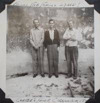
19402327<p>9 x 11-3/4 inches. 75 b&w photographs on 19 leaves including one laid-in photo. Photos 3" x 3". Ornate wooden album with wooden cutout of a cactus and a sleeping man in a sombrero to front cover fragile tan leaves. Many photographs captioned in ink on the lower margin of the photos themselves. Leaves chipping at the edges with some loss.</p><p>Photograph album documenting a trip by three 20-something white American men to various locations in Mexico shortly before the U.S. entered WWII. The men flew out of El Paso Texas and traveled to Mexico City Taxco Cuernavaca Teotihuaca and other locations. In addition to typical scenes of landmarks buildings etc. the album includes rare glimpses of daily life in Mexico with images of street and market scenes a bullfight landmarks off the beaten path and more.</p> hardcover
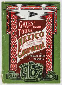
19032697Cleveland: Winn & Judson 1903. About very good. 64pp. Original color printed wrappers. Light wear to wraps spine chipping at foot. Light toning internally. An extensively detailed and well illustrated promotional for the Winter 1903 Gates Tour of Mexico with optional itineraries for the Grand Canyon Las Vegas and California. A 1904 article in the National Magazine lauded Gates as a "world-renowned manager of Mexican tours" stating that no one should contemplate touring Mexico with anyone else. Traveling to Mexico by rail in proprietary rail cars Gates provided full service tourism to all the most interesting and prominent locales in Mexico -- tourism the American way. Participants traveled south from Chicago through Texas and central Mexico to Mexico City and returned to the United States by way of the Sonoran Desert and El Paso. Heavily illustrated with photographs and a map of the route and with painstaking descriptions of travel amenities and the many sights and towns on the journey. Winn & Judson unknown