39 448 résultats
181888765Gide fils | Paris 1818 | 13 x 20.5 cm | 2 volumes reliés
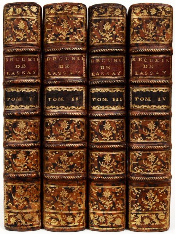
174386931Chez la veuve Foppens | A Brusselle 1743 | 9.50 x 16.50 cm | 4 volumes reliés
171287081Chez Guillaume van de water Guillaume & Jacob Poolsum | A Utrecht 1712 | 10 x 16.20 cm | 6 parties en 2 volumes reliés
179892004Chez Plassan | à Paris 1798 | 12.50 x 20.50 cm | relié
8vo. (8), 280 pp. With 11 views on 9 folding engraved plates. Contemporary boards with giltstamped spine label. Second edition of the Viennese merchant's travelogue, the first unabridged edition and also the first to contain the fine engraved illustrations. Kleemann (1736-1801) gives a detailed account of his travels from Vienna to Crimea, on to Constantinople, Izmir (Smyrna) and Trieste until reaching his destination, Kiliya (Kilianova) in the Ukraine, then an important merchants' city in the Danube delta. The plates include views of Kiliya, Kavschan and Caffa, while also depicting the Iron Gates, the Dardanelles and the seraglio in Bakhchysarai. The principal part of the volume is dedicated to descriptions of the places visited en route, providing insights into the everyday life of an 18th century traveller. In the appendix, the author discusses the type of government in Tartary, the relations between the nobility and the Khans in Crimea, nutrition, jurisdiction, religion and economy, concluding with information on Turkish measurements, weights and currency. The final pages contain a translation of the first page of the firman issued for Kleemann, allowing him to travel without let or hindrance and waiving all tolls. - Paper slightly brownstained, otherwise well preserved. Provenance: Unidentified early 19th century monogram stamp to title page. Later in the library of the Swedish collector and goldsmith Christian Hammer (1818-1905) with his bookplate on front pastedown; ultimately removed from the library of the Viennese collector Werner Habel (his ownership stamp, dated 1977, to front pastedown). VD 18, 10541721. Wurzbach XII, 37. Weber II, 561. Chatzipanagioti-Sangmeister 488.
771s. l. : s. d. (vers 1850). TRADUCTION FRANÇAISE INÉDITE D'ÉCRITS DE KOHL SUR SAINT-PÉTERSBOURG ET SUR MOSCOU
20014Paris, Jules Renouard et Cie, 1854. 2 vol. in-8, XVIII-276 pp. 11 pl. + 392 pp. 11 pl. demi-chagrin vert, filet à froid sur les plats, dos à nerfs orné de filets dorés et à froid, tête dorée (dos insolés, quelques petites épidermures, rousseurs).
1704PHO-397LAHONTAN (baron de). Dialogues de Monsieur le baron de Lahontan et d’un Sauvage, dans l’Amérique. Contenant une description exacte des mœurs & des coutumes de ces Peuples Sauvages. Amsterdam, Veuve de Boeteman, Et se vend à Londres, David Mortier, 1704. Fort volume in-12, basane marbrée, dos orné, tranches rouges . Sabin, n°38634. Première édition séparée, ornée d’une planche dépliante représentant un entretien entre un voyageur européen et des indigènes, de 2 cartes dépliantes (Portugal et Danemark), et d’une vue dépliante du port de Lisbonne,manque deux vues (Copenhague, Hambourg). Travail de ver en pied d’une dizaine de feuillets, supprimant des lettres. Des rousseurs. Partie inférieure de la carte du Danemark manquante. On a relié à la suite : LA BARRE DE BEAUMARCHAIS. Le Hollandois, ou Lettres sur la Hollande ancienne et moderne. Seconde édition. Suivant la Copie Imprimée, à Francfort, François Varrenstrapp, 1738.
175616201A Lausanne, chez Marc-Michel Bousquet, 1756. 4 vol. in-4 de (4)-XI-412 pp. ; (4)-533 pp. ; (4)-429 pp. ; (4)-491 pp., veau marbré, dos orné à nerfs, pièces de titre en maroquin rouge et de tomaison en maroquin noir, tranches rouges (reliure de l'époque).
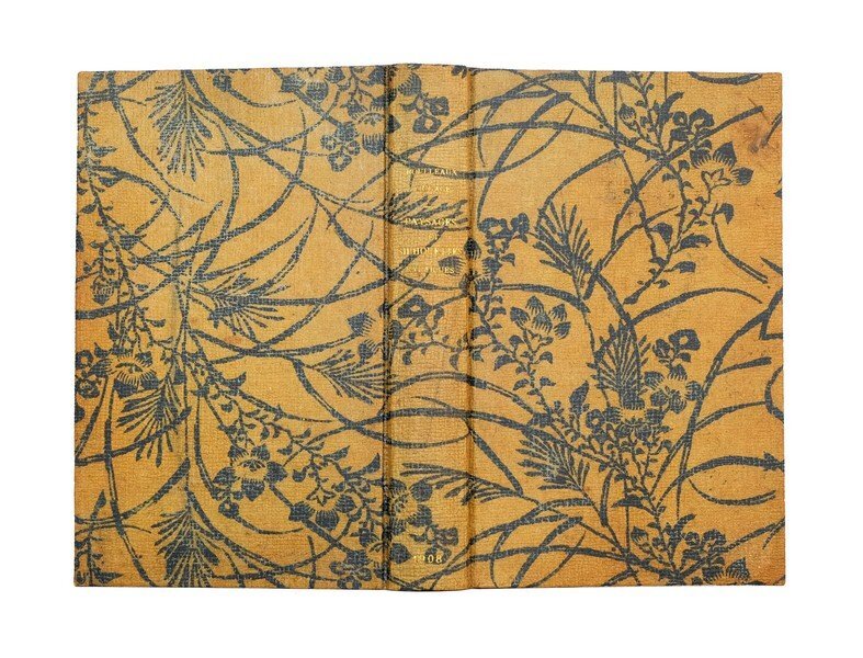
1368Paris : Librairie Plon, 1908. RÉCIT DE VOYAGE EN RELIURE DE PAPIER CUIR JAPONAIS D'UN TYPE PEU COURANT
4to. With folding hand-coloured engr. map, 16 engr. plates (some folding), and folding engr. table. Modern half calf with giltstamped red spine label and marbled boards. All edges marbled. First edition of "the best English work respecting Hungary" (Cox), soon translated into Dutch and French. Includes a chapter entitled "Alpine Excursions", describing the author's plant hunting activities. The chapter on Vienna, an account of which historiography has taken surprisingly little notice, deals extensively with the local gluttonous eating habits first described (and since immortalized) by Aeneas Silvius Piccolomini three and a half centuries earlier. Townson continues to describe at length the Imperial hothouses and zoo at Schönbrunn Palace. The book is also "a work valuable to the natural historian, particularly the mineralogist; it also contains a very particular account of the Tokay wines" (Lowndes). - The Surrey-born naturalist Robert Townson (1762-1827) took a year off from his studies at Göttingen, traveling to Vienna and throughout Austrian Habsburg lands. "He returned to Göttingen and published his first works, on reptilian physiology, in 1794 and 1795. He returned home in 1795 and was awarded the degree of LLD in 1796 by Edinburgh University. He settled again in Shropshire where his 'Travels in Hungary' (1797) was written. This contained pioneering botanical, entomological, and petrographic observations and spirited descriptions of his exploits, including those in the Tatra Mountains and in Slovakian caves" (ODNB). - An excellent copy in an appealing modern binding. Cox I, 168. Brunet VI, 20298. Not in Nissen (BBI) nor Simon (Bibl. Vin.) nor Simon (Bibl. Gastr.).
15748A Paris, Chez Maradan, an IX, 1800-1801. With 73 plates on 72 leaves (plates 28/29 are printed on one single leaf) and 6 tables. 18 volumes. 8vo. Contemporary calf, spines gilt with red and green labels with gilt lettering, and with gilt lettered on upper sides: 'Ferme expérimentale'. Musset-Pathay 308; Kress B.4312; not in Goldsmiths; not in Einaudi; not in Mattioli. First French translation of Young's works. Complete set of Young's most important works to which are added Delalauze's valuable notes. Of fundamental interest for the history of agriculture. Contains: Voyages au sud, à l'ouest, au midi de l'Angleterre. - Voyage au nord de l'Angleterre. 2 volumes. - Voyage à l'est de l'Angleterre. 3 volumes. - Voyage en Irlande. 2 volumes. - Lettres d'un fermier. 2 volumes. - Guide du fermier. - Expériences d'agriculture. 2 volumes. - Annales d'agriculture. 3 volumes. - Voyage en France. - Arithmétique politique.It is in the diffusion and popularisation of new and improved practices that the merit of Arthur Young's works lies. His descriptions of the tours he made through France and Ireland, the general descriptions as well as those of roads, commerce, manufactures, arts, country houses and palaces are still used as a source for the study of eighteenth-century conditions. - Added: the prospectus for the volumes 15-18. 11 pp. Sewn. A very fine copy.
1816R320140854Chez Gabriel Dufour. 1816. In-12. Relié plein cuir. Etat d'usage, Coins frottés, Dos satisfaisant, Intérieur acceptable. Environ 400 pages pour chacun des volumes - contre plats et tranches jaspés - titre, tomaison,filets et fleurons dorés sur le dos - quelques gravures en noir et blanc hors texte et quelques cartes géographiques hors texte dont la plupart coloriée - 9 photos disponibles.. . . . Classification Dewey : 910.4-Voyages
98434London Birt 1745. . First edition; 8vo xvi 347 i 39 ipp. a couple of gatherings in the appendix slightly proud contemporary sprinkled calf lightly rubbed short splits to joints corners bumped a very good copy.<br /> 'Pascoe Thomas kept a full and faithful daily journal of the incidents of this important four-year voyage. Included is an appendix giving an account of the treasure taken from the Nuestra Signora del Buono Carmella. This account. preceded the publication of the official account of Lord Anson's voyage by three years' Hill. At the bottom of page 36 of the appendix the exact latitude and remarkably the longitude of the fabled Strait of Anian are provided. This precise location of the Pacific entrance to the elusive Northwest Passage came from a Spanish document captured by Anson and gave rise to the suspicion that the Spanish had discovered the passage but kept it secret. <br /><br />Anson's voyage was a landmark of 18th-century English circumnavigation laying the groundwork for the British exploration of the Pacific in the later half of the 18th century. The expedition set out to cut off Spanish supplies of gold and silver from South America after the outbreak of war in 1739. Whilst successful taking a number of prize ships off the Philippines the cost was high: six ships were wrecked off the coast of South America or in rounding Cape Horn. <br /> Hill 1693; Sabin 95437. London, Birt, 1745. unknown
18311826<p>Henry Colburn and Richard Bentley London 1831. First Edition. Cloth. Very Good. 1st Octavo 8vo Edition; Two volumes Vol I iv-xxvi 1 directions to the binder 472pp; Vol II iv 452pp. Three engraved maps two of which are folding and twenty-three engraved plates many not in place as in directions to binder but all complete also two copies of one of the plates. Contemporary rebound cloth half calf Each volume with red and black spine labels. Spines stamped and lettered in gilt. All edges marbled. Beechey's expedition on board the H.M.S. Blossom formed part of a double-pronged assault on the western approaches to the Arctic. Sent by way of Bering's Strait to explore the northern coast eastward Beechey was to eventually link up with Franklin's second expedition working westward from the Mackenzie River. The two parties came within several hundred miles of each other one of Beechey's vessels managing to penetrate as far as Cape Barrow while Franklin turned back at Return Reef at about 149 degrees west. The narrative contains scientific data descriptions of Eskimo life and culture and much of importance relating to Alaska including the Aleutian Pribilov and other islands the Tuamotu Archipelago the Society Islands and Tahiti Hawaii and the coast of California. There are also valuable accounts of Monterey and San Francisco prior to the American conquest as well as a lengthy account of the mutiny of the Bounty as related by its sole survivor John Adams. Some foxing small tear title page Vol I repaired tear to page 472 Vol I. ink stain pp365- 370 Vol II. Very Good PLEASE NOTE: This book will incur extra postage and insurance charges. Please contact us for a quote. Quantity Available: 1. Shipped Weight: Under 5 kilogram. Category: Arctic & Antarctic; Antarctic; Exploration. Pictures of this item not already displayed here available upon request. Inventory No: 1826. . This book is extra heavy and may involve extra shipping charges to some countries.</p> Henry Colburn and Richard Bentley hardcover
folio [38 x 27 cm]; 211 pp, extra color lithographed (chromolithograph) title plate, plus 32 tinted or toned lithographed plates, large folding map showing the railway routes & elevation, tables, engraved initials. original cloth, gilt title lettering on cover, later cloth spine, edges worn, inner hinge re-enforced, light foxing on some leaves, mostly confined to margins, one plate with margins significantly trimmed but not affecting image, very good sound copy. A p Palau 25914. Spain & Spanish America II, 46. The book describes the completion of the first railway between Mexico City and Veracruz on the Atlantic coast and Jalapa. The plates are of bridges, tunnel construction, waterfall, views of several cities, a spectacular panorama bird's-eye-view of Mexico City, 2 plates of portraits, views, etc. The lithograph plates are by H. Iriarte, with designs mostly by S. Hernandez. The fine colored plate shows a steam engine pulling a train with tropical trees and a bridge and mountain in background. The text was translated into English by George F. Henderson. The project took 15 years to complete from the initial surveys to the official inauguration in 1871. The text includes detailed description of the geography, cities and construction, history, scientific information with tables A complete copy with all the excellent plates.
8vo [23 x 15 cm]; xix, 419 pp 3 folding maps on two sheets, two maps hand colored in outline. half red morocco and matching red boards, raised bands, gilt spine title lettering, front joint cracked & repaired, bookplates of Francis Hagner and Andrew Taylor, polar archivist, interior clean and near fine. A picture of this book is available upon re TPL 2315. Streeter 3709. Hill p274. Field 1411. Wagner-Camp 101. Arctic Bibliography 16124: 'Contains biographical sketch of the author with comment on the mystery of his death by his brother, narrative of expedition of Peter Dease and Thomas Simpson with party of twelve men to explore the northern coast of America from Mackenzie River westward and from Coppermine River eastward to Back River. Contains the journey from Fort Garry (Winnipeg) to Fort Chipewyan; descent of the Slave and Mackenzie [Rivers], etc.; discovering Boothia (now Simpson) Strait; exploration of the southern coast of Boothia Peninsula and Victoria Island. Includes detailed remarks on geographic features along the routes, weather and travel conditions; the Indians and Eskimos of the Mackenzie, northern Alaska and Coppermine regions'. An appendix lists about 150 plants collected along the coast between Coppermine River and Point Turn again, 1838, with reference to literature by Sir W. J. Hooker, eminent botanist, magnetic variation and dip observed by Simpson. Besides the maps called for in the book there are several contemporary maps, mounted on rear endpapers, including two maps taken from the Times of November 1st and 2nd, 1876 relating to the Nares Arctic expedition in the Alert and Discovery with two pages of text on same; and a folding map of the Arctic regions showing the route of the Captain Austin expedition, undated but nineteenth century, entitled Map of the Arctic Seas to Illustrate Franklin's Footsteps, Chapman & Hall (corner damage).
8vo [23 x 15 cm]; two volumes, xlviii, 406; x, 463, 26 [publisher's ads dated Jan 1841], complete with 13 maps and plates including large folding map in pocket, frontis in each volume, view plates, costume plates, other illus, appendix, errata. rebacked preserving most of original blind-stamped cloth and spines, gilt spine title lettering on each volume, lightly rubbed, very good or better, interior clean and unmarked, solid binding, original ribbon in map pocket. A picture of this book is avail A narrative of the author's extensive travels, including a detailed introduction on his observations of the events in Afghanistan, his travels through present day India, Ldiana, Rupur, Nadaun, Ladak, through Kashmir, Little Tibet, through the mountains, and other parts of Central Asia, with good description of the peoples, customs, jungles, nature, plants, buildings, religion, events, interviews with important persons, etc. 'He traveled for amusement, saw much and was assisted in his observations by the possession of some knowledge of science' [DNB]. The plates and other illustrations are quite good. Yakushi V38. Baker 264.
- Chez Buisson, A Paris 1798 - 1799, In-8 (12,5x19,5cm), (4) viij, 515pp. et (4) 412pp. et (4) 399pp. et (4) 326pp. et (4) ij, 402pp. ; (2) 30Pl., 5 volumes reliés. - Edition originale des 4 premiers volumes parus en 1798, et du 5e volume de 1799 en supplément contenant un précis de l'histoire de la Chine et le voyage en chine et en Tartarie de Huttner, ainsi que de l'atlas de 32 planches (moeurs chinoises, pieds des femmes chinoises, costumes, architecture...) et qui paraît également pour la première fois dans la seconde édition. Les 4 premiers volumes contiennent 4 frontispices et 3 grandes cartes dépliantes en fin du tome 4 (excellentes cartes du voyage, de la Chine...). Nombreux tableaux en fin du volume 4, sur le commerce, la monnaie... 39 planches dont 4 frontispices, 4 cartes. Reliures en pleine basane brune marbrée d'époque. Dos lisses ornés de 2 types de fers caissonnés et de roulettes. Pièces de titre en maroquin rouge et de tomaison en maroquin vert. Dentelle d'encadrement sur les plats. Coiffes de tête des tome I et 4 arrachées. Une partie de la coiffe de tête du tome 2 arrachée. Coiffes de queue des tomes 1 et 2 élimées. Mors supérieur du tome 1 fendu. 2 trous de vers le long du mors inférieur du tome 5. Les 4 premiers volumes frottés. Mors supérieur du tome 4 ouvert en queue. Epidermures sur le dos du tome 2. Le tome 5, bien que très proche des 4 premiers est très sensiblement différent (typographie différente pour la pièce de titre, fers semblables), et ne semble pas avoir connu le même relieur, mais un meilleur relieur. Les planches 33 et 34 ont été reliés dans le texte du volume 5. Ex libris gravé aux armes : Bibliothèque du château de Menneval. Ce voyage fut assemblé d'après les papiers de Lord Macartney ainsi que des commandants et des ambassadeurs du voyage par le secrétaire de Macartney, sir George Staunton. Macartney fut envoyé en Chine sur ordre du roi george III en ambassade extraordinaire pour la première fois dans le but d'établir des relations commerciales, de rencontrer les élites chinoises et de rapporter de son voyage toutes les observations possibles. Il embarqua à Portsmouth avec trois navires, Le lion, l'Indostan et le Chacal. Macartney traversa en grande partie le pays en s'arrêtant à Tianjin et Pekin. Cependant, en raison de coutumes différentes, l'ambassade fut un échec complet. Pour les Chinois, les relations dipomatiques ne pouvaient se faire sur un pied d'égalité, les ambassadeurs devaient se prosterner devant l'empereur et lui prêter allégeance, ce que Macartney refusa, celui-ci ne pouvant accepter une quelconque subordination du roi d'Angleterre à l'empereur de Chine. Le rejet catégorique chinois des relations commerciales entraînèrent les prémices de ce qui constituera les guerres de l'opium et la chute de l'empire chinois. L'ouvrage demeure une des meilleures descriptions des contrées traversées par Macartney, offrant des informations précises sur les sciences, l'histoire naturelle, l'aristocratie... et sera eminemment utile aux suiveurs de Macartney. [ENGLISH DESCRIPTION ON DEMAND]
- Chez Marc Michel Rey, A Amsterdam 1766, In-12 (10,5x17cm), x (2) 388pp. et iv, 207pp. (25), 2 volumes reliés. - Edition originale française, rare et recherchée. Traduction de l'allemand par Dumas. La grande carte dépliante, placée à la fin du tome II, est manquante, et a été remplacée par une photocopie de la carte réduite proposée par la Bibliothèque Nationale de France sur son site Gallica. Elle fut dressée par le cartographe français Jacques-Nicolas Bellin (1703-1772) et publiée par l'abbé Prévost. Celle-ci a été repliée pour s'insérer en lieu et place de l'ancienne carte. Reliures en plein veau marbré d'époque. Dos lisse ornés. Pièce de titre et de tomaison en maroquin rouge. Un trou de ver en tête du tome I. Traces de frottements en coiffes et coins. Manque le faux-titre du second tome. Bel exemplaire. Le premier tome recense l'ensemble des voyages de découvertes effectués en Russie orientale, au Kamchatka, en Sibérie, et notamment et surtout celui de Vitus Bering qui en 1728, fut le premier à découvrir le passage du nord-ouest en laissant son nom au fameux détroit de Bering. Ce dernier effectua un voyage par la même voie jusqu'au sud de l'Alaska en 1741. L'ouvrage relate de nombreux voyages, notamment celui de Simon Dejnev autour de la péninsule Tchouke, celui de Mikhaïl Gvozdev et d'Ivan Fedorov à travers le détroit de Béring jusqu'au cap Prince-de-Galles, en Alaska, en 1732... Le second tome trait de l'histoire du fleuve Amour d'après l'ouvrage de Witfen sur la Tartarie septentrionale et orientale. Cette histoire détaille les rapports et les relations entre les Russes et les Chinois, ainsi que les interventions des Jésuites. [ENGLISH DESCRIPTION ON DEMAND]
8vo. (10), 340, (12), 12 pp. (appendix). Contemporary half calf, marbled sides, gold title on spine, marbled endpapers. Extremely rare first edition (with an appendix printed in 1857, so perhaps reissued at that time) of a pilot guide for parts of the Caribbean, stating explicitly that there is still no adequate information for all parts. Although it calls itself volume 1, it is not clear that any of the various publications under the title "The West India Directory" was intended as a companion volume to the present one. It clearly covers different content than "The West India Directory" published by John William Norie in 1827. - With library stamps of the Marinens Bibliothek, Copenhagen (the library of the Danish Royal Navy): in gold in the centre of the front board and in ink on the title-page. Head of spine cracked, front hinge weak, corners bumped, front endpapers loose, but still in good condition. OCLC 47915720.
8vo. (6), 184 pp. With 12 steel-engraved coastal profiles.Contemporary half black cloth, marbled sides. Extremely rare work on the sailing routes in the Caribbean, including the coasts of the Guyanas and Venezuela, by the great English hydrographer John Purdy (1773-1843). Purdy coined the term "pharology", the study of modern lighthouses and their design. He does not seem to have taken part in hydrographic expeditions himself, and his work consisted in writing works and constructing charts based upon the reports of others, but eventually he became a leading authority of his time on hydrography. He was instrumental in bringing Rennell's Current (to the south of the Isles of Scilly) before the notice of navigators. - Apart from the present work on the Caribbean, Purdy also produced a "Memoir, descriptive and explanatory, to accompany the New Chart of the Atlantic Ocean"; "The New Sailing directory for the Ethiopic or Southern Atlantic Ocean", 1837, and similar sailing directories, dealing with many other regions including the Mediterranean and the Americas. - The present work is designed - as stated on the back of the title-page - to illustrate "The general chart of the Caribbee Islands [... comprising] particular plans of the Virgin Islands, the Bocas of Trinidad. Chaguaramas Harbour in Trinidad, and St. George's Canada". A note on the same page suggests that this is a shortened version of a more comprehensive work to be published in the same year: "The whole of the Directory, with additions, will be included in the third volume of the 'Colombian navigator'". In the same year 1839 the second edition of that work appeared: "The Colombian Navigator, or Sailing Directory for the American Coasts and the West Indies". - With a library stamp on the buckram of the front board (anchor with "Marin. Bibl" and date "1839"), and also a manuscript paper piece pasted on the front board with the text "New Sailing Directions". Three owner's stamps on the title-page, two from the Marinens Bibliothek, Copenhagen (the library of the Danish Royal Navy). In good condition. Cf. Sabin 66694 (The Columbian Navigator, 1839). Not in Lowell J. Ragatz.
8vo. [3], [1 blank], 241, [1 blank] pp. Modern half calf with marbled sides. First edition in octavo, of which a second edition was published in Paris 1845. Shortly before this first octavo edition a folio edition was published with a second volume with plates, which is extremely rare. An edition in Portuguese was published in Rio de Janeiro 1834. Albin Roussin (1781-1854) was a renowned French naval commander and navigator, who undertook several marine surveys along the coasts of Africa and South America. He commanded the French hydrographic expedition to Brazil in 1819, and King Louis XVIII conferred the title of Baron on him for this work in 1820. When the present pilot guide for Brazil was published he had reached the rank of admiral. In 1821 the Imprimerie Royale had published his first work, also on the navigation of the Brazilian coast: Navigation aux Côtes du Brésil. The present pilot guide built on that account. Roussin had not been active at sea for several years leading up to the present publication. Shortly after the publication he received an order to lead a French squadron to the Brazilian coast. This must have been on the basis of the knowledge of the Brazilian waters that he displayed in his books. He completed his mission successfully and was awarded upon his return in France. - In very good condition. With stamps of the Marinens Bibliotek on the first flyleaf and title-page; authors name on the title-page underlined in red, several underlinings in pencil throughout and an annotation written in Danish in ink on p. 131. Wholly untrimmed. Borba de Moraes 1983, p. 753; Bosch 376; Rodrigues 2144; Sabin 73499.
1816j3331London: T Cadell & W Davies. G: in Good condition. Covers rubbed and scuffed. Spines faded. Some foxing. 1816. Fourth Edition. Purple hardback leather cover. 210mm x 140mm 8" x 6". 5663pp indexes. 44 plates and maps some fold out. Published between 1816-1824. . T Cadell & W Davies hardcover
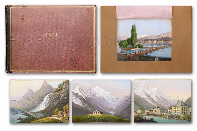
18402475CB(Um 1840). Quer-4°. Mit 13 lith. Ansichten, handkoloriert (ca. 8,5 x 11,5 cm), ausgeschnitten und montiert. Halblederband der Zeit mit Goldfileten und goldgepr. Titel «Album».