4 023 résultats
18794184Worchester: Charles Hamilton. 1879. Softcover. Very Good. Spine outer covering split. Wraps a bit soiled and with one small corner missing ; No. 72. Features Yucatan. Numerous tissue guarded b&w illustrations. With large color fold out featuring the mural paintings in Chichen-Itza; 129 pages . Charles Hamilton paperback
177248368Amsterdam: E. van Harrevelt & D.J. Changuion 1772. 4to. x 2 502 2 pp. Title in red & black. 14 maps 2 folding 2 engraved plates. Contemporary tree calf elaborately gilt decorated spine black tan & gilt morocco spine labels marbled endpapers minor shelfwear rubbing minor wear to corners still a VG fresh copy. Revised & expanded Dutch edition of this installment in the noted set originally compiled and begun by John Green in England further expanded and rewritten by Prevost with superior maps and illustrations and finally this Dutch addition with additional material. This volume opens with detailing the voyages of Bartholome de las Casas 1484-1566 to Venezuela and Guatemala; Jacques Cartier into Newfoundland and present-day Canada; as well as those of Pizarro Diego d’Almagro Vacca de Castro Blasco Nunez de Vela many illustrated and including detailed descriptions of Panama Peru Chili Panama Lima Paraguay the Amazon River and more. Of interest are the plates depicting in habitants of the Americas including domesticated Blacks Mulatto women in Lima and Peruvian Indians. E. van Harrevelt & D.J. Changuion, unknown
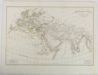
1820177230Paris. circa1820. Engraved map with original outline hand-colour 21.1 x 31.5cm original folds a few spots and a little creased but in very good condition. Latin map of the Ancient world encompassing Europe India Arabia the Middle East and North Africa by the French cartographer Jean Baptiste Poirson 1761-1831 finely engraved. . unknown
98434London Birt 1745. . First edition; 8vo xvi 347 i 39 ipp. a couple of gatherings in the appendix slightly proud contemporary sprinkled calf lightly rubbed short splits to joints corners bumped a very good copy.<br /> 'Pascoe Thomas kept a full and faithful daily journal of the incidents of this important four-year voyage. Included is an appendix giving an account of the treasure taken from the Nuestra Signora del Buono Carmella. This account. preceded the publication of the official account of Lord Anson's voyage by three years' Hill. At the bottom of page 36 of the appendix the exact latitude and remarkably the longitude of the fabled Strait of Anian are provided. This precise location of the Pacific entrance to the elusive Northwest Passage came from a Spanish document captured by Anson and gave rise to the suspicion that the Spanish had discovered the passage but kept it secret. <br /><br />Anson's voyage was a landmark of 18th-century English circumnavigation laying the groundwork for the British exploration of the Pacific in the later half of the 18th century. The expedition set out to cut off Spanish supplies of gold and silver from South America after the outbreak of war in 1739. Whilst successful taking a number of prize ships off the Philippines the cost was high: six ships were wrecked off the coast of South America or in rounding Cape Horn. <br /> Hill 1693; Sabin 95437. London, Birt, 1745. unknown
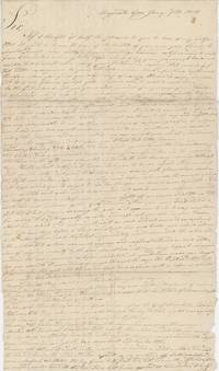
1818List2715Augusta Georgia 1818. Single letter three 9 x 16 inch pages letters with some tape repairs and stray holes at folds still quite legible. Very good. A letter written by Calvin Barnard to his friend Asa Holman of Bolton Massachusetts describing the former’s trip from Boston to Augusta South Carolina from November 25 to January 1. Barnard first traveled from Boston to Charleston South Carolina by boat from which he notes “almost a continual gagging and vomiting†from the passengers. In Charleston Barnard observes that the city is inelegant the unpaved streets “filled with mud†and views “the breastworks which were thrown up during the last warâ€. This would have been the War of 1812 of which Barnard was likely a veteran. South Carolina had engaged upwards of 5000 soldiers and had put up defenses along the coastline in anticipation of the war but it did not come to the mainland – although South Carolina was under naval blockade and the Sea Islands were targeted by the British.<br /> <br /> Barnard reaches Savannah Georgia on the 25th of December; similarly he finds it “although a place of considerable business†“about as dissatisfactory a place I ever was in.†Augusta which he reaches by foot “is much handsomer built and situated than Savannah but not less dissipated†– he remarks that “Being the first day of the year is in this part of the country another great day for getting drunk.†After spending some time in Augusta he finishes the letter with some pointed observations about its residents:<br /> <br /> “I have had a better opportunity of becoming acquainted with the manners customs and dispositions of the citizens of Augusta . I shall not do them injustice by dividing them into three classes in which the Negroes are excepted. The first class of which are the gentry as they would expect to be called made up of men from all parts who have become rich here mostly by avaricious and unjust means . And this class we cannot expect to see drink more than once a week. The second is mostly the natives of this state and South Carolina who are men of a little property of a little education and very little of an honorable principle of any kind and these are not often seen drunk in the forenoon. The third class appears to me to be made up of the off-scouring of every bad place on earth for I never saw their equal for drunkenness lying stealing fighting swearing from morning till morning again. It is not possible that the continent of America has in any other place their equal. If it had I think the whole world soon be sunk.â€<br /> <br /> He finds Augusta’s African-American residents the only trustworthy ones despite local opinions:<br /> <br /> “If any stealing is done here it is laid to the Negroes but I had my surtout a shirt and handkerchief stolen on Friday night last but have too good an opinion of the blacks to think they have them.â€<br /> <br /> Of interest as an outsider’s views on the early Antebellum South and on drinking – another pressing social issue of the day. unknown
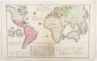
1835203763Philadelphia.: W. Marshall. Circa1835. Handcoloured engraved map 26.5 x 41.3 cms; 29.6 x 48.3 cms sheet central fold insets of "Oceanica" and "New Holland" central table some light staining in the image and margins in good condition. Eurocentrism laid bare. This 19th Century map includes a "State of Society" for each part of the world declared with a symbol to represent "Barbarous Half Civilized Civilized and Enlightened Societies" as well as noting religion and ethnicity. It includes a table of distances between chief towns or capitals and between these towns and Washington DC. Australia "New Holland" is styled principally as pagan barbarous unexplored and African a thin sliver of what is now New South Wales and Victoria is labelled civilized European and Protestant. Scarce. . (W. Marshall). unknown
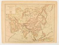
1875174830New York.: Harper & Brothers. 1875. Map printed in colour polar projection 21 x 27.1 cm marginal spotting and toning small edge tears to the inner margin but in god condition. Prepared for "Harper's School Geography" first published by Harper & Brothers in 1875. The map shows physical features mountains steppes plains rivers and deserts etc. together with sources of primary production: whale fisheries furs coffe tea minerals etc.The verso of the map with references and attractive line engravings part of the entry for Netherlands and Belgium. . Harper & Brothers. unknown
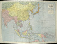
1940205763London.: Hutchinson & Co. Circa1940. Full colour folding map 70.7 x 93 cms; 76 x 101.2 cms sheet original folds short fold splits previous owner's neat title markings on the verso but the map in very good condition. A "Geographia" map of the war theatre in Asia and the Pacific including the northernmost coast of Australia. Showing railways and canals roads and steamer routes oilfields and pipe lines and a key to the unfederated states of Malaya. The Spratley Islands are marked as French and Thai territorial claims within French Indo China are marked. . Hutchinson & Co. unknown
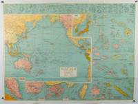
1945180206Sydney.: H.E.C. Robinson. Circa1945. Full colour inset maps principal cities and towns marked shipping routes international boundaries and railways. 99 x 73cm. Some small insect damage has been repaired on the verso visible on map as a few small lighter areas in the western Pacific. Pinpoint holes at folds paper repair along cover but a very good clean copy. From the Sydney publisher H.E.C. Robinson the firm founded in 1895 by Herbert Robinson 1857-1933 a founder of the Royal Geographical Society of Australasia. <br> <br>Although the map is undated North and South Korea are shown as divided which occurred in late 1945 and Manchuria is marked as still under Soviet occupation which only lasted until 1946 at which point it was handed over to Communist China. <br> <br>As well as what now would be considered Southeast Asia the main map shows the eastern half of India Tibet and parts of Mongolia the USSR and East Asia. Inset maps include: Caroline Islands Marshall Islands Federation of Malaya Singapore Hong Kong Taiwan Japan Hawaiian Islands Philippine Islands Midway Gaum and Wake Islands Fiji Islands Eastern & Western Samoa Santa Cruz and Solomon Islands New Caledonia Rabaul Tahiti Lord Howe etc. . H.E.C. Robinson. unknown
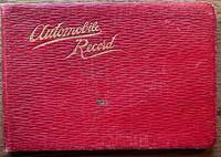
192036670Maine: n.p. 1920. Leather bound. Good. Oblong soft red leather ledger. Approximately 6.5" x 4.5." 64 leaves. Printed title page and explanation page. 60 pages used for writing down records. Several blank pages. Front cover shows light scratches a small stain and light creases. Small ink stain on a couple of blank pages towards the back else contents are clean. <br /> <br /> Records are written in columns for the first 56 pages. Column heading include date start time cyclo arrival time cyclo distance delays net running time average miles per hour roads party and remarks. Several empty pages until 4 pages of manuscript written in the memoranda section. The last note in this section is dated 1927. Alphabetical thumb index for expense records towards the back was not used. Title page does not have the name of the driver. However written at the bottom of the page is "1917 Ford #1750755 1921 Reg # 49290 Maine."Early trips recorded to Plymouth New Bedford Concord Boston Harvard Boothbay Harbor etc. Last driving record recorded August 1926. Although a date of 1927 recorded in the Memoranda section. A presentation card to "Uncle Charlie" enclosed with the inscription "may the roads be good the pleasure great and the blowouts few. n.p. unknown
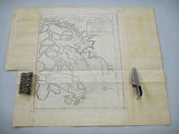
1749136827Paris. Circa1749. Engraved map on watermarked laid paper 20 x 27.3 cm of Fuzhou and coastline of Fujian Province original folds designed by the great French cartographer Jacques-Nicolas Bellin. This map is from the impressive 15-volume "Histoire Génèrale des Voyages" compiled by Antoine François Prévost map no. 2 Vol. 6. This map shows the estuary of Yangtze River Rivière de Chang. Very light browning on sheet edges but in very good condition. . unknown
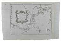
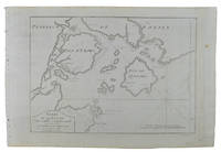
1749136826Paris. circa1749. Black and white engraved map on watermarked laid paper 20.9 x 32.7cm showing coastal area of Zhejiang Province Province de Che-kiang including Zhoushan Archipelago Isle de Chusan Zhoushan Bay Bay de Chusan and Xiangshan County Siang-chan-luen a walled city outside of upper border Ningbo Ning-po prefecture under Qing administration title cartouche lower left original folds. This map is No. 3 Vol. 6 from the impressive 15-volume "Histoire Generale des Voyages" compiled by Antoine François Prévost. Even browning mainly to the sheet edges in very good condition. . unknown
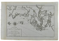
1749136795Paris. circa1749. Black and white engraved map of Quanzhou and Zhangzhou 21.1 x 30 cm here spelled Chin-chew and Chang-chew and both final words with added superscript "ou" on watermarked laid paper 25.6 x 38 cm original folds a few marginal spots simplified compass rose and a decorative fleur de lis bottom right in very good condition. Attractive map including the estuary of Quanzhou River Xiamen Emowi and Kinmen or Quemoy Quemowi island. The map was designed by the eminent French cartographer Jacques-Nicolas Bellin and here published as plate No. 22 in the impressive 15 volume compilation of voyages "Histoire Generale des Voyages" by Antoine François Prévost. . unknown
1749136781Paris. circa1749. Black and white engraved map on laid paper showing entrance to Pearl/Canton river Macao and the area which would become Hong Kong Sinn-gan-hien folded designed by the prominent French cartographer Jacques-Nicolas Bellin. This map is No. 16 Vol. 5 from the impressive 15-volume "Histoire Generale des Voyages" compiled by French novelist Antoine François Prévost. The walled city of Canton upper section is divided into areas of Tartar and Chinese. <br> <br>Some light even browning on paper added at margins good copy. Map measures 25.7 x 20.5. . unknown
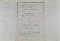
1749136794Paris. circa1749. Black and white engraved plan map of Peking on laid paper folded designed by the prominent French cartographer Jacques-Nicolas Bellin. This map is No. 18 Vol. 5 from the impressive 15-volume "Histoire Generale des Voyages" compiled by French novelist Antoine François Prévost. This city map shows two areas of walled cities: Ville Tartare Imperial city and the Forbidden City and Ville Chinoise ethnic Han residential area. <br> <br>Notes A and B represents buildings within the Forbidden City. A: Lieu de Plaisance ou l'on voit une Montagne faite a la main B: Grandes Cours du Palais de l'Empereur. Two missionary buildings French and Portuguese as well as the Tower of Mathematics illustrated within Ville Tartare. Two temples illustrated side by side near the south gate of the Ville Chinoise. <br> <br>Overall in good condition very light browning on edges and darker toning along the borders of the map. Text in French. Map measures 21 x 16.4cm. . unknown
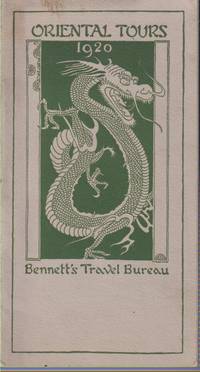
192021258Boston/new York/san Francisco: Benett's Travel Bureau Inc. . 1920. First Edition. Booklet. Very Good. Small discoloration to front wrappers. ; Text and illustrations printed in green. Detailed descriptions of tours leaving from San Francisco. Hand-bound with string. ; 16mo 6" - 7" tall; 12 pages . Benett's Travel Bureau, Inc. unknown
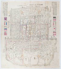
1900169765Circa1900. Large illustrated map of Beijing showing the city in the period following the invasion of the military forces of the Eight National Alliance old folds scale not given. Some scattered light foxing particularly at edges short closed tear at fold lower edge neat non acidic tape repair short section upper edge wear along folds and a couple of small unobtrusive holes with minor image loss. Blocks of text in traditional Chinese right and left upper sections stating each nation's occupied zone Japanese text title accompanies the English title along the upper section of the map. 63.7 x 56.9cm. Very good overall. A rare and significant large Japanese woodblock map of Peking Beijing issued just after the suppression of the Boxer Rebellion. Centred on the Forbidden City the map depicts Peking following the multinational suppression of the Boxer Rebellion or Yihetuan Movement of 1900. The map was issued to illustrate the areas of occupation associated with each of the powers in the Eight Nation Alliance. <br> <br>The map gives measurements of the city walls detailed names of streets and buildings and the boundaries of the inner and outer city including the forbidden city are shown with demarcation lines in pink yellow and blue. The hand coloured eight national flags of the occupation powers are featured at the right and left. <br> <br>This map is essentially a later edition of 京城内外首善全圖 a map of Beijing issued by the Qing for administrative purposes in the mid-19th century. The Japanese seized the wood blocks during the suppression of the Rebellion and subsequently pulled new impressions overprinting them additional details including flags and demarcations of areas of the city held by members of the Alliance. Versions are known in French German Japanese and as with the present example English. An attractive map of great historical interest. . unknown
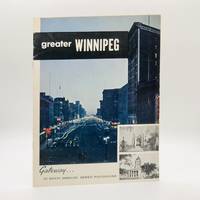
19505543Winnipeg Manitoba: Bureau of Travel and Publicity Manitoba Department of Industry and Commerce N.D. Circa 1950's. First Edition First Printing. Stapled Wraps. Unpaginated pp. 16. 8vo. measuring 8" x 10.5". Pictorial thrice-stapled card covers depicting the busy centre of the City of Winnipeg. Promotional booklet produced by the Province of Manitoba to attract potential tourists chiefly American visitors. Comprises of stunning period photographs of the city's various landmarks highlighting the various amenities including the city's many recreational and shopping facilities parks and playgrounds various religious and government monuments resorts notable events e.g. The Red River Exhibition Musical Festivals Theatre Performances etc. Also incudes a fine large colour fold-out map measuring 23" x 21" illustrating various landmarks and points of interest. Well-preserved showing no detectable flaws to the extremities or contents; near fine. Unrecorded in Peel. Not found in OCLC BAC/LAC University of Manitoba Archives & Special Collections et al. <br/><br/> Bureau of Travel and Publicity, Manitoba Department of Industry and Commerce paperback
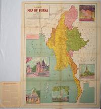
1951214601Delhi.: S.B. Makhija & Brothers. circa1951. Printed colour map 98.6 x 69 cms folding into pictorial wrappers 25.3 x 19.5 cms five pictorial colour inserts of pagodas and the Shwethalyaung reclining Buddha wrappers a little chipped marginal wear and three small fold splits in the map but overall in very good condition. Attractive large map of Burma with the provinces coloured steamship routes shown in red and printed in the booklet a range of information printed based on the 1951 census including climate agriculture and form of government "Burma became an independent nation completely outside the British Empire on January 4 1948 and is now a sovereign independent republic known as the Union of Burma". . S.B. Makhija & Brothers. unknown
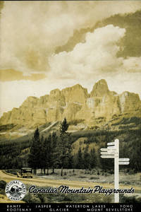
194853045Ottawa: Department of Mines and Resources n.d. circa 1948. n.d. circa 1948. CANADA. 10-1/4" x 7" in tinted pictorial wrappers. 32pp. Numerous black and white photographs. Map. Double column text. Information and photographs of Banff National Park the Banff-Jasper Highway Jasper National Park Waterton National Park Yoho National Park Kootenay National Park Glacier National Park and Mount Revelstoke National Park. Information includes history points of interest wildlife accommodations various recreations trail rides and hikes etc. One-page map showing main routes to the national parks in Alberta and British Columbia. Minimal wear to the extremities. Very good. Department of Mines and Resources, n.d. (circa 1948). unknown
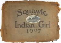
19073212Various locations near Ontario Canada 1907. About very good. 22 leaves illustrated with 178 black-and-white photographs most between 2.25 x 3.25 inches and 3.25 x 5.5 inches with some slightly smaller images cut into ovals but also including twenty-one panoramic images measuring 3.25 x 11.5 inches plus a thirty-seven-page typed narrative of the journey inserted throughout adjacent to relevant images. Oblong folio. Contemporary hand-decorated limp suede covers reading "Squawk and Indian Girl 1907" with a small oval photograph from the trip inset at center. Covers are detached and tattered at the edges main body of album sound with light chipping to edges with images in generally nice shape. A delightful and unique daily travel narrative and vernacular photograph album memorializing a canoe trip taken by two men and three women over the course of eleven days in the Thousand Islands region of Ontario in the summer of 1907. The narrative is written in a humorous style that often mimics a typical ship's log especially when it describes navigational challenges rough water bad weather or other obstacles blocking their progress. The travelers also describe are a variety of people their food various wildlife and sights encountered along the way such as local residents skunks birds an "old haunted house" and much more. Among the locations mentioned either as they stopped for a rest camped or paddled by are Maple Island Grindstone Island Hay Island Gananoque Lake Charleston Lake Blue Mountain Warren's Bay Red Horse Lake and Marble Rock. The photographs show members of the party in their canoes at campsites and in the midst of activities such as fishing hiking sitting around their campfires at night and so forth. A wonderful handmade document of a trip through the Canadian wilderness in the first decade of the 20th century. unknown
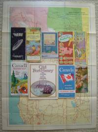
192611838Various Places: Dept. of Transport Canadian Travel Bureau; Canadian Pacific Etc. Very Good. 1926-1980. Ephemera. Canadian Pacific Passenger list with rubbing to spine soil & moderate foxing to white portions back cover at extremities; light foxing/soil to the edges inside front cover. Folding map with foxing on the blank back side of first panel Good condition on this item . Lake Louise brochure with horizontal fold crease bit of soil back edge. ; Including: 1. Canadian Travel Bureau Sectional Map Main Automobile Roads United States and Canada Western Sheet 1938; 26" x 36" color map in fine condition. 2. Canadian Pacific Passenger List SS. Montcalm 1926; 18 pp. including 12 pages for Cabin Passengers; ads; memorandum pages with no entries; folding map in rear. 3. Canadian Pacific hotels 1958; with color map 22 color phototgraphs most of hotels with rates and descriptive captions. 4. Shaw Festival folding brochure 1980 Summer Season. 5. Enjoy Magnificent Lake Louise map brochure with photos no date c. 1930. 6. Your Guide to . . . Northern Great Lakes Area 6th edition 1957; large folding map brochure folds out to 32" x 38" color maps on both sides. 7. Old Fort Henry the Citadel of Upper Canada; 48 p. booklet in white wrappers; color and b&w photographs map and other historical reproductions.8. Guided Tours Olympic Park Montreal 1978; folding pamphlet. 9&10. Two Canada Highway map brochures 1969 1970- folding out to 40" x 36" with color maps both sides mileage charts photos etc. . Dept. of Transport, Canadian Travel Bureau; Canadian Pacific, Etc. unknown
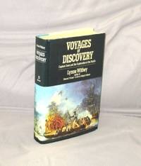
198729026New York:: William Morrow 1987. First Printing of the First Edition. A Fine tight copy in a Near Fine unclipped dust jacket. This is the story of the last great period of European sea exploration with Captain Cook being the preeminent explorer of the era with his discovery of the Hawaiian Islands circumnavigation of Australia the mapping of the Canadian and Alaskan coastlines as well as his voyage to Antarctica. William Morrow, unknown
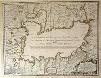
172354819Rainer Ottens. 1723. A most attractive map with early outline hand colour vertical fold barely visible diagonal crease upper half of map few very pale small brown spots otherwise a clean and bright image. Numbering in red pencil few annotations in pencil and light number stamp on reverse however not at all visible from front of map or affecting image. Sheet measures 46.6 x 60.2cm. . Rainer Ottens. unknown
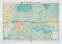
1572160554Tokyo 東京: 統制社Tosei-sha. 昭和 Showa 18. 1943. Colour folding map 54 x 75.5cm with original envelope. Envelope a little torn some occasional browning very good. The 13th map in this Standard Maps of Greater East Asia series of 20 maps. All text in Japanese. Shows railways shipping routes administrative boundaries airfields ports lighthouses mines oil wells etc. . 統制社(Tosei-sha) unknown