4 023 résultats
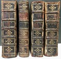
172435371A La Haye: Chez P. Husson; E. Johnson Printers 1724. Later printing. Leather bound. Fair. 12mos. Incomplete set. 4 volumes. Volumes 2456. Speckled brown calf leather bindings with raised bands on the spines. Gilt decorations on the spines. A few title labels remain. Bindings are sturdy. Illustrated. <br /> <br /> Condition of the leather varies with cracked joints damp staining and dryness. <br /> <br /> Volume II: 5 598 pages. Illustrated with 21 plates of which 4 are folding including 8" x 6.5" map of "Isle De La Guadeloupe". Leather is cracked on the joints and has some damp staining. Text block is uniform but cracked in the middle at page 265. Text and illustrations are in good condition with light toning to the contents. <br /> <br /> Volume IV: 5 539 pages 1 page blank 1. Illustrated with 13 plates of which 5 are folding including plans of "Isle De La Barbade" and "Plan du Port du Fort et du Bourg de la Grenade". Slight damp staining and warping of the boards. Text and illustrations in good condition. <br /> <br /> Volume V: 5 504 pages 1. Illustrated with 6 plates 2 folding including 10" x 6.5" "Carte De Lisle De Saint Christophle" and "L'Isle St. Domingue". Leather joints cracked with moderate damp staining on the rear board. Text and illustrations in good condition. <br /> <br /> Volume VI: 4 514 pages 1 58 pages 'Table Des Matieres Pour Les Six Volumes' 2. Illustrated with 6 plates of which 2 are folding including "Plan du Fort et d'une partie du Bourg de la Guadeloupe. Attiquee par les Anglais en 1703". Leather is damp stained and chipped. Joints cracked. Text block a bit warped. Some page corners creased. Text is clean and in good condition. Each volume has an armorial bookplate of "Elden Hall" on the front paste downs. <br /> <br /> Sabin 38411. Chez P. Husson; E. Johnson, Printers unknown
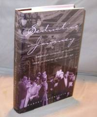
199823323<p>Chicago :: University of Chicago Press 1998. First Printing of the First US Edition. A Fine tight copy in a Fine bright dust jacket. The author begins this social history of American tourism in France in 1786 with Thomas Jefferson's journey toward self-improvement through the cultural tourism of the 1800's to the devastating effects of the First World War and it aftermath resulting in the Golden Age of French expatriation known as the the Roaring Twenties.</p> University of Chicago Press, hardcover
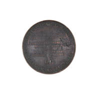
18174204892Paris: Puymaurin & Andrieu 1817. Somewhat aged but authentic issued condition. Bronze medal 41 mm. <p><p>A good example of the medal struck to commemorate the departure of the Uranie for Australia and the Pacific in 1817 under Louis de Freycinet.</p> <p>The Uranie landed at Shark Bay on the West Coast of Australia on 12 September 1818 where an observatory was set up. After visiting Timor and the Hawaiian Islands they reached Port Jackson in November 1818. They left on Boxing Day that year on a course for Cape Horn but on 13 February 1820 the ship was wrecked off the Falkland Islands. However all the crew and most of the records of the voyage and natural history specimens were saved and the voyage was completed on the Physicienne.</p> <p>The voyage was organised by the French government to make observations on geography magnetism and meteorology and became noteworthy for its natural history discoveries. This scientific bent is reflected in the detailed lettering on the obverse which has the main caption 'Hemisphere Austral. Physique Astronomie'. The design for this side of the medal is signed Puymaurin. The reverse of the medal shows the bust of Louis XVIII designed by F. Andrieu.</p> </p> . Puymaurin & Andrieu unknown
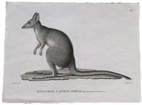
18244505062Paris: Langlois 1824. Fine. Black and white engraving 320 x 238mm. <p><p>Very rare early proof for an engraving of a potoroo in the zoological Atlas of the Freycinet voyage account: the engraving as finally published would include a further taxonomical detail in the form of added detail of the animal's skull titled "Son crâne" and the caption would be entirely changed renaming the animal completely from Kangurus lepturus as shown here to Hypsiprymnus white. These are names given to different specimens of Gaimard's Rat-Kangaroo collected by the Freycinet voyage zoologists Jean Rene Constant Quoy and Joseph Paul Gaimard. We are not aware of the reasoning that led to this change of name but such a substantial change from proof to finished engraving is noteworthy.</p> <p>In the text of the Zoologie section Quoy and Gaimard equate the "petit kanguroo ou le kanguroo-rat des habitans du Port-Jackson" with those shown in the First Fleet accounts of Phillip plate 47 and White plate 60 and tell a sad story of the live specimen that they collected: "Notre individu a vécu quelques jours à bord de l'Uranie: il devint victime de la férocité d'un chien que nous avions pris aux îles des Papous et qui l'étrangla au moment où il s'avançait vers lui en cherchant à le caresser." The dog ate our potoroo.</p> <p>They also describe coming across potoroos in the Blue Mountains: "Ces petits animaux sont d'un naturel très-doux et moins timides que les kanguroos. Dans un voyage que nous fîmes dans l'intérieur des Montagnes-bleues de la Nouvelle-Hollande nous eûmes occasion d'en voir un venir enlever familièrement au milieu de la case en terre qui nous servoit d'abri des restes d'alimens et s'enfuir par un trou à la manière des rats. Nous croyons que c'est une variété de l'espèce que nous venons de décrire".</p> <p>The index to the publication lists the animal as "Potoroo White du Port Jackson"."A French voyage in 1816 under the command of Louis Freycinet brought back to Paris a wealth of new specimens information and sketches of kangaroos. The published account of the natural history of the voyage which included striking plates of the 'Kanguroo Laineux' and the 'Potoroo White' was overseen by Georges Cuvier the leading French naturalist of the day" Des Cowley and Brian Hubber "Distinct Creation: Early European Images of Australian Animals" in The La Trobe Journal 66 Spring 2000; online resource. Perhaps we can assume that Cuvier enforced the name change.</p> </p> . [Langlois] unknown
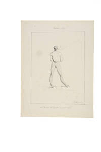
18194504053Guam 1819. In fine original condition. Original ink drawing 310 x 245 mm. fully signed and dated framed. <p><p>Jacques Arago artist on board Freycinet's Uranie during the French circumnavigation of 1817-20 drew this intimate portrait of Brother Ciriaco the curé in Agana the capital of Guam during the visit there of the Uranie expedition between March and June 1819. This is a charming and unusual portrait of a figure who likely expected to be taken more seriously: the cleric is shown in his "at home" attire his petit negligé smoking. His relaxed stance dressed in a vest and daringly striped leggings is further enriched by the addition of the most delicate slippers. </p> <p>Arago 1790-1855 was not only the most accomplished of the artists who made the voyage aboard the Uranie but was one of the most intriguing of the early travellers. The wonders of the long expedition stayed with him for the rest of his life and he continued writing and drawing about the Pacific right up until he lost his sight. In 1822 he published his own well-regarded account of the voyage Promenade Autour du Monde which was published in an English version in 1823. Over the ensuing decades he wrote more differing versions of this interesting account. </p> <p>The Freycinet expedition stayed for a long time in Agana where they were well received by the Spanish Governor Don Jose Medinilla. Agana modern Hagåtña is the capital of Guam and thus the westernmost state or territorial city of the United States despite its modern population numbering only about a thousand.</p> <p>As several of the Uranie crew had recently died from dysentery Louis de Freycinet took this opportunity to rest his men for several months. Here in the Marianas the Spanish missionaries were both powerful and respected and the sailors were required to attend holy week services. Arago was particularly known for his lively and arresting images of the people he encountered with a distinct preference for the unusual or the grotesque. Whether the priest knew that Arago was drawing him at this intimate moment is not known but it seems more likely that Arago captured this image surreptitiously and certainly the satirical tone of the caption - with its reference to the curé and his informal attire - suggests that this delightful vision of the priest off his guard was not meant to be shared. </p> <p>Although unpublished though fully signed and dated the drawing remained in the archives of Louis de Freycinet and his descendants which perhaps indicates that it was at least considered for publication in the massive official account of the voyage.</p> <p>---</p> <p>Arago's textual description</p> <p>In his own books Arago writes at some length various versions and editions including Voyage autour du Monde Paris 1840 vol. II pp. 141-5 and more briefly in his English version Narrative of a Voyage Round the World in the Uranie. commanded by Captain Freycinet. London 1823 pp. 248-50 about the primitive state of religion in the Marianas and the notably pragmatic approach to questions of morality in Agana. He singles out the curé Brother Ciriaco:</p> <p>"Nowhere perhaps is there so much and so little religion as at Guam. The women bestow their favours for a rosary. The men do not blush to offer you a sister or some other of their relations and will immediately after prostrate themselves at the foot of the altar. In the churches the two sexes are separate; and if you see few girls without a veil you also see few men gaze at them. In church the people behave like Christians; in the city and in the country like savages.</p> <p>"Here as in Spain the husbands are very jealous of their wives; lovers of their mistresses: but these excepted you may pay your court if you please to their sisters and friends; what is it to them What is not appropriated to themselves is no concern of theirs: and you will find men shameless enough to offer you as soon as you enter their houses one of their relations for fear you should cast an eye on their wives. At the same time you may be assured that if you please the wife you will not long sigh in vain.</p> <p>"We should be astonished at the prodigious number of processions and religious ceremonies with which the people are amused at Guam if we were not aware that the zeal of devotees and even the carelessness of the indifferent are beneficial to the church and particularly to the priest who takes advantage of every thing. Collections are made at the houses; requisitions are ordered; and there are few of the inhabitants who can escape that sort of tax. Such as have no money of which there is very little in the settlement provide fruit vegetables and meat to fill the stores of the priest who probably distributes a considerable portion among the poor. . . But I saw no poor at Guam!</p> <p>"I imagined the processions would cease when Lent was over and that the people would have a few days respite. By no means: they went on more sedulously than ever: and all things considered these poor people to whom the church prescribes rest or prohibits labour half the week are not so much to blame for devoting three-fourths of their lives to idleness. Is it not even from excess of zeal that the land is so neglected I cannot tell but I fear I was too severe in my first conjectures. Let me be more circumspect in future.</p> <p>.</p> <p>"It is truly painful to see a people who might so easily be guided aright given-up to the darkness in which they are enveloped and even in the present day adopting with blind confidence the absurd narratives of pretended daily miracles with which they are amused every hour of the day. Our learned Abbé de Quelen whose paternal cares are not confined to the instruction of the crew with whom he has made so long a voyage has had many conversations with the priest of Agagna; and he is convinced that the poor man can scarcely instruct his flock in the simplest lessons of the catechism as he is himself ignorant of the fundamental principles of our religion. As to Latin which he told us he had studied from his earliest infancy under the ablest professors at Manilla our chaplain who speaks it with the greatest fluency could scarcely make him understand a few words by turning and varying his phrases: and for my own part I am convinced that as long as such pastors as friar Ciriaco are sent to the Marianne islands religion will be little honoured there and the morals of the people will not be in the slightest degree improved".</p> </p> . Provenance: Until the 1960s in Freycinet family ownership subsequently in a private collection. unknown
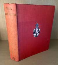
1938010727London: The Argonaut Press 1938. Limited Edition . Hardcover. Very Good. Two Volumes bound as one limited to 475 copies. This copy unnumbered. Quarto. Vol.I. cxxx166 pgs. Vol.II. 293 pgs. with index. Complete with all maps diagrams illustrations. Gently used with light fading to red cloth. Small bookplate to front endpaper. No other names or marks. Excellent overall. <br/> <br/> The Argonaut Press hardcover
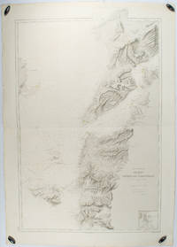
1883178272Paris.: Service hydrographique et océanographique de la marine. 1883 but1894. Engraved hydrographical chart on watermarked double sheet 99 x 63 cm soundings in metres lighthouses picked out in yellow and red inset map of the port and town of Tenedos central fold a few very slight edge tears to the generous margins light spotting and surface soiling but in very good condition. Fine and impressive large naval chart of this strategically important strait then still under the control of the Ottoman Empire. <br> <br>From a private collection; "Lord John Fitzroy Royal Yacht Squadron" in manuscript on the verso. . Service hydrographique et océanographique de la marine unknown
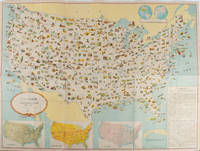
1955172003Washington D.C.: 国務省. Kokumishō. No date. circa1955. Large folding Japanese coloured map of the United States with 3 inset maps at foot of map showing main railways air and highway routes and hemispheres at the top right. Some browning mainly visible on reverse still a good copy. 66 x 81cm. An intricate and detailed pictorial map of the United States published in Japanese by the US State Department. The same type of map had been published since 1945 in English and subsequently in other languages. The Japanese language map is hard to find. The map is undated but was probably produced in the 1950's. The images include depictions of women board riders in two piece swimsuits of the sort popular in the 1950s but the inset text lists Alaska and Hawaii as external territories of the US indicating that the map was produced before they attained statehood in 1959. <br> <br>An inset panel provides information on the area and population of the US the population of major American cities mineral and other resources climate and topography. A note at the bottom right hand corner of the map states that copies of the map can be obtained free of charge from your nearest US Information Office. <br> <br>Every region of the country is decorated with an illustration of the natural resources industries or cultural or historical resources associated with that particular place. These include images of early colonial settlers the birthplaces of Mark Twain and Woodrow Wilson Booker T. Washington's house and Abraham Lincoln's grave; images of major dams oil fields coal mines cotton plantations etc. various animals and crops and images of ships cars and public buildings including the Statue of Liberty located rather oddly far out at sea. . 国務省. [Kokumishō]. unknown
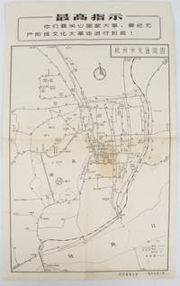
19671632381967. Vintage transportation black and white map of Hangzhou folded no scale a legend lower right corner shows bus/trolleybus routes and terminals. The map covers the old city of Hangzhou from the north side of the city 杭三中"Hangzhou No.3 High School" to the south side 钱江大桥 "Qiantang River Bridge". The West Lake is featured in the centre with its famous tourist spot 三潭映月 "Three Pools Mirroring the Moon" indicated. Bus/trolleybus routes connects schools hospitals municipal government departments cinemas department stores tourist spots around the West Lake etc are all shown on this map. <br> <br>Stained in the central section light wear along folds and edges otherwise good. Text in Chinese. Sheet measures 39.1 x 24.8cm The headline Chinese text in the box along the top of the map reproduces one of the highest directives from Mao's Quotations: "You must pay attention to state affairs and carry the great proletarian cultural revolution through to the end!" . unknown
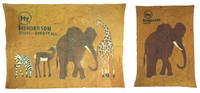
51314Atlanta: Henderson Travel Service 1973. Resist-dyed images printed on rough Batik-type cloth. 22 by 15.5 inches 56 by 39 cm; 23 by 33 inches 58 by 83 cm. Two banners picturing stylized elephants zebras gazelle and a giraffe with the Henderson logo used in the early 1970s with the slogan 'Does it All' on the larger example. <br /> <br /> Fraying to edges fold lines from storage with a few small moisture stains and a small tear to the bottom right of the larger banner at the giraffe's legs else both are very good examples. An uncommon piece from a company that was flying African-American travelers overseas in an era where large parts of their own country were restricted from completely free travel.<br /> <br /> It's not clear whether these were used as in-house advertisements or given away as souvenirs to clients but they're the first we've seen. The Henderson Travel Service started in Atlanta in 1955 by Jake and Freyde Henderson is America's oldest full-service African-American owned travel agency. Henderson Travel Service began in 1955 and by 1957 they had booked their first trip for a client to travel to Ghana to celebrate the country's independence. Out of this grew a full-service agency booking trips for clients to travel abroad including Martin Luther King's trip to Oslo to accept the Nobel Peace Prize in 1964. Today Henderson continues to book travel to Africa for many prominent professional and charitable organizations. <br/><br/> Henderson Travel Service hardcover
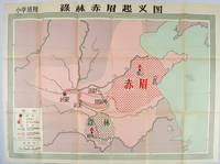
1958171563Beijing.: 地图出版社. Di tu chu ban she. 1st Edition 2nd Printing. 1958. Large Chinese coloured educational map folded. Scale 1:2000000 legend lower left corner showing the military advance of two peasant insurgent groups Lulin and Chimei's march towards the capital city Chang'an now Xi'an in 17 AD. In original worn paper wrapper map in very good condition. Text in traditional Chinese. Map measures 77 x 105.2cm. 王匡 Wang Kuang and 王凤 Wang Feng founded the Lulin Army in the region of modern Hubei Province. 樊崇 Fan Chong lead the Chimei also known as Red Eyebrows Army in the northern parts of modern Shandong Province. . 地图出版社. [Di tu chu ban she]. unknown
98185Arnhem Jan Jansz 1598. . First Latin edition. Small oblong folio 30; 10 ff. engraved plate to title-page 10 further plates & 5 maps with initial letter and colophon; engraved plate to title-page map of Bali 24 coastal profiles and a woodcut showing a pair of emu-like birds with initial letter. Contemporary vellum slightly cockled with some light soiling some early underlining in the text and neat ownership signature to title-page dated 1600. <br /> An anonymous account of the expedition led by Cornelis de Houtman published in the same year as the Dutch edition Journael vande Reyse der Hollandtsche Schepen ghedaen in Oost Indien. the title-page having the same plate. This is the first Latin edition the Arnhem issue. Two other Latin issues are known published in Paris and Middleburg the latter of which is most often seen.<br /><br />Houtman's voyage although disastrous in terms of the lives lost and barely profitable commercially demonstrated to the Dutch that they could circumvent the Portuguese monopoly on trade with the East Indies. In the year following Houtman's return twenty-five ships set out from Holland and Zeeland for the spice islands and thus began the history of the VOC the Dutch East Indies Company which was founded in 1602.<br /> Cf. Tiele pp119-120. Arnhem, Jan Jansz, 1598. hardcover
189064162Philadelphia PA: Wolf & Company 1890. Oblong 12mo. 6 x 4.25 in. 13 leaves unnumbered. Printed title. With 12 colour chromolithograph plates. Raised-embossed decorated & illustrated softcovers cover art on front cover of Native American paddling canoe and Hudson sidewheeler steamship in raised embossed gilt lettering advertisement for Kimball’s Straight Cut tobacco and High Grade Cigarettes on back cover punch-sewn w/ white silk braid minor age toning to fore-edges dustsoiling & minor crease on back cover interior NF bright chromos. First edition of this very rare tourist’s colour chromolithograph souvenir viewbook including images of the “Entrance to the Highlands The Dunderberg†“Adirondacks Highlands†“Mount Taurus and Breakneck†“West Point†“Washington’s Headquarters at Newburgh†and the “Sunnyside Home of Washington Irving.†Of particular interest is the view of the original barrel vault of the tomb of Ulysses Grant erected within 10 days of his entombment and later replaced with the 8000 ton granite tomb erected from 1892-1897. No copies in Worldcat. Wolf & Company, paperback
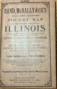
190935126Chicago and New York: Rand McNally & Company 1909. Map. Very good. Approximately 6/5" x 4" printed wraps with 78 pages of information inside. Interior contents and map are clean and in very good condition. Staples are a bit rusted. <br /> <br /> Publisher list of pocket maps printed on the back cover. Contents include list of Railroads Counties Towns advertisements and Hotels etc. Rand McNally & Company unknown
1672ICFELAQ59QY4Holland 1672. Later blue/grey paper wrappers. 4to. With 2 thin rules on the title-page. Set in roman types with incidental italic. First and only edition of a 1672 political pamphlet in the form of a spin-off from Henry Neville's very popular 1668 story of a voyage to the imaginary utopian/dystopian Isle of Pines. The present story is written as a conversation between three militia men on watch discussing the turbulent politics of 1672. One tells of his fictitious voyage and several years residence on a fictitious utopian island called Mallanbruino in the South Pacific. He says it is one degree south of the Isle of Pines. On Mallanbruino the industrious people were oppressed by an emperor but rose up and defeated him with help from a prince who also replaced the evil regents. They note the remarkable similarities to events in the Dutch Republic. The island then set up a new and fairer democratic representative political system bringing peace and happiness to the island. The three men conclude that the Dutch Republic should introduce such a system.Some spots and a small restoration to the extremities of the title-page otherwise in good condition. A fascinating but little-known pamphlet building political propaganda around a story related to the popular imaginary voyage to the Isle of Pines.l Knuttel 10600; M. Reinders Printed pandemonium pp. 195-199; STCN 863300111; not in Gove Imaginary voyages; Van Doorninck Vermomde en naamlooze schrijvers; Ford Isle of Pines 1668 1920; Scheckter Isle of Pines 1668 2011. unknown
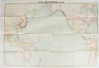
169329東京. Tokyo.: 九段書房.Kudan shobo. 大正十四 1925. Coloured folding Japanese map showing the military strength of Japan the United States and the United Kingdom in the Pacific original pictorial envelope scale not given. Some small holes at folds occasional light foxing a prior owner's signature on reverse minor wear envelope. Very good copy in like envelope. Map measures 54.4 x 78.8cm. The explanatory text in Japanese printed on the reverse in blue summarises the colonial possessions of the US and the UK as well as providing a comparison between the land size naval presence natural resources immigration issues and maritime transport capacities of Japan the United States and the United Kingdom. Legend indicates national regional provincial territorial boundaries canals undersea cables airline routes metropolitans capital cities mining fields hot springs ancient battle fields major trade ports Japanese embassies and consular offices. A large area marked 日本委任统治 "South Pacific Mandate" highlighted in a box is adjacent to Australian occupied Papua New Guinea. . 九段書房.[Kudan shobo]. unknown
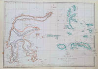
1860184035London.: Weekly Dispatch Atlas. circa1860. Map with outline handcolour 31.3 x 43.3; 33.3 x 48.7 cms sheet 12 x 17 inches small marginal bloom not affecting the map in very good condition. Detailed mapping of these two island groups by Edward Weller 1819–1884 from the ‘Weekly Dispatch Atlas’ an atlas published in monthly instalments from 1855 for subscribers to the long running newspaper. Weller was a pioneer in lithography and was sought after for his skill in producing detailed and accurate maps. . Weekly Dispatch Atlas. unknown
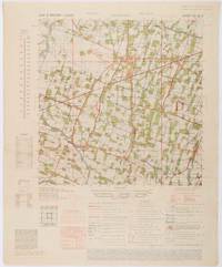
1945200411Washington D.C.: Army Map Service. First edition - revised AMS4. 1945. Army survey map printed in colour 36.7 x 36.7 cm; 58 x 48 cm sheet conversion graph glossary and administrative index to the inner margin; scale three column legend index to adjoining sheets and notes re grid references and mean declination to the foot; sheet toned a very few edge tears the map in very good condition. Wartime map produced by the US Army Map Service AMS who formed in 1942 and were at the forefront of military mapping campaigns during WWII and the post-war years. The very detailed map shows residency and administrative boundaries transportation ground and water features vegetation cultivation ruins religious sites "Graves; Chinese native" and "Cemetery; heathen Christian" walls hedges populated places built-up areas and buildings with those of iron stone wood and bamboo differentiated by colour; fishponds plantations and much more. . Army Map Service. unknown
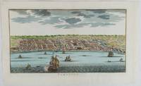
1750177186circa1750. Hand-coloured engraving 19.5 x 35.6 cm 25.5 x 41.6 cm sheet original folds two old paper repairs not affecting the image a trifle toned but in very good condition Attractive bird's-eye view town plan of Makassar in Sulawesi prepared for Abbé Prevost's monumental 'Histoire Générale des Voyages.' . unknown
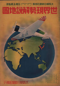
1937208633大阪朝日新聞社. Osaka Asahi Shinbunsha. Showa 12 1937. 10 colour maps not including insets or sketch maps in text on 12 pages. Handsome world map features as the centre fold colour pictorial paper wrappers. A little light soiling and horizontal crease wrappers. An attractive atlas. 38 x 26.7cm. A large format atlas with six pages of coloured maps showing the nations of the world and five pages of Japanese text. The publication seems to have been produced to celebrate the 1937 world record flight from Tokyo to London by Iinuma Masaaki and Tsugayoshi Kenji in their plane 'Kamikaze' which was sponsored by the Asahi Newspaper. The front cover depicts the plane soaring over a map of the world while the back cover also had a colour image of the 'Kamikaze' with an advertisement for the Oji Paper Company which we are told donated a hundred million yen to support the flight. The name 'Kamikaze" had at that stage not yet taken on the connotations which it acquired during the Pacific War. <br> <br>The maps inside the volume show political boundaries major cities and transport routes. The opening pages show the Japanese Empire including Japan proper Korea Karufuto and Manchukuo with small insets covering Taiwan the Chishima Archipelago and Japan's South Sea mandate. The accompanying text focuses on Japan's newly acquired client state of Manchukuo detailing its area population principle products etc while the map includes graphs illustrating Japan's trade with the world and with Manchukuo. China receives an entry of its own with a map of the Chinese Republic and information on the political situation population trade and infrastructure. The central pages of the volume are taken up with a double-spread map of the world including depictions of the flags of a selection of the world's nations. Other sections of the work cover Asia Europe America Africa and Oceania grouped together. The discussion of Oceania includes a section on Hawaii and some small and improbable depictions of Maori and Indigenous Australians. . 大阪朝日新聞社. [Osaka Asahi Shinbunsha]. unknown
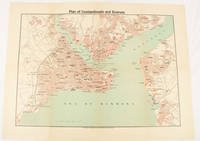
1925174961Constantinople.: The Anglo-American Book & Newsagency. 1925. Printed folding colour map 36 x 49.2 cm street grids for Stambul Pera Galata and Skutari railways and landing places marked small fold splits affecting the margins only now repaired with archival material two small holes at central folds pin-holes to the four corner some age-toning but in very good condition. A scarce map of the historic peninsula soon after the Republic of Turkey was founded and the capital moved to Ankara. Printed for the tourist market this map is a rare survival. . The Anglo-American Book & Newsagency. unknown
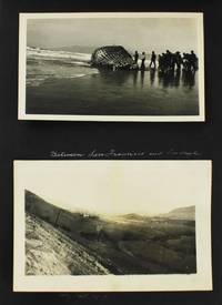
19195848Various locations in the United States 1919. Very good. 50 leaves illustrated with 198 tipped-in sepia-toned photographs almost all around 5 x 3 inches a handful somewhat smaller all with white ink manuscript captions in English. Oblong quarto. Contemporary black cloth photograph album with "Places and Faces" in gilt on front cover string tied. Moderate wear soiling and minor scuffing to boards. Occasional creasing and minor wear to images. A unique and informative photographic record of an extensive cross-country journey by a young Japanese man from San Francisco to New York in 1918 and 1919. The trip took place between December 1918 and September 1919 beginning in Yokohama. Though the traveler is unnamed he was most likely Fujisawa Tomonosuke the son of the founder of Fujisawa Yakuhin once one of the major pharmaceutical companies in Japan. The company is now called Astellas Pharma Inc. According to a company history Fujisawa Tomonosuke travelled to the United States in 1919 as the company opened a branch in New York. The last page of the present album shows a Buddhist-style memorial with an explanatory caption on the verso which states that Fujisawa Tomokichi Tomonosuke's father built it in 1918 to console thousands of deaths during World War I. The monument still sits in Domyoji Temple near Osaka. Another clue that the album was compiled by Tomonosuke is the practice by the compiler to identify all the subjects in the album by a prefix and their last name except for one who is constantly referred to as "Tom."<br /> <br /> Tomonosuke's journey begins in Yokohama where he boarded the Tenyo Maru which delivered him via Honolulu to San Francisco on December 26 1918. He stayed in San Francisco for about six months and visited numerous locations around the Bay Area including Stanford University the University of California at Berkeley Ocean Beach Seal Rock Golden Gate Park Oakland Lincoln Park and more. In late-May he makes his way to Los Angeles and Pasadena where he visits vast oil fields where one image is captioned "Hundreds of oil wells in Los Angeles" a Southern Pacific Railroad station the zoo Bush Garden and other sites.<br /> <br /> After a few days in southern California Tom sets off across the continent to his presumed ultimate destination of New York briefly visiting Salt Lake City Denver and Chicago before arriving at Niagara Falls by June 3. He includes numerous shots of the falls before arriving in New York City. His stay in New York was extensive and included many sightseeing tours to locations in New York but also New Jersey and Pennsylvania. He includes shots of Bronx Park the Poughkeepsie Bridge the Victory Arch the Statue of Liberty and other sights around Manhattan along withe scenes in Montclair Atlantic Highland and Culver's Lake New Jersey and a few locations in Pennsylvania such as Sawkill Falls on the Delaware River. He also witnessed the commemoration parades for both the American Army's 2nd Division and General Pershing's "Grand Parade Day" in New York City each of which he preserved in a handful of photographs.<br /> <br /> In addition to the variety of the settings the photographs reveal real skill and technique by the photographer. The images are mostly well composed and informative in nature. Despite the fact that the compiler was Japanese all of the captions are written in confident English lending further credence to the notion that the compiler was highly educated and confident as would be the son of the founder of one of Japan's most successful companies. An exceptional annotated vernacular photograph album preserving the adventures of a precocious Japanese business traveller in the United States just after the First World War. unknown
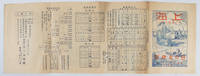
1935171622Shanghai.: 日の丸旅館. Hinomaru Ryokan. Circa1935. Black and white photographic illustrations 54 x 19.5cm. Single sheet printed double sided folded into 8 panels title image printed in blue and red shows a romantic scene across the river to the Bund with traditional Chinese craft and a modern ship in the foreground. Browning occasional light marks creasing and wear but overall a good copy of a scarce piece of Shanghai ephemera. Text in Japanese. Tourist brochure published by the Japanese inn Hinomaru Ryokan in Shanghai in the mid-1930s. The brochure is undated but it appears to have been published sometime after the First Shanghai Incident in 1932. Hinomaru Ryokan was named in honour of the Japanese national flag which was and is commonly called Hinomaru in Japanese. <br> <br>This interesting piece of Japanese Shanghai ephemera provides an outline of Shanghai and its Japanese community at a time when the Japanese residents numbered about 29000. The inn promotes its convenient location within the Japanese community and reassures visitors that the Hinomaru Ryokan is a safe place to stay given is close proximity to approximately 2000 Japanese troops stationed at the Marine's quarters at the ready to protect the residents. It also advertises the free tours of the area it runs and states it is a designated place of accommodation by the Japanese Consulate South Manchurian Railways Manchukuo embassy and the Japanese Tourist Bureau. Additionally the brochure lists the primary sights to be seen in Shanghai Suzhou and Hangzhou a 6-day sightseeing tour plan and train shipping and air schedules and prices. . 日の丸旅館. [Hinomaru Ryokan]. unknown
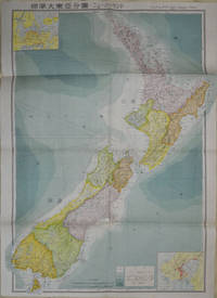
1572154080Tokyo: 統制社Tosei-sha. 昭和18 Showa1943. Folding colour map of New Zealand with inset of Auckland and Wellington top and bottom corners1:2000000 scale little light browning. Original envelope worn with closed tears. 54 x 76.5cm. Good copy. Scale plan of New Zealand printed by Tosei in 1943. The map legend shows infrastructure deemed important to the Land Survey Bureau of the General Staff Headquaters of the Imperial Japanese army such as boundaries powerlines quarries and mines; railroads sea-routes etc. . 統制社(Tosei-sha) unknown
192645424Amherst MA: Samuel T. Dana & Harriet Dana 1926. Six volumes. 4to. 32; 38; 38; 27; 37; 34 leaves; an additional 16 leaves in manuscript in 3 of the albums written by Harriet Dana at age 10. Approx. 300 real photos of Harriet & George Ruth Dana Samuel Dana many street scenes numerous large studio photos tipped-in of sights in Rome Florence Dresden and other areas. Over 450 black & white tipped-in photo postcards many of them real photo postcards a few gold-tone photo postcards; approx. 75 tipped-in colour postcards; two letters of introduction from Yale University Secretary Robert Maynard Hutchins letter of introduction from U.S. Secretary of Agriculture William Marion Jardine who served under Presidents Coolidge and Hoover; printed invitations to the Congress World Forestry Congress credentials numerous programs to operas and theaters in European cities; menus to the S.S. President Harding; Menus for the S/Y Meteor; menus for the conferences; Children’s Tea Menu for the S.S. President Harding; Passenger lists for the United States Lines President Harding; tourist maps pictorial maps manuscript annotations and more. Uniformly bound in pebbled black cloth two-ring binders 1 of them with SS President Harding ribbon stretched around the binding wear & rubbing to the corners bumping to the spines a couple of the binders with hinges starting many of the leaves with wear and some loose at the gutter margin still a remarkable archive. An incredible Jazz Age archive of travel photos ephemera and documents assembled by Samuel T. Dana and his daughter Harriet during the family’s five month trip through Europe for the First World Forestry Congress held in Rome Italy. The albums are filled with documentation and souvenirs from their grand tour through Europe. Included are photos of the participants in the World Forestry conference two of them are of Dana’s subcommittee at the meeting many of the registration credentials letters of introduction as well as invitations to meetings and parties associated with the conference. The Dana family had an audience with the Pope in Rome saw Benito Mussolini visited the major sights of Venice with pictures of young George Dana feeding the pigeons in the Plaza in front of St. Mark’s Cathedral. They attended Verdi’s opera La Traviata featuring the soprano Violetta Valery. From there they traveled through France Switzerland Austria Czechoslovakia Germany Denmark Norway Sweden and Finland. They have included their brochures for visiting assorted museums folk festivals operas in Munich historical sights in Prague the beautiful city of Dresden tramped through all parts of Paris voyaged on the S/Y Meteor of the Norwegian Steamship Lines through Sweden Finland and Norway with the special treat of including their menus for breakfasts lunches dinners and children’s teas great photo of the children for the Captain’s tea on the SS President Harding. The photographs feature street scenes in assorted places views from the top of the Arc de Triomphe and the Eiffel Tower many of the people they met in their travels and more. Dana met with foresters and visited timber stands throughout northern Europe and Scandinavia.Of particular interest are the many leaves hand-written by the 10-year old Harriet Dana 1916-2011 describing the places they visited her impressions of the sights the many experiences she had as well as very charming notes from family friends tipped-in which were to be opened during their travels. She has annotated many of the postcards and photos. These albums and her impressions offer an invaluable cultural insight into travel during the Jazz Age for the well-to-do. In addition there are several leaves in manuscript written in both pencil and pen of the prices and types of souvenirs purchased throughout Europe including dolls pennants mosaics many lead soldiers a toy loom toy boat decks of cards clothing china and many different types of jewelry. Harriet Merrill Dana Carroll would later attend Swarthmore college graduate from Yale Nursing School in 1941 and eventually retire in Bethesda Maryland in 1986. Samuel Trask Dana 1883-1978 was a world renowned forestry expert who graduated from Yale in 1907 entered the U.S. Forest Service where he began groundbreaking studies in the culture of renewable white pine and paper birch forests. He established several forest experimental stations intended to further research and promote the economic value of forests. He served in World War I and from 1923 to 1927 was the director of the Northeastern Forest Experiment Station in Amherst Massachusetts where his most significant achievement was helping to organize the First World Forestry Conference. This Congress was significant because he succeeded in helping to establish an international body to compile and track forestry resources all over the world. Subsequently he became the first dean of the University of Michigan School of Natural Resources which pioneered many trends in modern forestry. He served as chairman of the U.S. Timber Conservation Board President of the Society of American Foresters was appointed in 1958 by President Eisenhower to serve on the National Outdoor Recreation Review Commission and also studied proposals to preserve California’s redwood forests. Samuel T. Dana & Harriet Dana, hardcover