4 023 résultats
1884L0903dLondon: W H Allen. VG : in very good condition without dust jacket. Minor wear to base of spine and corners and to front endpapers. Contents clean and tight. 1884. First Edition. Blue/gilt hardback cloth cover. 260mm x 200mm 10" x 8". xvi 150pp plates. 8 b/w plates. . W H Allen hardcover
1982236257London: Gordon & Breach 1982. Hardback with printed boards showing light shelfwear. Contents remain clean sound bright throughout. TPW. First Edition. hardcover. Very Good/No Dust Jacket. Used. Gordon & Breach Hardcover
2009003690Jones and Bartlett Publishers 2009. 8vo size trade paperback; 248 bright white pages. From back: "This unique text looks at a wide variety of career opportunities in a broad range of direct healthcare settings such as hospitals physician practices nursing homes and clinics as well as non-direct healthcare settings such as associations managed car and health insurance companies consulting firms and medical supplier firms. Filled with first person accounts form healthcare managers working in the field these profiles will engage the reader while also covering the key function associated with these important roles. This hands-on text is the perfect resource for student so healthcare management nursing allied health business administration pharmacy occupational therapy public administration and public health. We note only minor edgewear. Thanks for shopping with us. 100% of your purchase benefits charity and supports literacy and life-long learning. Trade Paperback. Very Good/No Jacket. 8vo - over 7¾" - 9¾" tall. Jones and Bartlett Publishers Paperback
1930068764New York: Dodd Mead and Co. 1930. Book. Very Good. Hardcover. 1st Edition. 8vo - over 7¾" - 9¾" tall. Light green cloth lettered in gilt illus. in black. Cover cloth mildly tanned toward edges spine panel tanned spine extremities rubbed with minor surface loss. Mended rear hinge. Mild foxing to a few early leaves. 1st ed. 4th ptg.: Jan. 1930. xix321 pp. illus. w/ b&w plates maps. Dodd, Mead and Co. Hardcover
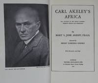
1931r6871aNew York: Victor Gollancz Ltd. G : in good condition without dust jacket. Rebind. Equatorial Africa map missing. 1931. First UK Edition. Navy blue hardback cloth cover. 230mm x 160mm 9" x 6". xix 321pp plates. 74 b/w plates. Heavy item - shipping supplement may apply for overseas. . Victor Gollancz Ltd hardcover
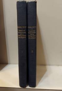
1942181010-MG30Madrid Spain: Espasa-Calpe S.A. 1942. TWO VOLUME SET text in Spanish . Hardcover. Very Good/No Dust Jacket. Espasa-Calpe, S.A. Hardcover
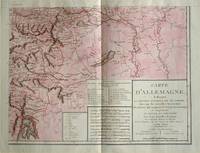
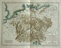
1805570721805. Copper engraving with handcolouring map shows the border of the Austrian Empire and Hungary Vienne sic and the Danube can be seen at the top of the map Two keys and scale inset. Few closed tears and some browning edges otherwise a clean and bright image. Map measures approximately 34 x 44cm. Map of Germany <br>indicating the present division of this empire as well as the new possessions of the princes who make up the Germanic body and including Batavia and Helvetia Switzerland with their divisions. by E. Mentelle a member of the institute and P. G. Chanlaire one of the authors of the National Atlas. An xiii 1805. Paris. There is a key to the explanation of the signs and an explanation of the colours used for the district of the various states contained in this map. . unknown
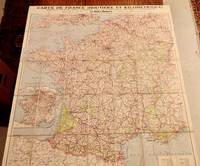
193050230Paris: Petit Parisien c. 1930. folding map. Very good . 39" x 35 inches. Folds neatly into 5 x 8" with linen backing. Map is in color. No date appears to be c. 1930. Condition is VERY GOOD ; very clean no damage colors bright. Excellent for framing. Travel/Ephemera. Stax. Petit Parisien unknown
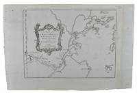
1749136827Paris. Circa1749. Engraved map on watermarked laid paper 20 x 27.3 cm of Fuzhou and coastline of Fujian Province original folds designed by the great French cartographer Jacques-Nicolas Bellin. This map is from the impressive 15-volume "Histoire Génèrale des Voyages" compiled by Antoine François Prévost map no. 2 Vol. 6. This map shows the estuary of Yangtze River Rivière de Chang. Very light browning on sheet edges but in very good condition. . unknown
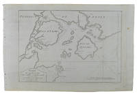
1749136826Paris. circa1749. Black and white engraved map on watermarked laid paper 20.9 x 32.7cm showing coastal area of Zhejiang Province Province de Che-kiang including Zhoushan Archipelago Isle de Chusan Zhoushan Bay Bay de Chusan and Xiangshan County Siang-chan-luen a walled city outside of upper border Ningbo Ning-po prefecture under Qing administration title cartouche lower left original folds. This map is No. 3 Vol. 6 from the impressive 15-volume "Histoire Generale des Voyages" compiled by Antoine François Prévost. Even browning mainly to the sheet edges in very good condition. . unknown
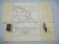
1749136795Paris. circa1749. Black and white engraved map of Quanzhou and Zhangzhou 21.1 x 30 cm here spelled Chin-chew and Chang-chew and both final words with added superscript "ou" on watermarked laid paper 25.6 x 38 cm original folds a few marginal spots simplified compass rose and a decorative fleur de lis bottom right in very good condition. Attractive map including the estuary of Quanzhou River Xiamen Emowi and Kinmen or Quemoy Quemowi island. The map was designed by the eminent French cartographer Jacques-Nicolas Bellin and here published as plate No. 22 in the impressive 15 volume compilation of voyages "Histoire Generale des Voyages" by Antoine François Prévost. . unknown
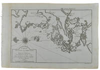
1749136781Paris. circa1749. Black and white engraved map on laid paper showing entrance to Pearl/Canton river Macao and the area which would become Hong Kong Sinn-gan-hien folded designed by the prominent French cartographer Jacques-Nicolas Bellin. This map is No. 16 Vol. 5 from the impressive 15-volume "Histoire Generale des Voyages" compiled by French novelist Antoine François Prévost. The walled city of Canton upper section is divided into areas of Tartar and Chinese. <br> <br>Some light even browning on paper added at margins good copy. Map measures 25.7 x 20.5. . unknown
1830009582Paris - 21 Quai Voltaire: Rosselin 1830. Map. Fine. Map. A fine map hand-coloured in outline folding into original marbled paper boards with title label to the front board. Boards rubbed conrners worn. The map measures 74 x 55cm and is in very good condition with the paper bright. A very good to fine copy of this rare map. Rosselin hardcover
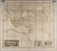
1853176118Paris.: Ministère d'Etampes et de Géographies. 1853. Engraved map with outline hand colour 67.2 x 75.1 cm sectioned and linen-backed two large vignettes: a view of Constantinople; and costumed Turks and European soldiers facing off across a stream the linen browned with some loss but not affecting the map with the fine nineteenth century label of Charles Delarue & Hivert on the verso. Fine map with beautiful vignettes by Adrien Toussaint Lallemand 1793 - c.1856 geographer and engraver at the Depôt de la Guerre. Lallemand was appointed at a precociously young age and later set up in business on his own the quality of his work assuring him of the continued business of the Depôt. <br> <br>Highly attractive map of the Ottoman Empire published at the outset time of the Crimean War 1853-1856. <br> <br>This item is held off-site. Please note there may be a few days delay while it is brought into our shop for viewing or mailing to you. Thank you for your understanding. . Ministère d'Etampes et de Géographies unknown
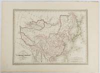
1837177519Paris. circa1837. Engraved map with original outline hand-colour 22 x 30 cm; 28.8 x 38.6 cm sheet marginal repair to the lower corner not affecting the map sheet lightly age-toned in very good condition preserved in a window mount. Fine map of China Japan and Central Asia noting Manchuria "Mandchourie" bordering Northern India and Turkestan in the West and Russia "Russie d'Asie" in the North. <br> <br>From the estate of the late collector and scholar Arthur Hacker with his pencilled catalogue mark on the verso. . unknown
180057070c1800. Copper engraving with handcolouring map shows Germany and parts of France Italie Hongrie Pologne and Prusse sic. Minor hole upper border few closed tears and some browning edges otherwise a clean and bright image. Map measures approximately 34 x 46cm. . unknown
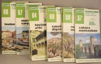
198042075Paris IGN France Institut Geographique National 1980 paperback. Twelve 12 folded topographic / tourist road maps 1978 1979 1980: Cahors Montauban through Pau Bagneres de Luchon. Text in FRENCH. -- Softcover folded maps. Conditon: very good minus about 2 inches wavy apparently from a too-short box; three covers have a little soil. IGN France Institut Geographique National paperback
1965117352London: Cambridge at the University Press for the Hakluyt Society 1965. Hb. Very Good/No Dj. 8vo. Second Series No. CXXIV 2 volumes pp. xii 2 273 and pp. vi 275-564 b/w illustrations fold-out plates. Ex-lib but vg nonetheless. Cambridge at the University Press for the Hakluyt Society hardcover
1930160422London: Hodder and Stoughton. Very Good in Very Good dust jacket. 1930. First Edition; First Printing. Hardcover. A first edition in very good condition with dust-jacket of equal condition. Dust-jacket has some wear and two small tears to back. Dark green boards with gilt lettering on cover and spine. Spine shows small amount of shelfwear. Signed and dated Aug. 1930 by previous owner. Pages are clean and tight. ; Buchan's second Dickson McCunn novel set in Scotland. ; 8vo; 320 pages . Hodder and Stoughton hardcover
1930160414London: Hodder and Stoughton. Very Good. 1930. First Edition; First Printing. Hardcover. A first edition in very good condition. Cover and interior of book are clean. Spine is slightly cocked and pages are not as tight as they once were. ; The story is about a group of people who are trapped in a castle by a madman. They must use all their ingenuity to escape before the madman kills them.; 8vo; 320 pages . Hodder and Stoughton hardcover
1930160423London: Hodder and Stoughton. Very Good. 1930. Hardcover. An edition in very good condition. There is some tanning to endpages with a bookseller's sticker on the front pastedown. There is also a small amount of foxing to pages. The exterior is clean with gilt lettering. The spine shows some signs of shelfwear. ; The story follows the adventures of Allan Quatermain an explorer of the African continent and his friend Henry Salt as they travel to find the hidden treasure of the castle Gay. Along the way they must outwit traps fight off fierce animals and evade the attention of villainous villains.; 8vo; 320 pages . Hodder and Stoughton hardcover
1912d1767London: John Lane - The Bodley Head. G : in Good condition without dust jacket. Cover rubbed. Previous owner inscription and bookplate to front paste-down. Occasional light foxing and marks. Occasional pencil notation. 1912. First Edition. Illustrated black hardback cloth cover. 220mm x 140mm 9" x 6". xi 331pp ads. 22 illustrations. . John Lane - The Bodley Head hardcover
1939r6598London: J M Dent & Sons Ltd. VG: in very good condition with rubbed and chipped dust jacket. 1939. First Edition. Blue hardback cloth cover. 240mm x 160mm 9" x 6". xvi 343pp plates. 16 b/w plates. The History of the Second World War. . J M Dent & Sons Ltd hardcover
1999040784Salem MA / Mansfield CT: Essex Institute / Martino Publishing 1999. Reprint. Hardcover. Fine. pp: ix 392 with index. Bound in gray cloth gilt lettering on spine. 9" x 6" Facsimile reprint of the 1926 edition. Essex Institute / Martino Publishing hardcover
189311000E.H. Krelage & Fils Haarlem 1893. Fair. Pamphlet Rear cover torn piece detached pages browned edge wear. 40 pp. E.H. Krelage & Fils, Haarlem unknown