4 023 résultats
2001abcvEarthyear Books 2001. Hardcover. Near Fine/Near Fine. the jacket is a little shelf rubbed. internally clean. well bound. near fine copy.S.K. Our orders are shipped using tracked courier delivery services. Earthyear Books hardcover
2001ojlhEarthyear 2001. Hardcover. Good/Good. 9x6x1. signed. Signed by the author in ink on the front end page. The jacket is shelf worn with creasing along the edges a sticker and a small closed tear. The boards are edge rubbed with scuffing along the edges. The binding is secure. Stamp and ink inscription from a previous owner on the front end page. no other ink inscriptions or annotations. Protected in cellophane. Extra postage required unless posted within South Africa. r12/11/2024 JHK. Our orders are shipped using tracked courier delivery services. Earthyear hardcover

1909BOOKS031594IWash. D.C.:: Int'l Bureau Amer. Republics. 1 leaf edge repaired; water staining & rumpling along bottom. 1909. ISBN: edge; Fair unmarked illus. Hardback; no DJ. 235 pp. Catalogs: SOUTH AMERICA. Keywords: CHILE. Int\'l Bureau Amer. Republics hardcover
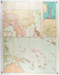
1943206908Chicago.: Geographical Publishing Company. 1943. 10 printed colour maps on a large single sheet 91 x 71 cms small inset map of the European theatre chronology of events original folds a few short fold splits archivally sealed; in very good condition. A suite of numbered U.S. war maps with Allied action overstamped in red by the publisher that for Germany and France with pictorial stamps for strategic targets including "Chemical Factories" and "Airplane Factories". The maps numbered 1 to 10: English Channel; Italy; Southern Greece; Western Mediterranean Sea; Germany and France; Baltic Sea and Scandinavia; China Burma India; Japan; Tokyo; and Greater Pacific Battle Zone: a large half sheet map noting the placement of US and Japanese bases. The "Chronology of Important War Events" lists action from the bombing of Pearl Harbour: "Japan's day of Infamy: Japanese air attack cripples American Fleet at Pearl Harbour" to March 21 1944 "Germans take over key political posts in Bulgaria and Romania". <br> <br>Issued by the Geographical Publishing Company of Chicago this educational sheet includes an advertisement for WLS Chicago "The prairie farmer station" with a list of their war broadcasts and a world clock. . Geographical Publishing Company. unknown
191023366New York: John Lane Company 1910. First American Edition. Hardcover. Very good. 10" x 8" xiii 202 pp beautifully illustrated with 40 color plates by the author. Bookplate on front pastedown with another underneath it light edgewear to boards some light discoloration to rear board; binding sound contents clean. Liddell 1860-1925 was a British landscape painter who traveled extensively in China where his family had business interests. A contemporary advertisement for this book says that "the author was actually admitted to parts of the Imperial Palace never before opened to a European and his work in China is absolutely unique. John Lane Company hardcover
3829707096.Gpaperback. Good. Access codes and supplements are not guaranteed with used items. May be an ex-library book. paperback
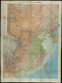
1953161304Edinburgh.: John Bartholomew & Son Ltd. 1953. Colour folding map laid down on linen. Scale 1:450000. 97 x 72 cm. Small holes and tears at some folds a little light browning. Cloth tape repair at fold adjoining upper card cover. Frederick Warne label upper cover a little creased and torn key includes glossary of Chinese geographical terms translated into English. Contour-coloured world map series. Published in the period immediately following the Korean War this map shows the 38th Parallel. . John Bartholomew & Son Ltd. hardcover
1993TRCH00007Boulder CO San Francisco & Oxford: Westview Press 1993 WYSIWYG pricing--no added shipping charge for standard shipping within USA. Full red cloth gilt titles on spine maps on burnt orange endpapers xv 688 pp 26 ff b & w photos not in pagination footnotes index. Some marginal notes and underlining nearly all in pencil else fine. DJ in Brodart archival cover. Barnett was in China during the war between the Communists and the Nationalist government in the late 1940s. In 1988 when much of China was re-opened to foreign visitors he revisited areas he had seen decades earlier and reported on the changes he saw in this book. Shipping weight 4 lbs. First Edition. . VG/Fine. 24 X 16 cm. Westview Press Hardcover
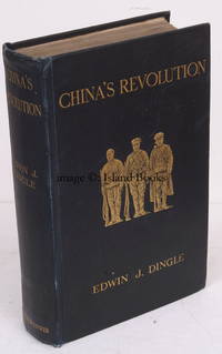
191220061T Fisher Unwin 1912. 8vo. First Edition with a portrait frontispiece original tissue guard present title in red and black 35 plates on 31 and 2 large folding maps on japon half-title lightly spotted otherwise some very light and occasional marginal spotting to text; original pictorial blue cloth upper elaborately blocked and lettered in gilt gilt back gilt top uncut upper hinge cracked but binding wholly sound a remarkably bright fresh clean copy. Sold from an institution with its faint tape-marks on covers bookplate on front paste-down press-mark on front free endpaper and small blind stamp on title. Well-illustrated account of the revolution at Wuchang Hankow and Hanyang. One of the first Caucasians to live in China for any length of time Dingle was resident in Hankow at the outbreak and remained throughout the revolt. Includes a valuable set of otherwise unpublished photographs of localities military detail and leading personalities many of the images are from the Upward collection. The author was appointed FRGS and later founded the School of Mentalphysics in California. RARE. T Fisher Unwin, hardcover
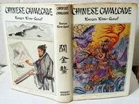
1963009363London: Herbert Jenkins 1963. Beautifully illustrated book written and illustrated by the author anfd inscribed and SIGNED by him on the half title page. Contains 106 pages in bright clean condition just some light browning to outer edges of pages not inside very faint foxing spots on title page. Many colour and B/w illustrations all present as listed plus very informative text of the author's travels in China Dustwrapper is lightly browned to extreme edges and very light rubbing to edgesnot price clipped 42/-net A pleasing example of this book espcially with signature SEE IMAGES. DETAILED IMAGES CAN BE TAKEN ON REQUEST . Signed by Author and Artist. First Edition. Boards. Very Good/Good Plus. Illus. by Kwan Kim-Gaul . 24 Cms X 16 Cms. Hardcover. Herbert Jenkins Hardcover
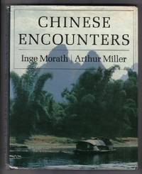
197911782New York: Farrar Straus and Giroux. Near Fine in Very Good dust jacket. 1979. First Edition; First Printing. Hardcover. 0374122083 . A very attractive stated first printing copy in Very Near Fine condition in Very Good dust jacket with limited soiling and chipping mainly at the spine ends SIGNED by author Arthur Miller and illustrator Inge Morath directly on the half title page; In 1983 Pulitzer prize-winning playwright Arthur Miller visits China with his Austrian born wife Inge Morath and publish the book Chinese Encounter about their experience. Morath's glorious photographs and Miller's talks reveil a remarkably candid look of the artistic expression in China of the last century; 8vo; Signed by Author & Illustrator . Farrar, Straus and Giroux hardcover
1984W1149London: Oriental Ceramic Society 1984. 200 pages. 4to. A well-researched and profusely illustrated exhibition catalogue of 3000 years of carved Chinese ivory. The book is in fine condition: clean and tight in a clean crisp and bright dust jacket that has just a hint of edgewear. First Edition. Hardcover. Fine/Very Good. 4to - over 9¾" - 12" tall. Book. Oriental Ceramic Society Hardcover
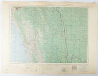
1955173072Washington D.C.: Army Map Service U.S. Army. 1955. Large colour map. 1:250000 scale. Transverse mercator projection. 23°00'N 91°30'E-22°00'N 93°00'E. Series U502 Sheet NF 46-6 Edition 1-AMS. Map measures 57.3 x 75.8cm. Slight wear creasing even light browning small closed tears on edges upper-right corner little foxed. Shows signs of use but map is clean and complete. Corps of Engineers Army Map Service map of Chittagong and surrounds compiled in 1955. Based on the British Indian one-inch and half-inch map series from 1938-43 and 1936-43 respectively. . Army Map Service, U.S. Army. unknown
1932biblio215<p><i>William Jackson. Joiner and Steele. London. 1932. 8vo. 67pp. Woodcut frontis. Original cloth gilt lettering to spine and cover. Teg. Signed limited edition 377/550. Joiner and Steele insert tipped in as called for. Bookplate of Peter M. Jeavons to fep. Foreword by Geoffrey West.</i></p><p><b><i>Stella Benson</i></b><i> 1892-1933 novelist poet and travel writer. She lived in China from 1920 whilst continuing to travel widely. She died in Hongay Indo-China in 1933.</i></p> William Jackson. Joiner and Steele hardcover
0243966245.Gpaperback. Good. Access codes and supplements are not guaranteed with used items. May be an ex-library book. paperback
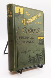
1886019502<p>New York: Charles Scribner's Sons 1886. First US Edition. Hardcover. Very Good. 298pp; Green cloth boards with gilt titling to front & spine illustration to front boards square and clean previous owner's name crossed out to FFEP pages slightly age-toned text unmarked binding is tight VG condition. Antique volume chronicling an 1884 journey by coach from Charing Cross in London to Ilfracombe a seaside resort on the North Devon Coast England. Illustrated by Edward L. Chichester.</p> Charles Scribner's Sons hardcover
20112092902144201028Kawade Shobo Shinsha 2011. Soft Cover. Fine. The book is in fine condition. Kawade Shobo Shinsha paperback
19382091502135417985Sanseido 1938. Soft Cover. Fine. Number of books: 1 Sanseido paperback
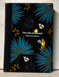
20175110069N. P.: Reading Life 2017. Hardcover. Very Good in No Dust Jacket dust jacket. Book is in the Chinese language. Sound binding and hinges. Clean bright pages. Paper over boards is clean with minor edge rubbing. Translation of "100 Years of Solitude."; 8.25" tall; 360 pages. Reading Life hardcover
18424026The Society For The Diffusion Of Useful Knowledge London 1842. Early Edition. Map. Good Condition/No Dust Jacket. No Date: Circa 1842 Engraved by J & C Walker. No Binding. Sheet Size: 34cm x 41cm. Hand coloured. Edition up to 1842 as Grahamland Enderby Land Sabrina land La Terre Adele Emerald Island and Balleny Island are shown. Ref: Tooley: 97. 0.5cm closed repaired tear with archival tape to lower left corner not affecting map. Slight age toning to sheet. In very good condition overall. Enderby land was discovered in February 1831 by John Biscoe on the Tula and named after Enderby Brothers of London owners of the Tula who encouraged their Captains to combine exploration with sealing. The beginning of the nineteenth century saw a period of rapid market growth and innovation in the map publishing world. Increased literacy and public interest in new frontiers and colonies overwhelmed the market because it was oriented toward the small affluent market of the previous century. With the intent to fill this void The Society for the Diffusion of Useful Knowledge SDUK was founded in 1828 in London by Lord Brougham and a group of men dedicated to the education of the aspiring working class and the Utilitarian ideal of 'Knowledge is Power.' The society produced an array of education materials but the series of maps was one of their most successful ventures. A number of engravers and printers were used to produce the maps which eventually exceed 200 sheets and continued to be published after the Society as a whole ceased to function. This map was produced to illustrate the latest discoveries in Antarctica including South Shetland Enderby Land Sabrina Land La Terre Adele and Balleny which are all delineated within the Antarctic Circle Quantity Available: 1. Shipped Weight: Under 1 kilogram. Category: Arctic & Antarctic; Geography & Maps. Pictures of this item not already displayed here available upon request. Inventory No: 4026. . The Society For The Diffusion Of Useful Knowledge unknown
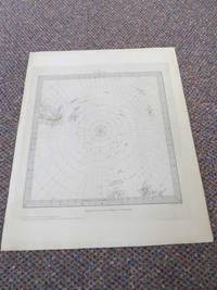
18314051<p>Baldwin & Cradock London 1831. First Edition. Map. Good/No Dust Jacket. Dated 1831: Map engraved by J & C Walker. Published Under the superintendence of the Society for the Diffusion of Useful Knowledge. Map of Antarctica as was known at that time. Part of New Orkneys and South Shetland Islands shown along with Palmers land Peter Island and Alexander Island. Grahamland and that part of the Antarctic Pensinsula had yet to be discovered. S.D.U.K. - Society for the Diffusion of Useful Knowledge. The beginning of the nineteenth century saw a period of rapid market growth and innovation in the map publishing world. Increased literacy and public interest in new frontiers and colonies overwhelmed the market because it was oriented toward the small affluent market of the previous century. With the intent to fill this void The Society for the Diffusion of Useful Knowledge SDUK was founded in 1828 in London by Lord Brougham and a group of men dedicated to the education of the aspiring working class and the Utilitarian ideal of 'Knowledge is Power.' The society produced an array of education materials but the series of maps was one of their most successful ventures. A number of engravers and printers were used to produce the maps which eventually exceed 200 sheets and continued to be published after the Society as a whole ceased to function. Engraved by J & C Walker. World on gnomonic projection. VI. From South Pole to 450 S. Lat. No.6. Published by Baldwin & Cradock 47 Paternoster Row June 1831. Under the superintendence of the Society for the Diffusion of Useful Knowledge. Tooley No.96 Quantity Available: 1. Shipped Weight: Under 1 kilogram. Category: Geography & Maps; Exploration. Pictures of this item not already displayed here available upon request. Inventory No: 4051. .</p> Baldwin & Cradock
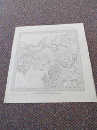
18314034The Society For The Diffusion Of Useful Knowledge & J & C Walker London 1831. Early Edition. Map. Good/No Dust Jacket. Map of The North Pole engraved by J & C Walker. No Binding. Sheet Size: 35cm x 33cm. Map approx. 27cm square. Slight age toning to sheet. In very good condition overall. Topography is depicted with fine hachures a fascinating variety of settlements and geographic features are labeled. Political divisions are shown including Alaska as part of the Russian Empire. The beginning of the nineteenth century saw a period of rapid market growth and innovation in the map publishing world. Increased literacy and public interest in new frontiers and colonies overwhelmed the market because it was oriented toward the small affluent market of the previous century. With the intent to fill this void The Society for the Diffusion of Useful Knowledge SDUK was founded in 1828 in London by Lord Brougham and a group of men dedicated to the education of the aspiring working class and the Utilitarian ideal of 'Knowledge is Power.' The society produced an array of education materials but the series of maps was one of their most successful ventures. A number of engravers and printers were used to produce the maps which eventually exceed 200 sheets and continued to be published after the Society as a whole ceased to function. Quantity Available: 1. Shipped Weight: Under 1 kilogram. Category: Geography & Maps; Exploration. Pictures of this item not already displayed here available upon request. Inventory No: 4034. . The Society For The Diffusion Of Useful Knowledge & J & C Walker unknown
2012326034Toronto: University of Toronto Press 2012. First edition. hardcover. very good/no dustjacket. 8vo oblong. pp.190 University of Toronto Press hardcover
1882008109La Popular Casa Editorial de Francisco Perez 1882. Book. Very Good. Hardcover. 1st Edition. First Spanish edition. La Popular Casa Editorial de Francisco Perez 1882 Barcelona. Very good hardcover half leather with marbled boards. Binding firm no writings. Volume II. Plates of El Doctor Baron Nordenskiold A. L. Palander and A Sibiriakoff. Some scattered foxing. The author was a Swedish explorer who became the first man to open and pass through the so-called Northeast Passage in the Arctic in 1879. La Popular, Casa Editorial de Francisco Perez Hardcover
1919190731-JP20New York N.Y.: Brentano's 1919. Hard cover in very good condition 1919. Some edge wear. Dust jacket in good condition wear. . Hard Cover. Very Good/Good. Brentano's Hardcover