(Collectif)Livre Rare Book
[IMAGERIE D'ÉPINAL]. IIIe RÉPUBLIQUE. ALEXANDRIE.-Livre Rare Book
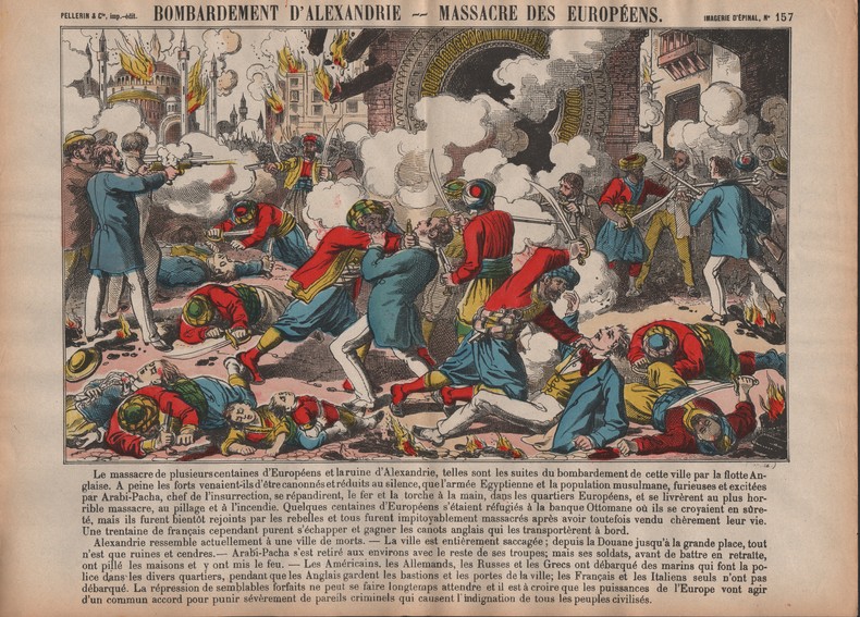
Bombardement d'Alexandrie. Massacre des Européens.-
ORD-12933Imagerie d'Épinal N°157. Epinal. Pellerin. Vers 1880. Grande gravure coloriée au pochoir, texte de 12 ligne au dessous de la gravure, dimensions de la feuille 403 x 292 mm. Bords de feuille brunis, menus défauts dus à la fragilité du papier, sinon bon état. (10).
Librairie Les Vieux Ordinaires · Toulon, France40,00 €