[Georgia Confederate Newspaper]Biblio.com
5 587 résultats
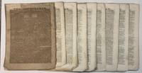
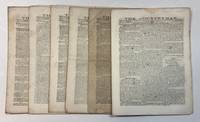
186241734Turnwold Putnam County Ga. 1862. Each issue a folio sheet folded to 8 pp. Each page 9-1/4" x12." Each number printed in three columns per page. No. 12 with a persistent corner chip and occasional small loss. Light foxing. Very Good. EACH ISSUE $250 OR THE ENTIRE RUN FOR $1000<br /> <br /> Crandall does not record Numbers 4 and 5; but AAS which says The Countryman was "suspended intermittently" evidently owns them. Its first printing was March 18 1862. The articles cover an array of subjects including of course much on the War: <br /> This interesting Confederate weekly was printed at Turnwold Turner's Putnam County plantation probably the only wartime newspaper so printed. "Joel Chandler Harris was an apprentice for Joseph Addison Turner. In 1862 Turner decided to produce a newspaper from his home at Turnwold Plantation. In fact in a more-than-semi-autobiographical book Harris wrote called On the Plantation he explains that the printing office for The Countryman was established 'in an outhouse.'. . . As was the typical arrangement for the time Harris worked for Turner in exchange for clothing and boarding at the Turnwold Plantation for the four plus years he apprenticed there. As a printer's devil Harris was responsible for setting and inking the type for the paper on the hand-press individually placing the letters so they were spaced appropriately for printing" "Joel Chandler Harris and The Wren's Nest" December 3 2020 Blog site of American Writers Museum accessed May 01 2026. <br /> Crandall 5152. Not in Parrish & Willingham. unknown
186241733Turnwold Putnam County Ga. 1862. Each issue a folio sheet folded to 8 pp. Each page 9-1/4" x12." Each number printed in three columns per page. No. 1 is browned. Very Good.<br /> <br /> Crandall does not record Numbers 4 and 5; but AAS which says The Countryman was "suspended intermittently" evidently owns them. Its first printing was March 18 1862. With the opening issue of this volume III Turner trumpets the "remarkable" success of The Countryman which has received a "universal acclaim of approbation" and has been financially successful. The articles cover an array of subjects including of course much on the War: Why the Hessians Enlist; the "worst provincialisms of the Yankees;" John Adams; observations on the War; the printing of The Countryman; poetry "The Old Plantation"; advertisements; President and leaders of the Confederate States; Iron; "Teaching Negroes to Read." <br /> This interesting Confederate weekly was printed at Turnwold Turner's Putnam County plantation probably the only wartime newspaper so printed. "Joel Chandler Harris was an apprentice for Joseph Addison Turner. In 1862 Turner decided to produce a newspaper from his home at Turnwold Plantation. In fact in a more-than-semi-autobiographical book Harris wrote called On the Plantation he explains that the printing office for The Countryman was established 'in an outhouse.'. . . As was the typical arrangement for the time Harris worked for Turner in exchange for clothing and boarding at the Turnwold Plantation for the four plus years he apprenticed there. As a printer's devil Harris was responsible for setting and inking the type for the paper on the hand-press individually placing the letters so they were spaced appropriately for printing" "Joel Chandler Harris and The Wren's Nest" December 3 2020 Blog site of American Writers Museum accessed May 01 2026. <br /> Crandall 5152. Not in Parrish & Willingham. Lomazow 687. unknown
2009153837New York New Haven: Whitney Museum of American Art / Yale University Press 2009. First Edition. First Edition. Published in conjunction with a traveling exhibition which opened at the Whitney Museum of American Art on September 17 2009 and closed at the Georgia O'Keeffe Museum on September 12 2010.<br /> <br /> Near Fine in a Near Fine dust jacket. Light bump to heel. Wrappers with light bumps to heel crown and top right corners and a light crease to bottom of front panel. Whitney Museum of American Art / Yale University Press unknown
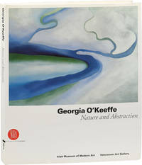
2007153950Milan: Skira 2007. First Edition. First Edition. Published in conjunction with a traveling exhibition which opened at the Irish Museum of Modern Art Dublin on March 7 2007 and closed at the Vancouver Art Gallery on January 13 2008.<br /> <br /> Near Fine in a Near Fine dust jacket. Bumps to lower corners of front and rear boards and a small bump to rear board at spine fold. Jacket with bumps to lower corners of front and rear panels taps to top of front and rear panels and faint toning to the extremities. Skira unknown
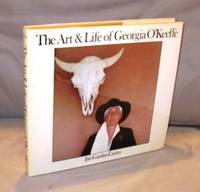
198524552New York::: Crown 1985. Third Printing of the First Edition. A Near Fine copy with two bumped corners in a Near Fine dust jacket. Georgia O'Keeffe has dominated twentieth-century American art and proved herself one of its most original talents. Jan Garden Castro's The Art & Life of Georgia O'Keeffe offers the most complete account of both the artist's fascinating private life and her extraordinary career. Georgia O'Keeffe's career has spanned much of the history of modern art in America. Here are more than a hundred paintings many rarely exhibited or reproduced photographs of O'Keeffe at various stages of her life and of the landscapes that inspired her and a text richly documented with letters and interviews. This material combined with Jan Castro's insightful criticism reveals O'Keeffe's legacy as an artist and the force of her intriguing personality. Crown,, unknown
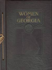
192732027Atlanta: Press of the Byrd Publishing Company 1927. First Edition. Hardcover. Good. Octavo. 164 pages 2 page index. Illustrated with photographs of important Georgia women including Corra Scott Harris Miss Ruth Blair Rebecca Felton Mrs. William Candler Mrs. Samuel Candler Dobbs Mildred Rutherford Mrs. Warren Aiken Candler and many others. Green string bound hardcover with embossed title and illustration on the front cover. A couple of news clippings attached to this copy. The first is gem clipped to the verso of the title page and concerns a "Mrs. Virginia May Phillips". The second clipping pasted down on the rear end sheet concerns a Gainesville Georgia newspaper column "Readers Write". The 1934 article concerns the Venable family in Atlanta and the efforts to construct a Confederate Memorial at Stone Mountain. A loose illustration "Ave Maria" was laid inside the book next to the photograph and biographical description of Mrs. Frank Tucker Mason formerly Elizabeth Venable. There is some soiling or fingerprints smudges to this page. Slight soiling to a few pages. Hardcover in good condition. Scarce 14 copies held in OCLC. Press of the Byrd Publishing Company hardcover
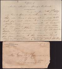
188936180Augusta: Georgia Railroad 1889. Paper. Good. Paper with printed letterhead at top and illustrated envelope. Paper is approx. 8" x 5". Folded. Contents written on one side and pertain to inspection of "white oak." Signed at the bottom by the Railroad Mater Mechanic manager John Cook. <br /> <br /> Letter comes with a printed illustrated envelope from the Georgia Railroad. The back side of the envelope is an illustration of the 1888 "Augusta National Exposition." Edge wear to the envelope. Envelope in fair condition. Georgia Railroad unknown
190330359Chicago: Poole Brothers 1903. Second Edition. Wraps. Very good. Wraps. 7.5" x 5". 32 pages. Illustrated with photographs plan of the Prison grounds and map of the railroad route in back. Gray illustrated covers with title on front. Poole Brothers unknown
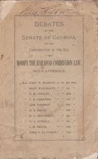
188533238Atlanta: Georgia Senate 1885. Wraps. Fair. Stitched wraps. 157 pages. Front cover chipped and scuffed. Bottom corners of several pages creased folded with bug damage on the far margins. No loss of print. Light scattered foxing and toning to the contents. Previous owner name top of the front cover appears to be Alexander S. Erwin. Debates concern Railroad Company practices. Senators named include John W. Maddox; Robert Falligant; F. H. Colley; T. B. Cabaniss; Lem Johnson; D. E. Smith; H.C. Sheffield; D. A. Russell; J. M. Smith; and John S. Davidson. Scarce. Fair condition only. This pamphlet was once possibly owned by Alexander Smith Erwin 1843-1907. Smith a veteran of the Confederate army and a prominent Athenian jurist is remembered for advancing further than any other Confederate soldier during Pickett’s Charge at Gettysburg. He joined Athens’ social and economic elite when he married into the prominent Cobb family. Source: Oconeehillcemetery dot com. Georgia Senate unknown
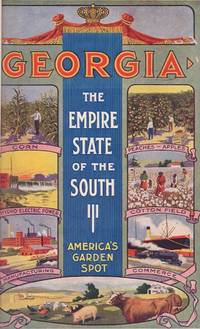
191531246Atlanta: Published by the Georgia State Department of Agriculture. Byrd Printing Atlanta 1915. First Edition. Hardcover. Good. Octavo. 104 pages. Illustrated with numerous photographs. Multi color designed wraps with title on the front cover. Promotional statement from the Georgia Department of Agriculture on the rear cover. Original wraps have been recased into a later green cloth hardcover with "Georgia" in gilt letters on the front cover and spine. Newer end papers added. "Serial No. 65 Published Quarterly April May June 1915 Entered as 2nd Class Matter Atlanta Ga." stamped on the title page. Previous owner's bookplate on the front paste down. Published by the Georgia State Department of Agriculture. Byrd Printing, Atlanta hardcover
1836List2949Clarke Cobb and Harris Counties Georgia 1836. Three documents. One four-page document measuring 5 x 8 ¾ inches likely previously a single sheet; water stained with some tearing at folds very good. One double-sided document measuring 8 x 10 inches; water stained and folded with large tears at folds possibly with part missing good. One single-sided document measuring 7 ¾ x 12 ¾ inches. Water stained and folded with large tears at folds much damage to margins good. Overall good. Three legal documents in which William Barber buys and sells plots of land shortly following the establishment of Cobb County. In 1834 and 1835 Barber buys plots from John Gann and Elizabeth Kennon for $100 each and in 1836 sells land to Gilbert Rake for $500. Gann is possibly the plantation owner Cobb County pioneer and State Senator. <br /> <br /> These land contracts date to a time at which a small number of Cherokee—whose territory included present-day Cobb County—had voluntarily left the area following the Indian Removal Act of 1830 while a majority had not done so. The Indian Removal Act required Indigenous people east of the Mississippi River to cede their land to Euro-Americans and move west of it to so-called Indian Territory now Oklahoma. In 1835 the US government met with a group of Cherokee claiming to represent the tribe in New Echota Georgia and signed a removal treaty. When the majority of the tribe viewing the treaty as illegitimate refused to move voluntarily the US government sent the military to intervene.<br /> <br /> Of interest to historians of Cobb County and land dealings between its early Euro-American residents during the removal of its Indigenous population. unknown
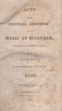
183330111Milledgeville: Prince & Ragland Printers 1833. First Edition. Hardcover. Good. Octavo. 358 pages. Later blue paper covered boards with blue cloth spine. Scattered foxing and toning to the contents. Pages 19-22 trimmed very close to text with very slight loss to content. 6 acts on Slavery listed in the index. Prince & Ragland, Printers hardcover
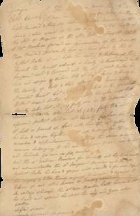
184441397Lumpkin County Georgia 1844. Folio 8" x 12-3/4". Three leaves: 1 1 blank 1 1 blank 2 pp. Completely in ink manuscript. Light tanning old folds minor wear and some short splits at fold edges. Prepared and signed by William H. Underwood as Solicitor for the complainant. Very Good.<br /> <br /> From 1805 through 1832 Georgia used a lottery system to distribute land taken from the Cherokee and Creek Indians. The Georgia Gold Rush began in 1829 and continued through the early 1840s. Separate Gold Lotteries in 1832 and 1833 divided lots into 40 acres and distributed them. The Georgia Gold Rush was the second significant gold rush in the United States and was particularly significant in the county seat of Dahlonega Lumpkin County where it began soon spreading through the North Georgia Mountains. Due to the significant amount of mined gold Congress established the Dahlonega Mint in 1838. By the early 1840s gold became less plentiful and many miners migrated to California for the California Gold Rush. "Dahlonega Gold Museum" Roadside Georgia website accessed on Wayback Machine Internet Archive October 2025; Wikipedia.<br /> Judge A. R. Wright issued a ruling 15 April 1844 enjoining Ramsey "from committing future waste spil or destruction in and upon the lot of land" until further order of the Court and required him to appear and respond to the complaint.<br /> Obadiah E. Payne a/k/a Paine 1807-1892 was a farmer from Floyd County Seth Strange c.1804-1881 was a farmer from Franklin County and James Ramsey c.1798-1869 was a farmer from Cherokee County doing gold mining in Lumpkin County for a time. United States Federal Census records on Ancestry website.<br /> William Henderson Underwood 1779-1859 was a Georgia lawyer a Captain in the War of 1812 and was elected Judge of the Western Circuit of Georgia in 1825. "Sketches of Georgia Lawyers. . . William Henderson Underwood" The Weekly Telegraph 14 June 1867 page 2.<br /> Augustus Romaldus Wright 1813-1894 was an American politician and lawyer who served in the U.S. House of Representatives from 1857-1859 served in the First Confederate Congress organized "Wright's Legion" of Georgia Volunteers and served as a colonel in the Georgia 38th Infantry C.S.A. President Lincoln offered him a position of provisional governor of Georgia in 1864 if the state withdrew from the Confederacy which it did not. "Wright Augustus Romaldus" online Biographical Directory of the United States Congress. unknown
1860825171860. GEORGIA. Minutes of the Union Society: Being an Abstract of Existing Records From 1750 to 1858. Comprising also Chronological lists of its Officers Members and Beneficiaries with the Anniversary Addresses of Hon. T.U.P. Charlton Col. Howell Cobb etc. Savannah: John M. Cooper & Co. 1860. 29 4 206 9 1 22 24 28pp. Orig. cloth. Very good or better. DE RENNE II p.615. PARRISH & WILLINGHAM 7930. OCLC 5634157 ref. A useful survey of Union Society records. There seems to be a question surrounding potential later issues. De Renne cites 1860 as the only publication date while Parrish & Willingham claim 1861. It is almost certain there were two issues of the present work the present copy being the earlier one without the latest entry dated "1861." An early Confederate imprint. Scarce. Parrish & Willingham locate only seven copies of the later issue. OCLC does not differentiate between potential issues. unknown
192041205Washington D.C.: Published by the United States Coast and Geodetic Survey 1920. Large folding nautical chart printed on heavy paper stock. Colored. A rare original coastal survey of Ossabaw Sound including Ossabaw Island Skidaway Island Wassaw National Wildlife Rescue and the Vernon and Ogeechee Rivers.<br/> <br/> Established by President Thomas Jefferson in 1807 as the Survey of the Coast the U.S. Coast and Geodetic Survey was the United States' first civilian scientific agency. This agency has followed its mission to survey the U.S. coastline create nautical charts of the coast and help increase maritime safety since its founding and has often played fascinating roles in significant chapters of U.S. history. It served in all theaters of the Civil War in the service of the Union Army and Navy pioneered acoustic exploration in the wake of the sinking of the Titanic and during WWI it worked to detect enemy submarines. In addition this agency worked to survey and produce detailed maps and renderings of the U.S. coast. These nautical survey maps commonly referred to as "T-sheets" provide fascinating insights into the history of the United States coastline which has and will continue to shift. These maps are the most important data source for understanding the physical and ecological characteristics of the U.S. shoreline. The present map is a highly detailed and accurate sea chart of the Ossabaw Sound and an important historical view of the developing Georgia. Published by the United States Coast and Geodetic Survey unknown
192041204Washington D.C.: Published by the United States Coast and Geodetic Survey 1920. Large folding nautical chart printed on heavy paper stock. Uncolored. A rare original coastal survey of Sapelo Sound including St. Catherines Island Sapelo Island and Black Beard Island.<br/> <br/> Established by President Thomas Jefferson in 1807 as the Survey of the Coast the U.S. Coast and Geodetic Survey was the United States' first civilian scientific agency. This agency has followed its mission to survey the U.S. coastline create nautical charts of the coast and help increase maritime safety since its founding and has often played fascinating roles in significant chapters of U.S. history. It served in all theaters of the Civil War in the service of the Union Army and Navy pioneered acoustic exploration in the wake of the sinking of the Titanic and during WWI it worked to detect enemy submarines. In addition this agency worked to survey and produce detailed maps and renderings of the U.S. coast. These nautical survey maps commonly referred to as "T-sheets" provide fascinating insights into the history of the United States coastline which has and will continue to shift. These maps are the most important data source for understanding the physical and ecological characteristics of the U.S. shoreline. The present map is notable for its inclusion of St. Catherines Island the northernmost outpost in Spanish Florida between 1587 and 1680 with Catholic friars and Spanish soldiers living among the Guale Indians for over a century there. After the Spanish abandoned the island Mary Musgrove a Muskogee leader and translator for James Ogelthorpe claimed the island. Later Button Gwinnett a signer of Declaration of Independence also called this island home. The map also shows Sapelo Island home to the Hog Hammock community. This community traces its origins to the end of the civil war when it was established as a reservation for former slaves. Many of the full-time inhabitants of the Hog Hammock Community today are African Americans known as Gullah or Geechees who descend from enslaved West African people brought to the island in the 1700s and 1800s to work the island plantations. This community is one of the few of its kind to survive the centuries and is closely tied to its home on Sapelo Island. This map is a highly detailed and accurate sea chart of Sapelo Sound and an important historical view of the developing coastal Georgia. Published by the United States Coast and Geodetic Survey unknown
192041206Washington D.C.: Published by the United States Coast and Geodetic Survey 1920. Large folding nautical chart printed on heavy paper stock. Colored. A rare original coastal survey of the Satilla River including Woodbine.<br/> <br/> Established by President Thomas Jefferson in 1807 as the Survey of the Coast the U.S. Coast and Geodetic Survey was the United States' first civilian scientific agency. This agency has followed its mission to survey the U.S. coastline create nautical charts of the coast and help increase maritime safety since its founding and has often played fascinating roles in significant chapters of U.S. history. It served in all theaters of the Civil War in the service of the Union Army and Navy pioneered acoustic exploration in the wake of the sinking of the Titanic and during WWI it worked to detect enemy submarines. In addition this agency worked to survey and produce detailed maps and renderings of the U.S. coast. These nautical survey maps commonly referred to as "T-sheets" provide fascinating insights into the history of the United States coastline which has and will continue to shift. These maps are the most important data source for understanding the physical and ecological characteristics of the U.S. shoreline. The present map is a highly detailed and accurate sea chart of the Satilla River from Bailey Cut to Burnt Fort and an important historical view of the developing Georgia. Published by the United States Coast and Geodetic Survey unknown
192041203Washington D.C.: Published by the United States Coast and Geodetic Survey 1920. Large folding nautical chart printed on heavy paper stock. Uncolored. A rare original coastal survey of the Golden Isles area and includes Jekyll Island and Little Cumberland Island<br/> <br/> Established by President Thomas Jefferson in 1807 as the Survey of the Coast the U.S. Coast and Geodetic Survey was the United States' first civilian scientific agency. This agency has followed its mission to survey the U.S. coastline create nautical charts of the coast and help increase maritime safety since its founding and has often played fascinating roles in significant chapters of U.S. history. It served in all theaters of the Civil War in the service of the Union Army and Navy pioneered acoustic exploration in the wake of the sinking of the Titanic and during WWI it worked to detect enemy submarines. In addition this agency worked to survey and produce detailed maps and renderings of the U.S. coast. These nautical survey maps commonly referred to as "T-sheets" provide fascinating insights into the history of the United States coastline which has and will continue to shift. These maps are the most important data source for understanding the physical and ecological characteristics of the U.S. shoreline. The present map is a highly detailed and accurate sea chart of the Golden Isles area and is an important historical view of the developing Georgia. Published by the United States Coast and Geodetic Survey unknown
192041202Washington D.C.: Published by the United States Coast and Geodetic Survey 1920. Large folding nautical chart printed on heavy paper stock. Uncolored. A rare original coastal survey of the St Catherines Sound and includes St. Catherines Island and Ossabaw Island.<br/> <br/> Established by President Thomas Jefferson in 1807 as the Survey of the Coast the U.S. Coast and Geodetic Survey was the United States' first civilian scientific agency. This agency has followed its mission to survey the U.S. coastline create nautical charts of the coast and help increase maritime safety since its founding and has often played fascinating roles in significant chapters of U.S. history. It served in all theaters of the Civil War in the service of the Union Army and Navy pioneered acoustic exploration in the wake of the sinking of the Titanic and during WWI it worked to detect enemy submarines. In addition this agency worked to survey and produce detailed maps and renderings of the U.S. coast. These nautical survey maps commonly referred to as "T-sheets" provide fascinating insights into the history of the United States coastline which has and will continue to shift. These maps are the most important data source for understanding the physical and ecological characteristics of the U.S. shoreline. The present map is notable for its inclusion of St. Catherines Island the northernmost outpost in Spanish Florida between 1587 and 1680 with Catholic friars and Spanish soldiers living among the Guale Indians for over a century there. After the Spanish abandoned the island Mary Musgrove a Muskogee leader and translator for James Ogelthorpe claimed the island. Later Button Gwinnett a signer of Declaration of Independence also called this island home. This map is a highly detailed and accurate sea chart of St. Catherines Sound and an important historical view of the developing coastal Georgia. Published by the United States Coast and Geodetic Survey unknown
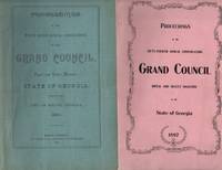
193434342Macon Georgia: Grand Council Royal and Select Masters State of Georgia 1934. Wraps. Good. Stapled wraps. Misc. lot of 25 Mason proceedings held in Macon Georgia years 1892-1934. All reports are dated. Nine of the issues have date stamps and three of the reports have written dates at the top. Condition overall for the lot is good to very good. Report years include 1892 1897 1898 1903 1906 1907 1909 1915 1916 1917 1918 1919 1920 1921 1922 1923 1924 1925 1926 1927 1928 1929 1930 1931 1932 1933 and 1934. Grand Council, Royal and Select Masters, State of Georgia unknown
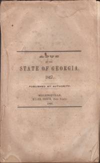
182731051Milledgeville: Printed by Camak & Ragland 1827. First Edition. Wraps. Fair. Wraps. 296 pages. Stitched wraps. Outer blank wraps missing. Title page and last 4 index pages have significant corner edge wear with minor loss of content in the index pages. Text is foxed toned etc. A fairly worn copy. Printed by Camak & Ragland unknown
184831056Milledgeville: Miller Grieve State Printer 1848. First Edition. Wraps. Fair. Stitched wraps. 352 pages. Title printed page 1. Front cover missing. Original blue rear outer wrap present. Blue paper spine chipped on the edges. Light to moderate toning and scattered foxing to the contents. Title page is creased. Resolutions passed cover Banks Cities and Towns Lodges Cemetery Railroads Slaves and Free Persons of Colour etc. Miller Grieve, State Printer unknown
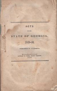
185031053Milledgeville: Richard M. Orme State Printer 1850. First Edition. Wraps. Fair. Stitched printed wraps. 456 pages. Front cover missing. Blue paper spine chipped and missing about half of the paper. Blue rear paper cover is present. Back cover chipped and creased. Corners first 10 plus pages folded. Last few pages creased. Light to moderate toning damp-stains and scattered foxing to contents. Resolutions cover Slavery Academies Churches Banks Colleges Cities and Towns Railroads Fire companies and more. Fair. Richard M. Orme, State Printer unknown
184831050Milledgeville: William Grieve State Printer 1848. First Edition. Wraps. Fair. Wraps. 352 pages. Stitched wraps with blue outer front title wrap. Front cover detached and chipped. Rear blue wrap missing. Light to moderate scattered foxing and toning to contents. Fair. William Grieve, State Printer unknown
186031057Milledgeville: Boughton Nisbet & Barnes State Printers 1860. First Edition. Wraps. Fair. Stitched wraps. 464 pages. Boards missing. Leather spine with title label present. Spine is vertically cracked. Moderate scattered foxing and toning to the contents. Acts cover "Local and Private Laws". Old pencil name of L C Dickson top of the front cover. Boughton, Nisbet & Barnes, State Printers unknown