White, Arthur SBiblio.com
34 272 résultats
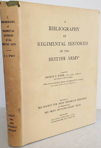
1965010893London: Society for Army Historical Research7 3/4" x 10" Viii265pp. First edition. Hard cover in dust jacket. Published London: Society for Army Historical Research 1965. 4to. viii265pp. Green cloth with gilt titles. Mild dust foxing on top edge light marginalia in text some check marks/short notation. Very good in very good dust jacket worn at the crown and upper tips. . Very Good. Hard. 1st. 1965. Society for Army Historical Research7 3/4" x 10", Viii+265pp. unknown
DUBLIN, 1985 - Cartonnage editeur à la bradel avec jaquette - In-8 -361 pages - très propre
6104DUBLIN, 1985 - Cartonnage editeur à la bradel avec jaquette - In-8 -361 pages - très propre
229796Oxford, Clarendon press, 1976 in-8, xxvii pp., 285 pp., 148 items, avec un portrait-frontispice en dépliant, percaline Bradel cerise sous jaquette.
1927051008New York City Ny: Harcourt Brace And Company 1927. First American Edition 1st Printing. Hardcover. Near Fine. 192 Pp. Red Cloth Spine And Cover Labels. First Printing Rahway Printers In Nj. Frontispiece Hand-Colored. <br/> <br/> Harcourt, Brace And Company hardcover
198755065Vilnius Lithuania: Vaga. Very Good; Portfolio is in Very Good condition with some light wear and . soiling lithographs are all in excellent condition. 1987. Hardcover. Portfolio of 24 lithographs from the first and second series of A Book of Vilnius originally published by Jonas Kazimiera Vilcinskis in Paris circa 1850-1862. Large illustrated paper-covered cardboard portfolio housing 24 color lithographs measuring 19.5 x 17 inches. Text in English Lithuanian and Russian. ; Folio 13" - 23" tall . Vaga hardcover
1877626178Boston, Lee a. Shepard, 1877. M. 8 Holzst.-Taf. u. 44 Textholzschn. XII, 367 S. OLwd. Einbd. etwas fleckig. St. verso Tit. (Young folks' series).
bross. edit. ill. con bandelle - prima edizione it. - trad. di Sara Culeddu in collaborazione con l'autrice
18544772ABLondon, Cooke, 1854. Mit Textillustrationen und 8 Holzschnitt-Tafeln. XII, 251 S. Geprägte ill-OLwd.
1736000473London Eng: Assigns of J. Sowle 1736. First Edition. Very Good -. Title continued: "for Demands Recoverable by the Acts made in the 7th and 8th Years of the Reign of King William the Third for the more Easie Recovery of Tithes Church-Rates &c. Printed and Sold by the Assigns of J. Sowle at the Bible in George-Yard Lombard-Street." xii 2 189 1 p.: 1 table; 20 cm. 8vo. Half calf with six gilt-ruled spine compartments and a gilt-tooled leather label in the second compartment reading: Prosecution of Quakers. Marbled paper over boards. All page edges marbled. Inscription largely erased from front fixed endpaper. Published anonymously by Quaker Joseph Besse who produced a number of important volumes recording the legal woes of early English and Welsh Quakers. This volume describes the prosecutions of Quakers from 1696 to 1736 in England and Wales arranged alphabetically by county. Quakers were prosecuted for refusing to pay the annual tithe one tenth of their income and other support for the Church of England. In Very Good- Condition: cover is rubbed; spine is sunned; leather is starting to separated at the head of the spine and lacking small section of leather at head of spine; first and last leaves have soiling of corners and light foxing; pages are otherwise clean and tight. Assigns of J. Sowle unknown
Un fiammeggiante romanzo di vita medievale che, nel suo miniaturizzato arazzo, descrive settantasette anni (dal 1038 al 1115) di Storia e microstoria dell' Europa cristiana e dell' Oriente bizantino islamico. Collana Fantasia & Memoria.
in 16°, bross. edit. ill. - prima edizione it. - trad. di Enrico Lenaz
2004123600Fundación Caixa Galicia 2004 Livre en espagnol. In-4 broché 30 cm sur 24. 284 pages. Jaquette légèrement tâchée et effrangée, sans gravité. Intérieur frais. Bon état d’occasion.
From the collection of the author, C.E. King, Volume 4 staplebound paperback in very good condition. Spine is sunned, and edges are slightly discoloured. Pages and text are clear and unmarked throughout. LW Used
Volume 5 staplebound paperback in very good condition. Spine is sunned, and edges are slightly discoloured. Pages and text are clear and unmarked throughout. LW Used
Staplebound paperback in very good condition. Spine is sunned, and edges are slightly discoloured. Pages and text are clear and unmarked throughout. LW Used
Paperback. Ex - library. A few light scores on covers. Library label and stamps on half - title page. Binding is intact, contents are clean and clear. AM Ex - Library
Mm 125x195 RARO. Edizione originale / RARE. Original edition - Volume cartonato, legatura editoriale in tela marrone, titoli e fregi in oro al dorso e al piatto anteriore, VIII-412 pagine. Ordinari segni del tempo alla tela, occhietto mancante, peraltro buona copia. Testo in inglese - english text. SPEDIZIONE IN 24 ORE DALLA CONFERMA DELL'ORDINE.
199465332ABNew York., The Museum of Modern Art., 1994. 29 x 25 cm. 263 S. OLeinen mit OUmschlag., 65332AB First printing. Sehr gutes Exemplar.
1904008782London, Chatto & Windus, 1904. ix, 213 S., 1 Blatt. Orig.-Leinenband. Die Vorsatzpapiere gering stockfleckig, sonst gut erhaltenes Exemplar mit nur leichten Gebrauchsspuren. Little foxing on the endpapers, otherwise an good copy with just minor traces of use.
Acquaforte, dimensioni 505x610 mm. Bellissimo esemplare, finemente colorato a mano.Opera tratta da: Atlas maritimus & commercialis, or, A general view of the world, so far as relates to trade and navigation: describing all the coasts, ports, harbours, and noted rivers ... : to which are added sailing directions for all the known coasts and islands on the globe, with a set of sea charts, some laid down after Mercator, but the greater part according to a new globular projection adapted for measuring distances...by scale and compass...the use of the projection justified by Dr. Halley. To which are subjoin'd two large hemispheres on the plane of the equinoctial containing all the stars in the Britannic catalogue: of great use to sailors for finding the latitude in the night. London: For J. & J. Knapton, W. & J. Innys [Etc.], 1728.Questo lavoro molto raro è nato dalla collaborazione di alcuni dei principali cartografi e scienziati del periodo, tra i quali Sir Edmund Halley, John Senex, Nathaniel Cutler, Steven Parker e Daniel Defoe. L’Atlas maritimus & commercialis venne ideato da Senex e Harris nel tentativo di competere con il popolarissimo The English Pilot di Mount & Page; tuttavia, nonostante la collaborazione fosse di altissimo livello scientifico, l’atlante non ebbe grande successo commerciale. Bibliografia: Mare Nostrum, a historic voyage across the Mediterranean Sea, Lussemburgo, 2003, p. 33; National Maritime Museum, Catalogue of the Library - Vol. Three, Atlas & Cartography, Londra, 1971, pp. 400-401, n. 341(22); R. Shirley, Maps in the Atlases of the British Library, Londra, 2004, pp. 1177-78, M.Hall -1a (22); cfr. The Compleat Plattmaker: essays on Chart, Map and Globe Making in England in the Seventeenth and Eighteenth Centuries, Berkeley, 1978. Etching, with fine later hand colour, very good condition.Taken from: Atlas maritimus & commercialis, or, A general view of the world, so far as relates to trade and navigation: describing all the coasts, ports, harbours, and noted rivers ... : to which are added sailing directions for all the known coasts and islands on the globe, with a set of sea charts, some laid down after Mercator, but the greater part according to a new globular projection adapted for measuring distances...by scale and compass...the use of the projection justified by Dr. Halley. To which are subjoin'd two large hemispheres on the plane of the equinoctial containing all the stars in the Britannic catalogue: of great use to sailors for finding the latitude in the night. London: For J. & J. Knapton, W. & J. Innys [Etc.], 1728.This very rare work was born from the collaboration of some of the leading cartographers and scientists of the period, including Sir Edmund Halley, John Senex, Nathaniel Cutler, Steven Parker and Daniel Defoe. The Atlas maritimus & commercialis was designed by Senex and Harris in an attempt to compete with Mount & Page's hugely popular The English Pilot; however, despite the collaboration was of the highest scientific level, the atlas did not have great commercial success.Bibliografia: Mare Nostrum, a historic voyage across the Mediterranean Sea, Lussemburgo, 2003, p. 33; National Maritime Museum, Catalogue of the Library - Vol. Three, Atlas & Cartography, Londra, 1971, pp. 400-401, n. 341(22); R. Shirley, Maps in the Atlases of the British Library, Londra, 2004, pp. 1177-78, M.Hall -1a (22); cfr. The Compleat Plattmaker: essays on Chart, Map and Globe Making in England in the Seventeenth and Eighteenth Centuries, Berkeley, 1978. S. Bifolco, "Mare Nostrum, Cartografia nautica a stampa del Mar Mediterraneo" (2020), p. 215, tav. 98.
Acquaforte, 300x430 mm, firmata nel cartiglio con il titolo: By H. Moll Geographer.Carta nautica firmata da Hermann Moll, che si definisce “geografo” e, pertanto, potrebbe essere il compilatore, oltre che l’incisore, dell’opera. Esistono degli esemplari della carta che recano in basso l’imprint: Printed for The Bowles in S.t Pauls Church yard ar John Bowles ar the Black Horse in Cornhill; altri presentano, in alto a destra, la numerazione page 753. V1. In alto a sinistra, troviamo un piccolo cartiglio raffigurante Gibilterra, che era appena stata ceduta all’Inghilterra con il trattato di Utrecht del 1713. La carta non è inserita in nessuno dei numerosi atlanti di Moll descritti da Shirley.Herman Moll (1654 - 1732) fu uno dei più importanti editori dediti al commercio di mappe in Inghilterra tra la fine del XVII e l’inizio del XVIII secolo. Sembra probabile che provenisse dalla Germania, forse da Brema, e che fosse a Londra già nel 1678. Le poche notizie biografiche sono dedotte dalla produzione, notevole, di materiale cartografico, frutto dell’attività alla quale si dedicava - come uso all’epoca - in qualità di incisore, disegnatore o editore. Dalla sua morte, nel 1732, della casa editrice Moll non si hanno più tracce; suo figlio Gilles Hendrick scomparve, infatti, prematuramente mentre la figlia Henderina Amelia Moll, è poco più che un nome testamentario. Le prime notizie di Moll sono relative al 1678 dove, come incisore, lavora per l’English Atlas di Moses Pitt e Sir Robert Hooke, uno dei sostenitori del progetto. Gran parte della sua carriera fu dedicata all’attività di incisore per produttori di mappe e editori, in particolare per James Knapton, realizzando le mappe per i resoconti di viaggio. Nel 1707 Moll iniziò a lavorare alla sua pubblicazione più famosa, il The World Described, una raccolta di mappe del mondo. Fu uno dei più famosi atlanti inglesi del XVIII secolo e richiese un lungo periodo di lavorazione; l’atlante fu completato solo nel 1717. Moll usava riempire gli spazi vuoti delle sue mappe con pannelli di testo, spesso con descrizione della regione raffigurata; altre volte, invece, con commenti poco lusinghieri sui rivali: gli inglesi Jeremiah Seller e Charles Price, John Senex e in particolare il francese Guillaume Delisle. Herman Moll fu coinvolto in numerose pubblicazioni: il Thesaurus Geographicus (1695), ripubblicato in seguito con diverse altre forme e ampliato per formare l’Atlas Geographus (1711) il Twenty Four New and Accurate Maps of the Several Parts of Europe (1706) e A New Description of England and Wales (1724). Nel suo testamento, non si fa menzione di uno stock di lastre da stampa o altri beni aziendali. È probabile che gran parte del materiale a cui il suo nome è legato fosse posseduto e finanziato da altri editori.Bibliografia: cfr. National Maritime Museum, Catalogue of the Library - Vol. Three, Atlas & Cartography, Londra, 1971, pp. 453-458; cfr. The Compleat Plattmaker: essays on Chart, Map and Globe Making in England in the Seventeenth and Eighteenth Centuries, Berkeley, 1978; cfr. S. Tyacke, Chartmaking in England and Its Context, 1500 - 1600, in “History of Cartography”, Chicago, 2007, pp. 1722 – 1753. Etching, 300x430 mm, signed in the cartouche with the title: By H. Moll Geographer.Nautical chart by Hermann Moll, who calls himself a "geographer" and, therefore, could be the compiler, as well as the engraver, of the work. There are copies of the map that bear the imprint below: Printed for The Bowles in St. Pauls Church yard in John Bowles in the Black Horse in Cornhill; others present, at the top right, page number 753. V1. At the top left, we find a small cartouche depicting Gibraltar, which had just been given to England with the Treaty of Utrecht of 1713. The map is not inserted in any of the numerous Moll atlases described by Shirley.Herman Moll (1654 - 1732) was one of the most important publishers dedicated to the trade of maps in England between the end of the seventeenth and the beginning of the eighteenth century. It seems likely that it came from Germany, perhaps from Bremen, and that it was in London as early as 1678. The few biographical information is deduced from the remarkable production of cartographic material, the result of the activity to which he dedicated himself - as was the custom at the time - as an engraver, draftsman or publisher. Bibliografia: cfr. National Maritime Museum, Catalogue of the Library - Vol. Three, Atlas & Cartography, Londra, 1971, pp. 453-458; cfr. The Compleat Plattmaker: essays on Chart, Map and Globe Making in England in the Seventeenth and Eighteenth Centuries, Berkeley, 1978; cfr. S. Tyacke, Chartmaking in England and Its Context, 1500 - 1600, in “History of Cartography”, Chicago, 2007, pp. 1722 – 1753. S. Bifolco, "Mare Nostrum, Cartografia nautica a stampa del Mar Mediterraneo" (2020), p. 214, tav. 97.
Mm 170x240 "LIMES - Rivista Italiana di Geopolitica, marzo/2021" diretta da Lucio Caracciolo - Brossura originale, 312 pagine con tavole a colori non comprese nel testo. Copia pari al nuovo; spedizione in 24 ore dalla conferma dell'ordine.
Paperback. Upper leading corner of front cover is dog eared, as are first 50 pages. Covers are unmarked, pages are clean, and the text is clean. TH Used
Paperback in very good condition. Cover edges, corners and spine ends are lightly bumped and worn. The covers, pages and text are otherwise clear and unmarked throughout, almost as new. LW Used