34 279 résultats
152759Paris, 1835 in-plano (68,5 x 52 cm), [4] ff. n. ch. (titre et table des planches), et 68 grandes planches à double page, gravées par Perdoux, Desaulx, Cardano, Misbach, Schroeder, Lameau, Fortier, etc., d'après les dessins de Bagetti ; le tout monté sur onglets demi-maroquin vert, dos lisse (reliure à l'imitation). Taches et rousseurs à certaines planches, trace de pliure à la page de titre.
162189S.l., (1793-1802) , Sept dessins gouachés sur vergé bleu ou blanc, contrecollés par l'auteur lui-même sur papier fort, certains encadrés d'un bord noir ou entourés d'un liseré de papier doré collé. Les deux pour certains. De formes rectangulaires, tous entre 40 cm de largeur sur 60 cm de longeur. Titre et date à l'encre au bas du recto de la vue a, "Vue de l'intérieur d'une Prison, inventée et Dessinée par Géligny, prisonnier de Guerre en Espagne (a Valladolida), le 28 Vendémiaire An 3". Les vues c, d et e sont signées à l'encre "Géligny inv'" et certaines sont datées. Des poèmes manuscrits conemporains (encre) au verso des vues b et d et au recto de la vue a. Quelques rousseurs et accrocs sans gravité.
Chartam Mediterraneam antea magna obrutam falsitate: quam proprijs expensis post longam septem annorum navigationem, summamque diligentiam in investiga[n]dis locorum gradibus et veris ventorum uijs, non sine manifesto libertatis ac vitae periculo, absoluimus; posteaq[ue] coram Ill.mo Commendatore Puccio classis Pontificiae Generali duce, a praeclarissimo nauta Fratre Vinceguerra equite Hierosolymitano examinatam, approbatam ac valde commendatam iam, ab antiquis erroribus purgatam, in lucem et nunc manu propria descriptam mittimus: ut in nostri saeculis gloriam, ad navigantium utilitatem, in posteros tra[n]feat. Accipe ergo illam generosa Italia (et si tibi magnae atq[ue] uberrimae virtutum parvum munusculum) sicut et alias elucubrationes nostras libenter accepisti, Interi[m] sub Clementissimo Pontifice felicit vive et in aeternum tua maneat felicitas. Romae a[n]no a Virginis par tu 1596. Inventor Prothei. Acquaforte e bulino, stampata su due fogli, dimensioni totali mm 745x595.Carta nautica del Mediterraneo compilata da Bartolomeo Crescenzio, ingegnere idrografico al servizio della Marina Papale; il primo a dedicarsi alla correzione delle inesattezze magnetiche nelle mappe nautiche del Mediterraneo. Alcuni nastri ai lati della carta, oltre che a decorare la stessa forse dovevano indicare anche la scala grafica. Numerosi toponimi indicano le isole e i luoghi lungo le coste. L’orientazione e fornita da diverse rose dei venti, il nord e a destra. L’autore afferma di aver personalmente sperimentato gli errori delle misurazioni tradizionali, grazie al suo impiego di idrografo sulle galee della flotta papale (dal 1588 al 1593) e ad altri viaggi fatti da passeggero e osservatore nel periodo 1594 -95. Il suo lavoro è diviso in cinque libri e tratta ogni aspetto della navigazione scientifica, dalla costruzione navale, alle correnti marine, alla descrizione di vari porti e rade. La bussola del marinaio e altri strumenti nautici sono discussi a lungo e illustrati. Crescenzio sosteneva che la declinazione magnetica fosse pari a zero nelle Azzorre, per aumentare gradualmente e uniformemente da Gibilterra al Mediterraneo orientale, raggiungendo il valore massimo di una lossodromia, cioè undici gradi, attorno al meridiano di Antiochia. Propose, pertanto, di correggere quest’errore ruotando l’asse di otto gradi in senso orario intorno alle Azzorre come centro fisso (questo valore è calcolato come media della declinazione del Mediterraneo). Il risultato finale è una carta nautica soddisfacente, anche se la stessa decisione di utilizzare un valore medio per la correzione della rotazione significava che l’aggiustamento nel Mediterraneo orientale era ancora insufficiente. L’opera, datata 1596, è accompagnata alla Nautica mediterranea di Bartolomeo Crescentio romano, pubblicata a Roma da Bartolomeo Bonfadino solo nel 1602. Nella dedica al cardinale Pietro Aldobrandini, con il quale il Crescenzio era entrato in stretta collaborazione dopo la morte dell’ammiraglio della flotta pontificia Emilio Pucci, l’autore spiega i motivi del ritardo della pubblicazione della Nautica mediterranea e del Portolano, affermando che “...il presente racconto la Nautica mediterranea, da me fabbricata e già sei anni sono data alla stampa, non prima di adesso finita per essere in tutto questo tempo da Nostro Signore e da Vostra Signoria Ill.ma in diversi viaggi e affari impiegato, si come anchora mi trovo”. Del Crescenzio è nota una carta manoscritta del Mediterraneo conservata alla National Library di Helsinki.Bibliografia: cfr. C. Astengo, La cartografia nautica mediterranea dei secoli XVI e XVII, Genova, 2000; C. Astengo, The Renaissance Chart Tradition in the Mediterranean, in “The History of Cartography”, Chicago, 2007, pp. 196-197; O. Baldacci, Le carte nautiche e il Portolano di Bartolomeo Crescenzi, in “Rendiconti Dell’Accademia nazionale dei Lincei” CCCXLVI (1949), 4, pp. 605-607; S. Bifolco - F. Ronca, Cartografia e top... In the cartouche at the top left : Chartam Mediterraneam antea magna obrutam falsitate: quam proprijs expensis post longam septem annorum navigationem, summamque diligentiam in investiga[n]dis locorum gradibus et veris ventorum uijs, non sine manifesto libertatis ac vitae periculo, absoluimus; posteaq[ue] coram Ill.mo Commendatore Puccio classis Pontificiae Generali duce, à praeclarissimo nauta Fratre Vinceguerra equite Hierosolymitano examinatam, approbatam ac valde commendatam iam, ab antiquis erroribus purgatam, in lucem et nunc manu propria descriptam mittimus: ut in nostri saeculis gloriam, ad navigantium utilitatem, in posteros tra[n]feat. Accipe ergo illam generosa Italia (et si tibi magnae atq[ue] uberrimae virtutum parvum munusculum) sicut et alias elucubrationes nostras libenter accepisti, Interi[m] sub Clementissimo Pontifice felicit vive et in aeternum tua maneat felicitas. Romae a[n]no à Virginis par tu 1596. Inventor Prothei. Numerous toponyms indicate the islands and the places along the coasts. The orientation is provided by different windroses, the north is on the right.Etching and engraving, printed on two sheets, total dimensions 745x595 mm. Nautical chart of the Mediterranean compiled by Bartolomeo Crescenzio, hydrographic engineer at the service of the Papal Navy.Bibliografia: cfr. C. Astengo, La cartografia nautica mediterranea dei secoli XVI e XVII, Genova, 2000; C. Astengo, The Renaissance Chart Tradition in the Mediterranean, in “The History of Cartography”, Chicago, 2007, pp. 196-197; O. Baldacci, Le carte nautiche e il Portolano di Bartolomeo Crescenzi, in “Rendiconti Dell’Accademia nazionale dei Lincei” CCCXLVI (1949), 4, pp. 605-607; S. Bifolco - F. Ronca, Cartografia e topografia italiana del XVI secolo. Catalogo ragionato delle opere e stampa, Roma, 2018, pp. 706-07, tav. 236 bis; Mare Nostrum, a historic voyage across the Mediterranean Sea, Lussemburgo, 2003, p. 11. S. Bifolco, "Mare Nostrum, Cartografia nautica a stampa del Mar Mediterraneo" (2020), pp. 44-45, tav. 11.
Carte Nouvelle De La Mer Mediterranee ou sont Exactement Remarques tous les Ports, Golfes, Rochers, Banks, de Sable &c: a l’usage des Arméès, du Roy de la Grande Bretagne. Dressé sur le Memoires les Plus Nouveaux par le Sr. Romain de Hooge.Acquaforte e bulino, dimensioni 585x1390 mm, firmata in lastra nel cartiglio in basso, dove figura l’imprint: A Amsterdam chez Pierre Mortier. Avec Privilége 1694.Esemplare nel raro primo stato di quattro, con la data 1694 e prima della correzione del titolo, dove si legge Mediteranee al luogo di Mediterranee. Magnifica coloritura coeva, in perfetto stato di conservazione.Opera tratta da: Cartes Marines a l'Usage des Armées du Roy de la Grande Bretagne: Faites sur les Memoires les plus nouveaux, des plus experts Ingenieurs et Pilotes, et enrichies des porfils des plus fameaux Ports de Mer et villes Maritimes de l'Europe. (…) Gravéès et recuillies par le Sr. Romain De Hooge Commissaire de Sa Majesté. A Amsterdam. Chez Pierre Mortier Libraire sur le Vygen Dam. M.DC. LXXXXIII. Avec Privilege de Nos Seigneurs les Etats de Hollande et West-Frise. Monumentale carta nautica del Mar Mediterraneo di Romeyn De Hooghe (1645 - 1708). L’opera è impreziosita da 38 mappe e vedute dei principali porti del Mediterraneo, ed è decorata da numerosi galeoni, galee, figure allegoriche e mostri marini. La carta è inserita in una sezione speciale del Neptune François di Pierre Mortier, intitolata Cartes Marines a l’Usage des Armées du Roy de la Grande Bretagne; le nove carte che compongono questa sezione, tutte incise dallo stesso de Hooghe, sono descritte da Koeman come “la più spettacolare cartografia nauica mai prodotta ad Amsterdam del XVII secolo”. La carta del Mediterraneo è la più grande, decorata e spettacolare della serie. Pierre Mortier fece stampare l’atlante in onore di Guglielmo III d’Orange (in olandese Willem Hendrik van Oranje-Nassau, anche noto come Guglielmo III d’Inghilterra), re olandese sul trono britannico. Le dimensioni dell’atlante, senza precedenti, e il ricorso ad artisti del calibro di de Hooghe hanno reso questa raccolta una delle più sontuose dell’epoca. Koeman lo definisce “l’atlante nautico più costoso del periodo”, inteso più come pubblicazione spettacolare che come un reale strumento ad uso dei navigatori. La carta è conosciuta in diverse edizioni o stati: la prima stesura reca nel titolo la parola Mediteranée con una sola “R”. Il termine viene corretto successivamente, mentre nella terza stesura la data è abrasa. L’ultima edizione della tavola ha l’imprint editorial corretto in: A Amsterdam chez J. Covens & C. Mortier. Le edizioni successive alle prime due ricorrono ne Le Neptune françois, ou Atlas nouveau des cartes marines: leveés et gravées par ordre exprés du Roy, pour lª usage de ses armées de mer dans lequel on voit la description exacte de toutes les côtes de la Mer Oceane, & de la Mer Baltique, depuis la Norwege au Detroit de Gibraltar. Où sont exactement marquées les routes quªil faut tenir, les bancs de sables, rochers & brasses dªeau; & generalement tout ce qui concerne la navigation reveu et mis en meilleur ordre par les Sieurs Pene, Cassini & autres.Bibliografia: T. Campbell, Early Maps, New York, 1981, pp. 96-7; C. Koeman, Atlantes Neerlandici: Bibliography of Terrestrial, Maritime and Celestial Atlases and Pilot Books Published in the Netherlands up to 1880 Vol. IV, pp. 423-431, M. Mor 5 (9); Mare Nostrum, a historic voyage across the Mediterranean Sea, Lussemburgo, 2003, p. 38; National Maritime Museum, Catalogue of the Library - Vol. Three, Atlas & Cartography, Londra, 1971, pp. 282-284, n. 238 (38); R. Putman, Early Sea Charts, New York, 1983, pp. 22-3, tav. 7; cfr. R. Shirley, Maps in the Atlases of the British Library, Londra, 2004, pp. 1236-1241; P. Whitfield, The Charting of the Oceans: Ten Centuries of Maritime Maps, British Library, 1996, pp. 86-7. Carte Nouvelle De La Mer Mediterranee ou sont Exactement Remarques tous les Ports, Golfes, Rochers, Banks, de Sable &c: a l’usage des Arméès, du Roy de la Grande Bretagne. Dressé sur le Memoires les Plus Nouveaux par le Sr. Romain de Hooge.Etching and engraving, 585x1390, signed in the lower cartouche with the imprint: A Amsterdam chez Pierre Mortier. Avec Privilége 1694.RARE FIRST STATE, of four, dated 1694, before the correction of the title.Magnificient example with fine original colouring, in excellent condition.The map is embellished with 38 inset maps and views of the major ports and harbors of the Meditereanean Sea, and numeorus galleons, allegorical figures and sea monsters.From: Cartes Marines a l'Usage des Armées du Roy de la Grande Bretagne: Faites sur les Memoires les plus nouveaux, des plus experts Ingenieurs et Pilotes, et enrichies des porfils des plus fameaux Ports de Mer et villes Maritimes de l'Europe. (…) Gravéès et recuillies par le Sr. Romain De Hooge Commissaire de Sa Majesté. A Amsterdam. Chez Pierre Mortier Libraire sur le Vygen Dam. M.DC. LXXXXIII. Avec Privilege de Nos Seigneurs les Etats de Hollande et West-Frise. This chart is the most decorative map of the Mediterranean issued for inclusion in an atlas.This beautiful map is included in a special section of the Neptune François by Pierre Mortier, titled Cartes Marines a l’Usage des Armées du Roy de la Grande Bretagne, that contains maps engraved by de Hooghe; these charts were judged by Koeman to be the most spectacular type of maritime cartography ever produced.According to Koeman the Neptune François was: …the most expensive sea-atlas ever published in Amsterdam.. Its charts are larger and more lavishly decorated than those of any preceding book of this kind. For the engraving and etching Mortier had recruited the most qualified artists. This magnificent work was intended more as a show piece than something to be used by pilots at sea.Bibliografia: T. Campbell, Early Maps, New York, 1981, pp. 96-7; C. Koeman, Atlantes Neerlandici: Bibliography of Terrestrial, Maritime and Celestial Atlases and Pilot Books Published in the Netherlands up to 1880 Vol. IV, pp. 423-431, M. Mor 5 (9); Mare Nostrum, a historic voyage across the Mediterranean Sea, Lussemburgo, 2003, p. 38; National Maritime Museum, Catalogue of the Library - Vol. Three, Atlas & Cartography, Londra, 1971, pp. 282-284, n. 238 (38); R. Putman, Early Sea Charts, New York, 1983, pp. 22-3, tav. 7; cfr. R. Shirley, Maps in the Atlases of the British Library, Londra, 2004, pp. 1236-1241; P. Whitfield, The Charting of the Oceans: Ten Centuries of Maritime Maps, British Library, 1996, pp. 86-7. S. Bifolco, "Mare Nostrum, Cartografia nautica a stampa del Mar Mediterraneo" (2020), pp. 158-159, tav. 68.
67644aafParis, L.C. Desnos, 1771, gr. in-folio, Avec 116 gravures de fleurs dans un brillant coloris plus récent. 1 f. + 69 p.; 1 f. + 72 p., Maroquin rouge du XIXème siècle, dos refait.
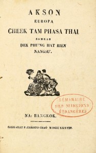
LCS-600Très rare édition originale du premier livre sorti de l’imprimerie catholique de Bangkok, l’un des tout premiers témoignages de l’essor de l’imprimerie en Thaïlande. Bangkok, 1838. Na : Bangkok, Sakkarat P. Christo Chao 1838. (= à Bangkok, l’année chrétienne 1838).In-12 composé de (2) ff. dont 1 de titre, 56 pp., et (1) f. Vignette gravée sur le titre. Conservé dans son cartonnage d’origine. Boîte moderne.155 x 98 mm.
1741KART0239Den Haag, Pieter de Hondt 1741. 2°. Titelbl., 1 nn. Bl., 44 S., 53 Tafeln (davon 52 doppelseitig), großteils mit reichen figuralen Kartuschen, Titelblatt in Rot- und Schwarzdruck, mit Titelblattvignette, Initialen u. Schlussvignette. Neuer Halbpergamentband, Deckel mit grünem Kleisterpapierbezug u. Pergamentecken, Schuber. Titelbl. u. Vorsätze gebräunt, flieg. Vorsatzbl. fleckig u. mit 2 kl. Wurmspuren. Textteil stellenweise etwas stockfleckig. Tafeln an den Rändern mit leichten Feuchtigkeitsspuren, vereinzelt verso leicht fingerfleckig, die letzten 10 Taf. am unteren Rand stärker gebräunt u. im rechten Rand mit schwarzem Tintenfleck. Vorletzte Tafel oben mit Eckabriss im weißen Rand. Insgesamt in gutem Erhaltungszustand, breitrandig und unbeschnitten. Koeman I,1:631; Goffart, Historical Atlases 544; Acta Cartographica 27,201; BM Catalogue of Maps 9; ADB 13,137f. ? Der Historiker Georg Horn (1620-1670) war 1653-70 Professor für Geschichte an der Universität Leiden, er verfasste neben anderem Lehrbücher für Universalgeschichte, die in ihrer Gesamtheit ein umfassendes Nachschlagewerk für Geographie und Geschichte bildeten und viele Jahre bei den Studierenden Hollands und Deutschlands sehr geschätzt waren. Vorl. eine Ausgabe - mit dem erklärenden Text in französischer Sprache - seiner 1667 erstmals erschienenen ?Accuratissima orbis delineatio?, mit allen im Verzeichnis genannten Karten. Das Werk beinhaltet gestochene Landkarten der bedeutendsten Kartographen dieser Zeit, die meisten stammen von oder sind gearbeitet nach Johannes Janssonius (1588-1664), weitere auch von Abraham Ortelius (1527-1598), Nicolas Blankaart (1624-1703), Johann Lauremberg (1590-1658) und enthält u. a. Karten zur biblischen Geschichte (11), Karten von Ägypten (2), Zypern, Griechenland (4), Spanien, Italien (5), Großbritannien (3) Frankreich zur Zeit Julius Caesars, des Heiligen Römischen Reiches, sowie eine Karte zur Illias, eine zur Expeditionsroute Alexander des Großen, eine des Fränkischen Reiches unter Karl dem Großen und auch eine Wiedergabe der Tabula Peutingeriana auf 4 Tafeln mit je 2 Abschnitten. Beeindruckender kompletter Atlas mit gut erhaltenen Kupfern.
220820S.l., 4 décembre 1700 (1701) in-12, 108 pp., couvertes d'une écriture fine et très lisible (environ 30 lignes par page, quelques biffures et ratures), avec un frontispice gravé avec un cartouche vide (Paris, chez Bonnart), portant un titre manuscrit Journal du sr. Frigard, ordinaire de la musique du Roy, veau brun, dos à nerfs cloisonné et fleuronné, tranches mouchetées de rouge (reliure de l'époque).
Acquaforte e bulino, impressa su carta vergata con filigrana "Corona a sette punte con lettere TB e P" (Woodward 282, trovata in un'altra carta stampata da Stefano Mozzi Scolari), con margini, in perfetto stato di conservazione.UNICO ESEMPLARE CONOSCIUTO dell'edizione di Stefano Mozzi Scolari di questa carta raffigurante il Mediterraneo Orientale, appartenuto alla collezione di Fritz Hellwig. Si tratta di uno dei 4 fogli che compongono una rarissima e sinora sconosciuta carta dell'Europa, il cui unico esemplare noto è conservato nella raccolta fattizia cinquecentesca della Biblioteca Civica di Bergamo [Atlante_Cinq-7-794]. L'esemplare di Bergamo è composto da tre fogli, di quattro; sinora sconosciuti ai repertori, vengono pubblicati per la prima volta in Bifolco-Ronca (pp. 662-663, tav. 218). Questi tre fogli fanno parte di una carta in quattro fogli dell’Europa pertanto è probabile che le eventualiiscrizioni si trovassero nel foglio occidentale mancante.In alto a sinistra si trova la Scala de miglia (25 miglia pari a mm 60). Orientazione fornita da una triplice rosa di sedici venti; sono indicati con la lettera iniziale e alcuni simboli i quattro venti principali e i quattro mezzi venti, il nord è in alto. Carta priva di graduazione ai margini. Acquaforte e bulino, ogni foglio misura mm 335x505 circa, per una dimensione totale della carta di 660x1050 mm circa.Sono privi di qualsiasi indicazione editoriale e del titolo, che si suppone dovesse essere riportato sul quarto mancante. La carta non è descritta dalla letteratura, fatto salvo per il foglio di sud-est che è studiato già da Almagià per l’esemplare della Vaticana; da Valeria Bella per quello della collezione Novacco e da Tolias e Zacharakis per quello della collezione di Margarita Samourkas. Almagià la definisce come una carta rozza e mediocre nell’incisione, ispirata dalla carta "Geographia particolare d’una gran parte dell’Europa" (1560) di Giacomo Gastaldi; conclude, inoltre, che la carta probabilmente sia manchevole del foglio occidentale, in quanto mostra la sola Sicilia orientale, in cui compaiono solo le due ultime lettere “IA”, del coronimo. Quindi già Almagià supponeva che il foglio da lui analizzato fosse parte di una carta più grande, ignorando, tuttavia, che componesse una carta del continente europeo. La datazione dell’opera è fornita dalla bandiera con il Leone di San Marco che campeggia sopra l’isola di Cipro; quindi è anteriore al 1572, anno in cui l’isola passò sotto il dominio ottomano. Non sono conosciuti altri esemplari di questa carta che, per quanto ne sappiamo, potrebbe non essere mai stata terminata. La lastra su cui era inciso il foglio di sud-est, invece, ebbe una tiratura successiva a cura di Francesco Valegio, il cui imprint appare nell’esemplare illustrato da Tolias (2006). Tuttavia, il Valegio, che non sicurò nemmeno di rimuovere la bandiera col simbolo marciano sull’isola di Cipro, potrebbe avere ristampato solo il foglio in questione.Sempre del foglio di sud-est esiste questa prova che reca l’imprint di Stefano Scolari, impresso sopra la raschiatura di quello di Valegio; è ancora presente la bandiera col simbolo di Venezia. Si presume che questo fu l’unico dei fogli che ebbe una ristampa. Altra bibliografiaAlmagià (1948): p. 85, n. 5 (foglio di sud-est); Cartografia Rara (1986): n. 84; Tolias (2011): p. 106, II.33, n. 1612; Zacharakis (1992): n. 2759. Tutte riferite al solo foglio di sud-est. [Eastern Mediterranean Sea] Anon – Venice 1570 circa (but Stefano Mozzi Scolari, Venice 1640-60)Etching with engraving, printed on contemporary laid paper with "Crown with seven points and letters TB and P" watermark (Woodward 282, founded in another map by Stefano Mozzi Scolari), with margins, very good condition.A magnific example of the third state, of three, of the SE sheet of the unknown map of Europe, (cf. Bifolco-Ronca, pp. 662-663, tav. 218). THE ONLY KNOWN COPY of the Scolari's issue. Example from the Fritz Hellwig collection. In the 16th century collection of the Biblioteca Civica of Bergamo [Atlante_Cinq-7-794] are preserved three sheets, of four, depicting Europe. They are devoid of any printing details and title, which is supposed to be reported on missing quarter. The map is not described by the literature, except for the south-east sheet, that it is already studied by Almagià for the example of the Vaticana; from Valeria Bella for that of the Novacco collection and from Tolias and Zacharakis for that of the collection by Margarita Samourkas. Almagià defines it as a rough and mediocre map in engraving, inspired from the particular Geographia particolare d’una gran parte dell’Europa (1560) by Giacomo Gastaldi. He concludes, furthermore, that the map is probably defective of the western sheet, as it shows only eastern Sicily, in which only the last two letters "IA" of the name appear. Then Almagià already assumed that the sheet he analyzed was part of a larger map, ignoring, however, that he composed the European continent. The date of the work is provided by the flag with the Lion of San Marco that stands above the island of Cyprus; therefore it is prior to 1572, the year in which the island came under Ottoman rule. No other copies of this map are known, as far as we know, it may never have been terminated. The plate on which the south-east sheet was engraved, on the other hand, was later printed by Francesco Valegio, whose imprint appears in the copy illustrated by Tolias (2006). However, Valegio, which does no the even took care of removing the flag with the march symbol on the island of Cyprus, he could have reprinted only the SE sheet. Always from the south-east sheet there is an issue (this one, it’s the only copy known) that bears the imprint of Stefano Scolari; is still present the flag with the symbol of Venice. It is assumed that this was the only sheet that had a reprint.Literature:Bifolco-Ronca, Cartografia e Topografia Italiana del XVI secolo, Catalogo ragionato delle opera a stampa (2018), pp. 662-663, tav. 218, III/III.Almagià (1948): p. 85, n. 5 (foglio di sud-est); Cartografia Rara (1986): n. 84; Tolias (2011): p. 106, II.33, n. 1612; Zacharakis (1992): n. 2759 (all of theme refere only at the SE sheet). Bifolco-Ronca, Cartografia e Topografia Italiana del XVI secolo, Catalogo ragionato delle opera a stampa (2018), pp. 662-663, tav. 218, III/III.
In-4 p., 9 volumi (di cui 1 di Supplemento), mz. pelle coeva con ang., dorso a cordoni con filetti e tit. oro, tagli sup. dorati. L'opera, in 8 volumi, pubblicati nel 1871-1881, è cosi' composta: - Vol. 1°: pp. XIII (list of subscribers), III-XLVI,102 (prefatory matter and indices) /// Vol. 2°: pp. (2),VIII,644, con 95 tavv. /// Vol. III: pp. (2),VIII,620, con 86 tavv. /// Vol. 4°: pp. (2),VIII,636, con 92 tavv. di cui 1 (la 262) in b.n. /// Vol. 5°: pp. (2),VIII,668, con 90 tavv. /// Vol. 6°: pp. (2),VIII,708, con 92 tavv. /// Vol. 7°: pp. (2),VIII,660, con 89 tavv. di cui 1 (la 485) in b.n. /// Vol. 8°: pp. (2),VIII,666, con 90 tavv. (la 599 è bis). - Il "Supplement", vol. 9°, pubblicato nel 1895-96, pp. (2),XXV,441, con 89 tavv. Importante e ricercata opera di ornitologia, magnificamente illustrata da complessive 723 tavole litografate di cui: 721 con pregevole coloritura a mano e 2 in b.n. Le bibliografie citano 722 tavv. "Ediz. originale", rara. Cfr. Zimmer,I, p. 177/179: "A very thorough manual of the subject, beautifully illustrated by J.G. Keulemans, Joseph Wolf, E. Neale and others.. Vol. IX was intended to treat only of species not included in the original work, but offers occasional corrections to the original letterpress, also" - Nissen,DIV,267 - The British Museum (Natural History),I, p. 479. Cfr. anche Benezit,VII, p. 774 che dell'artista olandese precisa: "Johannes Gerardus Keulemans (1842-1912), peintre animalier, graveur, illustrateur. Passionné d'histoire naturelle, ornithologue, il représente, selon un graphisme très précis, toutes les sortes d'oiseaux qu'il connait". Benezit,XIV, p. 687, dell'illustratore tedesco Joseph Wolf (1820-1899) così precisa: "Il peignit un grand nombre de tableaux d'oiseaux, s'amusant à les représenter dans les mutations de l'éclairage". Solo nel 9° volume 4 cc. con alone al margine super. bianco, altrimenti bellissimo esemplare.
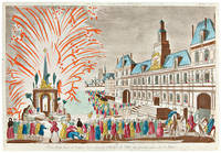
1762WRCAM46155Paris 1762. Two volumes. 62; 61 leaves each with a mounted plate. Images vary in size either 11 x 16 inches or 8 x 12 inches. Oblong folio. 19th-century gilt cloth rebacked in red morocco. Corners repaired. Wear and soiling to boards. Internally clean colors bright and fresh. Very good. Two large albums containing 123 brightly colored VUES D'OPTIQUE depicting scenes from Paris Rome London and many other locations in Europe. Lettering is typically printed at the top and bottom of the plate primarily in French with the letters at the top reading backwards. The letters above the text were deliberately reversed since these prints were designed for viewing in optical machines with a magnifying glass and a reflective mirror which gave the viewer an illusion of depth and reversed the image. The views are mostly of France including many scenes from Versailles and the ports of the realm. There are likewise a significant number of views of important landmarks around Rome. Other views depict notable locations in the Netherlands Denmark Germany Spain Poland and London. A handful of the plates show more unusual locales such as Mexico City Siberia St. Petersburg Peking Cayenne and French Guiana. Altogether an impressive collection of these handsome engravings. hardcover books
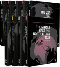
2023__1032303042Routledge 2023. Hardcover. New. 9300 pages. 11.00x8.25 inches. Routledge hardcover
1784200771Gedruckt bey der Kayserl. Academie der Wissenschaften, St.Petersburg 1770, 1774 und 1784 (Band 4)). 4 Blatt, 182 Seiten mit 40 teils gefalteten Kupfertafeln auf 39 Tafelblättern (davon 1 Karte) - VIII, 260 Seiten mit 46 teils gefalteten Kupfertafeln auf 37 Tafelblättern, davon 5 Karten - 1 Blatt, 508 Seiten mit 57 teils gefaltte Kupertafeln auf 51 Tafelblättern - 1 Blatt, XXVI, 218 Seiten ohne Tafeln 4°, modernes Halbleder mit Rückentitel, breitrandig gebundenes Exemplar, wenige Tafeln mit nur geringfügigen Beschädigungen, insgesamt außergewöhnlich gutes Exemplar mit sauberen Tafeln,
2022__1032200774Routledge 2022. Hardcover. New. pck edition. 9300 pages. 11.00x8.25 inches. Routledge hardcover
2025__1041226039Routledge 2025. Hardcover. New. pck edition. 9300 pages. 11.00x8.25 inches. Routledge hardcover
Universe Europe maritime eiusque navigationis descriptio = Generale Paschaerte van Europa, soe verre die Zeecusten ende Navigatien streckende zÿn. Gepractizeert Doer Lucas Jansz, Wagenaer va Enchusè. Met Privilegie tot 10. Iaren. 1.5.83. Acquaforte e bulino, 395x555 mm, firmata e datata in lastra in basso a destra Joannes à Doetecum. F.Dall'edizione tedesca dello Spieghel der Zeevaerdt. Terza edizione della carta, con la traduzione del nome di alcuni mari in latino, inserita nello Spieghel der Zeevaerdt a partire dal 1586.Magnifica prova, con piccoli restauri nei margini che interessano anche il bordo graduato, nel complesso in eccellente stato di conservazione.Carta nautica del Mediterraneo occidentale, estesa alle Isole Britanniche e all’Islanda, di Lucas Jansz. Waghenaer. Impreziosita da rose dei venti, mostri marini, velieri e stemmi araldici, la carta è inclusa nello Spieghel der Zeevaerdt di Waghenaer ed è caratterizzata dalla curiosa rappresentazione circolare dell’Islanda, che sarebbe stata rivista e corretta nella successiva versione. La tavola è conosciuta in tre diversi stati: il primo - avanti le aggiunte delle traduzioni in latino nel nome di alcuni dei mari e delle iscrizioni nelle barre della scala metrica - apparve solo nelle prime tre edizioni dello Spieghel der Zeevaerdt, pubblicate a Leida da Christophe Plantin nel 1583, 1584 e 1585; il secondo stato della lastra vede aggiunta l’isola di Rockall, un piccolo scoglio dell’Atlantico a ovest della Scozia, che viene rappresentato, senza il toponimo, a destra del vascello. Secondo Schilder questo stato della carta non sarebbe inserito in nessuna delle edizioni dello Spieghel der Zeevaerdt, ma sarebbe stato venduto separatamente a Leida da Van Raphelingen per la tipografia Plantin intorno al 1586. Il terzo stato della carta, pubblicato per la prima volta nella traduzione latina dello Spieghel der Zeevaerdt - stampata con il titolo di Speculum nauticum nel 1586 - vede alcuni nomi dei mari e delle scale grafiche tradotti per il mercato sud-europeo. Ad esempio, sotto al toponimo Midtlantse Zee, ad ovest della Sardegna, si legge, in piccolo, Mare Mediterraneum.Lo Spieghel di Waghenaer fu il primo atlante nautico a stampa; di conseguenza questa carta nautica dell’Europa e dell’Atlantico occidentale è la prima carta nautica stampata della regione. La data 1583 è incisa in piccolo riquadro sotto il cartiglio con il titolo; tuttavia, è possibile che Waghenaer avesse già realizzato questo carta portolano nel 1579, per venderla separatamente come strumento di navigazione. Incisa da Joannes van Doetecum la carta è impreziosita da numerose rappresentazioni di navi e ricoperta di linee direzionali che si irradiano da rose dei venti, decorazioni tipiche delle carte nautiche manoscritte, senza dubbio fonti cartografiche per questa mappa. I nomi dei luoghi vengono scritti continuamente verso l’interno intorno alla costa, da nord a sud, al fine di facilitarne la lettura al navigatore attraverso la ruotazione della mappa. Nella parte terrestre della tavola troviamo gli stemmi dei vari Paesi europei. La raffinatezza dello stile incisorio di Joannes van Doetecum è molto evidente in questa mappa. Joannes, insieme al fratello Lucas, proveniva da una famiglia di incisori originaria di Deventer, attiva ad Anversa, Haarlem e Amsterdam nella seconda metà del XVI secolo. Oltre alle mappe dello Spieghel, i fratelli Doetecum sono autori delle più belle carte pubblicate da Hieronymus Cock, Gerard de Jode e Abraham Ortelius. Una curiosità cartografica dell’opera è la presenza, a ovest delle coste irlandesi, della piccola isola del Brasile, o Hy Brasil, rappresentata nella consueta forma circolare con un fiume che la taglia in due. L’isola - qui denominata Brasiil – appartiene alla mitologia irlandese: coperta da un costante velo di nebbia, si dice che appaia per un giorno ogni sette anni. L’isola leggendaria apparve per la prima volta in una mappa di An... Universe Europe maritime eiusque navigationis descriptio = Generale Paschaerte van Europa, soe verre die Zeecusten ende Navigatien streckende zÿn. Gepractizeert Doer Lucas Jansz, Wagenaer va Enchusè. Met Privilegie tot 10. Iaren. 1.5.83. Etching with engraving, signed at lower right Joannes à Doetecum. F. From the German edition of the Spieghel der Zeevaerdt.A fine impression, printed on contemporary laid paper, small restorations in the margins that also affect the graduated edge, overall in excellent condition.Third state of Waghenaer's map of Europe, the British Isles, Iceland, and the western Mediterranean, including the Rockall Island and the Latin translation of some of the Sea’s names. Richly embellished with compass roses, sea monsters, sailing ships, coats of arms and rhumb lines, the chart appeared in an early edition of Waghenaer's Speigel der Zeevaerdt and is characterized by the curious circular representation of Iceland, which was revised in later reprints. Waghenaer's Spiegel was the first engraved sea atlas, making this sea chart of Europe and the Western Atlantic the earliest printed sea chart of the region. Because this chart was significantly larger than the others in the atlas, it rarely appears on the market in good condition. The fine engraving work of Joannes Doetecum is very much in evidence on this map. Doetcum came from a family of printmakers from Deventer, although Joannes and his brother Lucas moved to Antwerp. They engraved not only the maps in theS peigel, but also maps for Hieronymus Cock, Gerard de Jode, and Abraham Ortelius.Lucas Jansz Waghenaer (c. 1533–1606) was a navigator and the author of the ‘Spieghel der zeevaerdt’, the first pilot guide. He spent his early career as a naval officer between 1550 and 1579, interacting with other sailors and gaining vital experience for his later work. He then worked as a duties collector in Enkhuizen, before beginning to work on a project to combine accurate sailing directions with detailed maps. Sailors at the time generally relied on small books called rutters, which were often handwritten, or featured crude woodcut maps. They were wary of printed guides, as they could not be updated or personalised as easily as a manuscript and were thought to be less practical. Waghenaer aimed to change this attitude, and chose to do so by publishing his work as a large folio (rather than the traditional oblong), with copper engraved maps and typeset text. The first volume of the ‘Spieghel’ contains instructions on various navigation techniques and the use of the manual, and maps of coasts from Texel to Cadiz, each accompanied by a coastal profile. Portuguese navigators had pioneered the use of coastal profiles in navigation, but Waghenaer was the first to include them for every chart on a consistent scale. The second volume, published a year later, contained charts of the coasts north of Texel. They were engraved by Johannes van Doetecum, one of the finest workers of the age. The charts were based on Waghenaer’s own extensive experience, supplemented by manuscript and printed sources. The accompanying text was based on other sixteenth century navigation manuals. It was a revolutionary success, and was translated into German, Latin and French, as well as an unauthorised English edition. His work was so popular in England that the Anglicized version of his name, ‘Waggoner’, became a generic term referring to sea atlases and charts.Bibliografia: T. Campbell, Early Maps, New York, 1981, p. 86, tav. 39; B. Freitag, Hy Brasil: The Metamorphosis of an Island, From Cartographic Error to Celtic Elysium. Amsterdam, 2013; H.A.M. van der Heijden, De Oudste gedrukte kaarten van Europa, Utrecht, 1992, n. 12; C. Koeman, Lucas Janszoon Waghenaer: A Sixteenth Century Marine Cartographer, in “The Geographical Journal”, Vol. 131, No. 2 (June, 1965), pp. 202-212; C. Koeman, Atlantes Neerlandici: Bibliography of Terrestrial, Maritime and Celestial Atlases a... S. Bifolco, "Mare Nostrum, Cartografia nautica a stampa del Mar Mediterraneo" (2020), pp. 68-69, tav. 16.
231001S.l., s.d. (1826-28) in-folio, en feuilles ou broché sous couverture d'attente de cartonnage souple orange moucheté, le tout dans double emboîtage de carton vert moderne.
240634Amsterdam, E. Maaskamp, s.d. (1811) in-folio, titre bilingue, 12 planches accompagnées chacune de deux feuillets de légende, une en français, l'autre en néerlandais, cartonnage d'attente vert d'eau (reliure de l'époque). Coupes un peu usées.
The English pilot. Part III: Describing the Sea-coasts, Capes, Head-lands, Bays, Roads, Harbours, Rivers and Ports; together with the Soundings, Sands, Rocks and Dangers in the whole Mediterranean Sea, likewise the Courses and Distances from one Place to another. The Setting of the Tides and Currents. The Ebbing and Flowing of the Sea. The Bearing, Distance and Prospect of the Land, and how thwy shew themselves at Sea. Carefully corrected, with new Additions of several Ports, Harbours, Bays, and Prospects of Land, never before made Public, London, Printed for J. Mount, and T. Page on Tower-Hill MDCCLXXXI (1781).Volume in-folio (480x310 mm), legatura coeva in pelle, 86+38 pp., 17 carte geografiche incise a doppioa pagina, una più volte ripiegata raffigurante l'intero Mediterraneo pubblicata per la prima volta da Charles Price nel 1730.Il The English Pilot fu un importante atlante nautico britannico, pubblicato dal 1671 al 1803.Ideato da John Seller, venne proseguito dltri editori tra cui Charles Price, John Thornton e la ditta Mount & Page.La parte III copre tutto il Mar Mediterraneo, in 14 sezioni, con frontespizio, testo descrittivo e un set di diciassette mappe. Le carte dell'Englis Pilot erano intese come carte per la navigazione, quindi ci fu uno sforzo per renderle accurate. L'opera include la grande carta nautica del Mar Mediterraneo, arricchita da cartigli contenenti piani nautici di Civitavecchia, Livorno, Nettuno e delle baie di Tunisi e Alessandretta. La carta è firmata da William Mount e Thomas II Page, rispettivamente figlio di Richard e Thomas I. Un esemplare della tavola, con la data 1730 è conservato in una raccolta di carte - senza titolo e data - di Charles Price nella collezione della British Library (Maps C.8.b.16, cfr. Shirley p. 1270, M.PRI-1a, 19). Charles Price finì in prigione (1731) per non aver onorato i propri debiti economici; probabile quindi che la lastra passò nelle mani della tipografia Mount & Page. La troviamo inclusa nel volume III del The English Pilot, curata dagli editori John Mount e Thomas II Page tra il 1730 ed il 1771 (cfr. Shirley, p. 1260, M.M&P-8°, 6). La data “1730” viene abrasa nelle tirature successive dell’opera. Il terzo volume dell’English Pilot, è noto in 19 diverse edizioni, a partire dal 1703 e fino al 1803. Basato sulle carte del Mediterraneo stampate da John Seller nel 1677, viene in seguito aggiornato da nuove e migliori carte.Bibliografia: cfr. National Maritime Museum, Catalogue of the Library - Vol. Three, Atlas & Cartography, Londra, 1971, pp. 460-462; R. Shirley, Maps in the Atlases of the British Library, Londra, 2004, pp. 1257, M.M&P-7c, (1, 2); p. 1260, M.M&P-8a (6); pp. 1263-1264, M.M&P-13b (11); p. 1270, M.PRI-1a (19); cfr. The Compleat Plattmaker: essays on Chart, Map and Globe Making in England in the Seventeenth and Eighteenth Centuries, Berkeley, 1978. The English pilot. Part III: Describing the Sea-coasts, Capes, Head-lands, Bays, Roads, Harbours, Rivers and Ports; together with the Soundings, Sands, Rocks and Dangers in the whole Mediterranean Sea, likewise the Courses and Distances from one Place to another. The Setting of the Tides and Currents. The Ebbing and Flowing of the Sea. The Bearing, Distance and Prospect of the Land, and how thwy shew themselves at Sea. Carefully corrected, with new Additions of several Ports, Harbours, Bays, and Prospects of Land, never before made Public, London, Printed for J. Mount, and T. Page on Tower-Hill MDCCLXXXI (1781).Folio (480 x 310 mm), J. Mount, T. Page, 1781, Contemporary calf, woodcut Royal arms on title, 17 engraved maps, woodcut coastal profiles and illustrations in the text.The English Pilot was an important British sea-atlas published from 1671 to 1803. Initially published by John Seller, publication of the atlas changed hands periodically, with other publishers including Charles Price, John Thornton, and the Mount & Page firm. Part III covers the whole Mediterranean Sea, in 14 sections, with title page, descriptive text, and set of seventeen maps. Features a large folding map titled "A Correct Chart of the Mediterranean Sea from the Coast of Portugal to the Levant." and 16 other maps which are double-page folio sheets covering parts of the Mediterranean and are all embellished with compass roses, rhumb lines and costal profiles.The charts from the English Pilot were intended as working charts so there was an effort to make them accurate, although predictably, many seamen complained that the charts were consistently out of date and that changes were slow to appear, a charge levelled at virtually every British, French and American Chart maker, including the respective governments of these nations. Ironically, it was in no small part due to the proprietary nature of the information included in the maps and sailing directions that there was a tendency for commercial pilots to pass the information from mariner to chart-maker more slowly than might otherwise have been the case, although the chart makers on the Thames and otherwise were undoubtedly reluctant to immediately make each and every necessary correction, for fear of undermining the economic viability of their businesses.Bibliografia: cfr. National Maritime Museum, Catalogue of the Library - Vol. Three, Atlas & Cartography, Londra, 1971, pp. 460-462; R. Shirley, Maps in the Atlases of the British Library, Londra, 2004, pp. 1257, M.M&P-7c, (1, 2); p. 1260, M.M&P-8a (6); pp. 1263-1264, M.M&P-13b (11); p. 1270, M.PRI-1a (19); cfr. The Compleat Plattmaker: essays on Chart, Map and Globe Making in England in the Seventeenth and Eighteenth Centuries, Berkeley, 1978. S. Bifolco, "Mare Nostrum, Cartografia nautica a stampa del Mar Mediterraneo" (2020), pp. 218-219, tav. 100.
1662bf4740Chez L'auteur Relié 1662 "MAGNIFIQUE ENSEMBLE DES QUATRE CONTINENTS CARTOGRAPHIÉS PAR LE PREMIER CARTOGRAPHE FRANÇAIS, DANS UN ÉTAT DE FRAICHEUR INCOMPARABLE. Quatre volumes petit in-4 (18,5 x 25 cm), reliés en plein veau brun de l'époque. Les reliures sont toutes identiques, dos à 5 nerfs, titrés, roulettes dorées sur les coupes. Nicolas Sanson d'Abbeville est considéré comme le fondateur de la cartographie en France. En 1627, rencontrant Richelieu (il venait d'Abbeville et s'était installé à Paris), il fut présenté par lui à Louis XIII, qui le nomma Géographe Ordinaire du Roi. Il cartographia quatre continents (ici présents : l'Europe, l'Asie, l'Afrique et l'Amérique), et fut même le premier à cartographier certaines parties du globe (ainsi, par exemple, la région des grands lacs canadiens, avec sa carte ""Le Canada ou Nouvelle France"" (carte datant de 1656)). Il fut le premier Français à concevoir le plan d'un atlas mondial. Les cartes et le texte de chaque volume sont entièrement montés sur onglets. Chaque carte reçoit un commentaire explicatif, avec informations sur l'économie, les habitants et les moeurs du pays décrit, tiré des auteurs anciens (Pline, Strabbon...), de récits de voyageurs ou de rapports des missions des jésuites. De plus, chacune des cartes présente les tracés de contours des pays ou régions aquarellés. Les volumes s'organisent comme suit : L'Europe (sans date) : Titre et dédicace gravés sur double page, 12 cartes doubles et 30 feuillets imprimés au recto. L'Asie (1662) : 108 pages (avec erreurs connues de chiffrage et inversion de feuillets) et 17 cartes doubles. L'Afrique (1662) : 96 pages et 17 planches doubles, proposant 18 cartes (car l'une des planches porte deux cartes) (ce volume est le seul à présenter une petite mouillure sur les quelques premières pages). L'Amérique (1662) : non paginé (80 pages) et 15 cartes doubles. Nos exemplaires sont en TRÈS BEL ÉTAT. Les pages sont très fraiches, sans aucune réelle trace, tache, piqûre ni mouillure. Les cartes, particulièrement, sont dans un vraiment très bel état de fraîcheur, avec des couleurs extrêmement éclatantes. Les reliures présentent des traces peu visibles de réparations anciennes. Les volumes ont étés reliés avec contre-gardes, mais sans pages de garde. Ce rare ensemble est véritablement en TRÈS BEL ÉTAT. Livraison a domicile (La Poste) ou en Mondial Relay sur simple demande."
Carta tratta da: Arcano Del Mare Di D’Ruberto Dudleo Duca Di Nortumbria e Conti Di Warvich Diuiso in libri sei. Nel primo, de' quali si tratta della longitudine praticabile in diuersi modi, d'inuenzione dell'Autore. Nel secondo, delle carte sue generali, e de' portolani rettificati in longitudine, e latitudine. Nel terzo, della disciplina sua marittima, e militare. Nel Quarto, Dell'Archittetura sua Nautica di Vascelli da guerra. Nel Quinto, Della Navigazione scientifica, e perfetta cioe Spirale ò di gran Circoli.". El volumen 2 contiene el libro sexto: "Nel sesto, Delle carte sue Geografiche, e Particolari in Fiorenze, MDCLXI.: In Firenze, Nella Stamperia di Francesco Onofri. 1646.Coppia di incisioni ad acquaforte e bulino, rispettivamente di dimensioni 435x745 e 435 x365 mm.Raro ed importante portolano del Mediterraneo. Magnifico esemplare, su carta vergata coeva, in ottimo stato di conservazione.Carta nautica del Mediterraneo con proiezione di Mercatore, disegnata dall’inglese Robert Dudley ed incisa a Firenze da Antonio Lucini. Dudley (1574-1649) era il figlio illegittimo di Robert Dudley, conte di Leicester, e cognato del famoso circumnavigatore Thomas Cavendish. Dudley si unì alla Royal Navy e condusse una spedizione in Sud America nel 1594-1595. Nel 1596, comandò la nave Nonpareil nel riuscito attacco del Conte dell’Essex a Cadice, e fu nominato cavaliere per i suoi servizi. Dopo un viaggio di alcuni anni nei Caraibi, fu condannato all’esilio in Italia, dove si stabilì nel 1605, divenendo geografo alla corte di Ferdinando I, Granduca di Toscana. A Firenze, Dudley mise a frutto la sua esperienza navale; lavorò come costruttore di navi, consulente nei progetti di costruzione di porti e delle loro fortificazioni. Contemporaneamente scrisse anche la sua opera più importante e nota: Dell’Arcano del Mare, un manuale di navigazione. Una prima versione manoscritta del testo sopravvive nel Museo di Storia Naturale a Firenze, in tre volumi, due datati 1610. Una seconda versione più completa (ca. 1636-1646) è alla Biblioteca Reale di Monaco e contiene una serie di carte manoscritte. La versione a stampa Dell’Arcano del Mare fu pubblicata a Firenze nel 1646-1648, per essere poi ristampata, come Arcano Del Mare, Nella nuova stamperia, per Giuseppe Cocchini, all'insegna della Stella. Ad istnaza di Iacopo Bagnoni, & Antonfrancesco Lucini. 1661.L’Arcano (o “Segreti del mare”) è una sorta di enciclopedia di materie nautiche - dalla costruzione navale alla navigazione e all’astronomia. Fu stampato in sei volumi che contengono un gran numero di illustrazioni, diagrammi tecnici, immagini di strumenti ecc., ma, soprattutto, una serie di 146 carte che coprono tutte le parti del mondo. L’Arcano è il primo atlante nautico costruito sulla proiezione di Mercator, particolarmente adatta alla navigazione. Le carte nautiche sono incise da Antonio Francesco Lucini e l’opera costituisce uno dei più grandi atlanti del mondo. Pubblicato per la prima volta nel 1646 quando il suo autore aveva 73 anni, non era solo il primo atlante nautico del mondo e il primo ad utilizzare la proiezione di Mercatore, ma anche il primo a mostrare la deviazione magnetica, le correnti e i venti dominanti e a esporre i vantaggi del ‘Great Circle Sailing’ - la distanza più breve tra due punti su un globo. L’atlante è diviso in sei libri, o sezioni: il primo libro tratta della longitudine; il secondo tratta degli errori nelle carte nautiche esistenti e comprende il portolano per il Mediterraneo e 15 carte generali; il terzo libro tratta della disciplina navale e militare e contempla una lunga sezione sulla tattica navale; il quarto libro descrive il metodo di progettazione e costruzione di navi e si occupa dell’architettura navale, fornendo le linee e le dimensioni delle navi; il quinto libro è interamente dedicato alla navigazione e ai metodi di misurazione della declinazione del sole e delle relative posizioni delle stel... Etching and engraving, printed on two sheets (435x745 and 435 x365 mm), with margins, very good conditions.Map of the Mediterranean Sea taken from the beutiful: Arcano Del Mare Di D’Ruberto Dudleo Duca Di Nortumbria e Conti Di Warvich Diuiso in libri sei. Nel primo, de' quali si tratta della longitudine praticabile in diuersi modi, d'inuenzione dell'Autore. Nel secondo, delle carte sue generali, e de' portolani rettificati in longitudine, e latitudine. Nel terzo, della disciplina sua marittima, e militare. Nel Quarto, Dell'Archittetura sua Nautica di Vascelli da guerra. Nel Quinto, Della Navigazione scientifica, e perfetta cioe Spirale ò di gran Circoli.". El volumen 2 contiene el libro sexto: "Nel sesto, Delle carte sue Geografiche, e Particolari in Fiorenze, MDCLXI.: In Firenze, Nella Stamperia di Francesco Onofri. 1646.A rare and important charts of the Mediterranea Sea. Dudley was the illegitimate son of Robert Dudley, Earl of Leicester, and brother-in-law of the celebrated circumnavigator Thomas Cavendish. Dudley joined the Royal Navy and led a privateering expedition to South America in 1594-1595. In 1596, he commanded the ship Nonpareil in the Earl of Essex's successful attack on Cadiz, and was knighted for his services.Dudley sought to have his legitimacy established at court, but his attempts failed, and he fled abroad, eventually settling in Florence. Dudley was summoned to return to England but refused and was stripped of his titles and estates.In Florence, Dudley put his naval experience to good use; he worked as a ship-builder, consulted on construction projects for harbours and their fortifications, while also writing his magnus opus, a handbook of navigation, ‘Dell’Arcano del Mare’.An early manuscript version of the text survives in the Museo di Storia Naturale, in Florence, in three volumes, two dated 1610. A second, more complete version, dated [ca.1636-1646?] is in the Royal Library, Munich, containing a series of manuscript charts.The printed version, ‘Dell’Arcano del Mare’ was published in Florence in 1646-1648 and re-issued as ‘Arcano Del Mare’ in Florence in 1661. The ‘Arcano’ (or ‘Secrets of the Sea’) was printed in six volumes, an encyclopaedia of matters marine from ship-building through to navigation and astronomy, containing large number of illustrations, technical diagrams, pictures of instruments and so on, but more importantly, a series of 146 charts covering all parts of the world.The ‘Dell’Arcano’ is the first printed sea atlas of the world, and the charts form the first series constructed on the Mercator projection, a projection particularly suited to navigation. However, the ‘Dell’Arcano’ was too large for use on board ship, and too elaborate. The charts were engraved by Antonio Francesco Lucini, and are performed in an elaborate style, the lettering with long flourishes, elaborate compass roses and so on, an expensive production, in the preparation of which Lucini later noted that he had taken 12 years and used 5,000 pounds of copper.The charts are puzzling. Some are clearly drawn from Dudley's own experiences, such as those of northern South America; some from other English sources, presumably communicated to him by brother officers at some point in his career; and some from charts that he owned, but the whole contains remarkable charts of all parts of the world, and not all the sources can be identified.After his death, Dudley's library passed to Ferdinand II, Grand Duke of Tuscany, and much of it resides in the Bibliotheque Nazionale, Florence, including an interesting and important group of English manuscript charts, drawn by John Daniel, while the scientific instruments are to be found in the Museo Galileo, in the same city.Dudley’s ‘Dell’Arcano’ is one of the most important of all sea atlases and yet it had no heirs and, seemingly, no influence, so it stands alone, a unique and as yet little understood masterpieceBibliografia: V. Arri... S. Bifolco, "Mare Nostrum, Cartografia nautica a stampa del Mar Mediterraneo" (2020), pp. 196-197, tav. 85.
Acquaforte e bulino, mm 475x605, firmata in lastra Hugo Allart excudit.Magnifico esemplare con meravigliosa coloritura coeva. Minimi restauri perfettamente eseguiti nella parte destra del foglio, nel complesso in ottimo stato di conservazione.Carta priva di titolo e data, basata sul modello di W. J. Blaeu del 1621, con la rappresentazione del Mediterraneo orientale all’interno del continente africano, inserita in un curioso cartiglio floreale. Sebbene priva di data, la carta è probabilmente riferibile al 1680 circa ed è strettamente connessa all’opera di Casparus Lootsman. Infatti, anche qui troviamo disegnata, a nord dell’Islanda, un’ignota massa di terra alla quale sono associate alcune iscrizioni relative ad altrettante scoperte: t’Lant van Broer Ruys op gedaen Anno 1655, Baay door Gael Hamkes opgedaen An° 1654 e ’t Lant van Edam opgedaen 1655. La scala miliare, in basso a sinistra, è solo in miglia olandesi.La carta non è descritta da Koeman; il solo esemplare noto apparteneva alla collezione di Lord Wardington, venduta in asta da Sotheby’s nel 2005. Huych Allard (1625 - 1691) è il capostipite di questa famiglia di produttori di mappe, editori e tipografi. Probabilmente inizia la sua carriera editoriale nel 1645; nel 1684 risulta attivo ad Amsterdam, in “Calverstraet bij den Dam”. La sua attività si svolge in concomitanza con quella dei grandi produttori di mappe del tempo quali i Blaeu e gli Hondius-Janssonius. La sua produzione cartografica è scarsa e il successo della tipografia arriverà solo in seguito con il figlio Carel. Le opere di Huych Allard - che si firmava anche come Hugo Allaert e Allardt – sono, pertanto, oggi rarissime; Koeman registra solo un atlante composito alla British Library ed uno alla University Library di Leida. Altra raccolta nota è quella appartenuta alla collezione di Lord Wardington, venduta in asta da Sotheby’s nel 2005. Huych muore nel 1691, lasciando il suo negozio nelle mani di suo figlio, Carel Allard; di lui è noto solo che che fu battezzato il 19 gennaio 1648 e di sposò nel 1673 con Lucia van Doreslaer, divenendo padre di due figli, Abraham e Hugo. Poco prima della sua morte, in data 8 marzo 1706 Carel cede una quantità di beni, tra cui lastre di rame e atlanti, a suo figlio Abraham che si unisce a lui nel commercio. Abraham Allard si sposò nel 1704 e venne accettato come membro della “Constvercoopers gilde”, la corporazione dei commercianti d’arte, nel 1708. Da un atto del 1730, che menziona un tutore per i suoi cinque figli minorenni, si deduce che doveva essere morto poco prima.Durante la sua attività, Carel Allard ha realizzato molte mappe e alcuni atlanti, tuttavia, non può essere considerato un editore originale e di grande successo. I suoi atlanti sono composti principalmente da mappe provenienti dallo stock di altri editori come Janssonius e De Wit. Probabilmente anche per questo motivo non ottenne mai il privilegio. Dai registri della corporazione degli editori risulta che era stato accusato di vendere “obscoene en pasquilleuse teekeningen en printen” (stampe e disegni osceni e scurrili). Tuttavia, alcune delle carte geografiche di Allard, progettate e intagliate tra il 1680 e il 1700, sono opere originali, molto decorative, aggiornate e superiori alle mappe, ormai obsolete, di Blaeu e Janssonius. Bibliografia: C. Koeman, Atlantes Neerlandici: Bibliography of Terrestrial, Maritime and Celestial Atlases and Pilot Books Published in the Netherlands up to 1880 Vol. I, Amsterdam 1967, pp. 31-48; Sotheby’s, The Wardington Library. Important Atlases & Geographies, Londra, 18 october 2005, pp. 28-31, n. 6, ill. p. 28. Etching and engraving, 475x605 mm, signed “Hugo Allart excudit “.Magnificent example with wonderful old colors. Minimal restorations perfectly executed on the right side of the sheet, overall in excellent condition.Not described by Koeman, this VERY RARE chart came for the Wardington collection, sold as part of the Atlas by Sotheby's London, 2005.Not titled and dated, the mapi s based on the model of W. J. Blaeu of 1621, with the representation of the eastern Mediterranean within the African continent, in a curious floral cartouche.The chart is probably referring round 1680 and is closely related to the work by Casparus Lootsman: there is, to the north of Iceland, the same unknown mass of land and inscriptions relating to a discoveries: t'Lant van Broer Ruys op gedaen Year 1655, Baay door Gael Hamkes opgedaen An ° 1654 and 't Lant van Edam opgedaen 1655. The milestone scale, lower left, is in Dutch miles only.Huych Allard (1625 - 1691) is the forefather of this family of map makers, publishers and printers. He probably began his publishing career in 1645; in 1684 it is active in Amsterdam, in "Calverstraet bij den Dam". His activity takes place concurrently with that of the great producers of maps of the time such as the Blaeu and the Hondius-Janssonius. His cartographic production is scarce and the success of the typography will only come later with his son Carel. The works of Huych Allard - who also signed himself as Hugo Allaert and Allardt - are therefore very rare today; Koeman only records a composite atlas at the British Library and one at the University Library of Leiden. Another well-known collection is that belonging to the collection of Lord Wardington, sold at auction by Sotheby's in 2005. Huych died in 1691, leaving his shop in the hands of his son, Carel Allard.Bibliografia: C. Koeman, Atlantes Neerlandici: Bibliography of Terrestrial, Maritime and Celestial Atlases and Pilot Books Published in the Netherlands up to 1880 Vol. I, Amsterdam 1967, pp. 31-48; Sotheby’s, The Wardington Library. Important Atlases & Geographies, Londra, 18 october 2005, pp. 28-31, n. 6, ill. p. 28. S. Bifolco, "Mare Nostrum, Cartografia nautica a stampa del Mar Mediterraneo" (2020), pp. 150-151, tav. 63.
Nouvelle Carte Marine de la Partie d’Orient et d’Occident de la Mediterranée Avec la d’Escription des Principales Havres, Bayes, Rades, et emrages, en grand Point, le tout étables Par leur veritables Latitudes Marqué Par le Sieur Berthelot professeur D’Hydrographe à Marseille. Ce vendens che Iean Loots Marchant Librarie de Cartes et Autres Instruments de Marine pour les Ingenieurs et Canonniers, demeurant dans le Petit Rue de Pont Neuf à Amsterdam = Nieuwe Pas-kaart van ‘t Westelyckste deel der Middelantsche Zee met de Voor-naamste Havens alles gelegt op zyn Behoorlyke Breete tot Amsterdam by Ioannes Loots Boek Zeekart Verkooper en Graadboogmaaker inde Nieuwebrugsteeg inde Ionge Lootsman & Paskaart Van de Zee-kusten van Italie, Dalmatie, Sicilia, Grecia, Morea Malte en Candie Met de voornaamste Havens Int Groot Nooit voor dase Soo Gesien. ‘t Amsterdam by Ioannes Loots.Acquaforte e bulino, rispettivamente di dimensioni 605x525 mm (parte occidentale) e 600x530 mm (parte orientale). Buona prova, impressa su due fogli di carta vergata coeva, con sottili margini, alcuni restauri perfettamente eseguiti, nel complesso in buono stato di conservazione. Esemplare con tracce di usura, probabilmente utilizzato per la navigazione in mare. Rarissimo portolano del Mediterraneo di Johannes Loots. Doppio titolo, in francese e olandese, nel cartiglio in basso a sinistra del foglio di ponente; solo titolo olandese nel cartiglio in alto a destra del foglio di levante. L’imprint del Loots è riportato in entrambi i cartigli: tot Amsterdam by Ioannes Loots Boek Zeekart Verkooper en Graadboogmaaker inde Nieuwebrugsteeg inde Ionge Lootsman.Grande carta nautica del Mediterraneo, priva di data ma pubblicata tra il 1698 e il 1707. Si basa, come correttamente enunciato nel cartiglio con il titolo in francese, sulla carta pubblicata dall’idrografo François Berthelot a Marsiglia nel 1693. Rispetto alla tavola del Berthelot, vengono introdotti numerosi riquadri, contenenti altrettanti piani nautici. Nel foglio occidentale sono rappresentati i porti di: Formentera, Majorca, Minorca, Genova, La Spezia, Livorno, Alicante, Cartagine, Tangeri, Ceuta, Tunisi, Algeri, Taranto, e Tripoli. Nel foglio orientale troviamo quelli di Carabuso, Messina, Palermo, Trapani e Santa. Johannes Loots nacque ad Amsterdam nel 1665 circa. Le prime notizie lo danno come produttore di strumenti; intorno al 1693 si stabilì nel negozio in Nieuwebrugsteeg, con insegna “In de Jonge Lootman”. La scelta della strada non fu casuale; vivevano e lavoravano nella stessa via, infatti, Johannes van Keulen ed Hendrick Doncker, nel cui negozio Johannes Loots aveva svolto il suo apprendistato come produttore di strumenti matematici e nautici. Sebbene questa professione non lo qualificasse come venditore di libri e stampe, la corporazione dei librai, dopo qualche esitazione, lo accettò come membro nel maggio del 1693. L’attività di Loots come editore di carte è datata al primo aprile 1695: in un contratto notarile risalente a questa data, Loots fece un accodo con l’incisore Antoni de Winter per l’intaglio di un certo numero di carte nautiche da stampare in collaborazione. Si presume che queste carte siano poi state usate per il primo atlante nautico di Loots, il Het nieu en compleet Paskaart Boek van de Noord en Oost Zee, del 1697. Tuttavia, Antoni de Winter, non rispettando gli accordi, si associò con il perito agrario e matematico Claas de Vries con lo scopo di realizzare una guida nautica “con la proiezione di Mercatore e latitudine crescente”. Solo in seguito Loots venne coinvolto nel progetto e ricevette, il 2 luglio 1698, il privilegio per stampare un atlante nautico che, sebbene addirittura pubblicizzato nel Courster Amsterdamsche del 28 agosto 1698, non venne mai pubblicato. Durante il periodo 1698 – 1707, però, la tipografia produsse una cospicua quantità di mappe che venivano vendute in raccolte assemblate su ordinazione e senza un vero... Nouvelle Carte Marine de la Partie d’Orient et d’Occident de la Mediterranée Avec la d’Escription des Principales Havres, Bayes, Rades, et emrages, en grand Point, le tout étables Par leur veritables Latitudes Marqué Par le Sieur Berthelot professeur D’Hydrographe à Marseille. Ce vendens che Iean Loots Marchant Librarie de Cartes et Autres Instruments de Marine pour les Ingenieurs et Canonniers, demeurant dans le Petit Rue de Pont Neuf à Amsterdam = Nieuwe Pas-kaart van ‘t Westelyckste deel der Middelantsche Zee met de Voor-naamste Havens alles gelegt op zyn Behoorlyke Breete tot Amsterdam by Ioannes Loots Boek Zeekart Verkooper en Graadboogmaaker inde Nieuwebrugsteeg inde Ionge Lootsman & Paskaart Van de Zee-kusten van Italie, Dalmatie, Sicilia, Grecia, Morea Malte en Candie Met de voornaamste Havens Int Groot Nooit voor dase Soo Gesien. ‘t Amsterdam by Ioannes Loots.Etching and engraving, respectively 605x525 mm (western part) and 600x530 mm (eastern part).Good proof, printed on two sheets of contemporary laid paper, with thin margins, some perfectly executed restorations, overall in good condition. Example with traces of wear, probably due to use in navigation.Extremely rare Mediterranean portolan by Johannes Loots. Title in French and Dutch, in the cartouche, at lower left, in western part; only in Dutch in the cartouche at upper right in the eastern part. On both cartouche the imprint: tot Amsterdam by Ioannes Loots Boek Zeekart Verkooper en Graadboogmaaker inde Nieuwebrugsteeg inde Ionge Lootsman.It depicts the coastlines of large part of the Mediterranean Sea, from Gibraltar till the island of Creta, and also a small portion of the Atlantic in the approaches to Gibraltar. Very accurate description of the sea locations and, in the landside, detailed description of 20 important ports. In the lower left corner a cartouche in French: "Nouvelle Carte marine de la partie d'Orient et d'occident de la Mediterranee..." by Berthelot, professor in Marseille.Only a few of Johannes Loots'sea charts have survived to modern times, mostly because they were used by mariners at sea. Johannes Loots (1665 - 1726) was active from 1693 until his death in 1726. Loots began his career by Hendrick Doncker. Several charts from this maker were offered separately.In 1707, Loots sold 100 charts to Gerard Van Keulen. In 1707, Loots seems to have purchased the plates of Jacob Robijn.Bibliografia: C. Koeman, Atlantes Neerlandici: Bibliography of Terrestrial, Maritime and Celestial Atlases and Pilot Books Published in the Netherlands up to 1880 Vol. IV, pp. 409-421, Lts 2, (114, 115). S. Bifolco, "Mare Nostrum, Cartografia nautica a stampa del Mar Mediterraneo" (2020), pp. 162-163, tav. 70.
1702LBW-7981Venezia, Ragheno, 1702. In-folio, vélin rigide, étiquette de maroquin rouge recollée sur le plat supérieurportant l’inscription «M. de Souzy» (reliure de l’époque).
In-4 gr. (mm. 360x219), 3 volumi, p. pelle bazana coeva, filetti dorati ai piatti, dorso a cordoni (abrasioni) con ricca decoraz. e tit. oro su tassello, tagli rossi, pp. (12),472,23; (8),496,39; (6),480,(2); con 3 belle antiporte figur. inc. in rame, 4 carte geografiche (più volte ripieg.) e 58 magnifiche tavv. f.t. (numerosiss. più volte ripieg.). Vi figurano: “plans, costumes, medailles, inscriptions, idoles, lampes & autres restes des anciennes villes, ou des productions de l’art, de la nature, etc”.<br> I primi 2 volumi sono in "prima edizione francese" - Il 3° vol. (che completa l’opera) è in "edizione originale" e porta il titolo: “Voyages en anglois et en françois en diverses provinces et places de la Prusse ducale et royale, de la Russie, de la Pologne &c.”, contenant un Traité de divers Ordres de Chevalerie.., avec des remarques géographiques, topographiques, historiques & politiques sur ces provinces & autres pays.. comme le Macklembourg, la Pomeranie, la Covelande, la Livonie, l’Estonie..”. Testo su due colonne, in francese e inglese.<br> L’opera descrive i viaggi compiuti da La Mottraye nel corso di oltre 26 anni, attraverso quasi tutta l’Europa sino alla Tartaria, al Levante e all’Africa. Le tavole, molte delle quali incise da William Hogarth, sono tutte di grande interesse. La Mottraye (1674-1743) fu particolarmente attento nel descrivere città, monumenti ed antichità, ma la sua opera contiene anche una vasta messe di notizie che riguardano le istituzioni, le usanze ed i costumi. Boucher de La Richarderie loda l’accuratezza delle sue descrizioni, mentre altri lo accusano di digressioni teologiche. Sicuramente fu agevolato nelle sue ricerche in Scandinavia e nell’Est dell’Europa dall’amicizia con Carlo XII di Svezia, che poi seguì in esilio in Moldavia. Avendo visitato moltissimi paesi, la sua opera fornisce interessanti ritratti contemporanei di città importanti come Costantinopoli, Venezia, Uppsala, Londra, etc. <br> Cfr. Boucher de La Richarderie,I,216 - Gay,73 - Chadenat,6333 - Brunet,III,801.<br> Biographie Universelle,XXX, pp. 294/296: “La relation de ses courses si longues paru à la Haye en 1727, en 2 volumi Dès 1724 ils avaient paru en anglais. L’A. fut très mécontent de cette version.. les libraires d’Amsterdam avaient publié le second volume sans son aveu, pendant son absence, et avant qu’il l’eut achevé. Aussi de retour de sa dernière excursion au Nord, il en traduisit lui-meme la relation en anglais, et fit imprimer cette version, avec le texte en français en regard; l’ouvrage est intitulé "Voyage en diverses provinces..", 1732.. Les figures qui ornent ces voyages, sont généralement exactes et bien gravées: elles sont le premier ouvrage de Hogart, depuis si célèbre”.<br> Fresco esemplare, ben conservato.