23 948 résultats
196316512London England: Marlborough Fine Art Ltd. As New. 1963. Paperback. FREE UPGRADE to Courier/Priority Shipping Upon Request - IN STOCK AND IMMEDIATELY AVAILABLE FOR SHIPMENT - AS NEW THE TEXT BLOCK IS PRISTINE CLEAN UNMARKED AND IN EXCELLENT CONDITION - - 41 works catalogued; many b/w and several color illustrations. -- with a bonus offer-- . Marlborough Fine Art Ltd. paperback
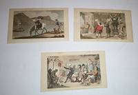
16-5286London: Rudolph Ackermann1813-1817. Collection of 11 colour aquatints. 12 x 19 to 13.5 x 22.4 cm. 3 smaller ones mounted on board. From the collection of Frederic Gale Ruffner Jr. the founder of Gale Research Detroit. Reference: John Roland Abbey Life in England in Aquatint and Lithography 1770-1860: Architecture Drawing Books Art Collections Magazines Navy and Army Panoramas etc. From the Library of J. R. Abbey. The Curwen Press Ltd. 1953 cat. no. 266.21 Second Tour p. 228. London: Rudolph Ackermann,1813-1817 unknown
2002G1565642821I3N00International Institute of Islamic Thought IIIT 2002. Paperback. Good. Pages can have notes/highlighting. Spine may show signs of wear. ~ ThriftBooks: Read More Spend Less.Dust jacket quality is not guaranteed. International Institute of Islamic Thought (IIIT) paperback
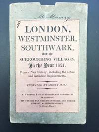
1821400373London: M.J. Godwin & Co 1821. Some pale offsetting. Hand-colored engraved map by Sidney Hall dissected into 21 sections and mounted on linen overall 30 5/8 x 20 7/8 inches folding to 7 x 4 3/8 inches. In original publisher's board slipcase pink printed title label on front. This large and handsome map spans the entire city of London and its environs drawn as its cover label reports from a new survey "including the actual and intended Improvements." At furthest left are Hyde and Regents Parks and at furthest left is Greenwich Park. The map shows as far north as Islington and Hackney and as far south as Deptford and Greenwich. The Thames is depicted horizontally across the map and the hand-coloring demarcates various areas and features such as central London defined by a red border the major streets done in pink the parks and water in green. Yellow is reserved only for Regent Street. Five bridges are shown from west to east: Vauxhall Westminster Waterloo Blackfriars and London. Clearly shown from top left and wandering southeast to the Thames is Regent's Canal the large project that had reached completion just one year before this map's publication. Printed at bottom is an alphabetical list of streets with a key to their positions on the map. With contemporary provenance signed by "M. Maury London Sept. 1821" on verso of linen and title label. <br/><br/> M.J. Godwin & Co unknown books
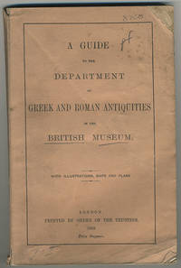
1913BNDGuLON69London: Printed By Order Of The Trustees 1913. 1913. 8vo. pp. 180. many text illus. most full-page. with half-title. contemporary half sheep worn. [London:] Printed By Order Of The Trustees, 1913. unknown
0728600412.Gpaperback. Good. Access codes and supplements are not guaranteed with used items. May be an ex-library book. paperback
1959158733London, New York & Toronto: Oxford University Press 1959. XIV, 264 Seiten. 8° (17,5-22,5 cm). Orig.-Leinenband mit Orig.-Schutzumschlag. [Hardcover / fest gebunden].
Sm. 4to., Best Edition, on laid paper, with a frontispiece and 7 plates, endpapers lightly spotted; marbled boards, cloth back gilt, backstrip lettered in MS, uncut, covers age-marked, short split in upper joint but binding entirely sound, internally a very good, clean copy. Delightful period guide withy numerous trade advertisements. This, the second edition, is thoroughly revised with much new matter. VERY SCARCE
196037890Her Majesty s Stationery Office, London, 1960. XI, 88 Seiten, 1 Titelbild + Bildteil mit 48 Tafeln; 4°, 25 x 18,5 cm, Leinen mit Schutzumschlag
18899194London: Pr. by order of the Trustees 1889. 8vo. vi 2 1 blank 198 2 1 blank pp.; 13 plts. & illus. <br><br>A room-by-room guide to the collection then on display. Profusely illustrated with maps plans drawings and photographs. Original printed wrappers soiled spine cocked and torn at bottom front wrapper chipped at top right corner and creased. First dozen leaves dog-eared and soiled in outer corners. Title-page mostly torn away with loss. N.J.H.S. rubber-stamp on title-page. Most pages clean. Good. Pr. by order of the Trustees unknown books
16 pages, illustrated. eng
8vo, 102 pages, illustrated, bibliography. eng
1905RO60004732Punch Publications. 5 july 1905. In-4. Broché. Bon état, Couv. convenable, Dos satisfaisant, Intérieur frais. 17 pages. Très nombreuses illustrations noir et blanc in et hors texte par différents illustrateurs.. . . . Classification Dewey : 420-Langue anglaise. Anglo-saxon
1905RO60004736Punch Publications. 2 august 1905. In-4. Broché. Bon état, Couv. convenable, Dos satisfaisant, Intérieur frais. 17 pages. Très nombreuses illustrations noir et blanc in et hors texte par différents illustrateurs.. . . . Classification Dewey : 420-Langue anglaise. Anglo-saxon
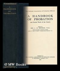
1935149860London : The National Association Of Probation Officers 1935. First Edition. Hardback. Near fine copy in the original gilt-blocked cloth. Slightest suggestion only of dust-dulling to the spine bands and panel edges. Remains particularly well-preserved overall; tight bright clean and strong. ; 366 pages; Description: 366 p. ; 22 cm. Subjects: Probation --Great Britain --Social service --Courts. London : The National Association Of Probation Officers hardcover
1935148884London The National Association Of Probation Officers 1935. First Edition. Hardback. Fine copy in the original gilt-blocked cloth. Slightest suggestion only of dust-dulling to the panel edges. Remains particularly well-preserved overall; tight bright clean and strong. ; 366 pages; Description: 366 p. 22 cm. Subjects: Probation --Great Britain. Social service. Courts --Great Britain. London, The National Association Of Probation Officers hardcover
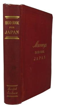
189385519London: John Murray 1893. 3rd ed revised and for the most part re-written by Basil Hall Chamberlain. Hardcover. Good. frontis folding map 2 folding illustrations 16 maps 15 folding including a pocket map index x 459p. plus 1p. errata and 27p. advertisements. Burgundy cloth. 19cm. Moderate chipping at head of backstrip. Free endpapers replaced. Title-leaf missing a small blank piece along fore-edge. A few maps have edge-wear due to misfolding and a couple have minor splitting along folds. The pocket map appears to have been added to this 1893 printing of the Third Edition. <br/><br/> John Murray hardcover books
1985Q-0440134986Dell 1985-01-01. Mass Market Paperback. New. In shrink wrap. Looks like an interesting title! Dell paperback
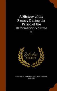
1897056116London: Longmans Green and Co. 1897. New Edition . Hardcover. Very Good Plus. 8vo. LONDON : 1897. New Edition in 6 volumes. Hardback. Original dark red sand-grained cloth; gilt lettered spines. Original black end-papers. Untrimmed edges as issued. Small portrait of The Late Bp. Creighton tipped to first e-p. Neat owner name to head of title-page. No internal markings. Some foxing. Tight bright and clean. Spines very slightly dulled. VERY GOOD. 8vo. Heavy; 6 VOLUMES - extra postage needed. Will be well-packed for posting/shipping. Rosley Books for Antiquarian books C.H.S. Cumberland D.L.S. Everyman G. K. C. Keswick Inklings Literature MacDonald Rarities Theology and History. We accept PayPal. SCARCE <br/> <br/> Longmans, Green, and Co. hardcover
1987246148Oxford : Published for the Institute of Historical Research by Oxford University Press 1987. First Edition. Hardcover. Fine cloth copy in a near fine very slightly edge-nicked and dust-dulled dust wrapper now mylar-sleeved. Minor library marks remain internally. Remains particularly and surprisingly well-preserved; tight bright clean and sharp-cornered. Series; Victoria history of the counties of England. Physical description; 290 p. : ill. ; 31 cm. Notes; Includes bibliography and index. Summary; Chalke and Dunworth hundreds are in south-west Wiltshire on the Dorset border. The parishes of Chalke hundred were united by being part of Wilton abbey's estate before the Norman Conquest but most of the hundred is homogeneous. Long and narrow parishes lie north and south across the river Ebble and are characterized by extensive chalk downs. Until farmsteads were built on the downs in the 19th cen-tury nearly all settlement was in small riverside villages. From the Reformation to the 19th century the earls of Pembroke owned most of the eastern parishes. Sheep--and-corn husbandry and more recently arable and dairy farming was the pattern of agriculture in all the parishes except Semley where there is a remarkable survival of common pastures. Dunworth hundred is largely in the Vale of Wardour and land in most of its parishes belonged to the Barons Arundell of War-dour as successors to Shaftesbury abbey. It is an area of broken landscape and mixed farming in which only Tisbury has grown larger than an ordinary village. Except at Tisbury there has been little manufactur-ing in the area but Portland stone has been extensively quarried at Chilmark Teffont Evias and Tisbury and greensand stone has been quarried at the Donheads. Partly because of its stone Dunworth hundred is notable for its secular buildings. The castle at Wardour is the only one to survive in Wiltshire; Fonthill Abbey in Fonthill Gifford was the most remarkable house of its day in England. Among the many farm-houses of local stone which survive from the Middle Ages is Place Farm at Tisbury which was frequently visited by the abbess of Shaftesbury and has the largest medieval barn in England. Except for Sedgehill parish and part of Donhead St. Mary parish both hundreds are in an Area of Outstanding Natural Beauty: the exceptions are in a Special Landscape Area. Subjects; Wiltshire England — History. Social & cultural history. England. History / Medieval. History / Modern / General. History / Europe / Great Britain. Science / Life Sciences / Botany. Wiltshire - History. Genre; Illustrated. Oxford : Published for the Institute of Historical Research by Oxford University Press hardcover
0716816792.Gpaperback. Good. Access codes and supplements are not guaranteed with used items. May be an ex-library book. paperback
2001x-033377809XPalgrave Macmillan 2001. Hardcover. New. 323 pages. 8.50x5.75x0.75 inches. Palgrave Macmillan hardcover
A9781345879346Hardback. New. hardcover
2026x-1836994354Cabi Publishing 2026. Paperback. New. 312 pages. 6.77x2.00x9.61 inches. Cabi Publishing paperback
8vo. First Edition with frontispiece and very numerous photographs maps and plans in the text; blue cloth upper board and backstrip blocked and lettered in gilt gilt top a near fine copy. A STANDARD REFERENCE AND SCARCE IN THIS CONDITION.