71 résultats
183511052Koblenz: Karl Baedeker. 1835. Second Edition. Hardcover. Very Good. Boards a bit sunned spine label browned and lightly chipped but still readable "Klein's Rheinreise Zweite Auflage". Neat notation with black ink on first blank page dated 1837. Bookplate. Two illustrations and two steel engraved fold out maps. Very light browning to a few single pages not affecting contents. ; This book is the expanded and revised edition of Professor J. A. Klein's Rheinreise. Converted into a guidebook by the legendary bookdealer of Coblenz Germany - Karl Baedeker. The first book to bear his original name Bädeker and the precursor of the entire series. A virtually unique publication - extremely rare ; 16mo 6" - 7" tall; 517 pages . Karl Baedeker hardcover
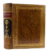
1817ST18762Halle and Berlin: Hallisches Waisenhaus 1817. 275 x 215 mm. 10 3/4 x 8 3/8". 210 leaves 18 pp. 4 leaves. <br/> REMARKABLY FINE CONTEMPORARY MARBLED CALF covers with complex gilt border composed of plain rules and decorative rolls smooth spine divided into compartments by gilt Greek key rolls top and bottom compartments with all-over gilt scallop design long central panel of black morocco with elaborate gilt vase and floral ornament surrounded by small gilt stars and with red morocco titling label above; FULL SPECKLED CALF DOUBLURES the front doublure with a painted lyre featuring gilt strings sword and wreath the rear with a monopteros with an eternal flame at the center upon a plinth superimposed upon which is an onlaid black morocco label framed in gilt and with gilt lettering "18. Oct. 1813" both doublures framed with red morocco supporting an elegant scrolling gilt band densely gilt turn-ins blue silk moiré endleaves all edges gilt an expert two-centimeter repair at head of spine. With frontispiece 21 portraits and 11 maps three folding one with flap all but one with inserted tissue guard. ◆Joints with slight flaking a hint of wear along tail edges as expected bottom spine compartment faintly rubbed with minor loss of gilt a little oxidation to the wreath on front doublure but A VERY HANDSOME BINDING with only minor condition issues. Light overall browning to plates because of paper content but virtually no foxing and only very occasional some quite faint spotting; THE TEXT itself IN NEARLY PRISTINE CONDITION extraordinarily clean bright and fresh with just one or two negligible imperfections.<br/> <br/> In a wonderful binding with unusual doublures this work commemorates the so-called "Wars of Liberation" that effectively ended French hegemony over Europe and that forced Napoleon into exile. Also known as the War of the Sixth Coalition the conflict took place between 1813-14 following Napoleon's retreat from Russia in 1812. Though the major battles primarily took place in German territory rulers of Russia Prussia Austria Spain Portugal the United Kingdom Sweden and many German States all banded together to oppose France. In March of 1814 the allies entered Paris prompting the French Senate to depose Napoleon and install Louis XVIII as the French sovereign. Although Napoleon would briefly return from his exile on Elba to stage a comeback in 1815 it was short lived and ended in his final defeat. The majority of the text here discusses the events of 1813 and 1814 during the height of the conflict and includes portraits of the major players and maps helping to illustrate the most important battles. This work is beautifully printed on thick white paper and is clearly meant to act as both a chronological record of the events and a memorial to those who liberated the German states from a tyrannical power. The lovely marbled calf binding opens to reveal two exceptional doublures painted in the manner of an antique vase with a lyre wreath and sheathed sword on the front doublure and on the rear a monopteros this latter circular colonnade with an eternal flame bearing a small morocco onlay emblazoned with the date 18 October 1813. This refers to the Battle of Leipzig also called the Battle of Nations fought from 16-19 October--by many accounts the single largest and bloodiest battle of the entire Napoleonic Era. It marked a decisive turning point in the Wars of Liberation and was an obvious source of pride for the German people. Given the momentous nature of the book's content the present grand and beautifully designed binding serves as a suitably striking vehicle of presentation. Hallisches Waisenhaus unknown
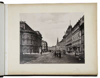
1899ABC_46445Budapest Dresden Innsbruck München: Calderoni és társa Verlag von Stengel & Co Fritz Gratl 1899. Half black leather red buckram sides blind-stamped boards gold-stamped spine with the date "1899" marbled endpapers. Oblong album 32 x 41 cm. Album with 43 photographic prints of various sizes 22 x 16.5 to 30 x 24 cm pasted on thick paperboard. From mountains in Austria to city views and interiors of churches in Budapest Vienna Innsbruck and München: all can be found in the 43 photographic prints in the present album. They were taken in at the end of the nineteenth-century probably in 1897 and 1899 according to blind-stamps in the prints. The photographers of most images are unknown except for the 6 photographs of Innsbruck which were made by the Innsbruck photographer and publisher Fritz Gratl. He likely made some of the other photographs of Austrian mountains towns and the city of Salzburg as well since his other known photographs cover similar subjects. Most prints of Vienna and some of Budapest were published by Stengel and Company in Dresden Germany in 1897. They and also Fritz Gratl were famous printers and publishers of postcards with similar picturesque images and the photographs in the present album are possibly the original images used to make the postcards.22 photos bear the blind stamp of the photographic studio. 4 photos have handwritten captions in pencil. The binding shows some minor signs of wear slight foxing or browning of the outer edges of the paperboards not affecting the photographs some photographs slightly faded or rubbed mostly at the edges not affecting the actual image the paper board of the print of "Budapest - Neues Parlament" has a slightly damaged spot in the lower margin not affecting the integrity of the board or the print. Overall in good condition. An album of 43 photos showing the sights of Hungary Austria and Germany. Calderoni és társa, Verlag von Stengel & Co, Fritz Gratl, hardcover
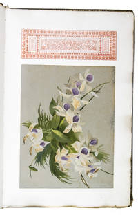
1896ABC_48884Colophon: Amsterdam 1896. Large folio ca. 51 x 33 cm. Calligrafie und Druck von Johan. K. Koning Contemporary gold-tooled burgundy leather the front board with a large gold-stamped monogram as a centrepiece the intertwined initials of the couple: AJ and EdR with the date "24-26 August" above and the year "1896" below lettered in gold both boards show a single fillet frame along the outer edges gold-tooled turn-ins beige watered silk endleaves. Wedding album comprising five manuscript texts of occasional plays 4 in German 1 in Dutch written in a neat cursive in blank ink on thick laid paper each illuminated with a 4-line decorated initial in red blue and white on a gold/bronze field richly decorated with penwork in black ink extending down into the inner margin. Each text is preceded by a letterpress title leaf set in neo-Gothic type also used for the general title several text leaves and the colophon. Further with 1 gouache illustration on grey paper sheet size ca. 32 x 24.5 cm mounted on the first leaf showing a bouquet of flowers 14 printed ephemera relating to the "Polterabend" wedding-eve party and the wedding on single or double leaves in various sizes the wedding announcement/introduction to the wedding-eve party and attached is a photo of the couple in a circular frame of red wax 5 menu cards the lyrics to 6 German songs a musical score by the German composer Wilhelm Aletter 1867-1934 and an announcement of the comic opera Des Teufels Antheil by the French composer Daniel Auber 1782-1871 performed by the Frankfurter Opernhaus on 25 August 1896 in Frankfurt am Main. Also with two manuscript wedding speeches in German written in black ink on paper two mounted albumen prints the first showing two actors dressed as a Frisian farmer and his wife and the other showing a man in Chinese dress 56 large ornamental vignettes printed in red or blue throughout 17 ornamental tailpieces printed in black blue and red and some dried flowers mounted on several leaves. 60 ll. A sumptuously executed wedding album presented to the Dutch groom August Janssen 1865-1918 and his bride Ella de Ridder 1877-1951 produced in honour of their wedding celebrations which took place on 24-26 August 1896 in Frankfurt am Main Germany. Most of the album concerns their "Polterabend" the wedding-eve party similar to present-day bachelor-/bachelorette parties except for the bride and groom joining together in the festivities. The main event now associated with a Polterabend is the smashing of porcelain by the wedding guests in order to bring luck to the couple's marriage but in general the evening is filled with plays and songs written and performed for the couple by their family and friends.A few performing actors were members of the Janssen-family a Dutch business family who had amassed their fortune with the tobacco cultivation in the former Dutch East Indies. They were also known for their generosity and philanthropic activities in the Netherlands. At the head of this family was the German-Dutch merchant Peter Wilhelm Janssen 1821-1903 one of the founders of the Deli Maatschappij in Sumatra and father of the groom who was his second son. His eldest son Christian Wilhelm Janssen 1860-1927 was married to Susanna Dorothea Anna Rehbock 1862-1933. Her brother the Dutch merchant Heinrich Carl Rehbock 1865-1938 was married to Caroline Janssen 1871-1951 one of the five daughters of Peter Wilhelm Janssen. Among the other actors were the brother of the bride Gustave von Ridder 1874-1956 the German playwright Hermann Otto Rudolf Presber 1868-1935 the German lawyer Paul Roediger 1859-1938 and his Dutch wife Julie Louise Charlotte Elink Schuurman 1875-1961 the sisters Anna Maria Humser 1876-1974 and Elisabeth Else Humser 1872-1967 daughters of the German lawyer and politician Gustav Adolph Humser 1836-1918 who was chairman of the Frankfurt city council at the time of the wedding celebration.The groom August Janssen 1864-1918 started his business career at trade offices in Bremen and London. He subsequently left for the former Dutch East Indies where he founded several enterprises. His wealth enabled him to engage in philanthropic activities. For example the municipality of Baarn benefited from his generosity he erected two public swimming pools there at his own expense. The bride Ella Elisabeth de Ridder 1877-1951 was the only daughter of the Belgian-German merchant August Cornelius de Ridder 1837-1911 known for his distinguished art collection of mainly Dutch and Flemish paintings of the 17th century which he built at his house at Kronberg near Frankfurt am Main. The famous Anglo-Hungarian artist Philip Alexius de László 1869-1937 painted Ellas portrait in 1903 in Baarn at the house of Hendrik Cornelis van den Honert 1854-1916 the successor of Peter Wilhelm Janssen as director of the Deli Maatschappij in 1898. De László had also painted her mother Johanna Elisabethe Louise May 1853-1942 around 1898 and two of her children in 1908.A unique wedding album of two members of prominent German-Dutch business families written and printed in 1896 as a special single copy publication. The album was produced in Amsterdam by Johan K. Koning who took care of the calligraphy of the texts and the printing of the divisonal titles explanatory leaves and vignettes.The spine and edges and corners of the boards show signs of wear with some minor loss of material at the foot of the sipne and the tips of the corners of the boards the leather is somewhat faded adn scratched all without affecting the general clarity of the tooling or the integrity of the binding. The watered silk on the first free flyleaf is torn some offsetting to the blank versos of the leaves and some glue residue on the leaves with dried flowers. Otherwise in good condition. hardcover
180755735Weimar Geographischen Instituts 1807-13. Folio-oblong. 38 x 48 cm. Contemp hcalf. Spine a little rubbed. A paperlabel pasted on upper part of spine. Corners bumped. Stamp on "Netz-Karte"/ "Tableau". With 3 other "Netz-Karte" on verso of Sect. 311 a. 14. The engraved title-page in French present as Sect. 10. With all 204 engraved plates 203 maps. The maps clean and fine throughout. unknown
1880006743Frankfurt Main Germany: Bockelmann"s Kunstverlag 1880. Published in 1880's this beautiful collection contains all 150 single-sided loose engravings showing various cities and major buildings/cathedrals of Germany just prior to the turn of the century. Beautiful set covering most of Germany. Engraved title page and two page index. Engravings are clean. Sides of case are torn/worn. Overall very unique and rare collection of engravings. Individual pages may retail for as much as $50 or more each. Decorative Cloth. Very Good/Slipcase. 4to - over 9¾" - 12" tall. Bockelmann"s Kunstverlag hardcover
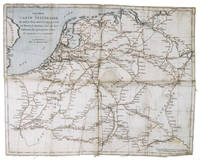
1810ABC_48289Amsterdam: E. Maaskamp 1810. Folded. An engraved map printed on linen ca. 33.5 x 43 cm. partly coloured by hand in red and blue ink. Extremely rare itinerary map of Northwestern Europe in the time of Napoleon printed on linen. It encompasses the north of the French empire including present day Netherlands Belgium Luxembourg and northern France down to Paris as well as the confederation of the Rhine present day Germany to Berlin in the east and Stuttgart in the south. The present edition of the map printed on linen is very rare as we have only been able to trace one other copy in sales records of the past 100 years and none in institutions.The map shows the routes between the major cities indicating post stations as well as the time of travel between each stop. These routes have here been coloured in red and the rivers canals and sea are coloured in blue.The present map is most likely the first edition but this is difficult to ascertain as it is not dated. Later editions followed as well as an English translation in 1815. On the separate map for the later editions also printed on linen the borders are adapted to the political situation of the time after 1815: the borders of the Kingdom of the Netherlands are indicated and "Royaume des Pays Bas" is added including "et Pays-Bas" at the end of the title. On our map the Netherlands are rendered as belonging to the French Empire after 1810 meaning it must have been printed before the other examples.The map is slightly frayed around the edges with some soiling/staining mostly on the right half. Otherwise in good condition.l Cf. Picarta 1 copy later ed.; WorldCat 71396772 2 copies later ed. E. Maaskamp, unknown
180756070Weimar Geographischen Institute 1807-13. Folio-oblong. Loose sheets in a box. Containg 128 engraved maps each measuring ca. 30 x 45 cm. Mostly clean and fine but some with annotations some with browning and some with traces of use. <br/><br/><em>Present are the following maps Sections: 3-12 17-24 29-36 42-48 53-60 64-66 71-74 80-81 86-90 97-98 103-108 114-126 135-142 151-159 167-173 180-186 193-197 204-208 216-219 227-231 239-243 and 248-254. </em> unknown
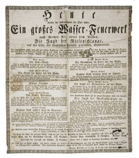
1829D6FA440BWJBFDresden 1829. 1mo broadside 46.7 x 39.1 cm. A rare unique broadside announcing a fireworks display at the river Elbe Dresden organized by Franz Kölbel a famed pyrotechnician from Graz Austria. The show was held on 5 September 1829 and reviewed in the Wiener Zeitschrift für Kunst Literatur Theater und Mode. The paper praised the spectacular rockets "deren ausgeworfenen Sterne so lange fortschimmerten und so hoch in den Lüften hin schwebten dass sie sich unter die wirklichen Sterne zu verlieren schienen". Franz Köbel also sold fireworks at his shop in Graz.Some soiling and staining edges frayed damaged at 2 folds small repairs. Overall in good condition.l Cf. Wiener Zeitschrift für Kunst Literatur Theater und Mode 118 1 Oct. 1829 p. 979; for Kölbel: Steiermärckisches Intelligenzblatt zur Grätzer Zeitung 45 21 March 1842 p. 172; not in KVK; WorldCat. unknown
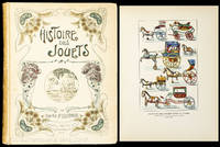
190010347AB1900. Paris Librairie Hachette um 1900. 4°. 316 S. 47 Farbtafeln dv. 1 doppelseitig und zahlr. Ill. Illustrierter Pappband. Einband mit Gebrauchsspuren. Auf dem Innendeckel eingeklebtes Ex Libris "Biblioteka Lancucka". Sauberes gut erhaltenes Exemplar. unknown
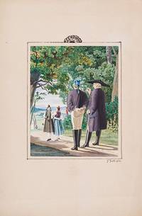
1870200077AG1870. no place c.1870. Original Gouache. Plate Size: 14 cm x 17.5 cm. Sheet Size: 21.6 cm x 32.7 cm. Original 19th century artwork. In excellent condition. Discreet duplicate stamp of 'Regia Berolin.' on reverse. Artist's Beautiful gouache of a traditional verdant rustic setting in southern Germany. Young maids in traditional dress tread the path to church followed by a young male in the company of a solemn fatherly pastor. Ferdinand Justi 2 June 1837 in Marburg Germany - 17 February 1907 in Marburg was a German linguist and Orientalist. He finished his studies of linguistics at the University of Marburg and the University of Göttingen. In 1861 he lived in Marburg where in 1865 he became associate and in 1869 full professor of comparative linguistics and Germanic philology. In addition to his academic work he studied with meticulous precision the life of the Hessian peasants in the last third of the 19th century especially in the immediate and wider area of Marburg on which he wrote his observations and described it in countless sketches and watercolors. One of his main themes included buildings furniture agricultural implements and especially costumes with all its subtleties and accessories. Wikipedia unknown
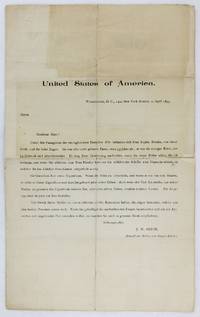
18952672Washington DC: April 2 1895. Good. 4pp. on a single folded sheet with two small photographs tipped in. In German. Quarto. Old folds some separation along central horizontal fold small chip to first leaf minor soiling. One photograph chipped. A sad document detailing the plight of a mother and son who perished in the sinking of the German transatlantic ocean liner Elbe on January 30 1895. The document seeks to detail exactly the times of death of the mother and son in order to determine whether the heirs of the mother or son have title to the property belonging to the family. Translated into English a portion of the opening reads: "She left some property here in Germany. If her son survived her if by a minute he inherited that property and it now belongs to his heirs; but if death overtook him before his mother the property never belonged to him or now to his heirs but to other people. The matter is now before the court."<br /> <br /> The Elbe collided with a Scottish ship called the Crathie in the North Sea on January 30 1895 while on the way from Bremen to New York City; the Elbe was a very popular ship amongst immigrants from Central and Eastern Europe looking to make their way to the United States. The two victims detailed in the present document were a German-American immigrant mother and son who had previously settled in Indianapolis and then moved to Washington D.C. Sophie and Eugene Rhodes. At the time of their deaths Eugene was a student at Heidelberg University in Germany. The present document opens with a typed notice from the counsel to the family detailing their presence on the Elbe and asking for details of their deaths. This is followed by photographs of both Sophie and Eugene tipped to the second page then two pages of questions attempting to locate the missing travelers. Brief answers to the questions were supplied in ink by Ernst Linkmeyer assistant engineer on the Elbe and one of only twenty survivors of the wreck. The survivors of the wreck of the Elbe included just four passengers and sixteen crew members who crowded onto the only rescue boat that survived the collision. The death toll of the wreck of the Elbe totaled 334 including Sophie and Eugene Rhodes. April 2 unknown
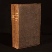
1836993H7London: Whittaker & Co. 1836. First edition. Cloth. Very Good. 9" by 5.5". None Stated. A first-edition two-volume travel narrative by Edmund Spencer portraying Germany and neighbouring regions through the observations of an English resident. In the publisher's original cloth bindings. First edition. Complete in two volumes.Both volumes are illustrated with colour frontispieces printed in oil colours by G. Baxter after a painting by J. C. Zeitter. With a large fold-out map of Germany to Volume I. With the odd vignette illustration throughout. Collated complete. A detailed travel account describing the people customs and landscapes of Germany and neighbouring regions written by Edmund Spencer from the perspective of an English resident. In the publisher's original cloth bindings. Externally smart. Slight rubbing and bumping to extremities. Slight fading to extremities and spines. Previous owner's bookplates to front paste downs. Scattered spotting and one or two tide marks to front free endpapers. Internally firmly bound. Pages bright and clean with the odd spot heavier to first and last few leaves and fore edge. Slight cockling to pages. Very Good Whittaker & Co. hardcover
1832biblio109<p><i>Tombleson. London. 1832 1834. 2 volumes. Royal 8vo. 190pp; 181 4pp. Engraved title pages. Folding panoramic map; folding map. 137 6869 engraved plates. Later half calf marbled boards raised bands to spine in six compartments gilt lettering and spine rules. Marbled boards with a little shelf wear. Upper hinges reinforced. Minor worm damage to lower edge of reps Vol.II. Occasional light foxing and offsetting. Signature of Edward Lock to fep of each volume. A handsome set with all plates as listed.</i></p><p><b><i>William Tombleson</i></b><i> 1795-1846 Artist illustrator and engraver.</i></p> Tombleson hardcover
182039080Trier: Lintz 1820. Two vols. in one. 8vo. Copper-engraved frntsp. title page separate title pages for each vol. 28 large folding copper-engraved maps & plates on very thick cotton rag. Recent simulated black calf gilt lettrng on spine vry slght foxing on title very slght dustsoilng to fore-edges still an exceptionally clean and bright uncut copy. First edition of this exceedingly scarce history and archaeological description of Trier and its surroundings focusing on the Celtic and Gallo-Roman period. Trier is considered to be the oldest continuously extant city in Germany having been founded before 16 BC. This work describes the bridge over the Moselle River at Trier Porta Nigra the amphitheater Roman Baths the tomb of Secundier the Diana monument artifacts weapons and more. Lintz, unknown
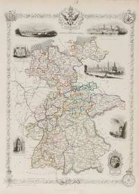
1851200104AG1851. London Edinburgh & Dublin J & F. Tallis 1851. Original steel engraving / Vintage map. Drawn and engraved by John Rapkin. Partly hand-coloured. Illustrations by N. Whitlock and Engraved by J. Rogers. Plate Size: 25 cm x 34.8 cm. Sheet Size: 27.5 cm x 37.4 cm. Vintage 19th century map in very good condition. Published in the Illustrated Atlas And Modern History Of The World Geographical Political Commercial & Statistical Edited By R. Montgomery Martin. Beautiful and fascinating map of a fragmented Germany from the Victorian Era. The coloured delineation show the patchwork of kingdoms duchies states and 'Kleinstaaterei' or mini-/micro-states that comprised much of the territory of the ancient and recently expired Holy Roman Empire. The Kingdom of Bavaria is the largest of these with Saxony and Hanover also significant local powers. The non-contiguous Coburg a tiny state exerts outsized influence due to its ties with the British Royal family: reigned Queen Victoria was the daughter of a Coburg princess. Miniature Oldenburg Hesse Biankenburg and Gottingen vie with each other in this crowded field of states. Prussia also has outposts in this busy area around which are Holland Prussia France Switzerland Tyrol Bohemia and the already-mentioned Prussia. The railway system is shown as are the numerous towns and cities of the region. Relief is depicted with hachuring. A doubled-head eagle accompanies the titular cartouche and a decorative border is adorned with armorial coat-of-arms and ceremonial medals - suggestive of the necessary pomp-and ceremony of such a thronged political and diplomatic landscape. John Tallis 7 November 1817 3 June 1876 was an English cartographic publisher. His company John Tallis and Company published views maps and atlases in London from roughly 1838 to 1851. Tallis set up as a publisher with Frederick Tallis in Cripplegate in 1842; the business moved to Smithfield in 1846 and was dissolved in 1849. From 1851 to 1854 Tallis operated as John Tallis and Company. He started The illustrated news of the world and national portrait gallery of eminent personages in 1858 selling it for £1370 in 1861; it folded in 1863. Wikipedia The most important project John Tallis undertook was the 'Illustrated Atlas' from 1851. The original map we offer here was part of this exceptional Atlas and all the maps it contained are still today considered as the last reminder of an era of lavish map production. Tallis worked the project together with John Rapkin 1815-1876 and it was Rapkin's style and talent that we have to thank for when we marvel at these maps today. What makes these maps so special is the detail of engraved vignettes that surround the map and often show indigenous scenes people in their environment and even more so historical buildings or historical views of towns and cities architecture and landscape. The project of 'The Illustrated Atlas' was designed to be finished just in time for the anxiously awaited "Great Exhibition of the Works of Industry of All Nations" or The Great Exhibition sometimes referred to as the Crystal Palace Exhibition in reference to the temporary structure in which it was held was an international exhibition that took place in Hyde Park London from 1 May to 11 October 1851. It was the first in a series of World's Fairs exhibitions of culture and industry that became popular in the 19th century and it was a much-anticipated event. The Great Exhibition was organized by Henry Cole and Prince Albert husband of the reigning monarch Queen Victoria. It was attended by numerous notable figures of the time including Charles Darwin Samuel Colt members of the Orléanist Royal Family and the writers Charlotte Brontë Charles Dickens Lewis Carroll George Eliot and Alfred Tennyson. Music for the opening was under the direction of Sir George Thomas Smart and the continuous music from the exhibited organs for the Queen's procession was "under the superintendence of William Sterndale Bennett". Wikipedia unknown
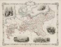
1851200103AG1851. London Edinburgh & Dublin J & F. Tallis 1851. Original steel engraving / Vintage map. Drawn and engraved by John Rapkin. Partly hand-coloured. Illustrations by J. Salmon and engravings by S. Fisher. Plate Size: 33 cm x 26.5 cm. Sheet Size: 37.4 cm x 27.4 cm. Vintage 19th century map in very good condition. Published in the Illustrated Atlas And Modern History Of The World Geographical Political Commercial & Statistical Edited By R. Montgomery Martin. Beautiful and fascinating map of Prussia from the Victorian Era. Prussia's boundaries are highlighted and illustrate its non-contiguous make up. Four De-jure 'Kleinstaaterei' or mini-/micro-states can be seen holding within the borders of Prussia - evidence of the fragmented nature of the German lands throughout the existence of the recently expired Holy Roman Empire. But this was changing: In the west lie Prussia's post-1815 acquisitions in Westphalia and the Rhineland while in the east 'Prussian Poland' and 'Posen' remind the viewers of the fate of the erstwhile Polish state. Four additional territorial possessions resemble globules from the main bodies of Prussian land. The more ancient lands of East Prussia and Brandenburg are identified also. Prussia is located in a busy neighbourhood with Denmark Sweden Russia Austria Saxony France Belgium and Holland abutting Berlin's territory. The islands of the Baltic are also identified. The much-heralded German railway system is shown on the map linking ports like Hamburg and Stettin to Berlin. The map is littered with the names of famous towns and cities such as Memel Konigsberg and Warsaw in the East Cracow Prague and Dresden in the South to Magdeburg and Dortmund in the west. The region's rivers such as the Elbe and Vistula are also identified. Relief is depicted through hachuring. A scale-bar is shown in the lower left corner. A Prussian eagle stands perched upon the highly decorative map border. John Tallis 7 November 1817 3 June 1876 was an English cartographic publisher. His company John Tallis and Company published views maps and atlases in London from roughly 1838 to 1851. Tallis set up as a publisher with Frederick Tallis in Cripplegate in 1842; the business moved to Smithfield in 1846 and was dissolved in 1849. From 1851 to 1854 Tallis operated as John Tallis and Company. He started The illustrated news of the world and national portrait gallery of eminent personages in 1858 selling it for £1370 in 1861; it folded in 1863. Wikipedia The most important project John Tallis undertook was the 'Illustrated Atlas' from 1851. The original map we offer here was part of this exceptional Atlas and all the maps it contained are still today considered as the last reminder of an era of lavish map production. Tallis worked the project together with John Rapkin 1815-1876 and it was Rapkin's style and talent that we have to thank for when we marvel at these maps today. What makes these maps so special is the detail of engraved vignettes that surround the map and often show indigenous scenes people in their environment and even more so historical buildings or historical views of towns and cities architecture and landscape. The project of 'The Illustrated Atlas' was designed to be finished just in time for the anxiously awaited "Great Exhibition of the Works of Industry of All Nations" or The Great Exhibition sometimes referred to as the Crystal Palace Exhibition in reference to the temporary structure in which it was held was an international exhibition that took place in Hyde Park London from 1 May to 11 October 1851. It was the first in a series of World's Fairs exhibitions of culture and industry that became popular in the 19th century and it was a much-anticipated event. The Great Exhibition was organized by Henry Cole and Prince Albert husband of the reigning monarch Queen Victoria. It was attended by numerous notable figures of the time including Charles Darwin Samuel Colt members of the Orléanist Royal Family and the writers Charlotte Brontë Charles Dickens Lewis Carroll George Eliot and Alfred Tennyson. Music for the opening was under the direction of Sir George Thomas Smart and the continuous music from the exhibited organs for the Queen's procession was "under the superintendence of William Sterndale Bennett". Wikipedia unknown
186713590Berlin Mittler u. Sohn 1867. Lex8vo. Textvol. bound in cont. hcalf back rubbed. Beilage-vol. cont. hcloth. VII729 pp. and 54 partly folded "Anlagen" incl. fold. map. 9 Anlagen bound with text in the textvolume. hardcover
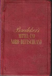
186321313Coblenz: Verlag Von Karl Baedeker. 1863. Eleventh Edition. Hardcover. Very Good. A handsome and tight copy with spine professionally repaired - about 1/4 of the spine is not original. Former owner's name on front free endpaper. Very light toning to first and last few pages. ; This is an early-style Baedeker with its beautiful Biedermeier period boards and with the iconic steel-engraved maps. Hinrichsen D48a; 16mo 6" - 7" tall; viii 284 pages . Verlag Von Karl Baedeker hardcover
188639077Frankfurt: Selbstverlag d. Architeckten und Ingenieur Vereins 1886. 8vo. viii 650 pp. Woodcut-engraved & illust. title over 500 maps photos diagrams plans some maps large folding & colour text illusts. Recent three-quarter simulated blk calf over marbled boards occasional light toning slght foxing still a VG copy. First edition No. 1362 of this very scarce architectural history of Frankfurt am Main from its founding as a city until 1886. The contributing engineers & architects have included detailed descriptions and histories of railroad stations jails court houses factories harbor facilities sewage systems lighting & power systems other public buildings churches schools and much more. Selbstverlag d. Architeckten und Ingenieur Vereins, hardcover
1899171411899. Women's Suffrage Germany P. Aug. Rosler. "Wahre und Falsche Frauen Emanzipation Truths and Lies: Women's Emancipation". Written in German. Stuttgart und Wien: Dof Roth'sche Verlagshandlung 1899. Printed by Hieronymus Muhlberger in Augsburg. 60 pages. 9 x 6 in. Original paper wraps. Very rare. At the time that this description is being written no copies are recorded in American institutions. OCLC search results are at best an estimate and can vary over time. An early German language treatise regarding popular myths on women's suffrage and the Women's Question die Frauenfrage. The volume lists the Madonna mother of Christ as one example of virtuous women whom all respect. German women were granted the right to vote and be elected from November 12 1918 immediately after the Armistice of WWI. Handwritten ink annotation on front cover. Front and back cover are detached; pages 1-16 detached; pages 49-60 detached. In good condition. unknown
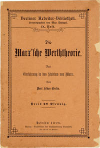
189647650Berlin: Expedition der Buchhandlung Vorwärts 1896. First Edition. Octavo 19.5cm.; publisher's orange wrappers printed within typographically decorative border; 52pp.; text printed entirely in blackletter. Some shallow chipping to upper cover fore-edge not approaching text some light soil textblock uniformly toned else a Very Good copy internally clean and sound. At head of title: "Berliner Arbeiter-Bibliothek" IX. Heft. One of a series of educational Marxist pamphlets issued under the banner the "Berliner Arbeiter-Bibliothek" this introducing its readers to the theory of surplus value without having to wade through Marx's original text. Other titles in the series covered the benefits of unionism and labor protection legislation; provided a concise history of the Paris Commune; and included an edition of Bellamy's "Looking Backward. Expedition der Buchhandlung Vorwärts unknown
187318840Coblenz And Leipsic: Karl Baedeker. 1873. Third Edition. Hardcover. Very Good-. Boards with light rubbing to extremities. Spine and front hinge professionally repaired. Small closed tear to front map. Slight tanning and foxing to first and last few pages. Pencil notes in front and back. A nice and tight copy ; With 28 Maps and 27 Plans. Biedermeier boards ; 16mo 6" - 7" tall; 516 pages . Karl Baedeker hardcover
187717394Leipsic: Karl Baedeker. 1877. Sixth Edition. Hardcover. Very Good. Spine a bit sunned. Spine top lightly frayed. First few pages browned and a bit frail. Else a very attractive tight copy ; With 15 Maps and 27 plans ; 16mo 6" - 7" tall; 332 pages . Karl Baedeker hardcover
187317393Coblenz And Leipsic: Karl Baedeker. 1873. Third Edition. Hardcover. Very Good-. Boards with rubbing to extremities and lightly bumped. Spine a bit sunned. Front hinge a bit gapping. ; With 28 Maps and 27 Plans ; 16mo 6" - 7" tall; 516 pages . Karl Baedeker hardcover