12 653 résultats
177633412London: J. F. W. Des Barres for The Atlantic Neptune 1776. Large engraved chart from Des Barres' Atlantic Neptune on two sheets of laid paper joined each bearing "J Bates" watermark. 43x31 inches sheet size nice margins; contemporary hand-color in outline; slightest offsetting a superior copy. State 4 of 7. Fine chart depicting the waters between New Bedford and Martha's Vineyard.<br/> <br/> Buzzards Bay and the Vineyard Sound including the Elizabeth Islands and the western half of Martha's Vineyard. Showing much more on-shore information than is typical for a Des Barres chart there are details of property boundaries structures even a road from Menemshaw Pond to Tisbury. Native names throughout remain largely unchanged today. Joseph Des Barres was born in Switzerland in 1721 and educated in Basel before emigrating to England and entering the Royal Military College where he learned engineering and the art of surveying. In 1756 Des Barres was commissioned a Lieutenant in the Royal American Regiment and dispatched to North America. He served in America during the Seven Years War under Colonel Bouquet Lord Howe and General Amherst and participated in the Quebec campaign as General Wolfe's engineer. Though Des Barres was responsible for the surveys done of Nova Scotia and the Isle of Sable the surveying of the coastline of what became the United States was undertaken by Major Samuel Holland a Dutchman who joined the British army during the French and Indian War as an engineer and became ultimately Surveyor General for North America. Holland was in charge of a rather large staff that included Charles Blaskowitz and George Gauld. They ultimately provided greatly improved charts for the entire coastline and the Gulf of Mexico. All this work was done prior to the Revolution which necessarily brought the surveys to an end. The publishing supervised by Des Barres continued throughout the war years. Des Barres compiled and edited the atlas maintaining a high standard throughout. His primary motive seems to have been the navigational usefulness of the charts. He clearly envisioned a navigator's needs in approaching a shoreline. The Atlantic Neptune was the first new survey of American coastlines in a century and the need was very great. The charts were plagiarized for the next thirty or forty years. Des Barres also had a flare for making charts aesthetically appealing so that they are invariably handsome as well as unfailingly interesting.<br/> <br/> Stevens 88D; John Carter Brown Library Charting the East Coast of North America The Atlantic Neptune Providence: 1972; Robert Lingel 'The Atlantic Neptune' in the Bulletin of the New York Public Library July 1936 pp.571-603; Augustus P. Loring 'The Atlantic Neptune' in American Maritime Prints New Bedford: 1985. J. F. W. Des Barres for The Atlantic Neptune unknown
177933200London 1779. Engraved and aquatint map period hand colouring. 14 lettered references large inset with title as above. Rare revolutionary chart of the Hudson River showing the American defenses on the eve of the Battle of Fort Montgomery.<br/> <br/> On October 6 1777 a British force led by Lieutenant General Sir Henry Clinton attacked Forts Montgomery and Clinton from the landward side where the American defenses were only partially completed. Support from cannon fire from British ships on the Hudson River that had passed through the chevaux de frise on the lower river. By the end of the day both forts had fallen to the British who burned the forts and tore down the stonework buildings. However the battle was a pyrrhic victory for the British. The campaign against the forts caused delays in reinforcing General John Burgoyne at Saratoga where Americans forced the British surrender ten days later at the Battle of Saratoga before Clinton's forces could arrive. The present map which depicts the Forts and the River defenses prior to the battle is from The Atlantic Neptune the finest large scale sea atlas of the United States and Canadian Atlantic coastline ever produced. The maps in the atlas were produced over a seven-year period 1775-82 and are well known for their accurate portrayal of various sounds bays bars harbors as well as navigational hazards. This atlas was used extensively by the Royal Navy during the American Revolution. Des Barres studied under the great mathematician Daniel Bernoulli at the University of Basel before continuing on to the Royal Military College at Woolwich. On the outbreak of the Seven Years war in 1756 he joined the British Royal American Regiment as a military engineer. He came to the attention of General James Wolfe who appointed him to be his aide-de-camp. From 1762 Des Barres was enlisted to survey the coastlines of Nova Scotia Newfoundland and the Gulf of St.Lawrence while his colleague Samuel Holland charted the New England coast and further south. In 1774 Des Barres returned to England where he began work on the Neptune. His dedication to the project was so strong that often at his own expense he continually updated and added new charts and views up until 1784. That year he returned to Canada where he remained for a further forty years becoming a senior political figure and a wealthy land owner and living to the advanced age of 103. The Atlantic Neptune was the first British sea atlas of her North American colonies and one of the most important achievements of eighteenth century cartography. With an official commission from the Royal Navy Des Barres published the first volume in London in 1775 which was soon followed by further volumes. Des Barres' monumental endeavor eventually featured over two-hundred charts and aquatint views many being found in several states. All of the charts were immensely detailed featuring both hydrographical and topographical information. The Neptune met with the highest acclaim from the beginning and is today widely regarded as superior to all other atlases produced during its time. Henry Stevens identified only a single state of this chart issued coloured or uncoloured which appeared in some examples volume four part two of the Atlantic Nepture; the map however is not listed in the engraved list of maps for that section and given the rarity was likely not issued in all copies.<br/> <br/> National Maritime Museum: Henry Stevens Collection: HNS156; Cf. Phillips Atlases 1198; Hornsby Surveyors of Empire: Samuel Holland J.F.W. Des Barres and the Making of the Atlantic Neptune 2011. unknown
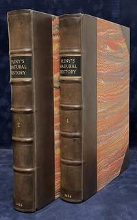
121437London Printed by Adam Islip 1601. . First edition in English first issue with the Islip imprint; 2 vols folio 30.5 x 20.7 cm; 2 title pages each with woodcut allegorical device woodcut head- and tailpieces decorative initials last leaf with errata on recto and colophon on verso one or two instances of early marginalia; lacking first blank leaf in each volume scattered light foxing and staining a few marginal open and closed tears scattered small rust holes costing a few letters faint dampstaining to a few gatherings; late 18th-century half calf over marbled paper-covered boards edges speckled red sometime rebacked with original spines laid down gilt tooling to spines red morocco title labels to spines lettered in gilt; a handsome copy.<br /> 'Over and over again it will be found that the source of some ancient piece of wisdom is Pliny.' PMM 5<br /><br />A handsome first edition first issue of Philemon Holland's renowned English translation of Pliny's Natural History. The most popular of Holland's translations it had never before been printed in English and would not be attempted again for another 250 years.<br /><br />One of the greatest translators of the Elizabethan age Holland's Pliny was an important source for Shakespeare. 'In Othello's allusion to the Pontic Sea Shakespeare was clearly drawing upon Pliny's Historie as translated by Holland Similarly Pliny has also been cited as a source for Othello's reference to the "medicinal gum" of "the Arabian trees"' Payne Search for Meaning 63 and many trace Caliban in The Tempest to Holland's Pliny.<br /><br />'The importance of Pliny lay not so much that he was an inexhaustible source for monsters eclipses and the stranger habits of all created things but that in the pages of Philemon Holland's translation Shakespeare found that emphasis on Nature which he employed and re-interpreted in the tragedy' Evans The Language of Shakespeare's Plays.<br /> STC 20029.5; Pforzheimer 496; ESTC S115918; Brueggemann 670; Lowndes 1885; cf. PMM 5. London, Printed by Adam Islip, 1601. hardcover
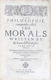
16031168London: Printed by Arnold Hatfield 1603. First Edition. Very good. First complete edition in English containing everything you’d ever want to know of what Romans thought about private daily life. An essential balancing compendium for all the Roman history books the historiographer’s question is always what else was going on. It’s a spectacular read but you better wipe off your magnifying glasses because this book is 1400 pages of well-spaced but small type. Full mottled calf by Riviere & Son signed on the verso of the front free endpaper morocco labels marbled endpapers all edges gilt woodcut initials and headpieces rebacked a few faint scratches tiny chip paper flaw from the title page’s edge but fine and complete with the errata. The condition is exceptional for this book. Ugly copies abound but no copy like ours has sold at auction or in the trade since this one sold at Sotheby’s in 1989 for $4675 expensive then and expensive now but the finest of copies usually are. Ex–James Hale Bates 1845–1901 the American travel writer with his armorial bookplate upside down on the rear endpaper. Ex–The Garden Limited see below their bookplate also upside down next to Bates’ the error in placement certainly made by Bates The Garden owners intentionally followed suit. 4 p.l. 1363 1 pp. 32 leaves. Ref: STC 20063. ESTC S115981. Harris p. 116. Lowndes III 1891. The exalted Elizabethan translator Philemon Holland 1552–1637 was a physician and Latinist whose love of the classics prompted his devotion to rendering ancient authors into the language of Shakespeare and his output was prodigious. His first project was a translation of the Roman historian Livy published in 1600. The next year Holland tackled Pliny’s massive Natural History he also translated significant historical works of Suetonius 1606 and Ammianus Marcellinus 1609. The contents of the Morals are amazing. They confront a wild range of topics embracing fortune exile animal intelligence health advice for newlyweds the education of children benefitting from one’s enemies the value of having few or many friends how to recognize a flatterer and 10 times as many more. And though Catullus’ neoteric poems and some documents survive the primary only other source of the private details of Roman daily life beyond this book is just graffiti on the walls of Roman ruins like at Pompeii. Individual Plutarch treatises had been previously translated into English some more liberally than others but this is the first translation of the entire sequence of essays that make up the “Moralia.†Further the value of the collection is enhanced because Plutarch borrows from lost Greek works some of which would otherwise be unknown to us.<br /> <br /> The modern provenance here is at the zenith. It’s no hyperbole to say that the collection of The Garden Ltd. was the most outstanding American library of notable books put together in the second half of the 20th century. It was comprised of high spots from all periods breathtaking in their impeccable condition. It included the last 1st edition seen of Cervantes’ 1605 Don Quixote and a set of Shakespeare’s 4 folios bought by Dick Manney and then bought by us from Sotheby’s by private treaty in 1991. Does this collection have a backstory It does. Haven O’More was a genial narcissist with an autobiography fattened on bombastic exaggeration. His oft asked question was “Do you know who I am†It should have been “Do you know who I think I am†He found a rich investor Michael Davis and with Davis’ loot he built a staggering library in awe-inspiring condition that he planned to place at the center of his zanily conceived “new sacred city.†But O’More was holding aces and eights and after a public confrontation at Christies over a Gutenberg Bible Davis got bored with O’More’s antics and forced a 1989 sale at Sotheby’s titled The Garden Ltd. Printed by Arnold Hatfield unknown
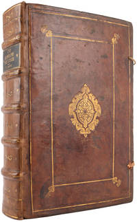
160021144631600. London: Adam Islip. 1600. Folio. Contemporary English calf covers gilt and ruled in blind to a panel design with gilt arabesque-centrepieces cornerpieces incorporating fleurs-de-lys and crowns see below ties and endpapers renewed corners skilfully restored sometime sympathetically rebacked spine gilt in compartments raised bands ruled in gilt gilt black morocco lettering-piece; pp. x 804 809-1351 1354-1403 43 large woodcut printer's device to title-page woodcut portraits of Elizabeth I to verso of title-page and of Livy to A4v woodcut decorated and factotum initials woodcut head- and tailpieces; contemporary ink marginalia and underlining to 8 pp.; extremities and boards slightly rubbed; bound without first blank final blank partly torn away a little browning mainly to margins occasional stains outer corners of first 3 ff. skilfully restored not affecting text outer corners and lower margin of final 3 ff. reinforced; overall a very good copy. First edition of the first complete translation of Livy into English and the earliest major publication of Philemon Holland 1552-1637 in a handsome contemporary binding possibly from the circle of Henry Frederick Prince of Wales 1594-1612. Holland's Livy his first published translation was the first in a series of unabridged translations of canonical Latin authors that established his reputation as the 'translator generall in his age' Pforzheimer 495. The present work gave English readers their first complete Livy and quickly became one of the most influential classical histories available in the vernacular. 'Holland claimed to have written the whole manuscript with the same pen: ""a monumental pen"" says Fuller which ""he solemnly kept"" and which ultimately was enclosed in silver by a lady of his acquaintance' DNB commemorating the scale and ambition of the undertaking. The translation is frequently cited among the intellectual sources of Shakespeare's Coriolanus. While Thomas North's Plutarch supplied the narrative framework Holland's Livy appears to have contributed a broader political temper to the play one sceptical of purely martial heroism and more attentive to negotiation compromise and civic pragmatism. The work's influence continued well into the seventeenth century; during the English Civil War it was read across ideological divisions - by constitutional theorists such as Sir Francis Nethersole by Leveller writers and by Royalist pamphleteers - for its complex treatment of Rome's transition from monarchy to republican government. Provenance: Possibly from the circle of Henry Frederick Prince of Wales 1594-1612 eldest son and heir apparent of James I widely admired by contemporaries for his learning and intellectual seriousness and the founder of a substantial and carefully assembled library said to have contained more than a thousand volumes. Bindings associated with the prince's collection are known to employ crowned fleur-de-lys badge tools of the same decorative type as those found on the present volume see British Armorial Bindings Online stamps 14 15 23 and 29. The large strapwork centrepiece belongs to a recognised group of high-quality London 'centrepiece' bindings produced for patrons at the upper end of the trade. The workshop responsible appears to have had connections with the printing house of John Bill later King's Printer from 1617 Pearson 'English centrepiece bindings ca. 1560-1640 in Manchester libraries' no. 008g. Pforzheimer 495; ESTC S114001. hardcover
240634Amsterdam, E. Maaskamp, s.d. (1811) in-folio, titre bilingue, 12 planches accompagnées chacune de deux feuillets de légende, une en français, l'autre en néerlandais, cartonnage d'attente vert d'eau (reliure de l'époque). Coupes un peu usées.
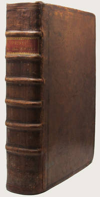
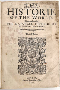
163434275London: Printed by Adam Islip and to be sold by John Grismond in Ivy-lane and to be sold at the Signe of the Gun 1635 1634 1634. The first Tome. The second Tome. The second printing with numerous corrections of the first English translation. Printed by Adam Islip in 1634 the first volume contains the title-page dated 1635 which was offered for sale by John Grismond the second volume retains the 1634 title-page. Elaborate woodcut printer's device to title engraved floriated initials and fine head and tail pieces throughout. Folio in 6s 2 vols. bound in one an excellent copy bound in full contemporary polished calf in original state the back with raised bands over cords covers with double fillet rules in blind. 56 614 42; 12 632 86. Advertisement leaf at end of vol. II pp. Collated complete. An especially desirable copy of this highly important book. In its rare original state this book is seldom encountered. The textblock is crisp and unpressed and remains in a very pleasing state of preservation some minor evidence of damp in a few places as to be expected the spine with expert restoration at the head and tail of the panel a beautiful copy. IMPORTANT EARLY ISSUE OF THE GREAT TRANSLATION OF PLINY INTO ENGLISH BY PHILEMON HOLLAND. The second printing of the first full English translation of this important book. First published in Venice in 1469 “The ‘Natural History†of Pliny the Elder is more than a natural history: it is an encyclopaedia of all the knowledge of the ancient world. .He was a compiler rather than an original thinker and the importance of this book depends more on his exhaustive reading he quotes over four hundred authorities Greek and Latin than on his original work. All the spare time allowed him by a busy administrative career was devoted to reading; he began long before daybreak his nephew the younger Pliny recorded and grudged every minute not spent in study; no book was so bad he used to say as not to contain something of value. When he died the 'Natural History' the sole extant work out of one hundred and two volumes from his pen was still incomplete. It comprises thirty-seven books dealing with mathematics and physics geography and astronomy medicine and zoology anthropology and physiology philosophy and history agriculture and mineralogy the arts and letters. He is scrupulous in his acknowledgment of his sources you must he wrote with honest humility declare those from whom you have profited and the whole of the first book is devoted to the tables of contents and authorities which bear witness to his method.<br> The HISTORIE soon became a standard book of reference: abstracts and abridgments appeared by the third century. Bede owned a copy Alcuin sent the early books to Charlemagne and Dicuil the Irish geographer quotes him in the ninth century. It was the basis of Isidorets Etymologiae and such medieval encyclopedias as the Speculum Majus of Vincent of Beauvais and the Catholicon of Balbus. One of the earliest books to be printed at Venice the center from which so much of classical literature was first dispensed it was later translated into English by Philemon Holland in 1601 and twice reprinted a notable achievement for so vast a text. .<br> More recently scholars as various as Humboldt and Grimm have praised and acknowledged their debt to it. Over and over again it will be found that the source of some ancient piece of knowledge is Pliny. PMM<br> The standard of reference for scholars since the 15th century Holland’s translation made it available to the English speaking world for the first time. Although not strictly scientific itself mingling a good deal of the author's fancy with fact Pliny's NATURALL HISTORIE was important in stimulating scientific thought in succeeding generations. "It is an encyclopedia of all the knowledge of the ancient world set out in an orderly fashion. It was the source of much medieval knowldege--and legend--and the model for such works as the SPECULUM MAJUS of Vincent of Beauvais. The high regard in which it was held in the world of the Renaissance can be seen by its early appearance in print 1472" PMM.<br> The HISTORIE divided into 37 libri or "books" was completed except for finishing touches in 77 CE. In the preface dedicated to Titus who became emperor shortly before Pliny's death Pliny justified the title and explained his purpose on utilitarian grounds as the study of "the nature of things that is life" "Preface" 13. Heretofore he continued no one had attempted to bring together the older scattered material that belonged to "encyclic culture" <br>egkyklios paideia the origin of the word encyclopaedia. Disdaining high literary style and political mythology Pliny adopted a plain style--but one with an unusually rich vocabulary--as best suited to his purpose. A novel feature of the NATURALL HISTORIE is the care taken by Pliny in naming his sources more than 100 of which ae authors and sometimes the titles of the books many of which are now lost from which Pliny derived his material.<br> The HISTORIE properly begins with Book II which is devoted to cosmology and astronomy. Here as elsewhere Pliny demonstrated the extent of his reading especially of Greek texts.<br> Books VII through XI treat zoology beginning with humans VII then mammals and reptiles VIII fishes and other marine aninmals IX birds X and insects XI. In Books XII throuogh XIX on botany Pliny came closest to making great contributions to science. He drew heavily upon Theophrastus and still made important independent observations particularly those made during his travels in Germany. Pliny is one of the chief sources of modern lknowledge of Roman gardens early botanical writings and the introduction into Italy of new horticultural and agricultural discoveries.<br> Born at Como in 23 Pliny died while observing the eruption of Vesuvius in 79 A.D. His NATURALIS HISTORIA is a scientific encyclopedia often uncritical but very elaborate and of great value. Pliny attached to each book the list of his authorities 146 Roman and 327 Greek being quoted. He explained that people may be living at the antipodes and stated that the speed of light is greater than that of sound. His work includes the oldest account of ancient art. In addition it contains a remarkable amount of early information on Asia and Africa. Its influence throughout the Middle Ages was very great.<br> This is an especially nice copy of the second offering of the work in English. This issue corrected the many errors of the first English edition. As with the copy listed in the British Museum the first tome has a new title page dated 1635. Further this is a variant issue with “and are to be sold by John Grismond†after Adam Islip on the imprint. Dedicated to Sir Robert Cecil. Printed by Adam Islip and to be sold by John Grismond, in Ivy-lane and to be sold at the Signe of the Gun hardcover
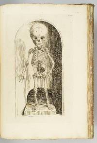
1739ST12883Leyden: Johann Arnold Langerak 1739. First Edition in Latin. 540 x 380 mm. 21 1/4 x 15". 70 leaves of text.Translated by William Dundass. <br/> Original red quarter vellum over marbled boards raised bands UNTRIMMED EDGES. Engraved printer's device on title large decorative initials and tailpieces EXTRA ENGRAVED TITLE AND 114 STRIKING PLATES OF ANATOMICAL FIGURES three folding. Wellcome II 401; Heirs of Hippocrates 468; Choulant-Frank pp. 252-3; Russell 213. ◆Vellum on spine rather worn with three one-and-one-half-inch pieces broken away revealing structure underneath paper boards quite chafed other minor problems externally but an entirely solid unrestored binding. A couple of plates with short closed marginal tears one folding plate with one-inch closed tear into image no loss untrimmed edges a little browned and brittle with isolated small chips occasional minor foxing or insignificant stains three plates lightly browned but still AN UNUSUALLY ATTRACTIVE COPY INTERNALLY with the broadest of margins with especially clean and fresh leaves and with rich impressions of the plates.<br/> <br/> With plates of notable visual impressiveness this was the finest anatomy book in England during the first half of the 18th century; it also was largely a plagiarism borrowing most of its engraved content from a work by the Dutch physician Govert Bidloo published in 1685. Bidloo's work was the first large-scale anatomical atlas to appear after Vesalius' epoch-making "De Humani Corporis Fabrica" and the plates which are highly praised by Norman and Garrison-Morton are characterized by startlingly detailed life-size depictions of the human body both adult and infant with figures flayed to reveal muscles opened to show organs and unfleshed to exhibit bones. According to Choulant-Frank Bidloo's publishers sold 300 impressions of these plates to Cowper probably to recoup some of their money after disappointing sales. Cowper took Bidloo's original 105 plates added nine of his own and produced an English translation of the original Latin text to accompany them. Discussing the original plates produced by Gerard de Lairesse 1641-1711 Norman says that the figures are displayed "in an emotional almost tender manner contrasting the raw dissected parts with the full soft surfaces of uncut flesh placing flayed bound figures in ordinary nightclothes or bedding setting ordinary household objects such as books jars or cabinets in the same scene as cut-up torsos or limbs. His illustrations brought the qualities of Dutch still-life painting into anatomical illustration and gave a new darker spiritual expression to the significance of the act of dissection." When Cowper's version of the atlas first appeared as "The Anatomy of Humane Bodies" in London in 1698 there was also a 1737 Leyden printing in English before our more scholarly Latin edition Bidloo complained to the Royal Society and accused Cowper of plagiarism and fraud resulting in much acrimony and heated pamphleteering between the two physicians. Notwithstanding this scandal Cowper's achievements and discoveries--including the pair of glands that bear his name--were considerable and his text improved significantly upon the original work. Unfortunately as the DNB notes "the notoriety of this case has served to obscure a true appreciation of Cowper and of his many original contributions to anatomical illustration." The atlases of Bidloo and Cowper appear on the market regularly but at 540 x 380 mm. the present copy is distinguished by its size which is significantly larger than what is typically seen with this edition--we have not been able to trace a copy larger than ours from marketplace or institutional records. Johann Arnold Langerak unknown
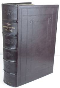
160011257London: Adam Islip. Good with no dust jacket. 1600. First English Edition. Leather. 10 lacking first blank 804 809-13511354-1403 41 lacking last blank pp. Collates complete save for first and last blanks pagination skips correspond to ESTC 006185333. Impressive thick folio 13" x 8.5" Magnificent modern rebinding in full blindstamped panelled dark leather 5 raised bands to the spine with florettes in the compartments title author and date in gilt. Fore-edge has title written on to be shelved edge out. Renewed end pages with college library bookplate and bookplate of Eric Gerald Stanley 1923-2018 a British Anglo-Saxonist and the Rawlinson and Bosworth Professor at Univ. Of Oxford. Title page with large engraved printer's mark remounted with some repairs an old signature in brown ink with date April 26 1600. Xylographic "The" in the title. Verso of title page has woodcut portrait of Queen Elizabeth and the verso of A4 has a portrait of Livy framed in bay leaves and fruits. Dedication page has upper corner torn and has been restored with loss of text and head woodcut old cellotape repair as well. To the Reader page has corner repaired with no loss some staining p251-255 small ink smear on one page Iiii quire corners restored a few other pages with minor stains or repairs in the corners Cccccc3 has a thin spot/small hole in the margin with no loss of text. Very occasional marginalia. Numerous engraved head and tail pieces type is clear paper is strong and nice. The first English edition of Livy's Roman History translated by Holland considered one of the greatest translators of the Elizabethan era. "His first published translation The Romane Historie 1600 was the first complete rendering of Livy's Latin history of Rome Ab Urbe Condita into English. According to John Considine: 'It was a work of great importance presented in a grand folio volume of 1458 pages and dedicated to the Queen. The translation set out to be lucid and unpretentious and achieved its aim with marked success. It is accurate and often lively and although it does not attempt to imitate the terseness of Latin it avoids prolixity.' " Livy or Titus Livius gives us the Ab Urbe Condita literally "From the Founding" a history of Rome from its very beginnings. The first 10 books are the most famous celebrated for their grandeur -- "it as a panegyrist of Rome and Italy that Livy finds his most memorable expression." Here we learn of the quasi-mythological history of Rome of Aeneas Romulus and Remus and the battles of the early kings of Rome; the Law of the Twelve Tables the wars against the Gauls the Latins and the Samnites and finally the battle -- complete with elephants --between Hannibal's son Hasdrubal and Nero. Livy was known as a supreme master of the Latin language. "His prose was worthy of Cicero's but more subtle more malleable and more lyrical." Livy probably wrote his history of Rome during the reign of Augustus Caesar; it is a fascinating work that in many cases is our only source of numerous aspects of Roman history; with vivid accounts of Tarquin the Proud the Carthagenian Wars and other events from Rome's tumultuous past. A beautiful and important book in a magnificent binding complete save for the front and rear blanks in quite good condition with a nice provenance. ; Folio 13" - 23" tall . Adam Islip hardcover
177634405London: J. F. W. Des Barres 1776. Engraved with color wash and outline color. Sheet: 31 x 42 1/4 inches. Expert restoration primarily at the upper margin. Two sheets joined both watermarked "J.Bates" and countermarked "JB". Fourth state of five. Among the earliest charts published by Des Barres were those relevant to the crisis in New England as the War of Independence broke out.<br/> <br/> This chart depicts the coast of Massachusetts from Salem to Scituate Harbor and includes the complicated hydrography of Boston Harbor and the confluent rivers. A considerable amount of coastal topography is included obviously relevant to warships. Fundamentally a chart for navigators it includes soundings and shoals with particularly strong detail along the Charles and Mystic Rivers as well as in Salem and Marblehead. Samuel Holland was the lead surveyor. In 1764 he was named Surveyor General of both the Province of Quebec and the Northern District of North America. He had a considerable staff and the British Navy assisted in providing soundings. From 1770 to 1774 his squad worked exclusively on northeastern colonies that soon became part of the United States. The surveys that derived from the industry of their work were the most accurate ever made to that time. They were sent to London where Des Barres supervised the engraving and publication. The charts were very soon put to use. Des Barres of Swiss-Huguenot extraction studied under the great mathematician Daniel Bernoulli at the University of Basel before continuing on to the Royal Military College at Woolwich. Upon the outbreak of hostilities with France in 1756 he joined the British Royal American Regiment as a military engineer. He came to the attention of General James Wolfe who appointed him to join his personal detail. During this period he also worked with the future legendary explorer James Cook on a monumental chart of the St. Lawrence River. From 1762 Des Barres was enlisted to survey the coastlines of Nova Scotia Newfoundland and the Gulf of St. Lawrence while his colleague Samuel Holland charted the New England coast. He also managed to gain access to some surveys of the American South Cuba and Jamaica. In 1774 Des Barres returned to England where he began work on The Neptune. His dedication to the project was so strong that often at his own expense he continually updated and added new charts and views up until 1784. That year he returned to Canada where he remained for a further forty years becoming a senior political figure and a wealthy land owner and living to the advanced age of 103.<br/> <br/> Stevens Collection 94d ; cf. Hornsby Surveyors of Empire: Samuel Holland J.F.W. Des Barres and the Making of the Atlantic Neptune. 2011. J. F. W. Des Barres unknown
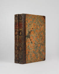
160184London: Adam Islip 1601. First Edition in English second issue. Very Good . Folio 11 3/4 x 8 inches 298 x 203 mm 2 VOLUMES bound into one. Pp. 58 614 42; 12 632 84 2. Title pages with woodcut devices present in both parts lacking blanks pi1 and Ppp8 woodcut initials head and tailpieces copious indexes of both volumes final errata sheet. Full later calf re-jointed extra-gilt spine with 5 raised bands some rust spots marginal tears and paper flaws eight leaves with expertly repaired corners with resulting small loss of text; occasional marginalia; paper supple and evenly toned; binding somewhat scuffed but firm and square. Armorial bookplate of James Backnell Praed pasted inside front cover.<br /> <br /> Carter 5; Pforzheimer 496; ESTC 006187259. A handsome and rare copy of the first full English translation of Pliny's Naturalis Historia by Philemon Holland the greatest translator of the Elizabethan age.<br /> <br /> «The 'Natural History' of Pliny the Elder is more than a natural history: it is an encyclopaedia of all the knowledge of the ancient world. The famous story of Pliny's death while trying to observe the eruption of Vesuvius at closer quarters than was prudent is often and justly cited as an example of the devoted curiosity on which the furthering of knowledge depends and to the Romans his writing on the natural sciences was pioneer work held in small esteem as he modestly says by his countrymen. He was a compiler rather than an original thinker and the importance of this book depends more on his exhaustive reading he quotes over four hundred authorities Greek and Latin than on his original work. All the spare time allowed him by a busy administrative career was devoted to reading ; he began long before daybreak his nephew the younger Pliny recorded and grudged every minute not spent in study; no book was so bad he used to say as not to contain something of value. When he died the 'Natural History' the sole extant work out of one hundred and two volumes from his pen was still incomplete. It comprises thirty-seven books dealing with mathematics and physics geography and astronomy medicine and zoology anthropology and physiology philosophy and history agriculture and mineralogy arts and letters. He is scrupulous in his acknowledgement of his sources you must he wrote with honest humility declare those from whom you have profited and the whole of the first book is devoted to the tables of con tents and authorities which bear witness to his method. The Historia soon became a standard book of reference. One of the earliest books to be printed at Venice the centre from which so much of classical literature was first dispensed it was later translated into English by Philemon Holland in 1601 and twice reprinted a notable achievement for so vast a text.» Carter John. Printing and the Mind of Man. New York: Holt Rinehart & Winston 1967. Adam Islip unknown
1979ZB393813North Holland 1979-2001. volumes 2-73; lacks volumes 18; 24. 1979-2001. partly bound library markings textually clean & tight price is for the set. - If you are reading this this item is actually physically in our stock and ready for shipment once ordered. We are not bookjackers. Buyer is responsible for any additional duties taxes or fees required by recipient's country. Photos available upon request. North Holland unknown
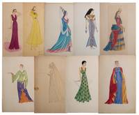
19409047Los Angeles California 1940. Good . 19 works of mostly pencil and crayon one is watercolor on either art paper or artist's board measuring approximately 20" x 13". Generally good plus to very good with varying degrees of wear; occasional chipping or dust soiling. <br /> <br /> This is a collection of spectacular fashion drawings created by a young African American woman in Southern California possibly while working for the WPA. Nicola Jeanette Holland Fowles was born March 5 1910 in Kansas City Missouri to John and Essie Holland. By 1920 the Hollands had moved to Los Angeles and Nicola attended and graduated from Jefferson High School in 1927. Nicola attended Pasadena City College taking art classes aspiring to be a costume designer. She enrolled in Lipson's School of Costume Design by 1935. Throughout the mid 1930's she held various costume design and dressmaking positions working for the Los Angeles Board of Education in the Visual Education Section of Works Progress Administration. She later held the titles 'Jr. Clerk' 'Jr. Artist' and later 'Department Head Ladies Alterations' at Eastern Columbia Department Store by 1940. We are not sure when or for whom these pieces were created one is dated 1936 but several of the designs remind us of the WPA's Costumes of the World series. <br /> <br /> "The Cocktail Hour" is an art deco design and features a tall slender African American woman holding a cigarette as well as her cigarette case. "Fur Cape and Matching Hat" shows a woman in a fur coat and fur hat wearing gloves and a green dress. Another shows a woman in a red dress with a blue and purple cape along with headwear reminiscent of Greek or Roman fashion; at least two other designs reflect ancient fashions as well. There's a woman in an Elizabethan gown another in regal medieval dress wearing a crown one shows a woman in 18th century French dress and a fourth is clearly Egyptian. Two "Dance Frock" and "Brocade" have prices of $15 and $20 respectively written in Nicola's hand on the verso leading to the inference that she exhibited and tried to sell some of these drawings. A few may also have been intended for publication as some have specific color codes detailed on versos. <br /> <br /> Nicola went on to various interesting jobs throughout the rest of her career and we'll be happy to furnish what we know to whomever acquires this collection. <br /> <br /> Unique and compelling original fashion designs from a Black female artist. unknown
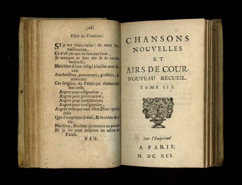
1690AMO-4534Reliure plein vélin ivoire de l'époque à coutures apparentes (vélin hollandais). Reste de titre à l'encre au dos (presque effacé). Légers frottements. Exemplaire frais, non restauré. Papier de qualité plus ou moins médiocre selon les tomes, parfois uniformément teinté. Collationné complet. Ce recueil est extrêment rare selon les différentes sources consultées. Sa mise en oeuvre semble hératique (nom d'éditeurn, dates et mention d'édition assez fantaisistes). Il semble pourtant que ce soit tout ce qui a paru de cet ensemble composé de chansons bacchiques, lestes et gaillardes. On lit dans le catalogue de livres provenant de la bibliotheque de monsieur Leroux de Lincy, n°225 (vélin, même collation) : "Recueil extrêmement rare, dans lequel on trouve un certain nombre de chansons relatives au règne de Louis XIV (vendu 58 francs à la vente Silvestre en 1845, ex. relié vélin comme le nôtre). "Il s'y trouve un grand nombre de couplets hostiles à Louis XIV". On trouve un autre recueil quasi identique à la date de 1688, est-le même ? Et un autre en 12 parties datées de 1696, qui ne semble pas être le même que notre exemplaire. On lit par ailleurs dans le catalogue de la bibliothèque de monsieur Cigongne à propros d'un exemplaire identique au nôtre : "Tome I. 3è édition (6 parties intitulées t. I à VI, et 1ère partie d'un 2ème volume, datée de 1690). Sur l'imprimé à Paris (Hollande), 1691. Petit in-12. maroquin olive par Trautz-Bauzonnet (n°1228 du catalogue Cigongne), avec ce commentaire : "On croit que c'est tout ce qui a paru de ce recueil.".
190944543Shoshone & Weiser Idaho & Northfield Falls Vermont: Robert Timothy Holland 1909-1911. 1909 - 1911. RAILROAD. First edition. Black cloth three-ring notebook with titles stamped in gold gilt on the front cover. An exceptional archive of 97 photographs Real Photograph Postcards and Cyanotypes documenting the construction of the P & IN Ry along the Weiser River from Milepost 76 north of Glendale ID to New Meadows ID and then the scenic Payette Lake area. These images include locomotives engineers survey crews sternwheelers excursions on RR hand cars massive steam shovels in operation and more. Archive of 67 original photographs sized 3 1/2" x 5 1/2" 29 Real Photograph postcards 3 cyanotypes sized 3 1/2" x 5 1/2" 1 color linen postcard 9 with ink annotations pencil annotations and notes on versos. These uncommon photographs & cyanotypes offer an extraordinary view of the construction of the Pacific & Idaho Northern Railway a successful shortline railroad which had purchased the rights and interests including surveys grades and right-of-way of the Weiser Idaho & Spokane Railway in 1899 later sold in 1914 to the Oregon Short Line Railroad. By 1909 the P&IN Ry was beginning the construction from Evergreen Idaho to New Meadows Idaho where the company was establishing the New Meadows Depot which would allow the P&IN Ry to serve as a "farm-to-market" railroad. In addition they were operating six Baldwin4-6-0steam locomotives four of them new Nos. 100-105. These excellent photographs show surveyors at work engineering crews steam locomotives supplies being hauled in by sternwheelers and horse-drawn covered freight wagons grading and laying of railroad ties temporary corduroy log railroad track beds over water construction of dikes railroad trestles and more. Many of the photos show Edwardian-era "Western" women riding the railroad construction hand cars hamming around with the survey and track building engineering crew shooting rifles and posing for the photographer. Notes on the back of several of the photographs and postcards provide invaluable identifying details to the participants especially the civil engineers and survey crew contracted with the J. G. White & Co. Inc. out of New York. Those identified include the project's chief engineer was Stuart Macaulay French 1878-1961 civil engineer who directed railroad building and irrigation projects for J. G. White & Co. from 1909-1920 before leaving for Seattle and Sedro Woolley as mining engineer; Karl L. Keyes 1880-1972 a local civil engineer based out of Weiser ID who began his career with the Chicago Milwaukee & St. Paul RR and then contracted for the P&IN Ry project; Howard McClymonds Yost 1885-1966 civil engineer who specialized in concrete work road building and later with U.S. Army; Charles B. Shirley Jr. 1890-1963 a Weiser ID surveyor who later became a banker; Harry Spooner b. 1875 accountant with the Oregon Short Line RR and the P&IN Ry in Weiser as well as the survey Levelman A.W. Bainbridge fl. 1900-1920 surveyor and engineer out of Colorado Springs and later Los Angeles CA. Holland b. 1892 was a young Vermonter whose family worked as engineers and surveyors with the Central Vermont Railroad who went West to Idaho where he worked on the track building project for the P&IN Ry later with the Lehigh Valley Railroad and serves with the 13th Engineers Construction Battalion and later 143rd Co. Transport Engineers with the A.E.F. during and after World War I. Two of the postcards included in this group were mailed to his older sister Joanna Florence Holland 1889-1925 a Vermont public school teacher. Most of the photos have strong contrast with a few sepia-tinted images with minor fading overall a collection in near fine condition. See: Don Strack Pacific & Idaho Northern Railway Overview Utah Rails 2010; The Progress of Sub-Division in Idaho under the Carey Act The Irrigation Age Vol. XXIV No. 1 pp. 55-56; Hiram Taylor French History of Idaho: A Narrative Account of its Historical Progress 1914. Robert Timothy Holland, 1909-1911. hardcover
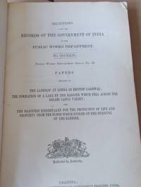
1896015709Calcutta: Calcutta : Office of the Supt. of Govt. Printing 1896 1896. Book measures 33x21.cm. 452pp 12 folding mapsplans 2 single page maps 8 full page illustrations. Bound in original publishers printed boards. Binding rubbed worn spine sellotaped library stamp on top board. Internally occasional stamp. Pages and plates in good clean condition. A good copy of a rare work. F. First Edition. Hardcover. Near Very Good. Quarto. Calcutta : Office of the Supt. of Govt. Printing 1896 Hardcover
11074Paris, Dezauche, 1790. 4 cartes géographiques horizontales, réhaussées en couleurs, de 157 x 60 cm., entoilées sur un beau tissu saumon, au format plié de 13 x 22 cm., chacune avec l'étiquette de Goujon (marchand de géographie ancienne et moderne) contrecollée, languette de vélin portant le nom des cartes. Emboîtage en bois imitant la forme de 2 livres in-4, demi-veau blond, dos lisses ornés de décors dorés, étiquettes de titre ("Hollande") et tomaison vertes avec décors dorés, plats saumon encadrés de roulettes dorées avec "Bibliothèque V. Perdonet" en lettres dorées au premier plat. Quelques frottements à l'emboîtage, les cartes étant quant à elles en parfaite condition.
18896249Paris 1889. 11 Ω x 9 9nches. Circa 1889 Day became intrigued with the French author Balzac and during a trip to Paris painted three watercolors while he was researching Balzac and making connections with other artists and authors. As well he photographed these houses and some of those original prints still turn up on the market. This is a wonderful watercolor painting of a house which probably captured his eye based on its whimsical architecture as well as the placard affixed to the front which reads “Defense D’Afficher†a phrase coined in the 1700’s which basically means “do not post any advertisements here.†A wonderful watercolor executed by F. Holland Day an avid publisher book collector and photographer F. Holland Day was a dedicated aesthete and well-known figure in turn-of-the-century Boston. He was one of the earliest advocates of Pictorial photography in America and like Alfred Stieglitz with whom he corresponded until they had a serious disagreement around 1902 he tirelessly wrote articles mounted exhibitions and encouraged like-minded photographers who supported the medium’s artistic potential. Fine condition. Matted in a glass frame with a smaller window which hides the bottom inch or so unpainted area. A rare and historically significant watercolor painting by this polyglot of photography book publishing and art. unknown
1743ABC_46524The Netherlands 1743. Folio ca. 32 x 21.5 cm. Contemporary blind-tooled vellum sewn on 6 vellum supports laced through the joints with the manuscript title on the spine red sprinkled edges. With some woodcut decorated initials. 24 parts in 1 volume. 4 15 1 31 1 30 2 7 1 9 2 blank 1 4 10 2 2 2 21-27 3 1 6 20 67 1 9 2 blank 1 48 8 1 2 blank 1 8 4 10 1 1 2 2 pp. Rare collection of missives ordinances petitions and extracts from resolutions concerning the conflicts surrounding and law proceedings concerning Jacob Coren van der Mieden 1698-1751. He fled his hometown of Alkmaar in fear he would be captured by the Court of Holland. Initially the Van der Mieden family was a wealthy noble family with a good reputation. Jacob's father Aris was mayor of the city of Alkmaar Jacob was appointed bailiff of Nieuwburgen in 1731. Here one of his judicial officers ran a reign of terror. The people felt that bailiff Jacob was protecting his officer which made him very unpopular. Jacob was also lord of Callantsoog where he imprisoned the former bailiff Jan Harge in 1740 after Harge was being accused of abuse of office. The problem was that he did so under such bad conditions that the wife of Harge complained to the Court of Holland after which Harge was exonorated and the Court of Holland turned to Van der Mierde. Out of fear of being put behind bars he fled to Lent near Nijmegen. His wife Susanna Doubleth appealed the court and advocated that her husband would be tried by the local court in Alkmaar instead of the Court of Holland. These request are added in this collection. The last ordinance in the collection is the conviction of his younger brother Adriaan counselor of the Court of Holland who was accused of co-writing the requests with Susanna which were quite libel and defamatory undermining the Court of Holland as the highest judiciary institution of Holland. Adriaan was suspended from the court in 1747. The fate of Jacob van der Mieden remains unclear.With a manuscript annotation on the title page signed by G.J. van Persijn 1791. Govert Jan van Persijn was a lawyer advocaat at the Court of Holland Antonius Quirinus van Persijn was his son. Govert Jan van Persijn also added letters to the index and occassionaly made some marginal annotations and corrections in the text. The binding is slightly dust soiled otherwise in very good condition.l J.G. Gijsberti Hodenpijl van Hodenpijl Extracten uit de crimineele ordonnantien van Holland gives the pamphlets individually; STCN 240322061 3 copies; WorldCat 1144496082 1258013052 3 copies also in STCN; not in De Buck; Knuttel; Tiele. hardcover
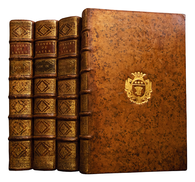
1737380701737 5 tomes en 4 volumes in-folio (391 x 250 mm), plein veau blond marbré de lépoque, dos à 6 nerfs guillochés or, ornés de caissons richement fleuronnés et cloisonnés, armes dorées au centre des plats, pièces de titre et de tomaison de veau havane et blond, coiffes et coupes filetées or, tranches rouges. A La Haye, par la Compagnie des Libraires [i.e. en France], 1737.
5 tomes en 4 volumes in-folio (391 x 250 mm), plein veau blond marbré de l’époque, dos à 6 nerfs guillochés or, ornés de caissons richement fleuronnés et cloisonnés, armes dorées au centre des plats, pièces de titre et de tomaison de veau havane et blond, coiffes et coupes filetées or, tranches rouges. Edition la plus complète des oeuvres collectives de Pierre Bayle, donnée par Pierre Desmaizeaux, proche protégé de l'auteur. "Edition qui doit être préférée à celle de 1727-31, parce qu'elle contient, de plus que la première, cent cinquante lettres à sa famille, formant un cahier de 211 pages qui est placé à la fin du premier volume" (Brunet). "Ce recueil contient tous les ouvrages publiés de Bayle, hors le dictionnaire. Il comprend aussi tout ce qui avait été imprimé de la correspondance" (Delvolve, 'Pierre Bayle…', Bibliographie, p. 436). Selon le catalogue de la BnF, qui se fonde sur le matériel typographique, cette édition aurait été imprimée en France, probablement à Trévoux. Vignette de titre allégorique gravée par Frederik Ottens, d'après Bernard Picard. Table des matières en tête de chaque volume et table des matières de l'ensemble en fin du volume IV. Le premier volume renferme plusieurs gravures sur bois dans le texte et 3 planches hors texte sur cuivre (pages 518, 578 [placé face 584] et 600). Le volume III est divisé en deux parties sous page de faux-titre, titre particulier et pagination continue. Le volume IV renferme plusieurs illustrations sur bois dans le texte dont trois grandes représentations des systèmes planétaires de Ptolémée (p. 394), de Ticho-Brahé (p. 398) et Copernic (p. 401). Quelques rousseurs et petites auréoles éparses. Quelques traces de restauration à la reliure. Très bel exemplaire en veau blond de l'époque aux armes de Jean-Claude Fauconnet de Vildé (1694–1765) dorées sur les plats (aux volumes II, II et IV). Ecuyer, conseiller du roi et de la Ville de Paris, il devint avocat à la cour et au Parlement (Catalogue des livres de feu M. Fauconnet de Vilde, Paris, de Bure le jeune, 1765, p. 24). (Guigard, II, 210. OHR, pl. 1654).
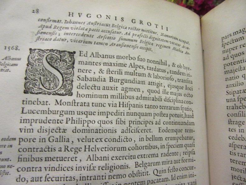
43797Amsterdam. Joannis Blaeu.1657. Grotius. Gd.in-4 en vélin d'époque.569 p.+ Index. Portrait gravé.Edition originale. Bel exemplaire .Rosace et fleurons estampés à froid.Dos à 6 nerfs,nom de l'Auteur et titre manuscrits.Hugo Grotius ou Huig de Groot ou Hugo de Groot.
200646226PRIMERA IMPRESION FACSIMIL A PARTIR DE LOS PERGAMINOS ORIGINALES PINTADOS A MANO DE ESTE IMPRESIONANTE ATLAS PORTUGUES DEL SIGLO XVI - 1519. CUYO ORIGINAL SE ENCUENTRA EN LA BIBLIOTECA NACIONAL DE FRANCIA.- Barcelona: M. Moleiro Editor 2006.- Son 8 mapas a todo color de 41 x 50 cm. aproximadamente sobre grueso papel apergaminado fielmente reproducidos incluso en su contorno perimetral que van en una caja de 645 x 47 cm. totalmente forrada en raso de seda de color granate con estampaciones doradas. Mas 2 grandes mapas a todo color en una gran hoja a pintada a doble cara de 625 x 1185 cm. sobre grueso papel apergaminado magistralmente reproducidos incluso en su contorno perimetral que van enrollados dentro de una caja poliédrica alargada y forrada en raso de seda de color granate con estampaciones doradas; Seguido de un VOLUMEN EXPLICATIVO con 427 p. 1 h.: Ilustrado con profusión de mapas a todo color; en Gran Folio 354 x 255 cm; Encuadernado en Plena Tela en raso de seda azul con camisa ilustrada.- VA ADJUNTA EL ACTA NOTARIAL QUE DICE: Yo José Antonio Caneda Goyanes Notario de Barcelona Colegio de Cataluña DOY FE. De que a la presente edición facsÃmil del ATLAS MILLER cuyo original se conserva en la Bibliotheque Nationale de France le corresponde el número 748 de la edición UNICA E IRREPETIBLE numerada en arábigo y limitada a 987 ejemplares realizada bajo la dirección de Manuel Moleiro RodrÃguez y editada por M. Moleiro Editor S. A. Forman parte de esa misma edición 77 ejemplares con numeración romana destinados a la Bibliotheque nationale de France al Editor y al Depósito Legal. Todo ello según el acta autorizada por mi el catorce de noviembre de dos mil tres número 933 de mi protocolo. Barcelona 14 de noviembre de 2003. Siguen la firma y el sello del Notario. Va copia en inglés de esta misma acta. En un magnÃfico estado de conservación. Según nos indica el editor: El ATLAS MILLER sin ninguna duda el más hermoso de la historia de la cartografÃa y según los especialistas la obra magna por excelencia nos permite tener un conocimiento bastante detallado de la situación geopolÃtica del mundo y la marcha de los descubrimientos y colonización de los pueblos del lejano Oriente en el primer cuarto del siglo XVI. El Atlas Miller fue creado por el equipo de cartógrafos más brillantes de la época ayudados para embellecerlo por el pintor y miniaturista Antonio de Holanda. EL PRESENTE FACSIMIL CONSTITUYE UN VERDADERO ALARDE EDITORIAL LOGRANDO UNA PERFECCIÓN ENCOMIABLE. DIGNO DE UNA GRAN BIBLIOTECA. GEOGRAFÃA GUÃAS Y ATLAS DEL EXTRANJERO Libro en español M. Moleiro, Editor hardcover
163478666London: Adam Islip 1634. Hardcover Quarto. Hardcover. Fair. 2 volumes rebound half leather decorated papered boards five raised bands to spine gilt lettering on black label two new blank end papers front and rear 614 42 632 86 pp 2 vol. signature of owner John Griffiths Jesus College Oxford 1947 glued to front pastedown of both volumes title page and preface missing in volume one first pages of both volumes with tears on corners edges trimmed in both volumes paper slip with contemprary description laid in volume 1light damp stains to edges and corners <br /> <br /> <br /> Standard shipping no tracking / Priority with tracking / Custom quote for large or heavy orders. Adam Islip hardcover
96391aafAmsterdam, Zacharias Chatelain 1730, in-Folio, XXII + 396 p. + 4; / II + 70 p. / VI + 723 p. + 34 p. double col.. With 3 engraved titelpges, 3 engr vign. on printed title, 2 folding maps, 51 double-page engravings and townplans+ 57 portraits by Jan Luyken, Bernard Picart, a.o.,. exlibris Carl Viol Amsterdam, contemporary full leatherbindings, spine richly gilt. Some signes of use esp. to the top of the spines.