131 résultats
177633412London: J. F. W. Des Barres for The Atlantic Neptune 1776. Large engraved chart from Des Barres' Atlantic Neptune on two sheets of laid paper joined each bearing "J Bates" watermark. 43x31 inches sheet size nice margins; contemporary hand-color in outline; slightest offsetting a superior copy. State 4 of 7. Fine chart depicting the waters between New Bedford and Martha's Vineyard.<br/> <br/> Buzzards Bay and the Vineyard Sound including the Elizabeth Islands and the western half of Martha's Vineyard. Showing much more on-shore information than is typical for a Des Barres chart there are details of property boundaries structures even a road from Menemshaw Pond to Tisbury. Native names throughout remain largely unchanged today. Joseph Des Barres was born in Switzerland in 1721 and educated in Basel before emigrating to England and entering the Royal Military College where he learned engineering and the art of surveying. In 1756 Des Barres was commissioned a Lieutenant in the Royal American Regiment and dispatched to North America. He served in America during the Seven Years War under Colonel Bouquet Lord Howe and General Amherst and participated in the Quebec campaign as General Wolfe's engineer. Though Des Barres was responsible for the surveys done of Nova Scotia and the Isle of Sable the surveying of the coastline of what became the United States was undertaken by Major Samuel Holland a Dutchman who joined the British army during the French and Indian War as an engineer and became ultimately Surveyor General for North America. Holland was in charge of a rather large staff that included Charles Blaskowitz and George Gauld. They ultimately provided greatly improved charts for the entire coastline and the Gulf of Mexico. All this work was done prior to the Revolution which necessarily brought the surveys to an end. The publishing supervised by Des Barres continued throughout the war years. Des Barres compiled and edited the atlas maintaining a high standard throughout. His primary motive seems to have been the navigational usefulness of the charts. He clearly envisioned a navigator's needs in approaching a shoreline. The Atlantic Neptune was the first new survey of American coastlines in a century and the need was very great. The charts were plagiarized for the next thirty or forty years. Des Barres also had a flare for making charts aesthetically appealing so that they are invariably handsome as well as unfailingly interesting.<br/> <br/> Stevens 88D; John Carter Brown Library Charting the East Coast of North America The Atlantic Neptune Providence: 1972; Robert Lingel 'The Atlantic Neptune' in the Bulletin of the New York Public Library July 1936 pp.571-603; Augustus P. Loring 'The Atlantic Neptune' in American Maritime Prints New Bedford: 1985. J. F. W. Des Barres for The Atlantic Neptune unknown
177633412London: J. F. W. Des Barres for The Atlantic Neptune 1776. Large engraved chart from Des Barres' Atlantic Neptune on two sheets of laid paper joined each bearing "J Bates" watermark. 43x31 inches sheet size nice margins; contemporary hand-color in outline; slightest offsetting a superior copy. State 4 of 7. Fine chart depicting the waters between New Bedford and Martha's Vineyard.<br/> <br/>Buzzards Bay and the Vineyard Sound including the Elizabeth Islands and the western half of Martha's Vineyard. Showing much more on-shore information than is typical for a Des Barres chart there are details of property boundaries structures even a road from Menemshaw Pond to Tisbury. Native names throughout remain largely unchanged today. Joseph Des Barres was born in Switzerland in 1721 and educated in Basel before emigrating to England and entering the Royal Military College where he learned engineering and the art of surveying. In 1756 Des Barres was commissioned a Lieutenant in the Royal American Regiment and dispatched to North America. He served in America during the Seven Years War under Colonel Bouquet Lord Howe and General Amherst and participated in the Quebec campaign as General Wolfe's engineer. Though Des Barres was responsible for the surveys done of Nova Scotia and the Isle of Sable the surveying of the coastline of what became the United States was undertaken by Major Samuel Holland a Dutchman who joined the British army during the French and Indian War as an engineer and became ultimately Surveyor General for North America. Holland was in charge of a rather large staff that included Charles Blaskowitz and George Gauld. They ultimately provided greatly improved charts for the entire coastline and the Gulf of Mexico. All this work was done prior to the Revolution which necessarily brought the surveys to an end. The publishing supervised by Des Barres continued throughout the war years. Des Barres compiled and edited the atlas maintaining a high standard throughout. His primary motive seems to have been the navigational usefulness of the charts. He clearly envisioned a navigator's needs in approaching a shoreline. The Atlantic Neptune was the first new survey of American coastlines in a century and the need was very great. The charts were plagiarized for the next thirty or forty years. Des Barres also had a flare for making charts aesthetically appealing so that they are invariably handsome as well as unfailingly interesting.<br/> <br/>Stevens 88D; John Carter Brown Library Charting the East Coast of North America The Atlantic Neptune Providence: 1972; Robert Lingel 'The Atlantic Neptune' in the Bulletin of the New York Public Library July 1936 pp.571-603; Augustus P. Loring 'The Atlantic Neptune' in American Maritime Prints New Bedford: 1985. J. F. W. Des Barres for The Atlantic Neptune unknown books
177933200London 1779. Engraved and aquatint map period hand colouring. 14 lettered references large inset with title as above. Rare revolutionary chart of the Hudson River showing the American defenses on the eve of the Battle of Fort Montgomery.<br/> <br/> On October 6 1777 a British force led by Lieutenant General Sir Henry Clinton attacked Forts Montgomery and Clinton from the landward side where the American defenses were only partially completed. Support from cannon fire from British ships on the Hudson River that had passed through the chevaux de frise on the lower river. By the end of the day both forts had fallen to the British who burned the forts and tore down the stonework buildings. However the battle was a pyrrhic victory for the British. The campaign against the forts caused delays in reinforcing General John Burgoyne at Saratoga where Americans forced the British surrender ten days later at the Battle of Saratoga before Clinton's forces could arrive. The present map which depicts the Forts and the River defenses prior to the battle is from The Atlantic Neptune the finest large scale sea atlas of the United States and Canadian Atlantic coastline ever produced. The maps in the atlas were produced over a seven-year period 1775-82 and are well known for their accurate portrayal of various sounds bays bars harbors as well as navigational hazards. This atlas was used extensively by the Royal Navy during the American Revolution. Des Barres studied under the great mathematician Daniel Bernoulli at the University of Basel before continuing on to the Royal Military College at Woolwich. On the outbreak of the Seven Years war in 1756 he joined the British Royal American Regiment as a military engineer. He came to the attention of General James Wolfe who appointed him to be his aide-de-camp. From 1762 Des Barres was enlisted to survey the coastlines of Nova Scotia Newfoundland and the Gulf of St.Lawrence while his colleague Samuel Holland charted the New England coast and further south. In 1774 Des Barres returned to England where he began work on the Neptune. His dedication to the project was so strong that often at his own expense he continually updated and added new charts and views up until 1784. That year he returned to Canada where he remained for a further forty years becoming a senior political figure and a wealthy land owner and living to the advanced age of 103. The Atlantic Neptune was the first British sea atlas of her North American colonies and one of the most important achievements of eighteenth century cartography. With an official commission from the Royal Navy Des Barres published the first volume in London in 1775 which was soon followed by further volumes. Des Barres' monumental endeavor eventually featured over two-hundred charts and aquatint views many being found in several states. All of the charts were immensely detailed featuring both hydrographical and topographical information. The Neptune met with the highest acclaim from the beginning and is today widely regarded as superior to all other atlases produced during its time. Henry Stevens identified only a single state of this chart issued coloured or uncoloured which appeared in some examples volume four part two of the Atlantic Nepture; the map however is not listed in the engraved list of maps for that section and given the rarity was likely not issued in all copies.<br/> <br/> National Maritime Museum: Henry Stevens Collection: HNS156; Cf. Phillips Atlases 1198; Hornsby Surveyors of Empire: Samuel Holland J.F.W. Des Barres and the Making of the Atlantic Neptune 2011. unknown
177933200London 1779. Engraved and aquatint map period hand colouring. 14 lettered references large inset with title as above. Rare revolutionary chart of the Hudson River showing the American defenses on the eve of the Battle of Fort Montgomery.<br/> <br/>On October 6 1777 a British force led by Lieutenant General Sir Henry Clinton attacked Forts Montgomery and Clinton from the landward side where the American defenses were only partially completed. Support from cannon fire from British ships on the Hudson River that had passed through the chevaux de frise on the lower river. By the end of the day both forts had fallen to the British who burned the forts and tore down the stonework buildings. However the battle was a pyrrhic victory for the British. The campaign against the forts caused delays in reinforcing General John Burgoyne at Saratoga where Americans forced the British surrender ten days later at the Battle of Saratoga before Clinton's forces could arrive. The present map which depicts the Forts and the River defenses prior to the battle is from The Atlantic Neptune the finest large scale sea atlas of the United States and Canadian Atlantic coastline ever produced. The maps in the atlas were produced over a seven-year period 1775-82 and are well known for their accurate portrayal of various sounds bays bars harbors as well as navigational hazards. This atlas was used extensively by the Royal Navy during the American Revolution. Des Barres studied under the great mathematician Daniel Bernoulli at the University of Basel before continuing on to the Royal Military College at Woolwich. On the outbreak of the Seven Years war in 1756 he joined the British Royal American Regiment as a military engineer. He came to the attention of General James Wolfe who appointed him to be his aide-de-camp. From 1762 Des Barres was enlisted to survey the coastlines of Nova Scotia Newfoundland and the Gulf of St.Lawrence while his colleague Samuel Holland charted the New England coast and further south. In 1774 Des Barres returned to England where he began work on the Neptune. His dedication to the project was so strong that often at his own expense he continually updated and added new charts and views up until 1784. That year he returned to Canada where he remained for a further forty years becoming a senior political figure and a wealthy land owner and living to the advanced age of 103. The Atlantic Neptune was the first British sea atlas of her North American colonies and one of the most important achievements of eighteenth century cartography. With an official commission from the Royal Navy Des Barres published the first volume in London in 1775 which was soon followed by further volumes. Des Barres' monumental endeavor eventually featured over two-hundred charts and aquatint views many being found in several states. All of the charts were immensely detailed featuring both hydrographical and topographical information. The Neptune met with the highest acclaim from the beginning and is today widely regarded as superior to all other atlases produced during its time. Henry Stevens identified only a single state of this chart issued coloured or uncoloured which appeared in some examples volume four part two of the Atlantic Nepture; the map however is not listed in the engraved list of maps for that section and given the rarity was likely not issued in all copies.<br/> <br/>National Maritime Museum: Henry Stevens Collection: HNS156; Cf. Phillips Atlases 1198; Hornsby Surveyors of Empire: Samuel Holland J.F.W. Des Barres and the Making of the Atlantic Neptune 2011. unknown books
177517671London: Published by J.F.W. Des Barres in 'The Atlantic Neptune' 1775. Copper-engraved and etched map with aquatint on two joined sheets. Printed on laid paper with `J Bates' watermark and `JB' countermark in excellent condition. Sheet size: 30 1/4 x 42 5/8 inches. With: The explanatory text leaf titled as above. 1p. folio 25 1/2 x 19 inches. The finest and most celebrated sea chart of Boston Harbor ever produced and a highly important Revolutionary War map depicting details relating to the Siege of Boston: with the very rare explanatory text leaf.<br/> <br/>This is one the most important maps contained in Des Barres' The Atlantic Neptune and one of the most significant large-scale maps of the Revolutionary War. It provides an invaluable record of Boston at the beginning of the war covering the area from the environs of the city out into the open waters of Massachusetts Bay. A particularly striking feature is the use of boldly etched and subtly aquatinted details to capture the diverse topography of the region including the numerous hills islands and river estuaries. It is important to remember that this was issued as a working sea-chart and as such the cartographer has naturally concentrated on features such as depth soundings indicated by detailed lines and based on surveys by Samuel Holland and George Callendar and the navigable channels between the harbor's numerous shoals which are delicately outlined in stipple-engraving. Holland's original manuscript map is today preserved in the British Hydrographic Library at Taunton Somerset. The present map shows the city of Boston with its streets carefully outlined occupying a pear-shaped peninsula a position that would soon prove precarious to its British defenders in the escalating conflict. This is the second state of five of Des Barres' chart and is identical to the Henry Stevens Collection variant 96D in the National Maritime Museum Greenwich. This state shows a number of notable changes when compared with the original and was evidently altered to take particular account of the Siege of Boston April 19 1775 to March 17 1776. Henry Stevens noted that this state depicted the addition of "Numerous Forts Batteries Redoubts &c. which have been inserted in many places notably on the Charles Town peninsula and on the mainland between 'Willis Creek' and 'Mystic River' also on the east and north side of 'Charles River' below 'Cambridge'.also to the south of 'Boston Neck' and 'Dorchester Neck'.This state is almost as rare as the first state. It is found in some copies of the earliest edition of the Neptune." The accuracy scope and artistic virtue of Des Barres's Chart of the Harbour of Boston was apparent to his contemporaries and it became the main source map of the area for decades to come. Joseph Frederick Wallet Des Barres was born in Switzerland where his Huguenot ancestors had fled following the repeal of the Edict of Nantes. He studied under the great mathematician Daniel Bernoulli at the University of Basel before immigrating to Britain where he trained at the Royal Military College Woolwich. Upon the outbreak of hostilities with France in 1756 he joined the British Royal American Regiment as a military engineer. He came to the attention of General James Wolfe who appointed him to join his personal detail. During this period he also worked with the legendary future explorer James Cook on a monumental chart of the St. Lawrence River. Upon the conclusion of the Seven Years War Britain's empire in North America was greatly expanded and this required the creation of a master atlas featuring new and accurate sea charts for use by the Royal Navy. Des Barres was enlisted to survey the coastlines of Nova Scotia Newfoundland and the Gulf of St. Lawrence. With these extremely accurate surveys in hand Des Barres returned to London in 1774 where the Royal Navy charged him with the Herculean task of producing the atlas. He was gradually forwarded the manuscripts of numerous advanced surveys conducted by British cartographers in the American Colonies Jamaica and Cuba of which the present map is based on the work of Samuel Holland conducted in the 1760s. The result was The Atlantic Neptune which became the most celebrated sea atlas of its era containing the first systematic survey of the east coast of North America. Des Barres's synergy of great empirical accuracy with the peerless artistic virtue of his aquatint views created a work that "has been described as the most splendid collection of charts plates and views ever published" National Maritime Museum Catalogue. The Neptune eventually consisted of four volumes and Des Barres's dedication to the project was so strong that often at his own expense he continually updated and added new charts and views to various editions up until 1784 producing over 250 charts and views many appearing in several variations. All of these charts were immensely detailed featuring both hydrographical and topographical information such that in many cases they remained the most authoritative maps of the regions covered for several decades. Following the completion of The Neptune Des Barres returned to Canada where he remained for a further forty years becoming a senior political figure and a wealthy land owner living to the advanced age of 103.<br/> <br/>Cf. GuthornBritish Maps of the American Revolution referring to Holland's original manuscript 59/3; Krieger & Cobb p.107 1781 issue; Lingel Atlantic Neptune N91.2; National Maritime Museum Henry Stevens Collection K0713 HNS 96D; National Maritime Museum Catalogue 78-83; Nebenzahl Bibliography 3; Stevens Bibliography of the Atlantic Neptune unpublished pp.211-216; Sellers & Van Ee 945. Published by J.F.W. Des Barres in 'The Atlantic Neptune' unknown books
177634405London: J. F. W. Des Barres 1776. Engraved with color wash and outline color. Sheet: 31 x 42 1/4 inches. Expert restoration primarily at the upper margin. Two sheets joined both watermarked "J.Bates" and countermarked "JB". Fourth state of five. Among the earliest charts published by Des Barres were those relevant to the crisis in New England as the War of Independence broke out.<br/> <br/>This chart depicts the coast of Massachusetts from Salem to Scituate Harbor and includes the complicated hydrography of Boston Harbor and the confluent rivers. A considerable amount of coastal topography is included obviously relevant to warships. Fundamentally a chart for navigators it includes soundings and shoals with particularly strong detail along the Charles and Mystic Rivers as well as in Salem and Marblehead. Samuel Holland was the lead surveyor. In 1764 he was named Surveyor General of both the Province of Quebec and the Northern District of North America. He had a considerable staff and the British Navy assisted in providing soundings. From 1770 to 1774 his squad worked exclusively on northeastern colonies that soon became part of the United States. The surveys that derived from the industry of their work were the most accurate ever made to that time. They were sent to London where Des Barres supervised the engraving and publication. The charts were very soon put to use. Des Barres of Swiss-Huguenot extraction studied under the great mathematician Daniel Bernoulli at the University of Basel before continuing on to the Royal Military College at Woolwich. Upon the outbreak of hostilities with France in 1756 he joined the British Royal American Regiment as a military engineer. He came to the attention of General James Wolfe who appointed him to join his personal detail. During this period he also worked with the future legendary explorer James Cook on a monumental chart of the St. Lawrence River. From 1762 Des Barres was enlisted to survey the coastlines of Nova Scotia Newfoundland and the Gulf of St. Lawrence while his colleague Samuel Holland charted the New England coast. He also managed to gain access to some surveys of the American South Cuba and Jamaica. In 1774 Des Barres returned to England where he began work on The Neptune. His dedication to the project was so strong that often at his own expense he continually updated and added new charts and views up until 1784. That year he returned to Canada where he remained for a further forty years becoming a senior political figure and a wealthy land owner and living to the advanced age of 103.<br/> <br/>Stevens Collection 94d ; cf. Hornsby Surveyors of Empire: Samuel Holland J.F.W. Des Barres and the Making of the Atlantic Neptune. 2011. J. F. W. Des Barres unknown books
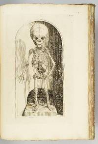
1739ST12883Leyden: Johann Arnold Langerak 1739. First Edition in Latin. 540 x 380 mm. 21 1/4 x 15". 70 leaves of text.Translated by William Dundass. <br/> Original red quarter vellum over marbled boards raised bands UNTRIMMED EDGES. Engraved printer's device on title large decorative initials and tailpieces EXTRA ENGRAVED TITLE AND 114 STRIKING PLATES OF ANATOMICAL FIGURES three folding. Wellcome II 401; Heirs of Hippocrates 468; Choulant-Frank pp. 252-3; Russell 213. ◆Vellum on spine rather worn with three one-and-one-half-inch pieces broken away revealing structure underneath paper boards quite chafed other minor problems externally but an entirely solid unrestored binding. A couple of plates with short closed marginal tears one folding plate with one-inch closed tear into image no loss untrimmed edges a little browned and brittle with isolated small chips occasional minor foxing or insignificant stains three plates lightly browned but still AN UNUSUALLY ATTRACTIVE COPY INTERNALLY with the broadest of margins with especially clean and fresh leaves and with rich impressions of the plates.<br/> <br/> With plates of notable visual impressiveness this was the finest anatomy book in England during the first half of the 18th century; it also was largely a plagiarism borrowing most of its engraved content from a work by the Dutch physician Govert Bidloo published in 1685. Bidloo's work was the first large-scale anatomical atlas to appear after Vesalius' epoch-making "De Humani Corporis Fabrica" and the plates which are highly praised by Norman and Garrison-Morton are characterized by startlingly detailed life-size depictions of the human body both adult and infant with figures flayed to reveal muscles opened to show organs and unfleshed to exhibit bones. According to Choulant-Frank Bidloo's publishers sold 300 impressions of these plates to Cowper probably to recoup some of their money after disappointing sales. Cowper took Bidloo's original 105 plates added nine of his own and produced an English translation of the original Latin text to accompany them. Discussing the original plates produced by Gerard de Lairesse 1641-1711 Norman says that the figures are displayed "in an emotional almost tender manner contrasting the raw dissected parts with the full soft surfaces of uncut flesh placing flayed bound figures in ordinary nightclothes or bedding setting ordinary household objects such as books jars or cabinets in the same scene as cut-up torsos or limbs. His illustrations brought the qualities of Dutch still-life painting into anatomical illustration and gave a new darker spiritual expression to the significance of the act of dissection." When Cowper's version of the atlas first appeared as "The Anatomy of Humane Bodies" in London in 1698 there was also a 1737 Leyden printing in English before our more scholarly Latin edition Bidloo complained to the Royal Society and accused Cowper of plagiarism and fraud resulting in much acrimony and heated pamphleteering between the two physicians. Notwithstanding this scandal Cowper's achievements and discoveries--including the pair of glands that bear his name--were considerable and his text improved significantly upon the original work. Unfortunately as the DNB notes "the notoriety of this case has served to obscure a true appreciation of Cowper and of his many original contributions to anatomical illustration." The atlases of Bidloo and Cowper appear on the market regularly but at 540 x 380 mm. the present copy is distinguished by its size which is significantly larger than what is typically seen with this edition--we have not been able to trace a copy larger than ours from marketplace or institutional records. Johann Arnold Langerak unknown
177634405London: J. F. W. Des Barres 1776. Engraved with color wash and outline color. Sheet: 31 x 42 1/4 inches. Expert restoration primarily at the upper margin. Two sheets joined both watermarked "J.Bates" and countermarked "JB". Fourth state of five. Among the earliest charts published by Des Barres were those relevant to the crisis in New England as the War of Independence broke out.<br/> <br/> This chart depicts the coast of Massachusetts from Salem to Scituate Harbor and includes the complicated hydrography of Boston Harbor and the confluent rivers. A considerable amount of coastal topography is included obviously relevant to warships. Fundamentally a chart for navigators it includes soundings and shoals with particularly strong detail along the Charles and Mystic Rivers as well as in Salem and Marblehead. Samuel Holland was the lead surveyor. In 1764 he was named Surveyor General of both the Province of Quebec and the Northern District of North America. He had a considerable staff and the British Navy assisted in providing soundings. From 1770 to 1774 his squad worked exclusively on northeastern colonies that soon became part of the United States. The surveys that derived from the industry of their work were the most accurate ever made to that time. They were sent to London where Des Barres supervised the engraving and publication. The charts were very soon put to use. Des Barres of Swiss-Huguenot extraction studied under the great mathematician Daniel Bernoulli at the University of Basel before continuing on to the Royal Military College at Woolwich. Upon the outbreak of hostilities with France in 1756 he joined the British Royal American Regiment as a military engineer. He came to the attention of General James Wolfe who appointed him to join his personal detail. During this period he also worked with the future legendary explorer James Cook on a monumental chart of the St. Lawrence River. From 1762 Des Barres was enlisted to survey the coastlines of Nova Scotia Newfoundland and the Gulf of St. Lawrence while his colleague Samuel Holland charted the New England coast. He also managed to gain access to some surveys of the American South Cuba and Jamaica. In 1774 Des Barres returned to England where he began work on The Neptune. His dedication to the project was so strong that often at his own expense he continually updated and added new charts and views up until 1784. That year he returned to Canada where he remained for a further forty years becoming a senior political figure and a wealthy land owner and living to the advanced age of 103.<br/> <br/> Stevens Collection 94d ; cf. Hornsby Surveyors of Empire: Samuel Holland J.F.W. Des Barres and the Making of the Atlantic Neptune. 2011. J. F. W. Des Barres unknown
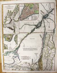
1776WRCAM36226London: Printed for Robt. Sayer and John Bennett August 17 1776. Engraved map consisting of eight folio sheets backed on linen 54 1/2 x 21 3/4 inches with contemporary color outlining and shading of some boundaries and geographic features. Slightly soiled occasional minor stains a few old repairs no loss of text. In a brown cloth slipcase. A very good copy. This famous map is one of the best for the provinces of New York and New Jersey during the colonial period. It is the fourth state described by McCorkle following versions published circa 1768 in 1775 and earlier in 1776. "The map includes western Connecticut and Massachusetts and most of Vermont. In 1775 the title became 'The Provinces of New York and New Jersey; with part of Pensilvania and the Province of Quebec'.Three insets were added in this state: A chart of the mouth of the Hudson River; A plan of the City of New York; Plan of Amboy.The following year the date changed to 1776. Later in the same year the title was extended to include 'Corrected and improved from the original materials by Govern.r Pownall' and Holland's rank was given as Major" - McCorkle. The present copy is the final version described by McCorkle. <br> <br> THE PROVINCES OF NEW YORK AND NEW JERSEY is in effect a large-scale map of the Hudson River and its tributaries including the Mohawk and settlement in New York is almost entirely confined to the banks of the Hudson and Mohawk rivers. The unexplored Adirondack County is left almost entirely blank with a lengthy notation that begins "Beaver Hunting Country of the Confederated Indians." Pennsylvania extends north into western New York state almost as far as the Mohawk Vermont is shown attached to New York with each existing township identified and the map extends north into Quebec beyond Montreal. Interesting notations on the country are scattered across the face of the map. For instance in Pennsylvania an area with little detail is simply noted as "endless mountains." The map is beautifully decorated with a pastoral title cartouche suggestive of the Hudson Palisades in the lower right corner. <br> <br> The map was created by Samuel Holland Surveyor General for the Northern District of North America. As a result of the French and Indian War 1755-63 Great Britain had acquired a new American Empire for which there were few adequate maps. Two new offices of surveyor general for the American colonies were established in 1763-64. The colonies were divided at the Potomac River into a northern and southern district and the respective surveyors appointed were Samuel Holland and Gerard De Brahm. Holland conceived of a general survey of North America east of the Mississippi to be based upon geodetic principles on a scale of one inch to one mile but work was interrupted in 1775 by the outbreak of the American Revolution. <br> <br> A very good copy of Holland's large and important map which includes western New England and portions of Quebec. DEGREES OF LATITUDE fig. 21. PHILLIPS ATLASES 1166 number 17. McCORKLE 768.3 775.6 776.13. Printed for Robt. Sayer and John Bennett, August 17 hardcover books
179011074Paris, Dezauche, 1790. 4 cartes géographiques horizontales, réhaussées en couleurs, de 157 x 60 cm., entoilées sur un beau tissu saumon, au format plié de 13 x 22 cm., chacune avec l'étiquette de Goujon (marchand de géographie ancienne et moderne) contrecollée, languette de vélin portant le nom des cartes. Emboîtage en bois imitant la forme de 2 livres in-4, demi-veau blond, dos lisses ornés de décors dorés, étiquettes de titre ("Hollande") et tomaison vertes avec décors dorés, plats saumon encadrés de roulettes dorées avec "Bibliothèque V. Perdonet" en lettres dorées au premier plat. Quelques frottements à l'emboîtage, les cartes étant quant à elles en parfaite condition.
1743ABC_46524The Netherlands 1743. Folio ca. 32 x 21.5 cm. Contemporary blind-tooled vellum sewn on 6 vellum supports laced through the joints with the manuscript title on the spine red sprinkled edges. With some woodcut decorated initials. 24 parts in 1 volume. 4 15 1 31 1 30 2 7 1 9 2 blank 1 4 10 2 2 2 21-27 3 1 6 20 67 1 9 2 blank 1 48 8 1 2 blank 1 8 4 10 1 1 2 2 pp. Rare collection of missives ordinances petitions and extracts from resolutions concerning the conflicts surrounding and law proceedings concerning Jacob Coren van der Mieden 1698-1751. He fled his hometown of Alkmaar in fear he would be captured by the Court of Holland. Initially the Van der Mieden family was a wealthy noble family with a good reputation. Jacob's father Aris was mayor of the city of Alkmaar Jacob was appointed bailiff of Nieuwburgen in 1731. Here one of his judicial officers ran a reign of terror. The people felt that bailiff Jacob was protecting his officer which made him very unpopular. Jacob was also lord of Callantsoog where he imprisoned the former bailiff Jan Harge in 1740 after Harge was being accused of abuse of office. The problem was that he did so under such bad conditions that the wife of Harge complained to the Court of Holland after which Harge was exonorated and the Court of Holland turned to Van der Mierde. Out of fear of being put behind bars he fled to Lent near Nijmegen. His wife Susanna Doubleth appealed the court and advocated that her husband would be tried by the local court in Alkmaar instead of the Court of Holland. These request are added in this collection. The last ordinance in the collection is the conviction of his younger brother Adriaan counselor of the Court of Holland who was accused of co-writing the requests with Susanna which were quite libel and defamatory undermining the Court of Holland as the highest judiciary institution of Holland. Adriaan was suspended from the court in 1747. The fate of Jacob van der Mieden remains unclear.With a manuscript annotation on the title page signed by G.J. van Persijn 1791. Govert Jan van Persijn was a lawyer advocaat at the Court of Holland Antonius Quirinus van Persijn was his son. Govert Jan van Persijn also added letters to the index and occassionaly made some marginal annotations and corrections in the text. The binding is slightly dust soiled otherwise in very good condition.l J.G. Gijsberti Hodenpijl van Hodenpijl Extracten uit de crimineele ordonnantien van Holland gives the pamphlets individually; STCN 240322061 3 copies; WorldCat 1144496082 1258013052 3 copies also in STCN; not in De Buck; Knuttel; Tiele. hardcover
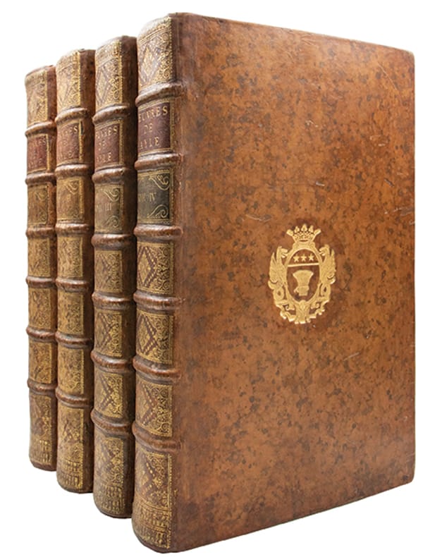
1737380701737 5 tomes en 4 volumes in-folio (391 x 250 mm), plein veau blond marbré de lépoque, dos à 6 nerfs guillochés or, ornés de caissons richement fleuronnés et cloisonnés, armes dorées au centre des plats, pièces de titre et de tomaison de veau havane et blond, coiffes et coupes filetées or, tranches rouges. A La Haye, par la Compagnie des Libraires [i.e. en France], 1737.
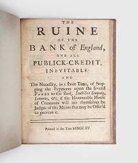
1715184362London: Printed in the Year 1715. The Bank of England critiqued by a founder of the Bank of Scotland First edition of this eyewitness account of the birth of British public banking and a prescient warning of the instability of the Bank of England amid the South Sea Bubble. Starting out as a merchant John Holland 1658-1721 was part of the group which secured backing for the Bank of Scotland Act in 1695: he served as its first governor for two years and later assumed a consultancy role into the 1710s. The Ruine recounts Holland's concern at the state of government finance in the 1710s and particularly at the commonly held belief that borrowing from the South Sea Company would be a viable source of public revenue. Quarto 191 x 144 mm pp. ii 13 1. Woodcut initials head- and tailpieces. Recent quarter calf spine ruled in gilt and with brown morocco label marbled paper boards edges sprinkled red. Contemporary ink manuscript correction to p. 2. Light browning pagination slightly shaved page numerals at head slightly shaved: a very good copy. ESTC T46920: Goldsmiths' 5236; Hanson 2180. hardcover
1776M11157London: Robert Sayer and John Bennett 1776. Very Good. Notes: This is the upper section of a two sheet map published in Thomas Jeffery's American Atlas. Size : 686x533 mm 27.01x20.98 Inches Coloring: Hand Colored Reference: Goss #69; McCorkle #768.3 Category: Maps United States East New York; Robert Sayer and John Bennett unknown
176764856Lemgo, Meyer, 1764-1767. 4°. Mit einer gefalt. Tabelle. Zus. ca. 2.900 S., HPgmt.-Bde. d. Zt. m. durchzogenen Bünden u. Rotschnitt.
176117861761 Chez Petrus Schenk, Amsterdam, 1761. Grand in-folio (54 cm x 33 cm), pleine toile muette (ancienne). (viii), 18, 4 (table des planches). 56 planches dépliantes (dont une très grande) + 6 planches. Planches gravées sur cuivre par Jan Schenk. Texte en Hollandais.
176821121ABAmsterdam, Veuve van Tongerlo & Fils, 1768. 32,5 cm. Titelbl., 339 (recte 139) S. mit zahlr. feinen Versalien und Schlusskartuschen, 19 gef. Kupfertafeln, (1) Bl. Die Tafeln gestochen von J. C. Philips und G. Folkema nach Zeichnungen des Verfassers. Späteres Halbleder (Hardcover), Fadenheftung auf echten Bünden, Sprenkelschnitt. 2 Werke in einem Band. [2. franz. Ausg.] Sehr schönes sauberes und festes Exemplar. Die ersten 10 Seiten mit einem schwachen Feuchtigkeitsfleck außerhalb des Textes.
17364780On a joint à la tête du Catalogue quelques Observations générales sur les Coquilles, avec une Liste des principaux Cabinets qui s'en trouvent, tant dans la France que dans la Hollande; Une autre Liste des Auteurs les plus rares qui ont traité de cette matiere, & une Table Alphabetique des Noms arbitraires, tant François que francises, attribués aux Coquilles par les Curieux. Mit gest. Titel von Cl. Duflos nach Boucher. Paris, Flauhault et Prault Fils, 1736. 8vo. (17,8 x 10,7 cm). VI (recte VIII), 167 S., (6 S.), 1 weißes Blatt. Pappband im Stil d. Zt.
174911118La Haye, Neaulme, 1749 ; 2 tomes reliés en un volume in-12 ; plein veau fauve marbré, dos à faux-nerfs dorés, décoré et doré, pièce de titre grenat, roulette dorée sur les coupes, tranches rouges (reliure de l'époque) ; (8), 228, (4), pp. [229]-449, (1) pp. faute à corriger.
1707SB-22879Leiden, Pieter vander Aa, 1707. Ganzpergamentband der Zeit mit Rückentitel; Buchdeckel mit blindgeprägter Ornamentik. Sammlung von Reisebeschreibungen, die 1707 in einer Reihe des Leidener Verlegers und Buchdruckers Pieter vander Aa erschien. Die gesamte Reihe umfaßte Reiseberichte im Zeitraum von 1246 bis 1696 und wurde seinerzeit in 28 Bänden veröffentlicht. Vander Aas Verlag war berühmt für seine anspruchsvolle Reise- und Entdeckerliteratur, ferner für naturwissenschaftliche, bevorzugt botanische und medizinische Literatur sowie für Atlanten und Ansichtenwerke. Der hier vorliegende Band enthält die folgenden 9 Reisebeschreibungen: I. Reys door de straat van Magellanes in't Jaar 1593 . Mitgaders Engelse Reysen na de Bermudas mof Summer-Eylanden. En eerst Hendrik May's Schip-breuk daar ontrent in't Jaar 1593 (26 S., 2 Bl). II. Reys-Togten Van Johan Smith . in het Jaar 1593 (81 S., 5 Bl.). III. Drie Sheeps-Togten Guiana, in America gelegen, door den Engelssen Ridder Walther Ralegh, gadaan in de Jaren 1595. 1596. 1597 (64 S., 4 Bl.). IV. Benjamin Woods ongelukkige Reys na Ost-Indien, met drie Schepen 1596 (13 S., 1 Bl.). V. De Voyagien van Johan Davis, gedaan na Oost-Indien, in de Jaren 1598 en 1604 (49 S., 3 Bl.). VI. Berigt van een Mahometaans Koopman, aanga ande Cambalu, Mitsgaders moeijelijke Reys van Benedictus Goes, gadaan va Lahor over Land door Tartaryen na China. In't Jaar 1598 (24 S., 2 Bl.). VII. Twee Breieven van William Adams; wegens sijn Reys uyt Holland na Oost-Indien, metvijf Schepen, Anno 1598 en vervolgens (24 S., 1 Bl.). VIII. Opmerkelyke Reystogten van den Heer Antony Sherley, gedaan in den Jahre 1599 na Persien (41 S., 1 Bl.). IX. Reysen van Johan Mildenhal, na de Landen van Persien, en die van de Grooten Mogol gedaan . a. 1599 en 1600 (54 S., 3 Bl.). Alle Berichte mit separatem Titelblatt, dieses jeweils mit gestochener Illustration, sowie mit separatem Register im Anhang. Enthalten sind insgesamt 22 ausfaltbare Kupferstich-Illustrationen, darunter 4 Karten.
1795elala1560Amsterdam: D.M.Langeveld 1795. 1795. 8vo. pp. 68. with half-title. hand-coloured engraved title by N. van der Meer & 15 hand-coloured engraved plates. Uncut in original wrs. spine & part of rear wr. defective marginal soiling & dampstaining to several leaves short tears in 2 leaves affecting page numbers only. First Edition. Description of the public festivities in Amsterdam celebrating the French invasion the abolition of the stadholderate and the declaration of the Batavian Republic. Landwehr Studies in Dutch Books with Coloured Plates 240. 1st Edition. Amsterdam: D.M.Langeveld, 1795. unknown
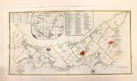
1775M11134London 1775. Very Good. Notes: An early and important map showing St. Johns Island Prince Edward Island.<br>Samuel Johannes Holland 1728 – 28 December 1801 was a Dutch-born Royal Engineer and first Surveyor General of British North America. Size : 375x710 mm 14.76x27.95 Inches Coloring: Original Hand Coloring Category: Maps Canada East Prince Edward Island; unknown
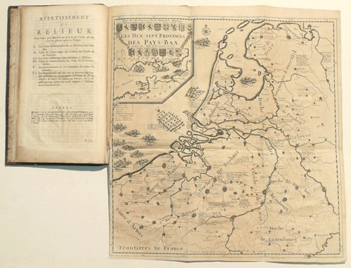
17010039521701 Amsterdam, Jean Malherbe, 1701. Grand in-4 oblong (197 X 314 mm) basane brune, dos cinq nerfs, caissons dorés ornés aux petits fers, titre doré, tranches mouchetées en rouge (Reliure de l'époque) ; (4) ff. de titre, préface, avis au relieur et errata, (1) carte dépliante, (4) planches dépliantes, (1) mappemonde dépliante, 109 pages, (1) page d'achevé d'imprimer, (1) f. de privilège. Épidermures sur les plats, fentes aux mors, coiffes arrachées, coins élimés, ors du titre en grande partie effacés. Ex-libris manuscrit ancien biffé, cachet encre violette sur le premier feuillet blanc et le titre.
1800130802Um 1800. Auf Bütten mit Wasserzeichen. 19,5 x 31,6 cm.
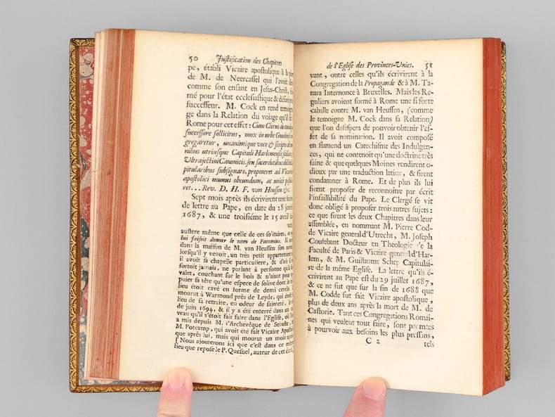
172066353Ouvrage posthume du R. Père Pasquier Quesnel, 1 vol. in-12 reliure de l'époque plein veau fauve, dos à 5 nerfs richement orné (macle et hermine alternées, chacune d'elles surmontée d'une couronne de prince du Saint-Empire), coupes et chasses ornées, s.n, 1720, XLIV pp., 1 f. n. ch., 288 pp.