6 228 résultats
1955128288Culver City CA: Columbia Pictures 1955. Draft script for the 1955 film. <br /> <br /> A crew of Air Force soldiers are called in for a difficult bombing mission on the border of Manchuria and North Korea and while the mission is successful in the end it takes a hefty toll on the group. <br /> <br /> White untitled wrappers. Title page present with credits for screenwriter Gries. 155 leaves mimeograph duplication. Pages Near Fine wrapper Near Fine bound with two gold brads. Columbia Pictures unknown
1955128288Culver City CA: Columbia Pictures 1955. Draft script for the 1955 film. <br/><br/>A crew of Air Force soldiers are called in for a difficult bombing mission on the border of Manchuria and North Korea and while the mission is successful in the end it takes a hefty toll on the group. <br/><br/>White untitled wrappers. Title page present with credits for screenwriter Gries. 155 leaves mimeograph duplication. Pages Near Fine wrapper Near Fine bound with two gold brads. Columbia Pictures unknown books
13872637-6Delmar Cengage Learning. Used - Good. Pages intact with minimal writing/highlighting. The binding may be loose and creased. Dust jackets/supplements are not included. Stock photo provided. Product includes identifying sticker. Better World Books: Buy Books. Do Good. Delmar Cengage Learning unknown
2006Q-0806310529Clearfield Co 2006-06-01. Paperback. New. In shrink wrap. Looks like an interesting title! Clearfield Co paperback
2020x-0367186543Routledge 2020. Paperback. New. 364 pages. 9.50x6.75x0.75 inches. Routledge paperback
19354-9T020Donegal Ireland: M. Harkin Publisher 1935. Hardbound. GOOD-. Tight some aging square. Green cloth covers with black lettering are faded and rubbed. Spine has softened ends and a reading crease. No dust jacket. There is the beginning of a crack on the end paper gutters. Age tanning of exterior page edges end papers and title page. Some pages with fingerprints. A small margin note on page 44. A 1937 newspaper clipping with a poem about Both-Chonais has been attached to page 87 which mentions Both-Chonais with a straight pin now rusted which has left a shadow on the facing page. "Under the nom-de-plume of "Maghtochair" Michael Harkin wrote a series of papers on the history and antiquities of Inis-Owen that first appeared in the columns of the Derry Journal. These he afterwards collected revised and published in1867 in book-form under the title "Inis-Owen Its History Traditions and Antiquities" by Maghtochair Inishowen Irish: Inis Eoghain "Island of Eoghan" County Donegal is Ireland's largest peninsula. The Introduction to this 1935 edition by F. Convery states "Mr. Harkin was familiar with the best authorities available in his day and from them he sifted with scholarly care the main facts regarding his native peninsula.Much of the folklore and allegory of the old peninsula had it not been for Michael Harkin's contribution must have been lost.". M. Harkin (Publisher) hardcover
Carta geografica tratta dal Tabularum Geographicarum contractarum libri septem di Petrus Bertius, edizione latina del 1616. L'opera contiene 219 carte che illustrano questa nuova versione della geografia del Bertius, per la prima volta pubblicata nel 1612 con le carte di Barent Langenes. Le carte derivano dal grande atlante di Mercator/Hondius, delle quali molte rappresentano una semplice riduzione. "After the death of Cornelis Claesz in 1609, Jodocus Hondius II became the new publisher of the work, composed by 7 parts in 1, with engraved title-page and 220 full-page engraved maps in text. All the maps were newly engraved and slightly larger in size, because Hondius was not able to acquire the original plates. With the new plates the work was definitely improved and enjoyed a growing demand of the public, which at that time had the choice between the Atlas Minor by Mercator and Bertius' Tabularum Geographicarum. The 219 plates, with the oval world map appearing twice, were produced to illustrate a new version of the geography of Bertius, published in 1616. According to King, their correct attribution is by Hondius, after Mercator and Hondius, taken from Bertius, who was only responsible for revising his text again" [cfr. G. King, Miniature Antique Maps]. Incisione in rame, perfette condizioni. A superior rival to the pocket Ortelius atlas appeared about 1598, under the imprint of Barent Langenes and Cornelis Claesz. Claesz also published the Tabularum Geographicarum contractarum libri septem, edition with texy by Petrus Bertius, in 1600. After the death of Cornelis Claesz in 1609, Jodocus Hondius II became the new publisher of the work, composed by 7 parts in 1, with engraved title-page and 220 full-page engraved maps in text. All the maps were newly engraved and slightly larger in size, because Hondius was not able to acquire the original plates. With the new plates the work was definitely improved and enjoyed a growing demand of the public, which at that time had the choice between the Atlas Minor by Mercator and Bertius' Tabularum Geographicarum. The 219 plates, with the oval world map appearing twice, were produced to illustrate a new version of the geography of Bertius, published in 1616. According to King, their correct attribution is by Hondius, after Mercator and Hondius, taken from Bertius, who was only responsible for revising his text again. "After the death of Cornelis Claesz in 1609, Jodocus Hondius II became the new publisher of the work, composed by 7 parts in 1, with engraved title-page and 220 full-page engraved maps in text. All the maps were newly engraved and slightly larger in size, because Hondius was not able to acquire the original plates. With the new plates the work was definitely improved and enjoyed a growing demand of the public, which at that time had the choice between the Atlas Minor by Mercator and Bertius' Tabularum Geographicarum. The 219 plates, with the oval world map appearing twice, were produced to illustrate a new version of the geography of Bertius, published in 1616. According to King, their correct attribution is by Hondius, after Mercator and Hondius, taken from Bertius, who was only responsible for revising his text again" [cf. G. King, Miniature Antique Maps]. Copperplate, in very good conditions. Koeman p. 42; King p. 96/99.
1913027188London 1913 JOHN MURRAY Hardcover
Carta tratta dalla rara raccolta di carte geografiche denominata Atlante Geografico, prima stesura delle opera dell’abate Bartolomeo Borghi, pubblicata in Siena dal Pazzini Carli. Molte delle carte, datate tra il 1788 ed il 1800, sono incise da Agostino Costa e poi successivamente inserite nell’opera Atlante generale dell'ab. Bartolommeo Borghi, pubblicato a Firenze nel 1819.Bartolomeo Borghi, che Vermiglioli (Biografia degli scrittori perugini, 1829) definisce "uno dei migliori geografi dell'Europa", nacque nel 1750 a Monte del Lago, piccola frazione del comune di Magione, in provincia di Perugia, sulle rive del Trasimeno. Ordinato sacerdote nel 1774, trascorse i primi anni del suo mandato nel paese natale, poi a Magione e quindi a Sorbello (Cortona).Appassionato studioso di geografia, applicò dapprima le sue conoscenze all'analisi delle terre a lui più familiari: nel 1770 scrisse Descrizione geografica, fisica e naturale del Lago Trasimeno (che sarà tuttavia data alle stampe per la prima volta solo nel 1821), e nel 1791 pubblicò negli atti dell'Accademia etrusca di Cortona una Dissertazione sopra l'antica geografia dell'Etruria, Umbria e Piceno, arricchendo entrambe le opere di una carta delle regioni descritte. Intanto la sua fama di cartografo, oltre che di geografo, cresceva, tanto da fargli ottenere le nomine a membro delle Accademie Cortonese e Reale di Firenze, e procurargli l'incarico, da parte di Pietro Leopoldo, di delineare la carta del catasto pubblico di Cortona e del contado di Castiglione.Nello stesso tempo gli orizzonti geografici della sua attività si allargavano sensibilmente, e se nell'Atlante Novissimo, illustrato ed accresciuto sulle osservazioni, e scoperte fatte dai più celebri e più recenti cartografi di Antonio Zatta (Venezia 1779-1785) il suo contributo fu ancora legato all'area toscana, nell'Atlante geografico che si pubblicò a Siena da Pazzini Carli tra il 1798 ed il 1800 il Borghi tracciò la maggior parte delle carte e spaziò dalle province del Sud-Est dell'Inghilterra, al Regno di Danimarca, alla Romania.Una sorta di prova generale, quest'ultima, della sua opera più importante, quell'Atlante generale dell'ab. Bartolommeo Borghi, pubblicato a Firenze nel 1819. L'Atlante, corredato da brevi descrizioni storiche, politiche, civili e naturali che introducono le carte relative ai territori afferenti a ciascun Impero o Regno illustrato, rispecchia il nuovo assetto geo-politico attuato dal Congresso di Vienna. Map taken form the very rare Atlante Geografico, the first draft of the abbot Bartolomeo Borghi, published in Siena by Pazzini Carli. Many of the mapss, dated between 1788 and 1800, are engraved by Agostino Costa and then later incorporated in the work of AB Atlante Generale di Bartolomeo Borghi, published in Florence in 1819.Bartolomeo Borghi, who Vermiglioli (Biography of writers Perugini, 1829) calls "one of the best geographers of Europe", was born in 1750 in Monte del Lago, a small fraction of the town of Mansfield, in the province of Perugia, on the shores of Lake Trasimeno. Ordained in 1774, spent the first years of his term in his hometown, then to Mansfield and then Sorbello (Cortona).A passionate student of geography, first applied his knowledge to the analysis of land more familiar to him: he wrote in 1770 Description geographical, physical and natural Lake Trasimeno (which will however be given to the press for the first time only in 1821), and 1791 published in the Proceedings of Etruscan Cortona a dissertation on the geography of ancient Etruria, Umbria and Piceno, enriching both the works of a map of the regions described. Meanwhile, his fame as a cartographer, as well as a geographer, was growing, so that he get the nomination as a member of the Royal Academies of Florence and Cortona, and give him the job, by Pietro Leopoldo, to outline the paper's public land Cortona and the county of Castiglione.At the same time the geographical horizons of its activities widened considerably, and if in the Atlas Novissimo, illustrated and amplified the observations and discoveries made by the most recent and most famous cartographer Antonio Zatta (Venice 1779-1785) his contribution was still related area of Tuscany, in the Atlas geographic monthly published in Siena by Pazzini Carli between 1798 and 1800 the villages drew most of the cards and spaced from the provinces of South-East of England, the Kingdom of Denmark, Romania.A sort of dress rehearsal, the latter, his most important work, quell'Atlante General of AB. Bartolomeo Borghi, published in Florence in 1819. The Atlas, accompanied by brief descriptions of historical, political, civil and natural to introduce the papers relating to the territories belonging to each United Empire or illustrated, reflects the new geo-political structure implemented by the Congress of Vienna.
Carta tratta da " Atlas géographique dressé sur les meilleures cartes de ces derniers terms.." edito a Venezia nel 1801. Acquaforte, coloritura coeva, alcune ossidazioni per il resto in ottimo stato di conservazione. Molto Rara. Map taken from "Atlas géographique dressé sur les cartes de ces derniers Meilleures terms .." published in Venice in 1801. Etching, original outline colour, some foxing otherwise in excellent condition. Very Rare.
Carta geografica tratta dal raro "Introduction a la Geographie" di G. Louis Le Rouge, pubblicato a Parigi tra il 1747 ed il 1756, a "Paris, chez l'Auteur, Prault le fils, la Veuve Robinot, 1756".L'opera, che l'autore definisce come "Atlas Nouveau Portatif à l'Uage des Militaires et du Voyageur', contiene 86 carte geografiche.Incisione in rame, coloritura coeva dei contorni, in ottimo stato di conservazione. Map taken from the "Introduction a la Geographie" published from 1747 and 1756, printed in "Paris, chez l'Auteur, Prault le fils, la Veuve Robinot, 1756".The work, which the author defines as "Atlas Nouveau Portatif à l'Usage des Militaires et du Voyageur", contains 86 maps.Copperplate with original outline colour, very good conditions.
1991x-1441930949Springer New York 1991. Paperback. New. 2nd edition. 404 pages. 9.25x6.25x1.00 inches. Springer New York paperback
SKU0199978Cengage Learning 2016-01-14. Paperback. Good. Textbook May Have Highlights Notes and/or Underlining BOOK ONLY-NO ACCESS CODE NO CD Ships with Tracking Cengage Learning paperback
2026__1119716780John Wiley & Sons Inc 2026. Hardcover. New. 3rd ed edition. 1008 pages. 8.60x1.90x11.00 inches. John Wiley & Sons Inc hardcover
47842644like new. unknown
1992Q-1558211454Lyons Pr 1992-05-01. Hardcover. New. In shrink wrap. Looks like an interesting title! Lyons Pr hardcover
1995Q-0828009449Review and Herald Pub 1995-01-01. Paperback. New. In shrink wrap. Looks like an interesting title! Review and Herald Pub paperback
1972007617Shannon Ireland: Irish University Press 1972. 403pp. fully documented history of the Jews of Ireland and their descendants abroard shows the antiquity of the Jewish connection with Ireland and traces the continuity of Jewish settlement there from the eleventh century to the beginning of the twentieth century. Material for the book was gathered chiefly from the nineteenth-century minute books of the Dublin Hebrew Congregation and from old directories newspapers and magazines epitaphs and obituaries wills and will abstracts in Somerset House in London and in the Genealogical Office in Dublin Castle and from early printed sources and manuscripts in Dublin libraries. Marked inside front cover and spine. First Edition. Cloth. Very Good/No Jacket. 8vo - over 7¾" - 9¾" tall. Ex-Library. Irish University Press hardcover
1828124619London: Geo. Virtue 1828. 1st edition. Very Good. octavo. cloth binding 3-780 xiiipp. engraved pls. index Inc. 40 nice engraved plates. Lacks title-page & prelims. commencing at page 3. Re-bound in black buckram. With all faults a nice copy of a scarce item (Geo. Virtue) hardcover
1997010964Provo Utah U.S.A.: Ancestry Inc 1997. 668pp/maps. Guide to locating Irish family records. Clean excellent condition. 1st Printing. Cloth. Near Fine/Near Fine. 4to - over 9¾" - 12" tall. Ancestry Inc Hardcover
First Edition, 12mo, signature and blind stamp address on half-title, a water stain on first 3 leaves, with the final advertiszement leaf, xviii, [2], 266, [2] pp., orig. cloth-backed boards, uncut, inner hinges cracked, printed paper label. Bradshaw, 7909.
ria9781780769769_inpHardback. New. New Book; Fast Shipping from UK; Not signed; Not First Edition; Between the nineteenth century and the mid-twentieth century television transformed from an idea to an institution. In Gender and Early Television Sarah Arnold traces women’s relationship to the new medium of television across this p hardcover
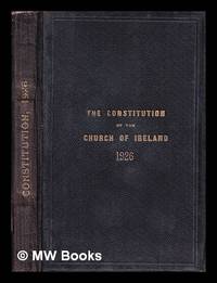
1926323797Dublin : Hodges Figgis 1926. 1st edition. Hardcover. SIGNED reports loosely inserted. Good copy in the original gilt-blocked cloth. Spine bands and panel edges somewhat bumped and rubbed as with age. Remains quite well-preserved overall. Physical description: 286 p; 21cm. Subjects: Church of Ireland. Constitution of the Church of Ireland. Dublin : Hodges, Figgis hardcover
2010SKU0628724CABI 2010-12-02. paperback. New. 7x1x9. New Textbook Ships with Tracking CABI paperback
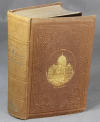
185930296New York: S. A. Rollo & Co 1859. First edition 8vo pp. iii-xviii 13- 531 1; inserted color lithograph frontispiece and title-p. double-page lithograph map 69 wood-engraved plates; original pictorial brown cloth gilt-stamped on upper cover and spine; the whole a little dull two signatures extended else very good. Smith American Travellers Abroad I-2: "Big and gaudy this book epitomizes the type of traveler and travel caricatured in Around the World in Eighty Days." <br/><br/> S. A. Rollo & Co hardcover books