TORGA Miguel,Livre Rare Book

9 219 résultats
57494Traduction de Claire Cayron, Chandaigne, 2017, 376 pp., broché, poinçon sur la quatrième de couverture, très bon état général.
75412Coll. "Ibériques", Paris, éd. José Corti, janvier 1994, Première Edition en français, in-8, cartonnage souple à rabats, couv. éd., 352 pp., table, en partie non coupé, Très bons contes sur le Portugal de Miguel Torga, interdit dans son pays dès sa parution. Très bon état
1938RO80012734SORLOT. 1938. In-12. Broché. Bon état, Couv. légèrement passée, Dos satisfaisant, Non coupé. 77 pages.. . . . Classification Dewey : 946-Espagne, Portugal
1999R300300832Aldeasa. 1999. In-8. Broché. Bon état, Couv. convenable, Dos satisfaisant, Intérieur frais. 72 pages - nombreuses photos en couleurs dans et hors texte. Plats contrepliés en un rabat, plans en couleurs sur les contreplats.. . . . Classification Dewey : 946-Espagne, Portugal
1979RO20206986BALLAND/ FRANCE ADEL. 1979. In-8. Broché. Bon état, Couv. convenable, Dos satisfaisant, Intérieur frais. 310 pages. . . . Classification Dewey : 946-Espagne, Portugal
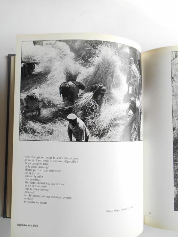
19891656711989 LES PORTUGAIS.Berhtramm, 1989 , in4°(24x30) relié,jaquette illustrée, 239pp.Plus de 200 photos à pleine page par de nombreux photographes (voir photos).Jacquette jaunie.Ouvrage en très bon état.
22547Paris, Corti 1996, 190x140mm, 141pages, broché. Bel exemplaire.
199952928BBBerlin:, Wagenbach, 1999. 8°. 136 S., Pappband (gut erhalten) (=Quartbuch)
Vitoria: H. Fournier, S. A. , 1968. Plastic. 12mo. 18 pages. All pictures. SUBJECT (S) Synagogue architecture - Spain - Toledo. OCLC lists 4 copies worldwide (Harvard, Univ of Florida, Yeshiva Univ, Hebrew Union Col) . Minor bumping to edges. Small amounts of wear to edges of photos. In Very Good condition. (SEF-36-2).
Toledo : Publicaciones del Centro Universitario de Toledo, 1973. Cloth. 8vo. 131 pages. Book 1. Contains illustrations. In Spanish. Sections include: La Sinagoga by Francisco Cantera Burgos; La Legislacion antijudia de los visigodos by José Luis Lacave Riaño; Los Barrios Judios de Toledo by Julio Porres Martin-Cleto; Los Judios Castellanos en la Primera Mitad Del Siglo XIV by Salvador de Moxó y Ortiz de Villajos; La Juderia Toledaa en la Guerra Civil de Pedro I y Enrique II; Del Problema Judio Al Problema Converso by Eloy Benitto Ruano; El Bachiller Palma, Autor de una Obra Desconocida en Favor de Los Conversos by Ramón Gonzálvez Ruiz; La Sociedad Conversa Toledana en la Primera Mitad del Siglo XVI by José-Carlos Gómez-Menor Fuentes; Costumbres, Fiestas y Ritos de los Judios Toledaos a Fines Del Siglo XV by Pilar León Tello; [&] Un Judeoconverso de 1492 by José-Carlos Gómez-Menor Fuentes. SUBJECT (S) : Jews - Spain - Toledo - Congresses; Joden. Raised bands with leather labels and gilt lettering. Staining on page 77. In Very Good condition. (SEF-5-1) .
056036Porto Campo das Letras 2008 in 8 (23,5x15,5) 1 volume broché, couverture à rabats, 422 pages [1]. Nicolau Tolentino de Almeida, Lisbonne 1740 - 1811, le plus grand poète satirique portugais du XVIIIème siècle. Collection '' Obras Classicas de Litteratura Portuguesa, Seculo XVIII. Très bel exemplaire ( Photographies sur demande / We can send pictures of this book on simple request )
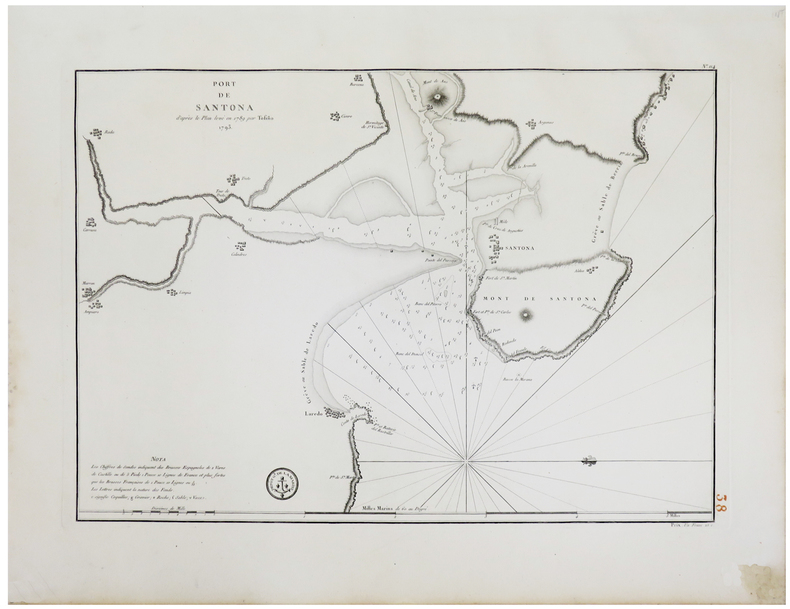
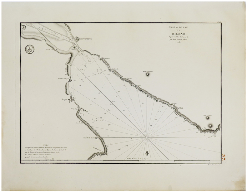
- le carte edite dal Depot de la Marine -Per contrastare lo strapotere navale della flotta inglese re Luigi XIV comprese la necessita di dotare le sue navi di carte nautiche in grado di renderle competitive con la marina antagonista. Un primo tentativo si ebbe con il Neptune Francais del 1693, ma solo agli inizi del diciottesimo secolo iniziò una grande campagna di rilievo delle coste del Mediterraneo e di altri mari, che portò alla realizzazione di numerose mappe, raccolte nel Dépot des Cartes et Planes de la Marine del 1720. Tuttavia il fondatore dell’idrografia francese può essere considerato a tutti gli effetti Jacques Nicolas Bellin (1703-1772) che per oltre cinquant’anni fu al servizio della Marina quale ingegnere e cartografo, tanto che gli venne assegnato il titolo quale primo “Ingegnere Idrografo della Marina” e quindi addirittura quello di “Idrografo Reale”. Durante il suo servizio gli furono commissionati i rilievi delle coste francesi prima e successivamente quelle di praticamente tutto il mondo conosciuto. La sua produzione fu immensa e le sue carte nautiche, di grande qualità, apparvero in più edizioni fino oltre la fine del diciottesimo secolo. Questo grande fondo cartografico diede vita alla produzione ed alla vendita di carte navali, prima basate su quelle del Bellin, successivamente ampliate e migliorate da altri ingegneri di marina, sia francesi che non. Le carte nautiche venivano vendute separatamente e recavano tutte l’inconfondibile timbro con l’ancora e le corone (quando regnava la monarchia) del Depot Generale de la Marine. Raccolte delle stesse carte venivano invece pubblicate sotto il nome di Neptune Francois, monumentale opera che ebbe numerosissime ristampe fino alla metà del secolo successivo. Il seguente gruppo di carte è tratto da un volume denominato Neptune de la Méditerranée, riguardante il Mediterraneo. Dove possibile sono indicati il nome del cartografo, spesso un capitano di vascello, e la data della carta. Incisioni in rame, in eccellente stato di conservazione, salvo controindicazioni.Carta nautica del golfo di Gibilterra, ridotta da quella disegnata nel 1786 dal celebre idrografo spagnolo Vicent Tofino de San Miguel (1732-95). To fight against the powerful English fleet, king Louis XIV decided to endow his ships with nautical charts that could enable them to compete with the enemy. The Neptune Francais, in 1693, can be considered a first attempt, but it was only at the beginning of the Eighteenth century that a campaign of study of the Mediterranean coasts and sea was started, leading to the realization of maps, collected in the Dépot des Cartes et Planes de la Marine in 1720. Nevertheless, the real founder of French hydrography can be considered Jacques Nicolas Bellin (1703-1772), who served for more than fifty years the navy as engineer and cartographer, which win him first the title of "Hydrographer Engineer of the Navy" and then of "Royal Hydrographer". His first commitment was to study the French coasts fisrt, and then of the whole world. His production was massive and his nautical charts, due also to their quality, were published in many edition until the end of the XVIII century. This allowance led to the production and the selling of sea charts, at first based on those from Bellin, then developed by other navy engineers. The sea charts were sold separately, all bearing the stamp with the anchor and the crowns of the Depot Generale de la Marine. Collections of the same charts have been published under the name of Neptune Francois, a monumental work which has been reissued many times until the half of the following century. The following group of charts is taken from a volume entitled Neptune de la Méditerranée, about the Mediterranean sea. Where possible, there is the name of the cartographer, very often the captain of the ship, and the date of the chart.
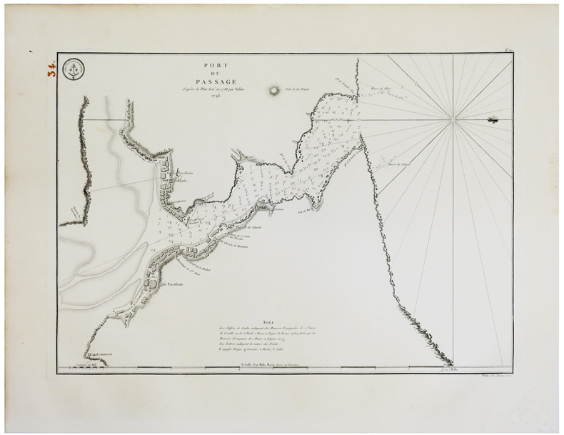
- le carte edite dal Depot de la Marine -Per contrastare lo strapotere navale della flotta inglese re Luigi XIV comprese la necessita di dotare le sue navi di carte nautiche in grado di renderle competitive con la marina antagonista. Un primo tentativo si ebbe con il Neptune Francais del 1693, ma solo agli inizi del diciottesimo secolo iniziò una grande campagna di rilievo delle coste del Mediterraneo e di altri mari, che portò alla realizzazione di numerose mappe, raccolte nel Dépot des Cartes et Planes de la Marine del 1720. Tuttavia il fondatore dell’idrografia francese può essere considerato a tutti gli effetti Jacques Nicolas Bellin (1703-1772) che per oltre cinquant’anni fu al servizio della Marina quale ingegnere e cartografo, tanto che gli venne assegnato il titolo quale primo “Ingegnere Idrografo della Marina” e quindi addirittura quello di “Idrografo Reale”. Durante il suo servizio gli furono commissionati i rilievi delle coste francesi prima e successivamente quelle di praticamente tutto il mondo conosciuto. La sua produzione fu immensa e le sue carte nautiche, di grande qualità, apparvero in più edizioni fino oltre la fine del diciottesimo secolo. Questo grande fondo cartografico diede vita alla produzione ed alla vendita di carte navali, prima basate su quelle del Bellin, successivamente ampliate e migliorate da altri ingegneri di marina, sia francesi che non. Le carte nautiche venivano vendute separatamente e recavano tutte l’inconfondibile timbro con l’ancora e le corone (quando regnava la monarchia) del Depot Generale de la Marine. Raccolte delle stesse carte venivano invece pubblicate sotto il nome di Neptune Francois, monumentale opera che ebbe numerosissime ristampe fino alla metà del secolo successivo. Il seguente gruppo di carte è tratto da un volume denominato Neptune de la Méditerranée, riguardante il Mediterraneo. Dove possibile sono indicati il nome del cartografo, spesso un capitano di vascello, e la data della carta. Incisioni in rame, in eccellente stato di conservazione, salvo controindicazioni.Grande carta nautica dello stretto di Gibilterra, raffigurante le coste spagnole da Cadice a Gibilterra e quelle del Marocco da Arzille a Punta Cala Mazari. To fight against the powerful English fleet, king Louis XIV decided to endow his ships with nautical charts that could enable them to compete with the enemy. The Neptune Francais, in 1693, can be considered a first attempt, but it was only at the beginning of the Eighteenth century that a campaign of study of the Mediterranean coasts and sea was started, leading to the realization of maps, collected in the Dépot des Cartes et Planes de la Marine in 1720. Nevertheless, the real founder of French hydrography can be considered Jacques Nicolas Bellin (1703-1772), who served for more than fifty years the navy as engineer and cartographer, which win him first the title of "Hydrographer Engineer of the Navy" and then of "Royal Hydrographer". His first commitment was to study the French coasts fisrt, and then of the whole world. His production was massive and his nautical charts, due also to their quality, were published in many edition until the end of the XVIII century. This allowance led to the production and the selling of sea charts, at first based on those from Bellin, then developed by other navy engineers. The sea charts were sold separately, all bearing the stamp with the anchor and the crowns of the Depot Generale de la Marine. Collections of the same charts have been published under the name of Neptune Francois, a monumental work which has been reissued many times until the half of the following century. The following group of charts is taken from a volume entitled Neptune de la Méditerranée, about the Mediterranean sea. Where possible, there is the name of the cartographer, very often the captain of the ship, and the date of the chart.
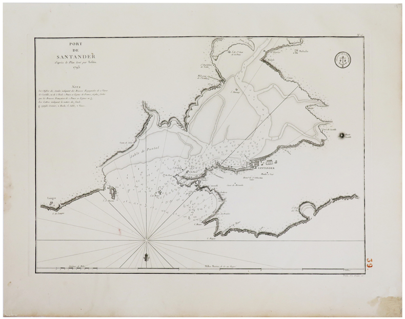
- le carte edite dal Depot de la Marine -Per contrastare lo strapotere navale della flotta inglese re Luigi XIV comprese la necessita di dotare le sue navi di carte nautiche in grado di renderle competitive con la marina antagonista. Un primo tentativo si ebbe con il Neptune Francais del 1693, ma solo agli inizi del diciottesimo secolo iniziò una grande campagna di rilievo delle coste del Mediterraneo e di altri mari, che portò alla realizzazione di numerose mappe, raccolte nel Dépot des Cartes et Planes de la Marine del 1720. Tuttavia il fondatore dell’idrografia francese può essere considerato a tutti gli effetti Jacques Nicolas Bellin (1703-1772) che per oltre cinquant’anni fu al servizio della Marina quale ingegnere e cartografo, tanto che gli venne assegnato il titolo quale primo “Ingegnere Idrografo della Marina” e quindi addirittura quello di “Idrografo Reale”. Durante il suo servizio gli furono commissionati i rilievi delle coste francesi prima e successivamente quelle di praticamente tutto il mondo conosciuto. La sua produzione fu immensa e le sue carte nautiche, di grande qualità, apparvero in più edizioni fino oltre la fine del diciottesimo secolo. Questo grande fondo cartografico diede vita alla produzione ed alla vendita di carte navali, prima basate su quelle del Bellin, successivamente ampliate e migliorate da altri ingegneri di marina, sia francesi che non. Le carte nautiche venivano vendute separatamente e recavano tutte l’inconfondibile timbro con l’ancora e le corone (quando regnava la monarchia) del Depot Generale de la Marine. Raccolte delle stesse carte venivano invece pubblicate sotto il nome di Neptune Francois, monumentale opera che ebbe numerosissime ristampe fino alla metà del secolo successivo. Il seguente gruppo di carte è tratto da un volume denominato Neptune de la Méditerranée, riguardante il Mediterraneo. Dove possibile sono indicati il nome del cartografo, spesso un capitano di vascello, e la data della carta. Incisioni in rame, in eccellente stato di conservazione, salvo controindicazioni.Carta nautica della città spagnola sulla Costa Blanca, ridotta sulla base di quella realizzata dal Tofino nel 1788. To fight against the powerful English fleet, king Louis XIV decided to endow his ships with nautical charts that could enable them to compete with the enemy. The Neptune Francais, in 1693, can be considered a first attempt, but it was only at the beginning of the Eighteenth century that a campaign of study of the Mediterranean coasts and sea was started, leading to the realization of maps, collected in the Dépot des Cartes et Planes de la Marine in 1720. Nevertheless, the real founder of French hydrography can be considered Jacques Nicolas Bellin (1703-1772), who served for more than fifty years the navy as engineer and cartographer, which win him first the title of "Hydrographer Engineer of the Navy" and then of "Royal Hydrographer". His first commitment was to study the French coasts fisrt, and then of the whole world. His production was massive and his nautical charts, due also to their quality, were published in many edition until the end of the XVIII century. This allowance led to the production and the selling of sea charts, at first based on those from Bellin, then developed by other navy engineers. The sea charts were sold separately, all bearing the stamp with the anchor and the crowns of the Depot Generale de la Marine. Collections of the same charts have been published under the name of Neptune Francois, a monumental work which has been reissued many times until the half of the following century. The following group of charts is taken from a volume entitled Neptune de la Méditerranée, about the Mediterranean sea. Where possible, there is the name of the cartographer, very often the captain of the ship, and the date of the chart. Sea chart of the Spanish city on the Costa Blanca, based onl Tofino's example of 1788.
1793LBW-18031793. 372 x 527 mm.
1793LBW-18041793. 372 x 526 mm.
1793LBW-18061793. 369 x 525 mm.
1793LBW-18071793. 367 x 523mm.
6371Paris, Fayard, 1960 15 x 19, 365 pp., cartes itinéraires, broché, très bon état
30451London Jonathan Cape 1926 in 12 (18,5x12) 1 volume reliure cartonnée de l'éditeur, dos toilé blanc, étiquette de titre imprimée contrecollée sur le dos et sur le plat supérieur, 95 pages, avec des illustrations hors-texte en noir et blanc, et un grand tableau dépliant (Folding diagram). (Second impression). Bel exemplaire ( Photographies sur demande / We can send pictures of this book on simple request )
1967RO20014088Cerres. 1967. In-8. Relié. Etat d'usage, Couv. convenable, Mors fendus, Intérieur bon état. 196p illustré de photos noir et blanc hors texte, cartonné, mors fendus sur les coiffes.Taches d'encre sur le tranche et quelques pages.Cartes sur la page de garde.. . . . Classification Dewey : 946-Espagne, Portugal
RO80035831TISNE Pierre, HATIER A.. Non daté. In-8. Cartonnage d'éditeurs. Bon état, Couv. fraîche, Dos impeccable, Intérieur frais. 559 pages. Nombreuses illustrations en héliogravures dans le texte et hors-texte. Quelques planches d'illustrations en couleurs, hors-texte. Reliure toilée rouge. Jaquette défraichie. Nombreuses notes au stylo dans le texte.. Avec Jaquette. . . Classification Dewey : 946-Espagne, Portugal
ROD0046732GAUTIER. ND. In-12. Broché. A relier, Couv. défraîchie, Dos abîmé, Quelques rousseurs. 300pp. Absence du 2nd plat de couverture. . . . Classification Dewey : 946-Espagne, Portugal
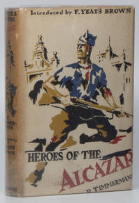
193702236New York: Charles Scribner's Sons 1937. First edition. Small octavo. Red cloth titled in yellow to spine; 215 1 pp.; map; photographic plates; dust jacket. Published while the Spanish Civil War still raged this book sympathetically portrays the successful defence of the Alcázar of Toledo by Colonel Moscardó and his vastly outnumbered troops. A propaganda coup for Spanish nationalists the defence of the Alcázar became one of the most enduring symbols of resistance toward Spanish republicanism. A Near Fine copy in a Very Good unclipped dust jacket. Spine browned; some light chipping to spine ends and general rubbing. Charles Scribner's Sons hardcover
1993LFA-126710851Un ouvrage de 196 pages, format 150 x 220 mm, broché couverture couleurs, publié en 1993, Pierre Téqui Editeur, bon état