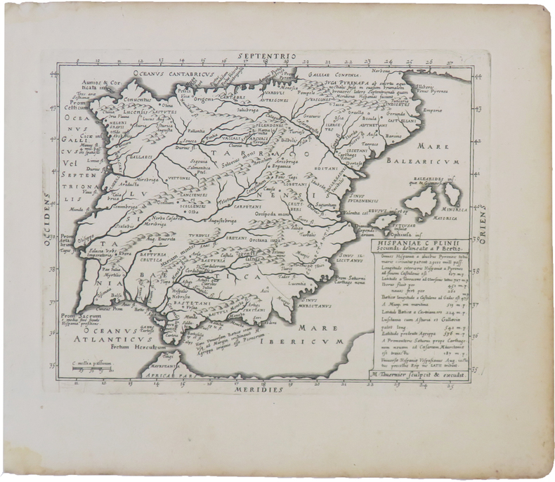
BERTIUS (Petrus).Livre Rare Book
9 209 résultats
LBW-3966Paris, Melchior Tavernier, 1628. 143 x 186 mm.
- EDIZIONE ORIGINALE, COLORITURA COEVA -Importante e decorativa mappa tratta dal "Nuovo Atlante Geografico Universale delineato sulle ultime osservazioni", edito a Roma dal 1792 fino al 1801, opera che la Calcografia Camerale commissionò al Cassini al fine di sostituire l’ormai obsoleto "Mercurio Geografico".Giovanni Maria Cassini, Chierico Regolare Somasco fu geografo e cartografo, ma anche intagliatore di architetture e prospettive - uno dei migliori discepoli di Giovanni Battista Piranesi - Cassini fu uno degli ultimi sferografi italiani del Settecento ed i suoi globi ebbero una notevole diffusione, come pure questo "Nuovo Atlante Geografico".Incisione in rame, coloritura coeva dei contorni, leggere bruniture, per il resto in ottimo stato di conservazione. L'Atlante del Cassini fu ristampato dalla Calcografia Camerale nel primo quarto del XIX secolo, prima del 1839. Solo gli esemplari di prima edizione come questo sono stampati su carta vergata coeva e sono colorati a mano in epoca. Le tirature del XIX secolo sono già su carta meccanica, priva di vergelle, e generalmente in bianco e nero. - FIRST EDITION, CONTEMPORARY OUTLINE COLOUR -The Italian painter and engraver, Giovanni Maria Cassini, produced this splendid map of as part of his epic three-volume atlas. Published in: Nuovo atlante geografico universale delineato sulle ultime osservazioni. Roma, Calcografia camerale, 1792-1801.Cassini was geographer and cartographer but he was also good at engraving architectural items and perspectives – he was one of the best disciples Giovanni Battista Piranesi had. Moreover, Cassini was one of the last artists to engrave spheres in the XVIII century and his globes were quite famous and widespread, and realized the most important Italian Atlas of the XVIII century; his maps always bear a cartouche, extremely rich in colours and details. Copperplate with fine original hand colour, some foxing, otherwise in very good condition.The Cassini's Atlas was reprinted by the Calcografia Camerale in the first quarter of XIXth century (before 1839). Only the first edition of the atlas is printed on contemporary laid paper, while the late issue are on XIXth century paper and often without colour.
- EDIZIONE ORIGINALE, COLORITURA COEVA -Importante e decorativa mappa tratta dal "Nuovo Atlante Geografico Universale delineato sulle ultime osservazioni", edito a Roma dal 1792 fino al 1801, opera che la Calcografia Camerale commissionò al Cassini al fine di sostituire l’ormai obsoleto "Mercurio Geografico".Giovanni Maria Cassini, Chierico Regolare Somasco fu geografo e cartografo, ma anche intagliatore di architetture e prospettive - uno dei migliori discepoli di Giovanni Battista Piranesi - Cassini fu uno degli ultimi sferografi italiani del Settecento ed i suoi globi ebbero una notevole diffusione, come pure questo "Nuovo Atlante Geografico".Incisione in rame, coloritura coeva dei contorni, leggere bruniture, per il resto in ottimo stato di conservazione. L'Atlante del Cassini fu ristampato dalla Calcografia Camerale nel primo quarto del XIX secolo, prima del 1839. Solo gli esemplari di prima edizione come questo sono stampati su carta vergata coeva e sono colorati a mano in epoca. Le tirature del XIX secolo sono già su carta meccanica, priva di vergelle, e generalmente in bianco e nero. - FIRST EDITION, CONTEMPORARY OUTLINE COLOUR -The Italian painter and engraver, Giovanni Maria Cassini, produced this splendid map of as part of his epic three-volume atlas. Published in: Nuovo atlante geografico universale delineato sulle ultime osservazioni. Roma, Calcografia camerale, 1792-1801.Cassini was geographer and cartographer but he was also good at engraving architectural items and perspectives – he was one of the best disciples Giovanni Battista Piranesi had. Moreover, Cassini was one of the last artists to engrave spheres in the XVIII century and his globes were quite famous and widespread, and realized the most important Italian Atlas of the XVIII century; his maps always bear a cartouche, extremely rich in colours and details. Copperplate with fine original hand colour, some foxing, otherwise in very good condition.The Cassini's Atlas was reprinted by the Calcografia Camerale in the first quarter of XIXth century (before 1839). Only the first edition of the atlas is printed on contemporary laid paper, while the late issue are on XIXth century paper and often without colour.
- EDIZIONE ORIGINALE, COLORITURA COEVA -Importante e decorativa mappa tratta dal "Nuovo Atlante Geografico Universale delineato sulle ultime osservazioni", edito a Roma dal 1792 fino al 1801, opera che la Calcografia Camerale commissionò al Cassini al fine di sostituire l’ormai obsoleto "Mercurio Geografico".Giovanni Maria Cassini, Chierico Regolare Somasco fu geografo e cartografo, ma anche intagliatore di architetture e prospettive - uno dei migliori discepoli di Giovanni Battista Piranesi - Cassini fu uno degli ultimi sferografi italiani del Settecento ed i suoi globi ebbero una notevole diffusione, come pure questo "Nuovo Atlante Geografico".Incisione in rame, coloritura coeva dei contorni, leggere bruniture, per il resto in ottimo stato di conservazione. L'Atlante del Cassini fu ristampato dalla Calcografia Camerale nel primo quarto del XIX secolo, prima del 1839. Solo gli esemplari di prima edizione come questo sono stampati su carta vergata coeva e sono colorati a mano in epoca. Le tirature del XIX secolo sono già su carta meccanica, priva di vergelle, e generalmente in bianco e nero. - FIRST EDITION, CONTEMPORARY OUTLINE COLOUR -The Italian painter and engraver, Giovanni Maria Cassini, produced this splendid map of as part of his epic three-volume atlas. Published in: Nuovo atlante geografico universale delineato sulle ultime osservazioni. Roma, Calcografia camerale, 1792-1801.Cassini was geographer and cartographer but he was also good at engraving architectural items and perspectives – he was one of the best disciples Giovanni Battista Piranesi had. Moreover, Cassini was one of the last artists to engrave spheres in the XVIII century and his globes were quite famous and widespread, and realized the most important Italian Atlas of the XVIII century; his maps always bear a cartouche, extremely rich in colours and details. Copperplate with fine original hand colour, some foxing, otherwise in very good condition.The Cassini's Atlas was reprinted by the Calcografia Camerale in the first quarter of XIXth century (before 1839). Only the first edition of the atlas is printed on contemporary laid paper, while the late issue are on XIXth century paper and often without colour.
Questa tavola è parte del libro di Isaac Commelin "Fredrick Hendrick Van Nassauw Prince Van Orangien Zyn Leven En Bedryf."Un libro molto bello che descrive la vita e le campagne navali e militari condotte da Frederick Hendrick Van Nassau, Principe di Orange, e illustrato con incisioni in rame raffiguranti le varie battaglie e assedi coinvolti nella lotta per controllare la ricchezza del Sud America e la guerra nei Paesi Bassi contro il dominio spagnolo.Incisione in rame, in buono stato di conservazione. The plate is part of the book by Isaac Commelin "Fredrick Hendrick Van Nassauw Prince Van Orangien Zyn Leven En Bedryf."A very fine book describing the life and naval & military campaigns waged by Fredrick Hendrick Van Nassau, Prince of Orange, and illustrated with copper engravings depicting the various battles and sieges involved in the struggle to control the wealth of South America, and the war in the Netherlands against Spanish dominion. On the death of his brother Maurice in 1625, Frederick Henry succeeded him in the stadtholderates of the five provinces of Holland, Zeeland, Utrecht, Overijssel and Guelders, and in the important posts of captain and admiral-general of the Union. Frederick Henry proved himself almost as good a general as his brother, and a far more capable statesman and politician. For twenty-two years he remained at the head of government in the United Provinces, and in his time the power of the stadtholderate reached its highest point. The 'Period of Frederick Henry,' as it is usually styled by Dutch writers, is generally accounted the golden age of the republic. It was marked by great military and naval triumphs, by world-wide maritime and commercial expansion, and by a wonderful outburst of activity in the domains of art and literature. The chief military exploits of Frederick Henry were the sieges and captures of Grol in 1627, 's-Hertogenbosch in 1629, of Maastricht in 1632, of Breda in 1637, of Sas van Gent in 1644, and of Hulst in 1645. During the greater part of his administration the alliance with France against Spain was the pivot of Frederick Henry's foreign policy. Also mentioned in this volume is the Dutch Admiral and folk hero Pieter Pietersen Hein (November 25, 1577- June 18, 1629). In 1623, he became vice-admiral of the new Dutch West India Company (WIC) and sailed to the West Indies the following year. In Brazil, he briefly captured the Portuguese settlement of Salvador, personally leading the assault on the sea fortress of that town. Then he attacked Luanda in Angola but failed to capture the city. In a subsequent raid in 1627 to retake Bahia, he failed but captured over thirty Portuguese ships with a large cargo of sugar. He also captured half of the Spanish treasure fleet in Matanzas Bay, Cuba and the resulting booty funded the Dutch army and allowed the subsequent capture of the town of S'Hertogenbosch.
Carta geografica tratta dal" Oorlogs tablessen, Oft uytgesochte Kaarten". La carta è circondata dalle piante delle principali città della regione. Incisione in rame, coloritura coeva, in ottimo stato di conservazione. Daniel de la Feuille, a Frenchman from Sedan, settled in Amsterdam about 1683 and built up a business there as an engraver, art dealer and book and map publisher.A beautiful and unkommon map taken from "Oorlogs tablessen, Oft uytgesochte Kaarten", published in Amsterdam at the end of 17th century. Copper engraving with fine original colour, in very good condition.
1379040Cologne: Chez les hétitiers de Pierre Marteau, 1711 2 vol. in-12, vol. 2: 240-(10) (tables des vol. 1 et 2), 6 planches gravées dont 2 dépliantes; vol. 3: (4)-270 pages. Re.l veau d'ép., dos à 5 nerfs, lég. usures, coiffe sup. du vol. 2 arrasée, travail de ver sur le plat sup. du vol. 2, autrement exemplaire en bon état, intérieur frais. Chaque volume est complet en soi: Le deuxième tome est une relation de l'Inquisition qui avait parue anonymement en 1687-88, ici dans sa version la plus complète, revue, corrigée et augmentée avec 6 planches. Le troisième tome traite des moeurs religieuses des Indiens.
Acquaforte, 1656 circa, con coloritura coeva dei contorni, in buone condizioni.Esemplare del secondo stato di due, con l’imprint di Jacques Lagniet e la data del 1661.La mappa proviene dal rarissimo foglio intitolato “L’Europe par P. Du Val Geographe du Roy”, dal quale è stato ritagliato all’epoca - come anche certificato dalle antiche iscrizioni a inchiostro su alcune delle mappe - venendo applicato su un supporto di carta contemporanea, a formare un piccolo atlante in-sedicesimo oblungo.Non abbiamo trovato bibliografia su questo foglio d’Europa, pertanto ci riferiamo alla scarsa letteratura sui fogli che rappresentano gli altri continenti.Secondo Philip Burden (che descrive la carta dell’America), lo scopo di questa rara curiosità cartografica di Pierre Duval non è noto. Fa parte di un insieme di quattro tavole raffiguranti i continenti. Può essere datato, per motivi cartografici, all’incirca nel 1656. Burden descrive un solo esemplare di primo stato e due prove con l’indirizzo di Lagniet.La mappa dell'Asia è stata recentemente descritta da Jason Hubbard, che elenca un solo esemplare di primo stato e 5 di secondo (cfr. Japoniae Insulae, The Mapping of Japan, p. 201).Richard Betz descrive 3 stati del foglio dell’Africa: senza la data, con l’imprint di Jacques Lagniet e la data del 1661, e con tracce di cancellazione sui suoi indirizzi (cfr Betz, The Mapping of Africa, pp. 294, 295). Elenca un solo esemplare di primo stato, tre copie di quello stampato da Lagniet e tre del foglio con l’indirizzo abraso. Di un secondo stato del foglio del continente europeo, siamo stati di censire solo l’esemplare conservato presso la Bibliotheque National de France, unica istituzione che vanta nella propria raccolta tutti e quattro i fogli dei continenti di Pierre Duval e Jacques Lagniet. Etching, circa 1656, with contemporary outline colour, good condition.Example of the second state, with the imprint of Jacques Lagniet and the date 1661.The map comes from the very rare sheet entitled “L’Europe Par le Sieur Du Val Geographe Ord. du Roy”, from which it was cut at the time and laid down on contemporary laid paper support, to form a small atlas, as certified by the ancient ink inscriptions on some of the maps.We have not found bibliography on this sheet of Europe, we therefore refer to the scarce literature on the sheets representing the other continents.According with Philip Burden “The purpose of this rare curiosity by Pierre Duval is not known. It forms part of a set of the four known continents. It can be dated to apporximately 1656 […] The second state bears the additional imprint of Jacques Lagniet and the date 1661” (cf. Burden, The Mapping of North America, pp. 417-418, n. 322). The map of Asia is recently described by Jason Hubbard: “This miniature map of Japan is on a sheet of maps of Asia. Besides the map of the Asian continent there are 17 detailed maps including Turkey, the Holy Land, Georgia and Arabia. […] This map was issued as a loose sheet of Asia maps; similar maps are known for Africa, America and Europe” (cf. Japoniae Insulae, The Mapping of Japan, p. 201).Richard Betz describes 3 states of the broadsheet of Africa: without the date, with the imprint of Jacques Lagniet and the date 1661, and with traces of erasure on his addres (cf. Betz, The Mapping of Africa, pp. 294, 295). According Hubbard the third state of the map of Asia is only an assumption.Of a second state of the broadsheet of Europe, we are able to find only the example at the Bibliotheque National de France. cf. J. Hubbard, Japoniae Insulae. The Mapping of Japan, pp. 199-201, n. 28; cf. Burden, The Mapping of America, n. 322, II/II; cf. Pastoureau (1984) p. 136; cf. Betz, The Mapping of Africa, pp. 294, 295, n. 85.
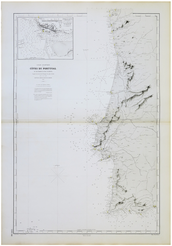
1874LBW-5713Dépôt des Cartes et Plans de la Marine, 1874-1890. 950 x 607 mm.
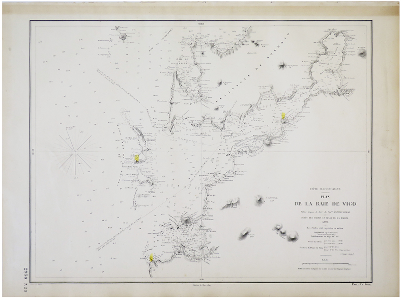
1870LBW-5711Dépôt des Cartes et Plans de la Marine, 1870-1890. 474 x 609 mm.
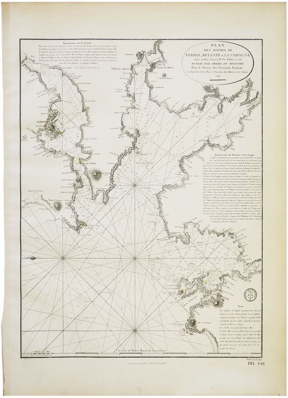
1792LBW-5709Dépôt des Cartes, Plans et Journaux de la Marine et des Colonies, 1792-1883. 585 x 436 mm.
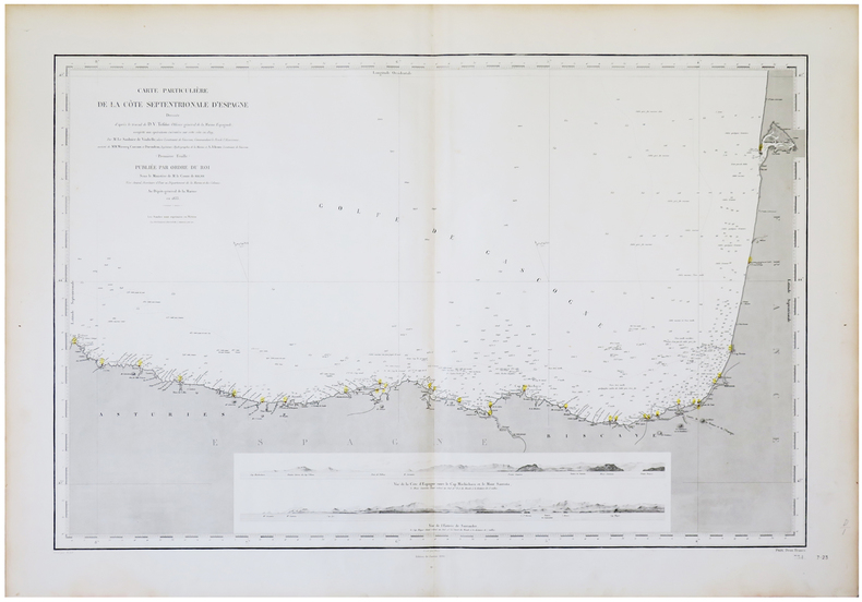
1833LBW-5637Paris, Dépôt-Général de la Marine, 1833-1890. 598 x 895 mm.
18060234-18Weimar, Vlg. d. Landes-Industrie-Comptoirs 1806. gr.-8°. VIII, 622 S. Mit gest. Titelvign. u. 17 Kupfertaf. (davon 1 kolor., gefalt. Karte v. Europa u. 3 gefalt. Pläne, 1 gefalt. Notentaf.). PBd. d. Zt. Mit Rückensch. Überklebte Fehlstelle am Reihentit. (2 x 3 cm.). Wasserrand durch die ersten Bll. - (Neueste Länder- und Völkerkunde. Ein geographisches Lesebuch für alle Stände, Bd. 1) [5 Warenabbildungen]
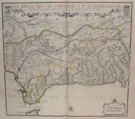
Rarissima carta geografica, tratta dal "Deliciae Hispaniae et Index Viatorius Indicans Itinera...". Cyprian Eichovius è lo pseudonimo di Matthias Quad (Deventer 1557 - Colonia 1613). Come spesso succedeva all'epoca per sfuggire alle persecuzioni cattoliche contro i protestanti Matthias Quad usò per la sua attività diversi pseudoni¬mi, tra cui quelli noti di C. Eichovius, M. Quadus, M. Quad von Kinckelbach e quello di Konrad Loew. Fuggito dall'Olanda in Germania nel 1587, studiò ad Heidelberg e divenne poi uno dei più prolifici esponenti della cosiddetta Scuola Cartografica di Colonia, durata per circa mezzo secolo (1570-1620 ca.) e formata principalmente da rifugiati fiamminghi ed olandesi tra i quali spiccano lo stesso Quad e Frans Hogenberg che ne fu il fondatore. Nel 1594 Quad pub¬blica a Colonia Europae, totius terrarum orbis partis praestantissimae descriptio. Nel 1596 ca., sempre a Colonia pubblica Typus Orbis Terrarum, ad Imitationem Universalis Gerhardi Mercatoris, un planisfero sulla base dell'opera marcatoria-na e nel 1600 pubblica il suo primo atlante mondiale autonomo: Geographisch Handtbuch, che è anche il primo edito in lingua tedesca. Nel 1608 ne uscì una edizione in latino Fasciculus Geographicus con quattro mappe inedite incise da Johann Bussemacher, suo assiduo collaboratore. A causa dei suoi numerosi pseudonimi la sua vasta produzione editoriale rimane ancora da identificare completamente. Le carte del Quad ebbero poca fortuna poiché stampate nel periodo dei grandi successi degli atlanti Orteliani; pertanto nessuna ristampa dell’atlante è nota, rendendolo rarissimo e molto ricercato nel mercato antiquario. Map taken form the very rare "Deliciae Hispaniae et Index Viatorius Indicans Itinera...". Cyprian Eichovius is the alias of Matthias Quad (Deventer 1557 - Cologne 1613). As it often appened then, to escape from Catholic persecution, Protestants, and Matthias Quad among them, used many alias for their work. The most famous used by the artis were C. Eichovius, M. Quadus, M. Quad von Kinckelbach and Konrad Loew. Quad escaped from Holland to Germany in 1587, studied in Heidelberg and afterwards became one of the most prolific artists of the Cartographic School of Cologne, whose activity lasted for 150 years (1570-1620 ca.). The school was basically built up by Flemish and Dutch artists escaping from persecution, among them also Frans Hogenberg, the founder of the school. In 1594 Quad published in Cologne Europae, totius terrarum orbis partis praestantissimae descriptio. In 1596 approximately, and again in Cologne, he published Typus Orbis Terrarum, ad Imitationem Universalis Gerhardi Mercatoris, a world map based on Marcator’s work but in 1600 he published his personal, indipendent world atlas, the Geographisch Handtbuch, which is also the first one published in German. In 1608 a Latin edition was issued, Fasciculus Geographicus, with four unpublished maps engraved by Johann Bussemacher, his collaborator. Due to his multiple alias, his huge production is still to be completely identified. Quad’s maps did not enjoy great success for they were published the same period of Ortelius’ atlases; for that reason, there is not a second edition known of Quad’s work, which makes his first one vary rare and sought-after.
1715LBW-716234 x 342 mm + feuillet de texte descriptif.
1690LBW-4836[1690-1695]. 93 x 288 mm.
1705LBW-2894Paris, chez l'auteur, 1705. 236 x 327 mm.
1715LBW024fa1715. 234 x 342 mm.
1707LBW0029cParis chez l'auteur 1707 443 x 483 mm.
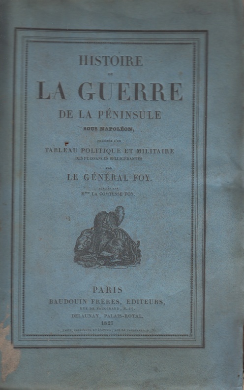
1827111750P., Baudouin frères, 1827 4 vol. in-8°, xv-403, 421, 406 et 379 pp, un tableau dépliant et 8 fac-similés hors texte, certains dépliants, brochés, rousseurs éparses, état correct
201078Londres, T. C. Hansard, 1821 in-8, [2] ff. n. ch. (faux-titre et titre), 250 pp., un f. n. ch. d'errata, demi-veau cerise à coins, dos à faux-nerfs orné de filets, guirlandes et pointillés dorés, pièce de titre noire, simple filet doré sur les plats, tranches mouchetées (reliure de l'époque). Accrocs aux coupes.
197674289Paris Gallimard 1976 1 vol. broché in-8, broché, couverture à rabats, non coupé, 222 pp. Edition originale de ce portrait de Salido, combattant antifranquiste que Guilloux a connu au temps où il était chargé d'accueillir des réfugiés de la guerre d'Espagne. Un des 25 exemplaires de tête sur vergé blanc de Hollande van Gelder (non justifié). En parfait état.
197674289Paris Gallimard 1976 1 vol. broché in-8, broché, couverture à rabats, non coupé, 222 pp. Edition originale de ce portrait de Salido, combattant antifranquiste que Guilloux a connu au temps où il était chargé d'accueillir des réfugiés de la guerre d'Espagne. Un des 25 exemplaires de tête sur vergé blanc de Hollande van Gelder (non justifié). En parfait état.
183716Paris, Chez Delaunay, 1820 in-8, (6)-439 pp., demi-veau tabac, dos lisse (reliure de l'époque). .
1783LBW004dfMadrid, 1783. En 20 sections gravées, montées sur toile bleue et pliées, formant une carte de 845 x 865 mm.