Wales, DavidBiblio.com

3 191 résultats
0521814154.Ghardcover. Good. Access codes and supplements are not guaranteed with used items. May be an ex-library book. hardcover
2004SONG0521814154Cambridge University Press 2004-03-08. 1. hardcover. Used: Good. 7.50x1.50x10.25. Buy with confidence. Excellent Customer Service & Return policy. Cambridge University Press hardcover
2004DADAX0521814154Cambridge University Press 2004-03-08. 1. hardcover. New. 7.50x1.50x10.25. Buy with confidence. Excellent Customer Service & Return policy. Cambridge University Press hardcover
53816nearly full length three quarter face with a fine moustache wearing his reversed cap and carrying a safety lamp inscribed on the mount "A Personally Conducted Royal Tour with compliments to the Mayor Sir Evan Morris 1889" and signed S.J. Leadbetter 11½" x 6½" in frame 18¼" x 13¼" no place In August 1889 Queen Victoria paid a visit to North Wales. On Monday 26th Princess Beatrice and her husband visited a colliery in Ruabon descending into the pit and firing a shot to blast the coal. Next day the Queen knighted Mr Evan Morris d. 1890 Mayor of Wrexham 1888-1889 who had been prominent in entertaining her before leaving for Balmoral. unknown
185948309o.J. (ca. 1859). 1 Blatt (23,9 x 29,8 cm), mit Grenzkolorit; Papier etwas braunrandig, leicht fingerfleckig, stockfleckig, bestaubt, gering gewellt, Ecke leicht angeknickt, ehem. Falzrand nachbeschnitten
1851200118AG1851. London Edinburgh & Dublin J.& F. Tallis 1851. Original steel engraving / Vintage map. Drawn and engraved by John Rapkin. Partly hand-coloured. Illustrations by N. Whitlock and Engraved by J. Rogers. Plate Size: 25 cm x 35 cm. Sheet Size: 27.2 cm x 37.3 cm. Vintage 19th century map in very good condition. Published in the Illustrated Atlas And Modern History Of The World Geographical Political Commercial & Statistical Edited By R. Montgomery Martin. Beautiful map of England and Wales from the mid-19th Century. Scotland can be seen to the north while the northern tip of Ireland is also included. France is shown peeping in in the lower right corner. The county structures are delineated across the map from Cornwall and Devon in the southwest to Northumberland in the northeast. The Welsh-English border is also delineated. The Isle of Man is included on the map. The railway system criss-crosses the map crowded with the names of cities and towns. Relief is shown with hachuring. Rivers are also shown. John Tallis 7 November 1817 3 June 1876 was an English cartographic publisher. His company John Tallis and Company published views maps and atlases in London from roughly 1838 to 1851. Tallis set up as a publisher with Frederick Tallis in Cripplegate in 1842; the business moved to Smithfield in 1846 and was dissolved in 1849. From 1851 to 1854 Tallis operated as John Tallis and Company. He started The illustrated news of the world and national portrait gallery of eminent personages in 1858 selling it for £1370 in 1861; it folded in 1863. Wikipedia The most important project John Tallis undertook was the 'Illustrated Atlas' from 1851. The original map we offer here was part of this exceptional Atlas and all the maps it contained are still today considered as the last reminder of an era of lavish map production. Tallis worked the project together with John Rapkin 1815-1876 and it was Rapkin's style and talent that we have to thank for when we marvel at these maps today. What makes these maps so special is the detail of engraved vignettes that surround the map and often show indigenous scenes people in their environment and even more so historical buildings or historical views of towns and cities architecture and landscape. The project of 'The Illustrated Atlas' was designed to be finished just in time for the anxiously awaited "Great Exhibition of the Works of Industry of All Nations" or The Great Exhibition sometimes referred to as the Crystal Palace Exhibition in reference to the temporary structure in which it was held was an international exhibition that took place in Hyde Park London from 1 May to 11 October 1851. It was the first in a series of World's Fairs exhibitions of culture and industry that became popular in the 19th century and it was a much-anticipated event. The Great Exhibition was organized by Henry Cole and Prince Albert husband of the reigning monarch Queen Victoria. It was attended by numerous notable figures of the time including Charles Darwin Samuel Colt members of the Orléanist Royal Family and the writers Charlotte Brontë Charles Dickens Lewis Carroll George Eliot and Alfred Tennyson. Music for the opening was under the direction of Sir George Thomas Smart and the continuous music from the exhibited organs for the Queen's procession was "under the superintendence of William Sterndale Bennett". Wikipedia unknown
33"x23" reinforced paper map. Undated - circa 1945? Scale: one quarter inch to one mile Geographical Section, General Staff, No. 3957 (Air). "F/O Ellis" neatly printed in each corner in ink. Average wear. Book
19399740AB[München], [Franz Eher], 1939. 37,5 x 28 cm. Zweifach gefaltetes farbiges Blatt. Gutes Exemplar. Mit einem Mittelknick, dort am Rand eingerissen.
200517405ABZittau, Verl. Graph. Werkstätten, 2005. 28 x 30 cm, 200 S. mit zahlr. Ill., graph. Darst., Kt. Illustrierter Pappband (Hardcover), Fadenheftung. Minimal bestoßen, sonst tadelloses gepflegtes Exemplar.
19911817ABKöln, DuMont, 1991. 24 cm. 199 (1) S. mit 86 farbigen Abbildungen, 14 Gartenplänen und Zeichnungen sowie einer Landkarte. Original Leinen (Hardcover), Fadenheftung. Sehr schönes sauberes und festes Exemplar.
20099074ABBerlin, Phaidon, 2009. 30 cm. 110 S. Mit zahlr. farb. Abb. Original Pappband (Hardcover), Fadenheftung. Gekürzte, überarb. und aktualisierte Ausg. Absolut verlagsfrisches Exemplar.
2002833ABAugsburg, Bassermann, 2002. 28,5 cm. 216 S. Mit zahlreichen farbigen Abb. im Text und auf Tafeln. Illustrierter Pappband (Hardcover), Fadenheftung. Seiten minimal lichtrandig, sonst neuwertiges Exemplar.
2005GEU2571Starnberg, Dorling Kindersley, 2005. 440 Seiten, zahlr. fotogr. Abb., H 28 x 24 cm, OPappband/ OUmschlag. - Guter Zustand. fest gebunden/ hardcover
19969359ABKöln, DuMont, 1996. 25 cm. 224 S. Mit zahlreichen farbigen Abbildungen. Original Pappband (Hardcover), Fadenheftung. Sehr gepflegtes tadelloses Exemplar.
198620111ABLondon, Whittet Books, 1986. 26,5 cm. 234 S. mit zahlr. Bildtafeln mit Fotografien von Edwin Smith, davon 8 in Farbe. Original Pappband (Hardcover), Fadenheftung. Repr. Titel mit einem minimalen Fleck. Schutzumschlag leicht berieben. Sonst tadelloses gepflegtes Exemplar.
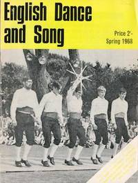
69-4934London United Kingdom: English Folk Dance and Song Society 1968. 4to. Staplebound Wraps. 35 pp. Mostly B&W Plates Very Good.From the collection of the late Frederick G Ruffner Jr founder of Gale Research Detroit. London, United Kingdom: English Folk Dance and Song Society, 1968 paperback
614091968-1978. 33 issues in 2 folders. v.30 2/3/4; v.31 2/3; v.32 1-4; v.33 1-4; v.34 1-4; v.35 1-4; v.36 234; v.37 123; v.38 123; v.39 12; v.40 1. All very good copies in the original wrappers loosely held in an Easibind folder aroma of tobacco probably clay-pipe. Publication was erratic with sometimes 4 issues per volume latterly with only three. 1968-1978. 33 issues in 2 folders. unknown
Navy blue octavo in a teal slipcase ; xiii, 268 p, 24 cm Eccentrics and eccentricities -- England -- Novel -- Humor
200518165ABLondon, Aurum Press, 2005. 31cm. 208 S. mit über 240 teils farb. Abb. aus dem Archiv der Zeitschrift Country Life. Original Pappband (Hardcover), Fadenheftung. Seiten etwas lichtrandig, sonst sehr schönes sauberes und festes Exemplar.
ria9781137507396_inpPaperback / softback. New. New Book; Fast Shipping from UK; Not signed; Not First Edition; This brand-new edition of English Grammar has been revised and updated throughout with grammatical explanations simplified more information on popular topics such as morphology and more illustrative examples and end-of-chapter exerci paperback
198614765ABLondon, George Weidenfeld & Nicolson Ltd., 1986. 20 x 27 cm. 160 S. mit zahlr. farb. Illustrationen. Original Pappband (Hardcover), Fadenheftung. First published. Tadelloses gepflegtes Exemplar.
20002111902154605157Sanseido 2000. Soft Cover. Fine. The book is in fine condition. Sanseido paperback
Light green-cloth octavo; xxii, 362 p ; 24 cm. Radicalism; Revolutionary War -- Great Britain -- History.
2021x-1838675728Emerald Group Pub Ltd 2021. Hardcover. New. 245 pages. 9.00x6.00x0.75 inches. Emerald Group Pub Ltd hardcover
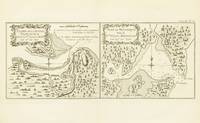
1774143636Paris: Chez Saillant et Nyon . chez Panckoucke 1774. Very Good. Paris Chez Saillant et Nyon . chez Panckoucke 1774. A two-panel engraved map printed surface 138 × 332 mm sheet size 252 × 363 mm. Vertical centrefold crease as issued; slight indentations to both panels; very slightly tanned and marked at the edges; in excellent condition. The two panels of the map show the Endeavour River where Cook beached the 'Endeavour' for repairs after striking the Great Barrier Reef in 1770 and Botany Bay respectively. It comes from the first French edition of the official account of the voyage 'Relation des voyages entrepris . pour faire des découvertes dans l'hémisphère méridional' 'Tome III. Pl. 17'. <p>Tooley 343; see Beddie 659. Chez Saillant et Nyon ... chez Panckoucke unknown