Anders, Ferdinand (u.a.)Antiquariat.de

2 823 résultats
19841205895Recklinghausen : Bongers Verlag, 1984. XXIII, 471 S. : zahlr. Ill. (z.T. farb.), graph. Darst., Kt. ; 24 cm; fadengeh., farb. illustr. Orig.-Pappband.
Gutes Ex.; Einband stw. geringfügig berieben. - Mit illustr. Beilage (Grußadressen / Nachträge / Ergänzungen); 24 S.; 22 cm; geheftet. - ... Seit Alexander von Humboldt, Johann Jakob Tschudi und Max Uhle waren es gerade Forscher aus Deutschland, Österreich und der Schweiz, die sich der Geographie, der Geschichte und der Archäologie des Andenlandes annahmen; die Erforschung der Frühzeit hat gerade in unseren Tagen an Intensität zugenommen. So werden in der Ausstellung neueste Ausgrabungen, die noch nicht wissenschaftlich publiziert sind, durch Herrn Dr. Walter Alva Alva erstmals einem größeren Publikum vorgestellt werden können. Durch sie wird die Geschichte des präkolumbischen Peru neu geschrieben werden müssen, der Katalog bietet hier einen ersten Ansatz. An ihm haben, unter der nimmermüden Federführung von Herrn Dr. Anders mit Herrn Professor Dr. Federico Kauffmann Doig, Lima, über 30 führende Wissenschaftler Perus mitgearbeitet. ... (Vorwort) // INHALT : PERU DURCH DIE JAHRTAUSENDE ---- Eine Anthologie ---- Plan einer Ausstellung Ferdinand Anders und Federico Kauffmann Doig. ---- Peru: Utopie und Wirklichkeit Luis Enrique Tord. ---- Land und Menschen Javier Pulgar Vidal. ---- Die ersten Peruaner Duccio Bonavia. ---- Die formative Phase Federico Kauffmann Doig. ---- Die Regionalkulturen (1.-8. Jh. n. Chr.) Ramiro Matos Mendieta. ---- Huari (8.-12. Jh. n. Chr.) Ramiro Matos Mendieta. ---- Königreiche und Föderationen der späten Zwischenzeit (1000-1470 n. Chr.) ---- Alberto Bueno Mendoza. ---- Pachacamac Federico Kauffmann Doig. ---- Tahuantinsuyo oder das Imperium der Inka Luis E. Valcärcel. ---- Die Eroberung des Inkareiches Juan Jose Vega. ---- Die Inka von Vilcabamba Ella Dunbar Temple. ---- Das Vizekönigreich von Peru Jose Antonio del Busto Duthurburu. ---- Auf dem Weg zur Unabhängigkeit Jose Augustin de la Puente. ---- Die Republik Peru Cesar Pacheco Velez. ---- Peru im 20. Jahrhundert Virgilio Roel. ---- Die Ethnographie von Peru Fernando Silva Santisteban. ---- Technologische Kenntnisse in Altperu Rogger Ravines. ---- Die magischen Pflanzen Perus Fernando Cabieses. ---- Die Produktionsweisen im Imperium der Inka Waldemar Espinoza Soriano. ---- Die Quipu des Regionalmuseums in Ica Carlos Radicati di Primeglio. ---- Die Scharrbilder von Nasca Maria Reiche. ---- Bemerkungen zur Kunst der Vizekönigszeit Francisco Stastny M. - (u.a.m.) ISBN 9783764703578
198447249Recklinghausen : Bongers 1984. XXIII, 471 S. : m. 200 Farb- u. 462 SW-Abb.. ; 24 cm Pp., gebundene Ausgabe, Hardcover/Pappeinband, Exemplar in gutem Erhaltungszustand
19831548CBWien, G. Grasl (= Katalog des Niederösterreichischen Landesmuseums, Neue Folge Nr. 133), 1983. 8°, 454 S. mit zahlreichen Farb- und s/w-Abbildungen einem Beiblatt vom Präsidenten von Peru (Fernando Belaunde Terry), original Pappband, 3. Auflage Einband mit leichten Beschabungsspuren, sonst sehr schönes, sauberes Exemplar (Re 05)
0656769777.Ghardcover. Good. Access codes and supplements are not guaranteed with used items. May be an ex-library book. hardcover
1332396089.Gpaperback. Good. Access codes and supplements are not guaranteed with used items. May be an ex-library book. paperback
1932101819Lima: Torres Aguirre 1932. Paperback. Good. 318p. maps tables graphics plans wrps yellowing pages slightly foxing and yellowing. A compilation of census data relative to the provinces of Lima and Callao Peru. Includes information on age race family demographics industry commerce religion and professions. Torres Aguirre paperback
186633997New York: Wm. C. Bryant & Co. Printers 1866. First edition. Stitched paper wrappers. Lacking rear wrapper front wrapper soiled else very good. 46 pp. 8vo. Contains 12 documents including: Decree approving and ordering the ratification of the Peru-Chilean Treaty of Alliance; Declaration of War against the Spanish Government; Naturalization of Foreigners serving in Peruvian and Chilean Vessels; 9 more. Biblioteca Peruana 1208. Basadre I 4935. Wm. C. Bryant & Co., Printers unknown books
186633997New York: Wm. C. Bryant & Co. Printers 1866. First edition. Stitched paper wrappers. Lacking rear wrapper front wrapper soiled else very good. 46 pp. 8vo. Contains 12 documents including: Decree approving and ordering the ratification of the Peru-Chilean Treaty of Alliance; Declaration of War against the Spanish Government; Naturalization of Foreigners serving in Peruvian and Chilean Vessels; 9 more. Biblioteca Peruana 1208. Basadre I 4935. Wm. C. Bryant & Co., Printers unknown
185628032Philadelphia: Charles Desilver 1856. 17¼" X 13 3/4" image 15" X 12½". Hand colored. Decorative border. Very good. 2" tear at upper right corner archivally repaired on verso touches upon one corner of border. Charles Desilver unknown
192335575ABLeipzig, Dieterich'sche Verlagsbuchhandlung, 1923. 8° (22x15), VIII, 294 S., 9 Bl., mit 3 Figuren im Text, 16 graphischen Tafeln, 1 gefaltete Karte, OHln mit farb WappenPräg, etwas angestaubt, Papier gebräunt, fest und sauber,
19933084844Münster & Hamburg: LIT 1993. 68, (56) Seiten. 8° (17,5-22,5 cm). Orig.-Broschur. [Softcover / Paperback].
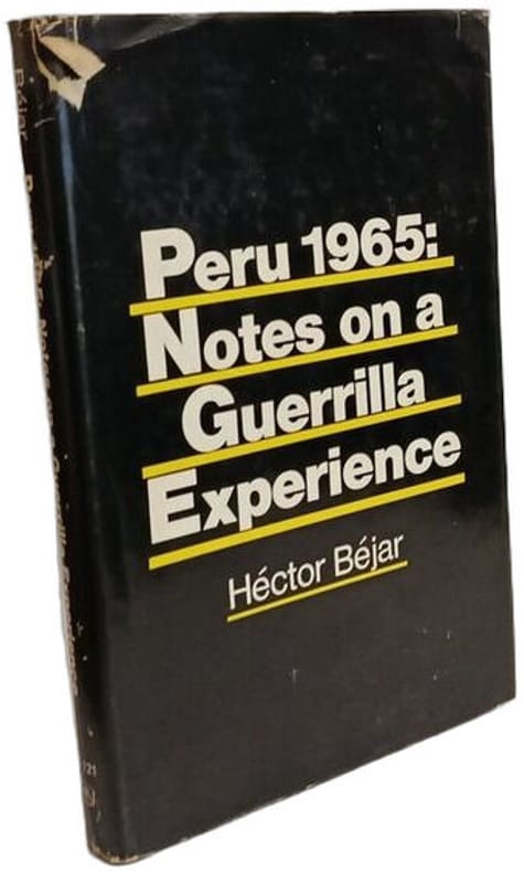
1970100145419Monthly Review Press 1970 in8. 1970. Cartonné jaquette. L'ouvrage d'Héctor Béjar analyse l'expérience de la guérilla de 1965 au Pérou en examinant les conditions objectives du pays et l'émergence de mouvements paysans cherchant à récupérer leurs terres. Il s'agit d'un travail visant à ouvrir la discussion sur cet événement historique basé sur l'expérience personnelle de l'auteur et primé par la Casa de las Américas en 1969
198812709CBStuttgart, Klett Verlag (= Länderprofile), 1988. 8°, 230 S. mit s/w-Abbildungen, illustr. original Kartonage (Paperback), Erstausgabe schönes, sauberes Exemplar (Re11)
19766671Rudolstadt, Greifenverlag, 1976. 8°; 312 Seiten, zahlr. Fotos; 1. Auflage Orig.-Leinen mit OU Umschlag randrissig, knickspurig; Flattervorsatz am festen Vorsatz verklebt und dieser beim Öffnen eingerissen; Papier gering gebräunt, leichte Gebrauchsspuren
1990139884Köln : Vista-Point-Verl., 1990. 216 Seiten mit zahlr. Ill., 8° , kart.
18512007AG1851. London & New York J & F. Tallis 1851. Original steel engraving / Vintage map. Drawn and engraved by John Rapkin. Partly hand-coloured. Plate Size: 24.7 cm x 33.8 cm. Sheet Size: 27.4 cm x 37.5 cm. Vintage 19th century map in very good condition. John Tallis 7 November 1817 3 June 1876 was an English cartographic publisher. His company John Tallis and Company published views maps and atlases in London from roughly 1838 to 1851. Tallis set up as a publisher with Frederick Tallis in Cripplegate in 1842; the business moved to Smithfield in 1846 and was dissolved in 1849. From 1851 to 1854 Tallis operated as John Tallis and Company. He started The illustrated news of the world and national portrait gallery of eminent personages in 1858 selling it for £1370 in 1861; it folded in 1863. Wikipedia The most important project John Tallis undertook was the 'Illustrated Atlas' from 1851. The original map we offer here was part of this exceptional Atlas and all the maps it contained are still today considered as the last reminder of an era of lavish map production. Tallis worked the project together with John Rapkin 1815-1876 and it was Rapkin's style and talent that we have to thank for when we marvel at these maps today. What makes these maps so special is the detail of engraved vignettes that surround the map and often show indigenous scenes people in their environment and even more so historical buildings or historical views of towns and cities architecture and landscape. The project of 'The Illustrated Atlas' was designed to be finished just in time for the anxiously awaited "Great Exhibition of the Works of Industry of All Nations" or The Great Exhibition sometimes referred to as the Crystal Palace Exhibition in reference to the temporary structure in which it was held was an international exhibition that took place in Hyde Park London from 1 May to 11 October 1851. It was the first in a series of World's Fairs exhibitions of culture and industry that became popular in the 19th century and it was a much anticipated event. The Great Exhibition was organized by Henry Cole and Prince Albert husband of the reigning monarch Queen Victoria. It was attended by numerous notable figures of the time including Charles Darwin Samuel Colt members of the Orléanist Royal Family and the writers Charlotte Brontë Charles Dickens Lewis Carroll George Eliot and Alfred Tennyson. Music for the opening was under the direction of Sir George Thomas Smart and the continuous music from the exhibited organs for the Queen's procession was "under the superintendence of William Sterndale Bennett". Wikipedia unknown
12040Perspective de Goacho.gravure avec cartouche de Titre et Astrolabe, vers 1790, 12,5 x 21,5 cm. en noir,petites marges
4968reliure éditeur - 17,5x27 - 192 pp - 1964 - éditions RENCONTRE, Lausanne.Collection " ATLAS DES VOYAGES, RENCONTRE" dirigée par Charles-Henri FAVROD.Nombreuses illustrations dans et hors texte.
1990RO40101206Peuples du Monde. 1990. In-8. Broché. Bon état, Couv. légèrement passée, Dos satisfaisant, Intérieur frais. 304 pages. Illustré de nombreuses photos en noir et blanc dans le texte. Cartes en noir et blanc hors texte.. . . . Classification Dewey : 985-Pérou
ISBN : 2907629026. Peuples du Monde. 1990. In-8 Carré. Broché. Bon état. Couv. légèrement passée. Dos satisfaisant. Intérieur frais. 304 pages. Illustré de nombreuses photos en noir et blanc dans le texte. Cartes en noir et blanc hors texte. 'Domaine Latino-Américain'. Préface de Jean raspail. Nuées à l'horizon. Giboulées...
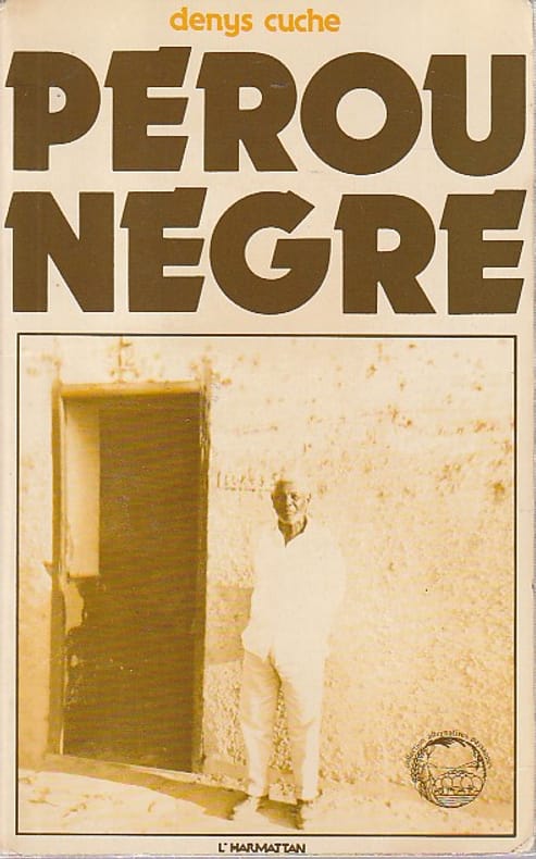
56765L'Harmattan, 1981, 192 pp., broché, couverture un peu défraîchie, état correct..
1991ROD0139855AMNESTY INTERNATIONAL. 1991. In-12. Broché. Etat d'usage, Coins frottés, Dos satisfaisant, Intérieur frais. 119 pages augmentées de nombreuses photos en noir et blanc dans et hors texte.. . . . Classification Dewey : 985-Pérou
Carta geografica, antica ed originale, raffigurante gli attuali territori del Perù, Ecuador e parte del Brasile. Piega centrale editoriale.Rigobert Bonne (1727-1795) fu uno dei più importanti cartografi del tardo XVIII secolo. Nel 1773 succedette a Jacques Bellin come cartografo reale in Francia.
In-8 gr. (mm. 265x183), bellissima legatura edit. figurata in oro e nero, titolo oro al dorso interamente decorato, risg. damascati, tagli dorati, pp. (4),XI,796, magnificamente illustrato nel testo da inc. su legno: sono “plus de 1100 gravures, 27 cartes et 18 plans” di cui 4 a colori, a doppia pagina o più volte ripieg. f.t. (Pérou et Bolivie, itinéraire de Charles Wiener - Plan du Gran Chimu - Plan de Cuzco, première capitale de l’Empire de Tahuantin-Suyu - Vallée de Santa-Ana, depuis le col de la Cordillère orientale jusqu’aux cerros de Ychitariato). “Le 9 juillet 1875, le Ministère de l’instruction publique m’a fait l’honneur de me charger d’une mission archéologique et ethnographique qui s’est terminée le 26 aout 1877”, così precisa nell’introduzione l’A., lo scienziato-esploratore franco austriaco Wiener (1851-1913), forse il più noto per i viaggi effettuati in Perù. La prima parte è dedicata alla descrizione del viaggio, con partenza da Lima; la seconda all’architettura, scultura, oreficeria, ceramica, pittura; la terza si occupa di etnografia, di divinità e culti peruviani, con in fine una sintesi archeologica e storica di queste popolazioni. "Edizione originale". Con aloni e fiorit. ma complessivam. un discreto esemplare.