603 résultats
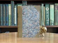
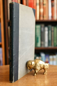
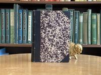
1851113549Quebec City Quebec: Rollo Campbell Printer 1851. Hardcover. Good. Vol. 10 in 5 folios Journal and 4 vol. appendix. Journal: viii 362 lx pages. 34 cm. Cloth spine with marbled boards. Appendix No. 1 A to T: Insert with alphabetized pages and notes inscribed and titled "Dst Court 1815-1816: Index" unpaginated. Appendix No. 2 U. to K.K. Unpaginated. Appendix No. 3 L.L. to Z.Z. Unpaginated. Appendix No. 4 A.A. to O.O.O. Unpaginated. Wear to some of the spines with stitching visible at the joints of some pages. Some yellowing to pages. Wear scuffing and discolouration to the bindings. Text clear and unmarked. Good condition. <br/><br/>Volume 10 of the Journal take for the Legislative Assembly of then province of Canada under the rule of the British Empire. A detailed record of legislative actions for a single calendar year with even more detailed appendices offering further details documents and records. A rich historical source for scholars of Canadian political history in the nineteenth century. Rollo Campbell, Printer hardcover
183711256162Halifax Nova Scotia: William Cunnabell 1837. Book. Very Good. Hardcover. First Edition. 12mo. original purple cloth bindingpaper spine label pp. iv 4 163 3 p. "Errata": p. 166. light wear at corners spine is faded some spotting to edges a rare pre-confederation imprint in sound clean condition. William Cunnabell Hardcover
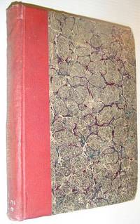
1869088165Montreal; n/a; Paris; Montreal; Montreal; New York: Eusebe Senecal; Canadian Naturalist; Librairie catholique de Périsse frères; John Lovell; Presses a vapeur de La Minerve; Christern 1869. Leather Bound. pp. 24; 31; 192; 110; 80; 64. 8vo. 3/4 tan leather over marbled boards. Gilt lettering to spine reads "Mélange Historique". Light edgewear ink title list to front free endpaper two library rubber stamps. Contents unmarked binding sound. Eusebe Senecal; Canadian Naturalist; Librairie catholique de Périsse frères; John Lovell; Presses a vapeur de La Minerve; Chri unknown
1860083899London: Printed by George Edward Eyre & William Spottiswoode for H.M.S.O. 1860. Hardcover. pp. 217. 1/2 black cloth over grey paper-covered boards. Gilt lettering to spine. 2 plates and 6 folding hand-coloured maps. Corners and spine ends frayed old tape to verso of title page has caused a yellowed brittle spot and another piece has stuck the title page a little crookedly to the next; text block age-toned a few old repairs to map folds; overall very nice condition. Peel 365: "Includes hand-coloured maps and one more chapter than Toronto edition.' See also Sabin 31937. Printed by George Edward Eyre & William Spottiswoode for H.M.S.O. hardcover
18808691880 rel. d. chagr. in-4 à coins avec lis. (coins et mors), d. 5 nerfs - titre frappé or - caiossons à fleurettes -, tête dorée, goutt. à témoin, nombr. gr. in et h-txt. et en bandeaux, 1 carte repliée des états-unis, qq. lég. piq., 779 p., 1880 Paris chez Quantin et Decaux Editeurs,
1856193721London: Chapman and Hall 1856. First edition. Hardcover. Good/No Dustjacket. 8vo. pp. xvi 343; viii 324 two volume set binding on volume one starting to crack but holding together Chapman and Hall hardcover
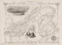
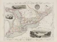
18512014AG1851. London & New York J & F. Tallis 1851. Original steel engraving / Vintage map. Drawn and engraved by John Rapkin. Partly hand-coloured. Plate Size: 33.3 cm x 25.5 cm. Sheet Size: 37.5 cm x 27.2 cm. Vintage 19th century map in very good condition. John Tallis 7 November 1817 3 June 1876 was an English cartographic publisher. His company John Tallis and Company published views maps and atlases in London from roughly 1838 to 1851. Tallis set up as a publisher with Frederick Tallis in Cripplegate in 1842; the business moved to Smithfield in 1846 and was dissolved in 1849. From 1851 to 1854 Tallis operated as John Tallis and Company. He started The illustrated news of the world and national portrait gallery of eminent personages in 1858 selling it for £1370 in 1861; it folded in 1863. Wikipedia The most important project John Tallis undertook was the 'Illustrated Atlas' from 1851. The original map we offer here was part of this exceptional Atlas and all the maps it contained are still today considered as the last reminder of an era of lavish map production. Tallis worked the project together with John Rapkin 1815-1876 and it was Rapkin's style and talent that we have to thank for when we marvel at these maps today. What makes these maps so special is the detail of engraved vignettes that surround the map and often show indigenous scenes people in their environment and even more so historical buildings or historical views of towns and cities architecture and landscape. The project of 'The Illustrated Atlas' was designed to be finished just in time for the anxiously awaited "Great Exhibition of the Works of Industry of All Nations" or The Great Exhibition sometimes referred to as the Crystal Palace Exhibition in reference to the temporary structure in which it was held was an international exhibition that took place in Hyde Park London from 1 May to 11 October 1851. It was the first in a series of World's Fairs exhibitions of culture and industry that became popular in the 19th century and it was a much anticipated event. The Great Exhibition was organized by Henry Cole and Prince Albert husband of the reigning monarch Queen Victoria. It was attended by numerous notable figures of the time including Charles Darwin Samuel Colt members of the Orléanist Royal Family and the writers Charlotte Brontë Charles Dickens Lewis Carroll George Eliot and Alfred Tennyson. Music for the opening was under the direction of Sir George Thomas Smart and the continuous music from the exhibited organs for the Queen's procession was "under the superintendence of William Sterndale Bennett". Wikipedia unknown
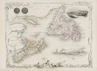
18512013AG1851. London & New York J & F. Tallis 1851. Original steel engraving / Vintage map. Drawn and engraved by John Rapkin. Partly hand-coloured. Plate Size: 25 cm x 32.5 cm. Sheet Size: 37.5 cm x 27.2 cm. Vintage 19th century map in very good condition. John Tallis 7 November 1817 3 June 1876 was an English cartographic publisher. His company John Tallis and Company published views maps and atlases in London from roughly 1838 to 1851. Tallis set up as a publisher with Frederick Tallis in Cripplegate in 1842; the business moved to Smithfield in 1846 and was dissolved in 1849. From 1851 to 1854 Tallis operated as John Tallis and Company. He started The illustrated news of the world and national portrait gallery of eminent personages in 1858 selling it for £1370 in 1861; it folded in 1863. Wikipedia The most important project John Tallis undertook was the 'Illustrated Atlas' from 1851. The original map we offer here was part of this exceptional Atlas and all the maps it contained are still today considered as the last reminder of an era of lavish map production. Tallis worked the project together with John Rapkin 1815-1876 and it was Rapkin's style and talent that we have to thank for when we marvel at these maps today. What makes these maps so special is the detail of engraved vignettes that surround the map and often show indigenous scenes people in their environment and even more so historical buildings or historical views of towns and cities architecture and landscape. The project of 'The Illustrated Atlas' was designed to be finished just in time for the anxiously awaited "Great Exhibition of the Works of Industry of All Nations" or The Great Exhibition sometimes referred to as the Crystal Palace Exhibition in reference to the temporary structure in which it was held was an international exhibition that took place in Hyde Park London from 1 May to 11 October 1851. It was the first in a series of World's Fairs exhibitions of culture and industry that became popular in the 19th century and it was a much anticipated event. The Great Exhibition was organized by Henry Cole and Prince Albert husband of the reigning monarch Queen Victoria. It was attended by numerous notable figures of the time including Charles Darwin Samuel Colt members of the Orléanist Royal Family and the writers Charlotte Brontë Charles Dickens Lewis Carroll George Eliot and Alfred Tennyson. Music for the opening was under the direction of Sir George Thomas Smart and the continuous music from the exhibited organs for the Queen's procession was "under the superintendence of William Sterndale Bennett". Wikipedia unknown
18512015AG1851. London & New York J & F. Tallis 1851. Original steel engraving / Vintage map. Drawn and engraved by John Rapkin. Partly hand-coloured. Plate Size: 32.2 cm x 25 cm. Sheet Size: 37.7 cm x 27.2 cm. Vintage 19th century map in very good condition. John Tallis 7 November 1817 3 June 1876 was an English cartographic publisher. His company John Tallis and Company published views maps and atlases in London from roughly 1838 to 1851. Tallis set up as a publisher with Frederick Tallis in Cripplegate in 1842; the business moved to Smithfield in 1846 and was dissolved in 1849. From 1851 to 1854 Tallis operated as John Tallis and Company. He started The illustrated news of the world and national portrait gallery of eminent personages in 1858 selling it for £1370 in 1861; it folded in 1863. Wikipedia The most important project John Tallis undertook was the 'Illustrated Atlas' from 1851. The original map we offer here was part of this exceptional Atlas and all the maps it contained are still today considered as the last reminder of an era of lavish map production. Tallis worked the project together with John Rapkin 1815-1876 and it was Rapkin's style and talent that we have to thank for when we marvel at these maps today. What makes these maps so special is the detail of engraved vignettes that surround the map and often show indigenous scenes people in their environment and even more so historical buildings or historical views of towns and cities architecture and landscape. The project of 'The Illustrated Atlas' was designed to be finished just in time for the anxiously awaited "Great Exhibition of the Works of Industry of All Nations" or The Great Exhibition sometimes referred to as the Crystal Palace Exhibition in reference to the temporary structure in which it was held was an international exhibition that took place in Hyde Park London from 1 May to 11 October 1851. It was the first in a series of World's Fairs exhibitions of culture and industry that became popular in the 19th century and it was a much anticipated event. The Great Exhibition was organized by Henry Cole and Prince Albert husband of the reigning monarch Queen Victoria. It was attended by numerous notable figures of the time including Charles Darwin Samuel Colt members of the Orléanist Royal Family and the writers Charlotte Brontë Charles Dickens Lewis Carroll George Eliot and Alfred Tennyson. Music for the opening was under the direction of Sir George Thomas Smart and the continuous music from the exhibited organs for the Queen's procession was "under the superintendence of William Sterndale Bennett". Wikipedia unknown
187028245Montreal, Canada Railway News Company, ca. 1870. 236 SS. 3 Bll., zahlr., teils ganzseitige Textabb., 7 mehrf. gefaltete Karten (1 kolor.) Halbleder der Zeit mit vergoldetem Rückentitel, 8°
1880089146Quebec Canada etc. 1880. Leather Bound. pp. 44; 61; 35; 147; 116; 163; 17; 24; 23; 18; 60; 15; 52; 10; 82; 20; 83; 11; 8; 8; 31; 61; 29; 79; 44; 29; 18. 8vo. Black leather over marbled boards. "DIVERS" in gilt to spine. Minor shelfwear; very good. Black. 27 individually published booklets bound together including reports rules speeches itineraries and other such administrative documents mostly in French mostly published in Montreal. unknown
1890866a4760Victoria BC: Queen's Printer 1890. Book. Fair. Hardcover. First Edition. 4to - over 9¾" - 12" tall. 395 pages. Public Acts dealing with: agricultural societies; Mischievous Animals Registration of Births Deaths and Marriages Bush Fires Cattle Ranges Incorporation of Companies Constitution County Courts Assignment for benefit of creditors Registration of Voters Firearms Game Protection Homestead Juvenile Reformatory Crown Lands Land Grants for Charitable and other purposes Land Registry Legal Professions Licenses Mechanics Lien Magistrates Medicine and Surgery Minerals other than coal Mines coal prospecting Mines coal regulation Municipalities New Westminster Incorporation persons dying intestate Provincial Royal Jubilee Hospital Quieting titles to real estate Railways Railways - Columbia and Kootenay land grant Railways - Shuswap and Okanagan land grant Rivers and Streams - clearing of Royal Columbian Hospital Sheriffs Supply Timber - marking University of British Columbia. Private Acts relate to: Ashcroft and Cariboo Railway Co British Columbia Electric Company British Columbia Jockey Club British Columbia Mills Timber and Trading Company Columbia and Carbonate Mountain Railway Company Columbia and Kootenay Railway and Navigation Company Coquitlam Water Works Crow's Nest and Kootenay Lake Railway Hill's Bar Gold Mining Company London and Canadian Fire Insurance Company Nanaimo Telephone Company National Electric Tramway and Lighting Company News-Advertiser Company New Westminster Electric Light Company Okanagan and Kootenay Railway Company Pacific Coast Fire Insurance Company Westmister Street Railway Company Westminster and Vancouver Tramway Company Vancouver Incorporation Vancouver Street Railways Company Victoria Lumber and Manufacturing Company. Binding intact. Above-average wear. Usual library markings. A sound copy. Queen's Printer Hardcover
182647476Montreal: Imprime´ chex James Lane 1826. 46 pp. with the errata slip. 1 vols. 8vo. Stitched in modern plain wrappers. A fine copy of a scarce and important Canadian pamphlet. 46 pp. with the errata slip. 1 vols. 8vo. Excerpts from a journal and letters written during a trip to the United States in 1819. This serves as a sequel to Viger's "Considerations sur les effets qu'ont produit en Canada la conservations des etablissemens du pays les mœurs l'education etc. de ses habitans." 1809. Sabin 10350; Gagnon I: 111; TPL 1190 Imprime´ chex James Lane unknown
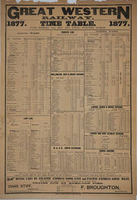
187724454Hamilton Ontario: Times Printing Co 1877. Railroad collectible. Good condition. Large imposing broadside printed in a variety of type fonts for the historic Canadian railway the first to be chartered in the province of Canada West today Ontario in 1834. From Monday 14th May 1877 Until Further Notice.<br /> <br /> Includes the Toronto Line and US stops New York Boston Albany Buffalo Suspension Bridge over Niagara Falls Detroit and Chicago.<br /> <br /> Schedules printed for the Loop Line; Toronto Line; Wellington Grey & Bruce Division; W. G. & B. South Extension; London Huron & Bruce Division; London and Port Stanley Division; and Sarnia Division. <br /> <br /> The Superintendent is Chas. Stiff; F. Broughton General Manager. Frederick Broughton severely cut costs at the railroad as a result of the 1873 financial crash; he was feared and hated within the company but managed to turn the Great Western into one of the best run railways of North America. <br /> <br /> At its peak the Great Western system covered 852 miles with its main operating base in Hamilton. The GWR's role as a bridge line between the New York Central and Michigan Central Railroads was highly profitable.<br /> <br /> Large printed sheet 17 1/2 x 25 1/2". Top edge chipped period folds flattened some period pencil calculations at left margin. OCLC: 1007494327 records a copy at Library & Archives Canada. Times Printing Co unknown
182647476Montreal: Imprime´ chex James Lane 1826. 46 pp. with the errata slip. 1 vols. 8vo. Stitched in modern plain wrappers. A fine copy of a scarce and important Canadian pamphlet. 46 pp. with the errata slip. 1 vols. 8vo. Excerpts from a journal and letters written during a trip to the United States in 1819. This serves as a sequel to Viger's "Considerations sur les effets qu'ont produit en Canada la conservations des etablissemens du pays les mœurs l'education etc. de ses habitans." 1809. Sabin 10350; Gagnon I: 111; TPL 1190 Imprime´ chex James Lane unknown books
1880105G4456Ottawa: Maclean Roger & Co. 1880. Book. Fair. Hardcover. First Edition. 8vo - over 7¾" - 9¾" tall. 504 pages including 38 pages of fascinating advertisements at back. Includes obituaries and index of names. Topics of particular note include the Pacific Railway question and a very full chapter on the Militia. Front board front free endpaper and title page detached as one but present. Back board and last two leafs detached as one. Page listing leaders of Canada's federal and provincial governments loose but present. Usual library markings. Average wear. Requires rebinding. A wonderful piece of Canadian history. Maclean, Roger & Co. Hardcover
1851124512Toronto: Thomas Maclear 1851. First Edition. Rebound. Very Good/No Dj. 8vo. Two volumes in one. Volume One: pp. cxxiv 290 80 business directory 24 List of subscribers index Volume 2 pp.xxiv 544 folding maps charts b/w illustrations.Rebound half leather binding.Bookplate on verso of front boards Thomas Maclear unknown
1846PHO-2308London, James Burns ; Toronto, R. and A. Rowsell, 1846. In-12°, 196pp., non coupé
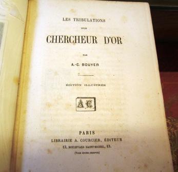
1860003301Librairie A. Courcier, Éditeur, 13 Boulevard Saint-Michel, s.d. (circa 1860). grand-in-8 (24 x 16 cm), 247 pp., reliure toile chagrinée rouge de l'éditeur, filets à froid sur le dos et les plats, plaque dorée sur le premier plat avec titre de l'ouvrage, tranches dorées. Date d'édition environ 1860. Illustré de quatre gravures coloriées, sur papier fort.
1821PHO-1025London: Longman, Hurst. 1821. in-8 ,XI + 320 pp. ,illustré avec 2 cartes (1 facsimilé)et 5 gravures in texte , relié pleine percale , dos lisse avec pièce de titre et auteur et date ,rousseurs sur le titre
1866003178Hachette et Cie (Imprimerie Générale de Ch. Lahure), 1866
184146404515Paris, Furne, 1841 ; grand in-8, demi-chagrin rouge, coins, dos orné, tranches dorées. (Reliure de l’époque). 2 ff., XVI pp., 568 pp.2 grandes cartes dépliantes et 133 planches hors-texte gravées sur acier (la plupart avec 2 illustrations) d’après les dessins de M. de SAINSON, dessinateur du voyage de l’Astrolabe, et de Jules BOILLY.La plus grande partie du volume (pp. 1 à 464) concerne les Antilles, Cuba, les Guyanes, la Colombie, le Brésil, le Paraguay, l’Argentine, la Patagonie, le Chili, la Bolivie, le Pérou, le Guatemala, le Mexique. Les États-Unis du Nord, le Canada, la Groënland occupent les pp. 465-550. Comme le souligne Sabin 57458, les illustrations sont d’un grand intérêt pour tout ce qui concerne les moeurs, les costumes des tribus indiennes d’Amérique du Sud et du Mexique. Quelques rousseurs sans gravité dans le corps du volume, plus forte sur les 2 premières pages.
185229323Paris: Sagnier Et Bray. Very Good with no dust jacket. 1852. First Edition. Hardcover. French Language; 8vo 8" - 9" tall; Later mauve cloth and marbled boards leather spine label iii iii and 328 iii 350 pages including half-titles original blue-green wrappers bound in. Bindings strong and clean with minor wear some scuffing at edges of spine labels texts tight and still very good slight soiling to wraps attractive copies. Sabin 7431. Lande S254 mentions the 2nd edition of 1859. French Language text. Primarily a history of the Roman Catholic church and its missions in Canada during the 18th and first half of the 19th Century. Provenance unknown religious initialed HV book plate and a second book plate removed. . Sagnier Et Bray hardcover
1896DEMO014097IChicago: The Caxton Club 1896. First American Edition. Hardcover. Fine. map in rear pocket. Tall octavo 229pp half vellum gray paper boards untrimmed; Ex libris John Thomas Lee who was President of The Caxton Club in the 1920s; in publisher's slipcase. see Sowerby 4072 for Jefferson's copy of this title. <br/><br/>A reprint of the first English translation London 1714; with the Map of the original French edition Paris 1713 in facsimile. Joutel was second-in-command of this expedition which failed to find the mouth of the Mississippi. Finley Collection 42; BASIC TEXAS BOOKS no. 114 G. "Most reliable eye-witness account of La Salle's two-years wanderings in Texas. The map based on La Salle's Mississippi explorations was the first accurate delineation of that river --Howes J266." Limited to only 206 copies. The first book published by The Caxton Club CCI. Map in rear pocket. The Caxton Club hardcover
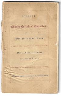
184524367Baltimore: J. Murphy for the Baltimore Historical Society 1845. First Edition. Softcover. Good. 9" x 6" 84 pp. Original front wrapper present somewhat creased rear wrapper lacking. Otherwise complete clean and sound with an old bookseller description tipped in between the copyright page and page 1. "One of the best background narratives for the study of the invasion of Canada in 1775--76. Father Carroll an unquestioned patriot was one of the three commissioners sent by Congress to placate the French-Canadians. The author s day-by-day diary describing the trip in a coach from Philadelphia to Montreal along with Samuel Chase and Benjamin Franklin the other commissioners is the only reliable one extant" Decker. Sabin 11068 Howes C-179 TPL 481. Scarce in the first edition. J. Murphy for the Baltimore Historical Society unknown