Rawlings, ThomasBiblio.com
603 résultats
1865087507London: Sampson Low Son and Marston 1865. First edition. Card covers. pp. ix 240. 8vo. Card covers with eggplant cloth decorated in blind and with gilt lettering to front board. Four plates and one folding map; one two-inch tear to a fold of the map. Spine sunned ownership rubber stamp to front free endpaper and title page. Sampson Low, Son, and Marston unknown
188755678Victoria New Westminster & Vancouver B.C.: The British Columbia Stationery & Printing Co. ca. 1887. 8vo. 5.75 x 7.6 in. 16 leaves unpaginated. sepia-tinted lithographed images bound leporello accordion style w/ 68 different images all w/ white & red borders. Embossed pebbled red publisher’s cloth gilt lettering front cover blind embossed raised borders very minor shelfwear 1 leaf w/ lifting from facing litho 1 very minor closed tear still a VG bright copy. First edition of this beautifully printed and illustrated souvenir book issued by the noted British Columbia printing firm which operated from 1885 to 1888 in Victoria and Vancouver BC. The views include the Victoria harbour the Fraser River Lighthouse birds-eye views of New Westminster Vancouver Coal Mining Co.’s Shaft No. 1 in Nanaimo the dockyards at Esquimalt Native American carvings totem poles and tribes people along with views of Sitka Alaska. Ferguson partnered with Pearson Robson & Hart in May 1886 to form the British Columbia Printing Co. who intended to establish themselves as the leading stationer printers in the province but due to the destruction of the company’s Vancouver branch by fire June 13 1886 and then on Sept. 1 1886 in Victoria but even though the company reconstituted and continued with their contract to print the West Shore Magazine locally as well as Canadian Pacific Railway literature the firm only survived until November 1888 when Ferguson returned to Winnipeg to open a book and stationery store. Worldcat locates 2 copies UBC WSU; See: Lana Okerlund British Columbia Stationery and Printing Company A Most Agreeable Place History of Booksellers and Stationers in British Columbia Oct. 3 2017; The West Shore Vol. 1 Vol. 13 1887 p. 496. The British Columbia Stationery & Printing Co., hardcover
1871115a8144Toronto: Copp Clark & Co. 1871. Book. Fair. Hardcover. First Edition. 12mo - over 6¾" - 7¾" tall. 94 pages. Authorized by the Council of Public Instruction of Ontario. "Deny the divine origin of Scripture and nevertheless you must keep the volume Bible as a kind of text book of morality if indeed you did not wish the banishment from our houses of all that is lovely and sacred and breaking up through the lawlessness of ungovernable passion of the quiet and beauty which are yet around our familes." - from Prefatory Notice. Contains 16 lessons. Somewhat above-average wear and soiling to embossed black cloth-covered boards. Binding intact. Prior owner's name upon front free endpaper else unmarked. Foxing to endpapers and contents. Valuable historical evidence of the prominence once placed upon Christian education and morality in the schools of Ontario. Author was a very influential Canadian in his day. A rare surviving copy. Copp, Clark & Co. Hardcover
1836745c6441Philadelphia: E.L. Carey & A. Hart 1836. Book. Fair. Hardcover. First American Edition. 4to - over 9¾" - 12" tall. 456 pages. Fold-out map present at title page. Foxing throughout. Binding open at title page. Bit of pencil writing to front endpaper. Back hinge open. Above-average wear and soiling. E.L. Carey & A. Hart Hardcover
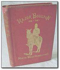
188615604121Toronto: Davis & Henderson/Grip Printing and Publishing 1886. Book. Good. Hardcover. First Edition. 12mo - over 6¾" - 7¾" tall. 531 pages. Black and white illustrations. Fold-out map. With a record of the raising of her majesty's 100th Regiment in Canada and a chapter on Canadian social and political life. Lovely gilt illustration and lettering upon red front board. Lettering upon spine worn but generally legible. Binding and hinges intact. No external markings. Endpapers unmarked. Library stamp to verso of frontis title page and its verso and page 25. No other markings. Minor lean to spine. Average wear. Sound copy. Davis & Henderson/Grip Printing and Publishing Hardcover
1897123a4300Toronto/London: James Hope & Co. The Copp-Clark Co. Bernard Quaritch 1897. Book. Good. Hardcover. First Edition. 4to - over 9¾" - 12" tall. 139-268 467-548 1-30pp. From the transactions of The Royal Society of Canada For 1897. Moderate wear. Bit of writing inside front board else unmarked. Narrow openings to binding in two places. Tears to two large fold-outs. Hinges intact. James Hope & Co., The Copp-Clark Co., Bernard Quaritch Hardcover
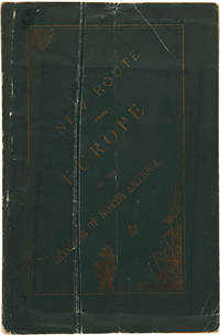
1881WRCAM30264AMontreal: John Lovell & Son 1881. 219pp. plus large folding color map. Original printed wrappers. Minor wear to wrappers three-inch closed tear in map. Contemporary stamp of the U.S. Geological Survey Library on titlepage. Internally clean. Very good. Issued by the Nelsen Valley Railway Transportation Company this pamphlet and map advertise a new route to the middle of North America. The route marked by a heavy red line takes potential passengers through Hudson's Strait to Churchill Harbor Canada then south by train to the United States border in northern Minnesota. PEEL 448. John Lovell & Son unknown books
1872WRCAM39322Montreal: Dawson Brothers 1872. Colored folding map 33 x 22 1/2 inches. Folded into original pebbled cloth. Front board detached. Bisected and mounted on linen as issued. Old bookplate and withdrawal stamp on front pastedown short closed tear along linen fold of upper outer section not affecting map itself. A handsome detailed folding map showing southeast Canadian territory including Cape Breton the Province of Quebec and provides detailed illustration of the northeast United States spanning from eastern Michigan all the way to New York Harbor. With two small insets of Newfoundland and the environs of Montreal and one larger inset extending to British Columbia and Manitoba. Also illustrates railway routings completed and those under construction and denotes "Free Grant Lands" with color illustration. An interesting late 19th-century map of Canada published only one year after western British Columbia joined the Canadian Confederation to help form the Canadian Pacific Railway. Dawson Brothers hardcover books
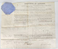
18671592141867. Good. 34x41 cm vellum document with embossed seal of Queen Victoria at upper left. One vertical and three horizontal folds. Small hole in centre. Signed by Andrew Russell Assistant Commissioner of Crown Lands. Signed at top by Sir John Michel Administrator of the Government of the Province of Canada. <br/><br/>An Indian Land Sale Grant refers to the legal transfer of ownership of reserve lands previously held in trust for First Nations to individuals or entities often through a sale or other disposition. The 102 acres here is Lot 26 Con. 13 Orford Township Kent County now Chatham-Kent. Andrew Russell 1804-88 became assistant commissioner of crown lands in July 1857. After Confederation when the Crown Lands Department was reorganized and divided by province Russell remained assistant commissioner for Ontario. Sir John Michel 1804-86 was Administrator of the Government of Canada in the absence of Governor-General Viscount Monck from September 30 1865 to February 12 1866 and from December 10 1866 to June 1867. hardcover
186912635London: Sampson Low Son & Marston 1869. Book. Very Good. Hardcover. First Printing of the First Edition. Very good withwear to extremities moderate soiling to covers and "Arcade Library 1869 " on ffep. colour frontis. and minor foxing. A solid copy. Sampson Low, Son & Marston Hardcover
187713560Victoria: T. N. Hibben & Co. Publishers 1877. Book. Very Good. Hardcover. First Printing of the First Edition. Rebound using the original boards and spine label. Probably Ex libris as there is a number stamped on the preface page. T. N. Hibben & Co., Publishers Hardcover
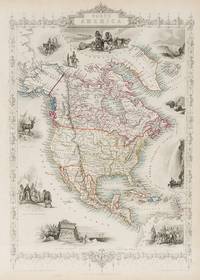
18512020AG1851. London & New York J & F. Tallis 1851. Original steel engraving / Vintage map. Drawn and engraved by John Rapkin. Partly hand-coloured. Plate Size: 24.2 cm x 35.4 cm. Sheet Size: 27.4 cm x 37.5 cm. Vintage 19th century map in very good condition. John Tallis 7 November 1817 3 June 1876 was an English cartographic publisher. His company John Tallis and Company published views maps and atlases in London from roughly 1838 to 1851. Tallis set up as a publisher with Frederick Tallis in Cripplegate in 1842; the business moved to Smithfield in 1846 and was dissolved in 1849. From 1851 to 1854 Tallis operated as John Tallis and Company. He started The illustrated news of the world and national portrait gallery of eminent personages in 1858 selling it for £1370 in 1861; it folded in 1863. Wikipedia The most important project John Tallis undertook was the 'Illustrated Atlas' from 1851. The original map we offer here was part of this exceptional Atlas and all the maps it contained are still today considered as the last reminder of an era of lavish map production. Tallis worked the project together with John Rapkin 1815-1876 and it was Rapkin's style and talent that we have to thank for when we marvel at these maps today. What makes these maps so special is the detail of engraved vignettes that surround the map and often show indigenous scenes people in their environment and even more so historical buildings or historical views of towns and cities architecture and landscape. The project of 'The Illustrated Atlas' was designed to be finished just in time for the anxiously awaited "Great Exhibition of the Works of Industry of All Nations" or The Great Exhibition sometimes referred to as the Crystal Palace Exhibition in reference to the temporary structure in which it was held was an international exhibition that took place in Hyde Park London from 1 May to 11 October 1851. It was the first in a series of World's Fairs exhibitions of culture and industry that became popular in the 19th century and it was a much anticipated event. The Great Exhibition was organized by Henry Cole and Prince Albert husband of the reigning monarch Queen Victoria. It was attended by numerous notable figures of the time including Charles Darwin Samuel Colt members of the Orléanist Royal Family and the writers Charlotte Brontë Charles Dickens Lewis Carroll George Eliot and Alfred Tennyson. Music for the opening was under the direction of Sir George Thomas Smart and the continuous music from the exhibited organs for the Queen's procession was "under the superintendence of William Sterndale Bennett". Wikipedia unknown
184711439Paris, Lemercier, 1847. Stahlstich, altkoloriert. Blattgröße: 35,5 x 52,2 cm, Druckspiegel: 34 x 48,5 cm.
1835PHO-1525Paris, chez Bellizard, Barthés, Dufour et Lowell ,1835, 2 volumes in-8, lxi-1fnch-456pp., 2ffnch-544pp., relié demi basane époque, dos lisse avec auteur et titre, tranches jaunes, petits frottements, coins usés, petites rousseurs carte et portrait.
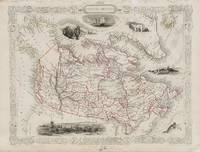
18512018AG1851. London & New York J & F. Tallis 1851. Original steel engraving / Vintage map. Drawn and engraved by John Rapkin. Partly hand-coloured. Plate Size: 33 cm x 24.6 cm. Sheet Size: 37.4 cm x 27.4 cm. Some fraying to the upper margins. Otherwise in very good condition with a small inkstain to the Montreal image. Beautifully Mounted ! John Tallis 7 November 1817 3 June 1876 was an English cartographic publisher. His company John Tallis and Company published views maps and atlases in London from roughly 1838 to 1851. Tallis set up as a publisher with Frederick Tallis in Cripplegate in 1842; the business moved to Smithfield in 1846 and was dissolved in 1849. From 1851 to 1854 Tallis operated as John Tallis and Company. He started The illustrated news of the world and national portrait gallery of eminent personages in 1858 selling it for £1370 in 1861; it folded in 1863. Wikipedia The most important project John Tallis undertook was the 'Illustrated Atlas' from 1851. The original map we offer here was part of this exceptional Atlas and all the maps it contained are still today considered as the last reminder of an era of lavish map production. Tallis worked the project together with John Rapkin 1815-1876 and it was Rapkin's style and talent that we have to thank for when we marvel at these maps today. What makes these maps so special is the detail of engraved vignettes that surround the map and often show indigenous scenes people in their environment and even more so historical buildings or historical views of towns and cities architecture and landscape. The project of 'The Illustrated Atlas' was designed to be finished just in time for the anxiously awaited "Great Exhibition of the Works of Industry of All Nations" or The Great Exhibition sometimes referred to as the Crystal Palace Exhibition in reference to the temporary structure in which it was held was an international exhibition that took place in Hyde Park London from 1 May to 11 October 1851. It was the first in a series of World's Fairs exhibitions of culture and industry that became popular in the 19th century and it was a much anticipated event. The Great Exhibition was organized by Henry Cole and Prince Albert husband of the reigning monarch Queen Victoria. It was attended by numerous notable figures of the time including Charles Darwin Samuel Colt members of the Orléanist Royal Family and the writers Charlotte Brontë Charles Dickens Lewis Carroll George Eliot and Alfred Tennyson. Music for the opening was under the direction of Sir George Thomas Smart and the continuous music from the exhibited organs for the Queen's procession was "under the superintendence of William Sterndale Bennett". Wikipedia unknown
188558338Port Hawkesbury Inverness Nova Scotia: n.p. ca. 1885. Four mounted albumen photos including three cabinet card sized photos w/ images sized 3.75 x 6.2 in. mounted on 4.25 x 6.5 in. brown boards gilt lettering stamped at lower fore-edges 1 small 3.25 x 3.25 in. photo on 5 x 5 in. gray studio mount card stock all w/ annotations on versos indicating locations and w/ manuscript greetings some soiling dustsoiling and minor spotting to the Cabinet photos the smaller image a tad over-exposed still all three with fairly good contrast and well-defined images. These scarce images depict the town and harbour of Port Hawkesbury situated along the Strait of Canso and the only really viable port along the strait which faced Point Tupper. Originally named Ship Harbour the town supplied men materials and repairs to the Gulf of St. Lawrence fishing fleet and two of these images show vessels either anchored or under sail. These cabinet photos appear to have been sent to “Angus†as “Pictures of ‘home dear home’†with manuscript notes indicating “Port Hawkesbury looking towards Pt. Tupper. . . from Pt. Tupper. . . across the harbour.†The final photo shows the small Langley family home built by John Langley 1849-1926 who had married Maria Ballieul Langley 1848-1925 in 1872. He was initially a barrel cooper and later ship’s carpenter boat builder and later a railway foreman. n.p., hardcover
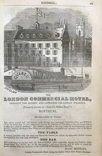
185158122Montreal: Printed and published by John Lovell St. Nicholas Street 1851. Thick 8vo. 2 xi-xv 2 18-692 pp. With numerous woodcut engraved advertisement illustrations. Original publisher’s embossed polished calf covers illustrated & embossed in blind gilt lettering on spine rear outer joint starting wear to fore-edges rubbing occasional light foxing still G copy. First edition of this excellent Victorian Canadian reference work with a focus on Eastern Canada filled with an excellent range of early illustrated ads for businesses manufacturers and professions in Canada and the United States. The illustrated ads for Canadian companies encompass the Montreal Fire Engine Manufactory with a portable fire engine illustrated; the London Commercial Hotel opposite the Quebec Steamboat wharf with scene of Quebec sidewheeler below the hotel; A.H. Armour & Co. Booksellers Stationers Printers & Bookbinders depicting a leather bound ledger; A. & S. Nordheimer Music & Musical Instruments with image of a large piano forte as well as the Hagar & Vogt Hamilton Organ Factory on Cannon Street. The final 100 pages entitled Advertisements from the United States captures an extraordinary mix of pre-Civil War American Businesses including Brown Lawson & Co. Wholesale Druggists Boston; Edwards Holman & Co. Salamander Safes; Bennet’s Temperance House in Buffalo NY; Gregory’s California Express in New York dispatching Letters for California twice a month carrying gold dust parcels packages and valuables often ahead of the postal service; Fowler & Wells Phrenology specialists in New York featuring a phrenology head as well as Hall’s Rochester Threshing Machines Separators and horse powers. Printed and published by John Lovell, St. Nicholas Street, hardcover
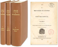
1854511091854. Fredericton: 3 Vols. Complete set. 1845-1855. Fredericton: 3 Vols. Complete set. 1845-1855. First Compilation of New Brunswick Statutes Canada. New Brunswick. The Revised Statutes of New Brunswick. Printed Under the Authority of an Act of the Legislature. Fredericton: J. Simpson Printer to the Queen's Most Excellent Majesty 1854-1855. Three volumes. Complete set. Octavo 9" x 6". Recent cloth gilt titles to spines endpapers renewed. Clean tears to first page of Volume I Preface annotations in early hand to margins of Volume I in some places interiors otherwise clean. Ex-library. Small stamps to title pages. $450. Only edition. Volume II: The Public Statutes of New Brunswick Passed in the Year 1854 Together with Those Unrepealed by the Revised Statutes; Volume III: The Local and Private Statutes of New Brunswick. Settled by the French New Brunswick was taken by the British in 1759 and incorporated into the colony of Nova Scotia. Its population expanded significantly through an influx of Loyalists after the American Revolution. Its enlarged population and distance from Halifax the capital of Nova Scotia led the colonial administrators to establish New Brunswick as a separate colony in 1784. The first collection of New Brunswick acts covering the years 1786-1805 was published in 1805. The Revised Statutes was the first compilation. In 1867 New Brunswick was one of the six colonies that became the Canadian Confederation. Sweet & Maxwell A Legal Bibliography of the British Commonwealth 3:77. unknown books
18220007721Paris: Chez Bechet 1822. First French Language edition. Original Boards. Good. 8vo xiv 351; vi 359 pages untrimmed in contemporary boards. Very scarce. <br/><br/>Attracted by the ideals of the "Declaration of Independence" Fanny Wright traveled extensively through the U.S.A. tracking how those ideals were being realized. In France who became almost like a daughter to Gen. Lafayette. She and her sister returned to America and with Lafayette were guests of Jefferson at Monticello. Later as a U.S. citizen she founded the Nashoba commune in Tennessee in anticipation of emancipation. She visited New York and Philadelphia West Point Niagara Falls Lake Errie and on to Lower Canada Montreal Lake Champlain Burlington Vermont Washington D.C. to Virginia with many observations along the way. This edition has a dedication to Lafayette by the translator who also supplied a new translation. Vol. 1 ends with remarks upon Morris Birkbeck's letters about the Illinois country. All in all Fanny Wright became one of the most remarkable women of the first half of the 19th century: among other accomplishments being the first woman to write this work the first travelogue by a woman. Howes D74; Sabin 18642; Clark Old South 16; Buck 137. Chez Bechet hardcover
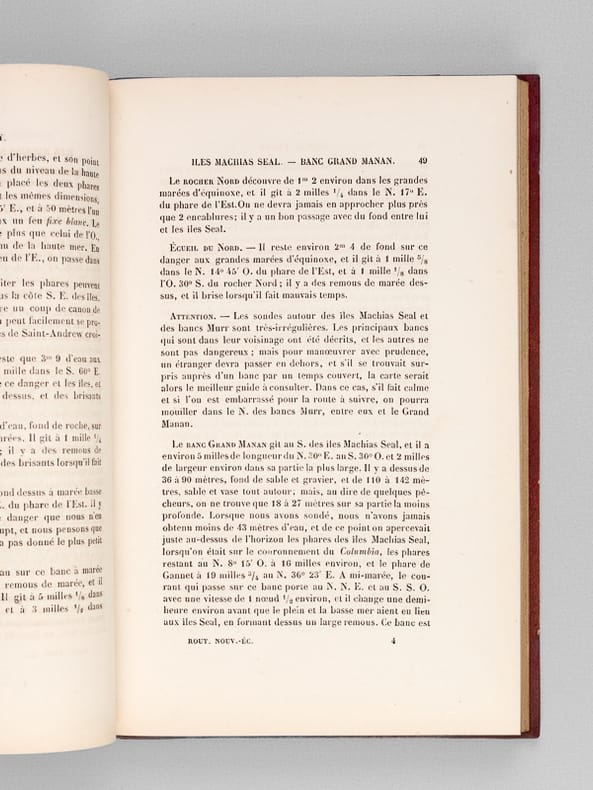
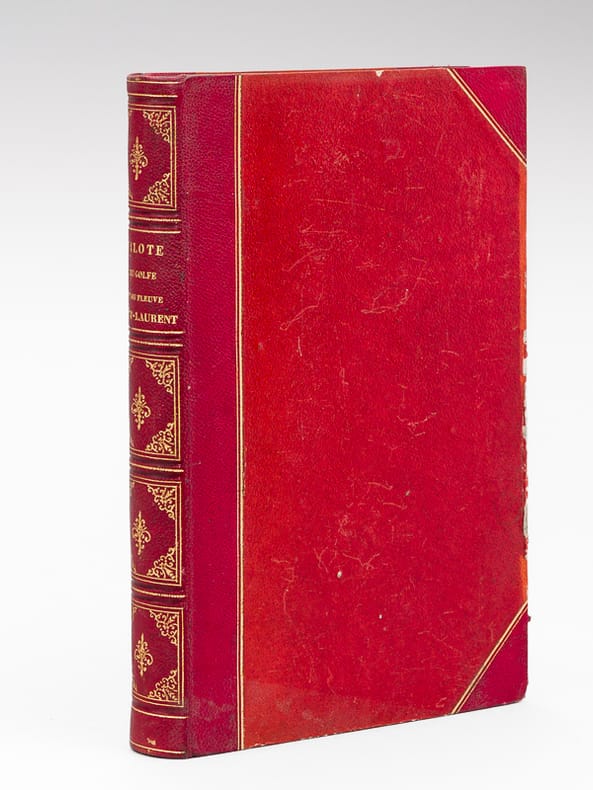
186163663[ Traduction par A. Le Gras ], 1 vol. in-8 reliure de l'époque demi-chagrin rouge à coins dos orné, double filet doré en mors et coins, coll. Dépôt des Cartes et Plans de la Marine, Imprimerie Administrative de Paul Dupont, 1861, 2 ff., IV-196 pp.
186363662Traduction par A. Le Gras, 1 vol. in-8 reliure de l'époque demi-chagrin rouge à coins dos orné, double filet doré en mors et coins, Imprimerie Administrative de Paul Dupont, 1863, XI-340 pp.
1886091031Ottawa: Department of Militia and Defence of the Dominion of Canada 1886. Hardcover. pp. xii 384. 8vo. Burgundy library-style binding with original wraps laid-in. Plates all present as called-for with some showing splits at folds and some chipping at edges. Ex-library with call number to spine and pocket remains to front endpaper. Edges scuffed contents brittle with some pages laid-in loose and chipped at edges. Scarce. Only two libraries in Canada hold a copy of this title. Peel 1396. OCLC 825062083. Contains General Middleton's report and that of the War Claims Commission and Map of Part of the Dominion of Canada Illustrating the Use of the Canadian Pacific Railway in the Movement of Troops to Quell the North-West Troubles in 1885 laid-in loose showing chips and tears. Department of Militia and Defence of the Dominion of Canada hardcover
189538161895 3 volumes, demi-reliure toile rouge in-octavo, dos long - titre frappé or et tomaison, tranches jaspées, illustrations : portraits et cartes, 488+536+694 pages, 1895 à Paris Letouzey et Ané Editeurs,
1863701572Calw und Stuttgart, Vereinsbuchhandlung und Steinkopf, 1863. VIII, 567 Seiten und 3 gefaltete Karten; VII, 603 Seiten und 3 Karten. Schlichte Pappbände der Zeit. Einbände leicht berieben. Sonst sauber.
1824PHO-2094Paris, Librairie de Gide Fils, 1824, In-8 (210x130mm),299 pp.- 1f., relié demi basane époque, dos lisse avec titre, tranches jaunes, illustré d’une carte repliée en couleurs (déchirure au pli), légers frottements, .