Alaska TravelBiblio.com
469 résultats
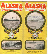
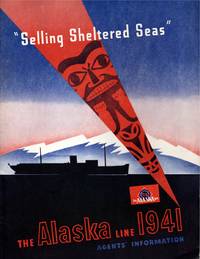
191411421Seattle: Alaska Steamship Company. Near Fine. 1941; 1914. Ephemera. Pacific brochure with 2" split top of spine 1" split bottom; closed 1" tear leading edge front cover; wear at edges with a heavy chip rear top edge causing loss on cover & several pages. Poor condition thus. Alaska Line with slight bump to lower front leading corner else fine. ; Alaska Line: illustrated stapled blue & black wrapper; tab indexed page foredges; includes charts and timetables lodging and transportation informations; information on side trips "what to see"; deck plans including 4 fould out plans in color; large folding map in rear pocket approx. "30 x 20" in color on what appears to be onion skin paper in pristine apparently unused condition. PACIFIC STEAMSHIP brochure: Illustrated stapled wrappers; 15 pp. With map photographs double page deck plan; 4to 11" - 13" tall; 21 pages . Alaska Steamship Company unknown
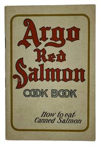
191110365San Francisco California 1911. 5.5 x 4" stapled booklet 36 pp color and black and white illustrations from drawings. A promotional cookbook of recipes making use of canned salmon issued by the Alaska Packers Association which was at the time the largest salmon packing company in Alaska operating canneries across the state and headquartered in San Francisco. The booklet prints recipes for 30 dishes and several sauces including "Salmon Pie" "Salmon Croquettes" and "Army and Navy Salmon Scouse" all of which call specifically for Argo Red Salmon. The cookbook additionally makes use of vibrant graphics to promote the products for instance the title page bears a color illustration of a child taking a wild ride on a salmon while waving a can above its head and the recipes are illustrated with color drawings of several of the dishes. Laid into the booklet is a color printed label for a salmon can in pristine condition. Booklet in excellent condition with a hint of toning to pages and a hint of foxing and spotting to covers. unknown
1959373005.Gpaperback. Good. Access codes and supplements are not guaranteed with used items. May be an ex-library book. paperback
1982Q-0882401572Alaska Geographic Society 1982-02-01. Paperback. New. In shrink wrap. Looks like an interesting title! Alaska Geographic Society paperback
1999Q-1566610478Alaska Geographic Society 1999-12-01. Paperback. New. In shrink wrap. Looks like an interesting title! Alaska Geographic Society paperback
192839103Chicago: Poole Bros. Inc. 1928. 1928. ALASKA. First edition. 8vo. 9" x 8" color pictorial wrappers folded to 9" x 4" 24 pp. including covers illustrated map deck plans. Map outlines the route of the Alaska Steamship Company and connections from Seattle to various ports in Alaska in red. The remainder of the booklet provides information on various trips from one Alaskan point to another along with the steamship used a deck plan of the steamship accommodations and rates for travel and sailing schedules. Agent stamp on cover panel covers lightly soiled rubbed along spine panel and lower spine split about four inches from the bottom else a good copy. Poole Bros. Inc., 1928]. unknown
ria9780323995825_inpPaperback / softback. New. New Book; Fast Shipping from UK; Not signed; Not First Edition; N/A paperback
190028458Washington Government Printing Office 1900. Orig. full cloth. Light discolouring to back. 169 pp. 168 photographic plates and 1 large folded map. <br/><br/><em>First edition. </em> hardcover
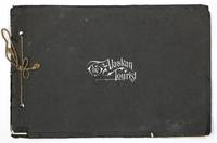
1905144857Skagway Alaska: Edw. H. Mitchell for Case & Draper ca. 1905. Oblong 12mo 22 X 15 cm. Illustrated with 16 tinted plates from photos including scenes of Skagway Summit of White Pass Lawton Glacier and Totem Poles at Sitka. Original black wrappers with white lettering on front cover and brown tie strings on spine. Minor chips to front edge of covers. A very good copy with clean and bright photos. Not in Tourville or Kurutz. For some reason seems very scarce. 1905 Edw. H. Mitchell, for Case & Draper unknown
122173Skagway Alaska: Edw. H. Mitchell for Case & Draper. Softcover. very good. 1st Edition. unpaginated. Oblong 12mo 22 X 15 cm. Illustrated with 16 tinted plates from photos including scences of Skagway Summit of White Pass Lawton Glacier and Totem Poles at Sitka. Original black wrappers with white letterng on front cover and brown tie strings on spine. Minor chips to front edge of covers. A very good copy with clean and bright photos. very good Not in Tourville or Kurutz. Seems very scarce. Probably considered more of a Skagway item based on the photos. Edw. H. Mitchell, for Case & Draper paperback
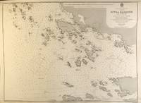
56397London: British Admiralty 1895 1925. . An engraved chart on heavy stock uncolored sheet size 20 x 27.5 inches. Published 30th Sept. 1895; Large Corrections Jan. 1898; Small corrections printed to 1925 and mss. to 1927. Some dust soiling at lower edge in general a nice clean copy a few additions in red pen. In lower right: "Engraved by Edwd. Waller". Chart number is 2348. Small typed label on verso giving chart & folio info. Published under the Superintendence of Rear Admiral W.J.L. Wharton. A detailed chart of the islands and coastal area around Sitka; the Sitka town plan indicates the Wireless Telephone Stn. Astronomical Stn. Indian Village and Mission. <br/><br/> London: British Admiralty, 1895 (1925). unknown
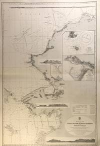
56407London: British Admiralty 1907 1928. An engraved chart on heavy stock uncolored sheet size 27.5 x 40 inches. Published 17th April 1907; New Edition Jan. 1923. Large Corrections 1st June 1928. Original horizontal fold a clean and attractive copy some small additions in red pen. Engraved shorelines in vignette. In lower right: "Malby & Sons". Chart number is 593. Small typed label on verso giving chart & folio info. Published under the Superintendence of Rear Admiral A. Mostyn Field. A large and detailed chart with inset maps of Chamisso and Port Clarence with an additional detailed inset of Port Clarence. From the Yukon River north to the Bering Strait Kotzebue Sound as far as Point Barrow on the coast of Alaska here designated as West Georgia. <br/><br/> London: British Admiralty, 1907 (1928). unknown
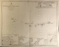
56421London: British Admiralty 1890 1928. . An engraved chart on heavy stock uncolored sheet size 34 x 27 inches. Published 9th July 1890; New Edition 28th Sept. 1928. Clean and attractive original vertical fold. In lower right: "Engraved 1890" and "Zc 1928". Chart number is 1501. Small typed label on verso giving chart & folio info. Published under the Superintendence of Captain W.J.L. Wharton. A detailed chart of the Aleutian islands including the Near Islands Rat Islands and Andreanof Islands groups. Included are nine small inset maps of harbours and anchorages on the various islands: Bay of Islands Korovin Bay Nazan Bay Bay of Waterfalls Suchikof Bay McDonald Bay Constantine Hr. Kiska Hr. and Chichagof Hr. Included in this chart are Attu Island and Kiska Island which were occupied by the Japanese during WW II. Two inset maps provide details of these islands: Chichagof Harbour on Attu Island and Kiska Harbour on Kiska Island. <br/><br/> London: British Admiralty, 1890 (1928). unknown
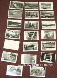
1941118561c1941-1949. Softcover. near fine. Complete set of 20 different real photo postcards: 18 from photos one cartoon facsimile and one map with route indicated. Cards printed on AZO post card photo paper. near fine 8 postcards printed "Permission Wartime Information Board" being numbers 1 2 3 4 14 15 1 6 and 17 9 postcards printed by "Permission of Public Roads Administrations" being numbers 5 6 7 8 9 10 11 12; no. 18 by the Canadian Post Card Co. Toronto Uncle Sam shaking hands across the border with a Mountie; and nos. 19 and 20 by "Permission of the National Film Board". 1941 paperback
199241004Seattle WA: University of Washington Press. NF. 1992. Paperback. Paperback in Near Fine condition. . 11 X 8.40 X 0.50 inches. 176 pages. Previous owners bookplate. . Quick Shipping All Books Mailed in Boxes Free Tracking Provided . University of Washington Press paperback
20192-1698166214Independently published 2019. Paperback. New. 686 pages. 10.00x8.00x1.72 inches. Independently published paperback
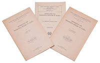
1923320787Washington D.C.: GPO 1923. 30pp. Folding map plates. With: . Circular No. 1 revised. 30pp. Folding map plates. With: . Revised October 15 1923. 18pp. Folding map plates. 3 vols. 8vo. Wrappers. 30pp. Folding map plates. With: . Circular No. 1 revised. 30pp. Folding map plates. With: . Revised October 15 1923. 18pp. Folding map plates. 3 vols. 8vo. Three copies of the first three issues of the Alaska Agricultural Experiment Station Circular No. 1 published to "give prospective settlers in Alaska and particularly homesteaders information on subjects which will be of more or less vital interest to them." Includes sections on climate agricultural areas where to locate homesteads how to obtain land the costs involved types of crops and live stock and more. Wickersham 8561. Wickersham 8561 <br/><br/> GPO unknown
193659748Montreal & Vancouver Canada; Los Angeles CA: Canadian National Railways Steamships January 1936. 4to. 8.25 x 9.4 which folds out into large 18.5 x 33.5 in. travel poster on recto map on verso colour-illustrated self-printed softcovers showing Prince Robert or Prince George cruising by Alaskan glaciers and totem pole cover art very minor shelfwear slight rubbing from the library of Archibald Angus MacDonald 1892-1977 stepson of famed southern California oil man William F. Byrne as well as oil company and drilling equipment company owner and manager of MacDonald & Burns Oil Producers stamp of Canadian National Railways 607 S. Grand Ave. Los Angeles CA w/in box on front. First edition of this rare and striking travel brochure for the Canadian National Steamship Co. filled with photographic views of sights in Wrangell Juneau Ketchikan Taku Glacier Skagway White Pass Lake Atlin and interspersed with striking Art Deco graphics in vivid orange purple green & black. The SS Prince Rupert & SS Prince George sister ships were constructed 1909-1910 at Swan Hunter & Wigham Richardson Ltd. both regularly running for decades the routes from Seattle to Victoria Vancouver Prince Rupert & Stewart BC and onto Skagway Alaska. The map includes details of the “Scenic Triangle Tour†of British Columbia on the Canadian National system which included stops in Jasper National Park Mount Robson Park and the Canadian Rockies. Worldcat locates 3 copies Bancroft Wisconsin Hist. Soc. Queens Univ. Ont. Canadian National Railways, Steamships, paperback
190747374New York: McClure Phillips & Co. 1907. Thick 8vo. xiv 2 330 pp. Photo frontisp. numerous photo plates illustrations. Green ribbed cloth embossed & gilt lettering & decoration on front cover gilt lettering on spine minor shelfwear very minor rubbing still VG bright copy from the author’s library w/ McLain bookplate on front pastedown presented to Mrs. John Howard Todd in January 1925 by the author w/ handwritten note laid-in identifying Onesime Sovey who went to the gold rush in 1897 with George Smith Portland Druggist. First edition presentation author’s copy signed of this excellent work detailing the fact finding tour by the author with the Senate Committee on Territories which visited Alaska and the Yukon in 1903. McClure, Phillips & Co., hardcover
196257025Anchorage AK: Alaskan Publishing Co. and Graphic Arts Press 1962. 4to. 1 xiii 76 pp. Photo frontisp. 50 plates & text illustrations including 42 of Laurence paintings. Illustrated softcovers cover art of Laurence painting blue lettering plastic comb-binding as issued minor shelfwear some very minor rubbing still VG copy inscribed on verso of front cover by Jeanne Laurence b. 1887-1980 artist and widow of Sydney Laurence author of “My Life with Sydney Laurence†as gift for Loma Underwood from Margaret Krogstad w/ ALS on illustrated stationery from Margaret to Loma dated 1962. First edition inscribed of this retrospective biography and catalogue of Sydney Laurence’s 1865-1940 foremost Alaskan painter whose artwork such as Going to the Potlatch and The Vanishing Race graced travel posters and brochures to Alaska for decades. Of additional interest is the inclusion of a wide range of 28 additional Alaskan authors and writers’ poetry and short writings including Sybil London Bates -- Jack London’s daughter Frances Anater Robert Atwood Shirley Barrett Carmen Compney Jr Edythe Corbin Anne Townsend and others. Alaskan Publishing Co. and Graphic Arts Press, paperback
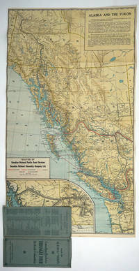
192726808Canada: Canadian National Railways 1927. Pamphlet. Very good condition. Double sided map of the railroad routes of the Canadian National Pacific Coast Services and the Canadian National Steamship Company Ltd. The map covers the area from Dawson Alaska to Portland Oregon. The verso is a pictorial map of the Triangle Tour of British Columbia Jasper National Park and Mount Robson Park with text about Jasper. <br /> <br /> Color map 17 x 30" folding 4 x 9 1/4" blue card wraps with green titles. Sml closed tear at one fold. Canadian National Railways unknown
189060273St. Paul MN: W.C. Riley Publisher Engraved by Charles Frey Franfurt Germany ca. 1890. Oblong 8vo. 9.75 x 6.25 in. 30 leaves unnumbered. sepia-tinted leporello accordion-style format. With 30 lithograph plates including 1 double-leaf plate w/ 2 birds-eye views of Minneapolis & St. Paul 1 birds-eye panoramic views of Northern Pacific train & Duluth Harbor many sepia-tinted views on remaining. Quarter-black cloth over elaborately decorated & embossed burgundy-coloured covers gilt lettering & decoration front cover minor scuffing edgewear small discrete paper repair to a few hinges hinge still a VG copy. Third edition “30000†of this nicely executed souvenir book issued in the same size as the popular “Boudoir†albumen souvenir photos for the Northern Pacific as its route opened through the Northern United States railroad lands for development across the West and expanding upon the much smaller original 1888 “Northern Pacific Tour.†These lithographs were created by hand-drawn images from photographs and printed using the Glaser/Frey lithographic process using five or more stones to lay down a series of separate shades offering a varnished look. The NP RR souvenir view book includes images of Dakota wheat fields Custer Battlefield monument Crow Indians at Yellowstone Montana cattle roundups and gold mining along the Columbia River with birds-eye views of Butte & Helena MT Spokane WA and salmon fishwheel as well as early birds-eye view of Portland OR. Views of Alaska include Sitka Juneau Totem Poles on Wrangel Island and the glaciers. The piece concludes with birds-eye view of San Francisco. W.C. Riley Publisher, [Engraved by Charles Frey, Franfurt, Germany], hardcover
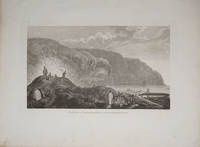
178522404London 1785. Very good condition. Copper engraved view of natives in traditional garb tending their kayaks at the water's edge. Drawn by John Webber and published in James Cook's third voyage around the world. 15 x 9 1/2" on large paper. unknown
1930142875Amsterdam: NP 1930's. Large original counter display. 29.5 X 41 cm. Probably unused display with the support on the rear unopened. Multi colored image. Minor old crease and a bit of surface abrasion otherwise in nice condition. This is a Dutch counter display for Alaska Brand slippers. There is no indicated manufacturer except a very small RT on the bottom left hand corner. The image shows a hunter/trapper with his rifle over his shoulder fur hat on his head and wearing a buckskin jacket. He is holding a pair of woolen slippers and has a big smile on. It appears the display was never used and shows very little wear. I am not sure if the brand was Alaska or the model of slippers. Fun Alaskan kitsch! 1930 NP unknown
1900124823San Francisco: Edw. H. Mitchell 1900. Undetermined. very good. Complete deck of 52 cards. No Jokers. Single card map with publishers inprint and date. Single advertising card. A nice example missing the box lid but with the box liner. very good The images on the cards are general views from all over Alaska but include Skaguay Canyon City Dawson and other subjects that relate to the Klondike and Yukon as well. The card backs illustrate the Seal of the District of Alaska and are decorated with totem poles. 1900 Edw. H. Mitchell unknown