469 résultats
1962715528PN. New. 1962. Soft Cover. Date is original print. This is a reprint edition. . PN paperback
20093925Alaska Editions 2009. Showing 21 international artist photographers with images printed using vegetable inks. Limited to 333 copies worldwide hand numbered. Large format book c. 36 x 28.5 cms. original quarter black velvet over printed boards all edges gilt. One of only 333 copies. Alaska Editions hardcover
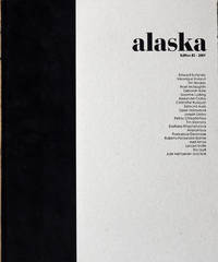
3924Showing 21 international artist photographers with images printed using vegetable inks. Limited to 1000 copies worldwide hand numbered. Large format printing 48 x 28 cms white printed paper wrappers open stitch spine. Alaska Editions Spring-Summer 2008. unknown
2006Q-1933375035Alaska Department of Fish and Game 2006-07-15. paperback. New. In shrink wrap. Looks like an interesting title! Alaska Department of Fish and Game paperback
0882402129.Gpaperback. Good. Access codes and supplements are not guaranteed with used items. May be an ex-library book. paperback
18231Washington GPO.1889. Hardcover. 8vo. 22.5cm portfolio containing 12 large folding maps tabbed rebound in black cloth with the original printed cover laid down fine thusads. Washington, GPO.1889 hardcover
1997260406001St. Herman of Alaska Brotherhood 1997. Paperback. Like New. St. Herman of Alaska Brotherhood; Sergieff St John of Kronstadt : A Companion Index for: My life in Christ. Platina CA : St. Herman of Alaska Brotherhood/St. Paisius Missionary School 1997. "This index is a companion to the 1897 English Edition of My Life in Christ first published in England and reprinted by Holy Trinity Monastery Jordanville New York." ISBN listed to cp as 1887904549 but recent searches on this return a completely different title. Staple-bound in publisher's glossy b&w photographic wrappers. 2 3-32. Foreword by Abbot Herman; life of St. John 10 pp; index pp 21-32. Condition notes: near fine clean copy of a surprisingly rare pamphlet. Light wear. We personally inspect every book we offer. St. Herman of Alaska Brotherhood paperback
0931163188.Gpaperback. Good. Access codes and supplements are not guaranteed with used items. May be an ex-library book. paperback
1970016271Washington D.C.: National Academy of Sciences 1970. First Edition First Impression. . Cloth Bound Boards. Near Fine. 1970 First Edition first impression. Size large quarto a heavy book 510 pages. Black textured cloth covered boards with gilt titles to the front cover and spine. Front paste-down and end-paper printed with a Map of Alaska and also the bordering part of Canada pinpointing the site of the Epicenter of the Earthquake on the map. Condition very good-near fine slight rub to corners and spine ends else fine contents very clean throughout. From the Library of Nicholas Ambraseys. Nicholas Neocles Ambraseys FICE FREng 1929-2012 was a Greek engineering seismologist. He was emeritus professor of Engineering Seismology and Senior Research Fellow at Imperial College London. For many years Ambraseys was considered as the leading figure and absolute authority in earthquake engineering and seismology in Europe. Size: 4to - over 9¾" - 12" tall <br/> <br/> National Academy of Sciences hardcover
0971950512-11-1-29Sebastian Press Serbian Orthodox Diocese Western America. New 2nd Edition. Very Good. With dust jacket. It's a well-cared-for item that has seen limited use. The item may show minor signs of wear. All the text is legible with all pages included. It may have slight markings and/or highlighting. Sebastian Press, Serbian Orthodox Diocese Western America unknown
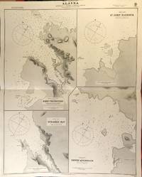
56417London: British Admiralty 1890 1925. . An engraved chart on heavy stock uncolored sheet size 27 x 34 inches. Published 2nd Aug. 1890; Small corrections printed to 1925 and mss. to 1927. Original horizontal fold a nice clean copy small additions in red pen. In lower right: "Engraved by Edwd. Weller". Chart number is 1433. Small typed label on verso giving chart & folio info. Published under the Superintendence of Captain W.J.L. Wharton. Four charts: Port Protection Steamer Bay St. John Harbour and Dewey Anchorage. Currently residents of Port Protection are featured in the National Geographic Channel reality series: Life Below Zero: Port Protection and its spinoff: Lawless Island. <br/><br/> London: British Admiralty, 1890 (1925). unknown
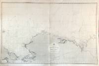
56479London: British Admiralty 1856 1932. An engraved chart on heavy stock uncolored sheet size 40 x 27.5 inches. Published Febr. 20th 1856; New Edition Dec. 1908. Large Corrections to Sept. 1932. Original vertical fold a very good copy some light wrinkling a few additions in red and some route marks in pencil. In lower right: "Engraved 1856". Chart number is 2435. Small typed label on verso giving chart & folio info. A large-scale chart extending from the Chukchi Peninsula in Asia to Liverpool Bay and Cape Bathurst in the Canadian Arctic. The course of the Mackenzie River is shown as well as the Porcupine River and Yukon River. The tip of Wrangell Island is shown at the left edge. <br/><br/> London: British Admiralty, 1856 (1932). unknown
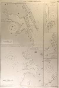
56413London: British Admiralty 1894 1928. . An engraved chart on heavy stock uncolored sheet size 27.5 x 40 inches. Published 6th August 1894; New Edition Aug. 1898; Large Corrections 14th Sept. 1928; Small corrections mss. to 1929. Clean and attractive original horizontal fold some small additions in red pen. In lower right: "Engraved by Edwd. Weller". Chart number is 2110. Small typed label on verso giving chart & folio info. Published under the Superintendence of Captain W.J.L. Wharton. Five anchorages in Frederick Sound and Clarence Strait: large plans of Gambier Bay and Port Chester; smaller plans of Woewodski and Eliza Harbours Fanshaw Bay and Cleveland Passage and Chasina Anchorage. First published 1894 this is a printing of 1928. <br/><br/> London: British Admiralty, 1894 (1928). unknown
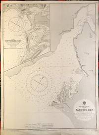
56391London: British Admiralty 1902 1922. . An engraved chart on heavy stock uncolored sheet size 20 x 27.5 inches. Published 13th Dec. 1902; New Edition 8th Jan. 1915. Small corrections printed to 1922 and mss. to 1929. Unfolded. Some wear and a short tears to lower margin basically clean and very good some revisions and additions in red pen. In lower right: "Engraved by Davies & Company". Chart number is 3313. Small typed label on verso giving chart & folio info. Published under the Superintendence of Rear Admiral Sir W.J.L. Wharton. Inset map of Controller Bay. Yakutat Bay has had various names; James Cook called it "Bering Bay" as indicated on this chart. Jean-François de La Pérouse who visited it in 1786 named it "Baie de Monti" for one of his officers; also in 1786 Captain Nathaniel Portlock named it "Admiralty Bay". The Spanish referred to it as "Almirantazgo" and it was also called "Port Mulgrave" when Alessandro Malaspina and José de Bustamante y Guerra sailed into the bay on their Malaspina Expedition 1789-94. <br/><br/> London: British Admiralty, 1902 (1922). unknown
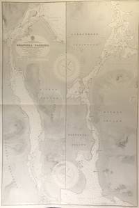
56415London: British Admiralty 1899 1930. . An engraved chart on heavy stock uncolored sheet size 27.5 x 40 inches. Published 20th Feb. 1899; New Edition 17th Jan. 1930. Original horizontal fold a clean and attractive copy some small additions in red pen. In lower right: "Engraved 1899" and "Zc 1930". Chart number is 3022. Small typed label on verso giving chart & folio info. Published under the Superintendence of Rear Admiral Sir W.J.L. Wharton. Divided vertically into two charts this extends from Frederick Sound to Sumner Strait showing the Lindenberg Peninsula Mitkof Island Woewodski Island. Previously known as Wrangell Strait this channel is 22 miles long. <br/><br/> London: British Admiralty, 1899 (1930). unknown
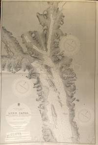
56427London: British Admiralty 1897 1925. . An engraved chart on heavy stock uncolored sheet size 40 x 27.5 inches. Published 6th March 1897; Large Corrections to June 1907; Small corrections printed to 1925 and mss. to 1930. Original vertical fold a clean and attractive copy some small additions in red pen. In lower right: "Engraved by Davies & Company". Chart number is 2462. Small typed label on verso giving chart & folio info. Published under the Superintendence of Rear Admiral W.J.L. Wharton. A highly detailed chart showing the north part of Admiralty Island and Chichagof Island Chatham Strait Glacier Bay; Inset map at the top: Continuation of Lynn Canal. Originally published 1897 this is an edition of 1925. <br/><br/> London: British Admiralty, 1897 (1925). unknown
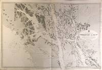
56426London: British Admiralty 1898 1926. . An engraved chart on heavy stock uncolored sheet size 27.5 x 40 inches. Published 23rd July 1898; Large Corrections to 6th August 1926; Small corrections mss. to 1927. Original horizontal fold a clean and attractive copy some small additions in red pen. Some wrinkling of paper at centre but not very noticeable on the printed side. In lower right: "Engraved 1898." and "Zc 1926". Chart number is 2288. Small typed label on verso giving chart & folio info. Published under the Superintendence of Rear Admiral Sir W.J.L. Wharton. A detailed and attractive chart of this major inlet. <br/><br/> London: British Admiralty, 1898 (1926). unknown
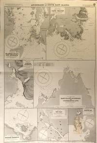
56419London: British Admiralty 1900 1925. An engraved chart on heavy stock uncolored sheet size 27.5 x 40 inches. Published 31st December 1900; New Edition January 1916; Small corrections printed to 1925 and mss. to 1927. Clean and attractive original horizontal fold some small additions in red pen. In lower right: "Engraved by Edwd. Weller". Chart number is 3138. Small typed label on verso giving chart & folio info. Published under the Superintendence of Rear Admiral Sir W.J.L. Wharton. Maps of seven anchorages: Klawak Inlet and Approach Cape Chacon Tamgas Harbour Mary Island Anchorage and Custom House Cove Hassler Harbour Yes Bay and Redfish Bay. Originally published in 1900 this is a 1925 printing. The small plan of Redfish Bay has corrections on a paste-over partly printed in red. Klawak is now known as Klawock and had a variety of names used by the Tlingit Klawerak Tlevak Clevak and Klawak. <br/><br/> London: British Admiralty, 1900 (1925) unknown
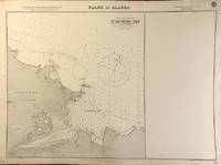
56403London: British Admiralty 1900 1923. . An engraved chart on heavy stock uncolored sheet size 27.5 x 20 inches. Published 10th Aug. 1900; New Edition July 1909; Small corrections printed to 1923. Unfolded. A nice clean copy. In lower right: "Engraved by Davies & Company". Chart number is 3143. Small typed label on verso giving chart & folio info. Published under the Superintendence of Rear Admiral Sir W.J.L. Wharton. One plan only of St. Michael Bay Norton Sound - South Shore St. Michael Island. <br/><br/> London: British Admiralty, 1900 (1923). unknown
2002Q-1574718142Creative Teaching Press 2002-03-27. Paperback. New. In shrink wrap. Looks like an interesting title! Creative Teaching Press paperback
1926320855Washington D.C.: GPO 1926. Illustrations. 5 vols. 8vo. Wrappers. Illustrations. 5 vols. 8vo. Bulletin No. 2. Vegetable Growing in Alaska. 1905. Wickersham 8559. Bulletin No. 3. Haymaking at Kenai Experiment Station. 1907. Wickersham 8560. Bulletin No. 4. Production of Improved Hardy Strawberries for Alaska. 1923. Wickersham 8562. Bulletin No. 5. Eradication of Tuberculosis in Cattle at the Kodiak Experiment Station. 1924. Wickersham 8591. Bulletin No. 6. Cereal Growing in Alaska. 1926. <br/><br/> GPO unknown
195059935Montreal & Vancouver Canada: Canadian National Steamships January 1950. 4to. 8.25 x 9.4 which folds out into 8 pp unpaginated. colour illustrated double-page oblong folio 16.5 x 9.4 in. colour-illustrated self-printed softcovers showing S.S. Prince George cruising by Alaskan glaciers and totem pole cover art minor edgewear light rubbing to fold crease still VG copy w/ former travel agency marking of Dorothy Van Nuys Travel Service. First edition of this nicely printed post-World War II travel brochure for the Canadian National Steamship Co. filled with interior illustrations for the new SS Prince George a Grand Trunk steamship built and launched in 1947 for the Canadian National Steamship Co. Her sister ship was the S.S. Prince Rupert and both regularly ran the routes from Seattle to Victoria Vancouver Prince Rupert & Stewart BC and onto Skagway Alaska. The map includes details of the “Scenic Triangle Tour†of British Columbia on the Canadian National system which included stops in Jasper National Park Mount Robson Park and the Canadian Rockies. Worldcat locates copies of the later 1953 & 1954 issues but not this imprint. Canadian National Steamships, paperback
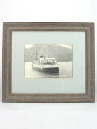
193049601930. Matted framed photograph. Very Good. Black & white platinum photo print in 4 x 6 inch light green matte behind glass 10 x 11.5 inch wood frame. The Princess Fleet were the coastal passenger liners of the Canadian Pacific Railway which also ran the ocean-going Empress Fleet. The Charlotte was commissioned by Captain J. W. Troup and built at the Fairfield shipyard near Glasgow in 1908 to be the finest flyer on the Pacific Coast when it entered service in the summer of 1909. The initial route was Victoria - Vancouver - Seattle. We estimated the date of our photo by examining crew and passenger attire. unknown
190652645New York: Benziger Brothers 1906. 8vo. 10 307 1 pp. Frontisp. photo 24 photo plates 1 large folding map. Green pictorial publisher’s cloth gilt illustration of totem poles gilt lettering & decoration on front cover spine very slight rubbing very light interior toning slight bumping to couple corners VG copy. Second edition 1st U.S. Edition of this Canadian Jesuit missionary’s efforts in Newfoundland and Alaska at the beginning of the 20th century against the backdrop of the Klondike and Yukon Gold Rush. He details his experiences living in mining camps of Nome and Kotzebue Sound for two years offers details of Alaskan Native Americans along with insightful short histories of Russian exploration and influence in the areas. Kurutz Klondike & Alaska Gold Rushes 168b. Benziger Brothers, hardcover
193059933Seattle WA & Portland OR: The Alaska Line Alaska Steamship Co. American Express Co. Travel Dept.Printers Frank McCaffrey ca. 1930. 4to. 20 pp unpaginated. printed on textured paper stock. Photo illustrations and photo plates for the Alaska Line steamships map on rear cover recto. Self-printed colour-illustrated softcovers Art Deco cover art of steamship next to towering Alaska glaciers and mountains w/ superimposed totem pole minor shelfwear slight rubbing still VG copy. First edition thus of this photo-illustrated brochure for the famed Alaska Steamship Co. which greatly benefited from a near monopoly of passenger and freight service to Alaska after the Merchant Marine Act of 1920. Included are photographic views of the steamships scenic landscapes Native American crafts gold mining Alaska airmail planes and more. Worldcat locates 1 copy U of AK Rasmuson Lib. The Alaska Line, Alaska Steamship Co., American Express Co., Travel Dept.[Printers, Frank McCaffrey, paperback