Alaska Nautical ChartBiblio.com
469 résultats
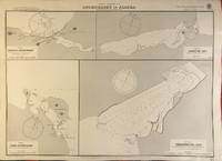
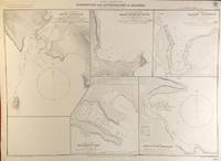
56400London: British Admiralty 1904 1928. . An engraved chart on heavy stock uncolored sheet size 27.5 x 20 inches. Published 11th Nov. 1904; Small corrections printed to 1928. Unfolded a nice clean copy. In lower right: "Engraved 1904" and "Zc 1928". Chart number is 3464. Small typed label on verso giving chart & folio info. Published under the Superintendence of Captain A. Mostyn Field. Maps of five anchorages in the Ikatan Peninsula and Sanak Island: Dora Harbour East Anchor Cove Sanak Acherk Harbour Peterson Bay and North East Harbour. <br/><br/> London: British Admiralty, 1904 (1928). unknown
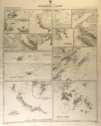
56425London: British Admiralty 1890 1925. . An engraved chart on heavy stock uncolored sheet size 27 x 33.5 inches. Published 11th Aug. 1890; New Edition July 1911; Small corrections printed to 1925 and mss. to 1929. Original horizontal fold a nice clean copy small additions in red pen. In lower right: "Engraved by Edwd. Weller". Chart number is 1454. Small typed label on verso giving chart & folio info. Published under the Superintendence of Captain W.J.L. Wharton. Fifteen anchorages various sizes: Kukak Bay Northwest and Yukon Hrs. Southwest Anche. Chernoffski Harbour Eagle Harbour Kulilyak Bay Pribilof Islands English Bay St. Matthew and Adjacent Islands Akun Cove Port Etches Port Wrangell Port Graham Kodiak Harbour and Shumagin Islands. <br/><br/> London: British Admiralty, 1890 (1925). unknown
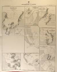
56424London: British Admiralty 1890 1924. . An engraved chart on heavy stock uncolored sheet size 27 x 33.5 inches. Published 2nd Aug. 1890; Large Corrections to Nov. 1908; Small corrections printed to 1924 and mss. to 1929. Original horizontal fold a nice clean copy small additions in red pen. In lower right: "Engraved by Edwd. Weller". Chart number is 1457. Small typed label on verso giving chart & folio info. Published under the Superintendence of Captain W.J.L. Wharton. Eleven anchorages: Unalaska Bay Captains Bay Cape Etolin Simeonof I. & Hr. Samganuda Bay Popof Strait and Humboldt Harbour Port Mulgrave Coal Harbour Doris & Anchorage Bays Nateekin Bay Liituya Bay and Sanborn Hr. <br/><br/> London: British Admiralty, 1890 (1924). unknown
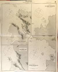
56417London: British Admiralty 1890 1925. . An engraved chart on heavy stock uncolored sheet size 27 x 34 inches. Published 2nd Aug. 1890; Small corrections printed to 1925 and mss. to 1927. Original horizontal fold a nice clean copy small additions in red pen. In lower right: "Engraved by Edwd. Weller". Chart number is 1433. Small typed label on verso giving chart & folio info. Published under the Superintendence of Captain W.J.L. Wharton. Four charts: Port Protection Steamer Bay St. John Harbour and Dewey Anchorage. Currently residents of Port Protection are featured in the National Geographic Channel reality series: Life Below Zero: Port Protection and its spinoff: Lawless Island. <br/><br/> London: British Admiralty, 1890 (1925). unknown
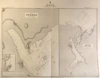
56416London: British Admiralty 1890 1924. . An engraved chart on heavy stock uncolored sheet size 33.5 x 27 inches. Published 11th Aug. 1890; Large Corrections to Aug. 1898; Small corrections printed to 1924 and mss. to 1927. Original vertical fold a nice clean copy small additions in red pen. In lower right: "Engraved by Edwd. Weller". Chart number is 1449. Small typed label on verso giving chart & folio info. Published under the Superintendence of Captain W.J.L. Wharton. Two large charts of anchorages: Port McArthur and Red Bay; the Port McArthur plan includes a small inset map of Port Conclusion. <br/><br/> London: British Admiralty, 1890 (1924). unknown
56393London: British Admiralty 1900 1924. . An engraved chart on heavy stock uncolored sheet size 27.5 x 20 inches. Published 29th May 1900; Large Corrections April 1905. Small corrections printed to 1924. Unfolded a nice clean copy. In lower right: "Engraved by Davies & Company". Chart number is 3136. Small typed label on verso giving chart & folio info. Published under the Superintendence of Rear Admiral Sir W.J.L. Wharton. Maps of four anchorages on Kodiak Island: Karluk Anchorage Larsens Bay Uyak Anchorage Shearwater Bay. <br/><br/> London: British Admiralty, 1900 (1924). unknown
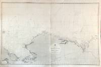
56479London: British Admiralty 1856 1932. An engraved chart on heavy stock uncolored sheet size 40 x 27.5 inches. Published Febr. 20th 1856; New Edition Dec. 1908. Large Corrections to Sept. 1932. Original vertical fold a very good copy some light wrinkling a few additions in red and some route marks in pencil. In lower right: "Engraved 1856". Chart number is 2435. Small typed label on verso giving chart & folio info. A large-scale chart extending from the Chukchi Peninsula in Asia to Liverpool Bay and Cape Bathurst in the Canadian Arctic. The course of the Mackenzie River is shown as well as the Porcupine River and Yukon River. The tip of Wrangell Island is shown at the left edge. <br/><br/> London: British Admiralty, 1856 (1932). unknown
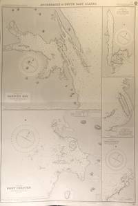
56413London: British Admiralty 1894 1928. . An engraved chart on heavy stock uncolored sheet size 27.5 x 40 inches. Published 6th August 1894; New Edition Aug. 1898; Large Corrections 14th Sept. 1928; Small corrections mss. to 1929. Clean and attractive original horizontal fold some small additions in red pen. In lower right: "Engraved by Edwd. Weller". Chart number is 2110. Small typed label on verso giving chart & folio info. Published under the Superintendence of Captain W.J.L. Wharton. Five anchorages in Frederick Sound and Clarence Strait: large plans of Gambier Bay and Port Chester; smaller plans of Woewodski and Eliza Harbours Fanshaw Bay and Cleveland Passage and Chasina Anchorage. First published 1894 this is a printing of 1928. <br/><br/> London: British Admiralty, 1894 (1928). unknown
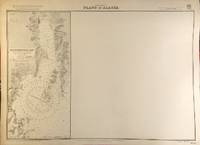
56394London: British Admiralty 1907 1930. . An engraved chart on heavy stock uncolored sheet size 27.5 x 20 inches. Published 22nd April 1907; Small corrections printed to 1930. Unfolded a nice clean copy some small marks in red pen. In lower right: "Engraved 1907" and "Zc 1930". Chart number is 3655. Small typed label on verso giving chart & folio info. Published under the Superintendence of Rear Admiral A. Mostyn Field. Much of this chart is blank; the left edge prints a map of Resurrection Bay showing Seward and the U.S. Naval Reservation. <br/><br/> London: British Admiralty, 1907 (1930). unknown
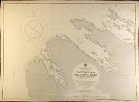
56398London: British Admiralty 1900 1929. . An engraved chart on heavy stock uncolored sheet size 27.5 x 20 inches. Published 13th July 1900; New Edition - Large Corrections 15th November 1929. Clean and attractive never folded. In lower right: "Engraved 1900" and "Zc 1929". Chart number is 3132. Small typed label on verso giving chart & folio info. Published under the Superintendence of Rear Admiral Sir W.J.L. Wharton. Saginaw Bay has recently 2019 been renamed to Skanax Bay following a petition from Tlingit tribal leaders complaining of its association with the 1869 Kake War during which a U.S. warship The Saginaw destroyed three Tlingit communities. <br/><br/> London: British Admiralty, 1900 (1929). unknown
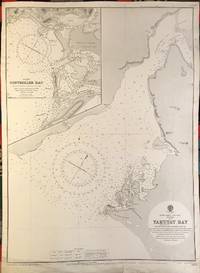
56391London: British Admiralty 1902 1922. . An engraved chart on heavy stock uncolored sheet size 20 x 27.5 inches. Published 13th Dec. 1902; New Edition 8th Jan. 1915. Small corrections printed to 1922 and mss. to 1929. Unfolded. Some wear and a short tears to lower margin basically clean and very good some revisions and additions in red pen. In lower right: "Engraved by Davies & Company". Chart number is 3313. Small typed label on verso giving chart & folio info. Published under the Superintendence of Rear Admiral Sir W.J.L. Wharton. Inset map of Controller Bay. Yakutat Bay has had various names; James Cook called it "Bering Bay" as indicated on this chart. Jean-François de La Pérouse who visited it in 1786 named it "Baie de Monti" for one of his officers; also in 1786 Captain Nathaniel Portlock named it "Admiralty Bay". The Spanish referred to it as "Almirantazgo" and it was also called "Port Mulgrave" when Alessandro Malaspina and José de Bustamante y Guerra sailed into the bay on their Malaspina Expedition 1789-94. <br/><br/> London: British Admiralty, 1902 (1922). unknown
56390London: British Admiralty 1907 1930. . An engraved chart on heavy stock uncolored sheet size 20 x 27.5 inches. Published 5th March 1907; New Edition 14th Feb. 1930. Clean and attractive never folded. In lower right: "Engraved 1907" and "Zc1930". Chart number is 3633. Small typed label on verso giving chart & folio info. Published under the Superintendence of Rear Admiral A. Mostyn Field. <br/><br/> London: British Admiralty, 1907 (1930). unknown
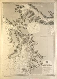
56389London: British Admiralty 1895 1925. An engraved chart on heavy stock uncolored sheet size 20 x 27.5 inches. Published 26th Aug. 1895; Large corrections to Nov. 1900; Small corrections printed to 1925 and mss. to 1930. Clean and attractive never folded some small additions in red pen. In lower right: "Engraved by Edwd. Weller". Chart number is 2337. Small typed label on verso giving chart & folio info. Published under the Superintendence of Rear Admiral W.J.L. Wharton. Sitka Sound was named Ensenada de Susto by Juan de la Bodega on 15 August 1775. It was later named Norfolk Sound by James Cook. In 1801 Fleurieu published a map naming it Baie Tchinkîtâné in an attempt to use Tlingit toponyms. <br/><br/> London: British Admiralty, 1895 (1925). unknown
56397London: British Admiralty 1895 1925. . An engraved chart on heavy stock uncolored sheet size 20 x 27.5 inches. Published 30th Sept. 1895; Large Corrections Jan. 1898; Small corrections printed to 1925 and mss. to 1927. Some dust soiling at lower edge in general a nice clean copy a few additions in red pen. In lower right: "Engraved by Edwd. Waller". Chart number is 2348. Small typed label on verso giving chart & folio info. Published under the Superintendence of Rear Admiral W.J.L. Wharton. A detailed chart of the islands and coastal area around Sitka; the Sitka town plan indicates the Wireless Telephone Stn. Astronomical Stn. Indian Village and Mission. <br/><br/> London: British Admiralty, 1895 (1925). unknown
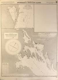
56402London: British Admiralty 1898 1925. An engraved chart on heavy stock uncolored sheet size 20 x 27.5 inches. Published 2nd Aug. 1898; New Edition Nov. 1921; Small corrections printed to 1925 and mss. to 1926. Clean and attractive never folded short tears to margin at lower right some small additions in red pen. In lower right: "Engraved by Davies & Company". Chart number is 837. Small typed label on verso giving chart & folio info. Published under the Superintendence of Rear Admiral Sir W.J.L. Wharton. Two maps: Seal Cove Gravina Island and Head of Kasaan Bay at Prince of Wales Island. <br/><br/> London: British Admiralty, 1898 (1925). unknown
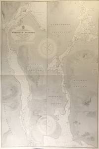
56415London: British Admiralty 1899 1930. . An engraved chart on heavy stock uncolored sheet size 27.5 x 40 inches. Published 20th Feb. 1899; New Edition 17th Jan. 1930. Original horizontal fold a clean and attractive copy some small additions in red pen. In lower right: "Engraved 1899" and "Zc 1930". Chart number is 3022. Small typed label on verso giving chart & folio info. Published under the Superintendence of Rear Admiral Sir W.J.L. Wharton. Divided vertically into two charts this extends from Frederick Sound to Sumner Strait showing the Lindenberg Peninsula Mitkof Island Woewodski Island. Previously known as Wrangell Strait this channel is 22 miles long. <br/><br/> London: British Admiralty, 1899 (1930). unknown
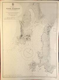
56409London: British Admiralty 1911 1924. An engraved chart on heavy stock uncolored sheet size 40 x 27.5 inches. Published 11th April 1911; New Edition 30th May 1921; Small corrections printed to 1924 and mss. to 1927. Original vertical fold clean and attractive some small additions in red pen. In lower right: "Engraved by Davies & Company". Chart number is 3754. Small typed label on verso giving chart & folio info. Published under the Superintendence of Rear Admiral H.E. Purey-Cust. Good detail of the northern end of Graham Island in the Haida Gwaii formerly Queen Charlotte Islands. The Dixon Entrance remains a contentious area today with ongoing disputes about the precise location of the boundary line between Canada and the USA. This 1924 map shows a dotted line just south of Prince of Wales Island with the text: "Approximate Boundary between British Columbia and Alaska". <br/><br/> London: British Admiralty, 1911 (1924). unknown
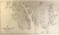
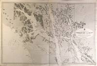
56418London: British Admiralty 1896 1925. . An engraved chart on heavy stock uncolored sheet size 46 x 28 inches. Published 15th Dec. 1896; Large Corrections to July 1907; Small corrections printed to 1925 and mss. to 1929. Original vertical folds a clean and attractive copy some small additions in red pen. In lower right: "Engraved by Davies & Compy.". Chart number is 2458. Small typed label on verso giving chart & folio info. Published under the Superintendence of Rear Admiral W.J.L. Wharton. A large and detailed chart extending from the Dixon Entrance north to Wrangell Island; the chart extends east to the Portland Canal and the edge of British Columbia including Observatory Inlet and Salmon Cove visited by Captain Vancouver in 1793 and so named because he set up his observatory there in order to calibrate the chronometers. Good detail of Prince of Wales Island and Clarence Strait. Originally published in 1896 this is a 1925 printing. <br/><br/> London: British Admiralty, 1896 (1925). unknown
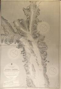
56427London: British Admiralty 1897 1925. . An engraved chart on heavy stock uncolored sheet size 40 x 27.5 inches. Published 6th March 1897; Large Corrections to June 1907; Small corrections printed to 1925 and mss. to 1930. Original vertical fold a clean and attractive copy some small additions in red pen. In lower right: "Engraved by Davies & Company". Chart number is 2462. Small typed label on verso giving chart & folio info. Published under the Superintendence of Rear Admiral W.J.L. Wharton. A highly detailed chart showing the north part of Admiralty Island and Chichagof Island Chatham Strait Glacier Bay; Inset map at the top: Continuation of Lynn Canal. Originally published 1897 this is an edition of 1925. <br/><br/> London: British Admiralty, 1897 (1925). unknown
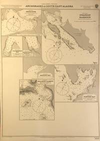
56401London: British Admiralty 1898 1920. An engraved chart on heavy stock uncolored sheet size 20 x 27.5 inches. Published 11th Nov. 1898; Large corrections to April 1904; Small corrections printed to 1920. Clean and attractive never folded some small additions in red pen. In lower right: "Engraved by Edwd. Weller". Chart number is 3008. Small typed label on verso giving chart & folio info. Published under the Superintendence of Rear Admiral Sir W.J.L. Wharton. Maps of seven anchorages at Lynn Canal Glacier Bay and Chatham Strait: Fritz Cove Swanson Harbour William Henry Bay Barlow Cove Anchorage Bartlett Bay Killisnoo Harbour and Funter Bay. <br/><br/> London: British Admiralty, 1898 (1920). unknown
56426London: British Admiralty 1898 1926. . An engraved chart on heavy stock uncolored sheet size 27.5 x 40 inches. Published 23rd July 1898; Large Corrections to 6th August 1926; Small corrections mss. to 1927. Original horizontal fold a clean and attractive copy some small additions in red pen. Some wrinkling of paper at centre but not very noticeable on the printed side. In lower right: "Engraved 1898." and "Zc 1926". Chart number is 2288. Small typed label on verso giving chart & folio info. Published under the Superintendence of Rear Admiral Sir W.J.L. Wharton. A detailed and attractive chart of this major inlet. <br/><br/> London: British Admiralty, 1898 (1926). unknown
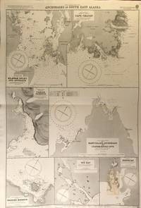
56419London: British Admiralty 1900 1925. An engraved chart on heavy stock uncolored sheet size 27.5 x 40 inches. Published 31st December 1900; New Edition January 1916; Small corrections printed to 1925 and mss. to 1927. Clean and attractive original horizontal fold some small additions in red pen. In lower right: "Engraved by Edwd. Weller". Chart number is 3138. Small typed label on verso giving chart & folio info. Published under the Superintendence of Rear Admiral Sir W.J.L. Wharton. Maps of seven anchorages: Klawak Inlet and Approach Cape Chacon Tamgas Harbour Mary Island Anchorage and Custom House Cove Hassler Harbour Yes Bay and Redfish Bay. Originally published in 1900 this is a 1925 printing. The small plan of Redfish Bay has corrections on a paste-over partly printed in red. Klawak is now known as Klawock and had a variety of names used by the Tlingit Klawerak Tlevak Clevak and Klawak. <br/><br/> London: British Admiralty, 1900 (1925) unknown
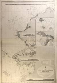
56407London: British Admiralty 1907 1928. An engraved chart on heavy stock uncolored sheet size 27.5 x 40 inches. Published 17th April 1907; New Edition Jan. 1923. Large Corrections 1st June 1928. Original horizontal fold a clean and attractive copy some small additions in red pen. Engraved shorelines in vignette. In lower right: "Malby & Sons". Chart number is 593. Small typed label on verso giving chart & folio info. Published under the Superintendence of Rear Admiral A. Mostyn Field. A large and detailed chart with inset maps of Chamisso and Port Clarence with an additional detailed inset of Port Clarence. From the Yukon River north to the Bering Strait Kotzebue Sound as far as Point Barrow on the coast of Alaska here designated as West Georgia. <br/><br/> London: British Admiralty, 1907 (1928). unknown
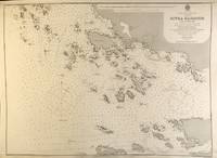
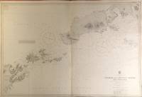
56420London: British Admiralty 1903 1929. . An engraved chart on heavy stock uncolored sheet size 40 x 27.5 inches. Published 23rd April 1903; New Edition 1st March 1929. Clean and attractive original vertical fold some small additions in red pen. In lower right: "Engraved 1903" and "Zc 1929". Chart number is 3336. Small typed label on verso giving chart & folio info. Published under the Superintendence of Rear Admiral Sir W.J.L. Wharton. A detailed chart of the Fox Islands Group in the Eastern Aleutians. <br/><br/> London: British Admiralty, 1903 (1929). unknown
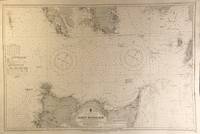
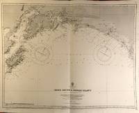
56423London: British Admiralty 1890 1925. . An engraved chart on heavy stock uncolored sheet size 34 x 27 inches. Published 9th July 1890; Large Corrections Jan. 1908; Small corrections printed to 1925 and mss. to 1929. Clean and attractive original vertical fold some additions in red pen. In lower right: "Engraved by Davies & Company". Chart number is 1499. Small typed label on verso giving chart & folio info. Published under the Superintendence of Captain W.J.L. Wharton. The south coast of Alaska centered on Prince William Sound. First published 1890 this is a printing of 1925. <br/><br/> London: British Admiralty, 1890 (1925). unknown